
|
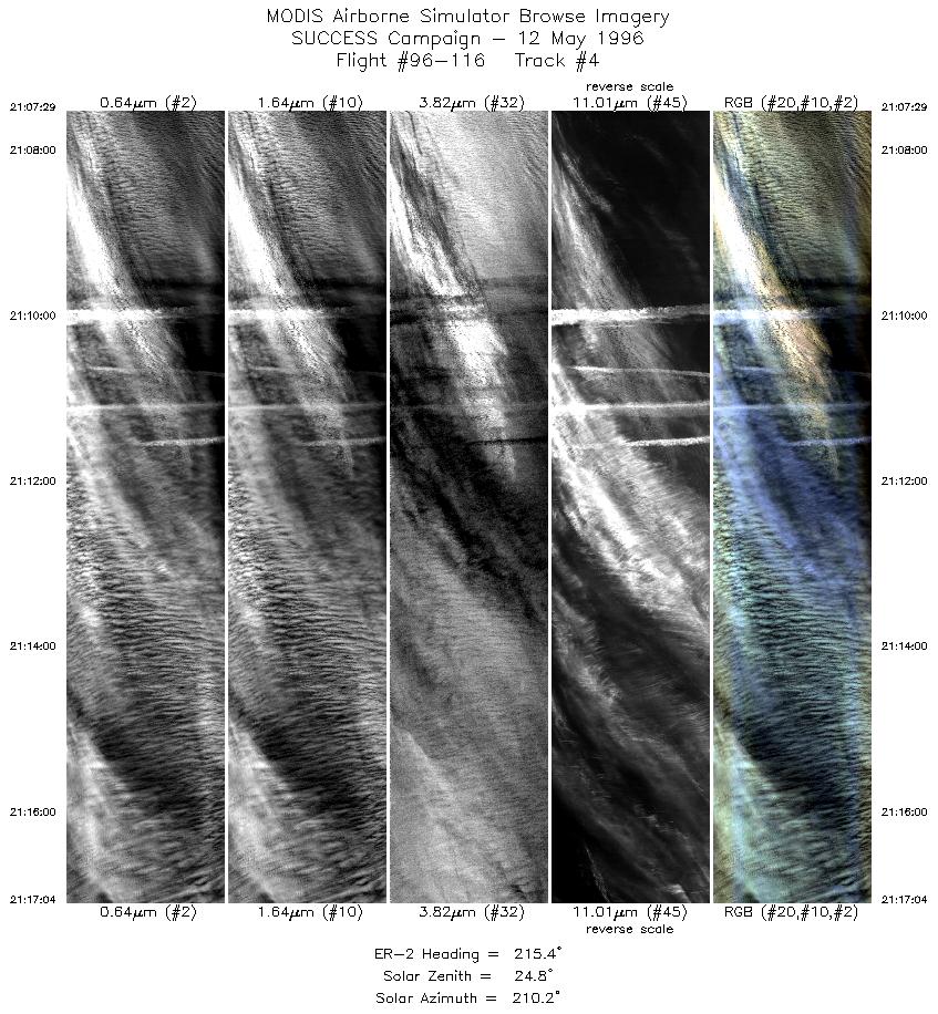
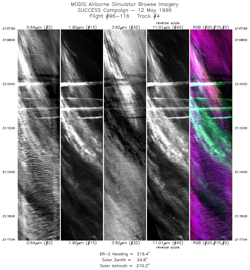
Sample Image

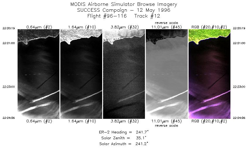
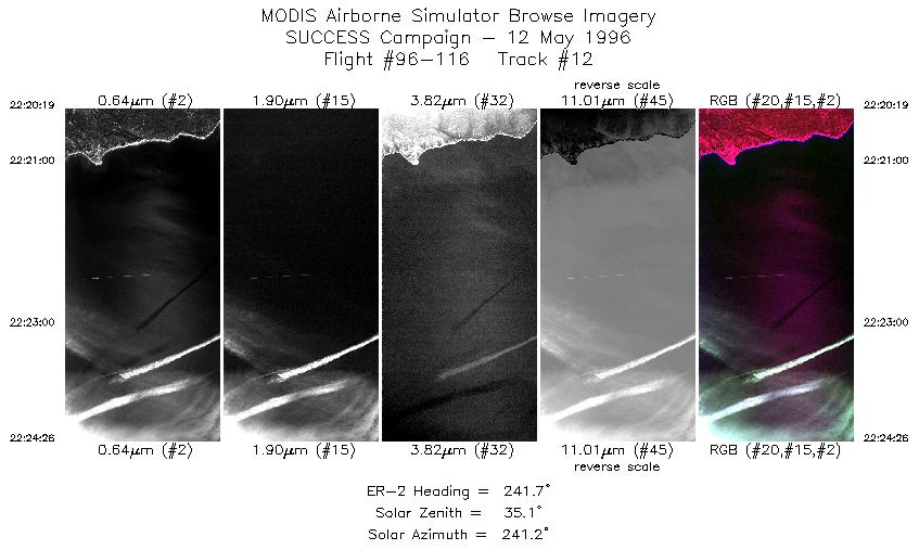
12 May 1996
Track #04
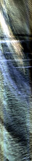

"Shadow-casting contrails over multi-layer cirrus and altocumulus clouds
off the northern California coast"
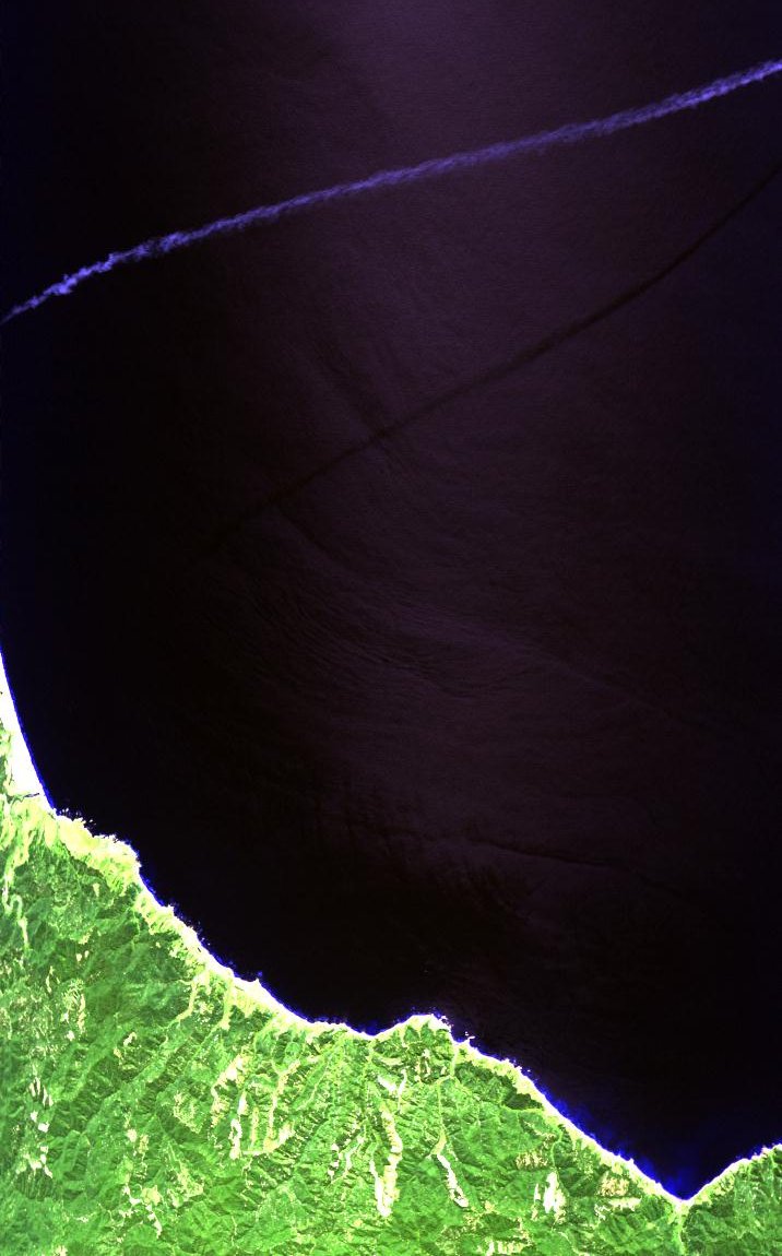
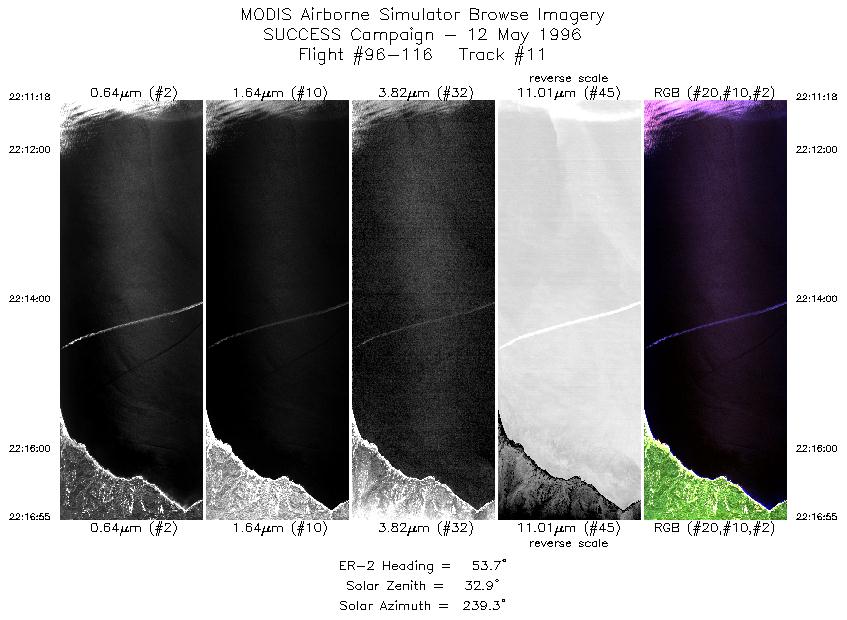
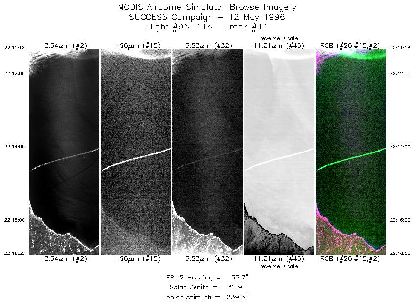
12 May 1996
Track #11
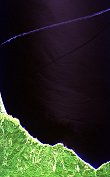
"Well-defined contrail in clear skies over the Pacific Ocean"
R: 2.15 microns
G: 1.65 microns
B: 0.64 microns
|
|
Summary Information
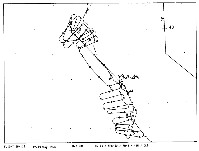
Date: May 12-13, 1996
ER-2 Flight Number: 96-116
Location: California Coast and Pacific Ocean
Principle Investigator: Dr. Brian Toon (NASA Ames)
Additional Sensors: MIR, CLS, RAMS, EOC
Level-1B Processing Information
Level-1B Data Version: #10
Calibration Type: Final
Calibration Version: SUCCESS_Ames 1.0
Temperature Adjustment: No
Status: Final Calibration Done
|
|
Flight Track Map


|
Level-1B Browse Imagery
Straight Line Flight Tracks: 30
Scanlines Processed: 65062
Solar Azimuth and Zenith Angles
|
Browse Images
|
Click on the Flight Track number to load images.
Lat/Lon ranges are for the BEG-END scanline nadir pixels.
|
Flight
Track |
Standard
Image |
Cirrus
Image |
Time_Span
(GMT) |
Heading
(Deg) |
Lat_Range
(Deg_N) |
Lon_Range
(Deg_W) |
Length
(Scanlines) |
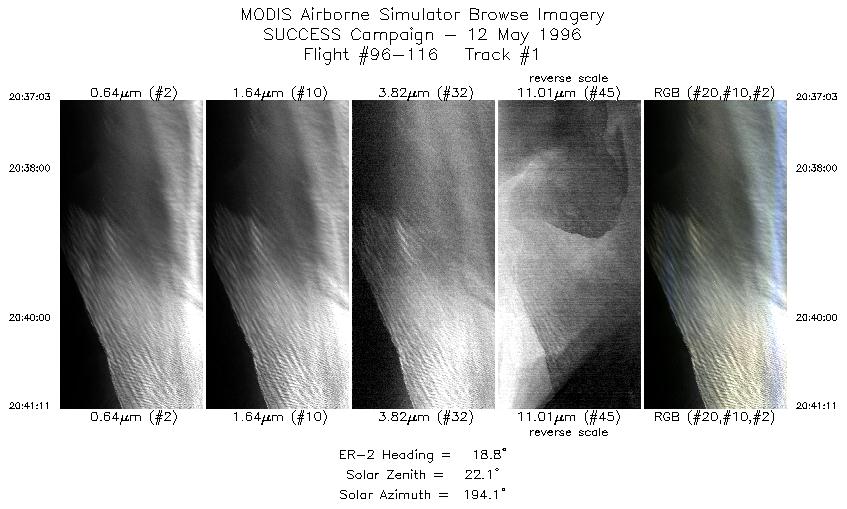
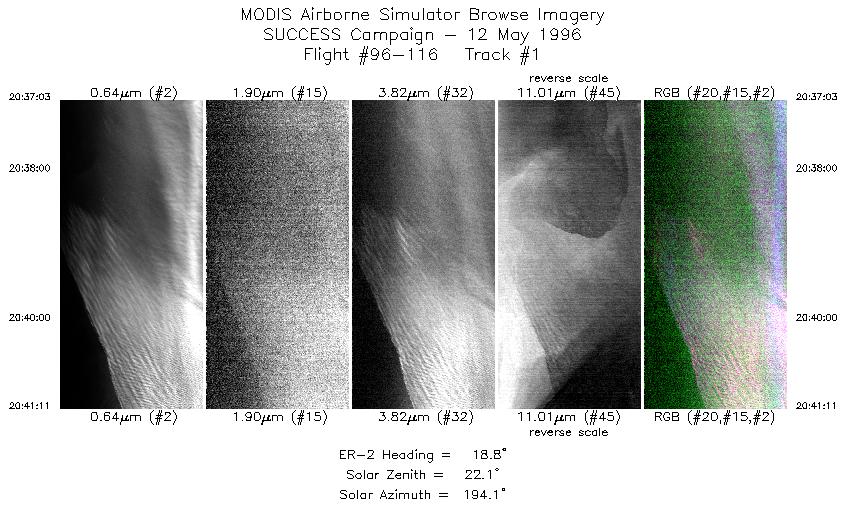
| 1 |
STD |
CIR |
20:37-20:41 |
19 |
40.00-40.47 |
124.93-124.73 |
1545 |
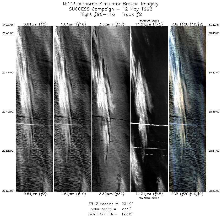
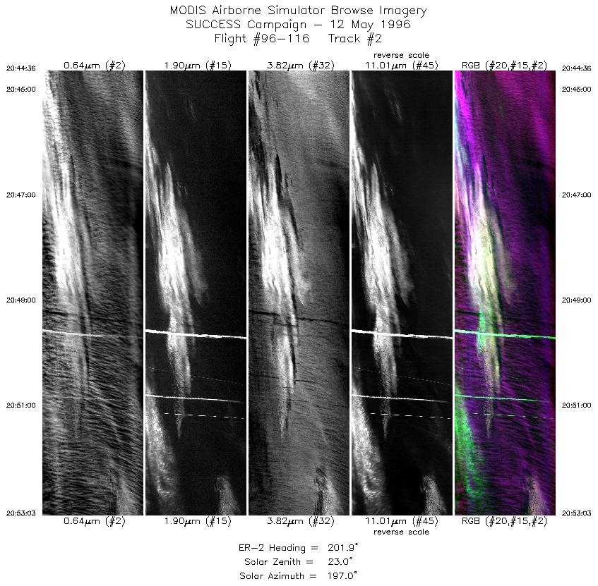
| 2 |
STD |
CIR |
20:44-20:53 |
202 |
40.58-39.74 |
125.01-125.43 |
3157 |
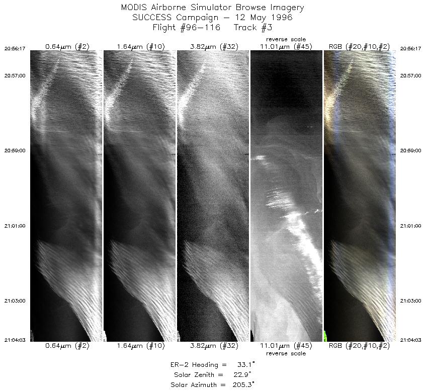
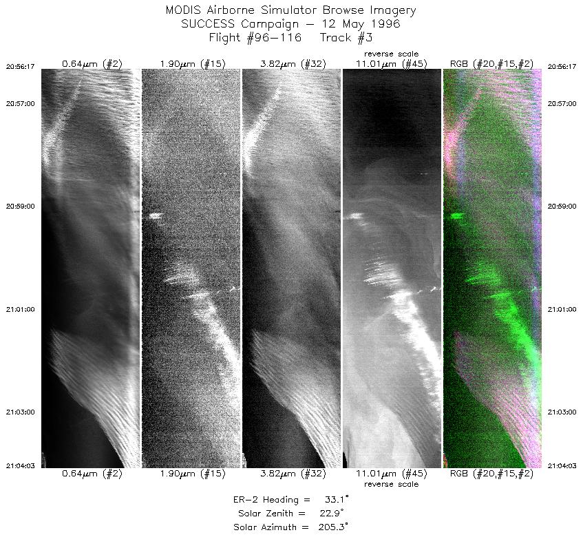
| 3 |
STD |
CIR |
20:56-21:04 |
33 |
39.63-40.38 |
125.14-124.53 |
2903 |
| 4 |
STD |
CIR |
21:07-21:17 |
215 |
40.53-39.69 |
124.80-125.64 |
3581 |
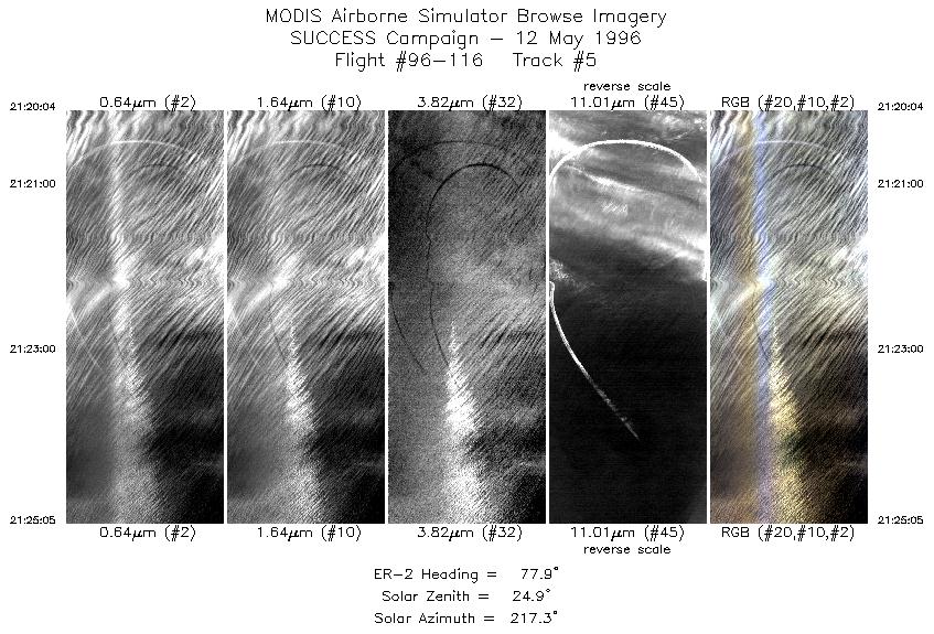
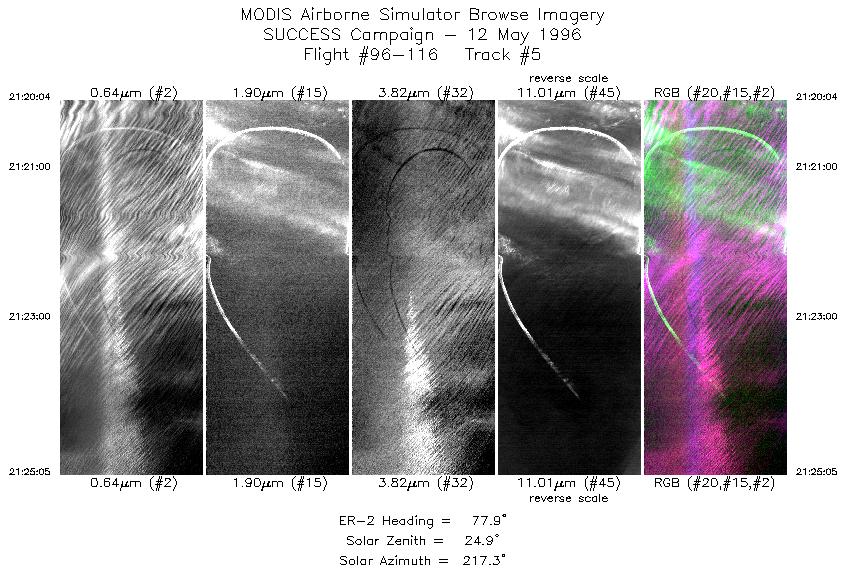
| 5 |
STD |
CIR |
21:20-21:25 |
78 |
39.51-39.61 |
125.42-124.71 |
1875 |
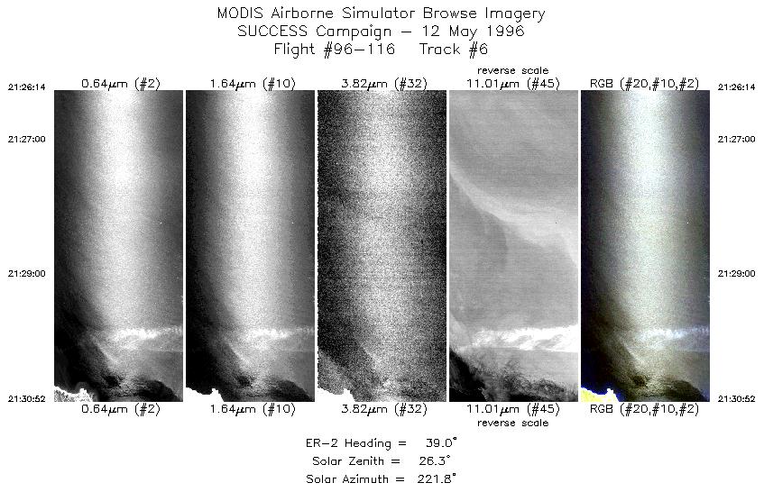
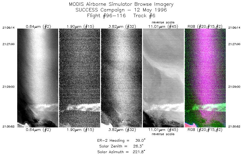
| 6 |
STD |
CIR |
21:26-21:30 |
39 |
39.67-40.10 |
124.57-124.15 |
1732 |
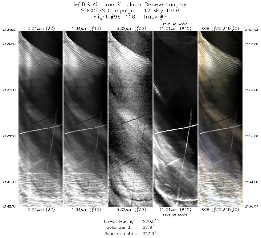
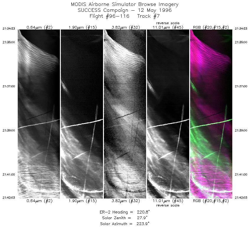
| 7 |
STD |
CIR |
21:34-21:42 |
221 |
40.27-39.66 |
124.41-125.15 |
2865 |
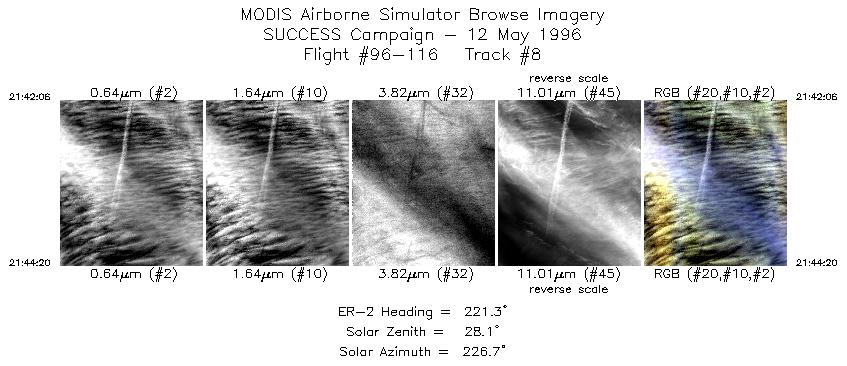
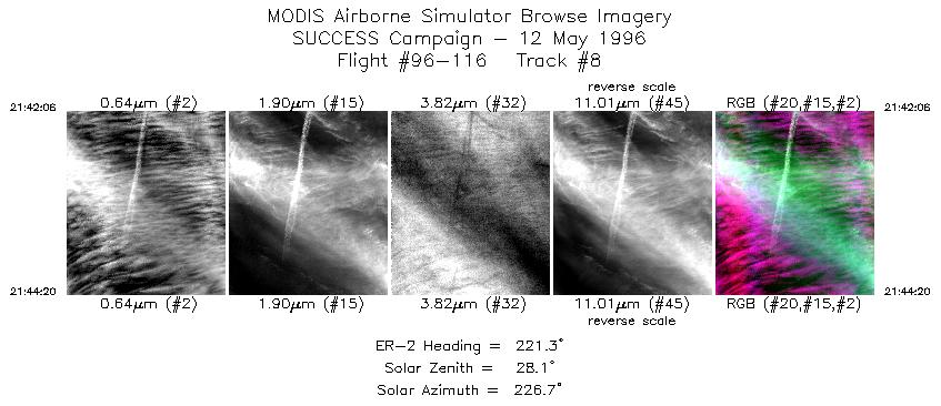
| 8 |
STD |
CIR |
21:42-21:44 |
221 |
39.66-39.48 |
125.16-125.38 |
834 |
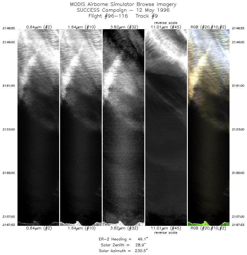
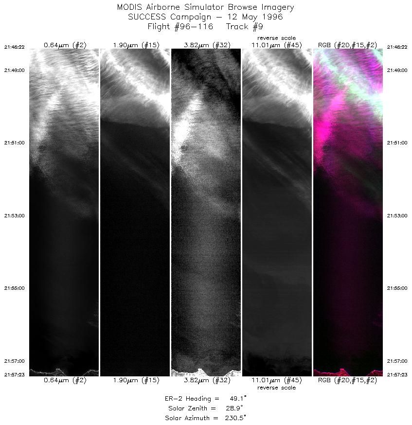
| 9 |
STD |
CIR |
21:48-21:57 |
49 |
39.36-40.06 |
125.07-124.08 |
3370 |
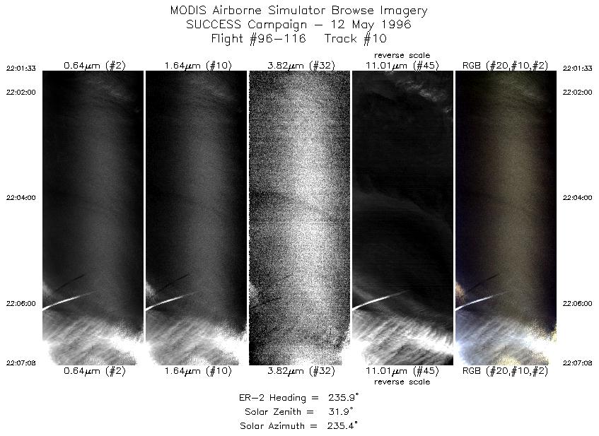
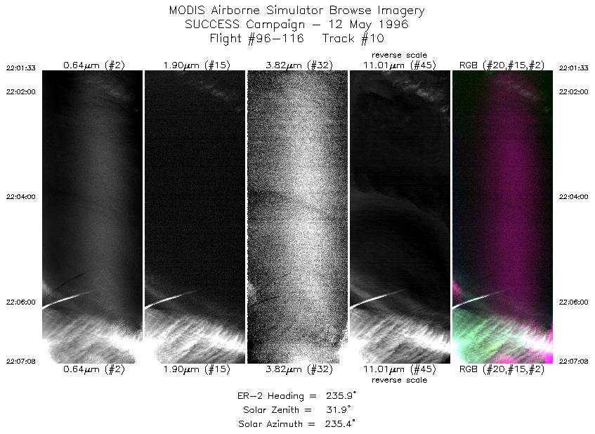
| 10 |
STD |
CIR |
22:01-22:07 |
236 |
39.84-39.52 |
123.98-124.66 |
2087 |
| 11 |
STD |
CIR |
22:11-22:16 |
54 |
39.37-39.76 |
124.42-123.76 |
2100 |
| 12 |
STD |
CIR |
22:20-22:24 |
242 |
39.98-39.78 |
123.93-124.45 |
1538 |
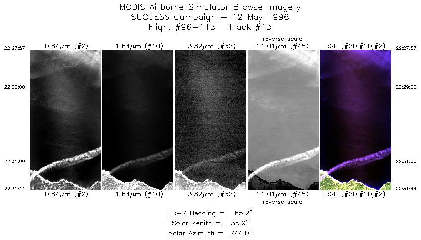
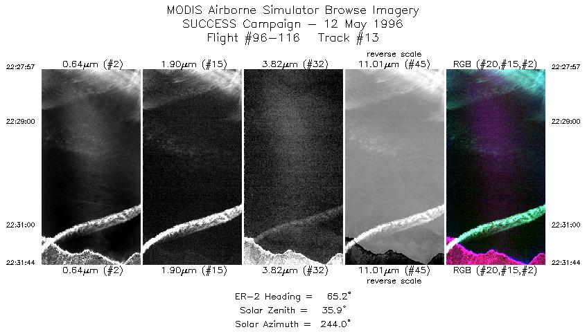
| 13 |
STD |
CIR |
22:27-22:31 |
65 |
39.56-39.76 |
124.31-123.80 |
1415 |
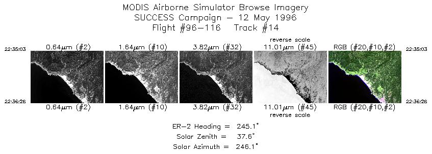
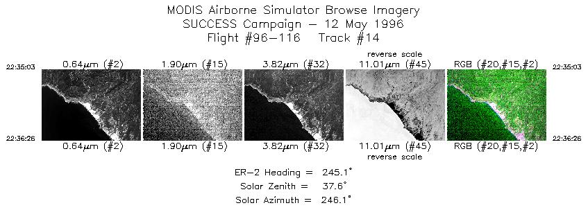
| 14 |
STD |
CIR |
22:35-22:36 |
245 |
39.55-39.49 |
123.67-123.84 |
517 |
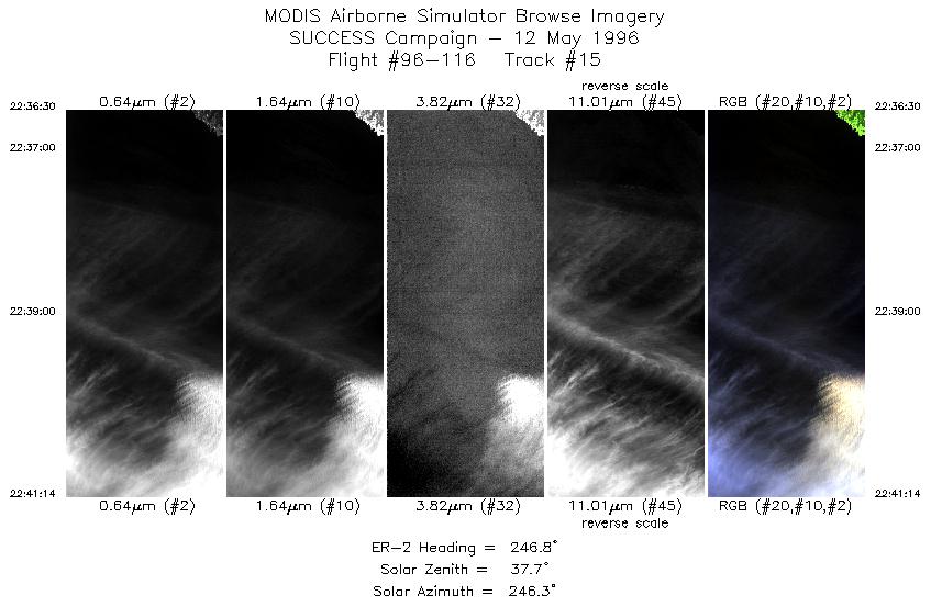
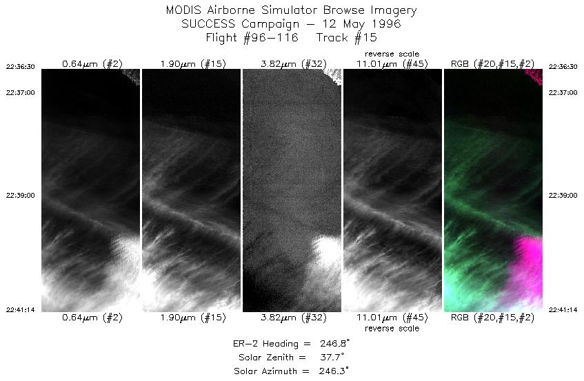
| 15 |
STD |
CIR |
22:36-22:41 |
247 |
39.49-39.29 |
123.85-124.47 |
1769 |
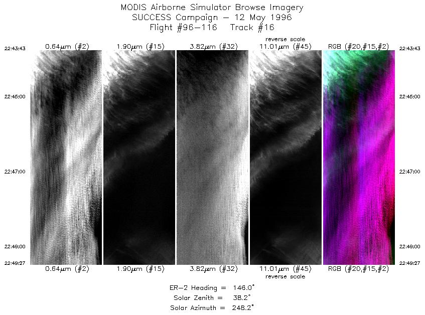
| 16 |
STD |
CIR |
22:43-22:49 |
146 |
39.06-38.53 |
124.50-124.03 |
2143 |
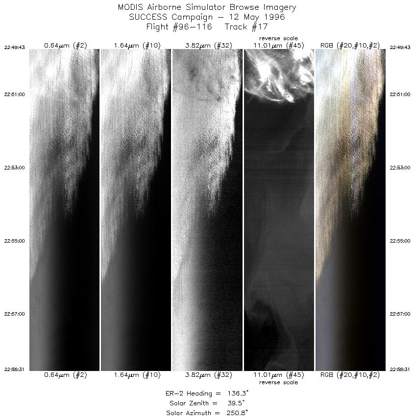
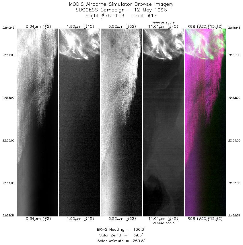
| 17 |
STD |
CIR |
22:49-22:58 |
136 |
38.50-37.78 |
124.01-123.15 |
3289 |
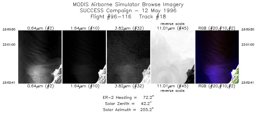
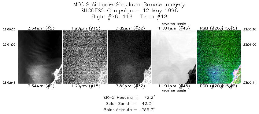
| 18 |
STD |
CIR |
23:00-23:02 |
72 |
37.75-37.83 |
122.92-122.61 |
878 |
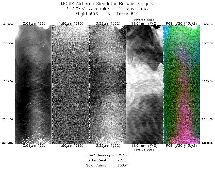
| 19 |
STD |
CIR |
23:06-23:12 |
254 |
37.61-37.43 |
122.52-123.38 |
2336 |
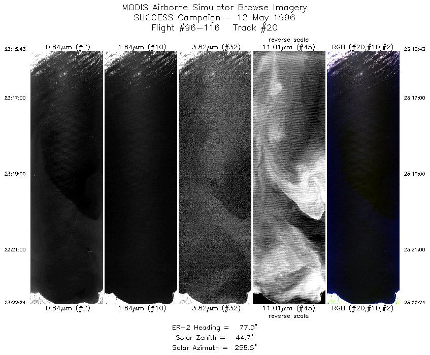
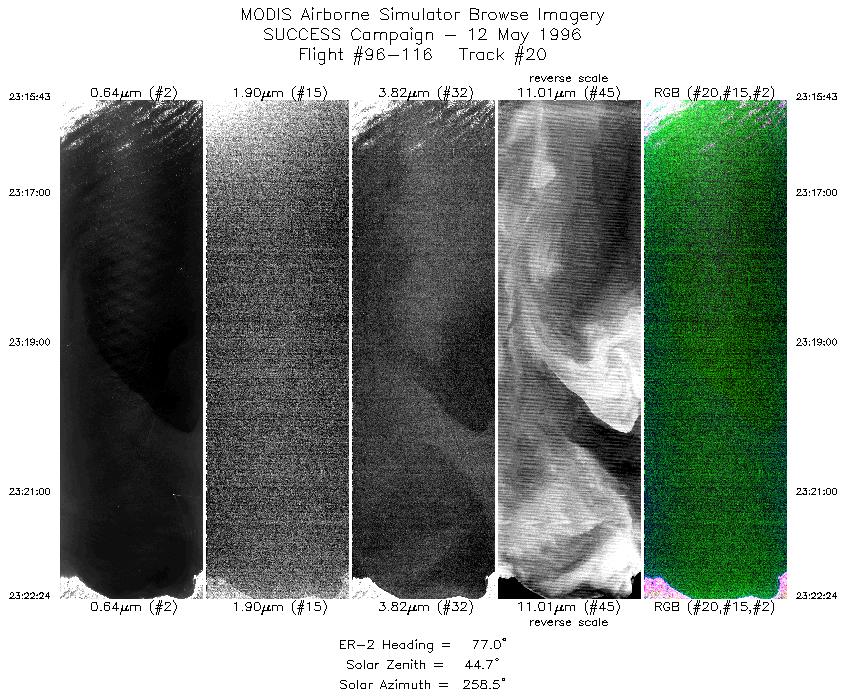
| 20 |
STD |
CIR |
23:15-23:22 |
77 |
37.20-37.38 |
123.32-122.42 |
2498 |
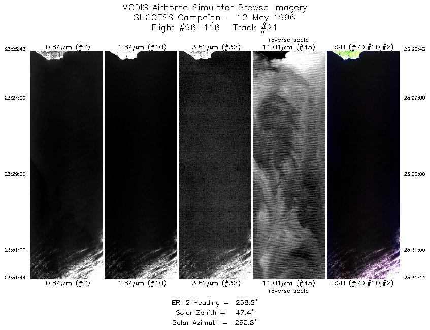
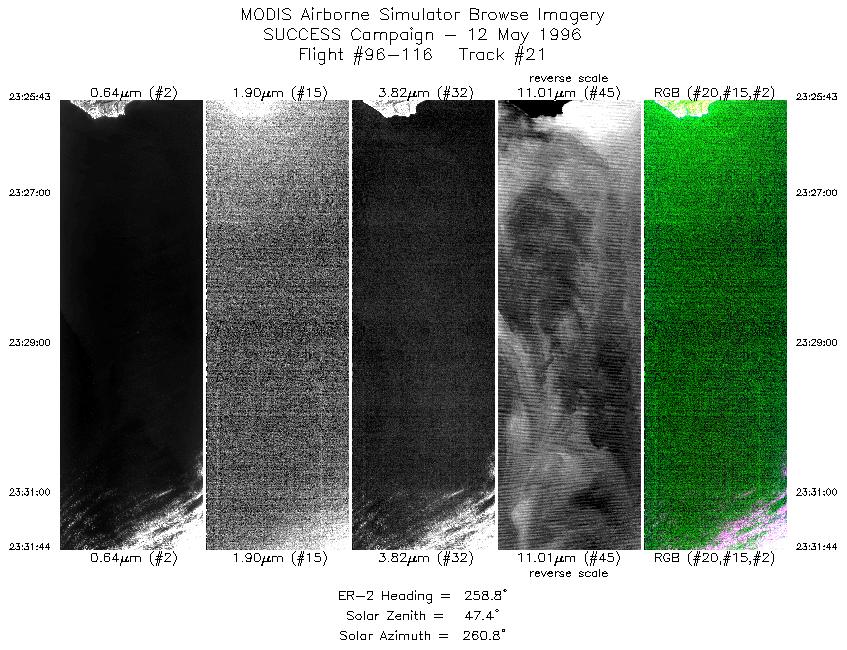
| 21 |
STD |
CIR |
23:25-23:31 |
259 |
37.16-37.04 |
122.36-123.21 |
2250 |
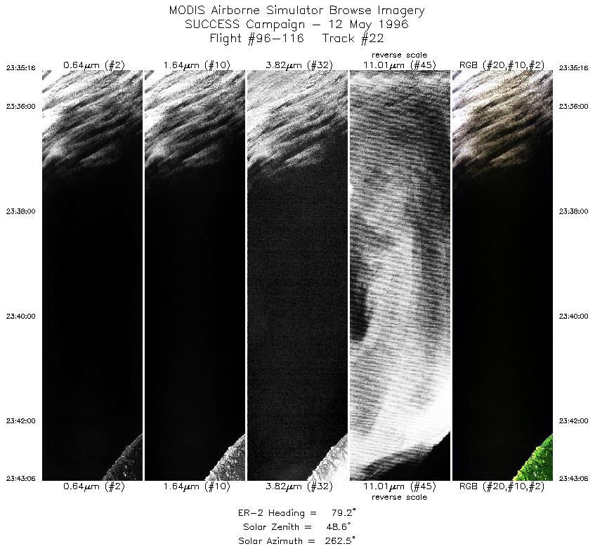
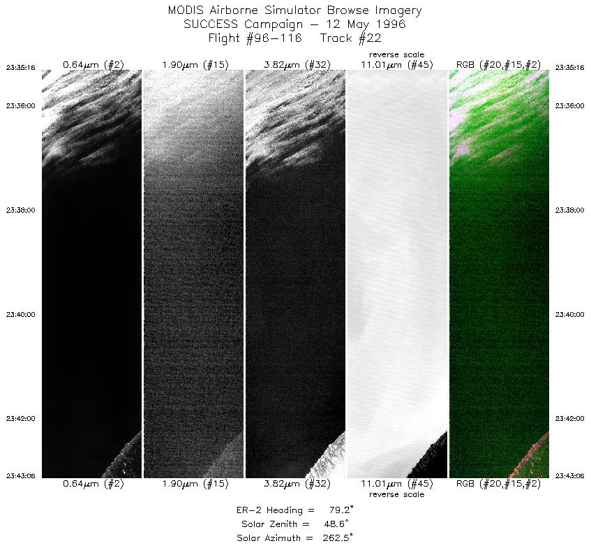
| 22 |
STD |
CIR |
23:35-23:43 |
79 |
36.80-36.95 |
123.17-122.12 |
2928 |
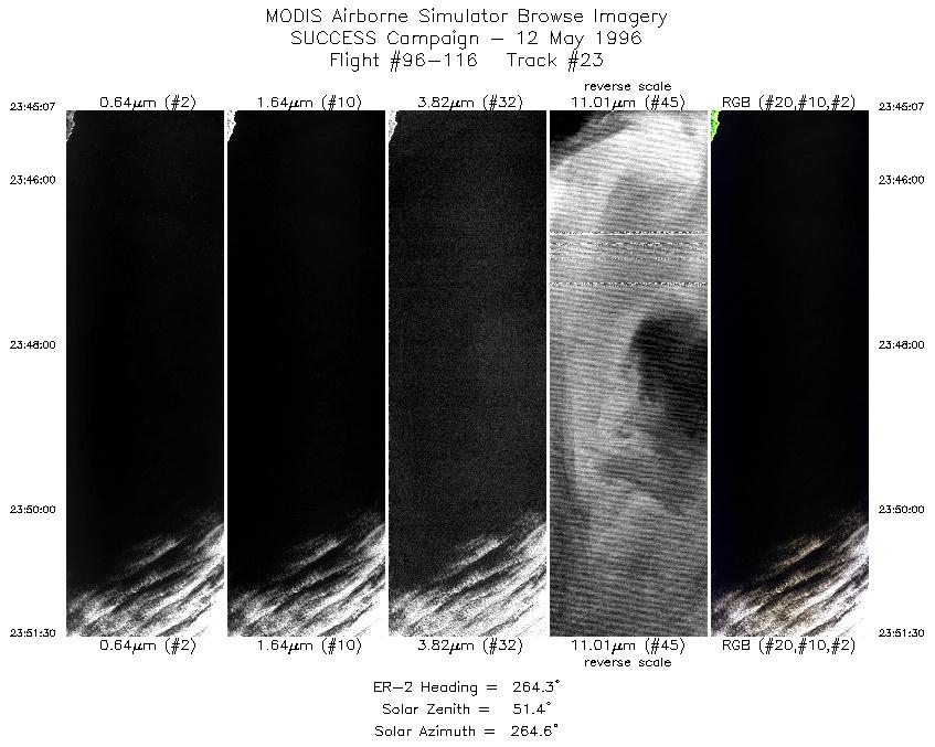
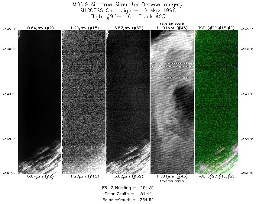
| 23 |
STD |
CIR |
23:45-23:51 |
264 |
36.81-36.77 |
122.10-123.01 |
2386 |
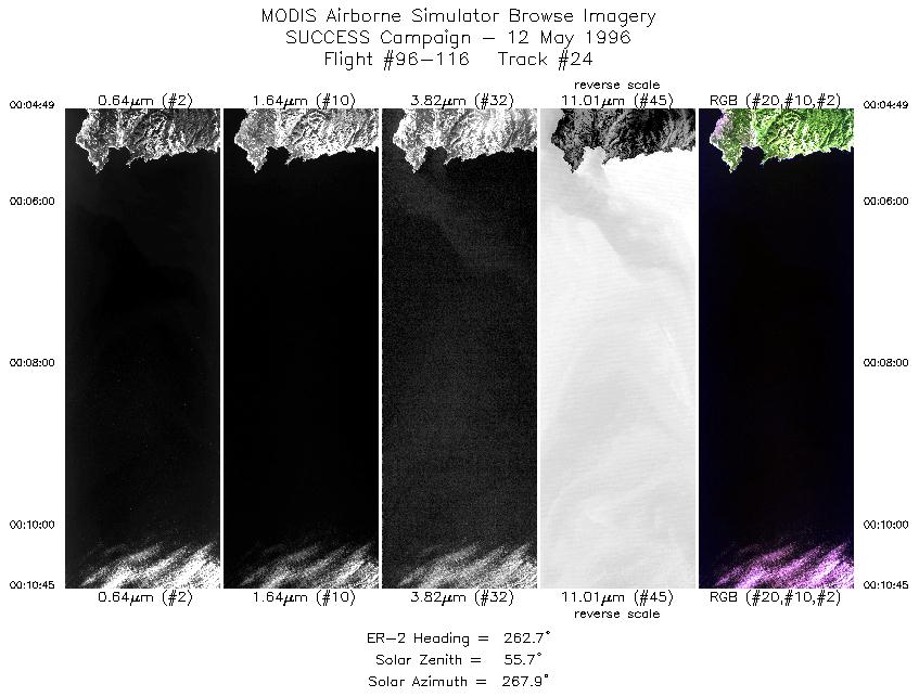
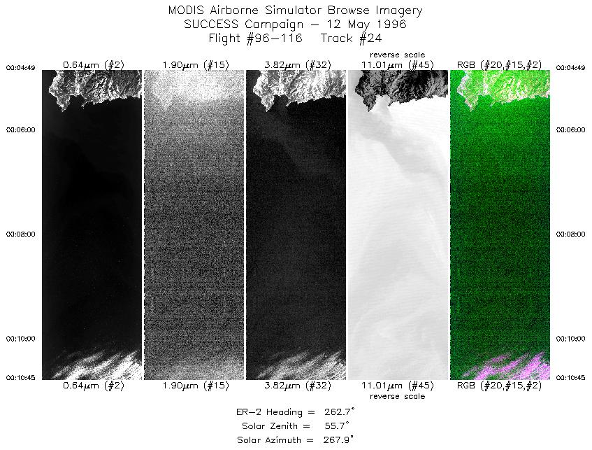
| 24 |
STD |
CIR |
00:04-00:10 |
263 |
36.49-36.43 |
121.85-122.69 |
2217 |
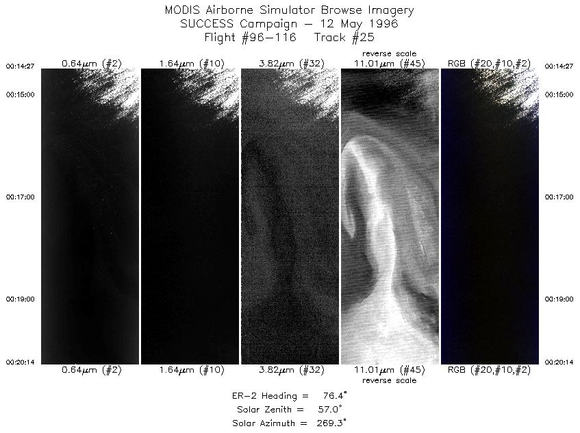
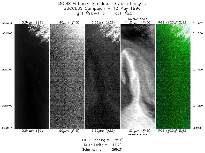
| 25 |
STD |
CIR |
00:14-00:20 |
76 |
36.19-36.35 |
122.67-121.92 |
2162 |
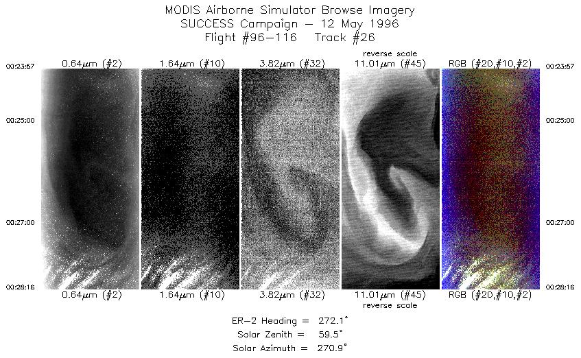
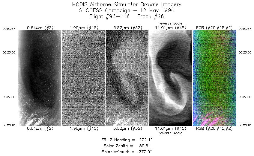
| 26 |
STD |
CIR |
00:23-00:28 |
272 |
36.14-36.17 |
121.93-122.54 |
1614 |
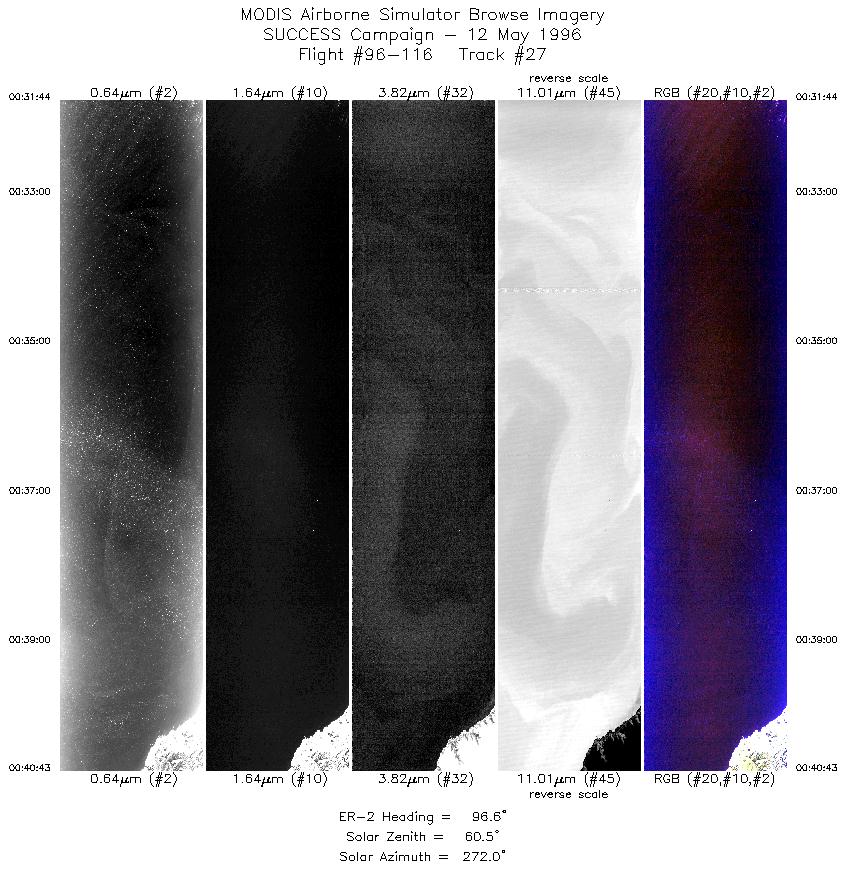
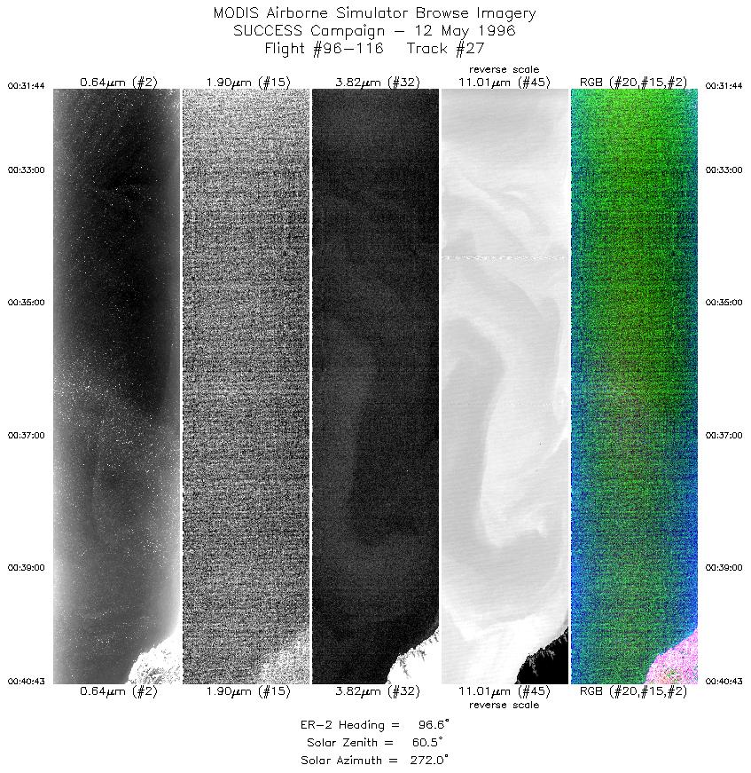
| 27 |
STD |
CIR |
00:31-00:40 |
97 |
35.93-35.84 |
122.59-121.41 |
3358 |
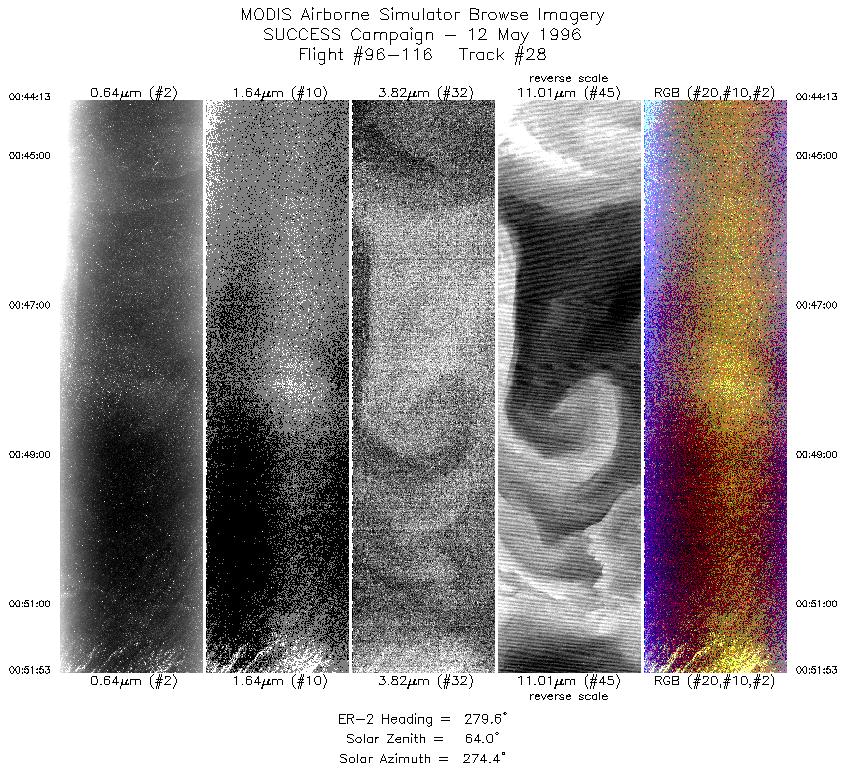
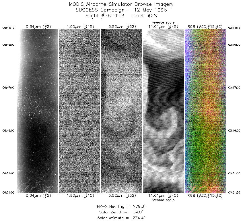
| 28 |
STD |
CIR |
00:44-00:51 |
280 |
35.63-35.81 |
121.49-122.57 |
2867 |
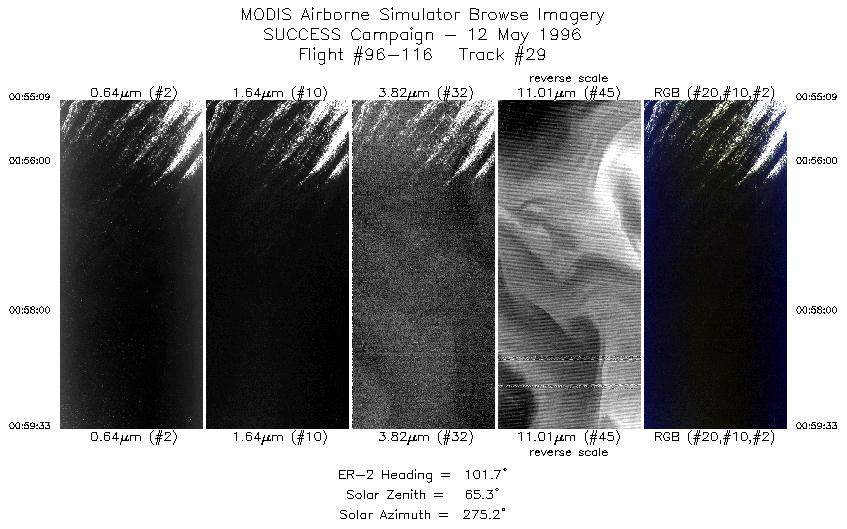
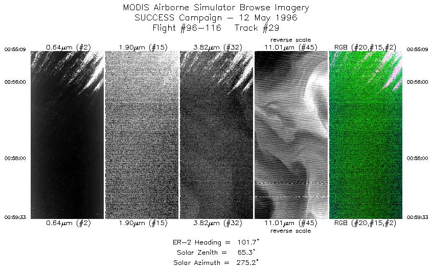
| 29 |
STD |
CIR |
00:55-00:59 |
102 |
36.04-35.94 |
122.54-121.98 |
1645 |
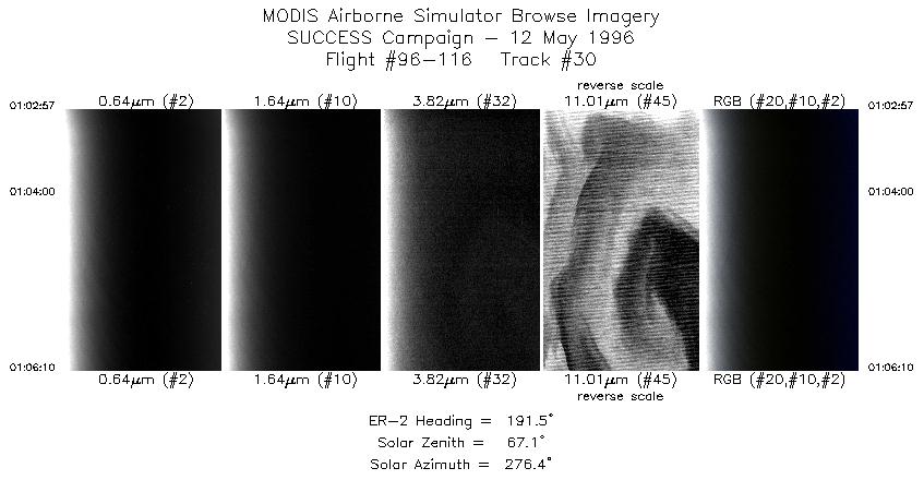
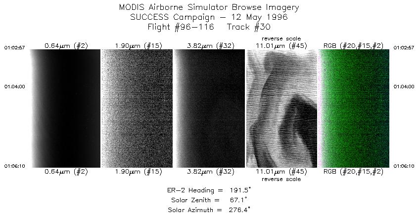
| 30 |
STD |
CIR |
01:02-01:06 |
192 |
36.02-35.67 |
122.06-122.16 |
1203 |
|
Standard Browse Images 01 through 30 in sequence |
|
Cirrus Detection Browse Images 01 through 30 in sequence |
Level-1B HDF Data Distribution Point
NASA GSFC Earth Sciences (GES) Data Center
NASA DAAC's
Additional Information
Coming Soon!
|
|
|
|
