
|
Sample Image

23 April 1996
Track #05


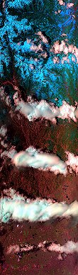
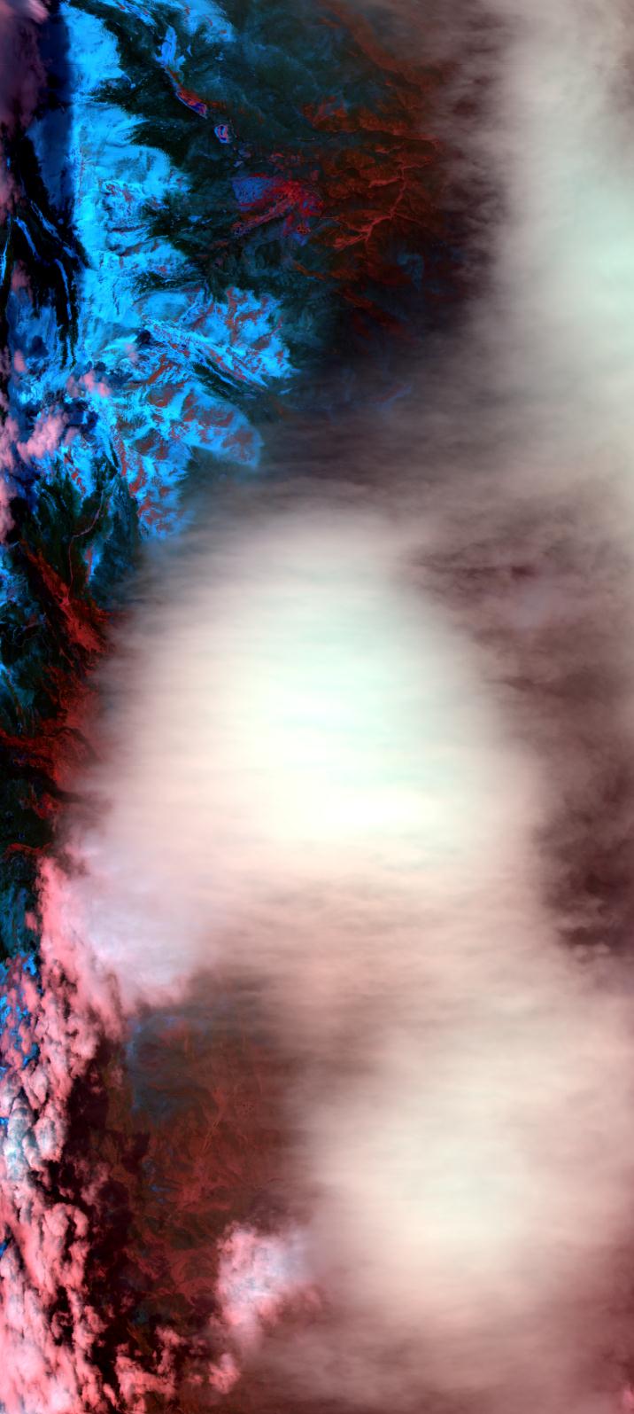
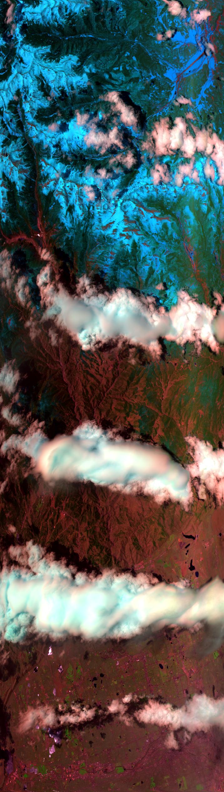
"Wave cloud over Colorado"
23 April 1996
Track #09
"Roll clouds over Colorado"
R: 2.15 microns
G: 0.94 microns
B: 0.65 microns
|
|
Summary Information
Date: April 23, 1996
ER-2 Flight Number: 96-107
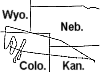
Location: Oklahoma CART Site, Kansas
Principle Investigator: Dr. Brian Toon (NASA Ames)
Additional Sensors: B&W_6"_RC-10, MIR, CLS, RAMS, HIS, EOC
Level-1B Processing Information
Level-1B Data Version: #10
Calibration Type: Final
Calibration Version: SUCCESS_Ames 1.0
Temperature Adjustment: No
Status: Final Calibration Done
|
|
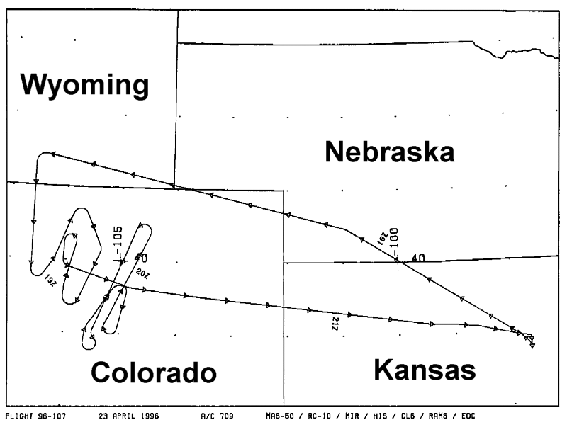
Flight Track Map

|
Level-1B Browse Imagery
Straight Line Flight Tracks: 12
Scanlines Processed: 31575
Solar Azimuth and Zenith Angles
|
Browse Images
|
Click on the Flight Track number to load images.
Lat/Lon ranges are for the BEG-END scanline nadir pixels.
|
Flight
Track |
Standard
Image |
Cirrus
Image |
Time_Span
(GMT) |
Heading
(Deg) |
Lat_Range
(Deg_N) |
Lon_Range
(Deg_W) |
Length
(Scanlines) |
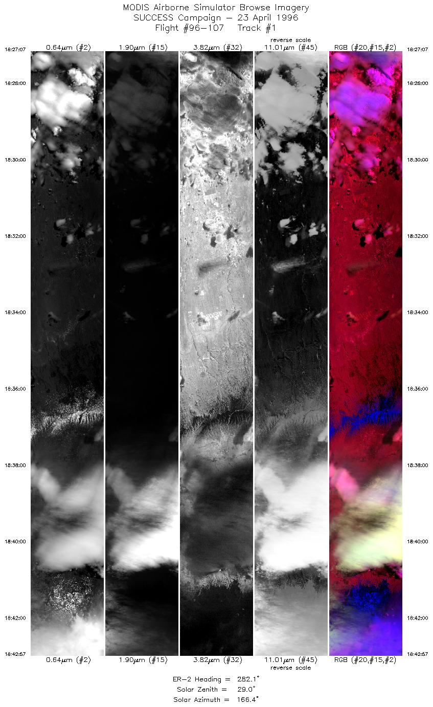
| 1 |
STD |
CIR |
18:27-18:42 |
282 |
41.06-41.45 |
104.03-106.37 |
5914 |
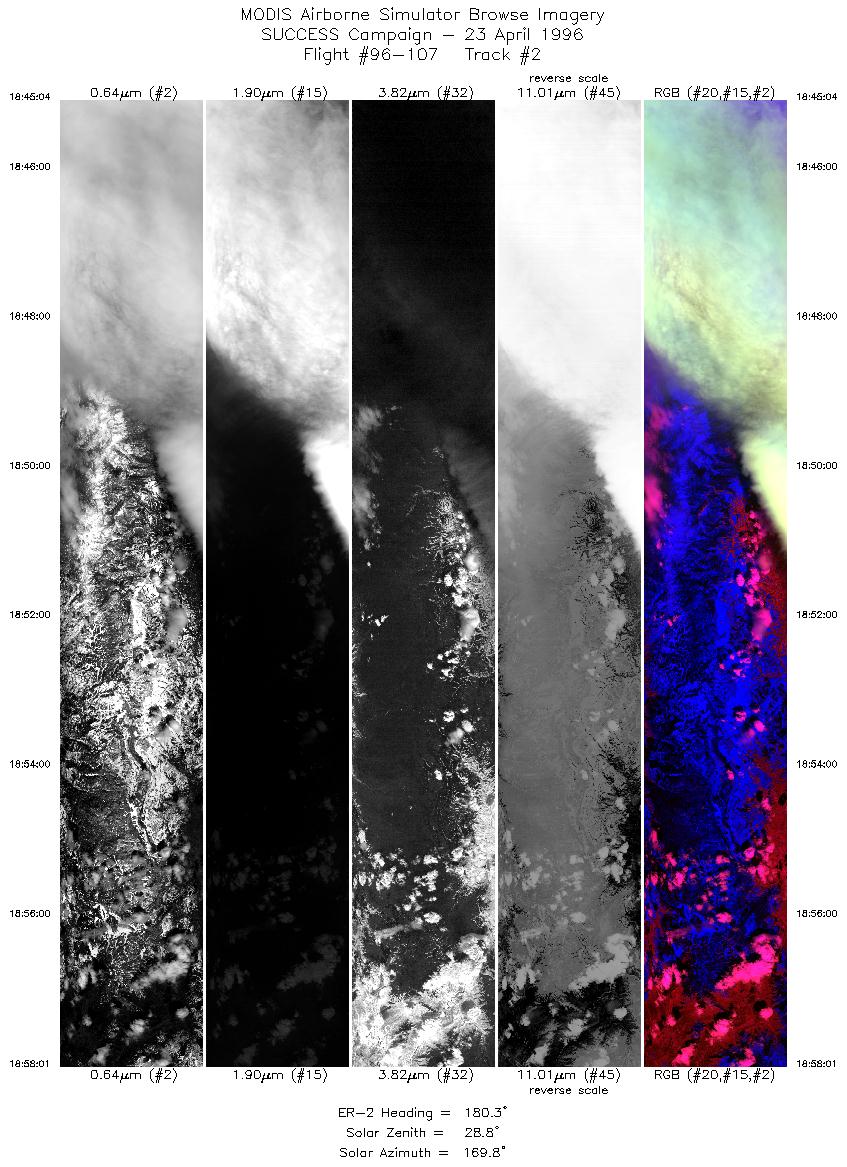
| 2 |
STD |
CIR |
18:45-18:58 |
180 |
41.31-39.85 |
106.58-106.60 |
4838 |
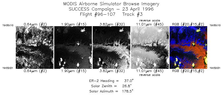
| 3 |
STD |
CIR |
19:00-19:02 |
37 |
39.79-40.00 |
106.39-106.20 |
817 |
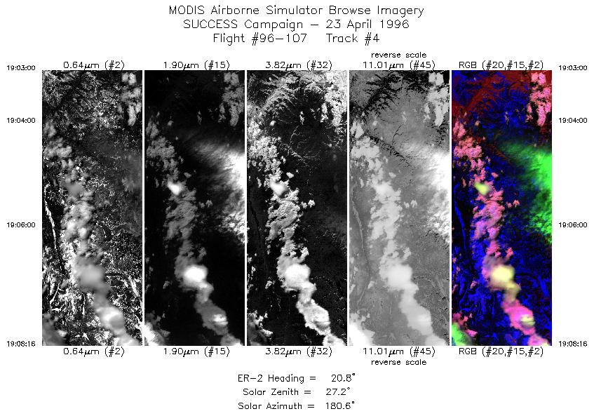
| 4 |
STD |
CIR |
19:03-19:08 |
21 |
40.07-40.63 |
106.16-105.87 |
1968 |
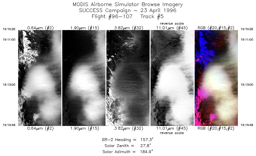
| 5 |
STD |
CIR |
19:10-19:14 |
157 |
40.64-40.20 |
105.61-105.36 |
1595 |
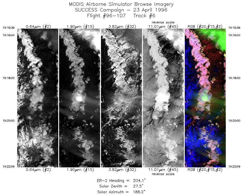
| 6 |
STD |
CIR |
19:15-19:22 |
204 |
40.11-39.45 |
105.36-105.75 |
2428 |
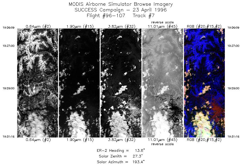
| 7 |
STD |
CIR |
19:26-19:31 |
14 |
39.65-40.23 |
106.00-105.81 |
1911 |
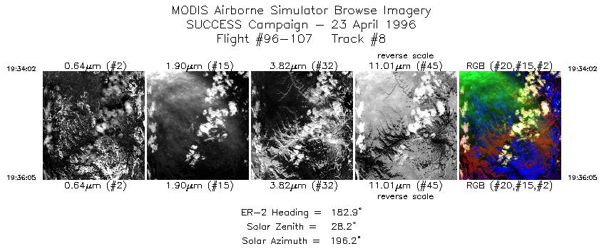
| 8 |
STD |
CIR |
19:34-19:36 |
183 |
40.24-40.01 |
106.02-106.03 |
767 |
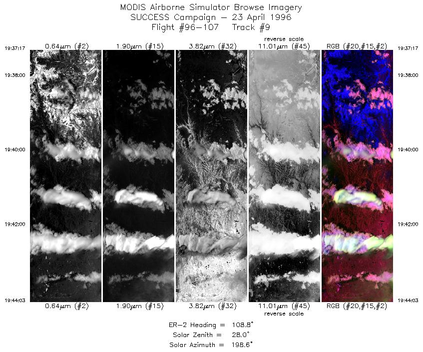
| 9 |
STD |
CIR |
19:37-19:44 |
109 |
39.91-39.68 |
105.94-104.97 |
2528 |
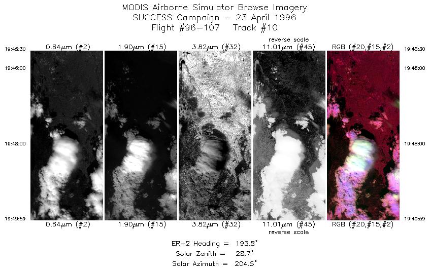
| 10 |
STD |
CIR |
19:45-19:49 |
194 |
39.55-39.07 |
104.88-105.03 |
1676 |
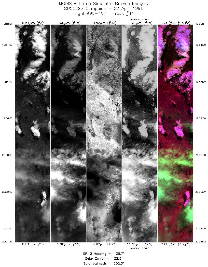
| 11 |
STD |
CIR |
19:52-20:04 |
26 |
39.14-40.36 |
105.25-104.46 |
4434 |
| 12 |
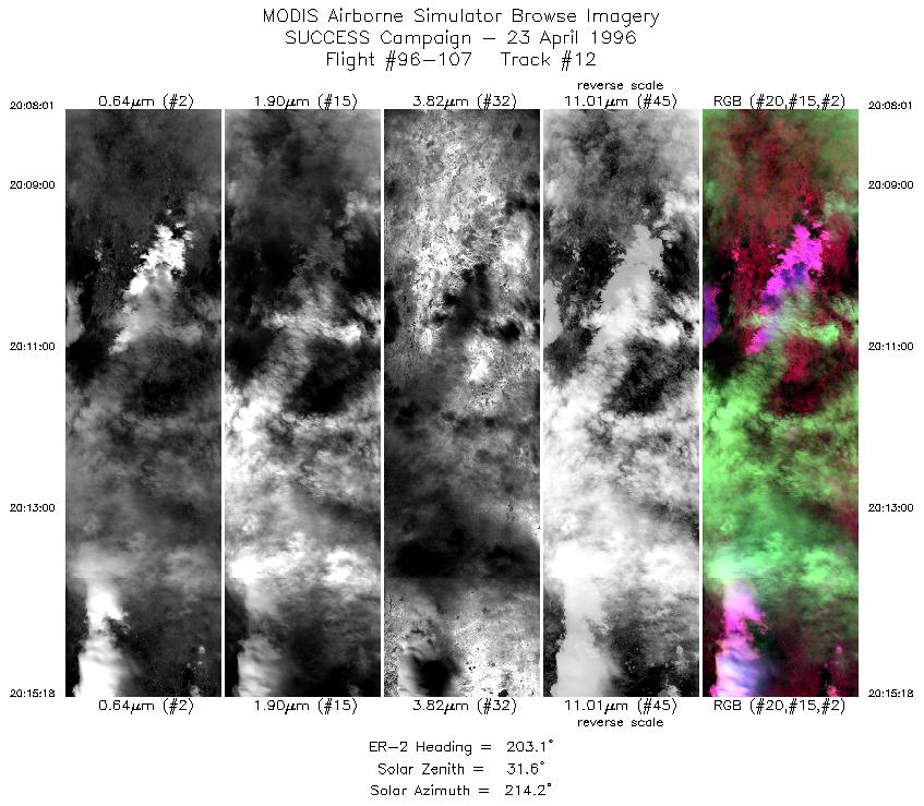
STD |
CIR |
20:08-20:15 |
203 |
40.41-39.64 |
104.71-105.11 |
2699 |
|
Standard Browse Images 01 through 12 in sequence |
|
Cirrus Detection Browse Images 01 through 12 in sequence |
Level-1B HDF Data Distribution Point
NASA GSFC Earth Sciences (GES) Data Center
NASA DAAC's
Additional Information
The objective of this mission was to
observe wave clouds over the front range and contrails during
overpass of the NOAA-14 satellite.
Take-off time was 1730 UTC and landing 2130 UTC. ER-2 flew to
approximately 41:22N 106:19W and arrived at approximately 1839
UTC. Mission was to overfly mountain wave clouds and contrails
in and out of the principal plane of the sun. Pilot was to visually
locate the clouds. Coorindate flight track with ground track of
the NOAA-14 satellite between 2031 and 2033 UTC. Track of satellite
was approximately 40:36:20N 107:18:00W; 41:19.5N 107:34.8N; 41:59:51
107:48:00W; 42:39:09 108:00:00.
The ER-2 aircraft flew parallel to NOAA-14 track while south of Denver.
The pilot reported the ER-2 flew over a long cirrus cloud
that extended for about 100 miles downwind of Larimer. This
cirrus appeared to be rolling and turbulent. Commercial aircraft
reported wave clouds. Could visually see roll clouds out side
cockpit window, put could not see them when over the clouds due
to cirrus above of the wave clouds. No persistant contrails, ER-2
overflew some non persistant contrails. Flew south of Denver to
get contrails and roll clouds. Flew satellite overpass while south
of Denver.
|
|
|
|