
|
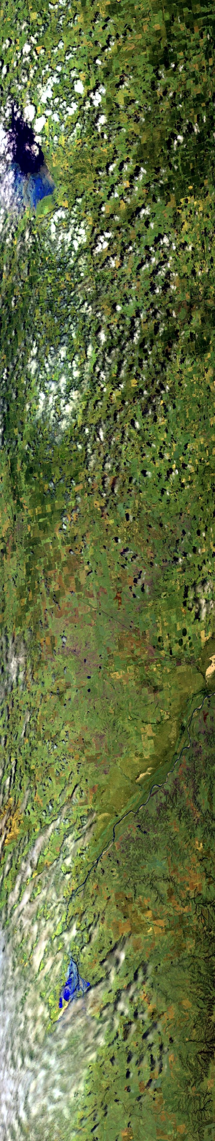
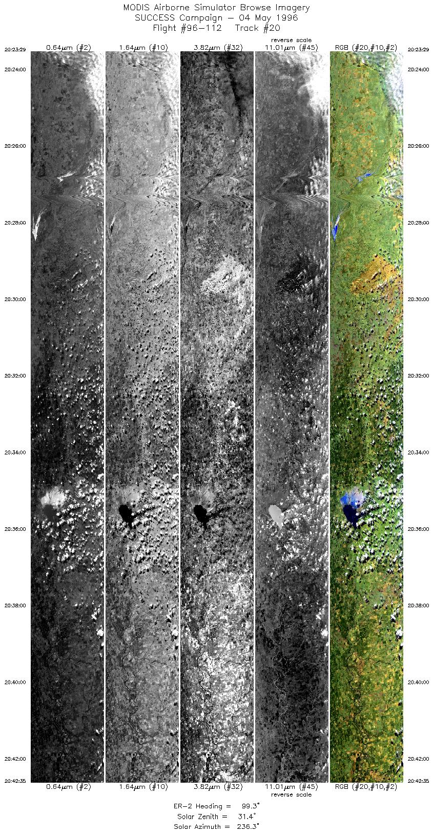
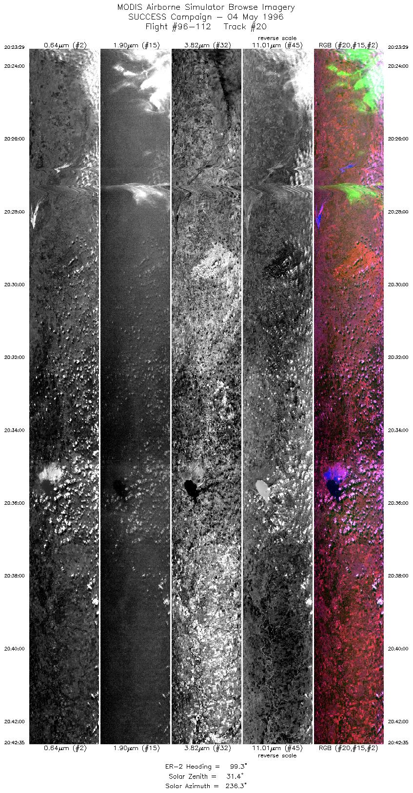
Sample Image

04 May 1996
Track #20
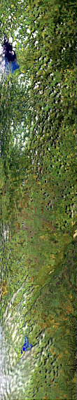

"Great Salt Plains Lake and
Cimmeron River, Oklahoma"
R: 2.15 microns
G: 1.65 microns
B: 0.64 microns
|
|
Summary Information
Date: May 4, 1996
ER-2 Flight Number: 96-112
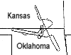
Location: Oklahoma CART Site & Kansas
Principle Investigator: Dr. Brian Toon (NASA Ames)
Additional Sensors: B&W_6"_RC-10, MIR, CLS, RAMS, HIS
Level-1B Processing Information
Level-1B Data Version: #10
Calibration Type: Final
Calibration Version: SUCCESS_Ames 1.0
Temperature Adjustment: No
Status: Final Calibration Done
|
|
Flight Track Map

|
Level-1B Browse Imagery
Straight Line Flight Tracks: 22
Scanlines Processed: 54687
Solar Azimuth and Zenith Angles
|
Browse Images
|
Click on the Flight Track number to load images.
Lat/Lon ranges are for the BEG-END scanline nadir pixels.
|
Flight
Track |
Standard
Image |
Cirrus
Image |
Time_Span
(GMT) |
Heading
(Deg) |
Lat_Range
(Deg_N) |
Lon_Range
(Deg_W) |
Length
(Scanlines) |
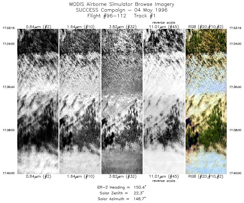
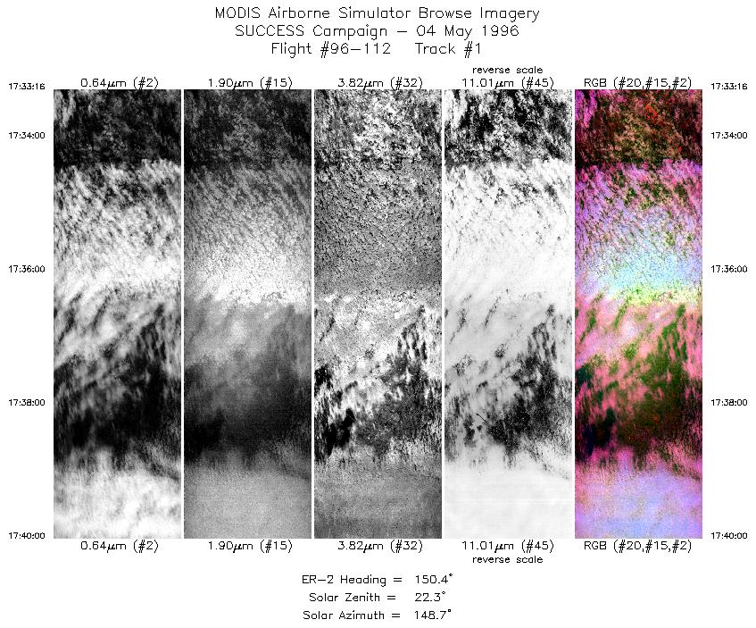
| 1 |
STD |
CIR |
17:33-17:40 |
150 |
35.98-35.31 |
95.89- 95.41 |
2516 |
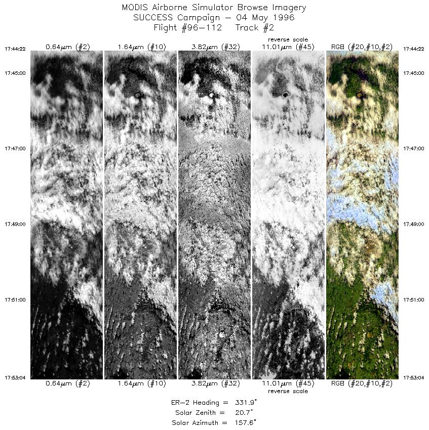
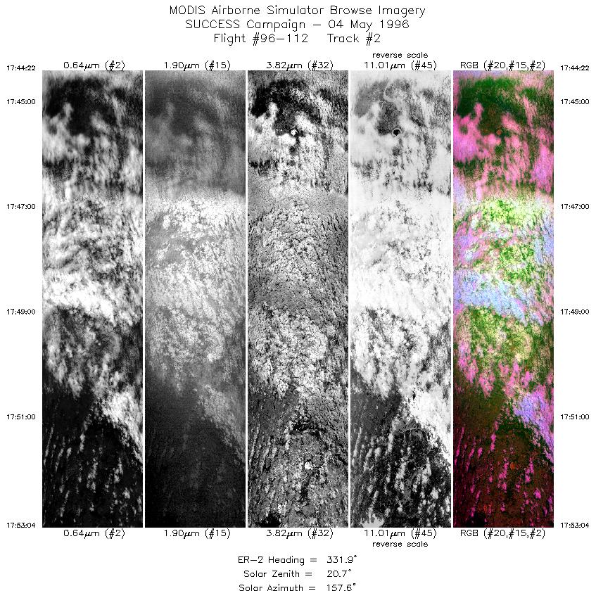
| 2 |
STD |
CIR |
17:44-17:53 |
332 |
35.53-36.40 |
95.20- 95.75 |
3252 |
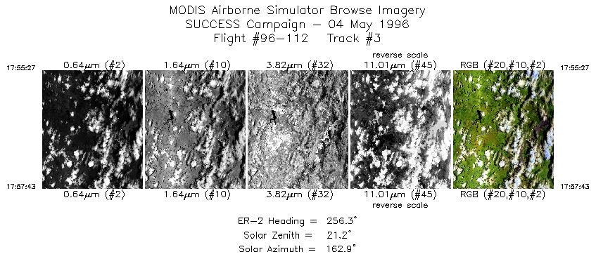
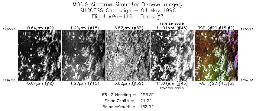
| 3 |
STD |
CIR |
17:55-17:57 |
256 |
36.49-36.40 |
96.04- 96.32 |
848 |
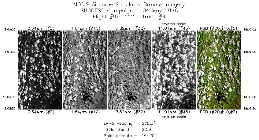
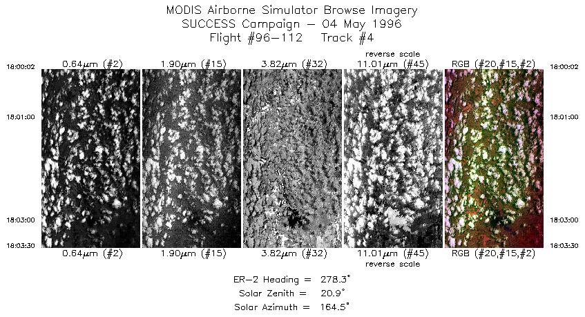
| 4 |
STD |
CIR |
18:00-18:03 |
278 |
36.38-36.45 |
96.64- 97.10 |
1296 |
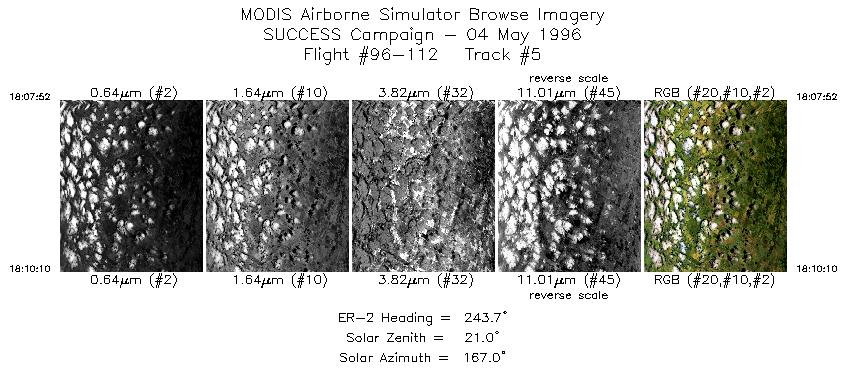
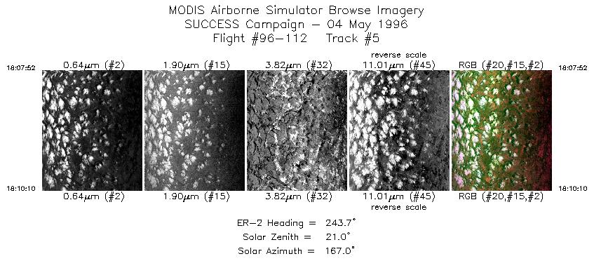
| 5 |
STD |
CIR |
18:07-18:10 |
244 |
36.68-36.57 |
97.58- 97.86 |
860 |
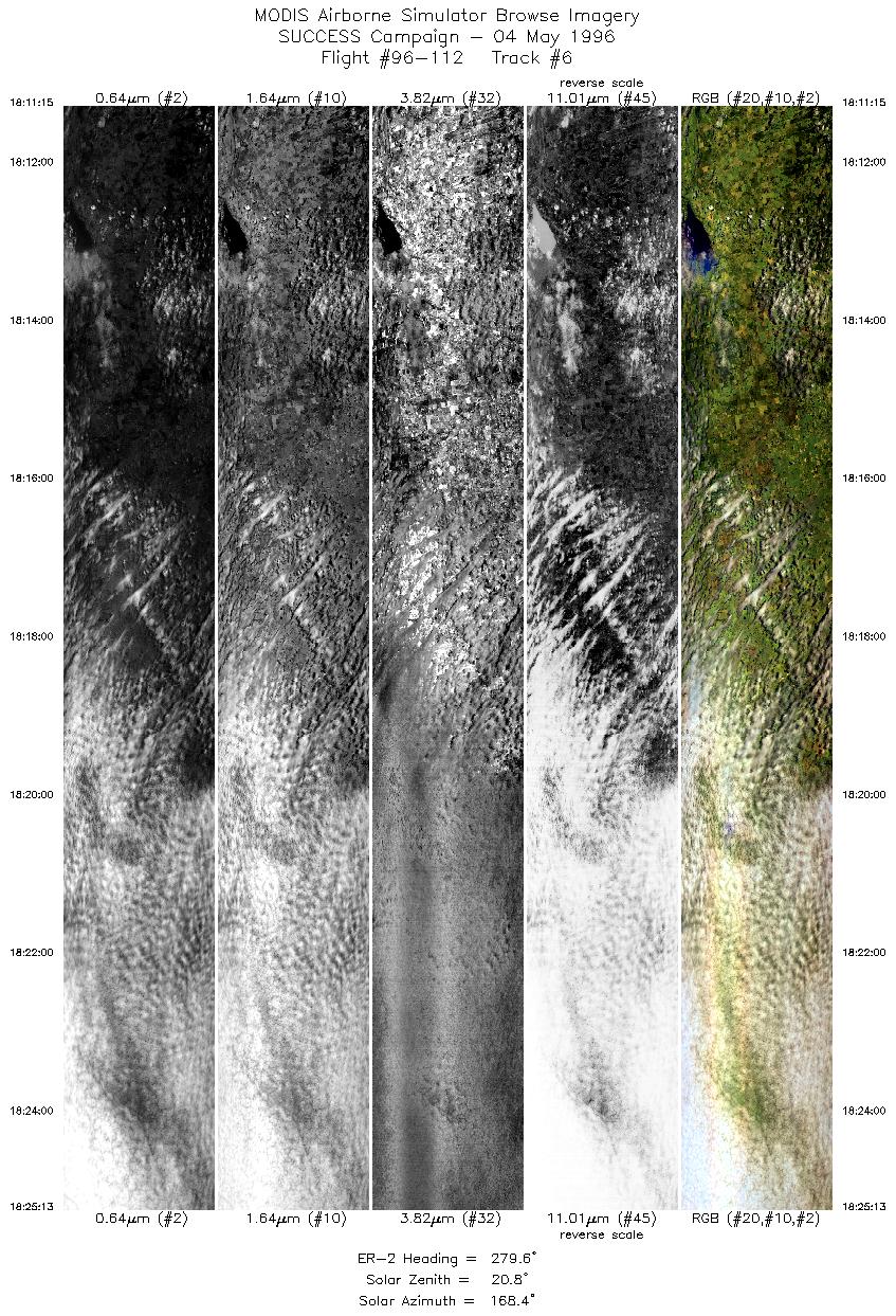
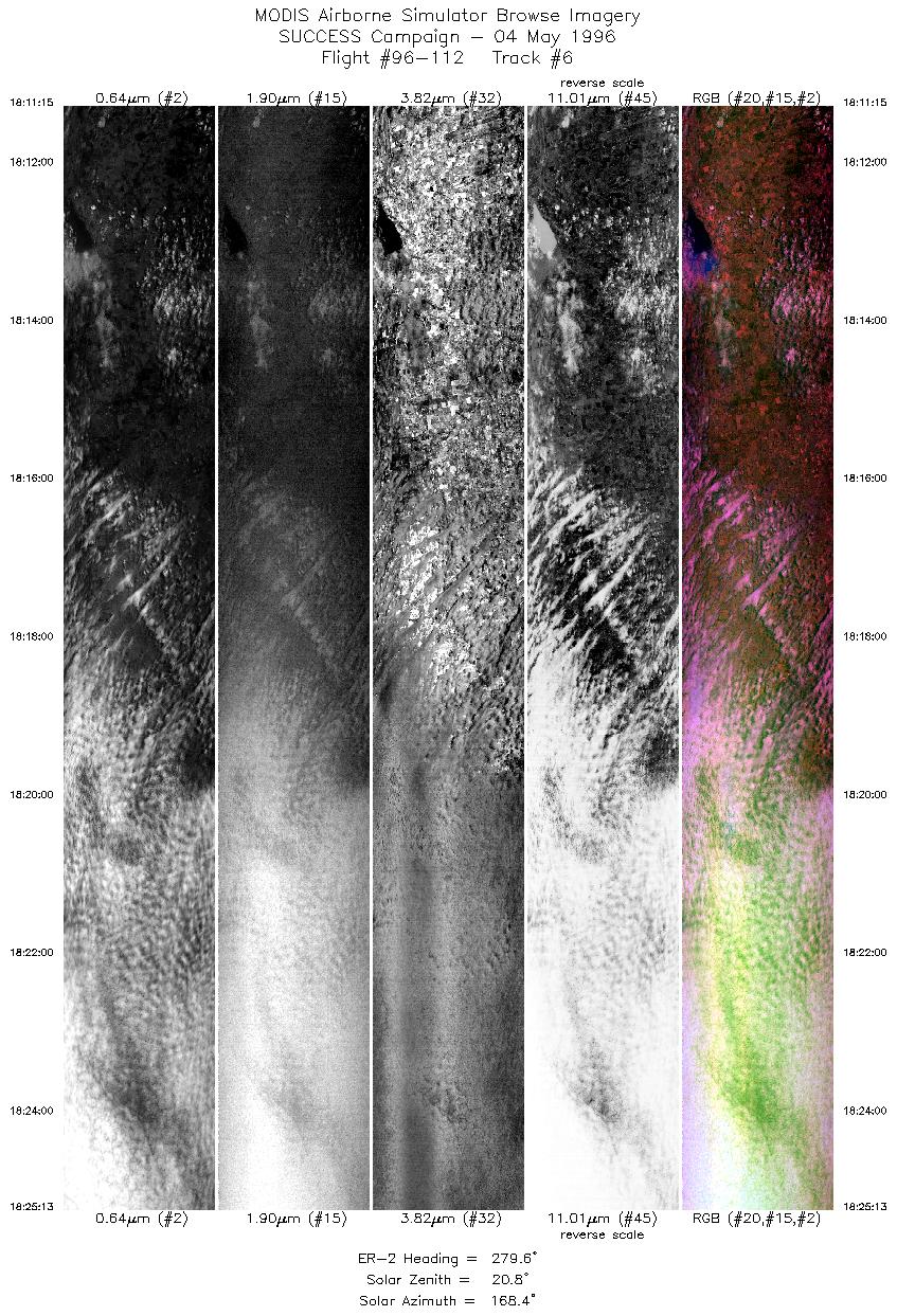
| 6 |
STD |
CIR |
18:11-18:25 |
280 |
36.58-36.83 |
98.00- 99.94 |
5219 |
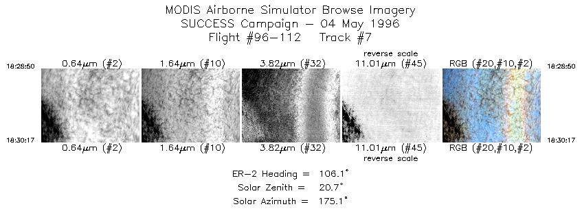
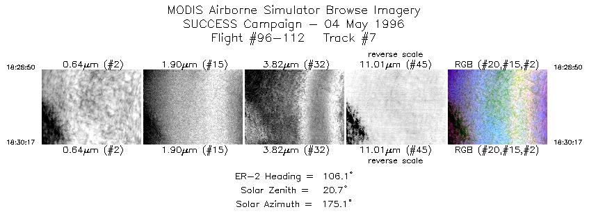
| 7 |
STD |
CIR |
18:28-18:30 |
106 |
37.03-36.99 |
99.84- 99.63 |
542 |
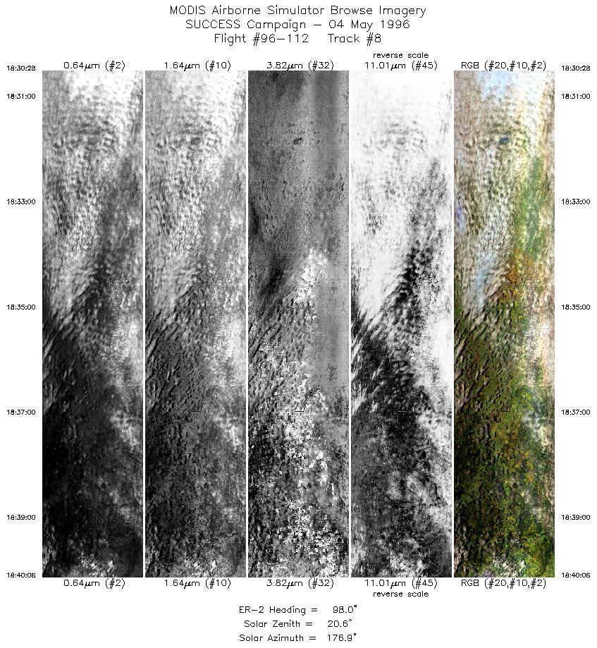
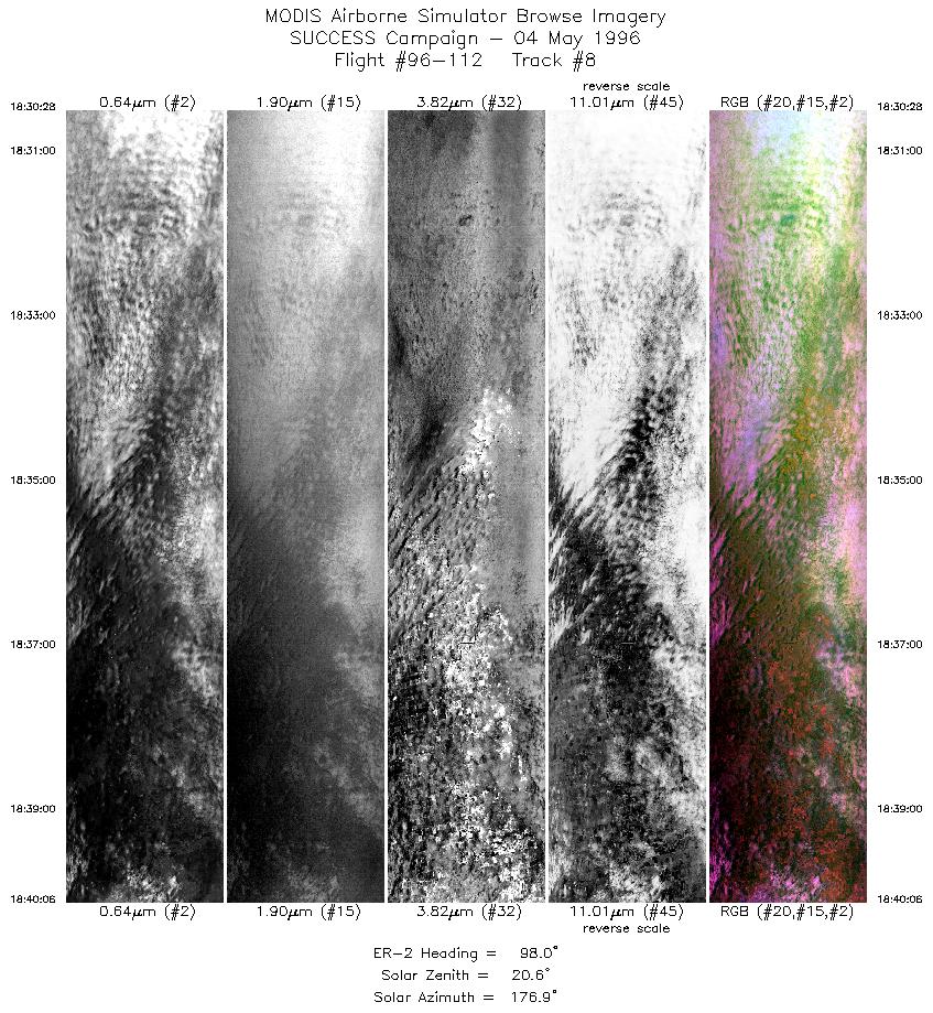
| 8 |
STD |
CIR |
18:30-18:40 |
98 |
36.99-36.81 |
99.60- 98.25 |
3599 |
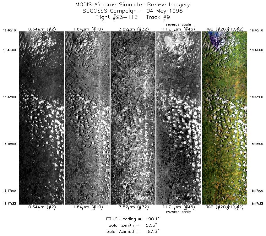
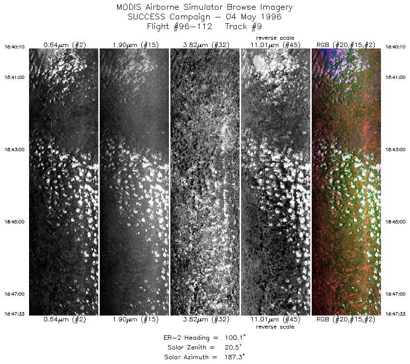
| 9 |
STD |
CIR |
18:40-18:47 |
100 |
36.81-36.67 |
98.24- 97.19 |
2759 |
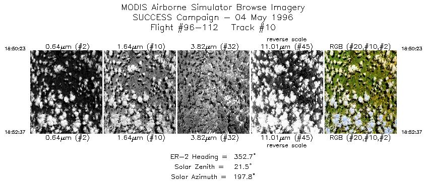
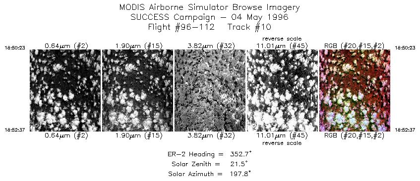
| 10 |
STD |
CIR |
18:50-18:52 |
353 |
36.88-37.14 |
97.00- 97.04 |
834 |
| 11 |
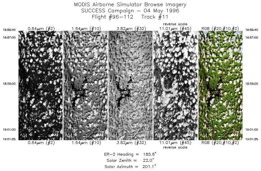
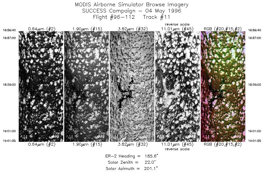
STD |
CIR |
18:56-19:01 |
186 |
37.06-36.53 |
96.76- 96.84 |
1775 |
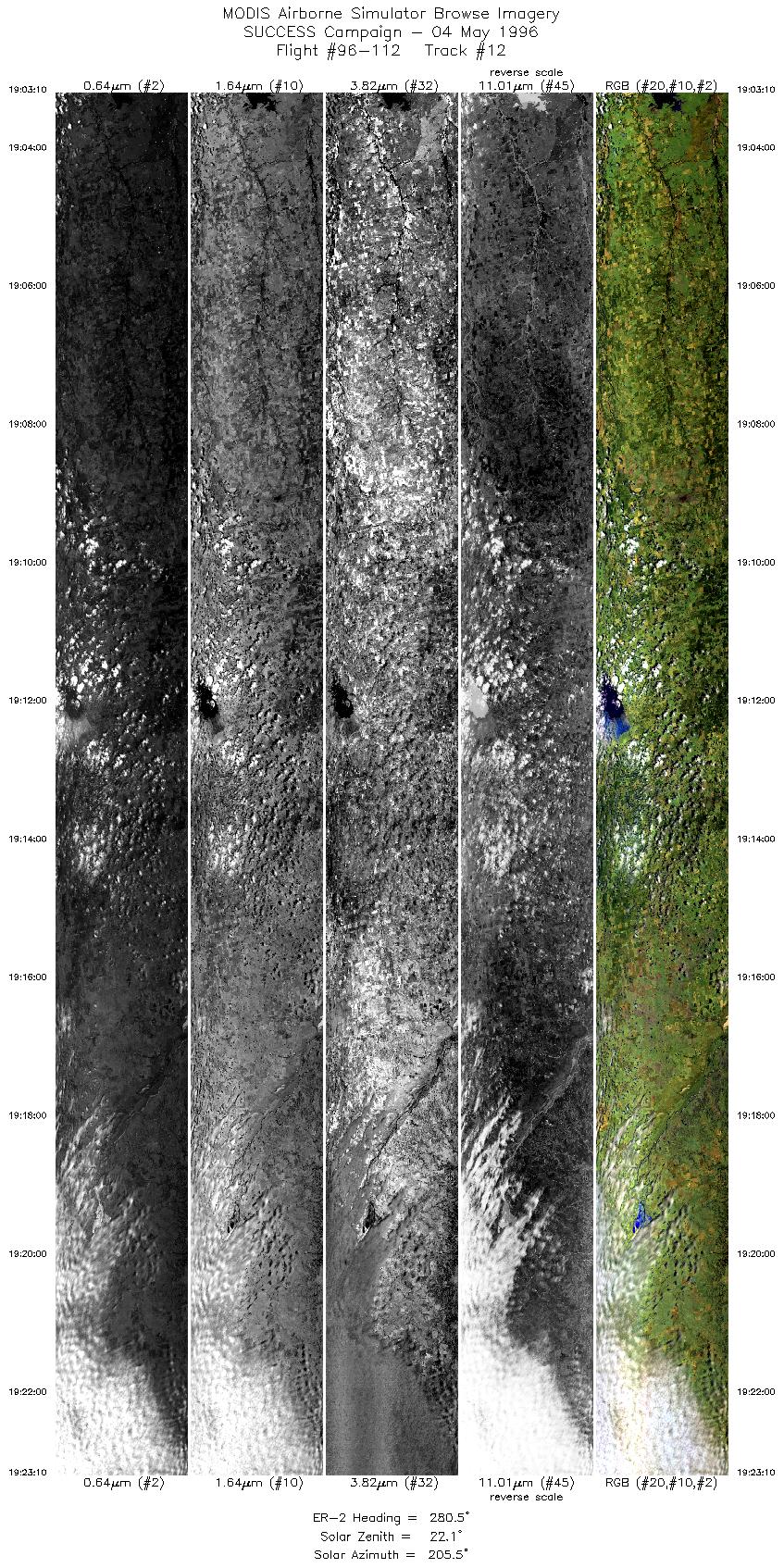
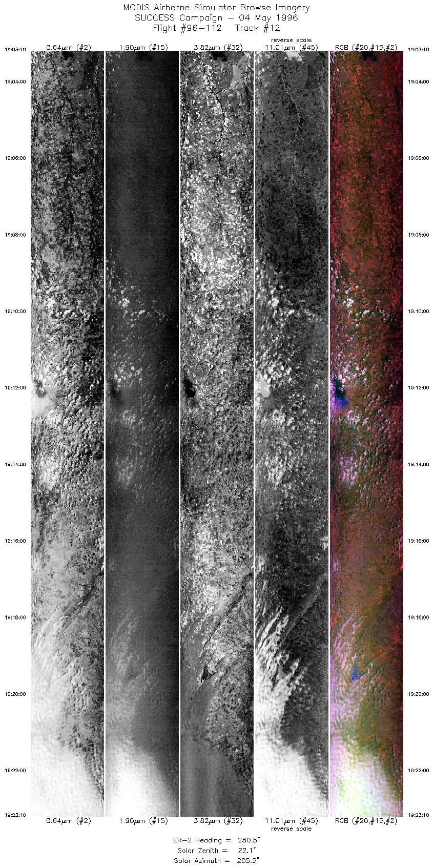
| 12 |
STD |
CIR |
19:03-19:23 |
281 |
36.44-36.81 |
97.02- 99.77 |
7472 |
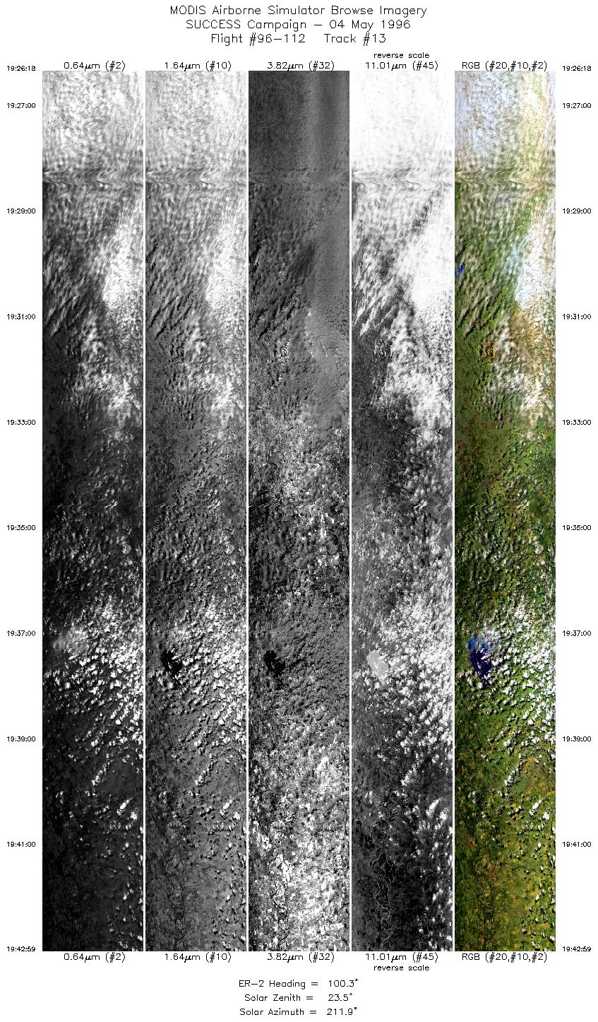
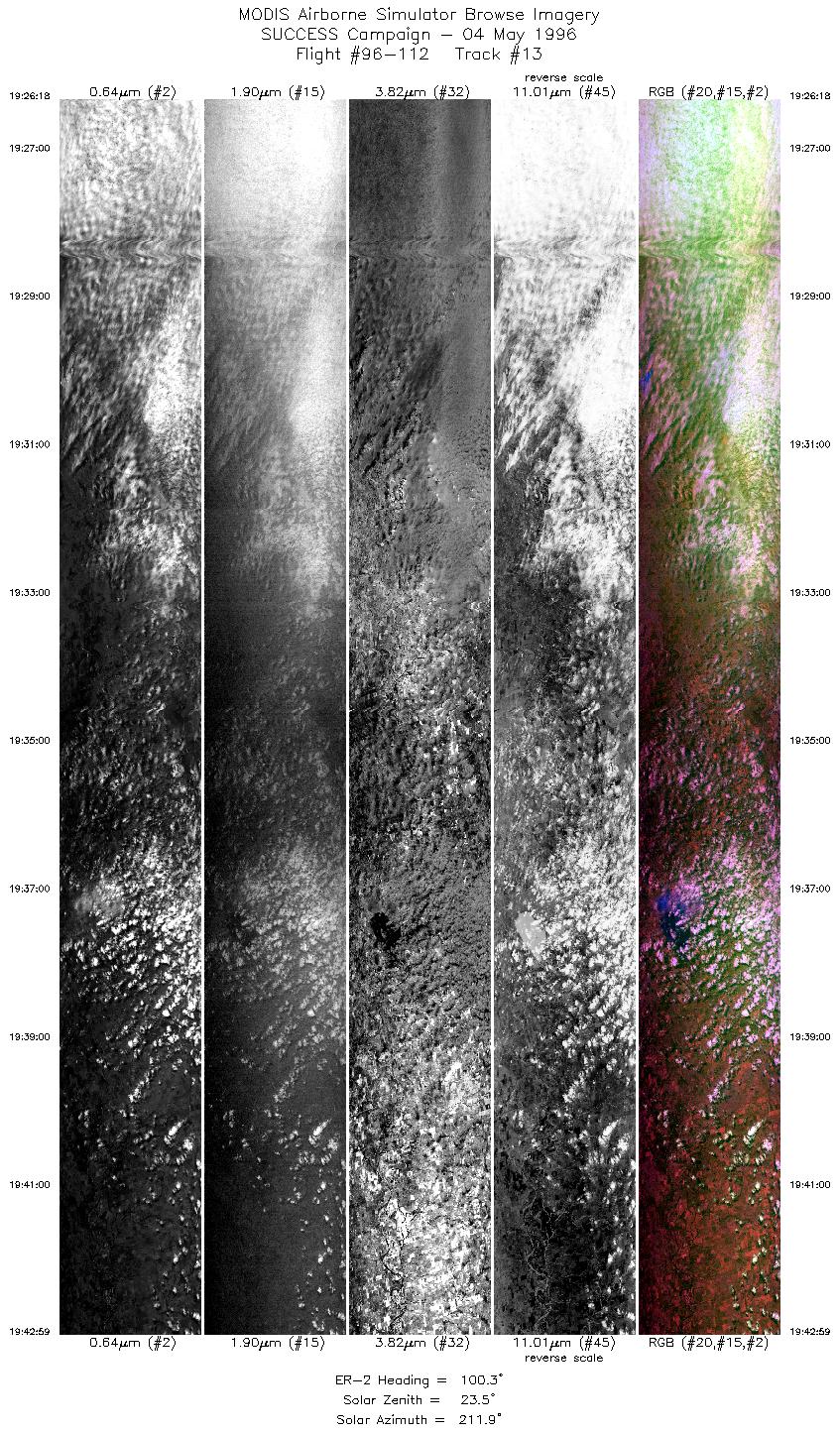
| 13 |
STD |
CIR |
19:26-19:42 |
100 |
37.01-36.71 |
99.75- 97.43 |
6233 |
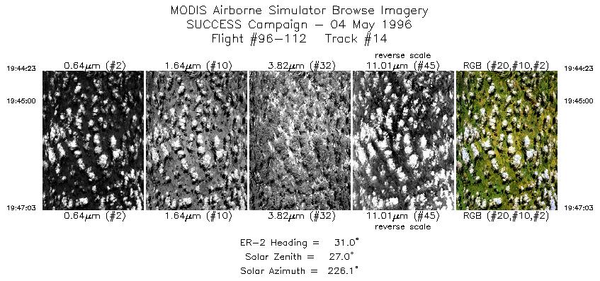
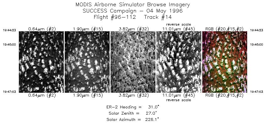
| 14 |
STD |
CIR |
19:44-19:47 |
31 |
36.76-37.03 |
97.26- 97.07 |
988 |
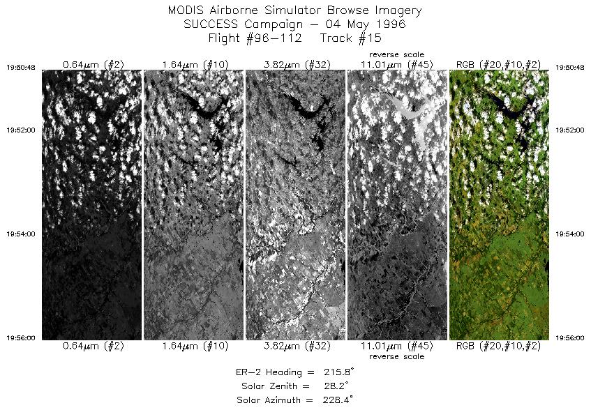
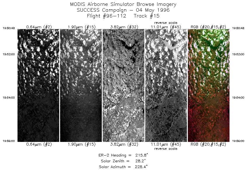
| 15 |
STD |
CIR |
19:50-19:55 |
216 |
36.88-36.41 |
96.85- 97.30 |
1942 |
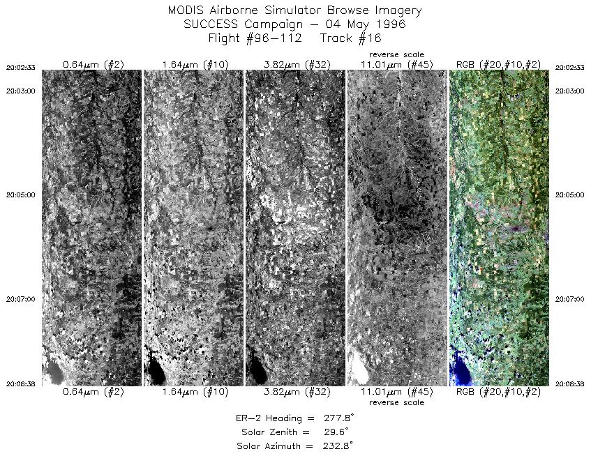
| 16 |
STD |
CIR |
20:02-20:08 |
278 |
36.49-36.61 |
97.40- 98.26 |
2273 |
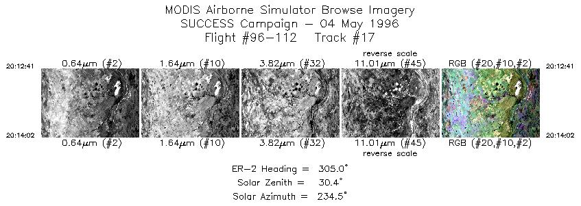
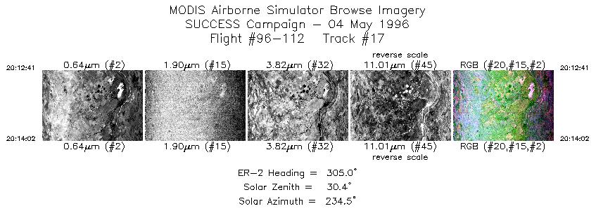
| 17 |
STD |
CIR |
20:12-20:14 |
305 |
36.57-36.67 |
98.80- 98.95 |
505 |
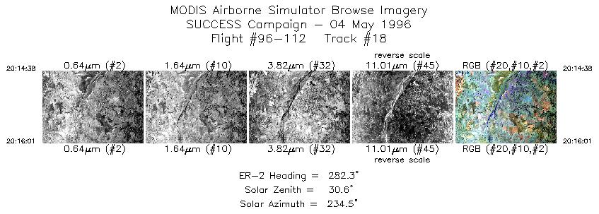
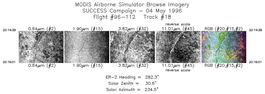
| 18 |
STD |
CIR |
20:14-20:16 |
282 |
36.70-36.74 |
99.03- 99.22 |
517 |
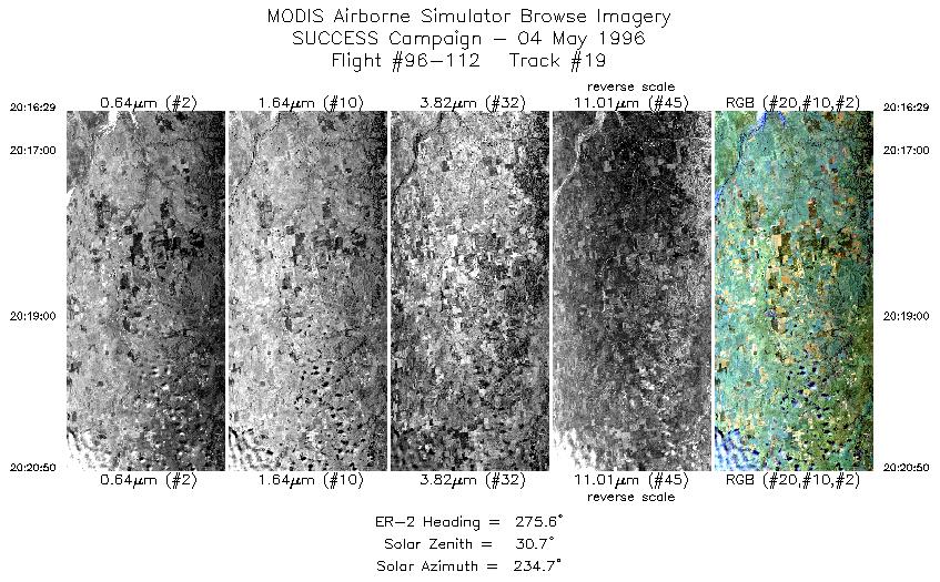
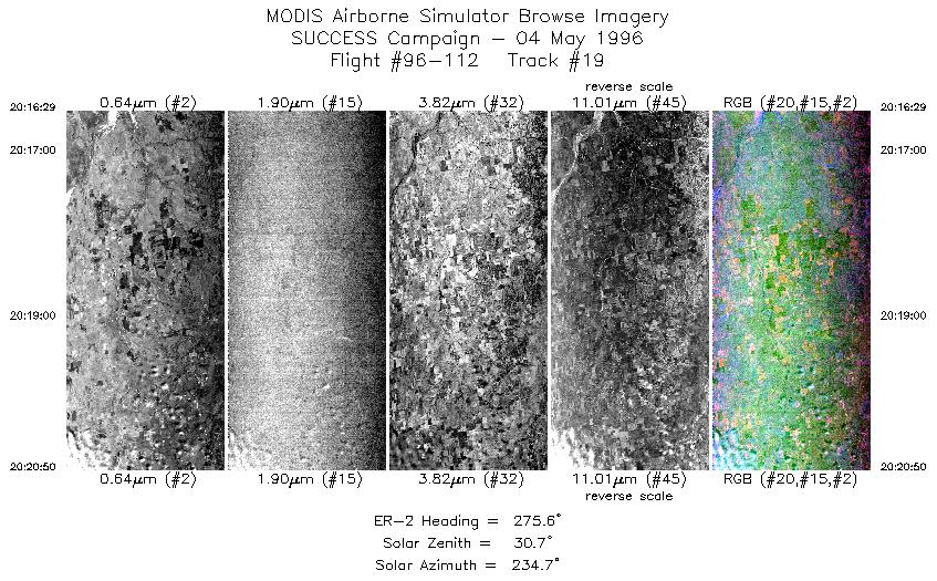
| 19 |
STD |
CIR |
20:16-20:20 |
276 |
36.75-36.82 |
99.29- 99.90 |
1625 |
| 20 |
STD |
CIR |
20:23-20:42 |
99 |
37.02-36.67 |
99.87- 97.21 |
7134 |
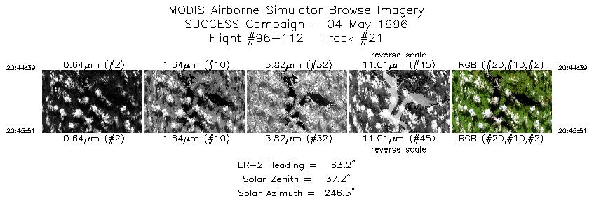
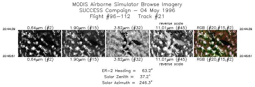
| 21 |
STD |
CIR |
20:44-20:45 |
63 |
36.74-36.80 |
96.96- 96.81 |
450 |
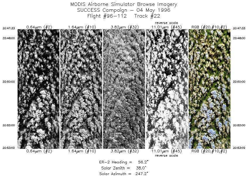
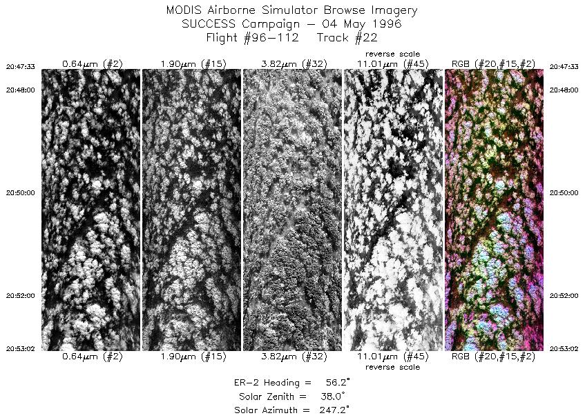
| 22 |
STD |
CIR |
20:47-20:53 |
56 |
36.91-37.27 |
96.62- 95.97 |
2048 |
|
Standard Browse Images 01 through 22 in sequence |
|
Cirrus Detection Browse Images 01 through 22 in sequence |
Level-1B HDF Data Distribution Point
NASA GSFC Earth Sciences (GES) Data Center
NASA DAAC's
Additional Information
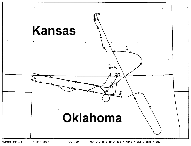
The objective of this mission was to fly coordinated flight patterns
with the T-39, DC-8 to sample contrails of Boeing 757. ARM aircraft
were also part of the science mission.
Also scheduled was to underfly the NOAA-14 satellite to assist in the development of
algorithms for satellite remote sensing of contrails.
The ER-2 took off at 1700 UTC and landed at 2140 UTC. ER-2 flew to ARM CART site and flew racetrack
pattern in the principle plane of the sun and then met up with the other aircraft. ER-2 flew a racetrack pattern
stacked with other aircrafts oriented approximately 280 and 100 degrees. On first southern leg of the race
track ATC redirected DC-8 and B757, the ER-2 followed to stay in stack formation with other aircraft. On
the eastern end of the northern leg of the racetrack the ER-2 broke away to make runs in the principal plane of
the sun, and met up with the other planes on the southern leg. ER-2 heading was with respect to the principle
plane of the sun at the following approximate times 1733-1740 UTC; 1743-1754 UTC; 1850-1852 UTC;
1856-1901 UTC; 1944-1947 UTC; 1951-1955 UTC 2044-2045 UTC; 2047-2053 UTC. Three race track
patterns were executed.
The pilot also noted broken low level clouds east of the ARM CART site, no low level clouds over the
site. Contrails were made throughout the mission with no naturally occuring cirrus (this was observed over the
Salina area along with low clouds). DC-8 contrails were approximately 20-25 miles long. ER-2 was behind
the DC-8 during the 18:00:00-18:03:30 UTC run. During the run between 18:13-18:47 ER-2 was between the
Boeing 757 and the DC-8 (and also during the first 80 miles of the 20:24:00-20:42:45 UTC
leg). Three miles behind the Boeing 757 during the 19:27 and 19:43 UTC run. Ahead of all planes during satellite
overpass.
|
|
|
|