
|
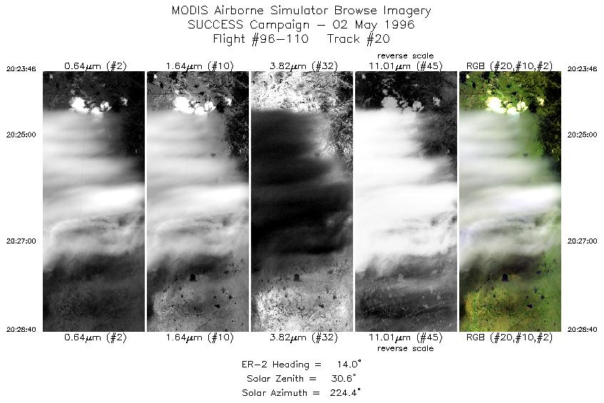
Sample Image

02 May 1996
Track #20
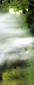

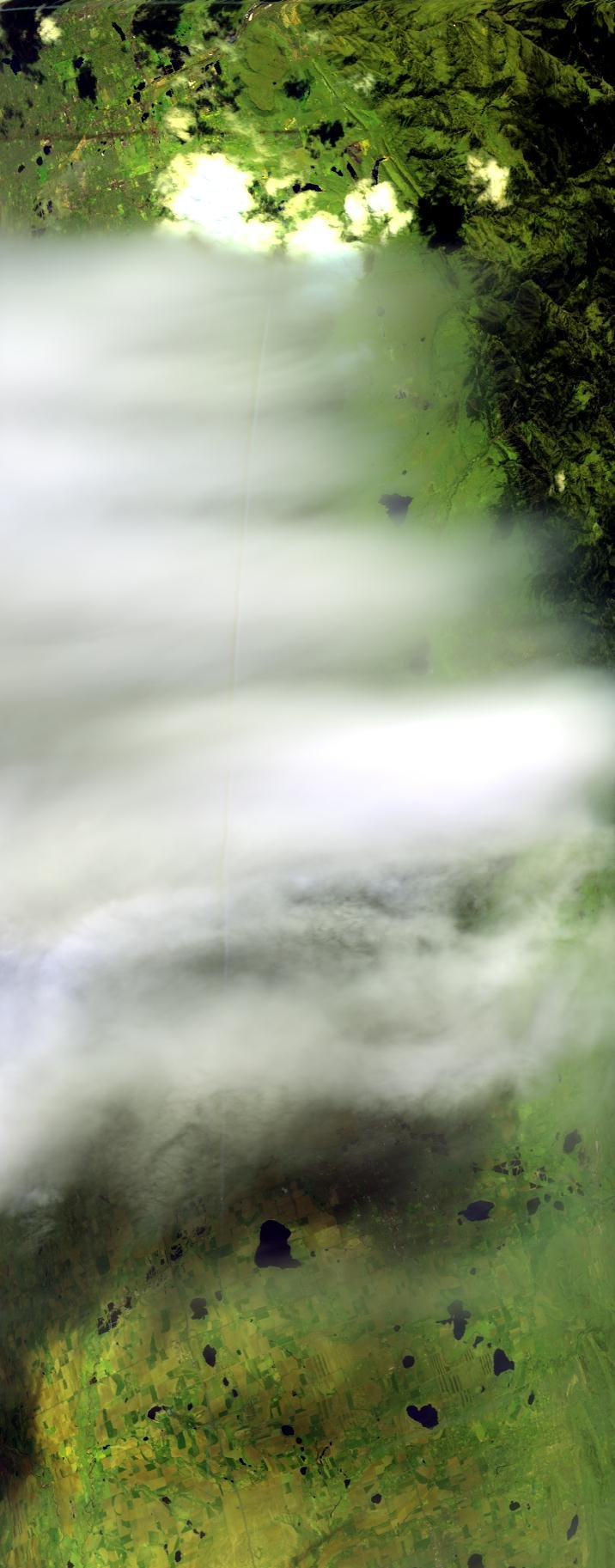
"Wave cloud near Boulder, Colorado"
R: 2.15 microns
G: 1.65 microns
B: 0.64 microns
02 May 1996
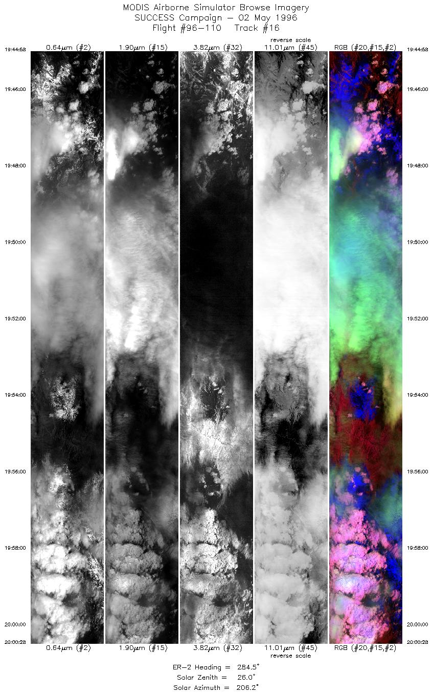
Track #16
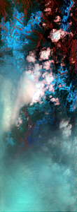
"Cumulus clouds over snow capped Mount Evans
(14,300 feet) west of Denver, Colorado"
R: 2.15 microns
G: 0.94 microns
B: 0.64 microns
|
|
Summary Information
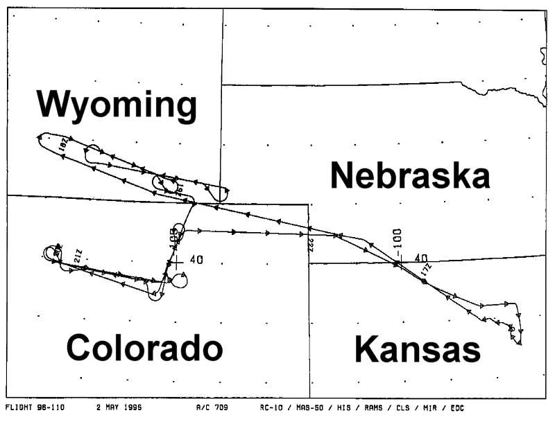
Date: May 2, 1996
ER-2 Flight Number: 96-110
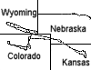
Location: Wyoming-Colorado-Nebraska-Kansas
Principle Investigator: Dr. Brian Toon (NASA Ames)
Additional Sensors: B&W_6"_RC-10, MIR, CLS, RAMS
Level-1B Processing Information
Level-1B Data Version: #10
Calibration Type: Final
Calibration Version: SUCCESS_Ames 1.0
Temperature Adjustment: No
Status: Final Calibration Done
|
|
Flight Track Map

|
Level-1B Browse Imagery
Straight Line Flight Tracks: 30
Scanlines Processed: 75137
Solar Azimuth and Zenith Angles
|
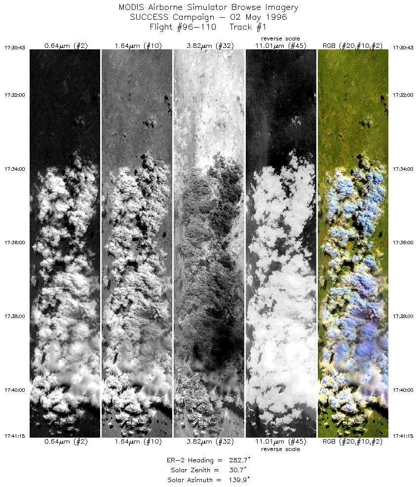
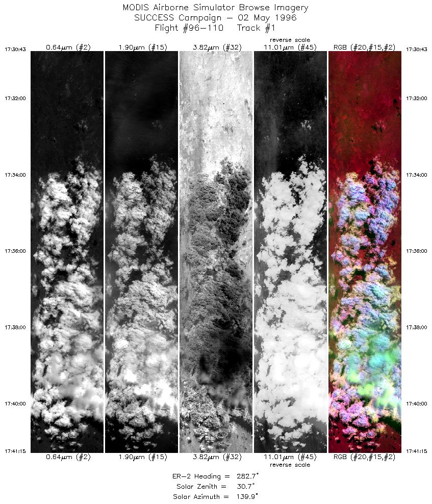
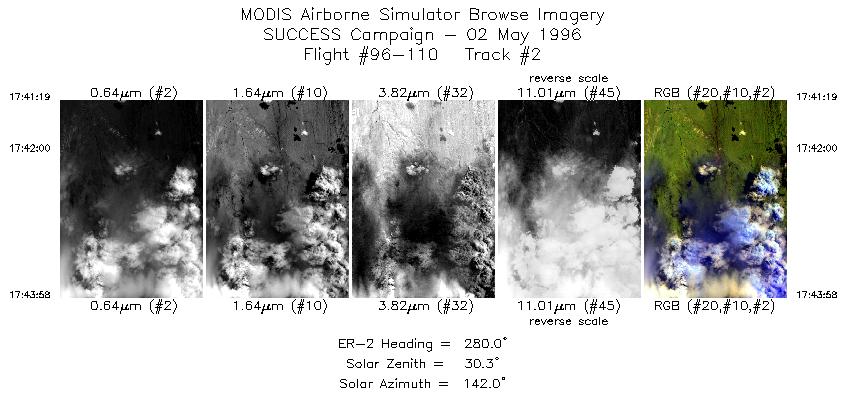
Browse Images
|
Click on the Flight Track number to load images.
Lat/Lon ranges are for the BEG-END scanline nadir pixels.
|
Flight
Track |
Standard
Image |
Cirrus
Image |
Time_Span
(GMT) |
Heading
(Deg) |
Lat_Range
(Deg_N) |
Lon_Range
(Deg_W) |
Length
(Scanlines) |
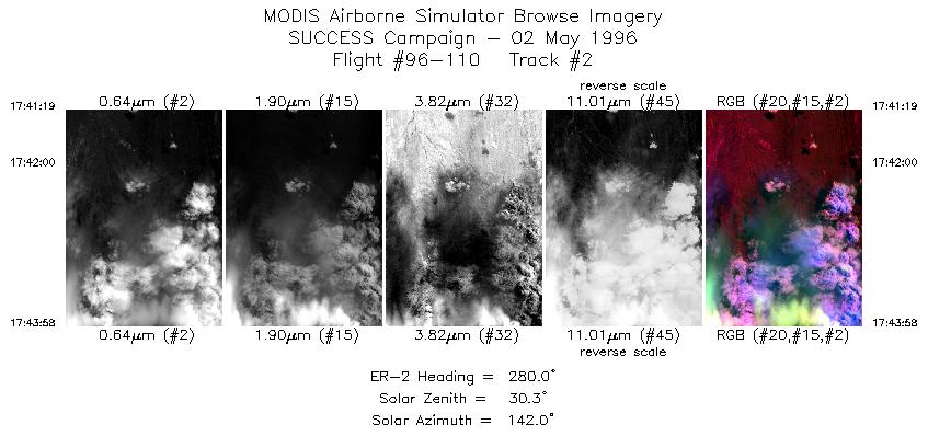
| 1 |
STD |
CIR |
17:30-17:41 |
283 |
40.86-41.08 |
103.55-105.05 |
3935 |
| 2 |
STD |
CIR |
17:41-17:43 |
280 |
41.08-41.14 |
105.06-105.43 |
991 |
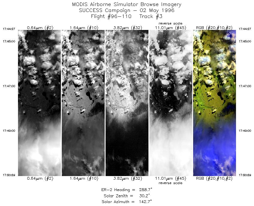
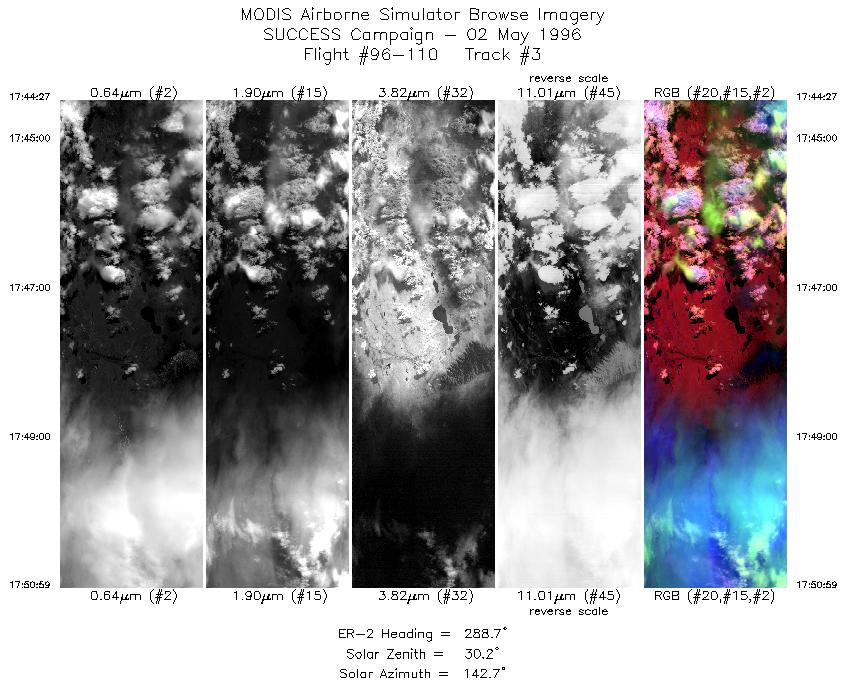
| 3 |
STD |
CIR |
17:44-17:50 |
289 |
41.15-41.40 |
105.50-106.41 |
2443 |
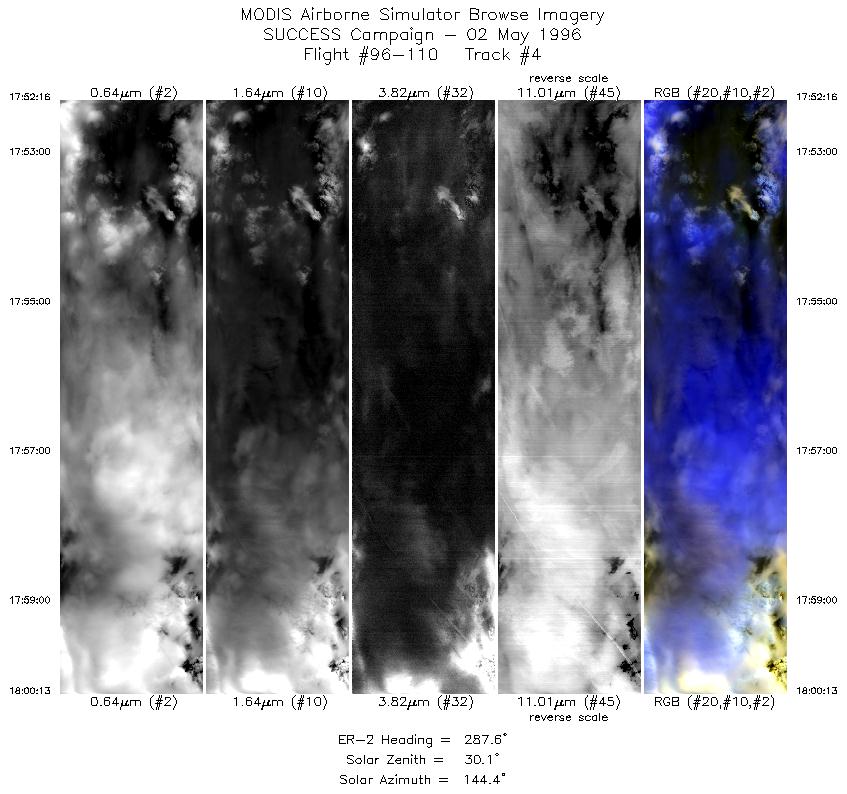
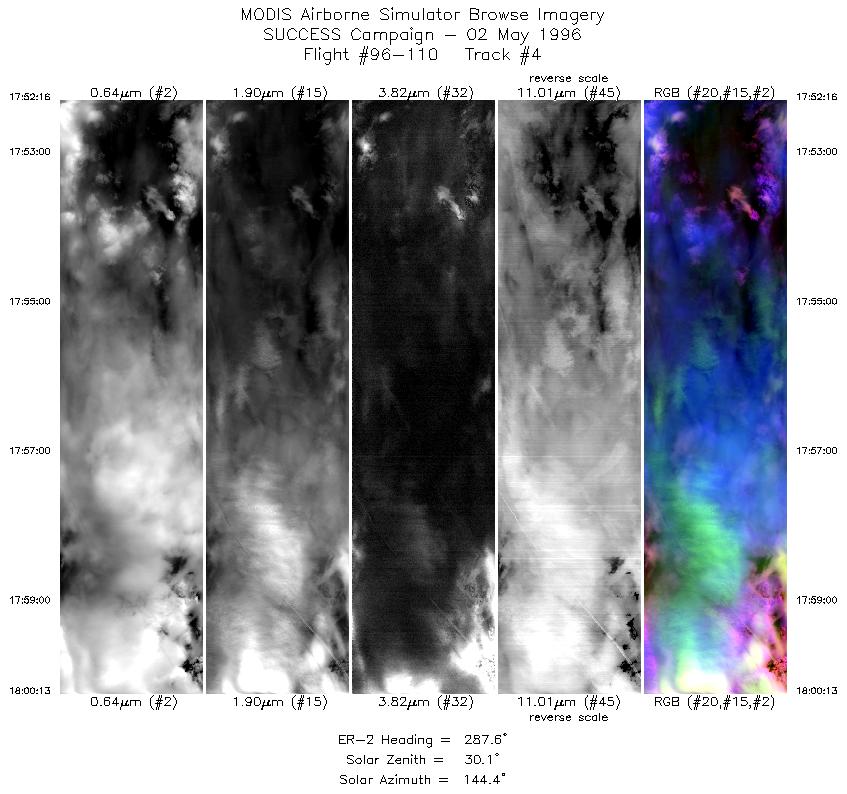
| 4 |
STD |
CIR |
17:52-18:00 |
288 |
41.44-41.73 |
106.58-107.71 |
2972 |
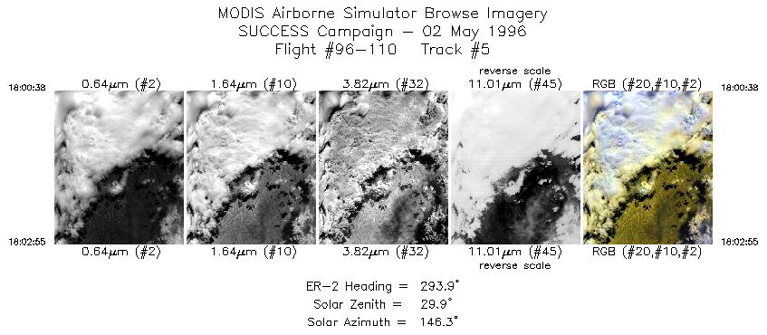
| 5 |
STD |
CIR |
18:00-18:02 |
294 |
41.74-41.84 |
107.78-108.09 |
854 |
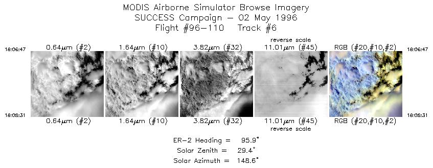
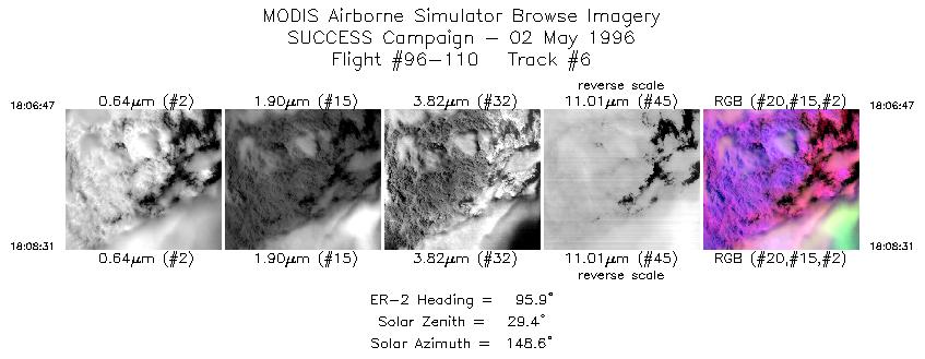
| 6 |
STD |
CIR |
18:06-18:08 |
96 |
42.07-42.05 |
107.93-107.66 |
649 |
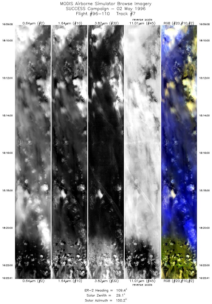
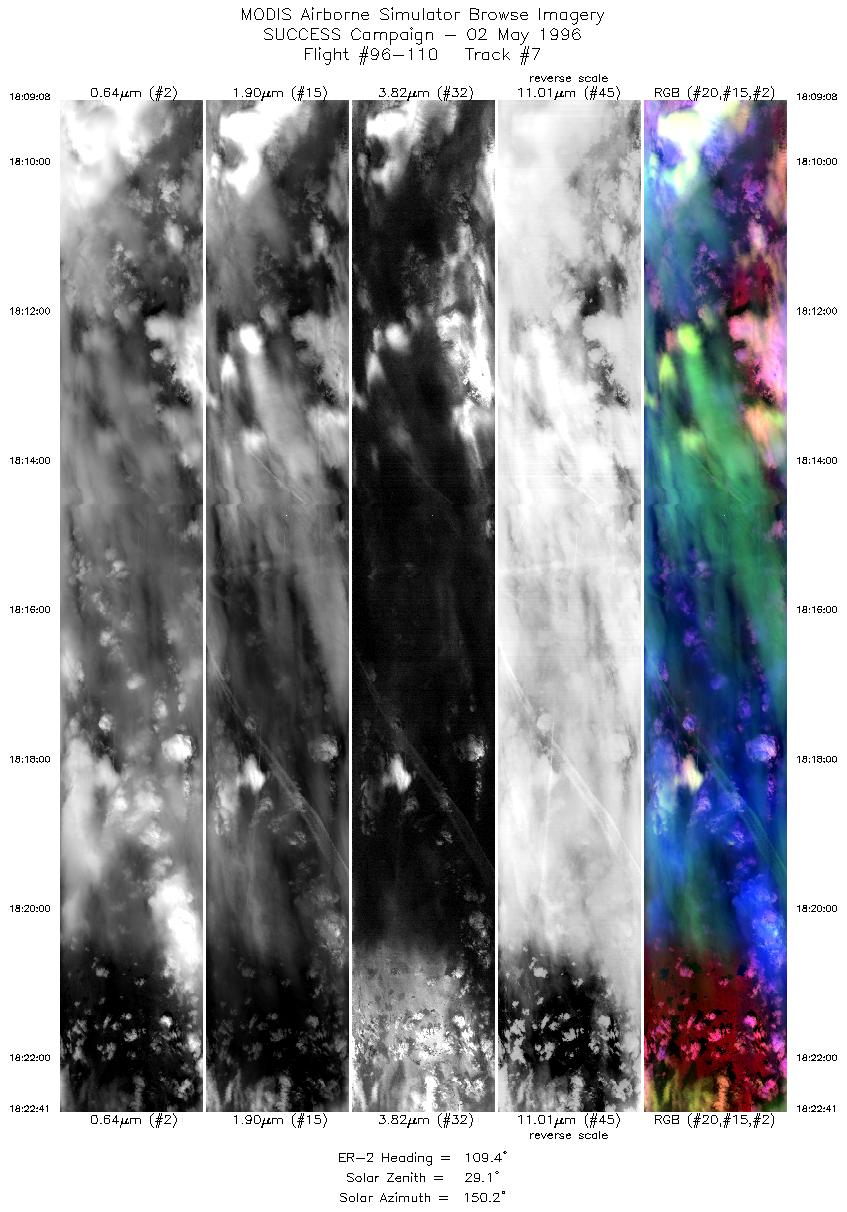
| 7 |
STD |
CIR |
18:09-18:22 |
109 |
42.03-41.50 |
107.57-105.58 |
5063 |
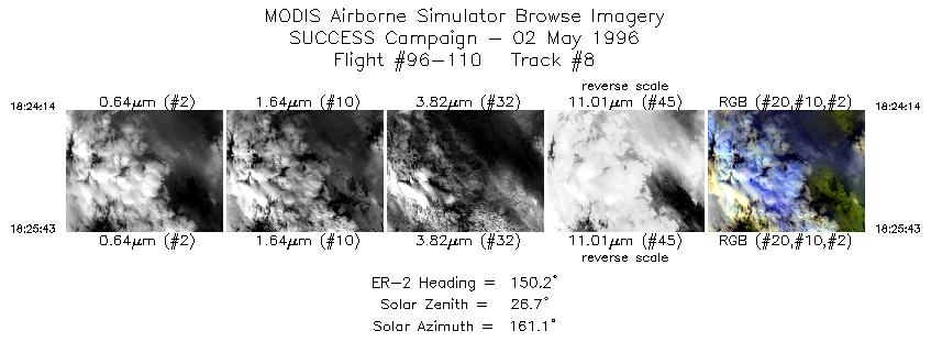
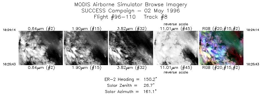
| 8 |
STD |
CIR |
18:24-18:25 |
150 |
41.38-41.23 |
105.42-105.30 |
555 |
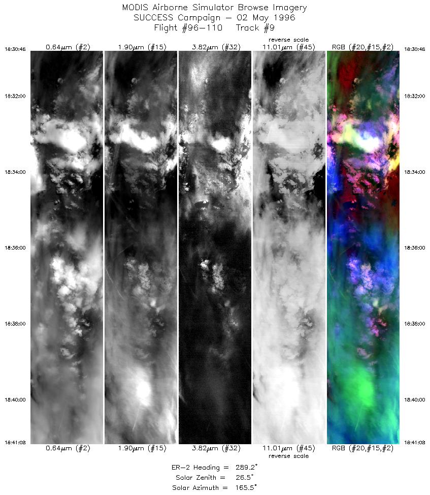
| 9 |
STD |
CIR |
18:30-18:41 |
289 |
41.41-41.81 |
105.29-106.73 |
3873 |
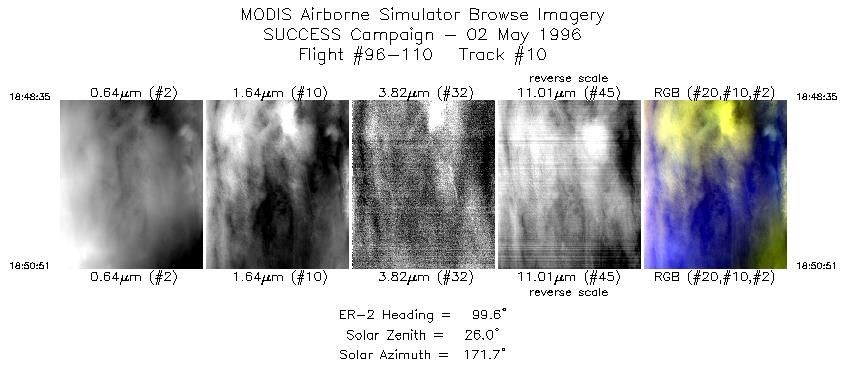
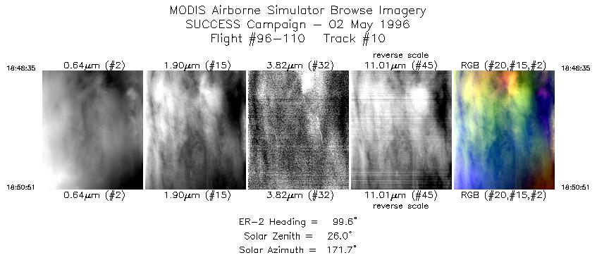
| 10 |
STD |
CIR |
18:48-18:50 |
100 |
41.62-41.58 |
106.72-106.38 |
848 |
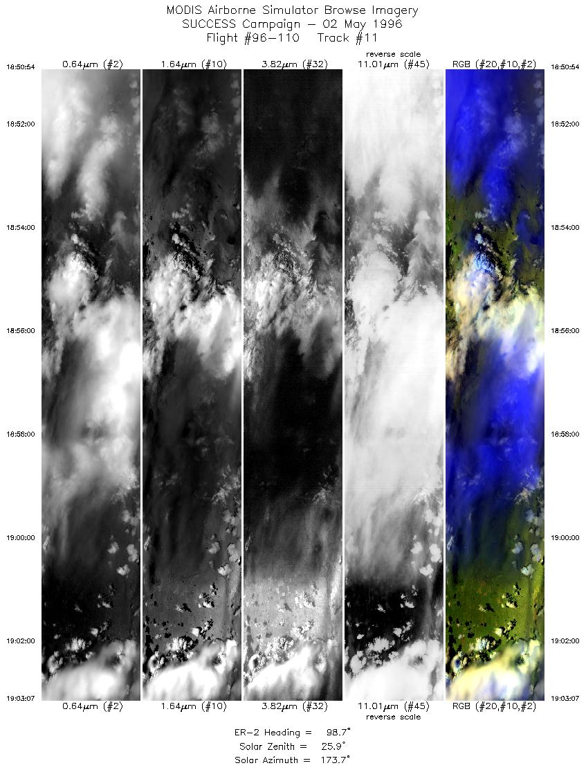
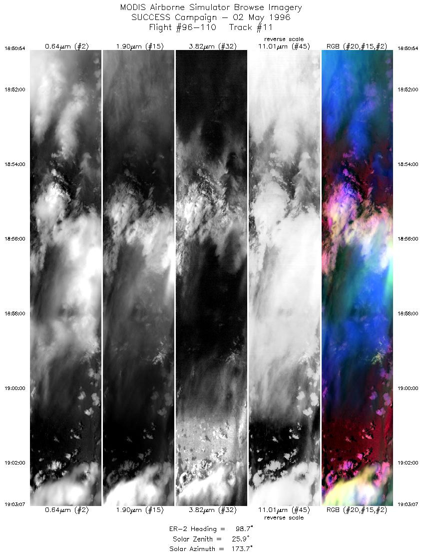
| 11 |
STD |
CIR |
18:50-19:03 |
99 |
41.58-41.35 |
106.36-104.50 |
4563 |
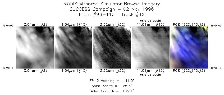
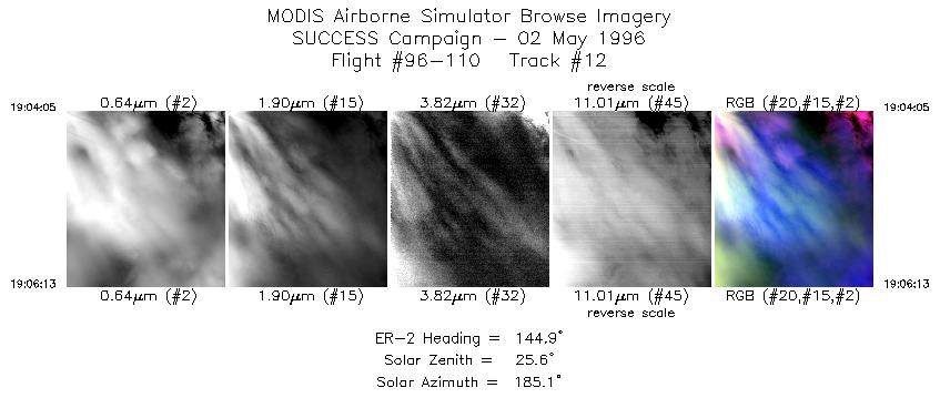
| 12 |
STD |
CIR |
19:04-19:06 |
145 |
41.30-41.10 |
104.38-104.19 |
798 |
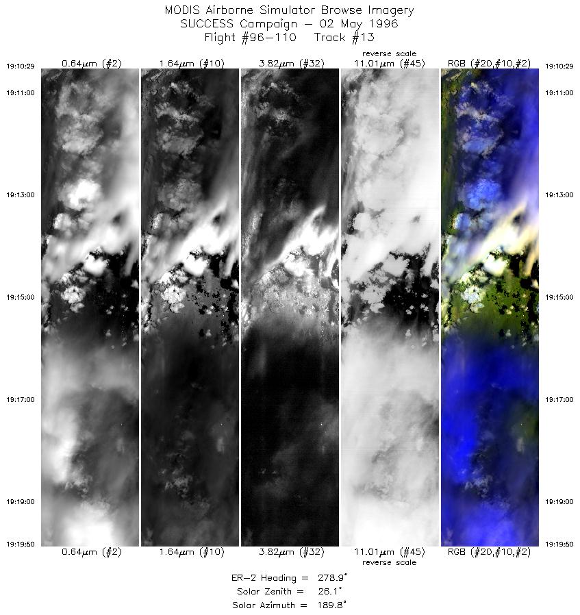
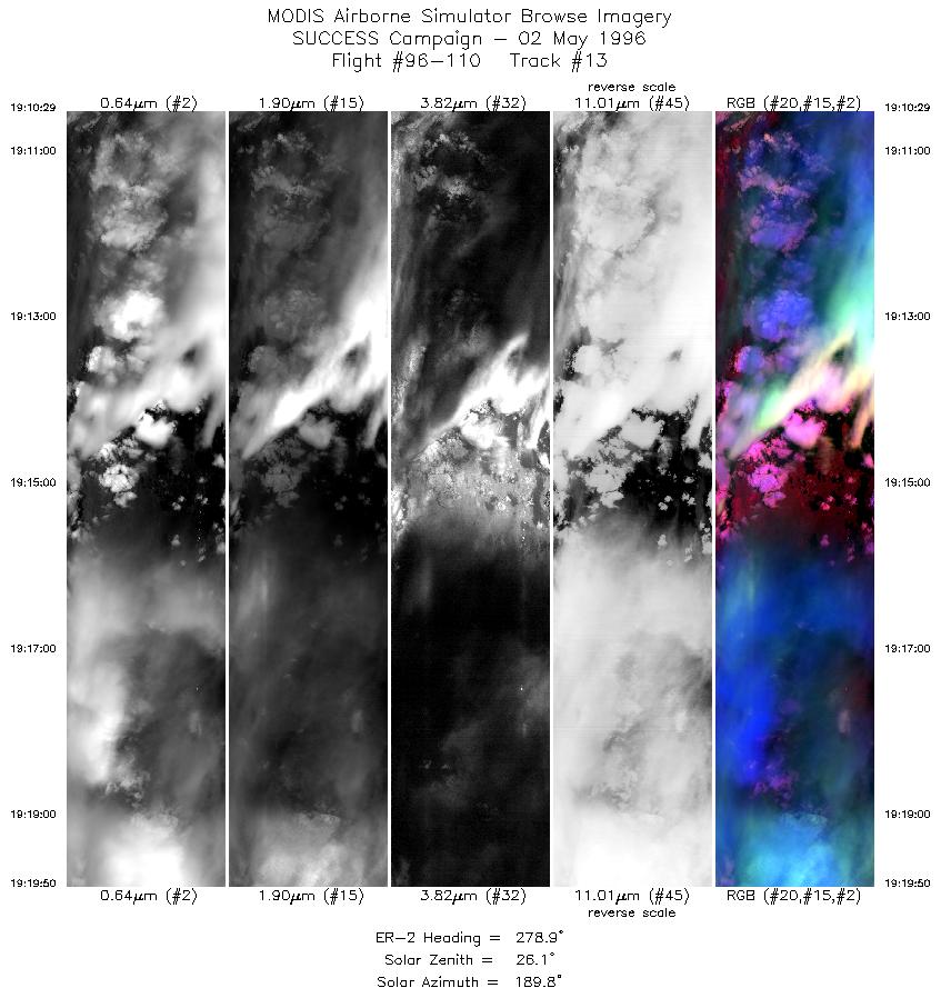
| 13 |
STD |
CIR |
19:10-19:19 |
279 |
41.29-41.47 |
104.03-105.40 |
3493 |
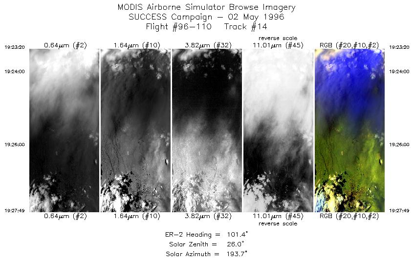
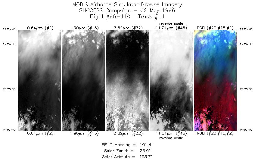
| 14 |
STD |
CIR |
19:23-19:27 |
101 |
41.23-41.13 |
105.43-104.75 |
1676 |
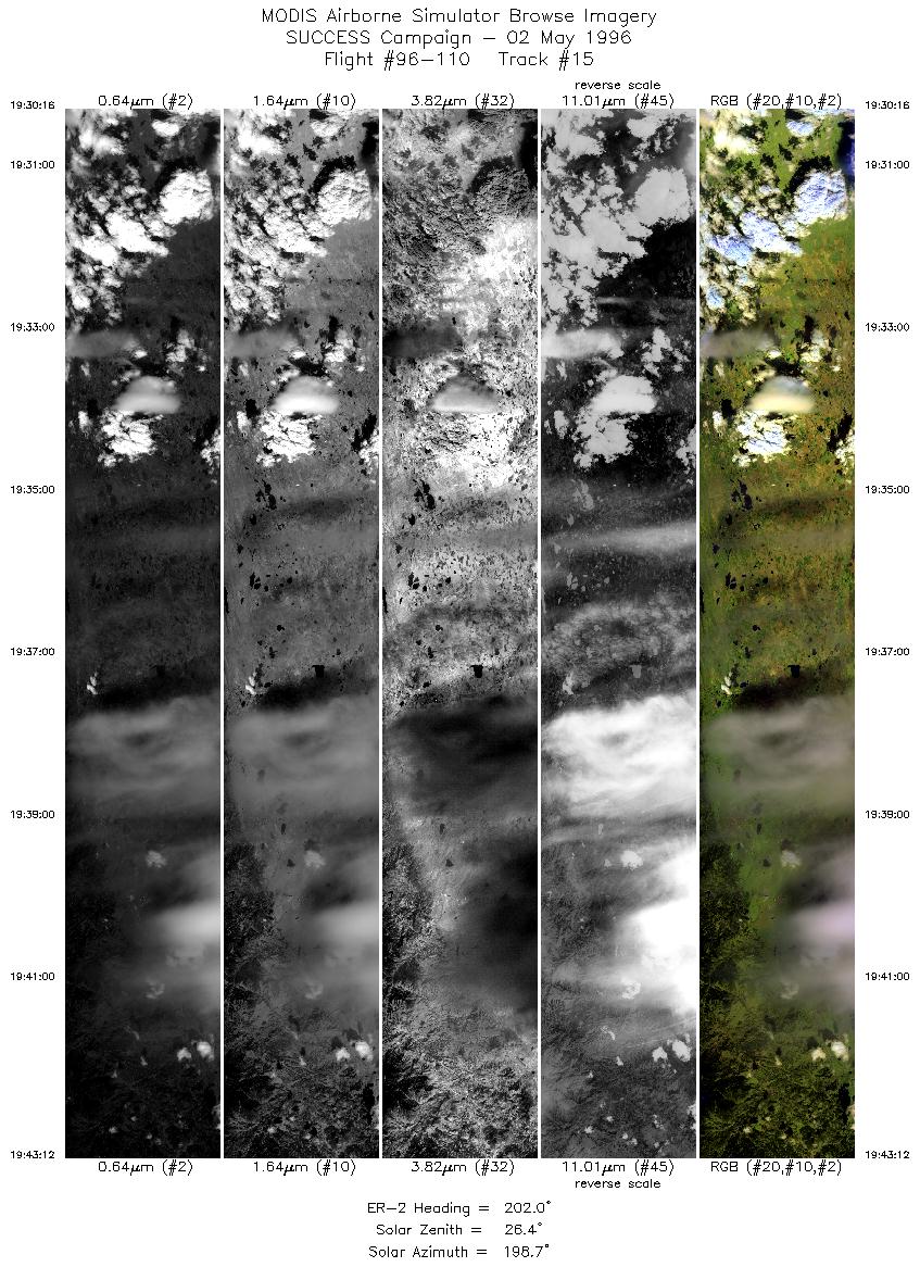
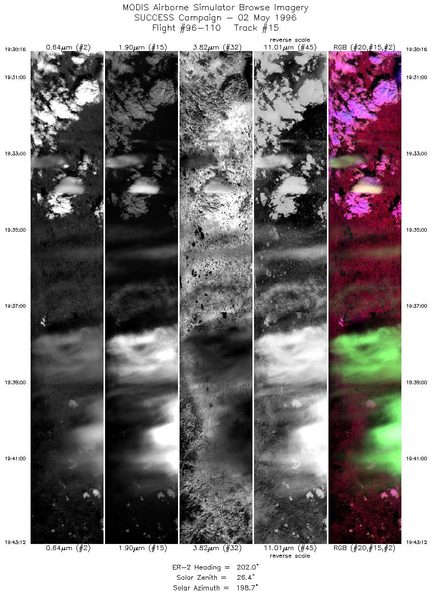
| 15 |
STD |
CIR |
19:30-19:43 |
202 |
40.92-39.56 |
104.72-105.36 |
4831 |
| 16 |
STD |
CIR |
19:44-20:00 |
284 |
39.47-39.96 |
105.55-107.74 |
5790 |
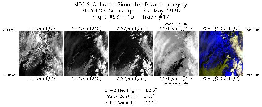
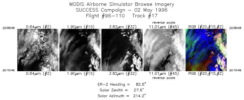
| 17 |
STD |
CIR |
20:08-20:10 |
83 |
39.79-39.82 |
107.40-107.12 |
735 |
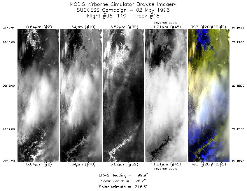
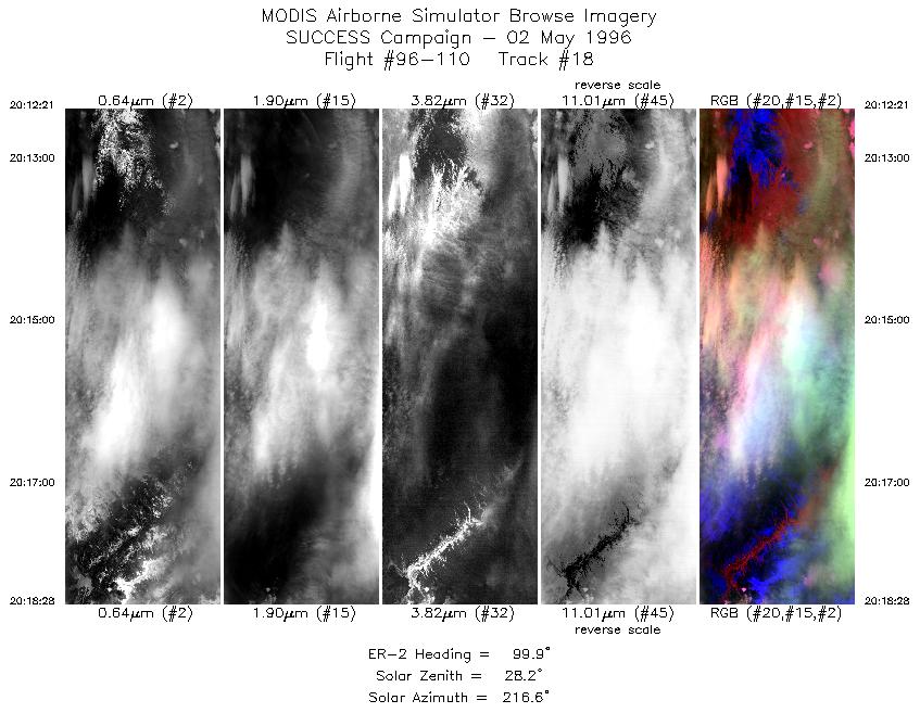
| 18 |
STD |
CIR |
20:12-20:18 |
100 |
39.82-39.71 |
106.89-105.99 |
2285 |
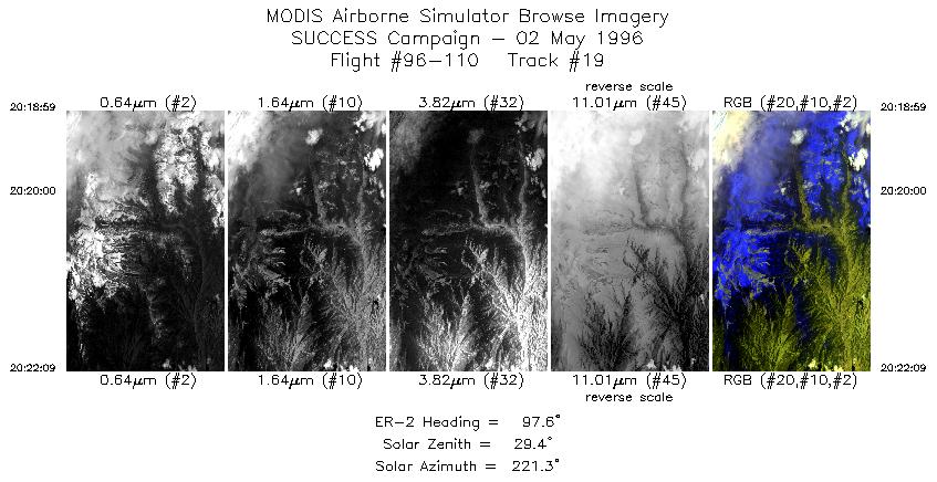
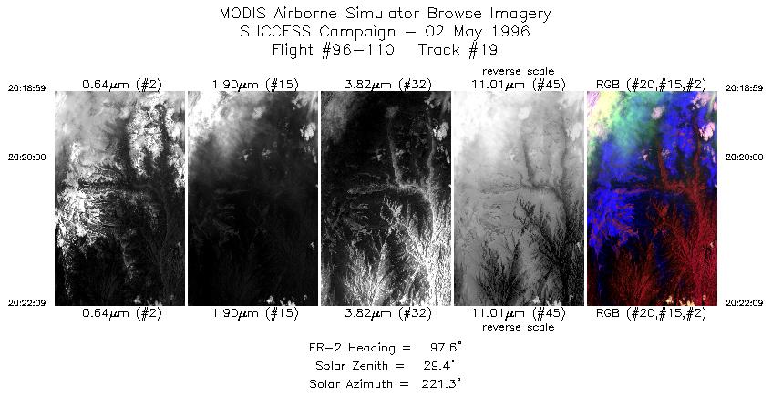
| 19 |
STD |
CIR |
20:18-20:22 |
98 |
39.71-39.66 |
105.91-105.43 |
1184 |
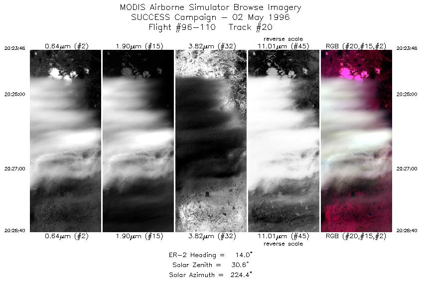
| 20 |
STD |
CIR |
20:23-20:28 |
14 |
39.76-40.30 |
105.25-105.02 |
1831 |
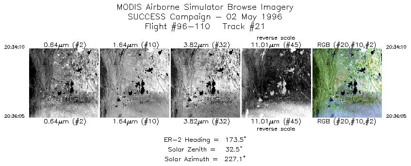
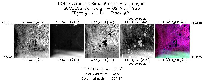
| 21 |
STD |
CIR |
20:34-20:36 |
173 |
40.55-40.34 |
105.08-105.04 |
717 |
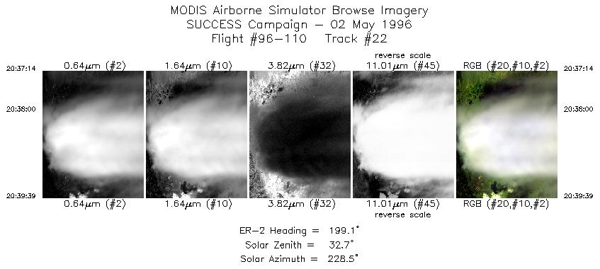
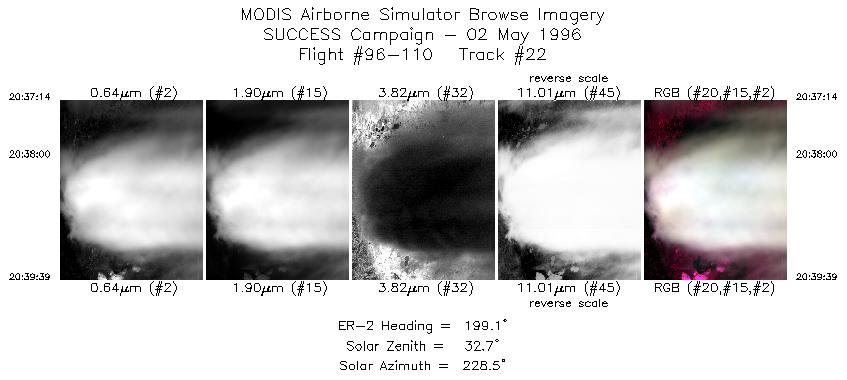
| 22 |
STD |
CIR |
20:37-20:39 |
199 |
40.21-39.96 |
105.06-105.17 |
904 |
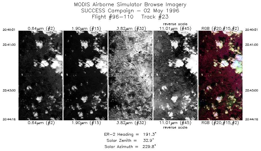
| 23 |
STD |
CIR |
20:40-20:44 |
191 |
39.88-39.45 |
105.20-105.30 |
1464 |
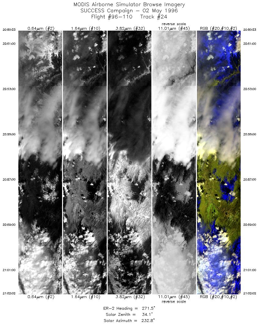
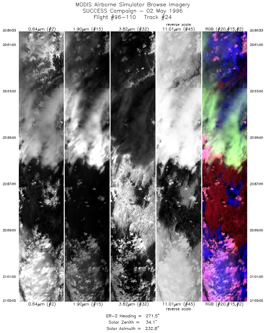
| 24 |
STD |
CIR |
20:50-21:02 |
272 |
39.71-39.89 |
105.81-107.48 |
4308 |
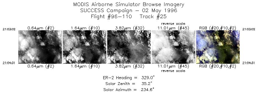
| 25 |
STD |
CIR |
21:03-21:04 |
329 |
39.96-40.11 |
107.60-107.71 |
556 |
| 26 |
STD |
CIR |
21:10-21:25 |
98 |
39.91-39.66 |
107.51-105.25 |
5678 |
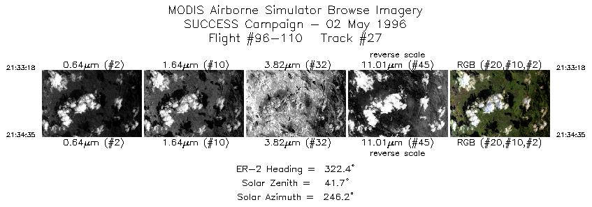
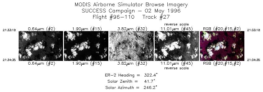
| 27 |
STD |
CIR |
21:33-21:34 |
322 |
39.65-39.77 |
105.08-105.19 |
481 |
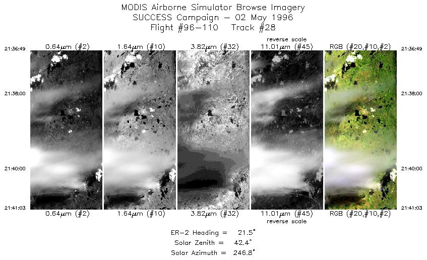
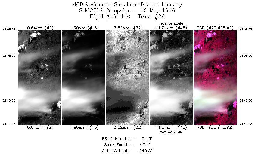
| 28 |
STD |
CIR |
21:36-21:41 |
22 |
40.01-40.46 |
105.16-104.91 |
1582 |
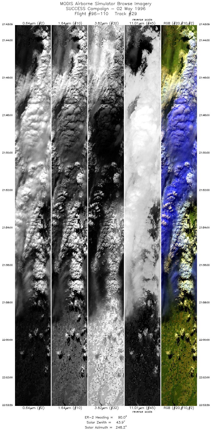
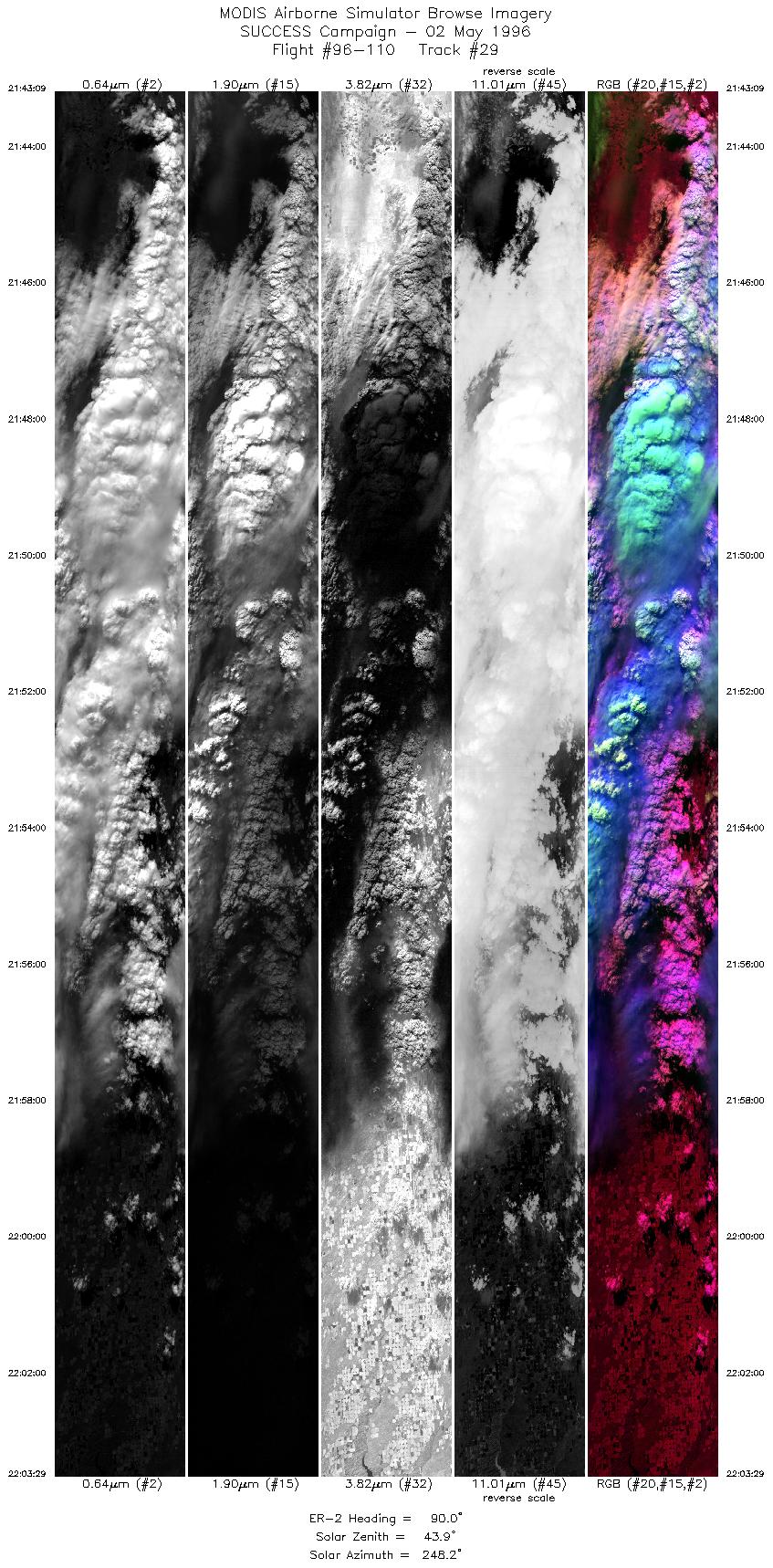
| 29 |
STD |
CIR |
21:43-22:03 |
90 |
40.55-40.49 |
104.62-101.53 |
7594 |
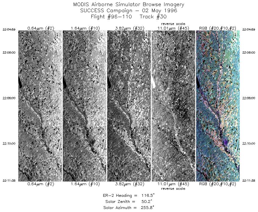
| 30 |
STD |
CIR |
22:04-22:11 |
117 |
40.42-40.08 |
101.32-100.42 |
2484 |
|
Standard Browse Images 01 through 30 in sequence |
|
Cirrus Detection Browse Images 01 through 30 in sequence |
Level-1B HDF Data Distribution Point
NASA GSFC Earth Sciences (GES) Data Center
NASA DAAC's
Additional Information
The objective of this mission was to observe the effect of DC-8 aircraft exhaust and contrails on wave clouds.
Take-off was 1630 UTC. ER-2 followed DC-8 to SE Wyoming. No set patterns were flown. The ER-2
followed the DC-8 south, runs were flown behind the DC-8. The ER-2 pilot reported heavy turbulence at
altitude; during portions of the flight the plane and instruments were strongly shaken.
The pilot reported being over contrails and was
level at the NOAA-14 overpass at 2035 UTC. Also noted were well defined wave clouds near Boulder CO.
|
|
|
|
