
|
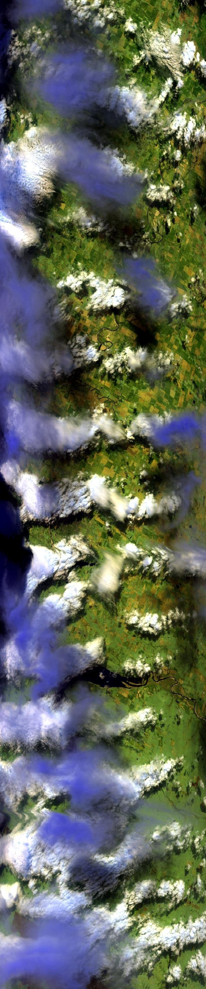
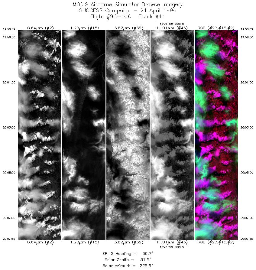
Sample Image

21 April 1996
Track #11
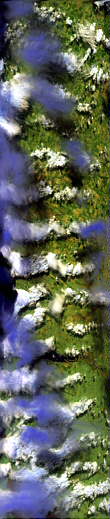

"Multi-level altocumulus and stratocumulus clouds near Ponca City, Oklahoma"
R: 2.15 microns
G: 1.65 microns
B: 0.64 microns
|
|
Summary Information
Date: April 21, 1996
ER-2 Flight Number: 96-106
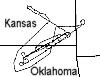
Location: Oklahoma CART Site
Principle Investigator: Dr. Brian Toon (NASA Ames)
Additional Sensors: B&W_6"_RC-10, MIR, CLS, RAMS, HIS
Level-1B Processing Information
Level-1B Data Version: #10
Calibration Type: Final
Calibration Version: SUCCESS_Ames 1.0
Temperature Adjustment: No
Status: Final Calibration Done
|
|
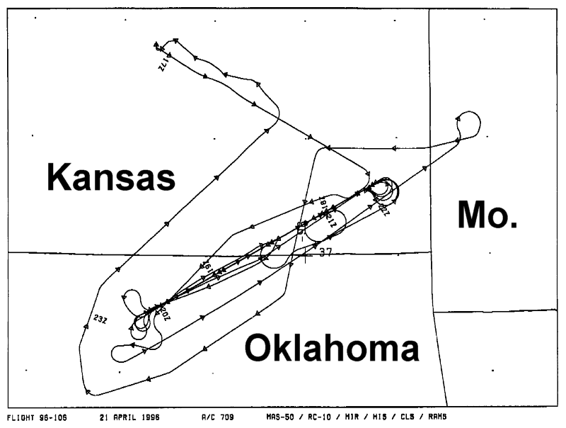
Flight Track Map

|
Level-1B Browse Imagery
Straight Line Flight Tracks: 19
Scanlines Processed: 61932
Solar Azimuth and Zenith Angles
|
Browse Images
|
Click on the Flight Track number to load images.
Lat/Lon ranges are for the BEG-END scanline nadir pixels.
|
Flight
Track |
Standard
Image |
Cirrus
Image |
Time_Span
(GMT) |
Heading
(Deg) |
Lat_Range
(Deg_N) |
Lon_Range
(Deg_W) |
Length
(Scanlines) |
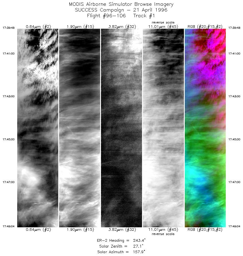
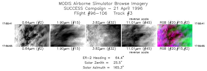
| 1 |
STD |
CIR |
17:39-17:49 |
243 |
37.56-37.09 |
95.37-96.42 |
3461 |
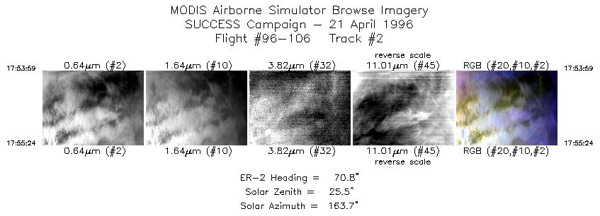
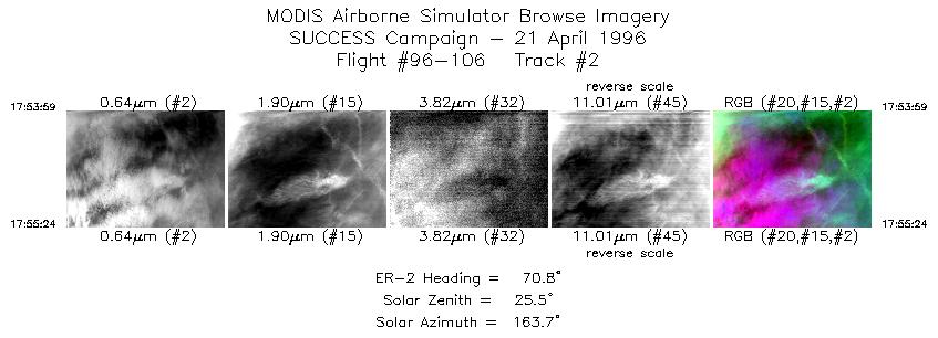
| 2 |
STD |
CIR |
17:53-17:55 |
71 |
37.06-37.11 |
96.06-95.86 |
531 |
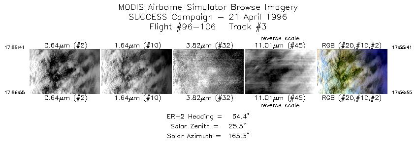
| 3 |
STD |
CIR |
17:55-17:56 |
64 |
37.13-37.18 |
95.82-95.65 |
461 |
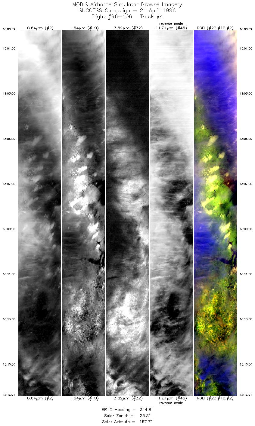
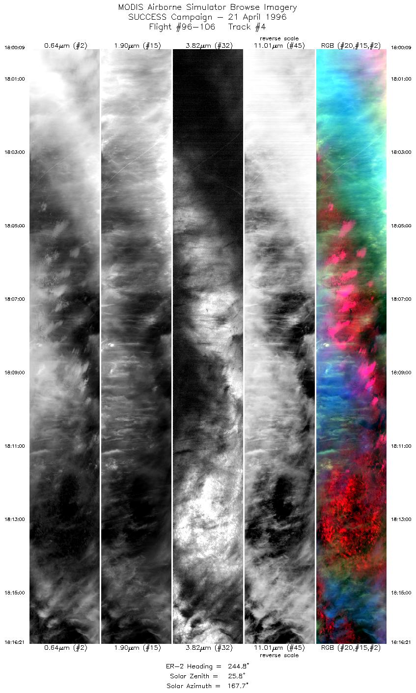
| 4 |
STD |
CIR |
18:00-18:16 |
245 |
37.38-36.55 |
95.78-97.62 |
6053 |
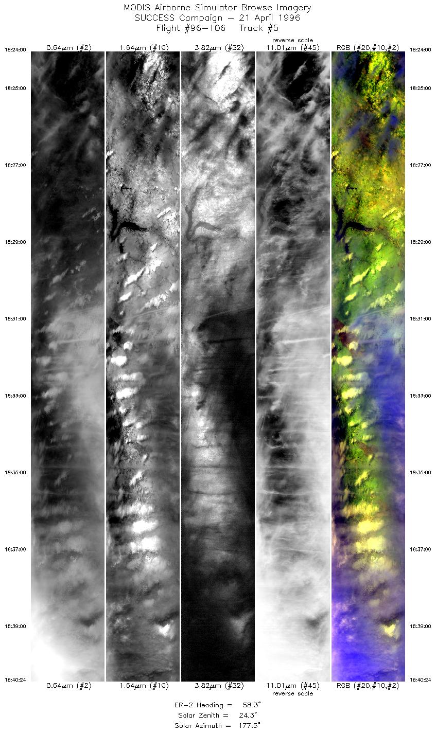
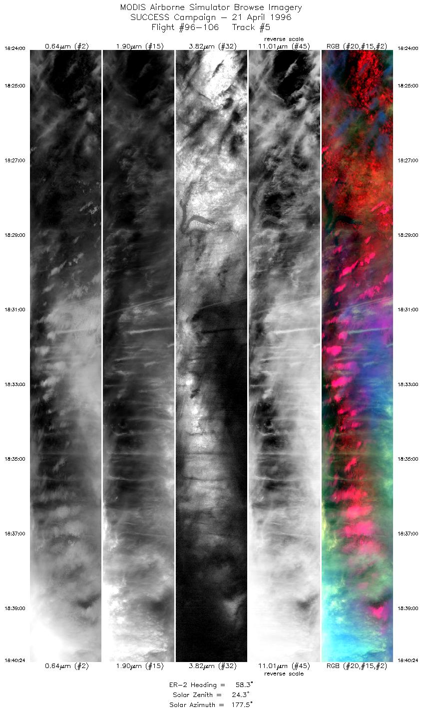
| 5 |
STD |
CIR |
18:24-18:40 |
58 |
36.58-37.55 |
97.54-95.39 |
6127 |
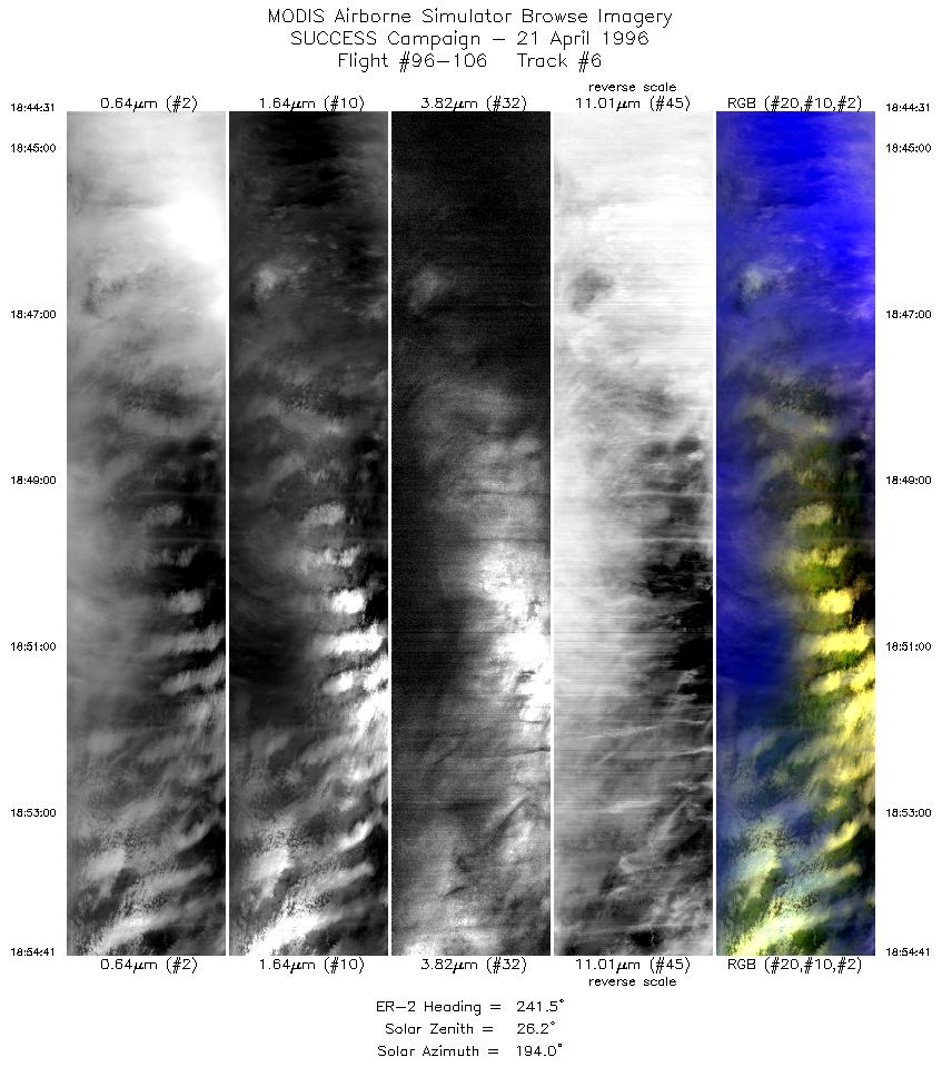
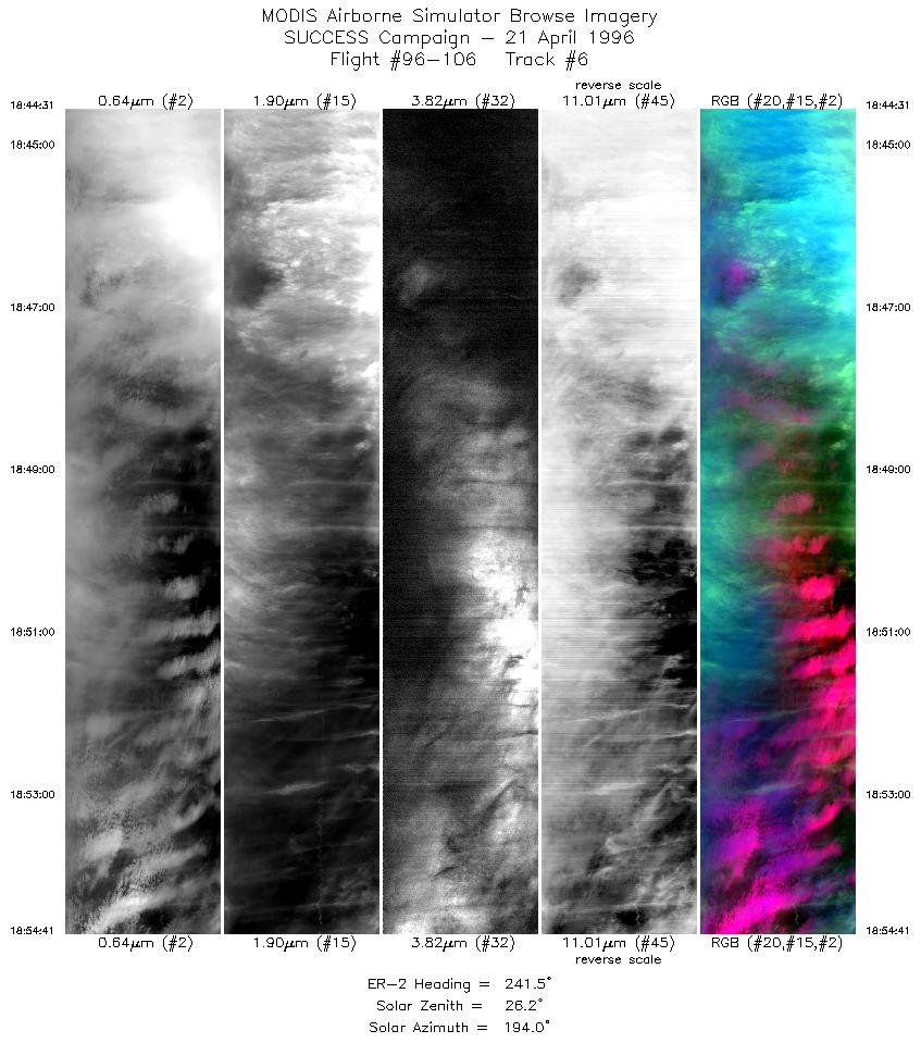
| 6 |
STD |
CIR |
18:44-18:54 |
242 |
37.65-37.12 |
95.15-96.36 |
3798 |
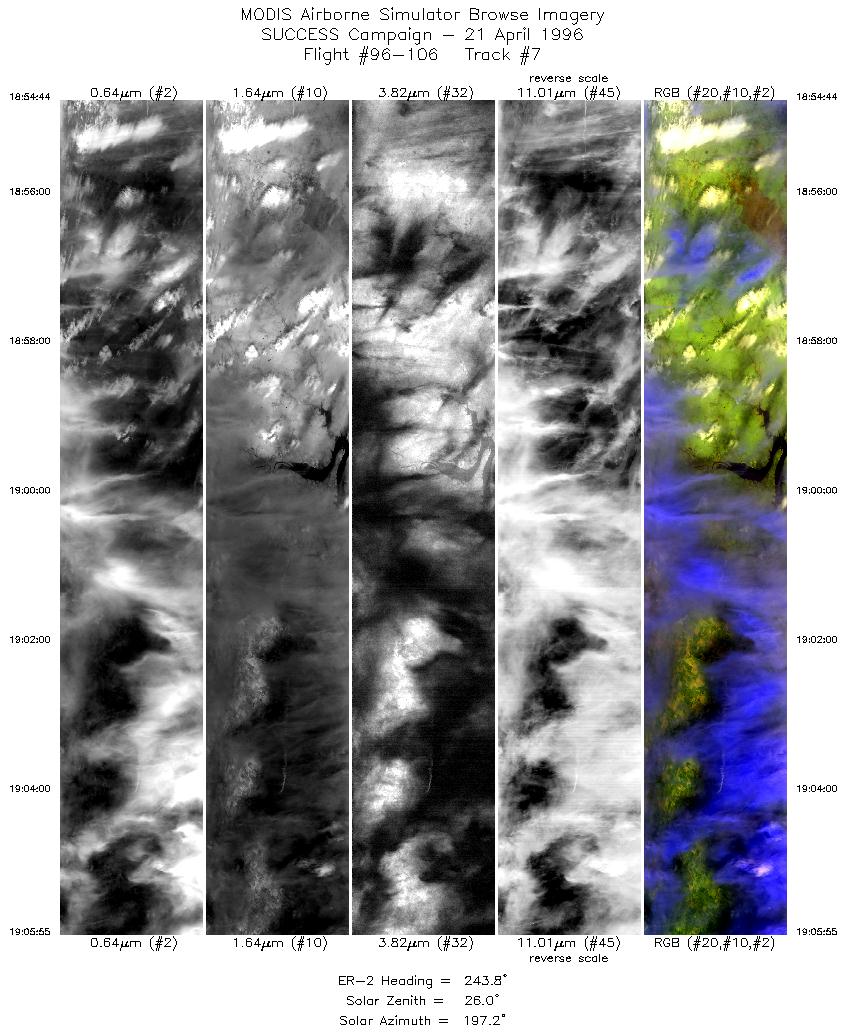
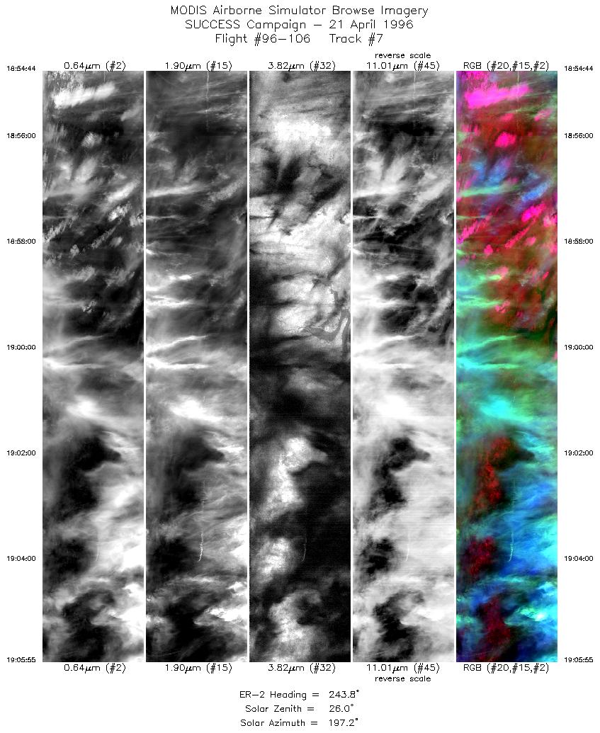
| 7 |
STD |
CIR |
18:54-19:05 |
244 |
37.12-36.53 |
96.36-97.66 |
4179 |
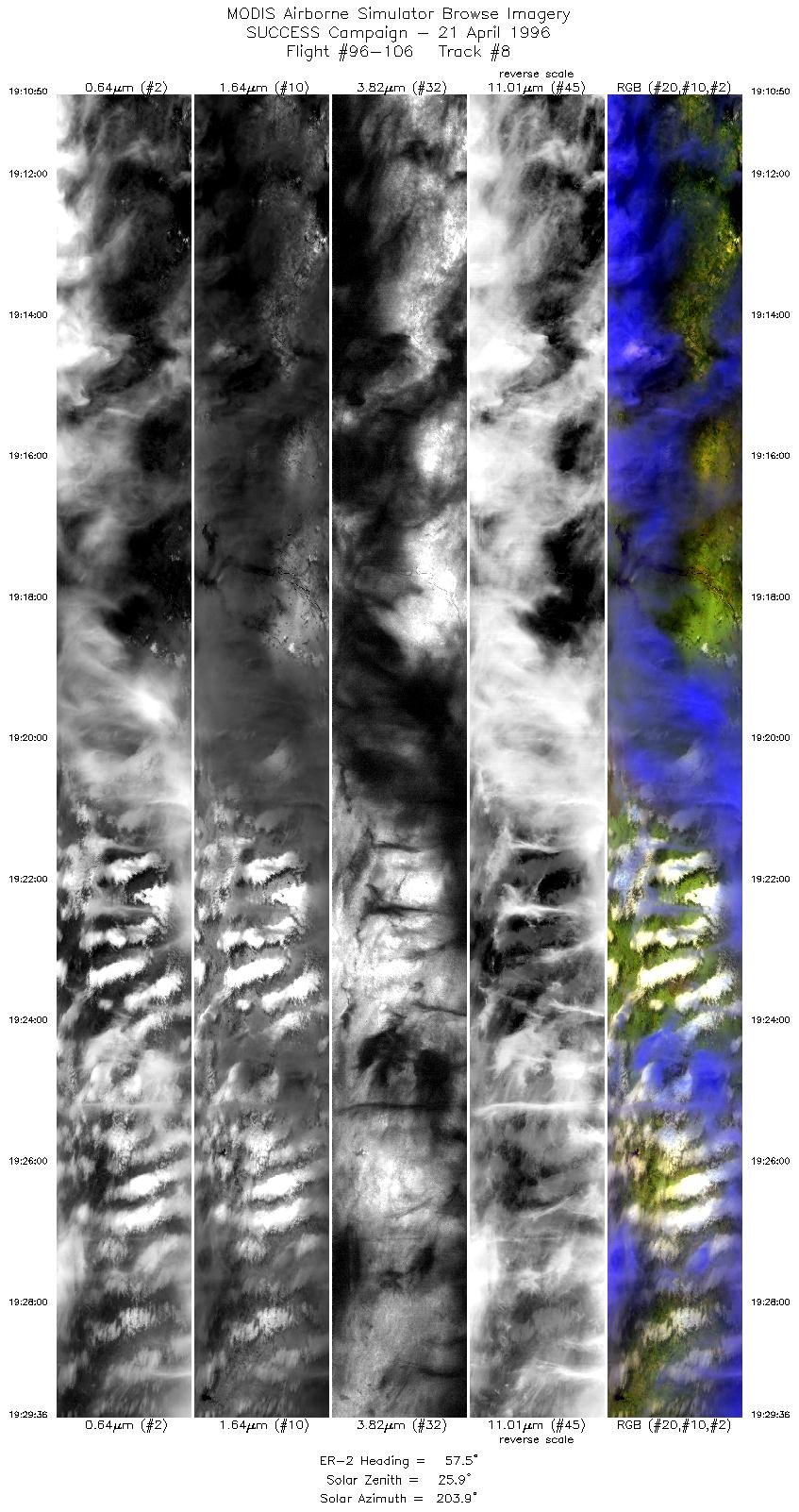
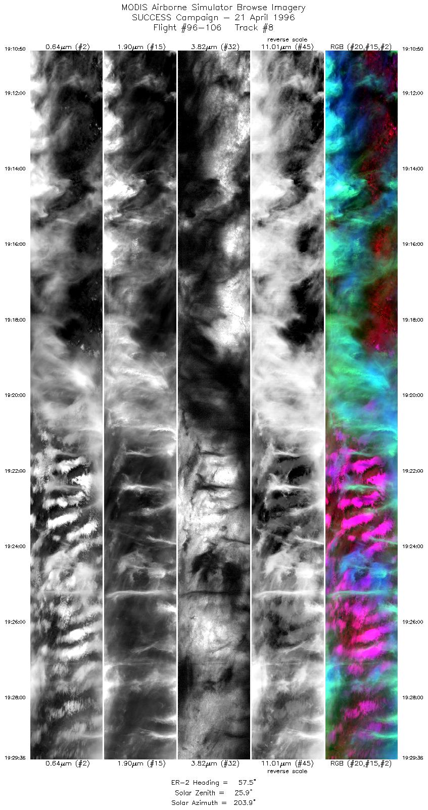
| 8 |
STD |
CIR |
19:10-19:29 |
57 |
36.46-37.55 |
97.81-95.39 |
7011 |
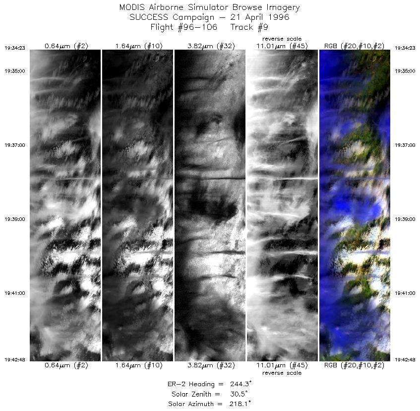
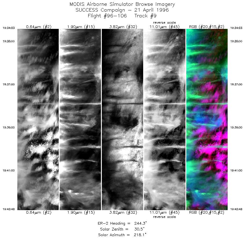
| 9 |
STD |
CIR |
19:34-19:42 |
244 |
37.61-37.17 |
95.23-96.25 |
3144 |
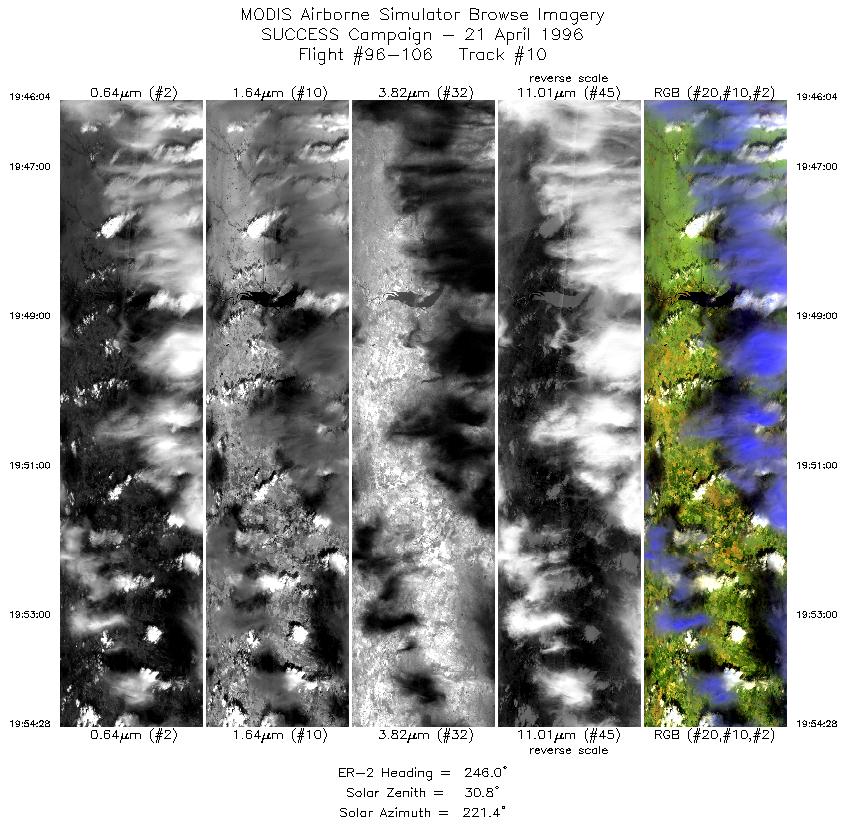
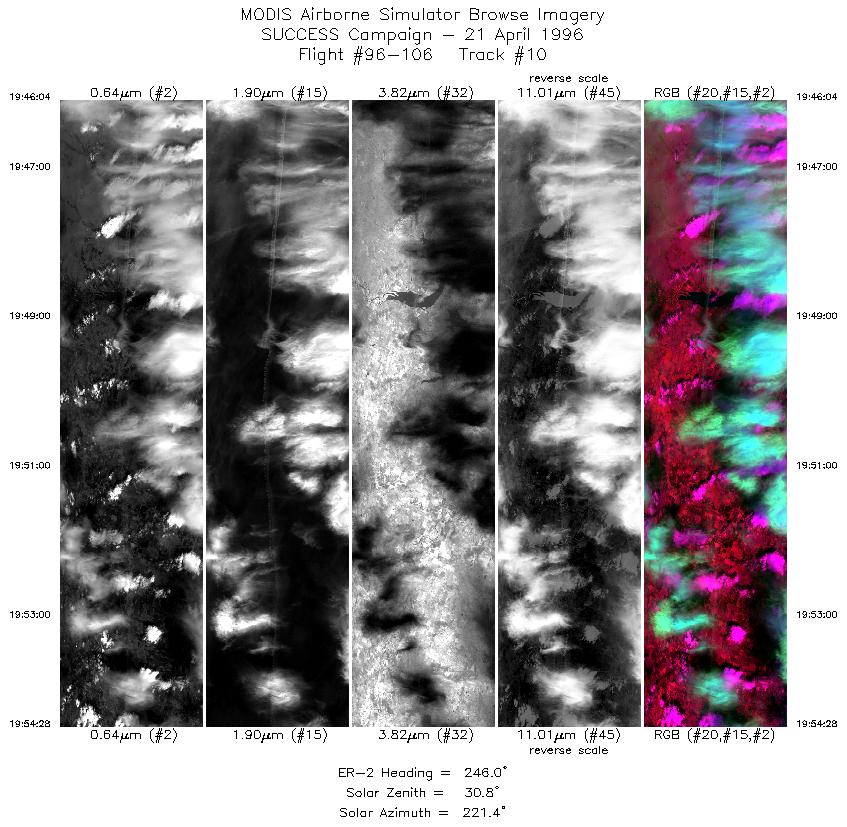
| 10 |
STD |
CIR |
19:46-19:54 |
246 |
36.90-36.55 |
96.56-97.62 |
3138 |
| 11 |
STD |
CIR |
19:58-20:07 |
60 |
36.51-36.97 |
97.76-96.53 |
3467 |
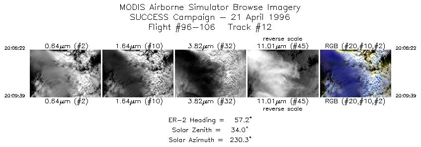
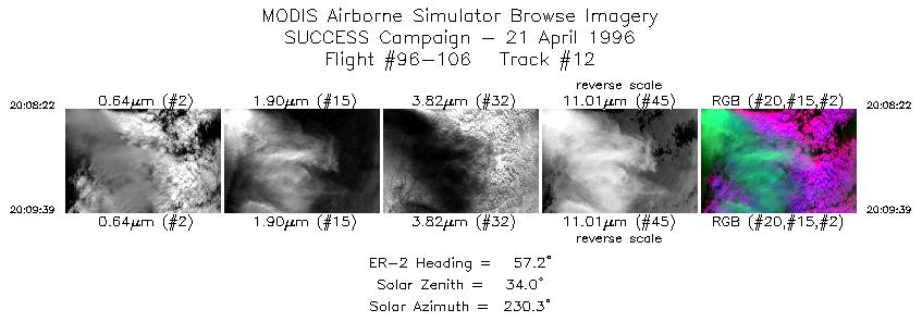
| 12 |
STD |
CIR |
20:08-20:09 |
57 |
36.98-37.06 |
96.47-96.31 |
480 |
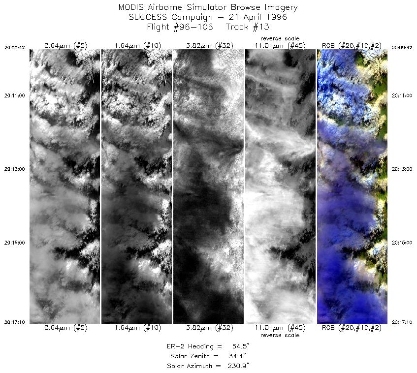
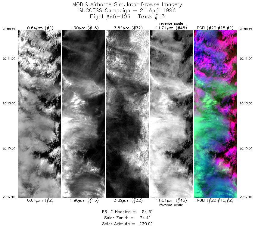
| 13 |
STD |
CIR |
20:09-20:17 |
55 |
37.07-37.54 |
96.30-95.39 |
2790 |
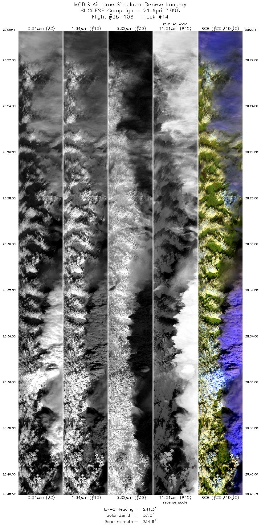
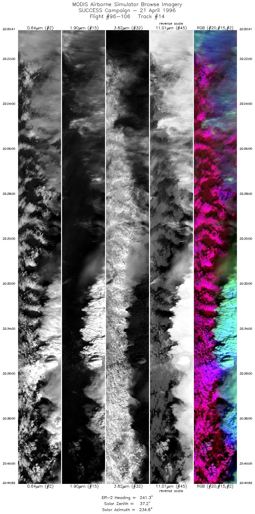
| 14 |
STD |
CIR |
20:20-20:40 |
241 |
37.64-36.55 |
95.20-97.62 |
7539 |
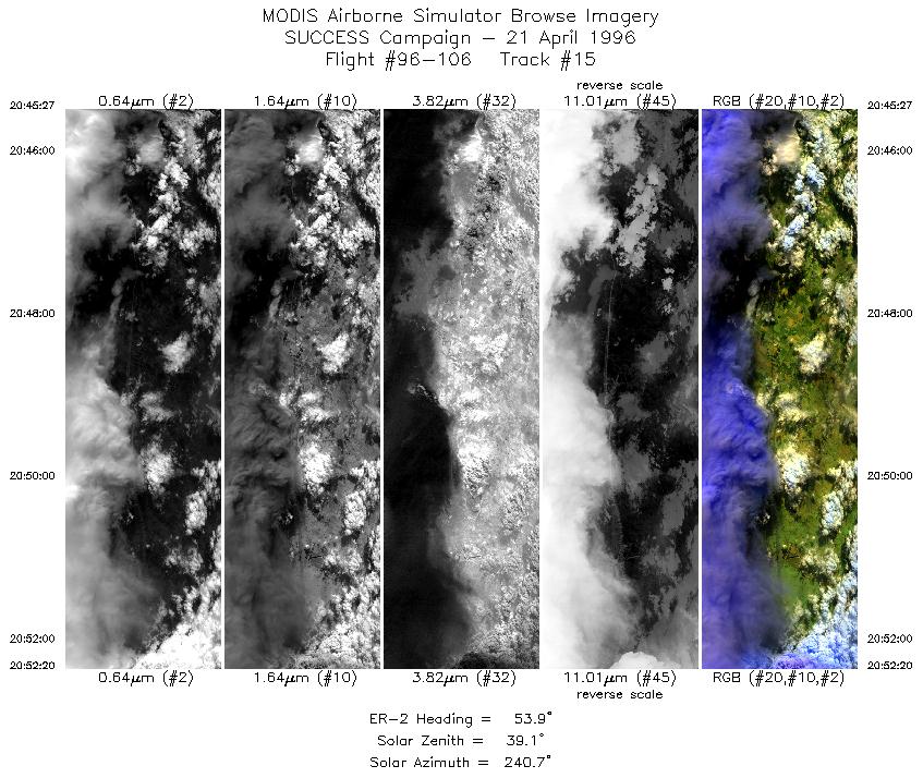
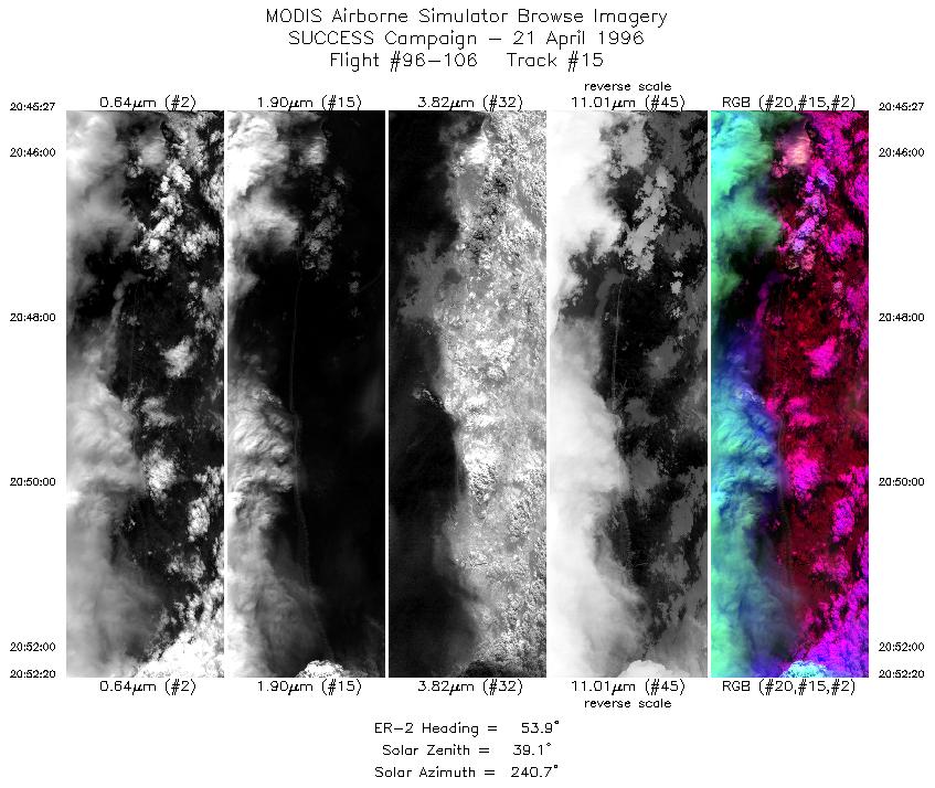
| 15 |
STD |
CIR |
20:45-20:52 |
54 |
36.55-36.97 |
97.63-96.78 |
2572 |
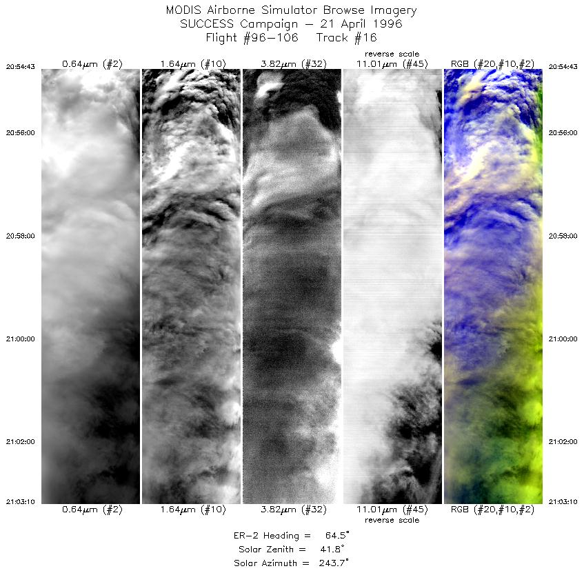
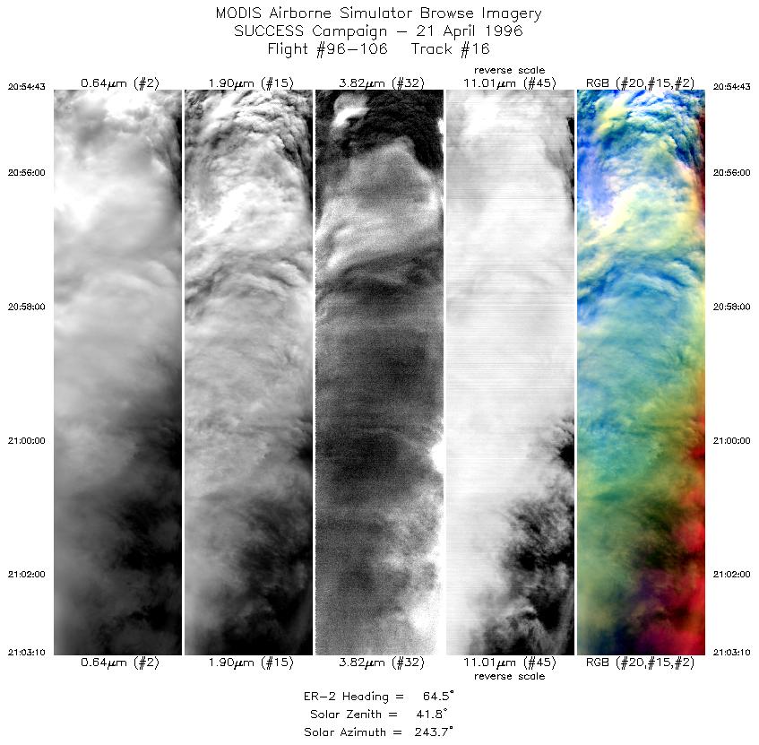
| 16 |
STD |
CIR |
20:54-21:03 |
65 |
37.08-37.54 |
96.46-95.39 |
3157 |
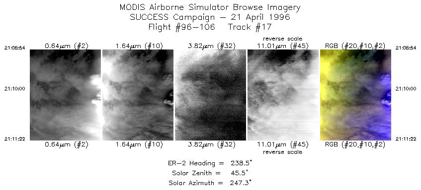
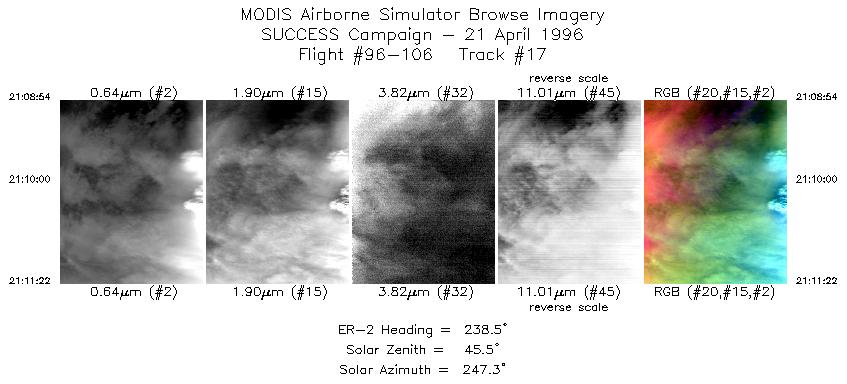
| 17 |
STD |
CIR |
21:08-21:11 |
238 |
37.64-37.51 |
95.17-95.48 |
922 |
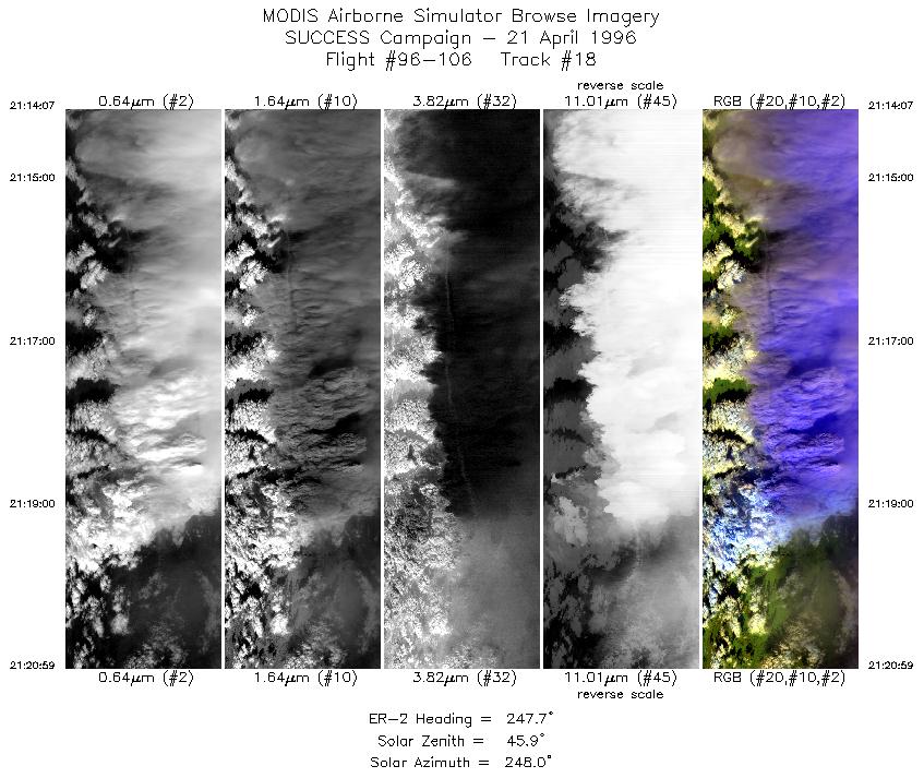
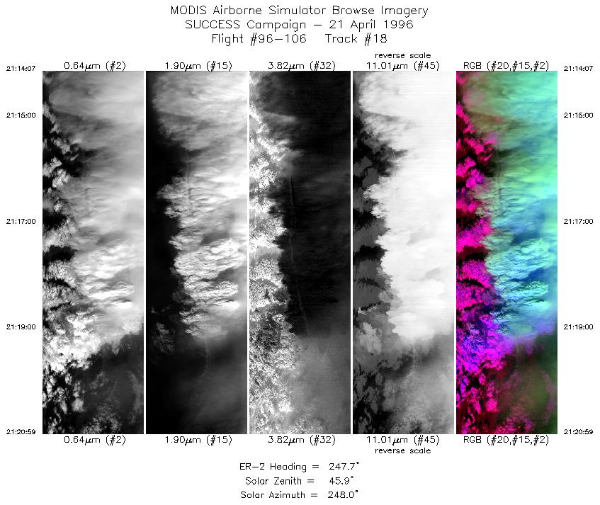
| 18 |
STD |
CIR |
21:14-21:20 |
248 |
37.48-37.19 |
95.86-96.76 |
2566 |
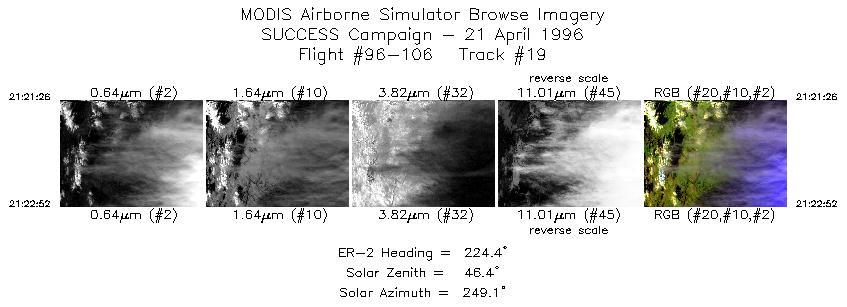
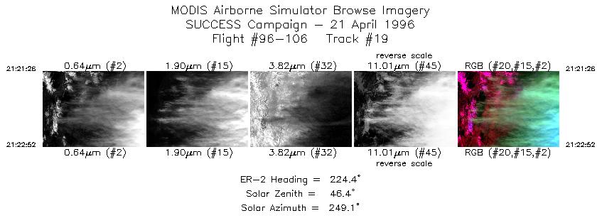
| 19 |
STD |
CIR |
21:21-21:22 |
224 |
37.16-37.05 |
96.81-96.95 |
536 |
|
Standard Browse Images 01 through 19 in sequence
|
~20000 |
|
Cirrus Detection Browse Images 01 through 19 in sequence
|
~20000 |
Level-1B HDF Data Distribution Point
NASA GSFC Earth Sciences (GES) Data Center
NASA DAAC's
Additional Information
The objective of this mission was to observe cirrus clouds of various ages and contrails in the presence of cirrus.
and investigate differences in the radiative signature of contrails and natural cirrus.
Take-off time was 1655 UTC and landing 2350 UTC. ER-2 flew 240 and 60 degree oriented lines (approximately
110 n mi long) over the ARM CART site (36 36.3'N 97 29.1'W) in coordination with the DC-8. ER-2 was at the
CART site at 1815 UTC and the cirrus was moderate. On the 1823 to 1840 UTC the cirrus had thickened (could
barely see the ground) and was extensive. During the later part of the cooridnated flight with the DC-8 the clouds
over the ARM site began to break-up. ER-2 ended a coordinated pattern with the DC-8 at 2138
to overfly convection in vicinity of the ARM site.
Convective overflights were of mature storms except the last leg when he flew over a storm that was just beginning
to have cirrus blow-off. Location and times of thunderstorm runs were 36:09N 97:46W (2138 UTC) to 38:00N
94:19W (2207 UTC); 38:0N 94:10W (2213 UTC) to 37:55 N 90:45 (2225 UTC) to 36:42N 96:13W (2237
UTC) to 36:00N 97:27W (2248 UTC) to 35:48N 98:17W (2253 UTC) to 37:37N 97:00W.
The pilot reported lots of cirrus and contrails (including that of the DC-8) over the ARM CART site.
There was an extended contrail toward end of coordinated runs with the DC-8.
The pilot then overflew cold convective cloud tops where a pileus cloud was noted.
A commercial aircraft contrail was noted at 1812 UTC. During legs
between 2045-2103 and 2109-2129 the ER-2 flew over the DC-8 traveling in the opposite direction. Followed a
long contrail (50-100 n. mi) during the 2109-2129 UTC leg. Circle rings of DC-8 spiral run near the end of the
coordinated segment were visible from the ER-2. While over mature storms did have an "elevator ride" but not too
much deviation in altitude. Reports of thunderstorm tops near 57K feet were consistent with pilot's observations.
Growing cell reached 45K feet.
|
|
|
|