
|
Sample Image

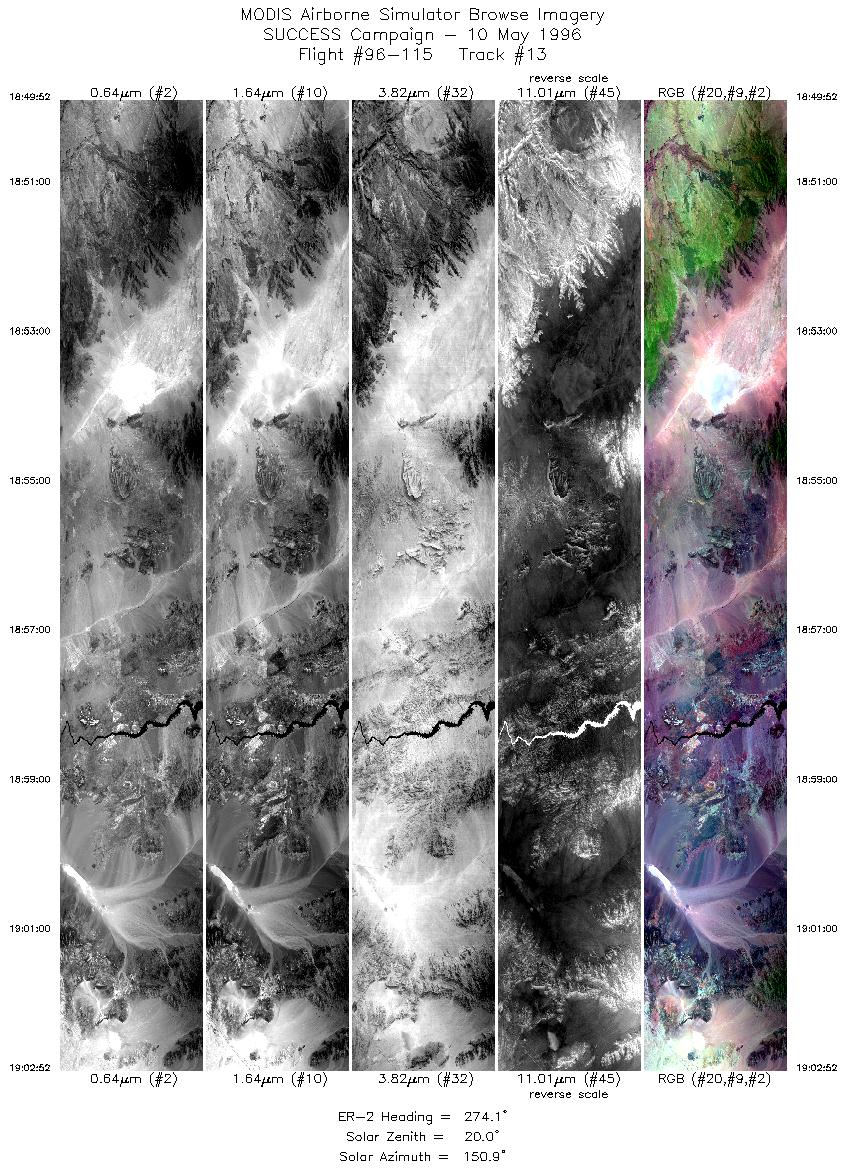
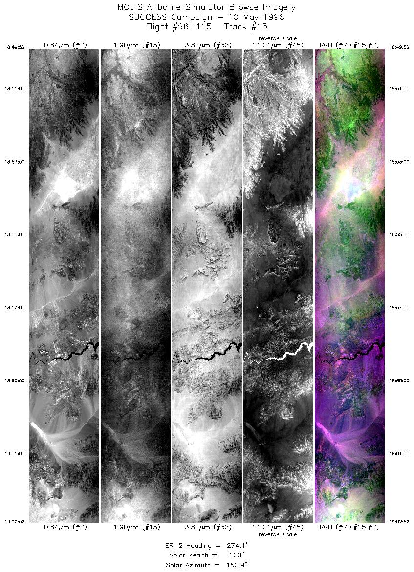
10 May 1996
Track #13


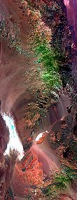
"Colorado River snakes through the Black Mountains
along the Arizona-Nevada border"
10 May 1996
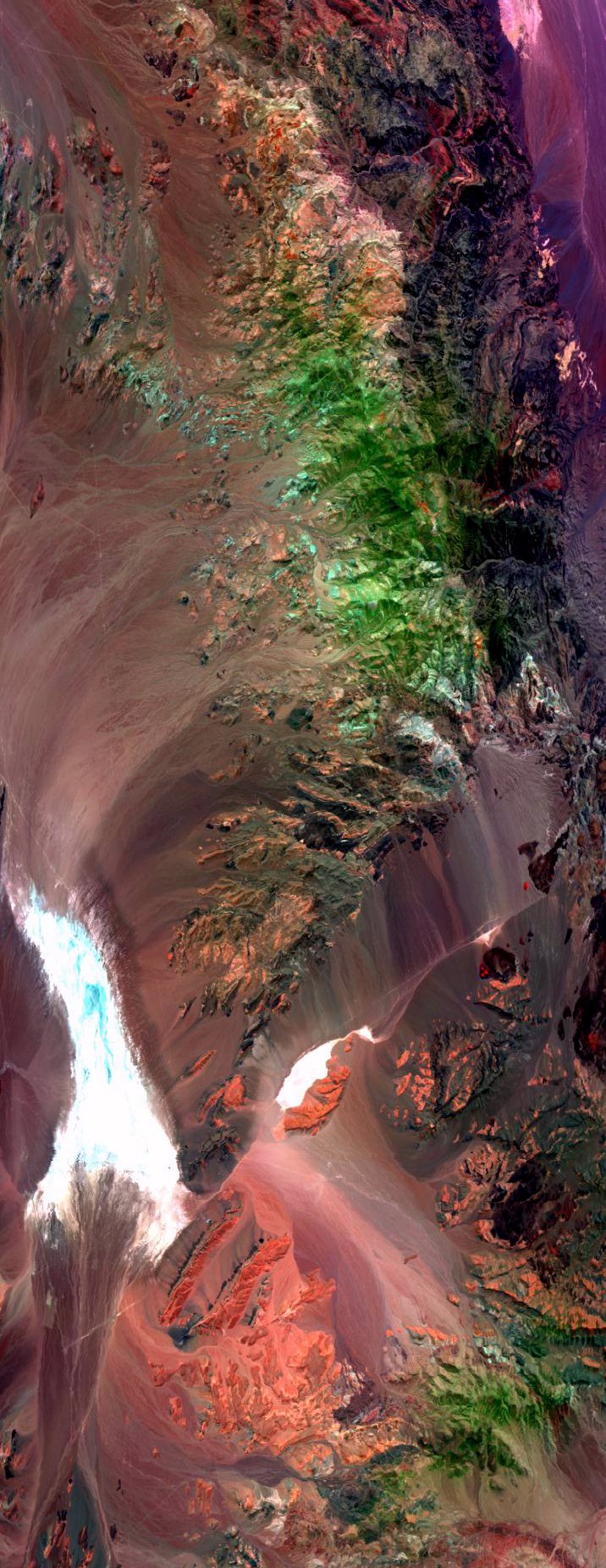
Track #16
"Death Valley National Park, California"
R: 2.15 microns
G: 0.95 microns
B: 0.65 microns
|
|
Summary Information
Date: May 10, 1996
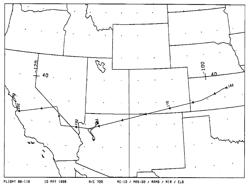
ER-2 Flight Number: 96-115
Location: Kansas to California (ferry)
Principle Investigator: Dr. Brian Toon (NASA Ames)
Additional Sensors: B&W_6"_RC-10, MIR, CLS, RAMS, HIS
Level-1B Processing Information
Level-1B Data Version: #10
Calibration Type: Final
Calibration Version: SUCCESS_Ames 1.0
Temperature Adjustment: No
Status: Final Calibration Done
|
|
Flight Track Map

|
Level-1B Browse Imagery
Straight Line Flight Tracks: 17
Scanlines Processed: 61306
Solar Azimuth and Zenith Angles
|
Browse Images
|
Click on the Flight Track number to load images.
Lat/Lon ranges are for the BEG-END scanline nadir pixels.
|
Flight
Track |
Standard
Image |
Cirrus
Image |
Time_Span
(GMT) |
Heading
(Deg) |
Lat_Range
(Deg_N) |
Lon_Range
(Deg_W) |
Length
(Scanlines) |
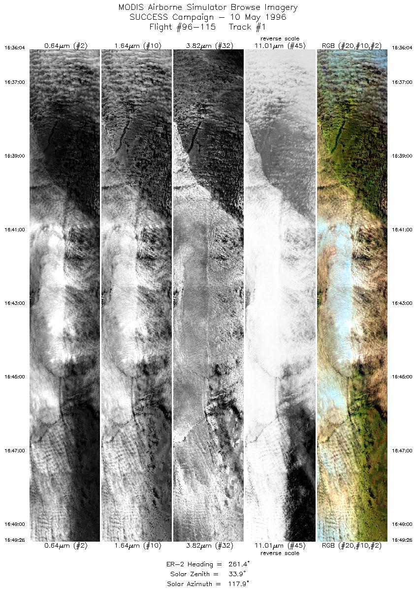
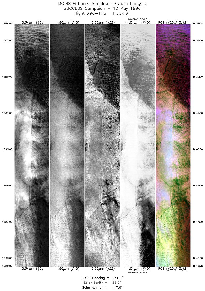
| 1 |
STD |
CIR |
16:36-16:49 |
261 |
37.88-37.63 |
101.11-102.94 |
4994 |
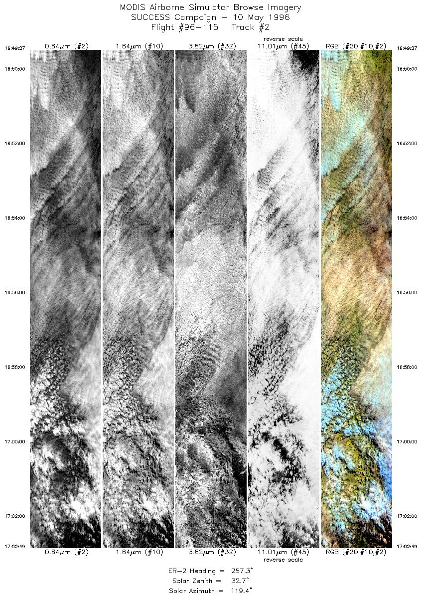
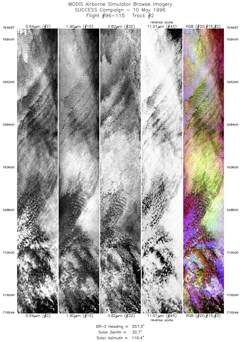
| 2 |
STD |
CIR |
16:49-17:02 |
257 |
37.63-37.37 |
102.93-104.72 |
4997 |
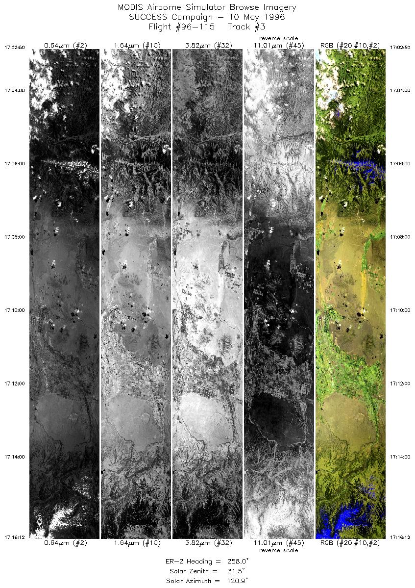
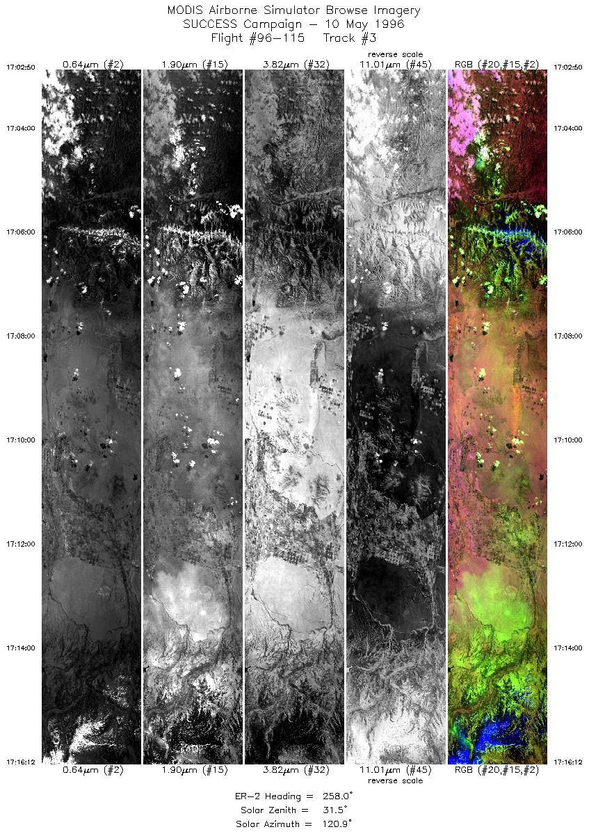
| 3 |
STD |
CIR |
17:02-17:16 |
258 |
37.37-37.06 |
104.73-106.57 |
4996 |
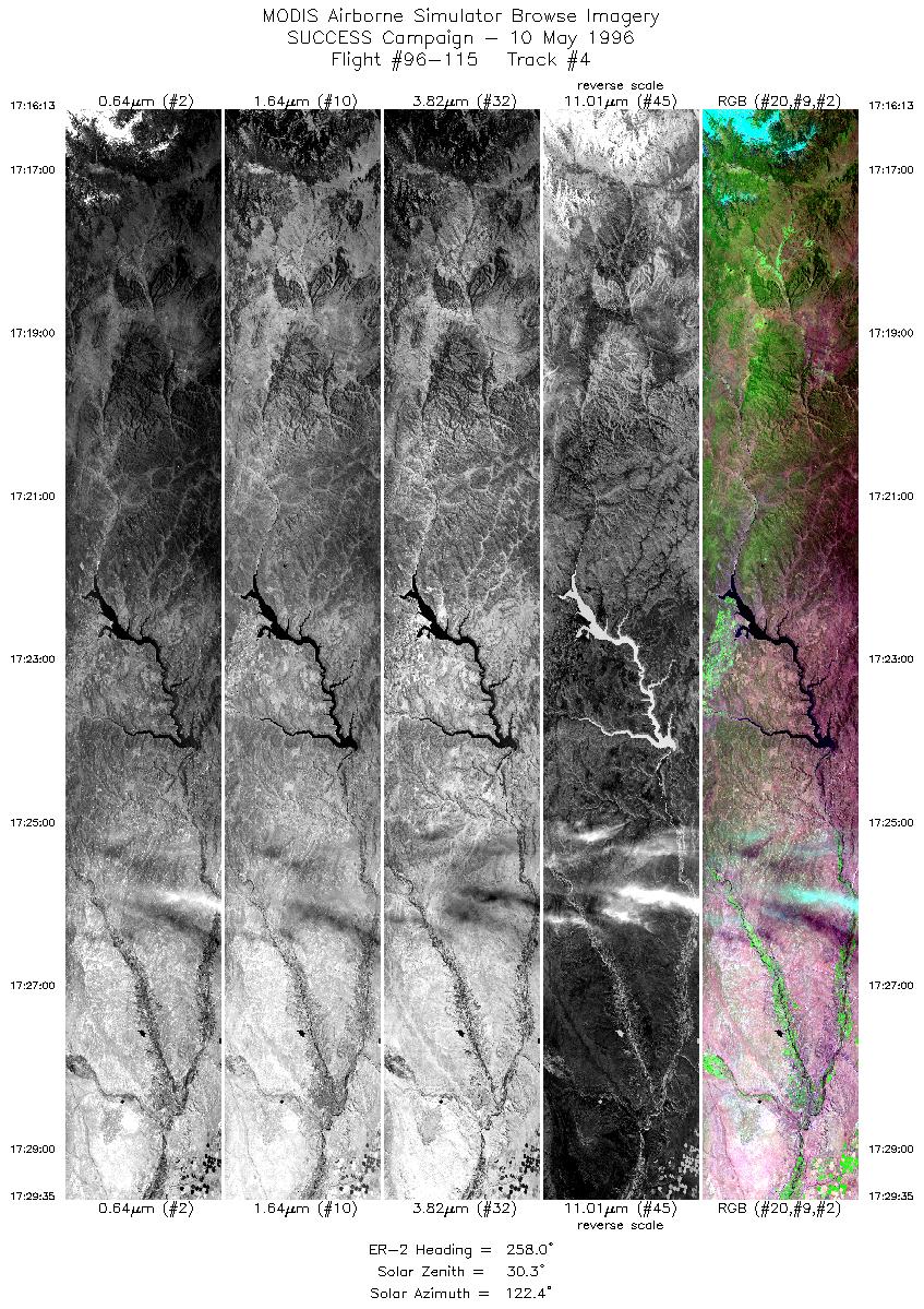
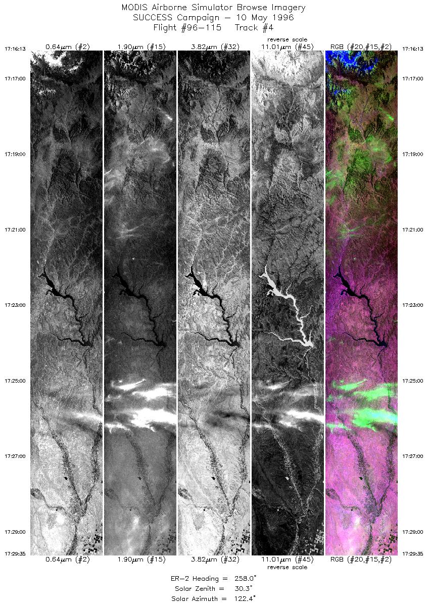
| 4 |
STD |
CIR |
17:16-17:29 |
258 |
37.06-36.74 |
106.57-108.38 |
4996 |
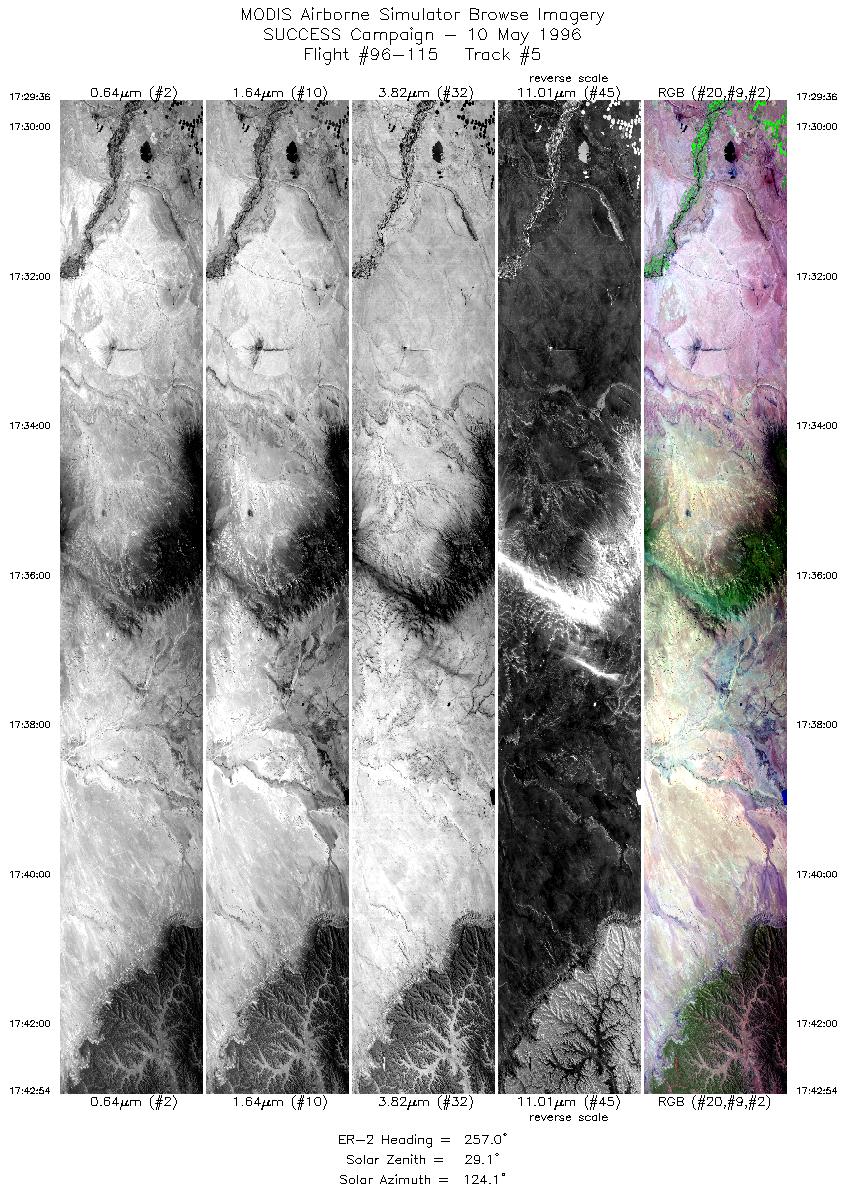
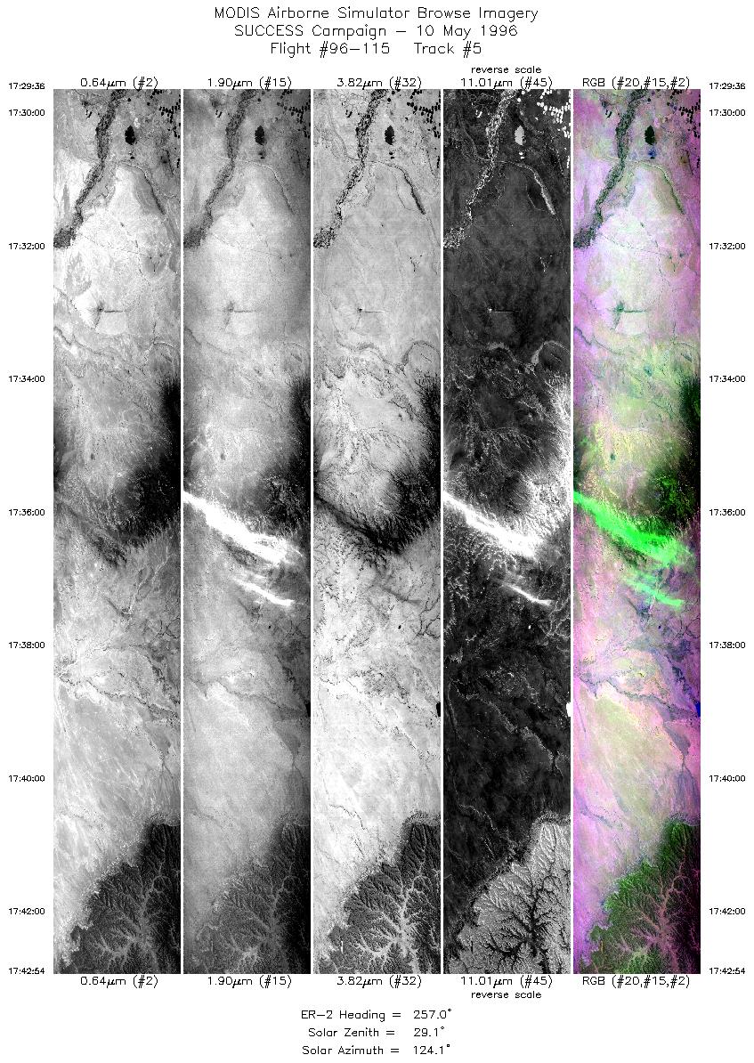
| 5 |
STD |
CIR |
17:29-17:42 |
257 |
36.74-36.38 |
108.38-110.15 |
4971 |
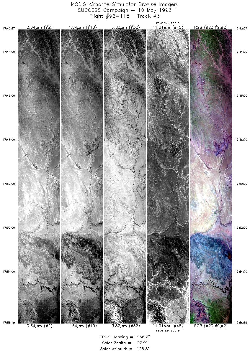
| 6 |
STD |
CIR |
17:42-17:56 |
256 |
36.38-36.01 |
110.16-111.90 |
4994 |
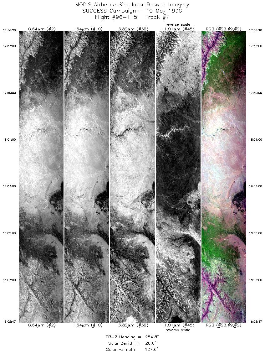
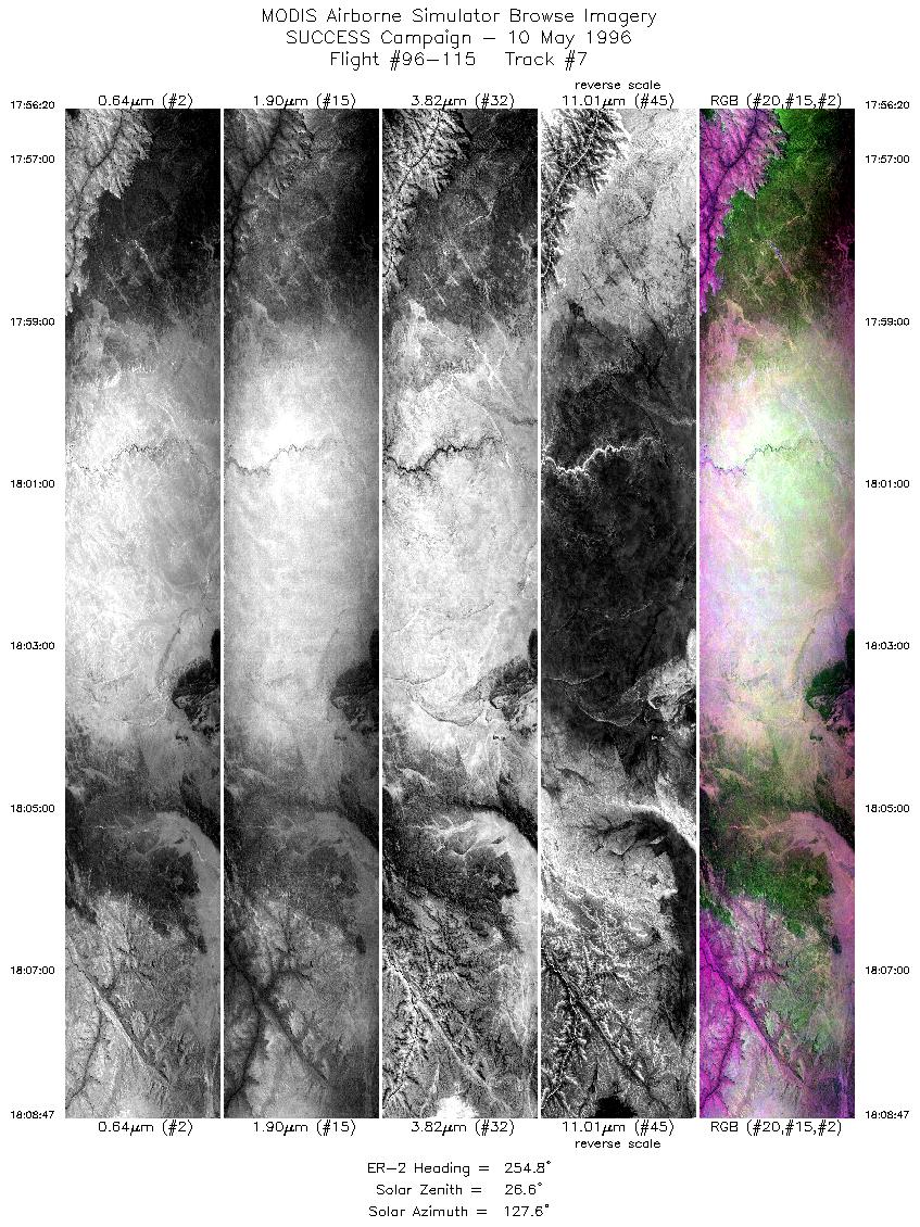
| 7 |
STD |
CIR |
17:56-18:08 |
255 |
36.01-35.63 |
111.90-113.52 |
4653 |
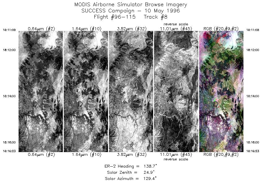
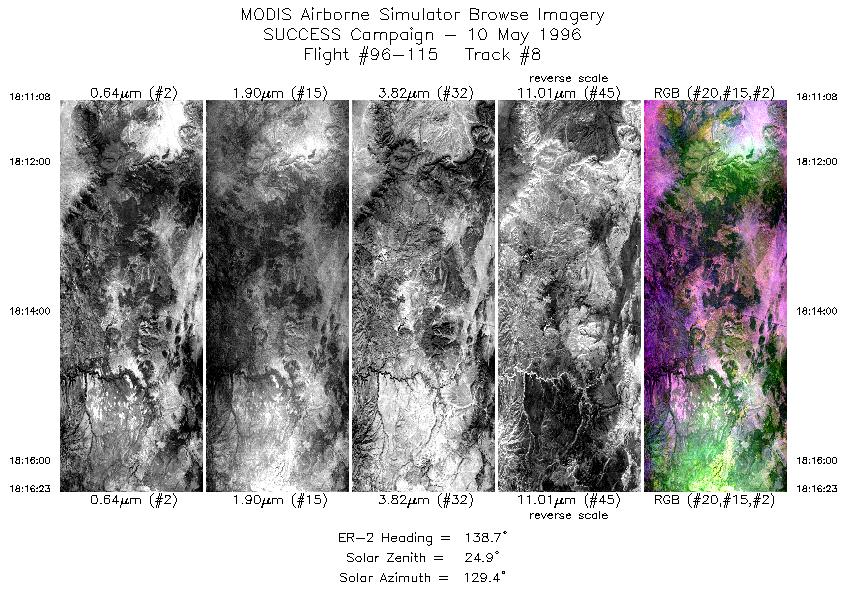
| 8 |
STD |
CIR |
18:11-18:16 |
139 |
35.42-34.99 |
113.56-113.08 |
1963 |
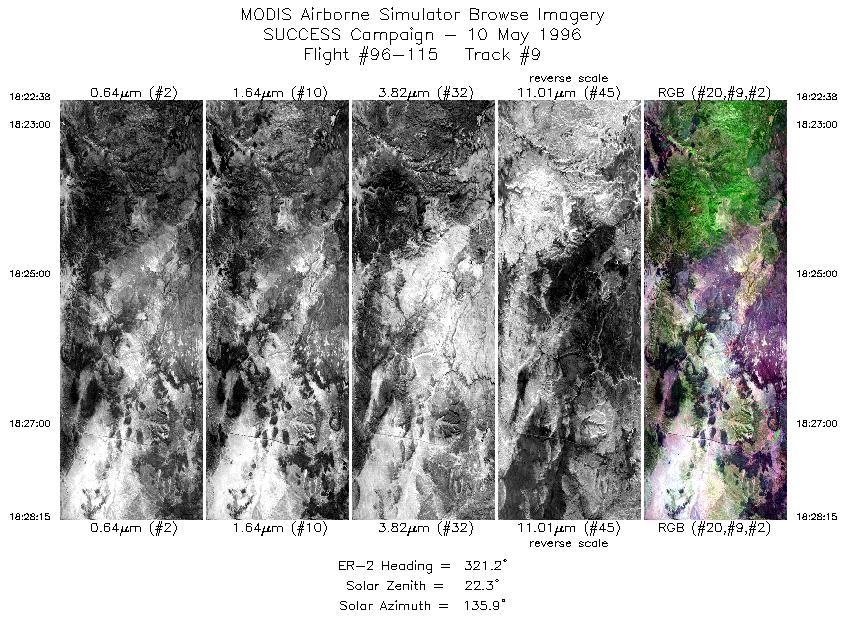
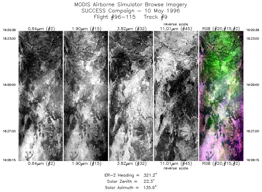
| 9 |
STD |
CIR |
18:22-18:28 |
321 |
34.83-35.32 |
112.85-113.32 |
2100 |
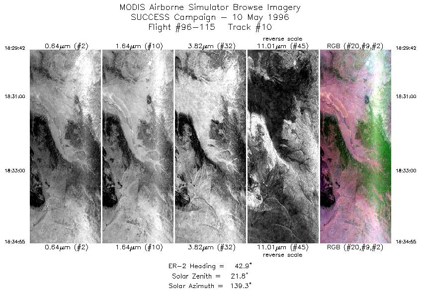
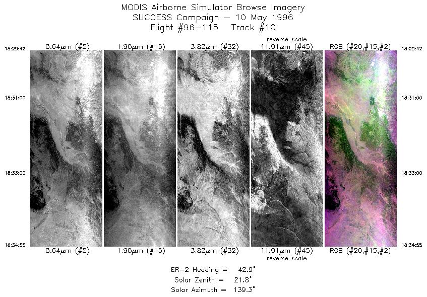
| 10 |
STD |
CIR |
18:29-18:34 |
43 |
35.47-35.90 |
113.31-112.81 |
1950 |
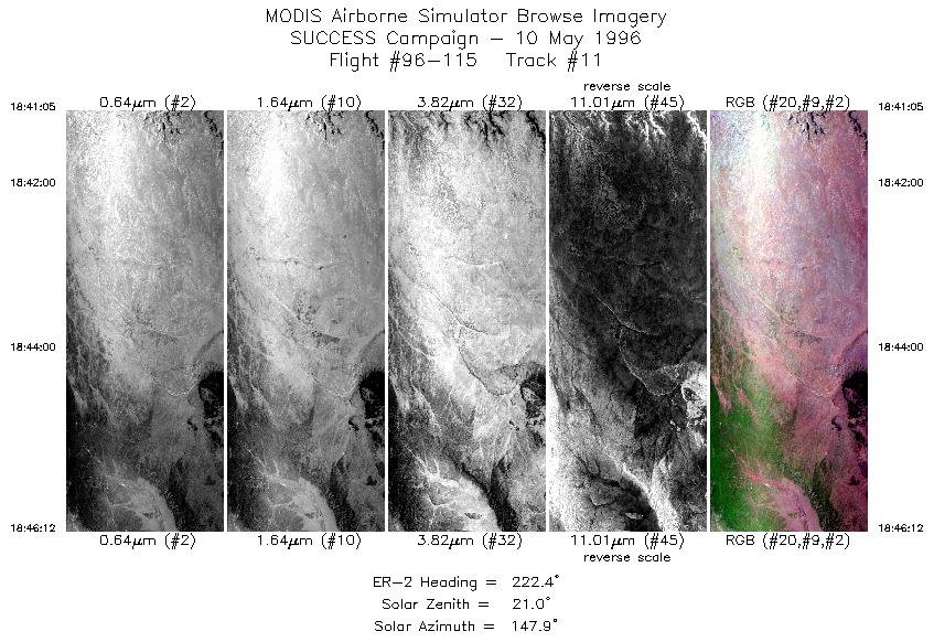
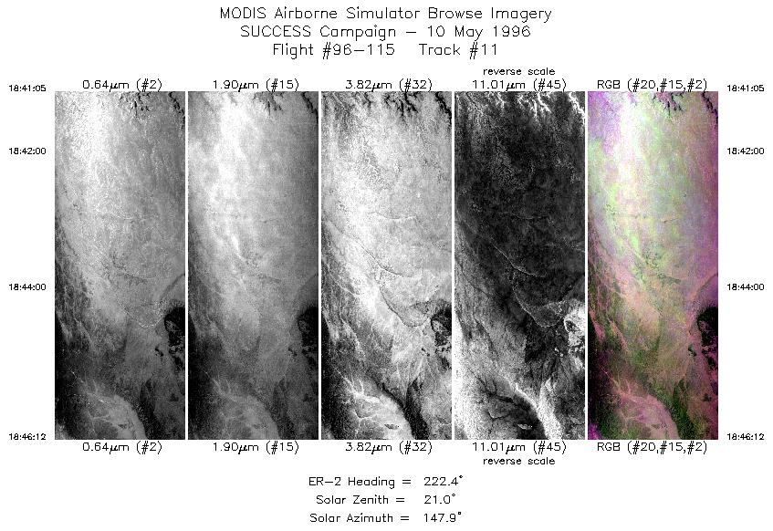
| 11 |
STD |
CIR |
18:41-18:46 |
222 |
36.08-35.67 |
112.61-113.08 |
1913 |
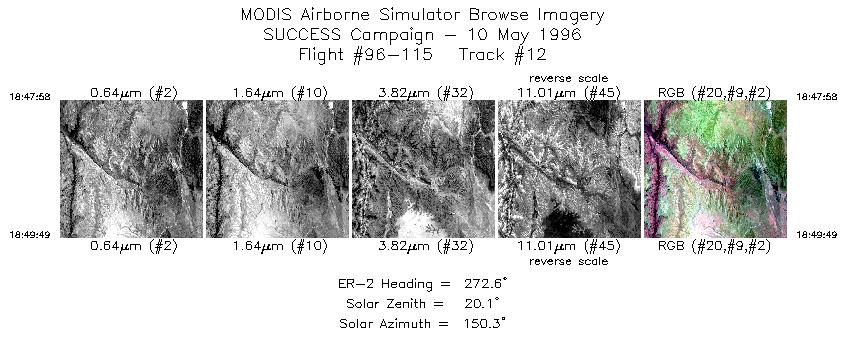
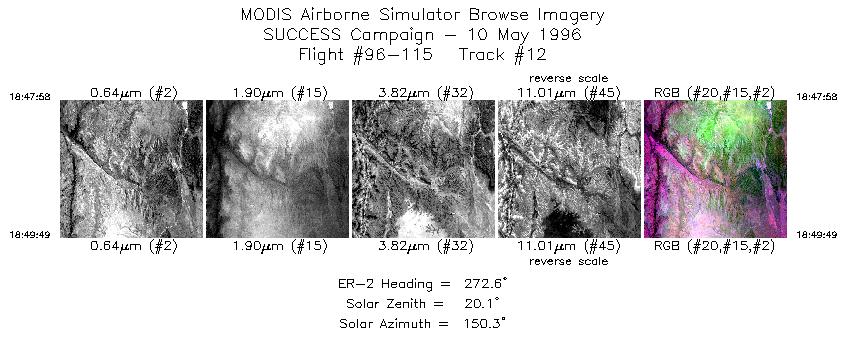
| 12 |
STD |
CIR |
18:47-18:49 |
273 |
35.61-35.62 |
113.29-113.54 |
692 |
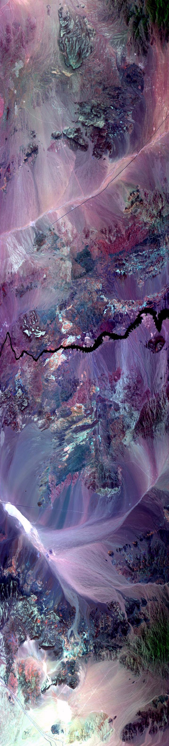
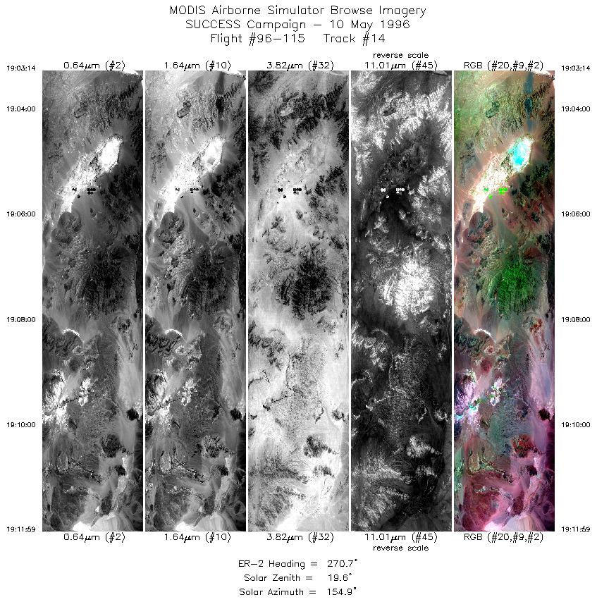
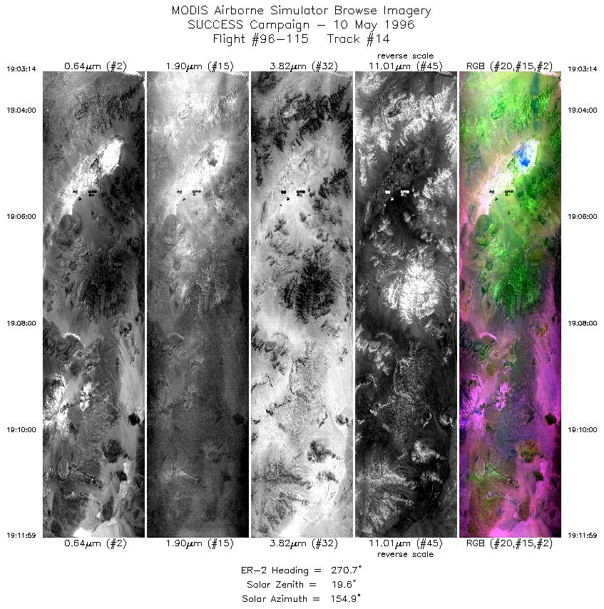
| 13 |
STD |
CIR |
18:49-19:02 |
274 |
35.63-35.76 |
113.54-115.32 |
4858 |
| 14 |
STD |
CIR |
19:03-19:11 |
271 |
35.75-35.77 |
115.37-116.57 |
3270 |
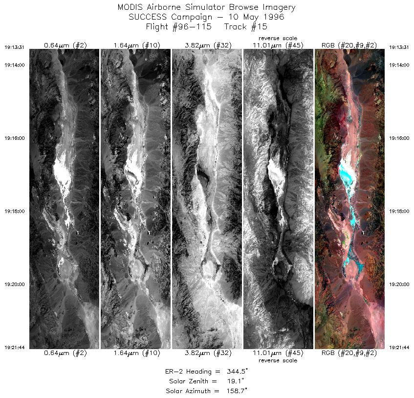
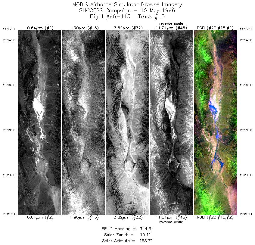
| 15 |
STD |
CIR |
19:13-19:21 |
344 |
35.87-36.77 |
116.73-117.01 |
3071 |
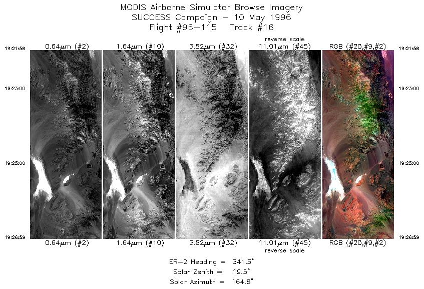
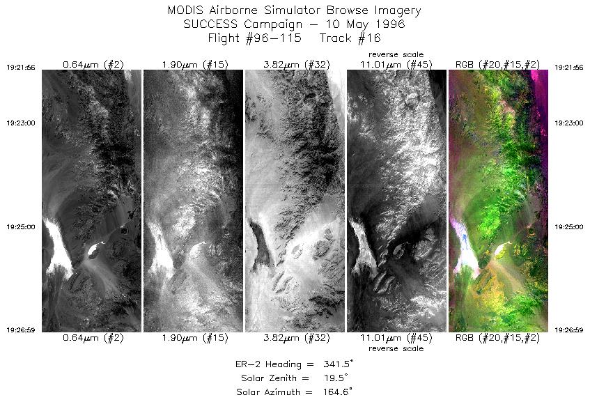
| 16 |
STD |
CIR |
19:21-19:26 |
342 |
36.79-37.33 |
117.02-117.24 |
1888 |
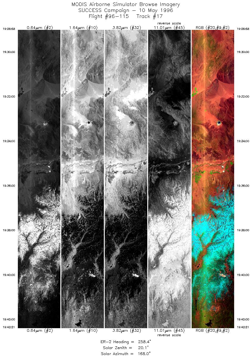
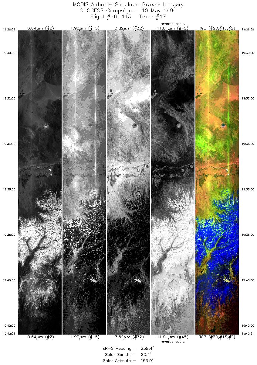
| 17 |
STD |
CIR |
19:28-19:42 |
258 |
37.40-37.09 |
117.47-119.31 |
5000 |
|
Standard Browse Images 01 through 17 in sequence |
|
Cirrus Detection Browse Images 01 through 17 in sequence |
Level-1B HDF Data Distribution Point
NASA GSFC Earth Sciences (GES) Data Center
NASA DAAC's
Additional Information
The objective of this mission was
to ferry the MAS instrument from Salina, Kansas
to Moffett Field, California
for continuation of SUCCESS field program.
The ER-2 launched at 1600 UTC and flew towards desert southwest
U.S. collecting mostly clear scenes. Beginning at 1811 UTC, a
RAMS calibration maneuver was executed, with the ER-2 flying 5
minute legs into the sun and away from the sun followed by 5 minute
legs back and forth perpendicular to the sun.
The pilot noted nice, clear scenes of Death Valley, California.
|
|
|
|