
|
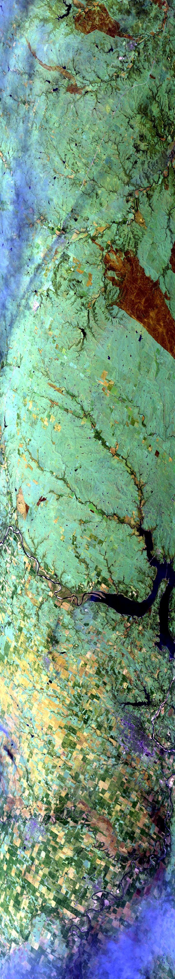
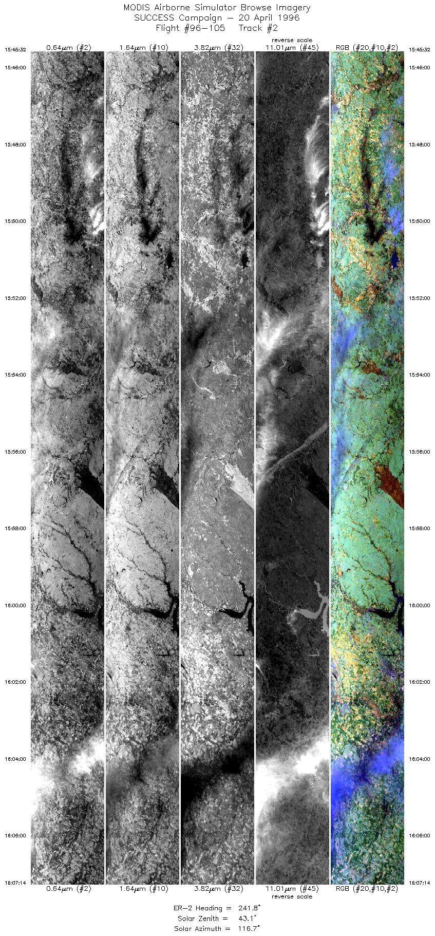
Sample Image

20 April 1996
Track #02
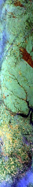

"Arkansas River, Kaw Reservoir,
and large contrail along the Kansas/Oklahoma border"
R: 2.15 microns
G: 1.64 microns
B: 0.65 microns
|
|
Summary Information
Date: April 20, 1996
ER-2 Flight Number: 96-105
Location: Oklahoma CART Site
Principle Investigator: Dr. Brian Toon (NASA Ames)
Additional Sensors: B&W_6"_RC-10, MIR, CLS, RAMS, HIS
Level-1B Processing Information
Level-1B Data Version: #10
Calibration Type: Final
Calibration Version: SUCCESS_Ames 1.0
Temperature Adjustment: No
Status: Final Calibration Done
|
|
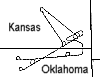
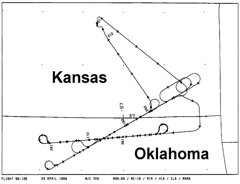
Flight Track Map

|
Level-1B Browse Imagery
Straight Line Flight Tracks: 17
Scanlines Processed: 71644
Solar Azimuth and Zenith Angles
|
Browse Images
|
Click on the Flight Track number to load images.
Lat/Lon ranges are for the BEG-END scanline nadir pixels.
|
Flight
Track |
Standard
Image |
Cirrus
Image |
Time_Span
(GMT) |
Heading
(Deg) |
Lat_Range
(Deg_N) |
Lon_Range
(Deg_W) |
Length
(Scanlines) |
| 1 |
STD |
CIR |
15:41-15:42 |
60 |
37.74-37.81 |
95.51-95.33 |
503 |
| 2 |
STD |
CIR |
15:45-16:07 |
242 |
37.64-36.47 |
95.20-97.78 |
8110 |
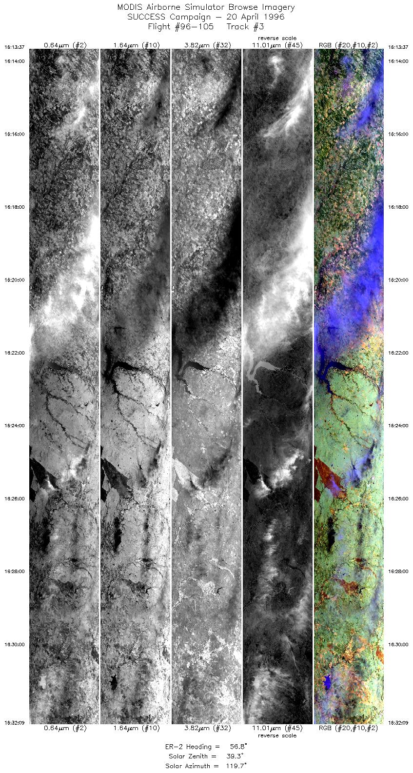
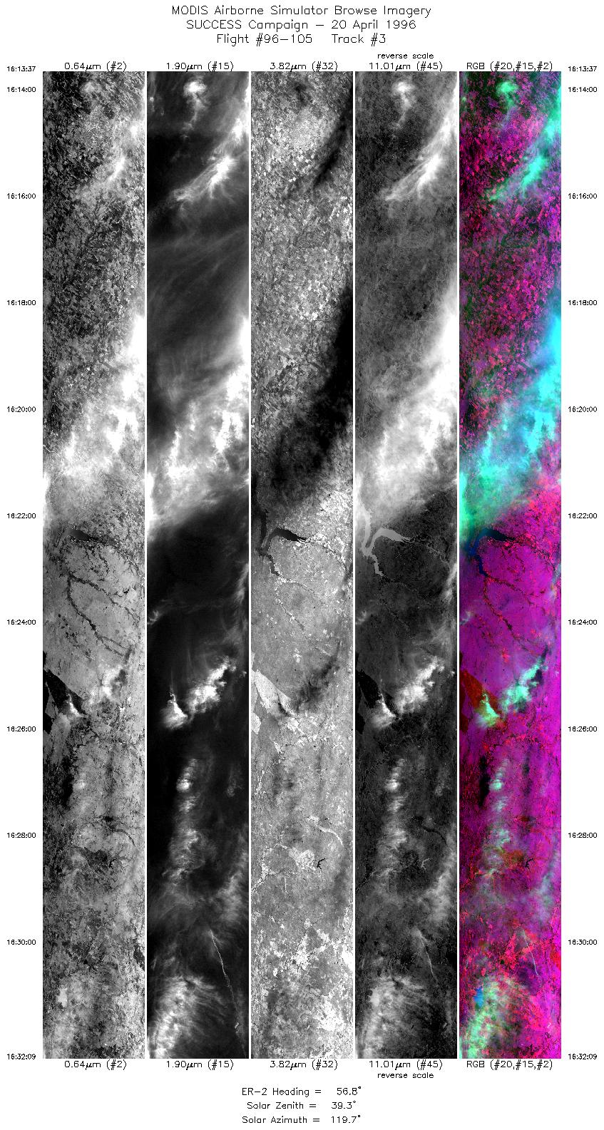
| 3 |
STD |
CIR |
16:13-16:32 |
57 |
36.35-37.41 |
98.04-95.71 |
6925 |
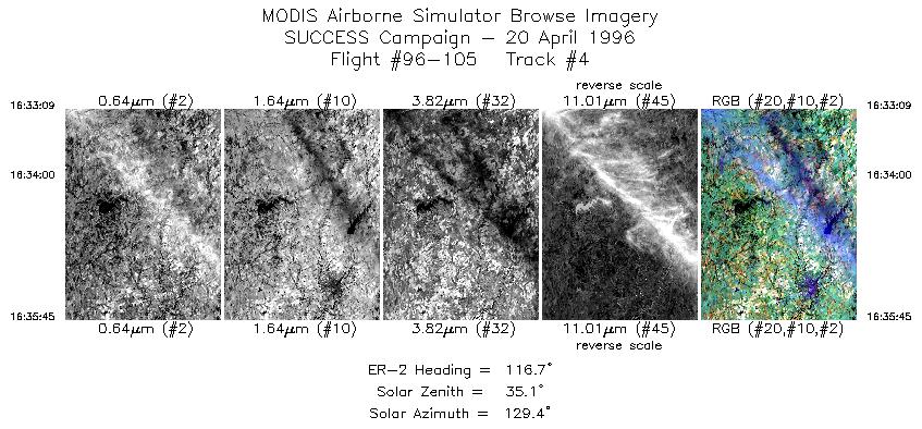
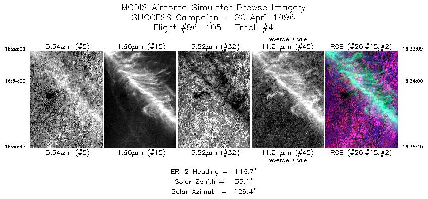
| 4 |
STD |
CIR |
16:33-16:35 |
117 |
37.41-37.28 |
95.57-95.24 |
972 |
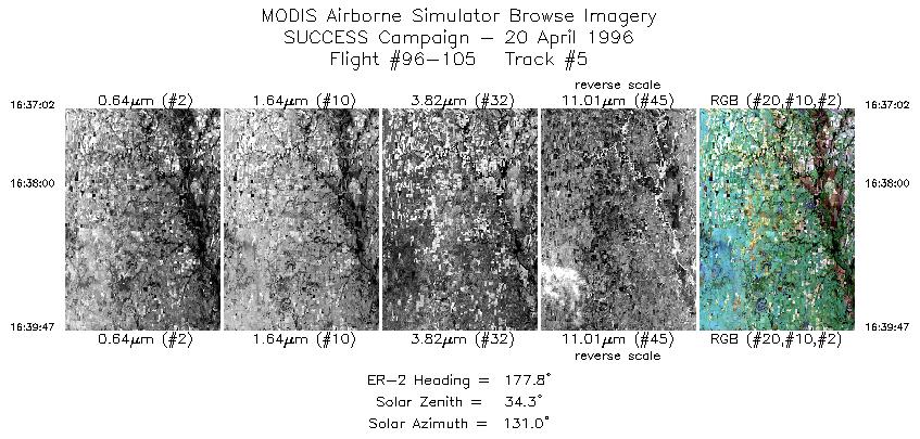
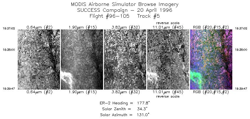
| 5 |
STD |
CIR |
16:37-16:39 |
178 |
37.17-36.87 |
95.15-95.14 |
1028 |
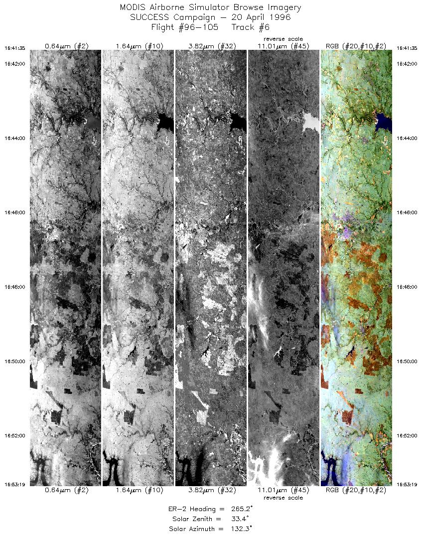
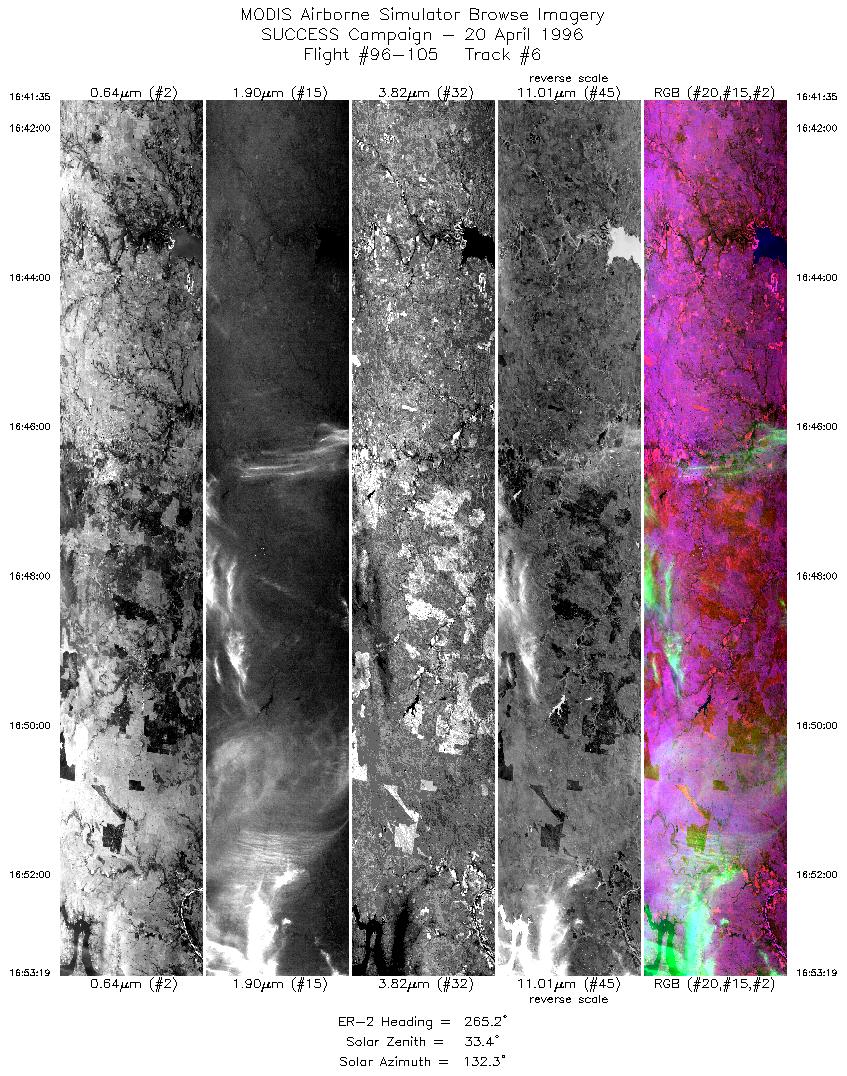
| 6 |
STD |
CIR |
16:41-16:53 |
265 |
36.74-36.65 |
95.31-96.90 |
4384 |
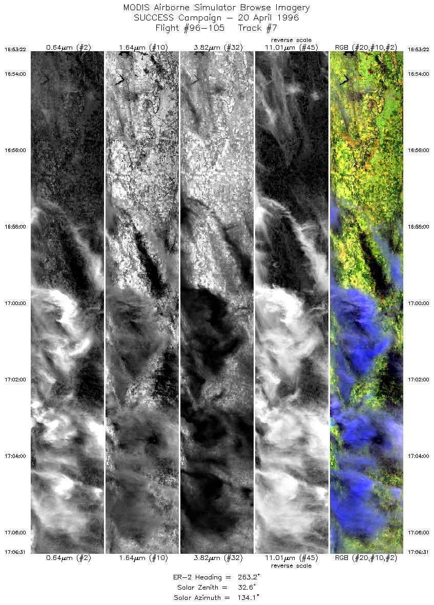
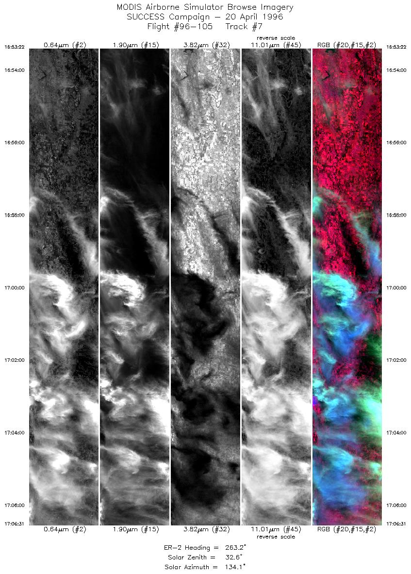
| 7 |
STD |
CIR |
16:53-17:06 |
263 |
36.65-36.51 |
96.90-98.71 |
4913 |
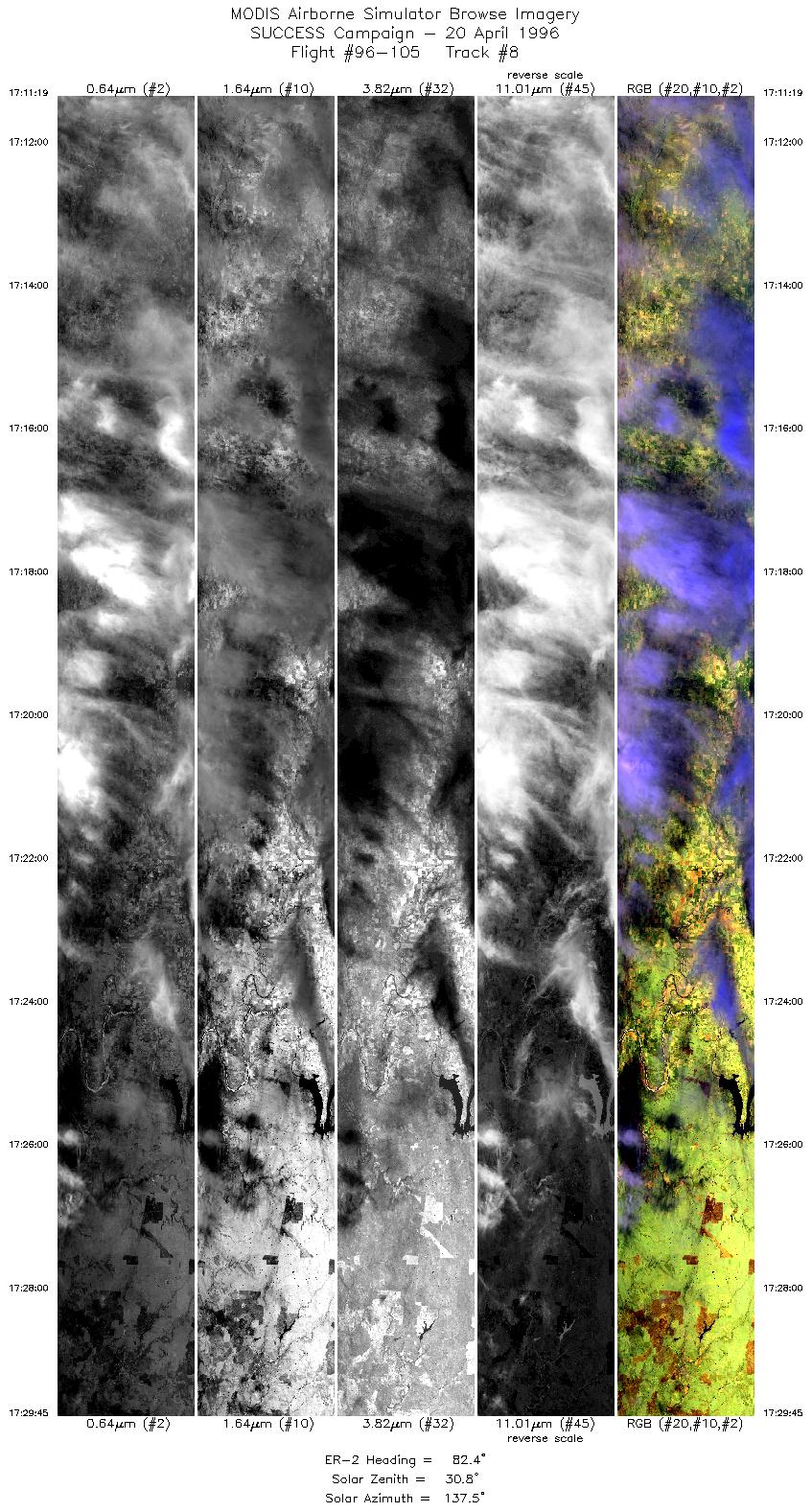
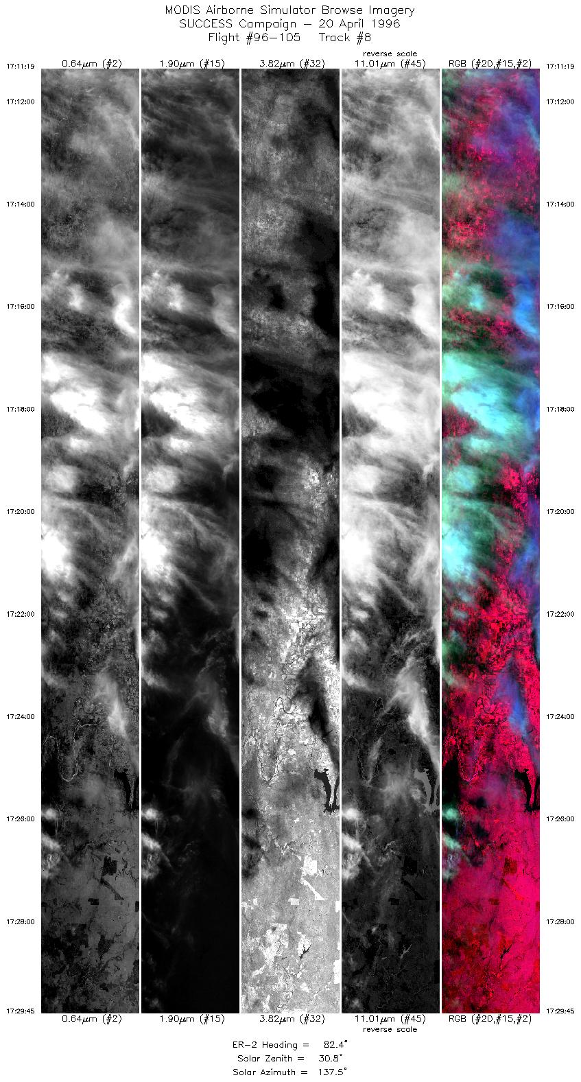
| 8 |
STD |
CIR |
17:11-17:29 |
82 |
36.50-36.69 |
98.87-96.25 |
6886 |
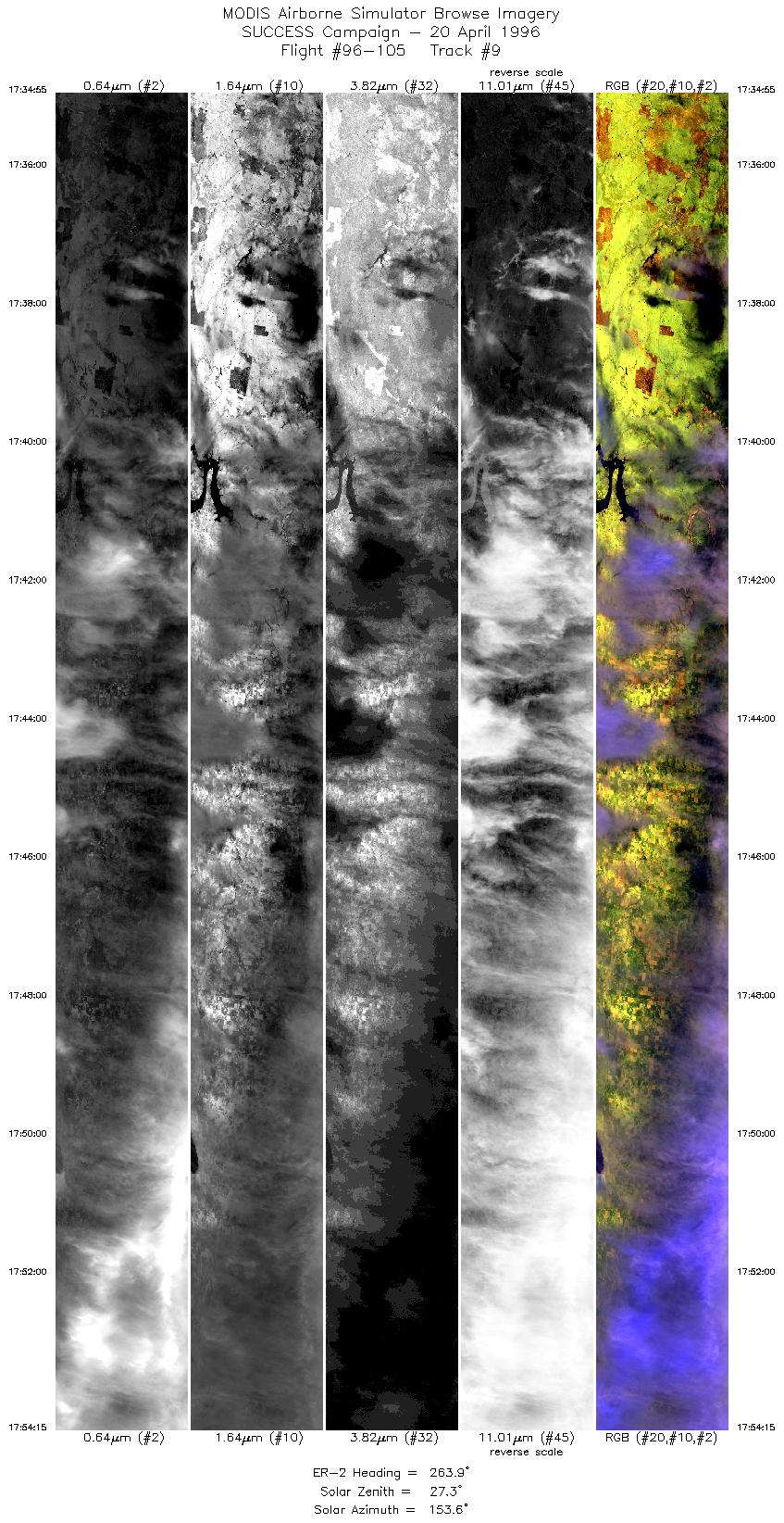
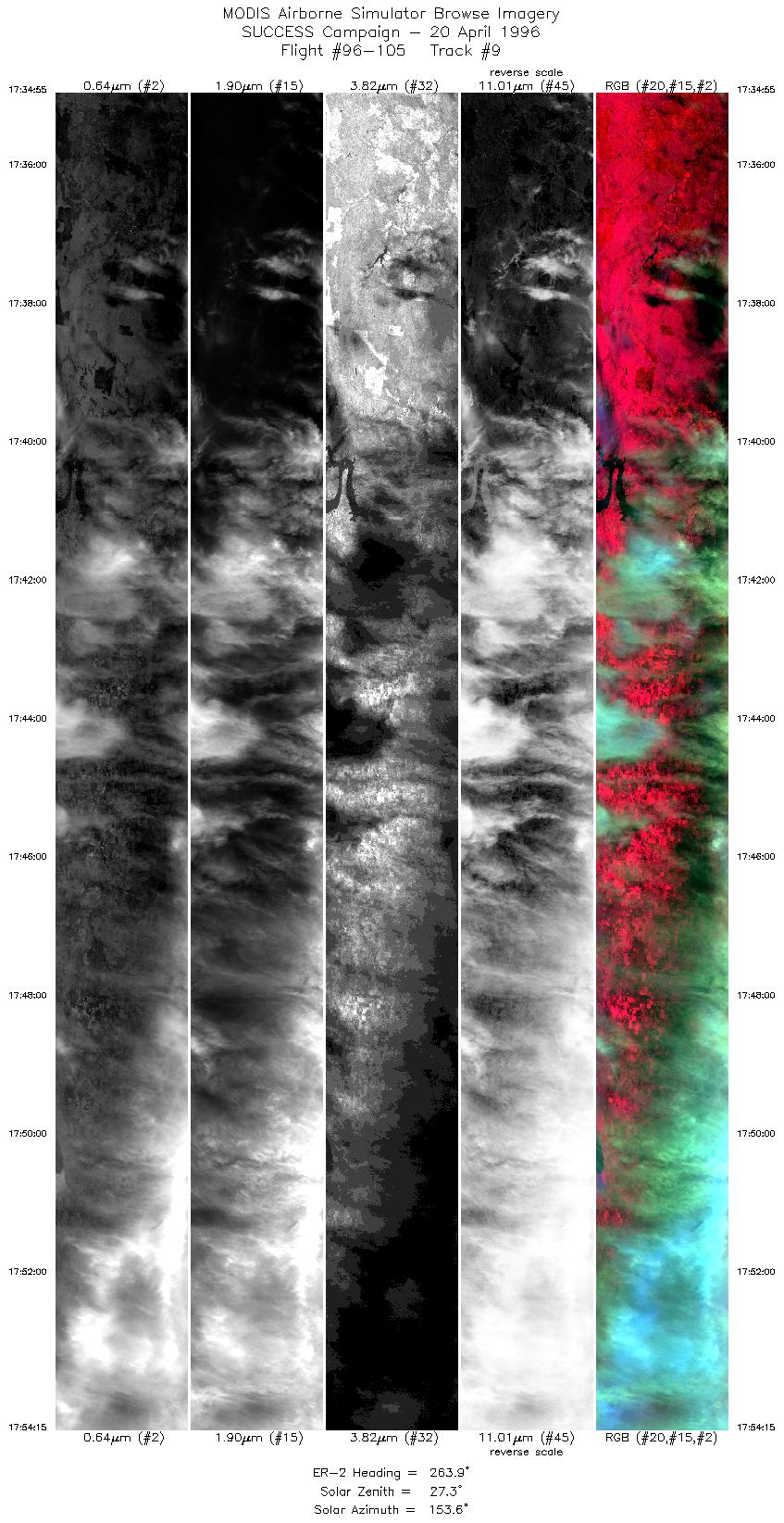
| 9 |
STD |
CIR |
17:34-17:54 |
264 |
36.70-36.52 |
96.08-98.71 |
7222 |
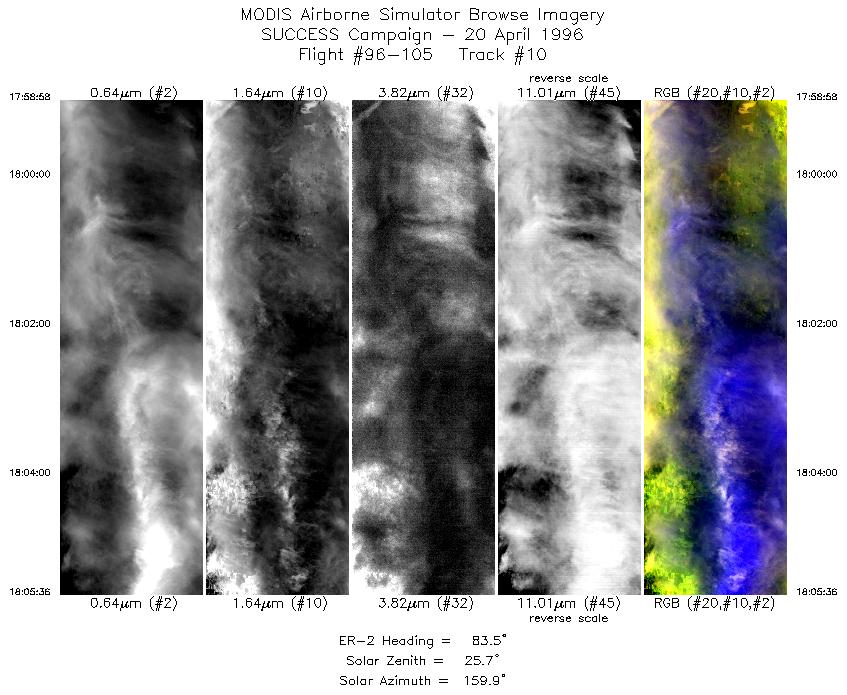
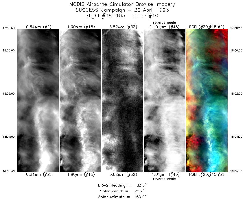
| 10 |
STD |
CIR |
17:58-18:05 |
84 |
36.50-36.57 |
98.90-97.97 |
2478 |
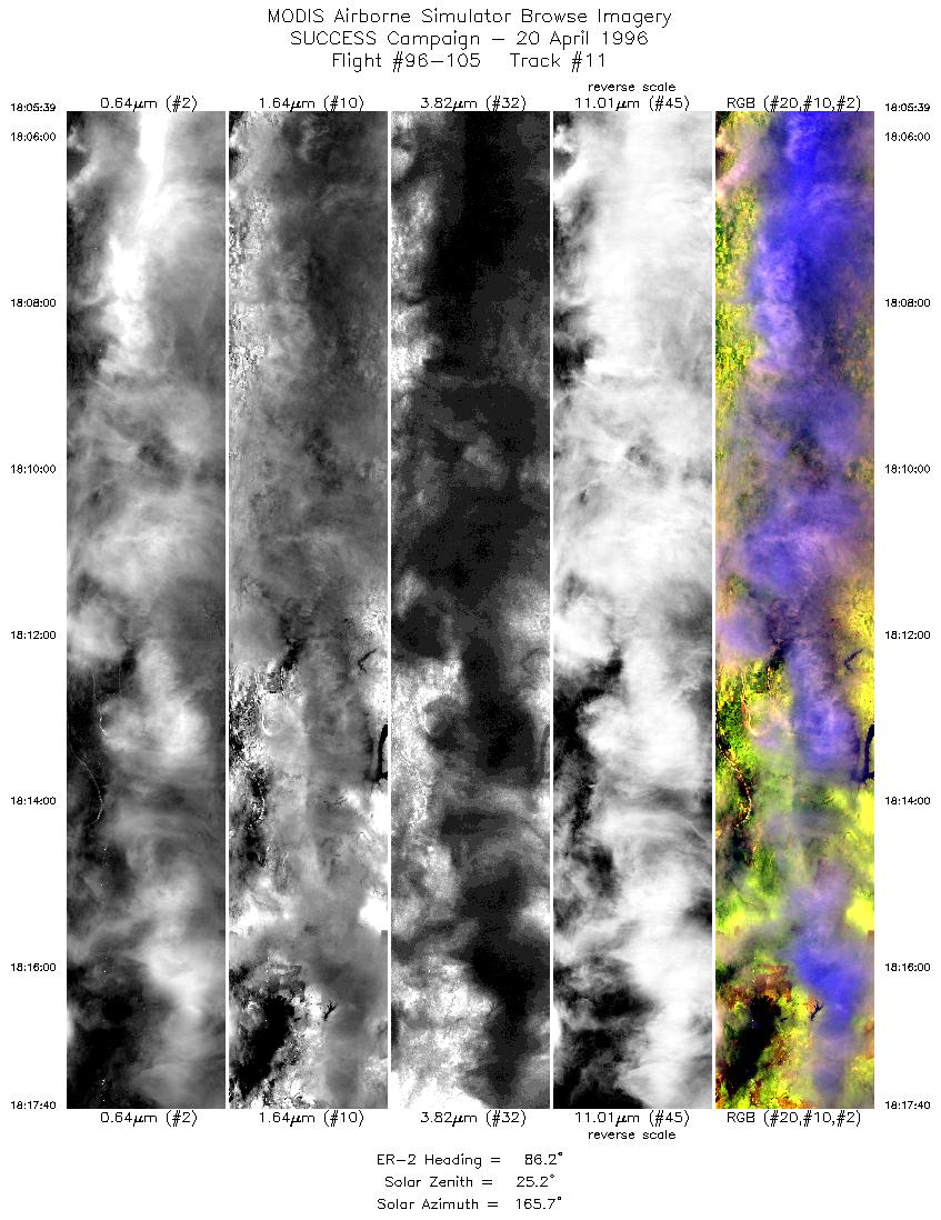
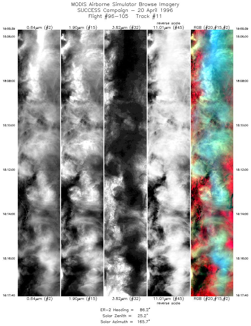
| 11 |
STD |
CIR |
18:05-18:17 |
86 |
36.57-36.69 |
97.96-96.25 |
4490 |
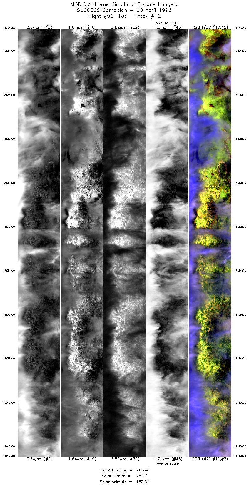
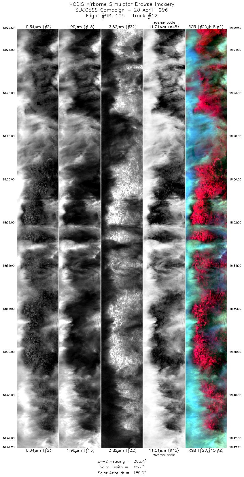
| 12 |
STD |
CIR |
18:22-18:42 |
263 |
36.70-36.52 |
96.08-98.72 |
7260 |
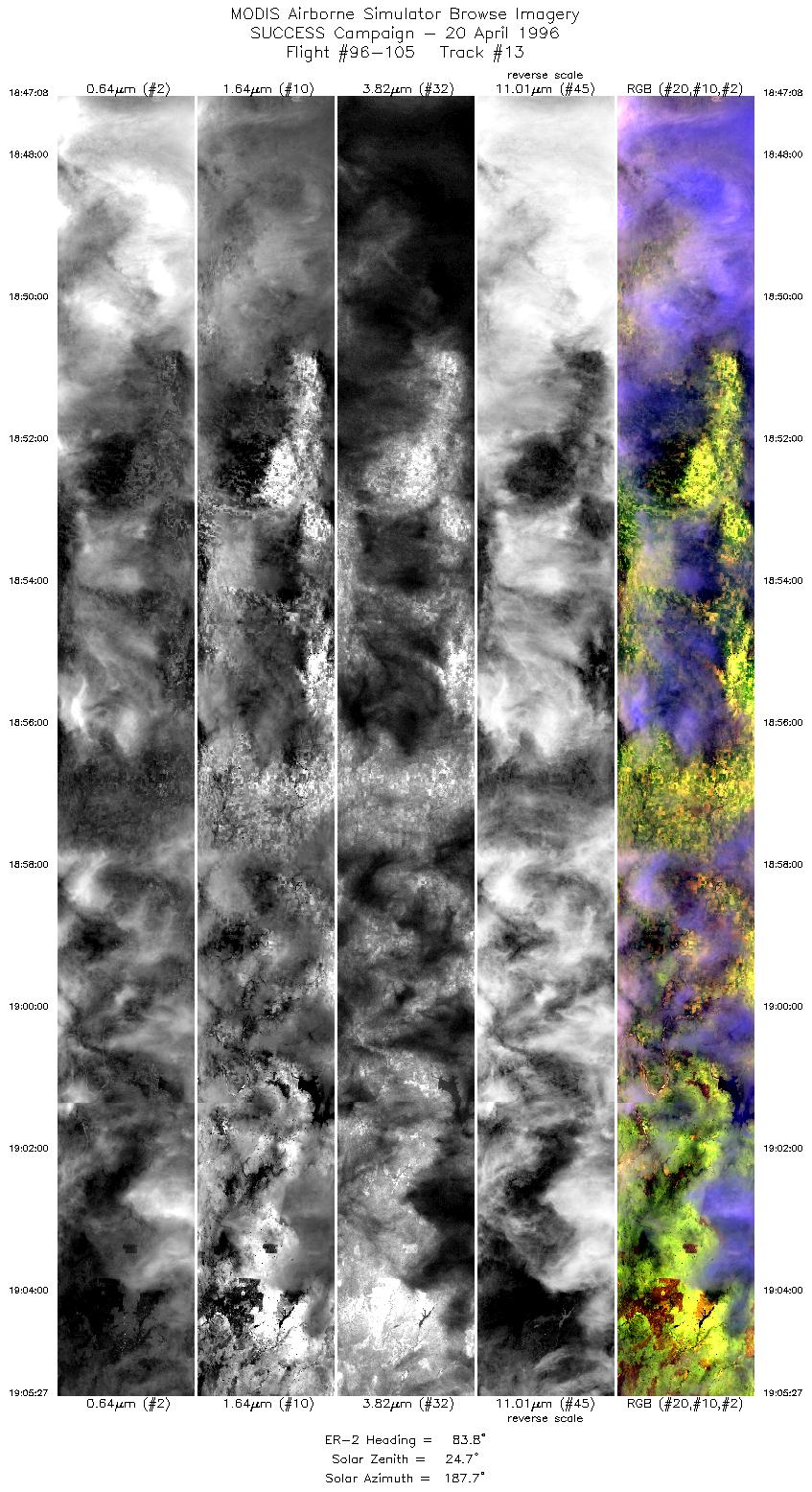
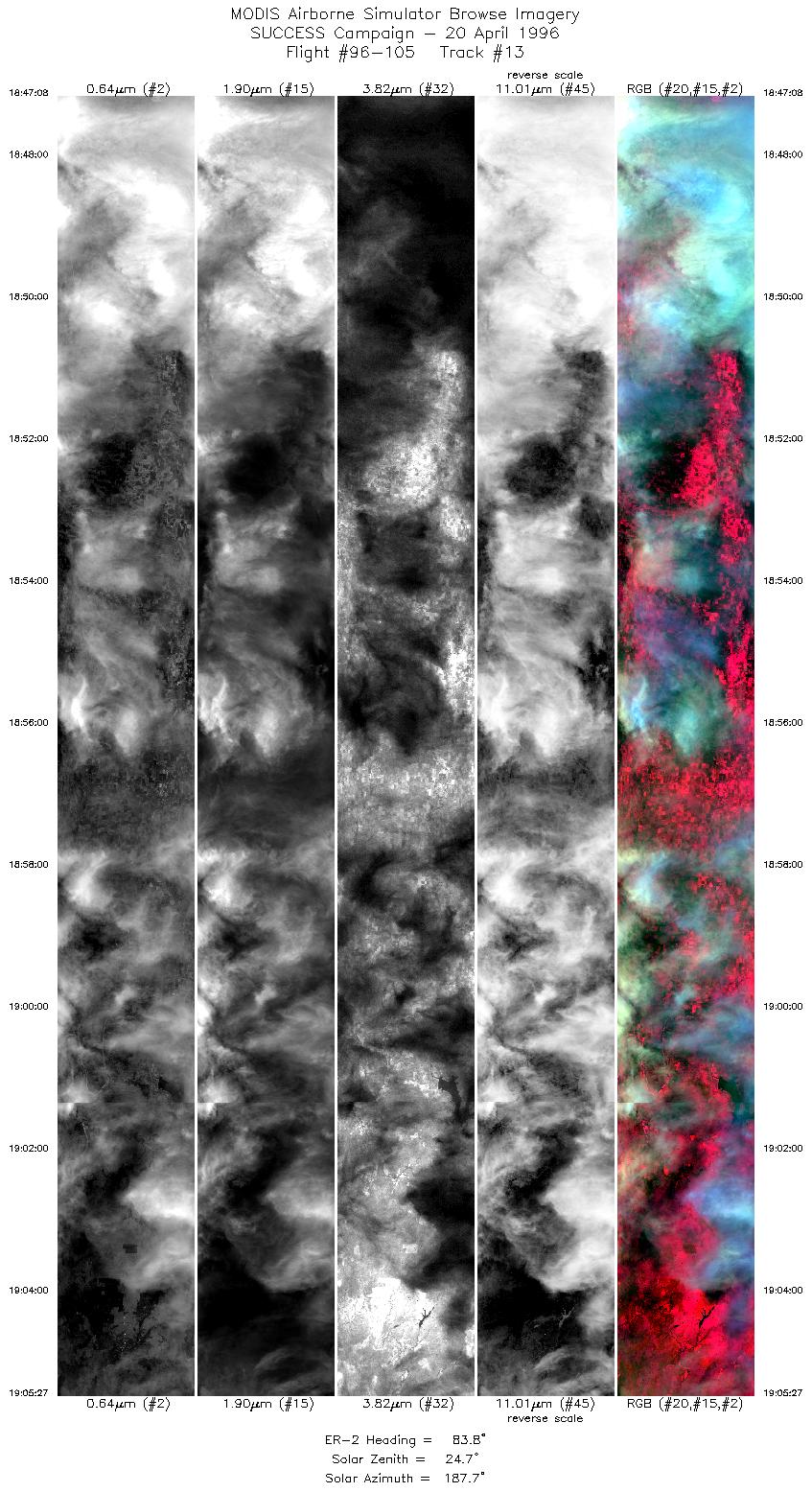
| 13 |
STD |
CIR |
18:47-19:05 |
84 |
36.50-36.69 |
98.89-96.26 |
6782 |
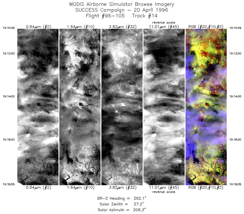
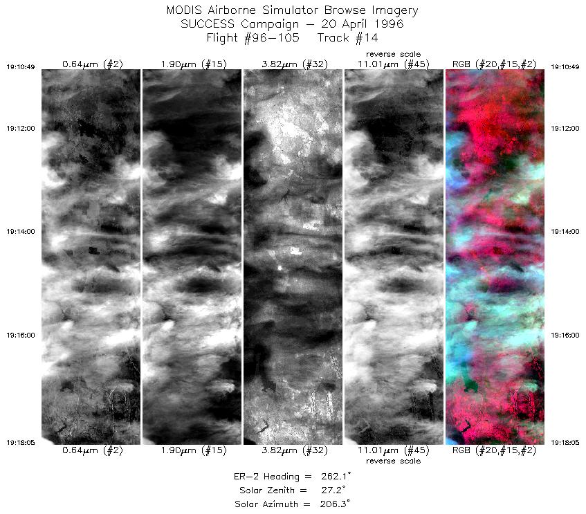
| 14 |
STD |
CIR |
19:10-19:18 |
262 |
36.70-36.63 |
96.08-97.06 |
2715 |
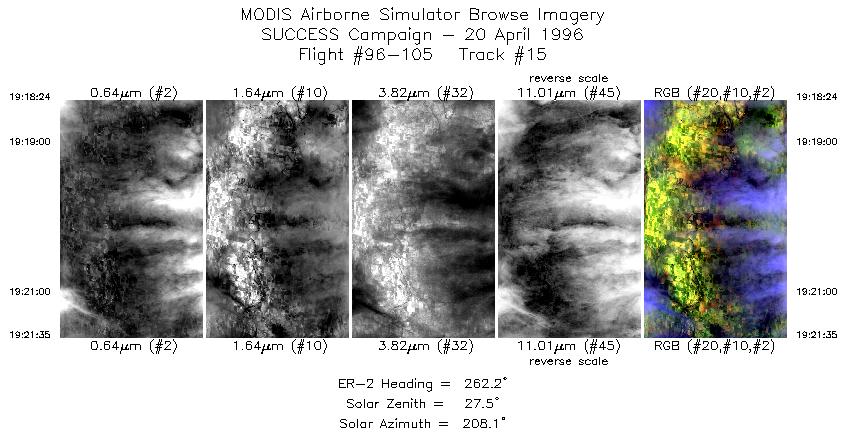
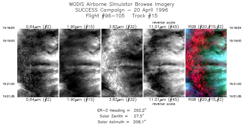
| 15 |
STD |
CIR |
19:18-19:21 |
262 |
36.63-36.60 |
97.09-97.52 |
1190 |
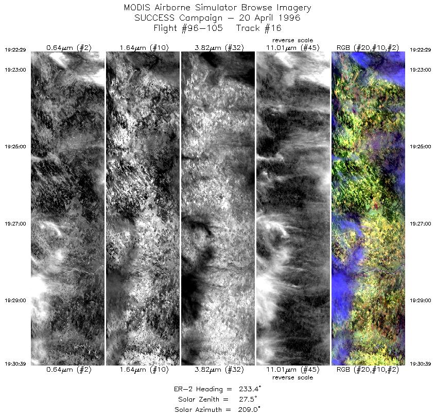
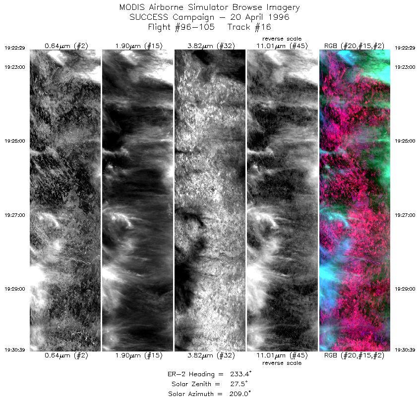
| 16 |
STD |
CIR |
19:22-19:30 |
233 |
36.55-36.10 |
97.62-98.55 |
3052 |
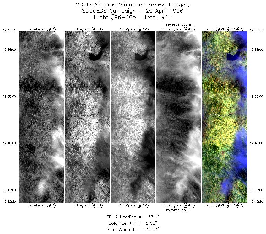
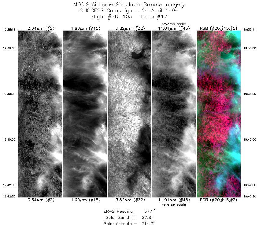
| 17 |
STD |
CIR |
19:35-19:42 |
57 |
36.03-36.45 |
98.72-97.81 |
2734 |
|
Standard Browse Images 01 through 17 in sequence
|
~20000 |
|
Cirrus Detection Browse Images 01 through 17 in sequence
|
~20000 |
Level-1B HDF Data Distribution Point
NASA GSFC Earth Sciences (GES) Data Center
NASA DAAC's
Additional Information
The objective of this mission was to observe cirrus clouds of various ages
and contrails in the presence of cirrus and
investigate differences in the radiative signature of contrails and natural cirrus.
The ER-2 aircraft flew ENE-WSW oriented lines over the ARM CART site.
The first two legs were approximately 115 nm long with
the ARM CART (36 36.3'N 97 29.1'W) site near the WSW end of the leg. This first leg was coordinated with
the DC-8 starting at 37 32.6 N 95 23.7W (060 at 115 from ARM site) with the second point at the ARM site.
After two legs the ER-2 heading was adjusted to approximately 80 and 100 degrees with straight line patterns
centered on the ARM site. Flight path of the ER-2 was again adjusted around 1925 (during the ninth horizontal
flight leg) to align with the DC-8 (headings of approximately 60 and 240 degrees).
The pilot reported cirrus, of varying thickness, in the westerly flow along ER-2 flight pattern.
as well as widespread cirrus and contrails during the twelve overpasses of the ARM
CART site (approximately 1604, 1618, 1657, 1721, 1745, 1808, 1833, 1856, 1921, 1945, 2009 and 2033 UTC).
At approximately 1556 UTC the MAS observed a large contrail (also shown in the sample image)
extending across the entire swath (37 km).
During first two legs that were coordinated with the DC-8, conditions were mostly
clear, the DC-8 was making broken contrails that were visible from the ER-2. At the end of flight ARM site was
mostly overcast, though breaks in the cloud did exist. Contrails were visible during mission. Circle rings of DC-8
spiral run near the end of the mission were visible from the ER-2.
|
|
|
|