SUCCESS Campaign
Flight #96-103

Sample Image
click image!
15 April 1996
Track #09


"Cumulus clouds over central Kansas"

R: 2.15 microns
G: 1.64 microns
B: 0.65 microns
Summary Information
Date: April 15, 1996
ER-2 Flight Number: 96-103
Location: Oklahoma CART Site, Kansas
Principle Investigator: Dr. Brian Toon (NASA Ames)
Additional Sensors: B&W_6"_RC-10

Level-1B Processing Information
Level-1B Data Version: #10
Calibration Type: Final
Calibration Version: SUCCESS_Ames 1.0
Temperature Adjustment: No
Status: Final Calibration Done

Flight Track Map

click map!
Level-1B Browse Imagery
Straight Line Flight Tracks: 10
Scanlines Processed: 24901
Solar Azimuth and Zenith Angles
Browse Images
Click on the Flight Track number to load images.
Lat/Lon ranges are for the BEG-END scanline nadir pixels.
Flight
Track
Standard
Image
Cirrus
Image
Time_Span
(GMT)
Heading
(Deg)
Lat_Range
(Deg_N)
Lon_Range
(Deg_W)
Length
(Scanlines)
1 STD CIR 18:10-18:14 341 36.97-37.37 98.00-98.13 1419
2 STD CIR 18:21-18:22 345 37.23-37.36 98.07-98.11 479
3 STD CIR 18:25-18:32 164 37.40-36.61 97.86-97.58 2673
4 STD CIR 18:35-18:38 345 36.56-36.82 97.80-97.88 934
5 STD CIR 18:40-18:42 165 36.89-36.63 97.68-97.59 847
6 STD CIR 18:46-18:47 342 36.65-36.79 97.83-97.88 486
7 STD CIR 18:50-18:59 164 36.81-35.81 97.65-97.31 3383
8 STD CIR 19:03-19:17 343 35.83-37.28 97.61-98.10 5114
9 STD CIR 19:20-19:33 164 37.33-35.89 97.83-97.33 4808
10 STD CIR 19:36-19:49 343 35.86-37.20 97.62-98.07 4758
Standard Browse Images 01 through 10 in sequence ~20000
Cirrus Detection Browse Images 01 through 10 in sequence ~20000

Level-1B HDF Data Distribution Point
NASA GSFC Earth Sciences (GES) Data Center
NASA DAAC's

Additional Information
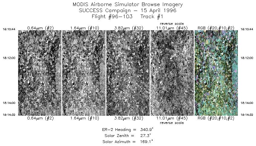
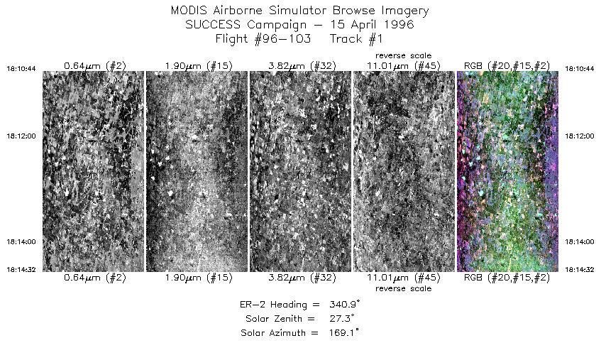
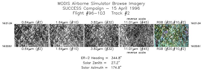
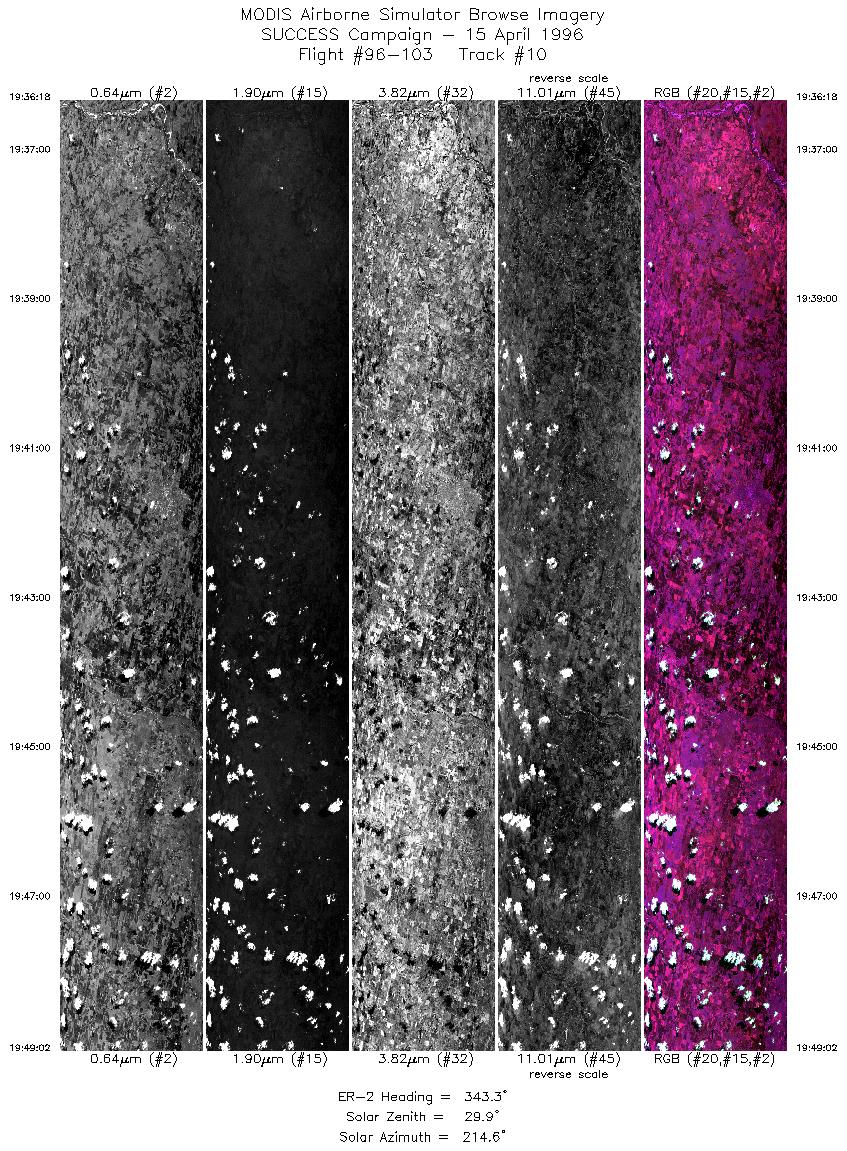
The objective of this mission was to measure non-persistent contrails and radiation over the ARM CART Site; and overfly ground-based instrumentation at the ARM CART site for comparison of ER-2 downlooking with surface based uplooking instruments. In addition, an aircraft (ER-2, DC-8, T-39) coordination exercise was scheduled.

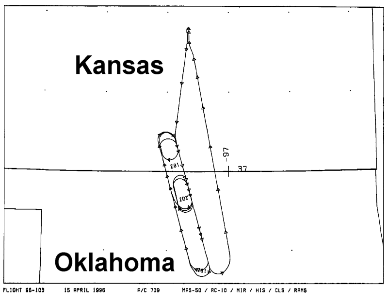
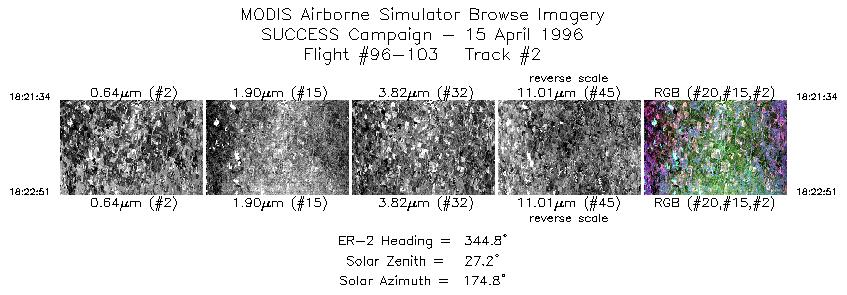
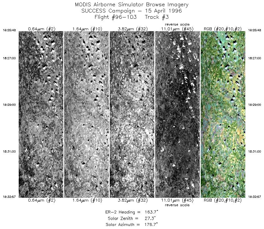
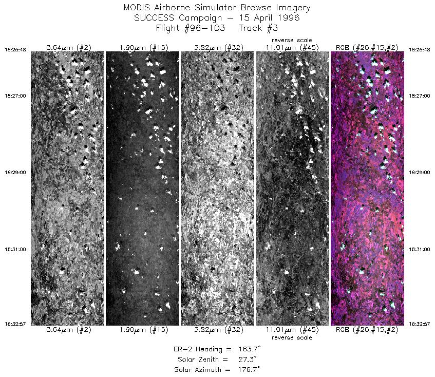
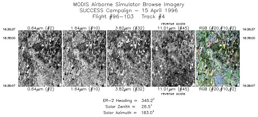
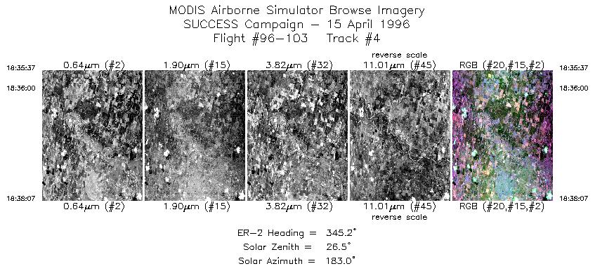
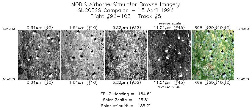
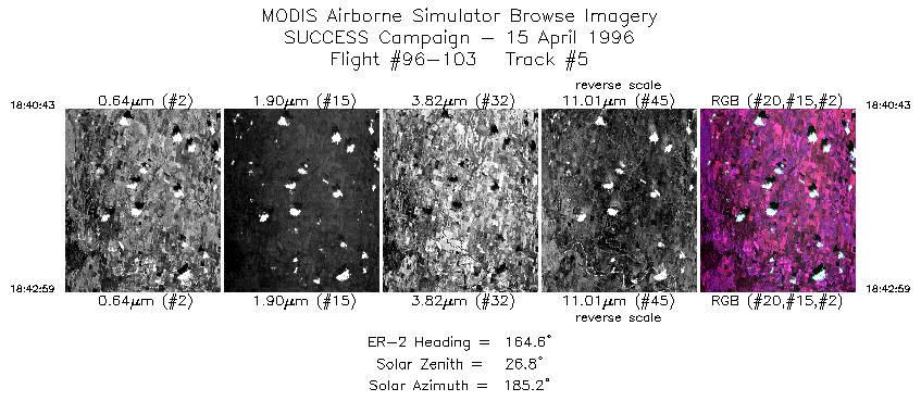
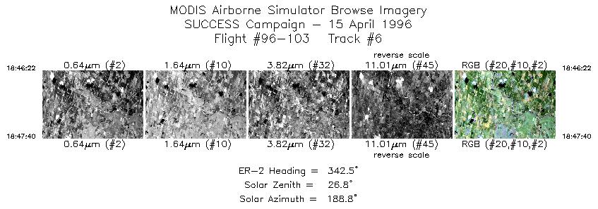
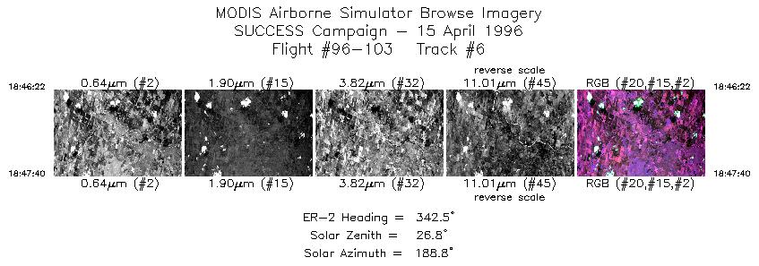
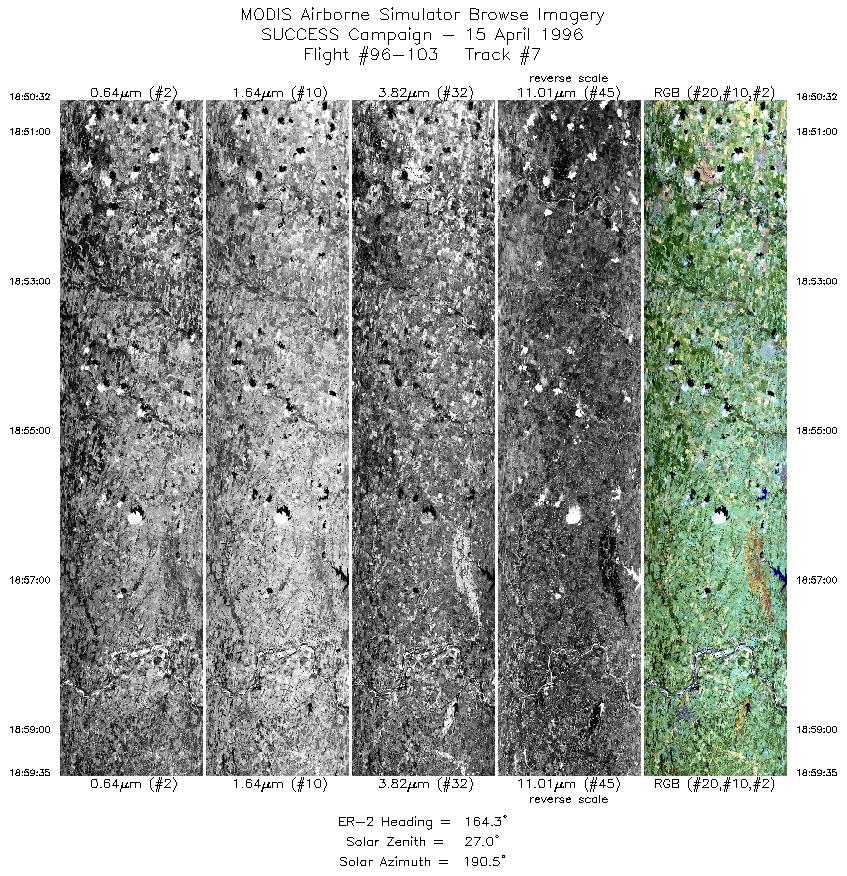
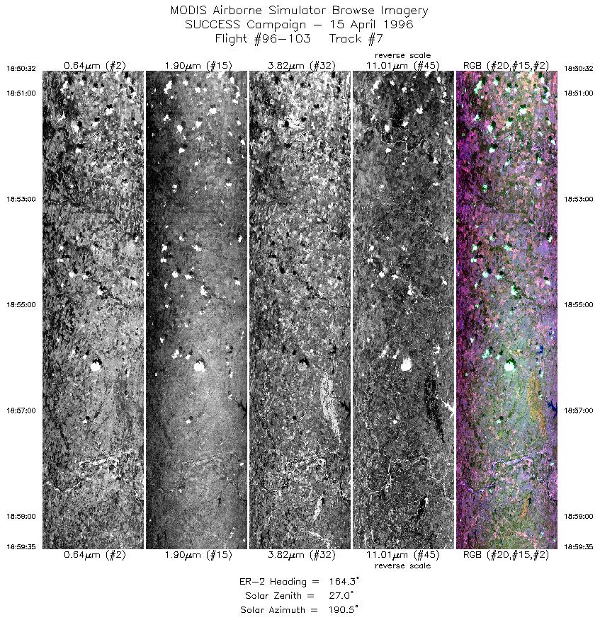
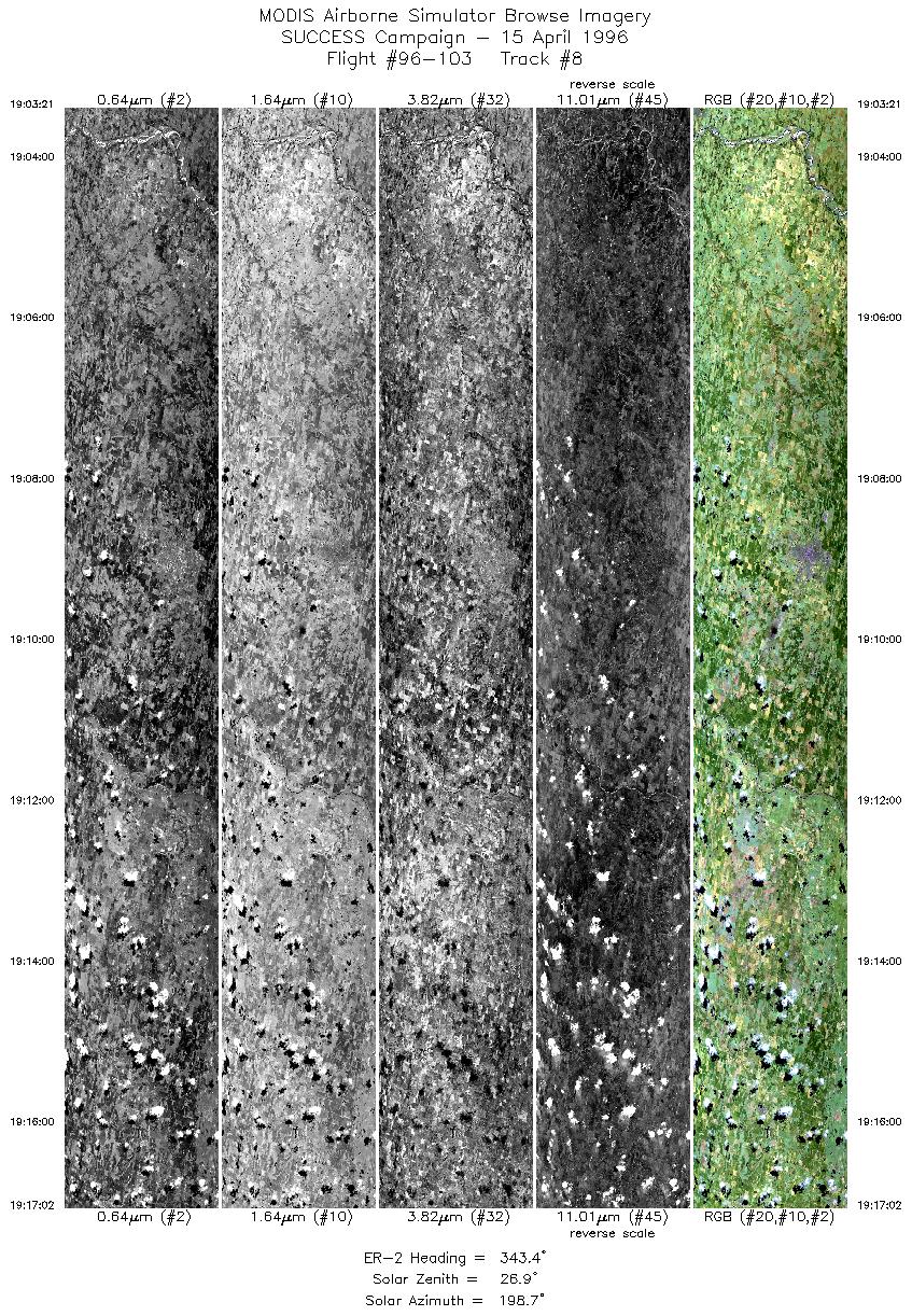
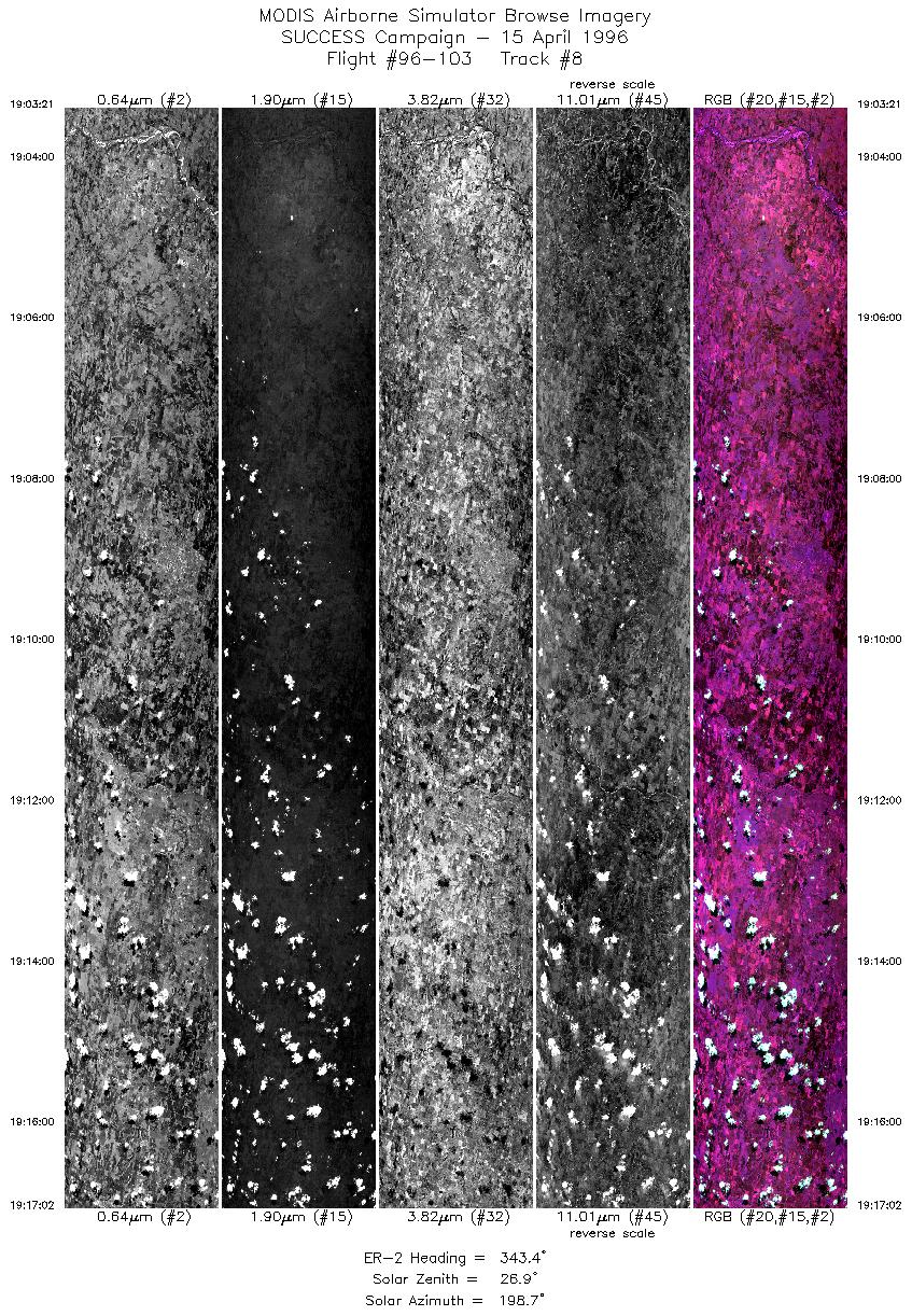
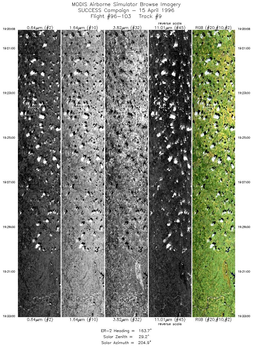
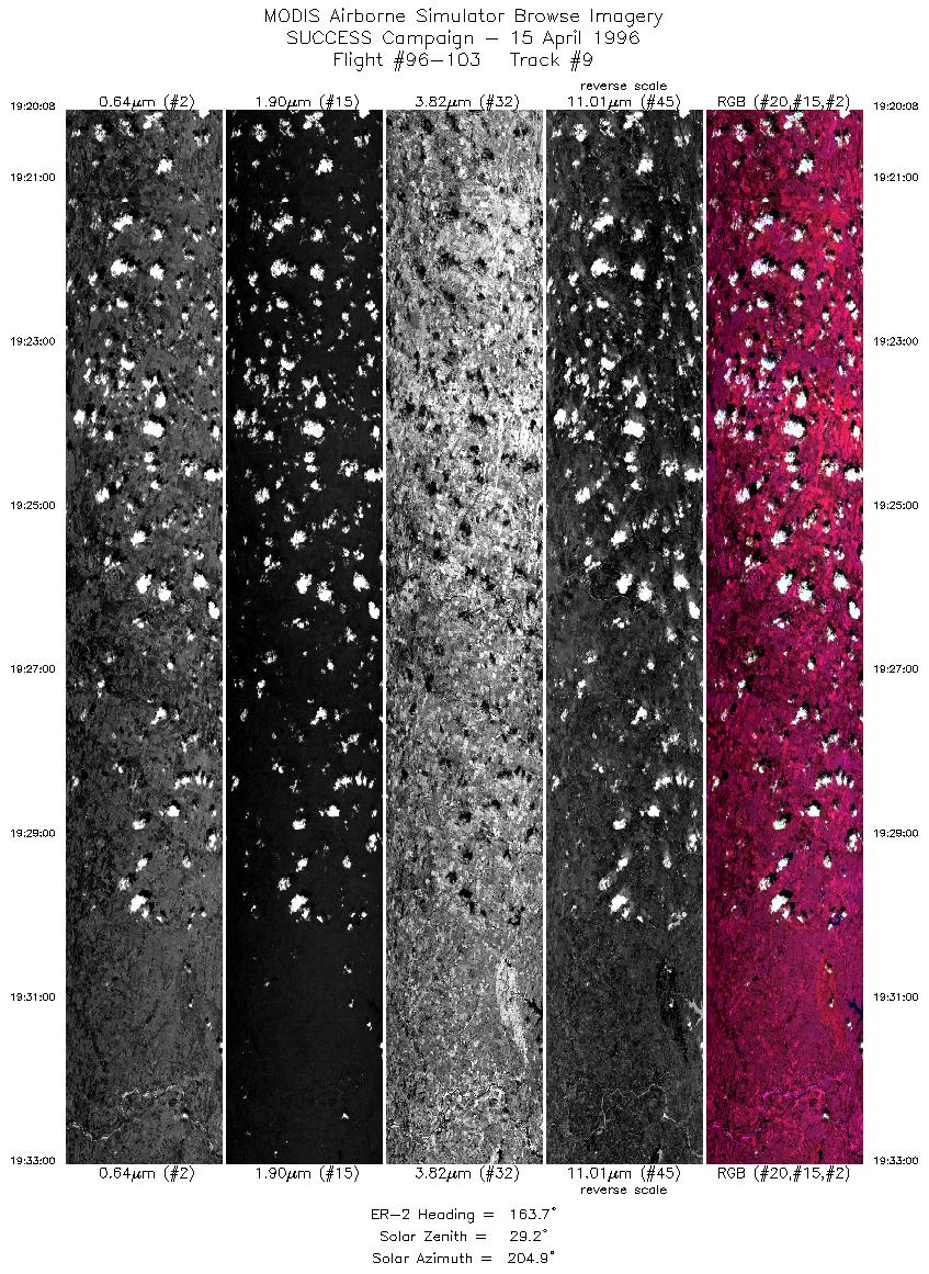
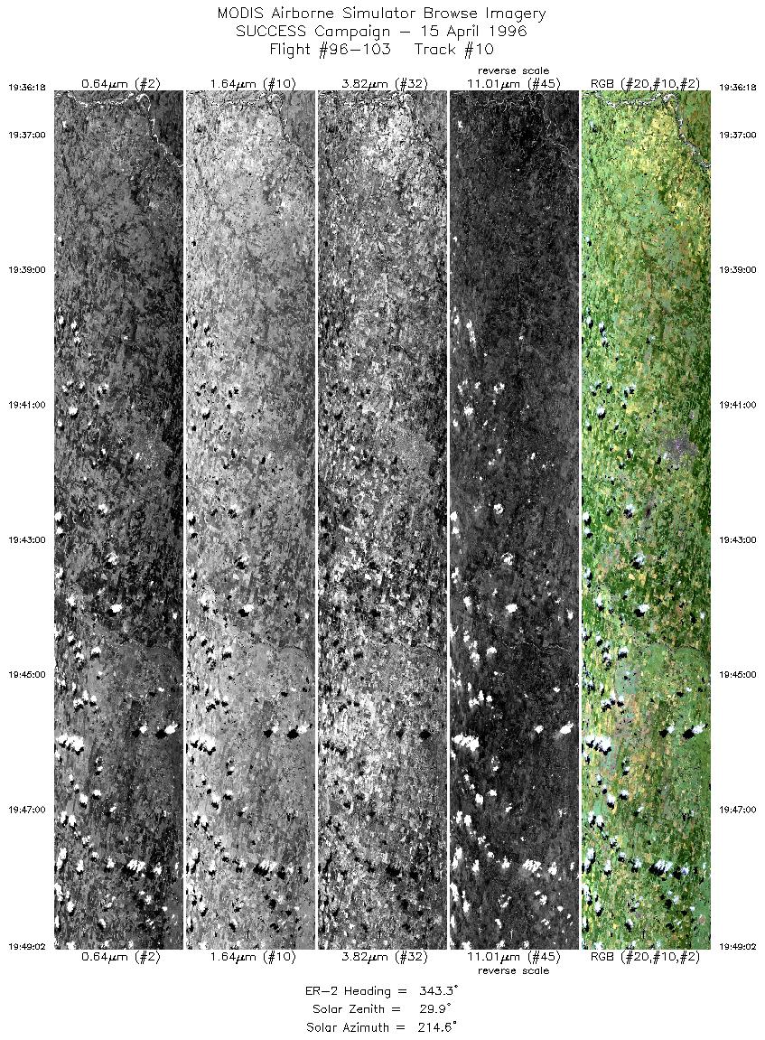
ER-2 launch at 1745 UTC; ER-2 recovery at 2045 UTC. ER-2 flew 2 1/2 revolutions of a racetrack pattern (headings 345 and 165 degrees) with flight lines roughly 100 nm. Starting on eastern leg (heading 165), the ER-2 overflew the ARM CART site (36 36.6'N 97 34.8'W) at center of eastern leg. Total of 3 overpasses of ARM CART site were made (1854, 1926, and 2001 UTC).

Skies were mostly clear at ARM CART site with increasing scattered boundary layer cloud formation on 2nd and 3rd overpass. DC-8 (on racetrack oriented 330/150 degrees) was unable to complete it's racetrack pattern due to air traffic control (ATC) vectoring of DC-8. This complicated aircraft coordination exercise, however ER-2 pilot reported verbal exchange placed ER-2 and DC-8 within about 30 seconds (~3 nm) of each other at CART site (1854 UTC).

ARM CART site Central Facility coordinates provided for DC-8 and ER-2 flight plans did not agree. Coordinates being verified for next flight.


Back to: [SUCCESS Campaign]

Another SUCCESS Flight?
#96-100 #96-101 #96-102 #96-103 #96-104 #96-105
#96-106 #96-107 #96-108 #96-109 #96-110 #96-111
#96-112 #96-113 #96-114 #96-115 #96-116 #96-117
Accessibility