
|
Sample Image

07 May 1996
Track #14
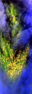

"Patchy clouds give way to clear skies over Alliance, Nebraska"
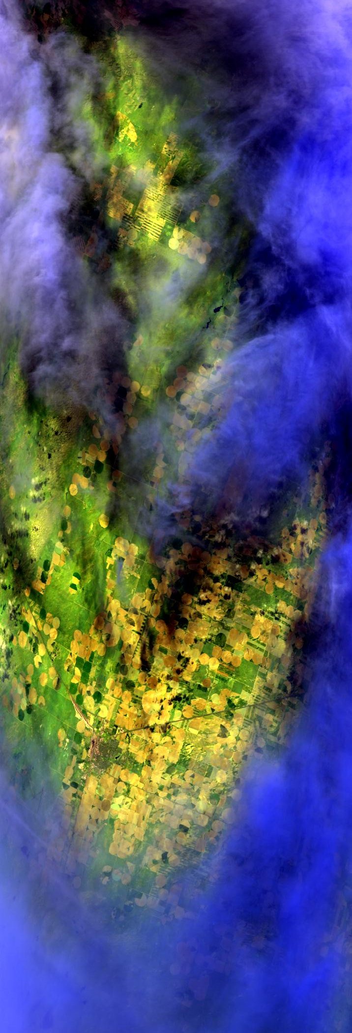
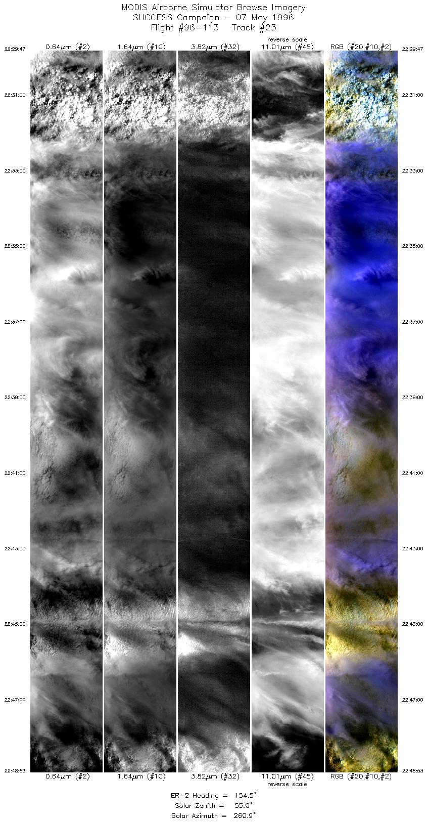
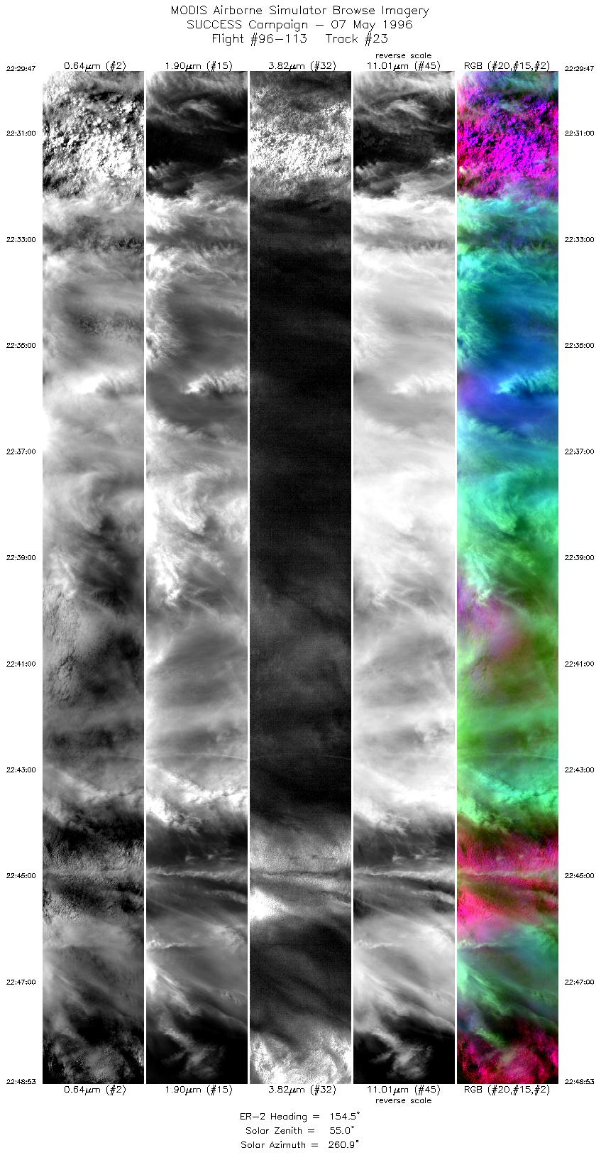
07 May 1996
Track #23

"Cirrus over thick cumulus congestus clouds blanket Ainsworth, Nebraska"
R: 2.15 microns
G: 1.65 microns
B: 0.65 microns
|
|
Summary Information
Date: May 07, 1996
ER-2 Flight Number: 96-113
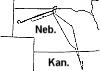
Location: Oklahoma CART Site, Kansas, Texas
Principle Investigator: Dr. Brian Toon (NASA Ames)
Additional Sensors: B&W_6"_RC-10, MIR, CLS, RAMS, HIS, EOC
Level-1B Processing Information
Level-1B Data Version: #10
Calibration Type: Final
Calibration Version: SUCCESS_Ames 1.0
Temperature Adjustment: No
Status: Final Calibration Done
|
|
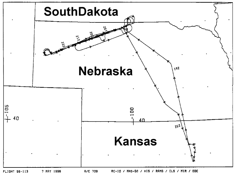
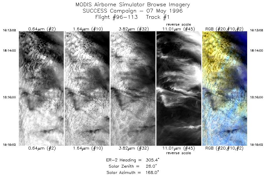
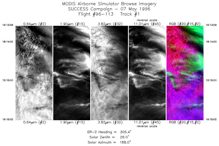
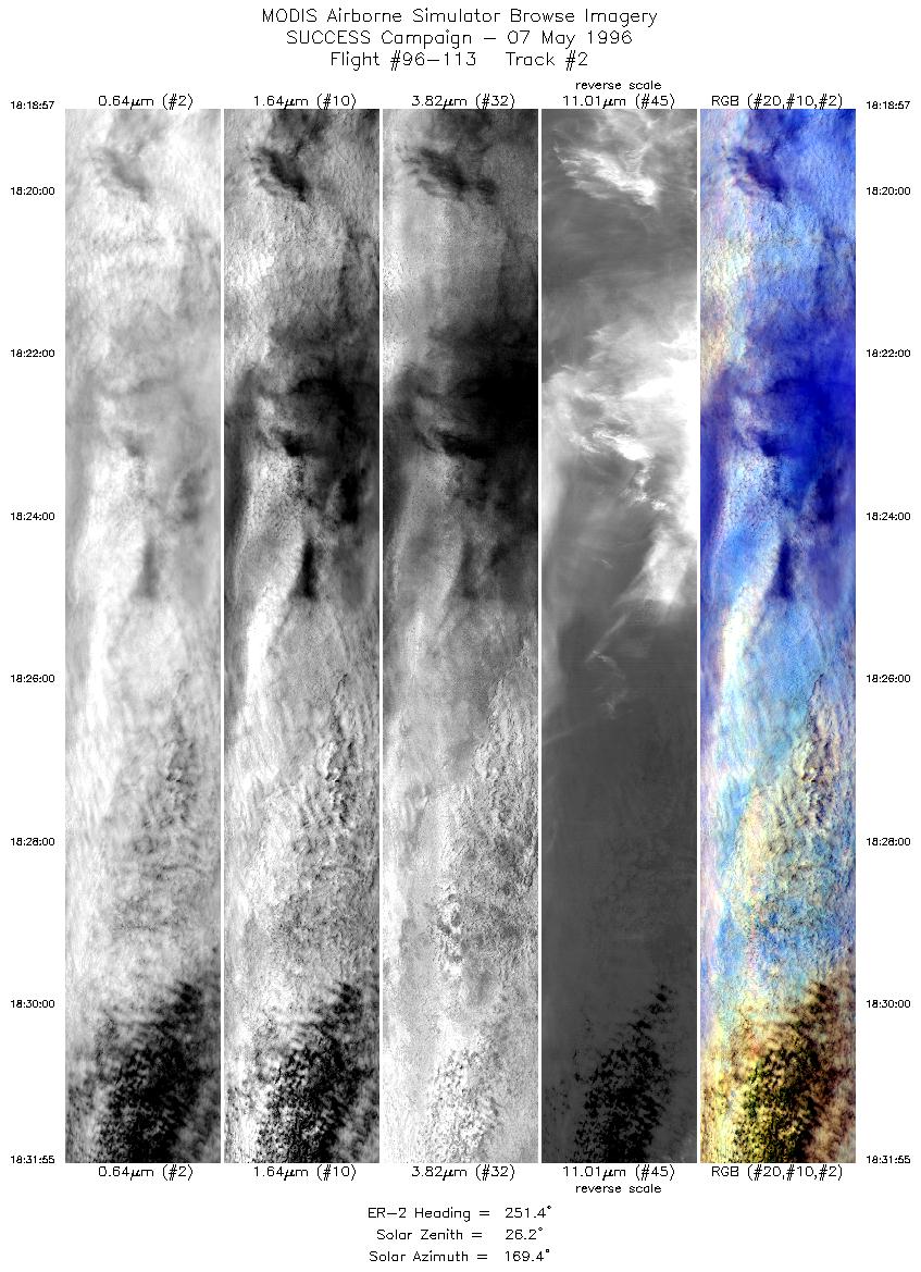
Flight Track Map

|
Level-1B Browse Imagery
Straight Line Flight Tracks: 23
Scanlines Processed: 77212
Solar Azimuth and Zenith Angles
|
Browse Images
|
Click on the Flight Track number to load images.
Lat/Lon ranges are for the BEG-END scanline nadir pixels.
|
Flight
Track |
Standard
Image |
Cirrus
Image |
Time_Span
(GMT) |
Heading
(Deg) |
Lat_Range
(Deg_N) |
Lon_Range
(Deg_W) |
Length
(Scanlines) |
| 1 |
STD |
CIR |
18:13-18:18 |
305 |
42.49-42.82 |
99.79-100.37 |
1830 |
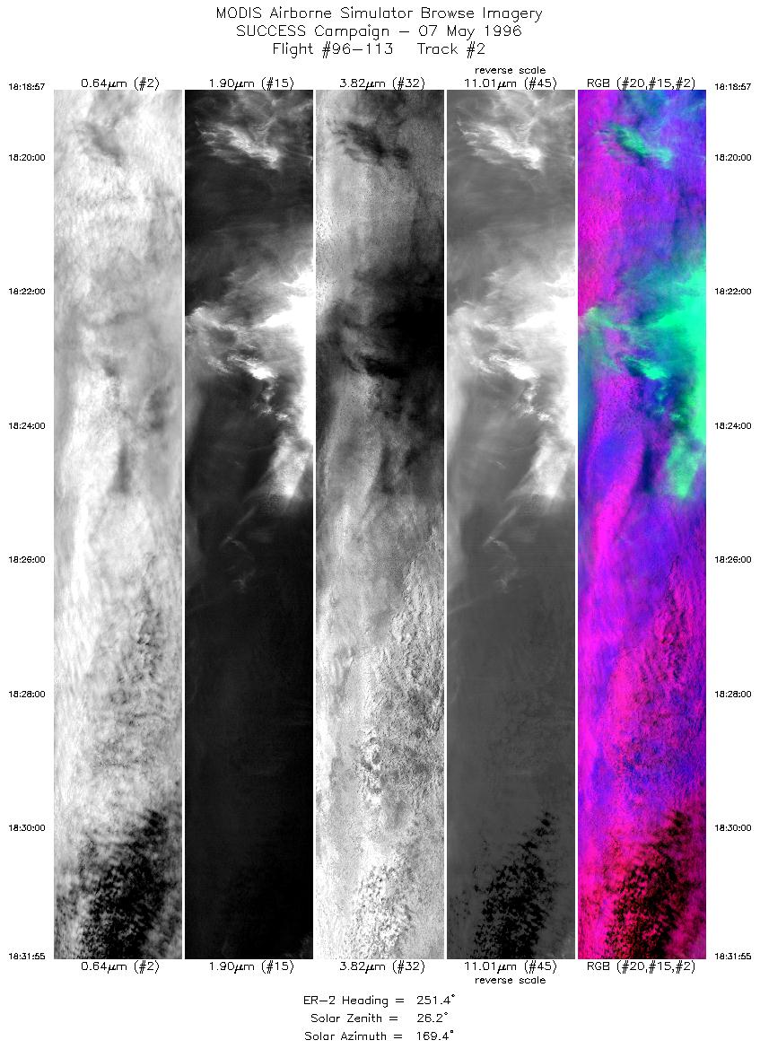
| 2 |
STD |
CIR |
18:18-18:31 |
251 |
42.83-42.35 |
100.50-102.28 |
4846 |
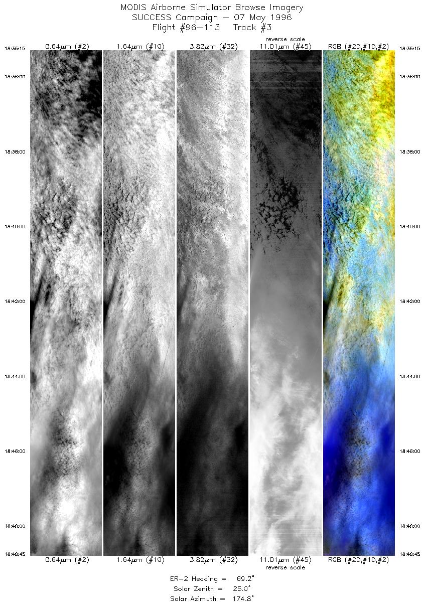
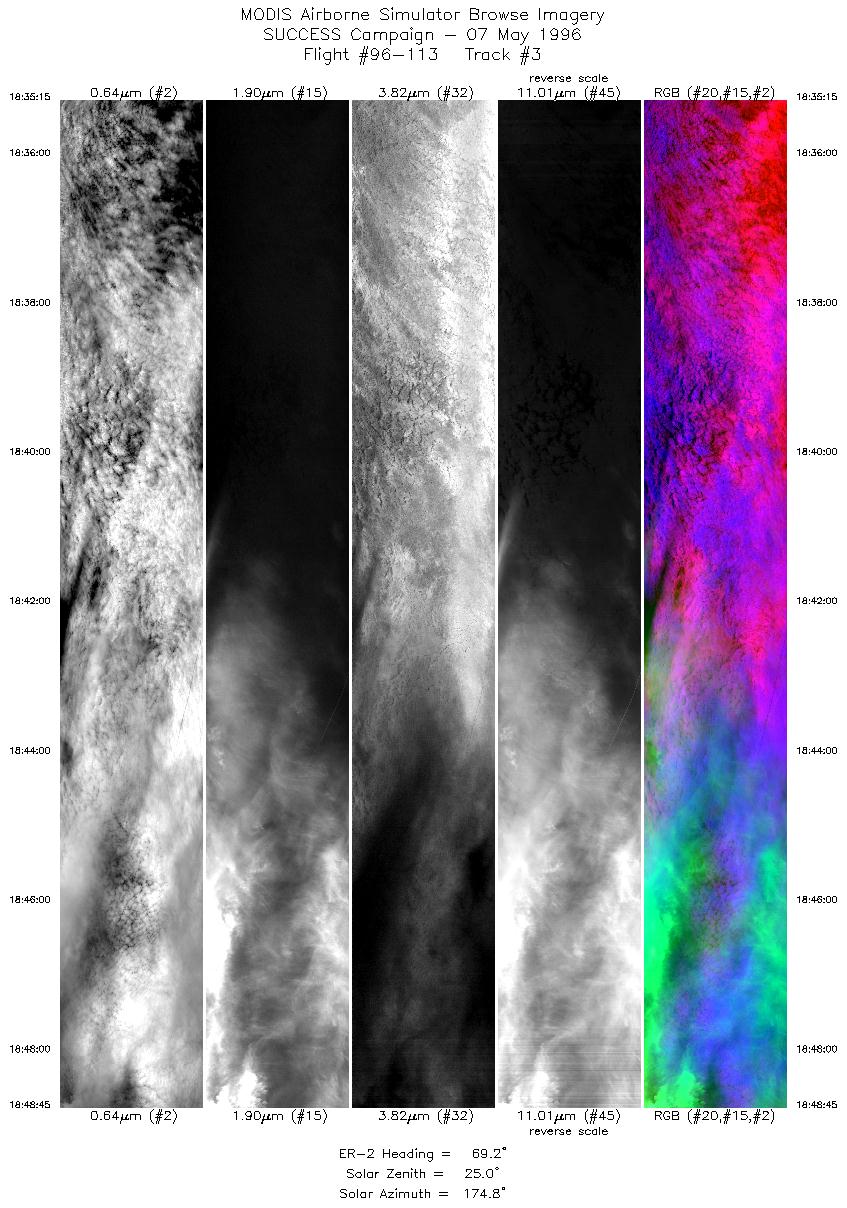
| 3 |
STD |
CIR |
18:35-18:48 |
69 |
42.16-42.72 |
102.11-100.11 |
5044 |
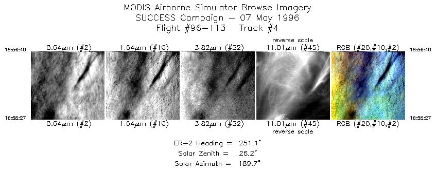
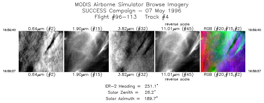
| 4 |
STD |
CIR |
18:56-18:58 |
251 |
42.81-42.74 |
100.58-100.83 |
667 |
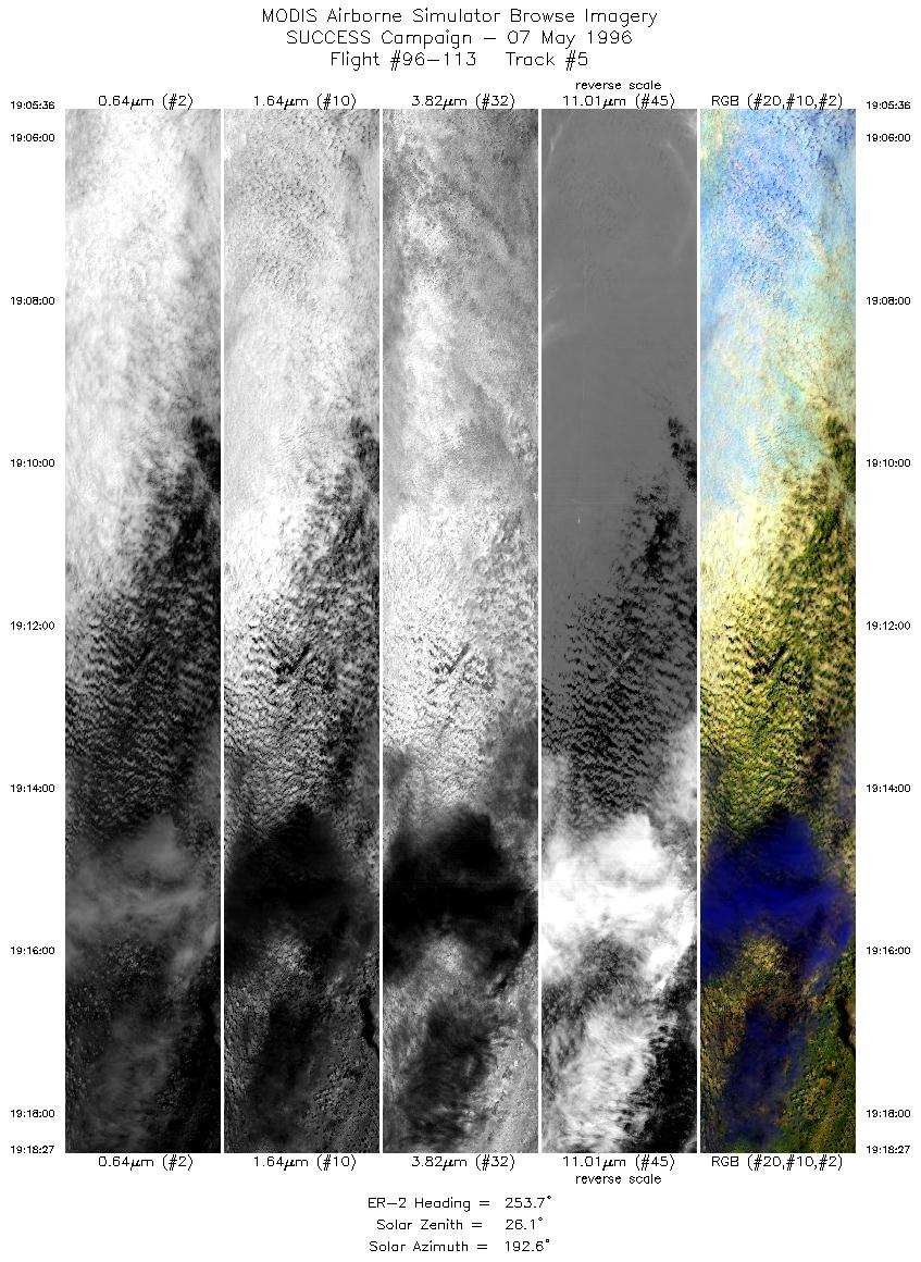
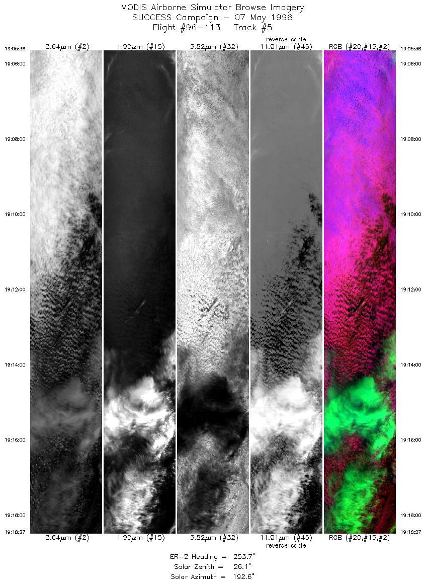
| 5 |
STD |
CIR |
19:05-19:18 |
254 |
42.55-42.06 |
101.53-103.25 |
4801 |
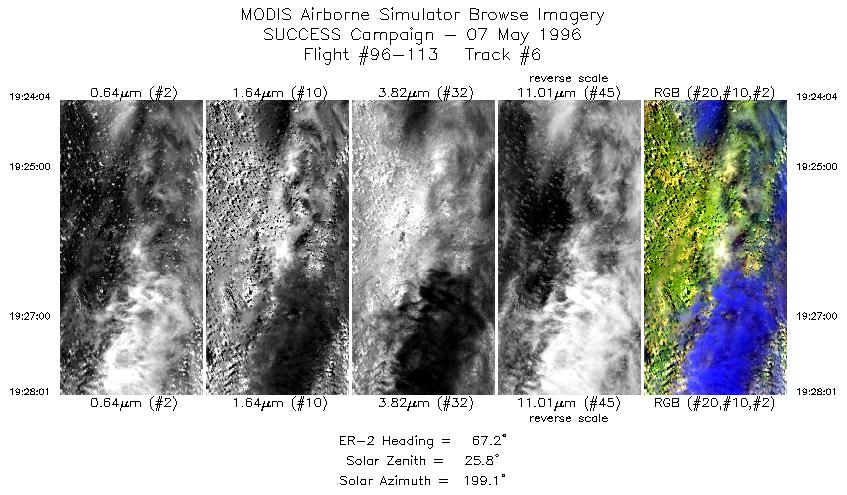
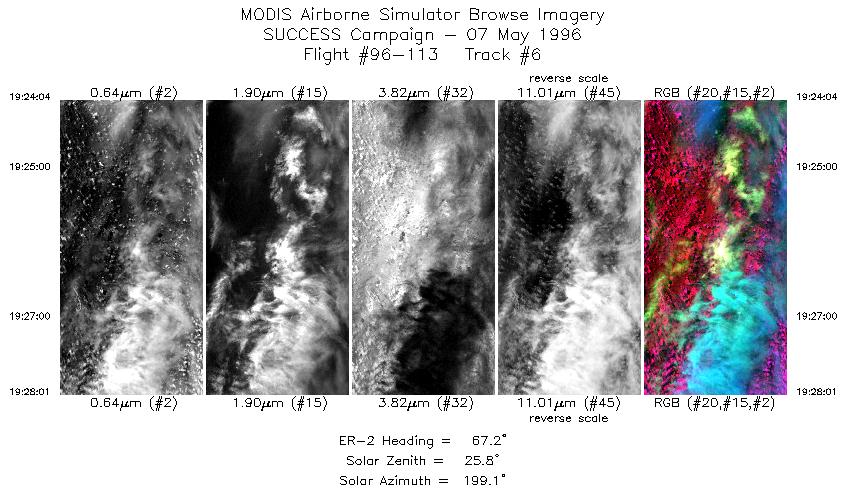
| 6 |
STD |
CIR |
19:24-19:28 |
67 |
42.00-42.17 |
103.44-102.86 |
1476 |
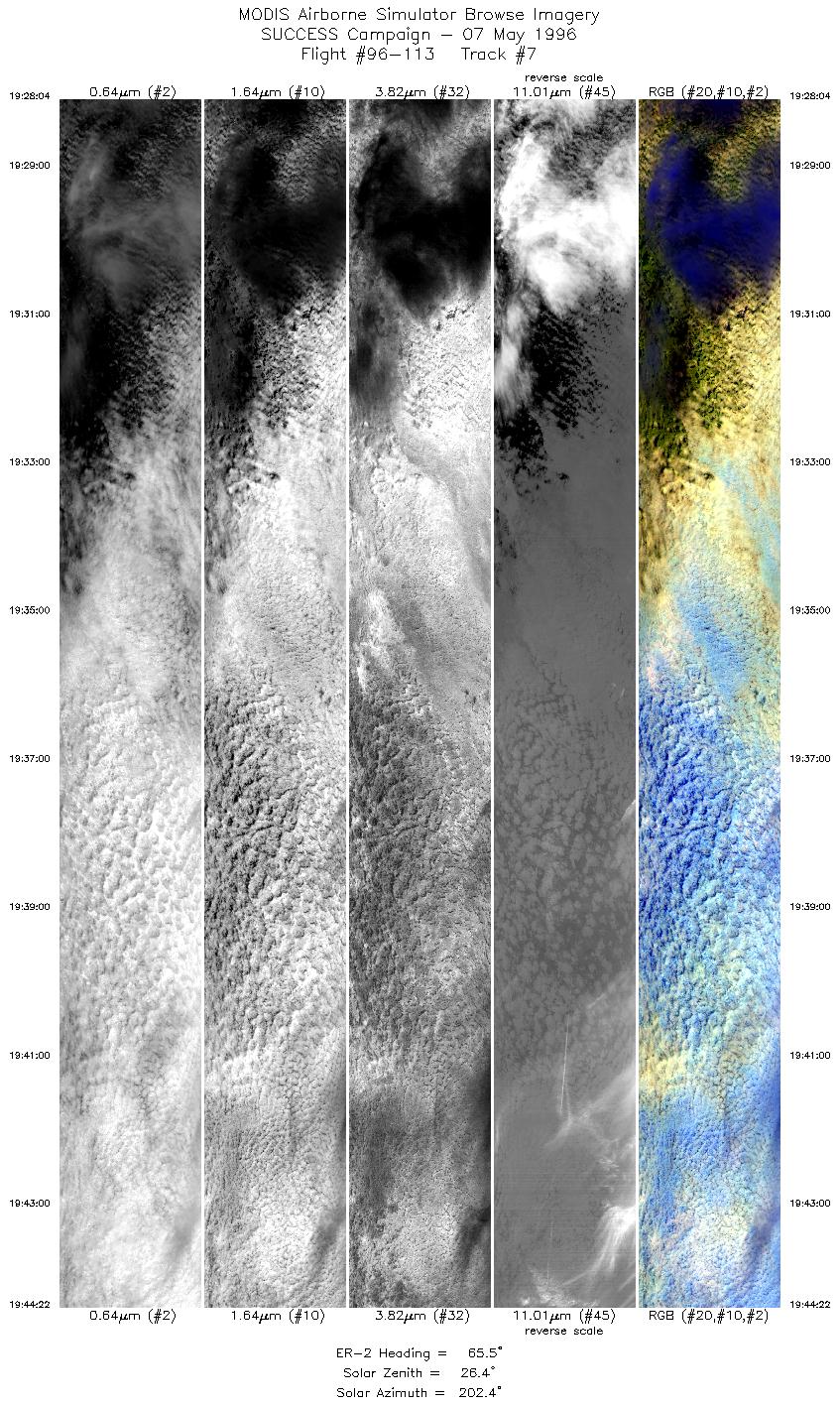
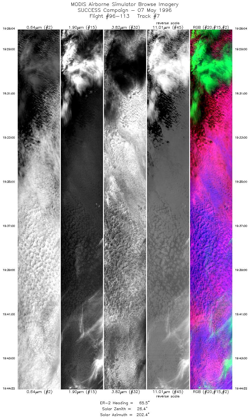
| 7 |
STD |
CIR |
19:28-19:44 |
66 |
42.18-42.86 |
102.85-100.43 |
6090 |
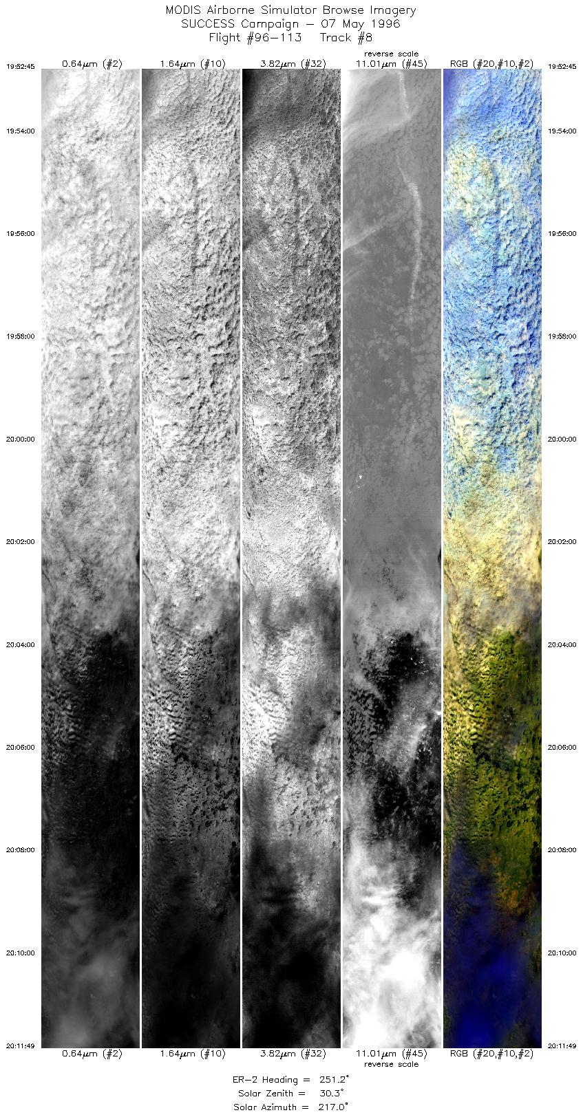
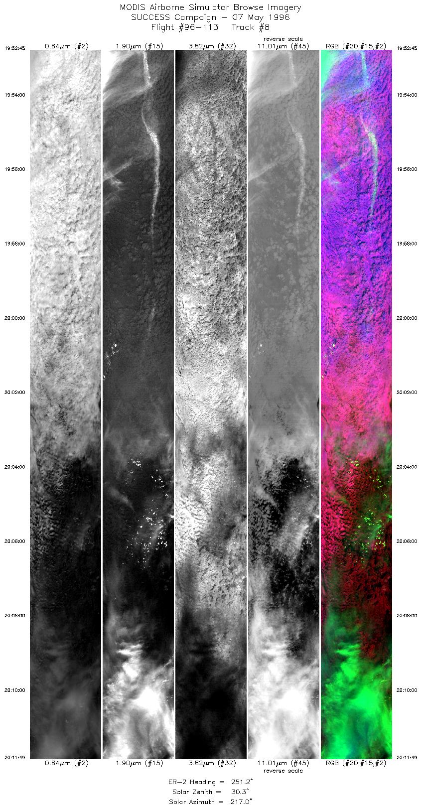
| 8 |
STD |
CIR |
19:52-20:11 |
251 |
42.79-42.07 |
100.58-103.25 |
7123 |
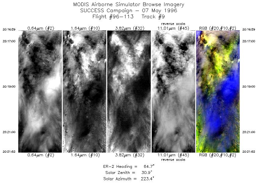
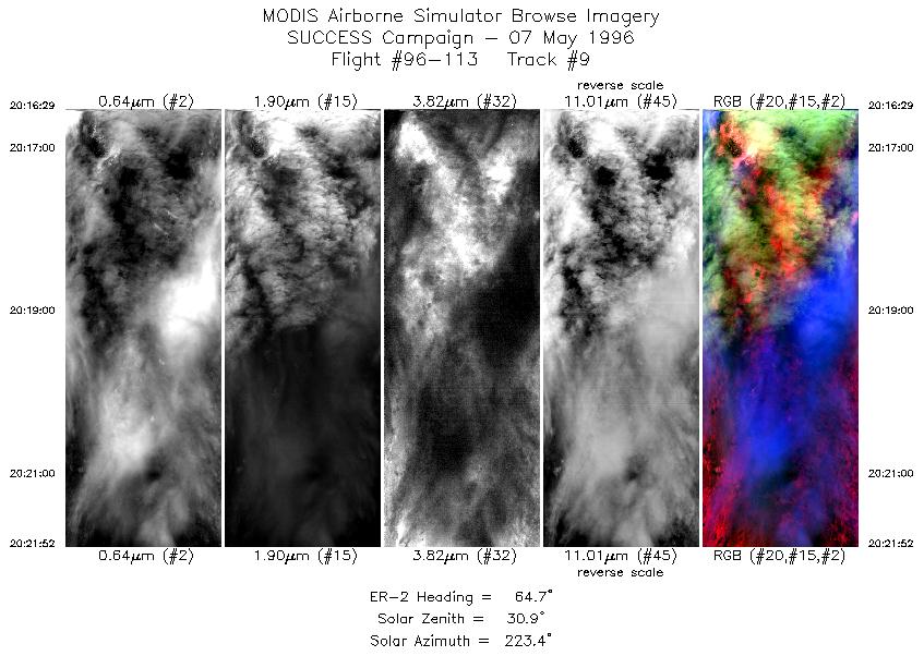
| 9 |
STD |
CIR |
20:16-20:21 |
65 |
41.99-42.22 |
103.47-102.70 |
2012 |
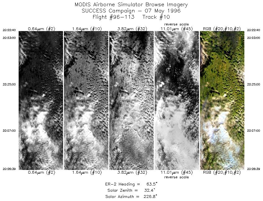
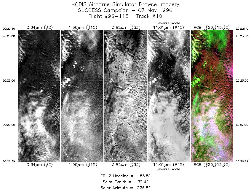
| 10 |
STD |
CIR |
20:22-20:28 |
63 |
42.25-42.56 |
102.59-101.75 |
2236 |
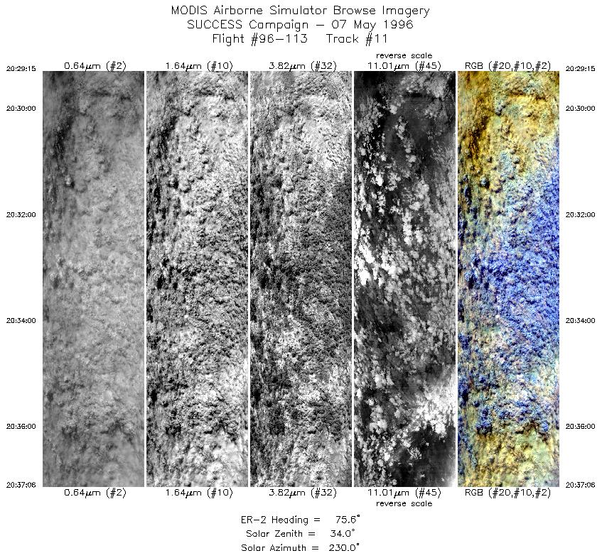
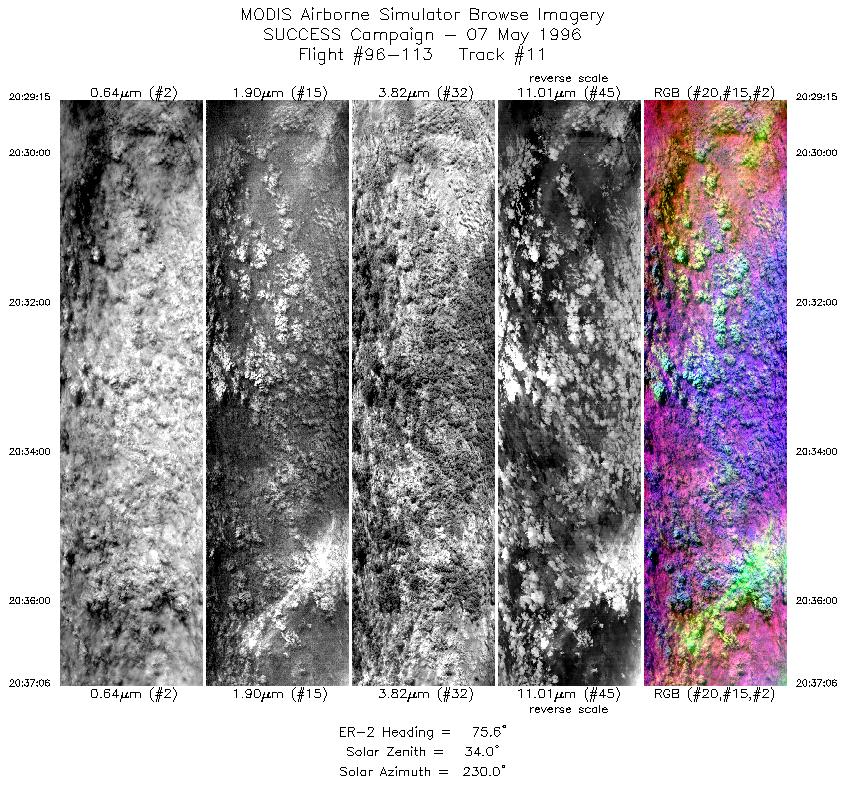
| 11 |
STD |
CIR |
20:29-20:37 |
76 |
42.59-42.83 |
101.67-100.49 |
2933 |
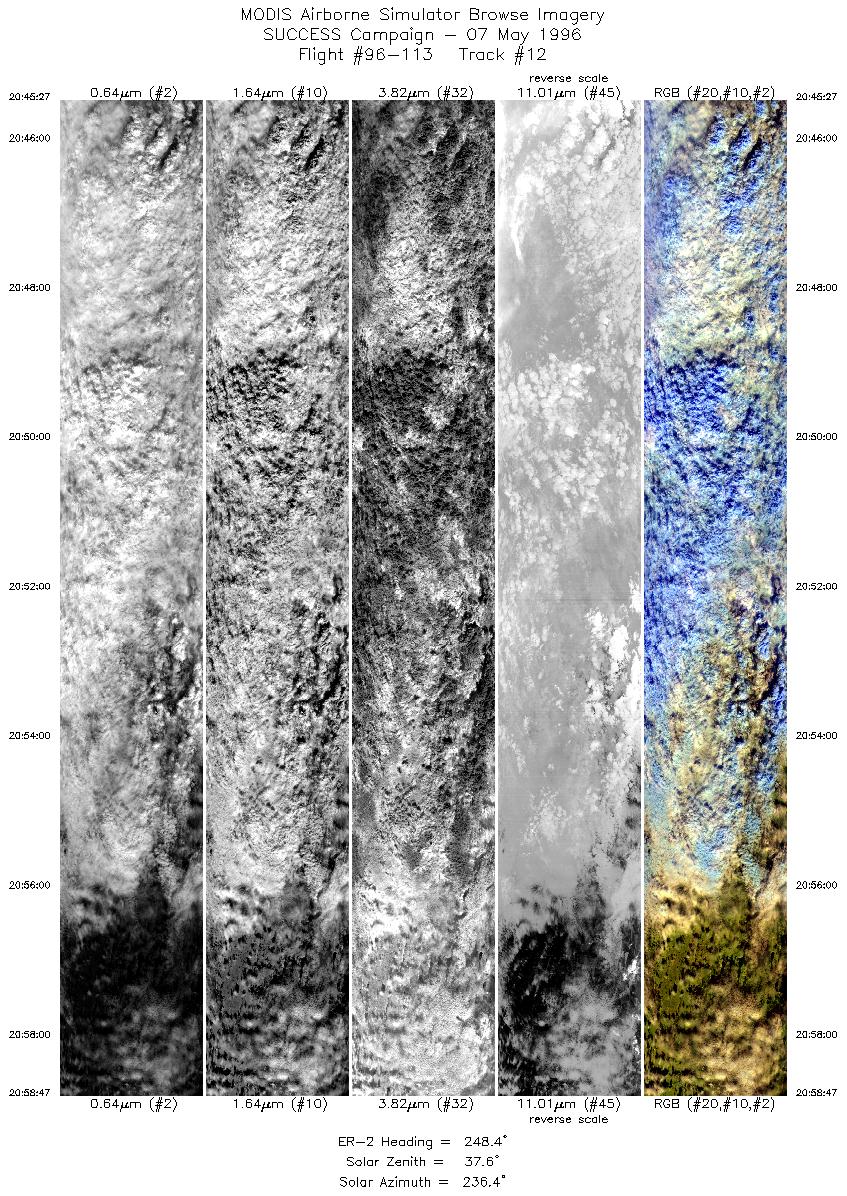
| 12 |
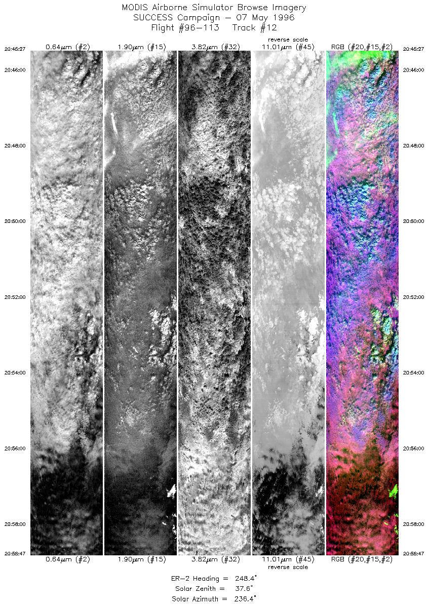
STD |
CIR |
20:45-20:58 |
248 |
42.94-42.46 |
100.09-101.99 |
4982 |
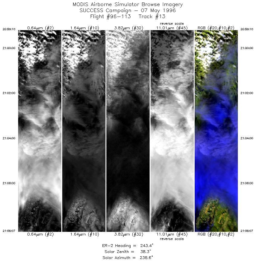
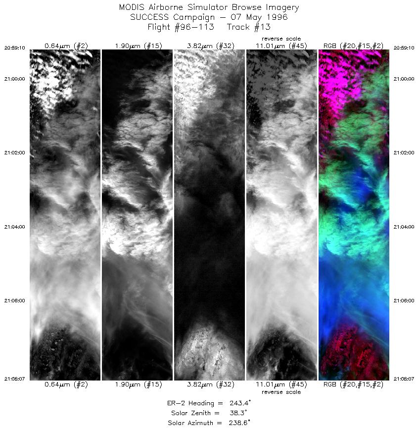
| 13 |
STD |
CIR |
20:59-21:08 |
243 |
42.44-42.03 |
102.04-103.23 |
3345 |
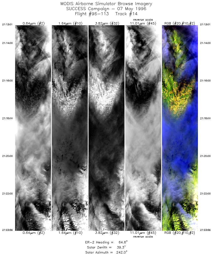
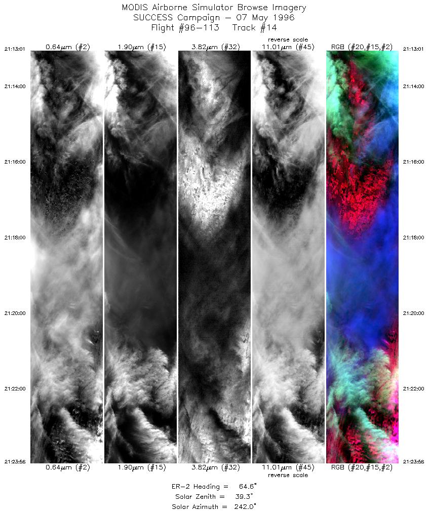
| 14 |
STD |
CIR |
21:13-21:23 |
65 |
41.99-42.44 |
103.49-101.93 |
4078 |
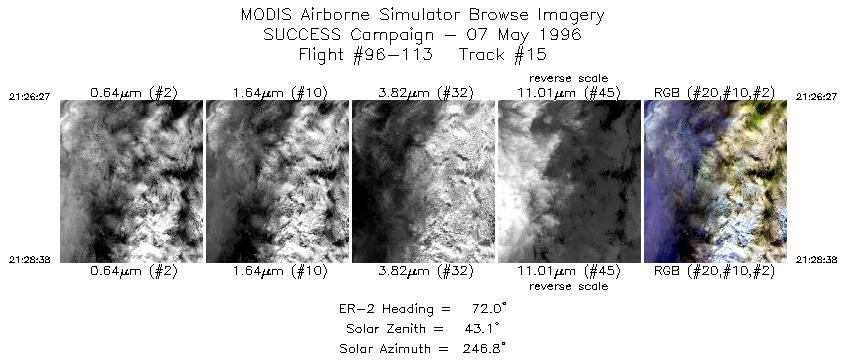
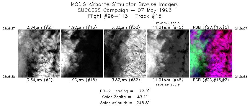
| 15 |
STD |
CIR |
21:26-21:28 |
72 |
42.56-42.65 |
101.58-101.26 |
816 |
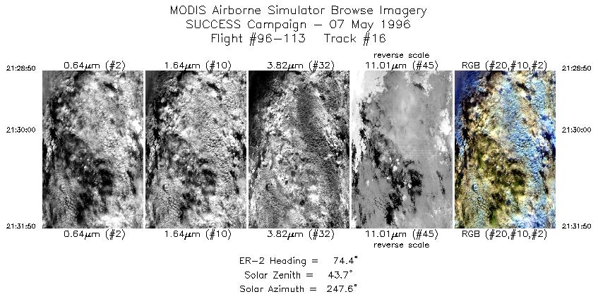
| 16 |
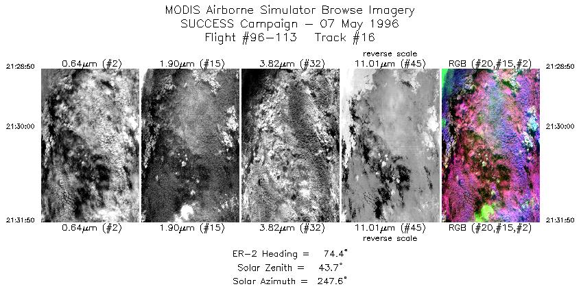
STD |
CIR |
21:28-21:31 |
74 |
42.66-42.76 |
101.23-100.79 |
1122 |
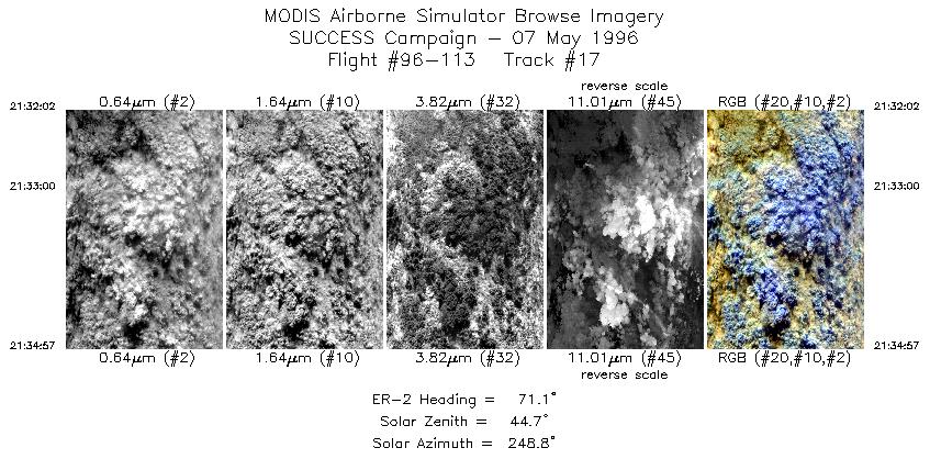
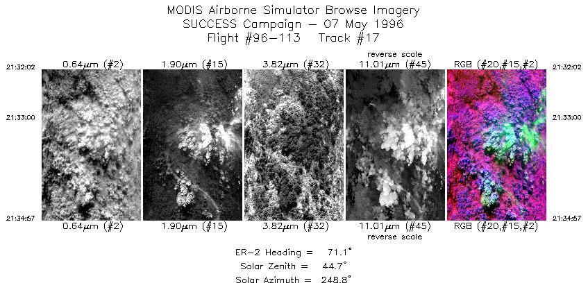
| 17 |
STD |
CIR |
21:32-21:34 |
71 |
42.76-42.88 |
100.75-100.33 |
1091 |
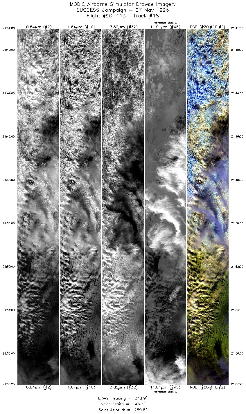
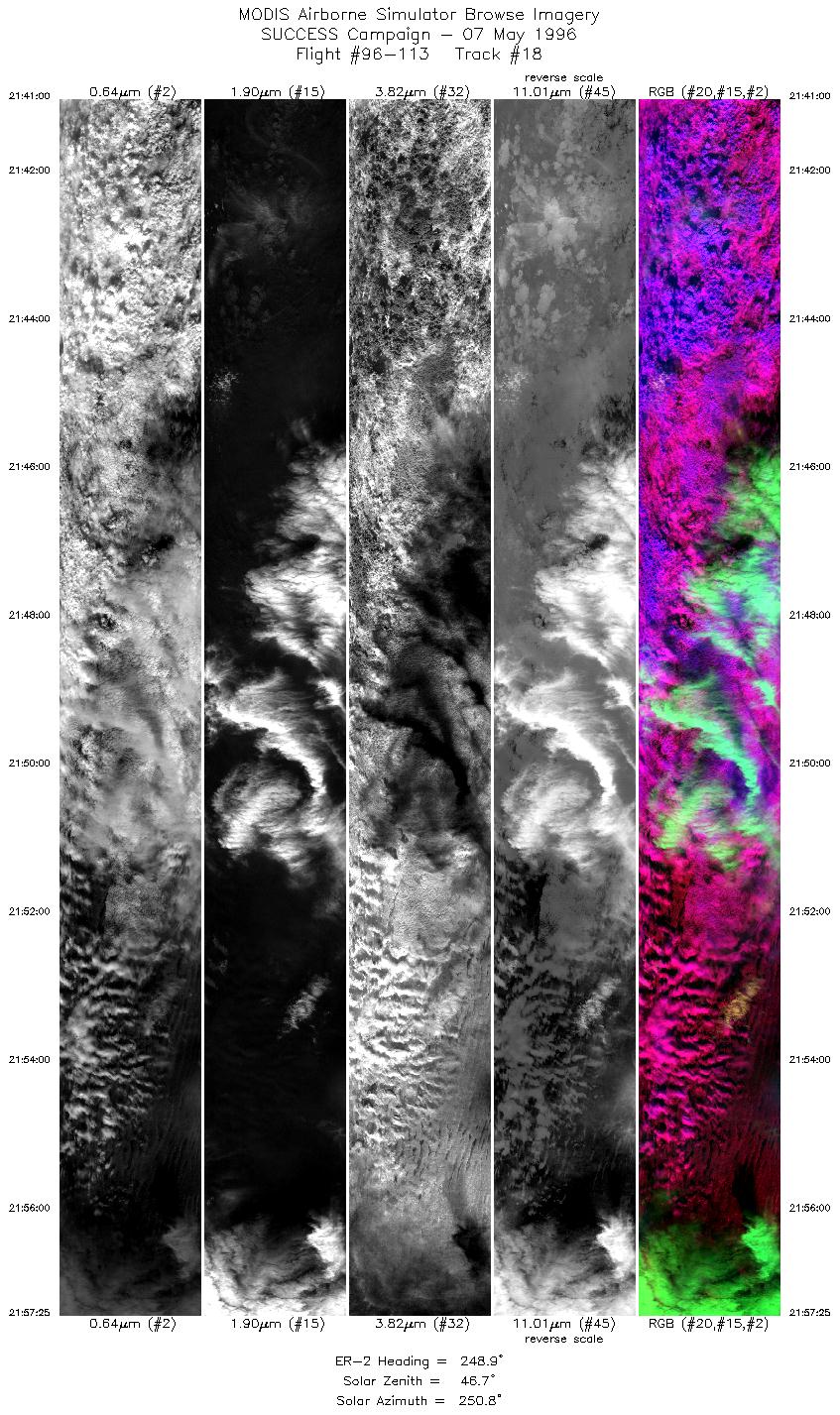
| 18 |
STD |
CIR |
21:41-21:57 |
249 |
42.94-42.31 |
100.13-102.42 |
6135 |
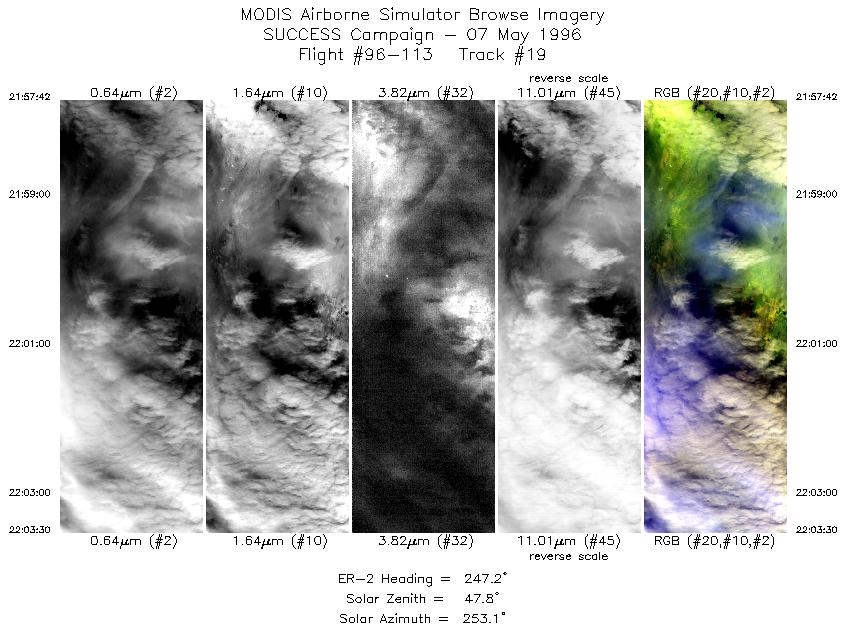
| 19 |
STD |
CIR |
21:57-22:03 |
247 |
42.29-42.06 |
102.45-103.23 |
2167 |
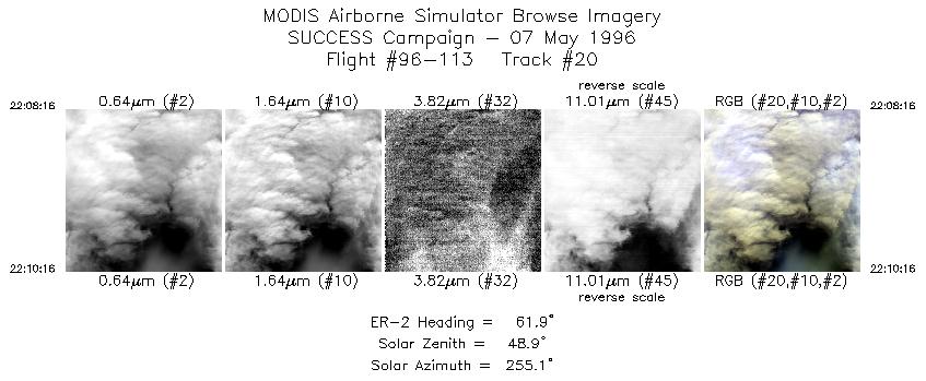
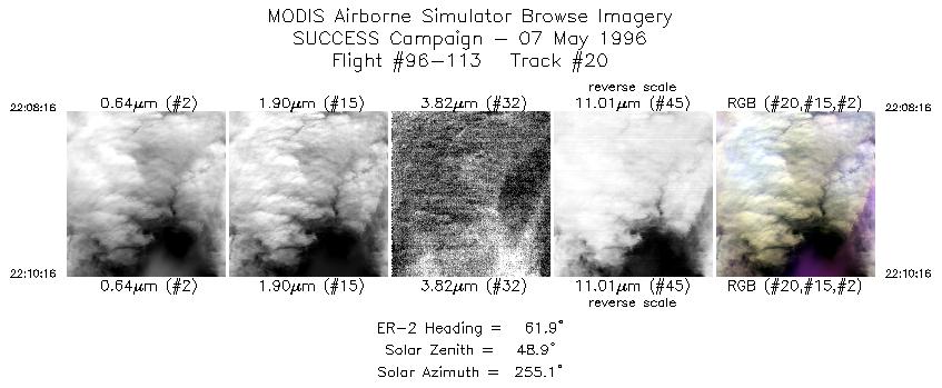
| 20 |
STD |
CIR |
22:08-22:10 |
62 |
41.98-42.07 |
103.48-103.20 |
748 |
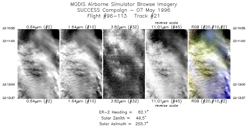
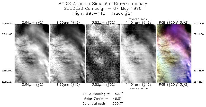
| 21 |
STD |
CIR |
22:10-22:13 |
62 |
42.08-42.24 |
103.18-102.75 |
1197 |
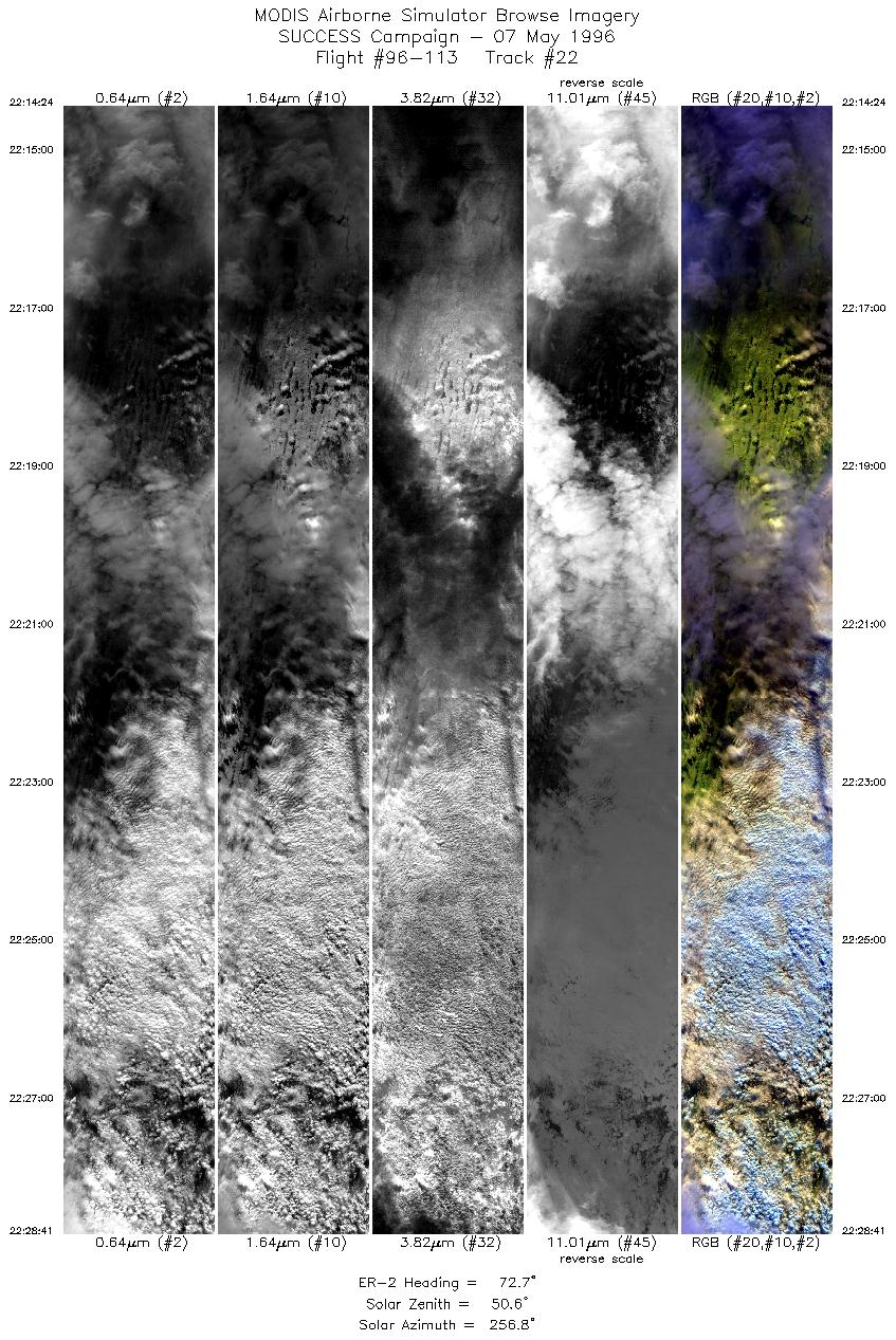
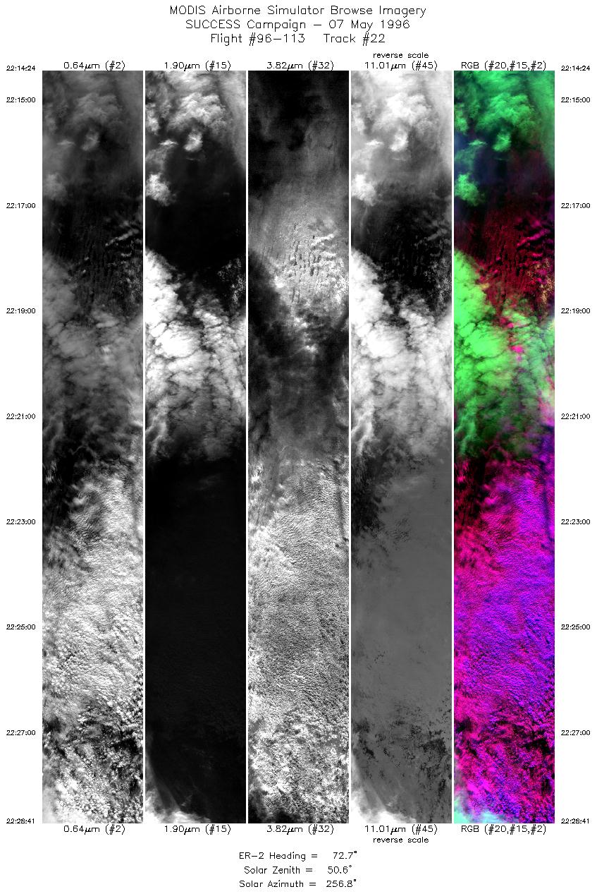
| 22 |
STD |
CIR |
22:14-22:28 |
73 |
42.27-42.83 |
102.64-100.52 |
5337 |
| 23 |
STD |
CIR |
22:29-22:48 |
155 |
42.80-40.90 |
100.37- 98.97 |
7136 |
|
Standard Browse Images 01 through 23 in sequence |
|
Cirrus Detection Browse Images 01 through 23 in sequence |
Level-1B HDF Data Distribution Point
NASA GSFC Earth Sciences (GES) Data Center
NASA DAAC's
Additional Information
The objective of this mission was to study
persistent contrails with coordinated
flights between ER-2, DC-8, TC-39, and B757 over the Nebraska panhandle.
The NOAA-14 satellite overpass took place east of flight region at 1940 UTC,
and assisted in the development of algorithms for satellite remote sensing
of contrails.
The ER-2 launched at 1730 UTC and landed at 2330 UTC. ER-2 flew
back and forth along 130 nm track oriented 250/70 true.
Persistent contrails, midlevel
cloud and some cirrus present. ER-2 had visual of B-757 and DC-8
on several legs and observed contrails on several legs including
meandering back and forth over young B-757 contrail from 2050
to 2057 UTC. During coordination, DC-8 doing radiation measurements,
T-39 sampling B-757 contrail. ER-2 also observed aged contrails,
reported as long as 100 nm in length. T-39 broke off after one
complete DC-8 racetrack. Last flight leg of ER-2 run at slightly
off 70 degrees was to make crossing of contrail for CALS instrument.
Total of 8 tracks flown by ER-2.
ER-2 met B-757 and DC-8 flying in opposite direction at 19:39:19
UTC for 1940 UTC NOAA-14 overpass.
ER-2 flying between the B-757 and DC-8 from 2050 to 2057 UTC observing
young B-757 contrail. Contrail visible in MAS data. ER-2 observed
contrails ranging in length from 10 to 100 nm and in age from
less than a minute to over 10 minutes old. ER-2 above B-757 and
DC-8 at 19:39:19 UTC for NOAA-14 overpass at 1940 UTC
The pilot reported a lack of cirrus;
and a clear visual of B-757 and DC-8. ER-2 and B-757/DC-8
were coordinated in stacked flight on first 250 true leg but ER-2
pilot was unable to find B-757 or DC-8 visually. ER-2 started
initial coordination of first leg about 1.5 minutes behind B-757
and DC-8 and finished the leg ahead of the B-757 and DC-8. ER-2
passed between the B-757 and DC-8 at about 20:25:50 and 21:30 going
in opposite direction.
|
|
|
|