
|
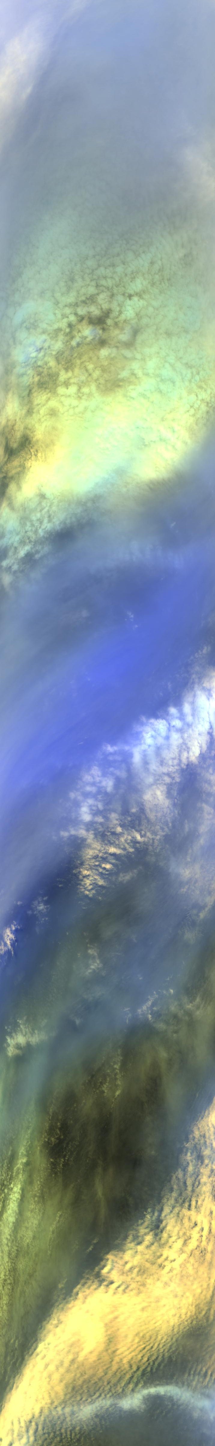
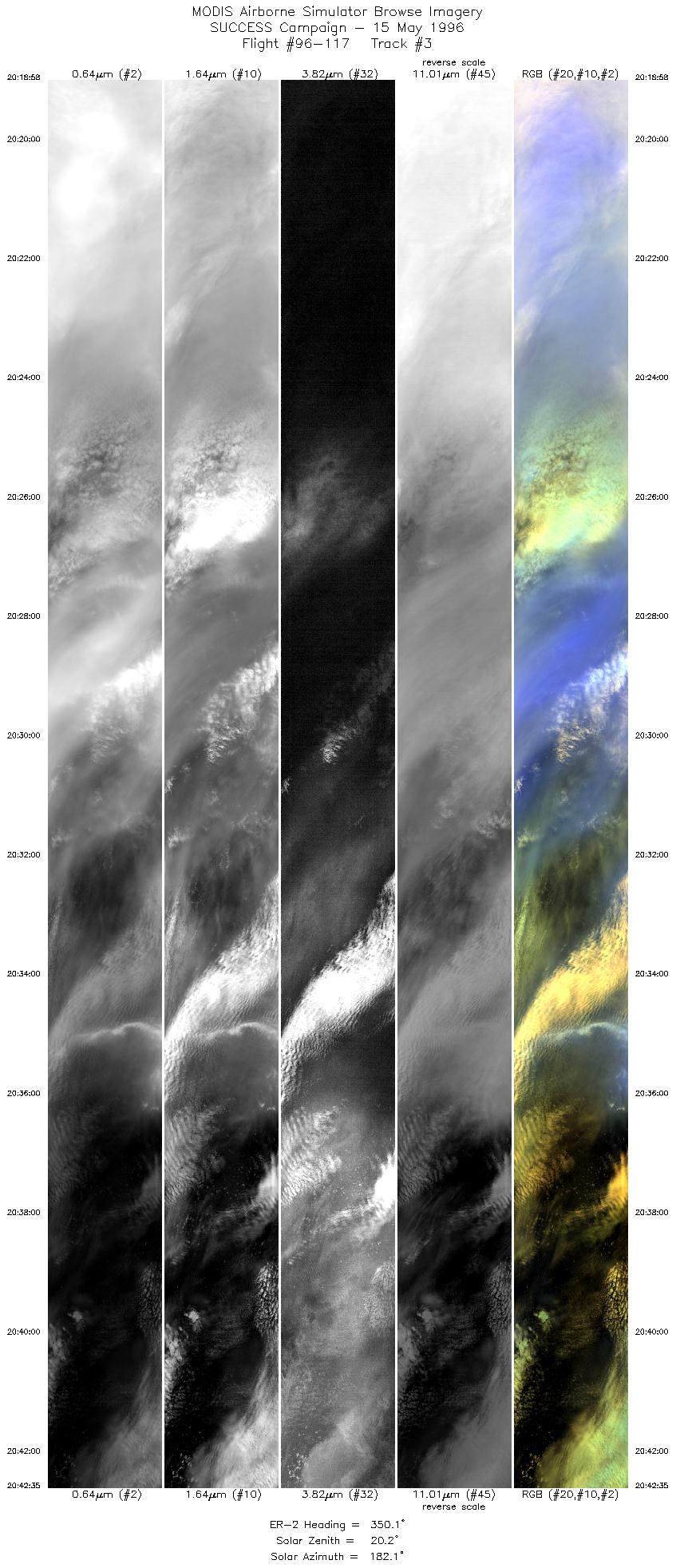
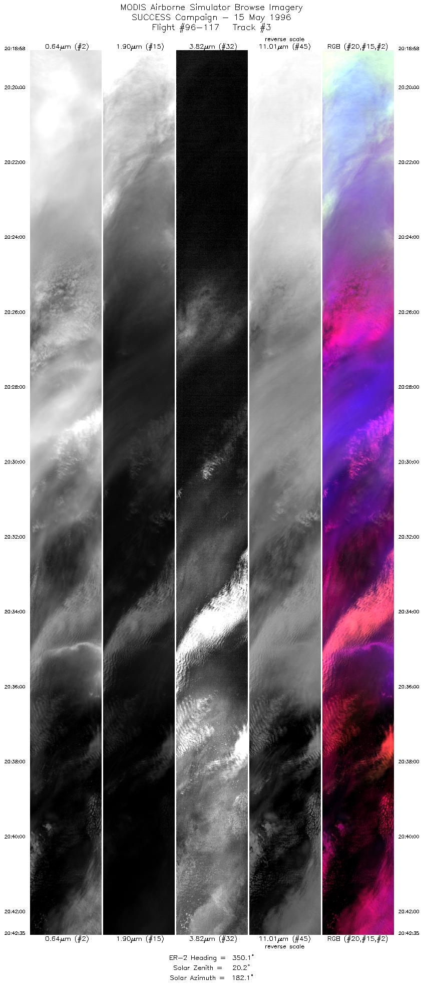
Sample Image

15 May 1996
Track #03
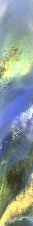

"Multi layers of Pacific cirrus and altocumulus clouds
off the northern California coast"
R: 2.15 microns
G: 1.65 microns
B: 0.64 microns
|
|
Summary Information
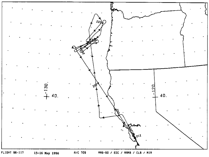
Date: May 15-16, 1996
ER-2 Flight Number: 96-117
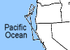
Location: Oregon Coast and Pacific Ocean
Principle Investigator: Dr. Brian Toon (NASA Ames)
Additional Sensors: MIR, CLS, RAMS, EOC
Level-1B Processing Information
Level-1B Data Version: #10
Calibration Type: Final
Calibration Version: SUCCESS_Ames 1.0
Temperature Adjustment: No
Status: Final Calibration Done
|
|
Flight Track Map

|
Level-1B Browse Imagery
Straight Line Flight Tracks: 25
Scanlines Processed: 73632
Solar Azimuth and Zenith Angles
|
Browse Images
|
Click on the Flight Track number to load images.
Lat/Lon ranges are for the BEG-END scanline nadir pixels.
|
Flight
Track |
Standard
Image |
Cirrus
Image |
Time_Span
(GMT) |
Heading
(Deg) |
Lat_Range
(Deg_N) |
Lon_Range
(Deg_W) |
Length
(Scanlines) |
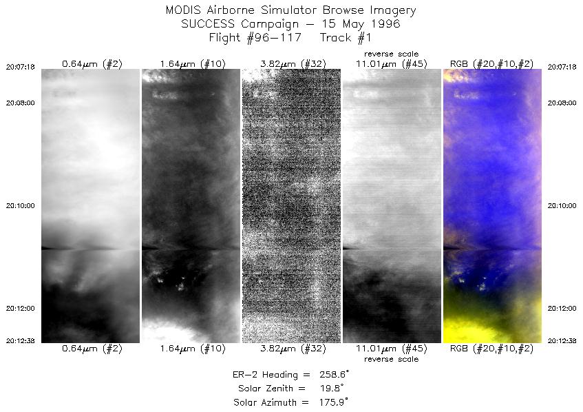
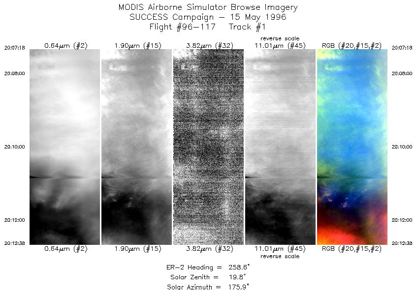
| 1 |
STD |
CIR |
20:07-20:12 |
259 |
38.71-38.62 |
124.23-124.97 |
1991 |
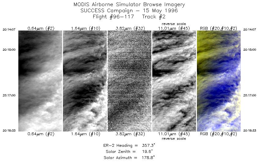
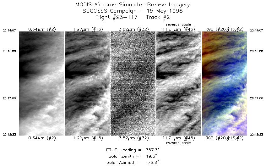
| 2 |
STD |
CIR |
20:14-20:18 |
357 |
38.71-39.22 |
125.12-125.14 |
1657 |
| 3 |
STD |
CIR |
20:18-20:42 |
350 |
39.27-41.98 |
125.15-125.66 |
8823 |
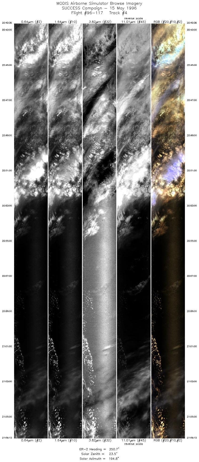
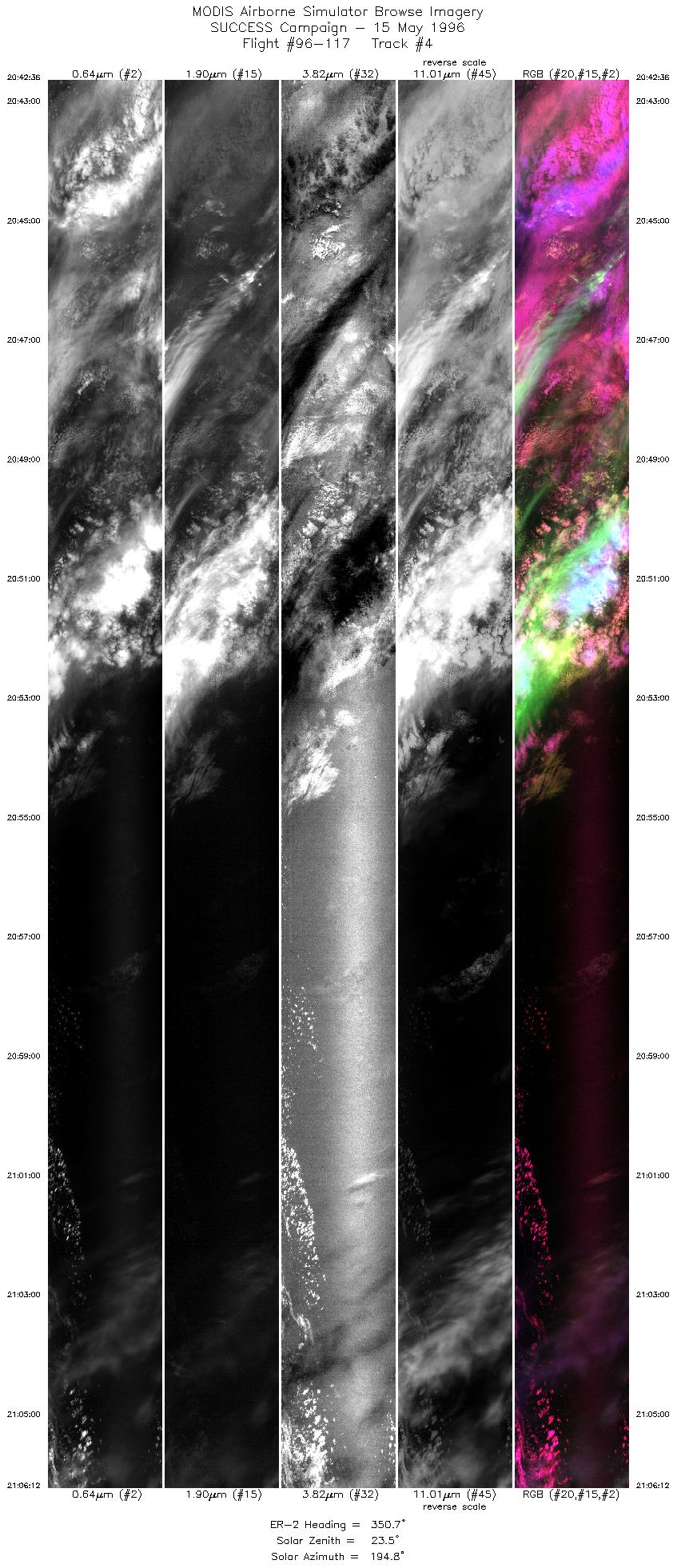
| 4 |
STD |
CIR |
20:42-21:06 |
351 |
41.99-44.76 |
125.66-126.22 |
8816 |
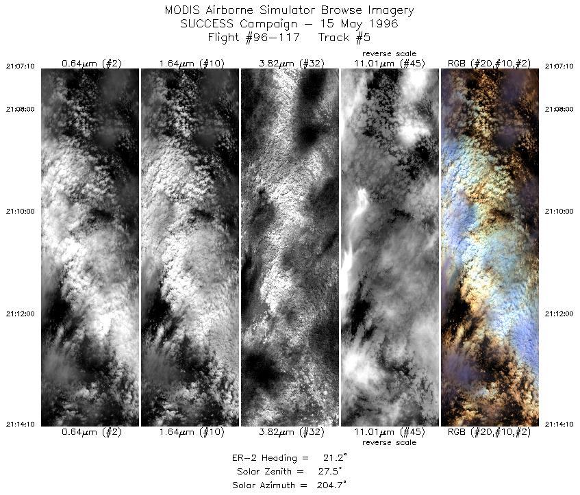
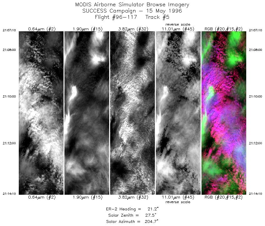
| 5 |
STD |
CIR |
21:07-21:14 |
21 |
44.88-45.66 |
126.20-125.79 |
2616 |
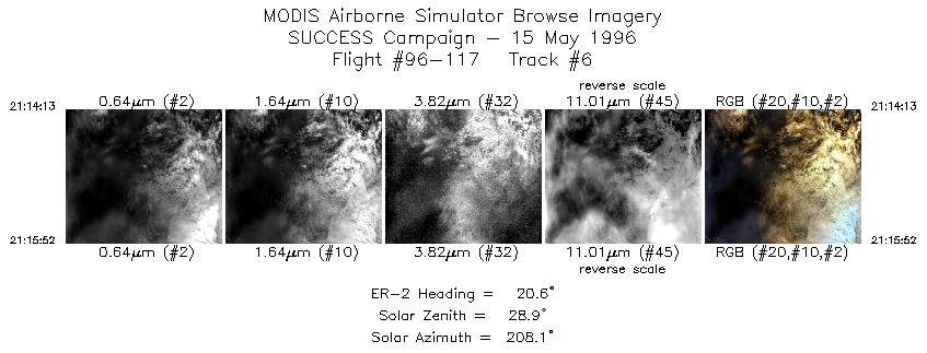
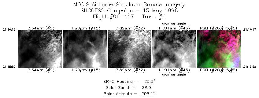
| 6 |
STD |
CIR |
21:14-21:15 |
21 |
45.67-45.85 |
125.79-125.69 |
617 |
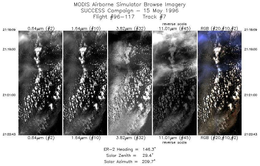
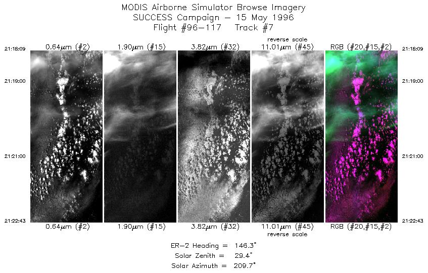
| 7 |
STD |
CIR |
21:18-21:22 |
146 |
45.87-45.46 |
125.40-124.98 |
1707 |
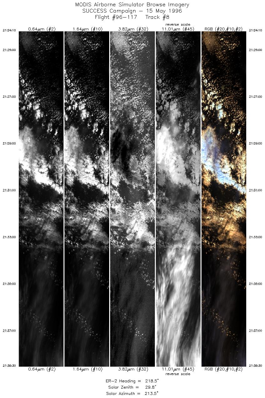
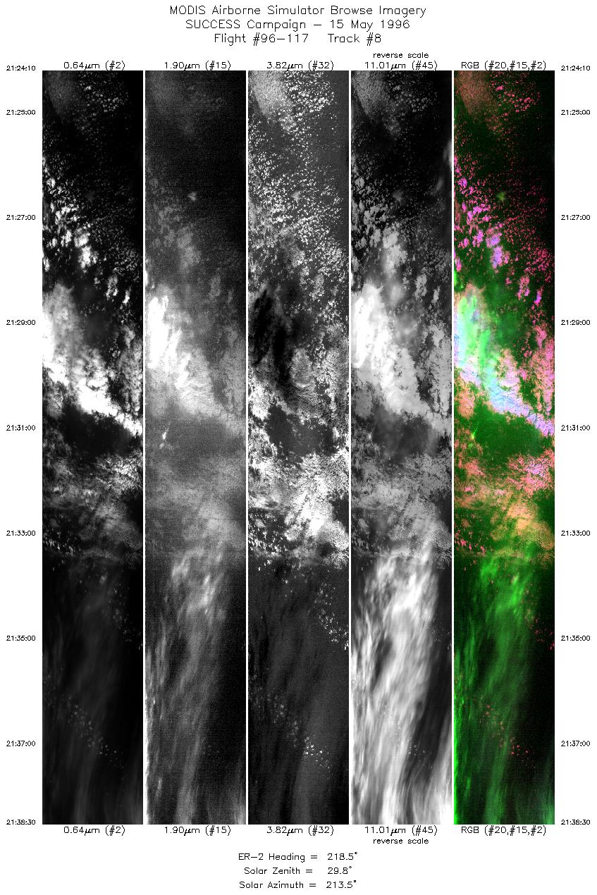
| 8 |
STD |
CIR |
21:24-21:38 |
219 |
45.31-44.11 |
125.00-126.43 |
5353 |
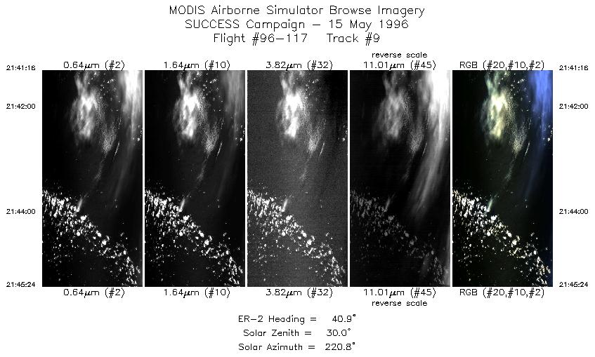
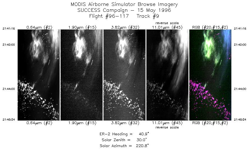
| 9 |
STD |
CIR |
21:41-21:45 |
41 |
43.99-44.38 |
126.22-125.80 |
1545 |
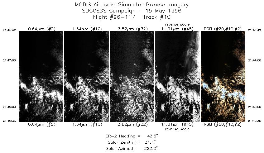
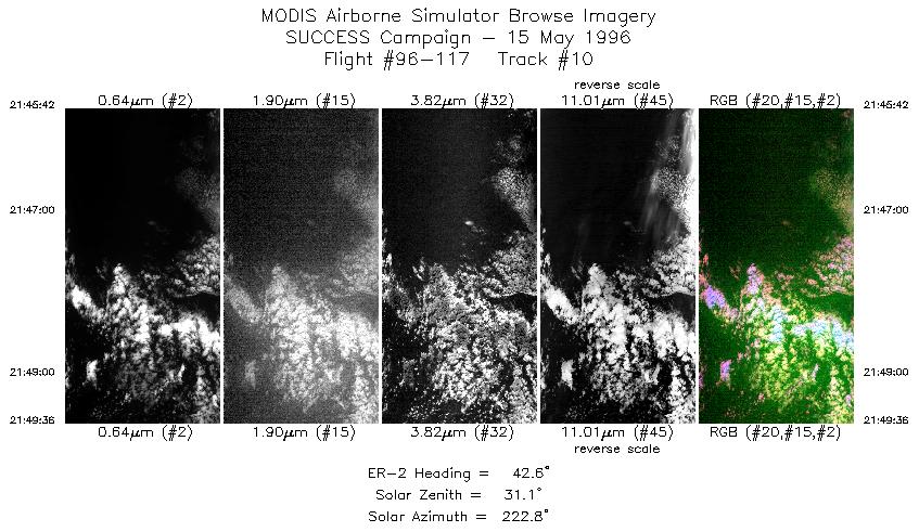
| 10 |
STD |
CIR |
21:45-21:49 |
43 |
44.41-44.72 |
125.78-125.31 |
1457 |
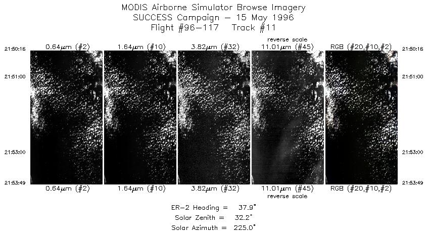
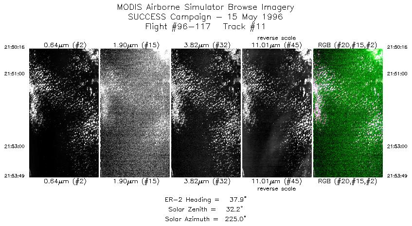
| 11 |
STD |
CIR |
21:50-21:53 |
38 |
44.77-45.12 |
125.22-124.87 |
1326 |
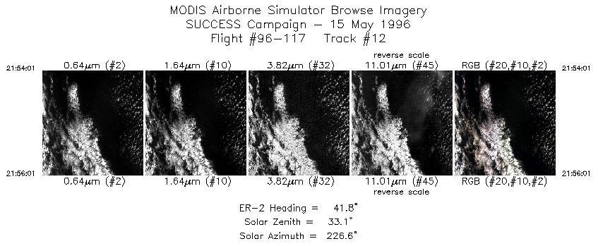
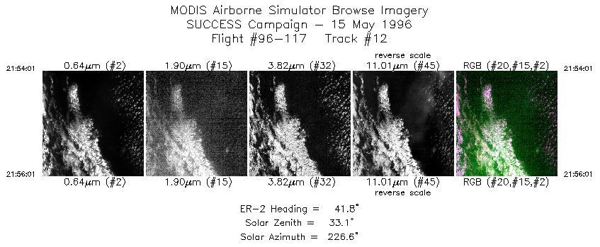
| 12 |
STD |
CIR |
21:54-21:56 |
42 |
45.14-45.30 |
124.85-124.61 |
748 |
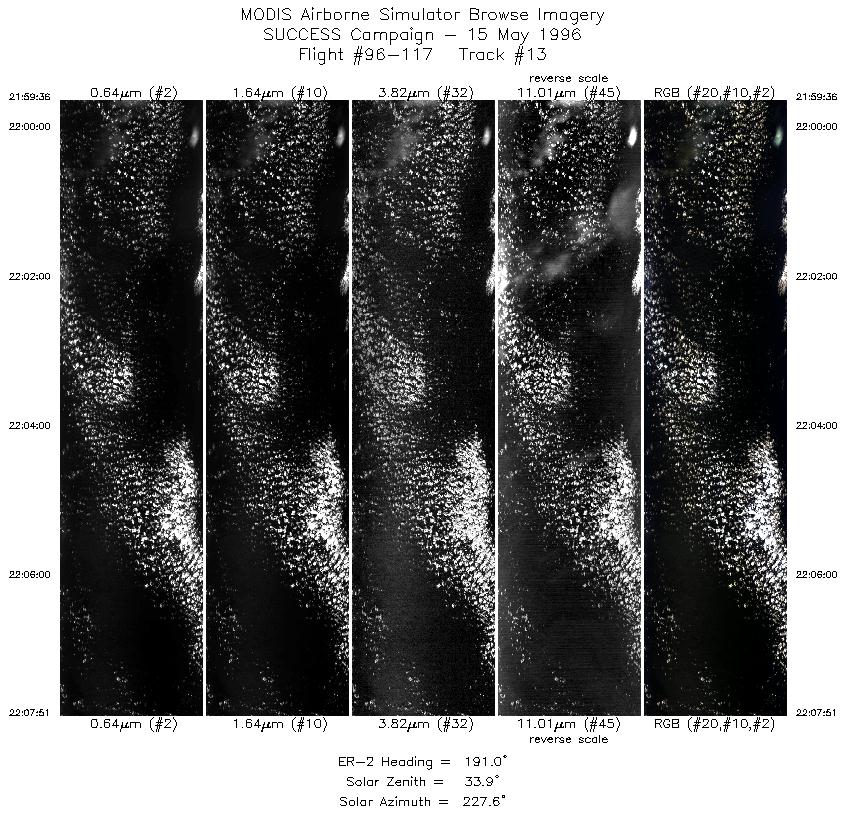
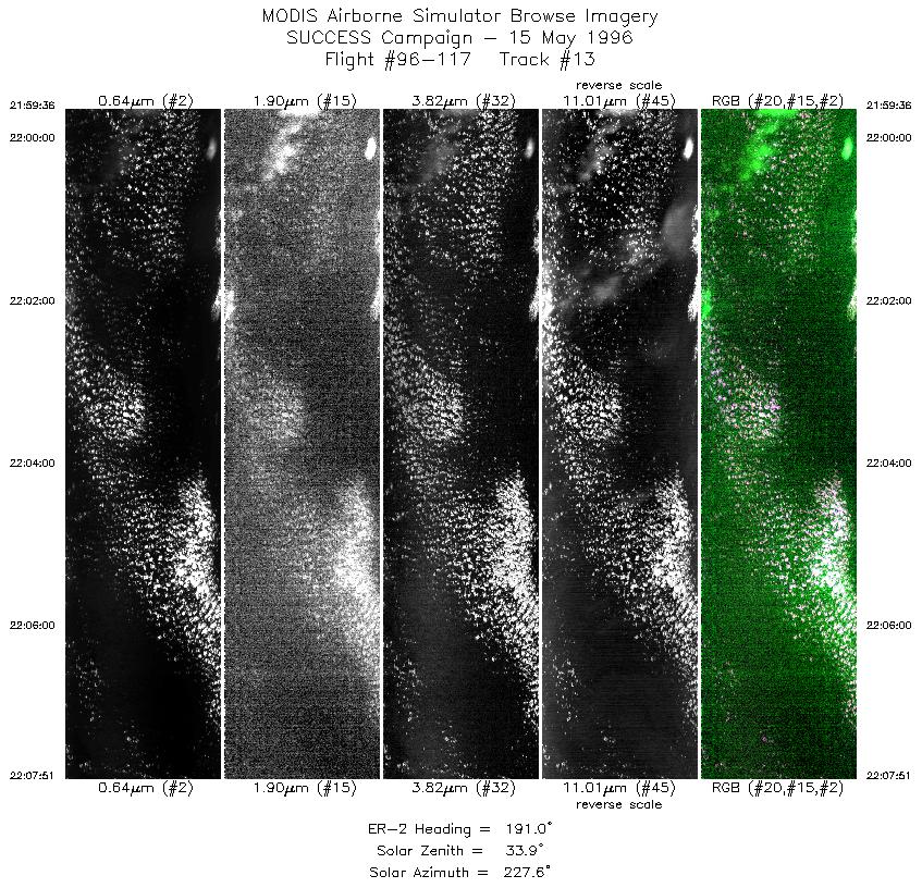
| 13 |
STD |
CIR |
21:59-22:07 |
191 |
45.42-44.54 |
124.83-125.08 |
3080 |
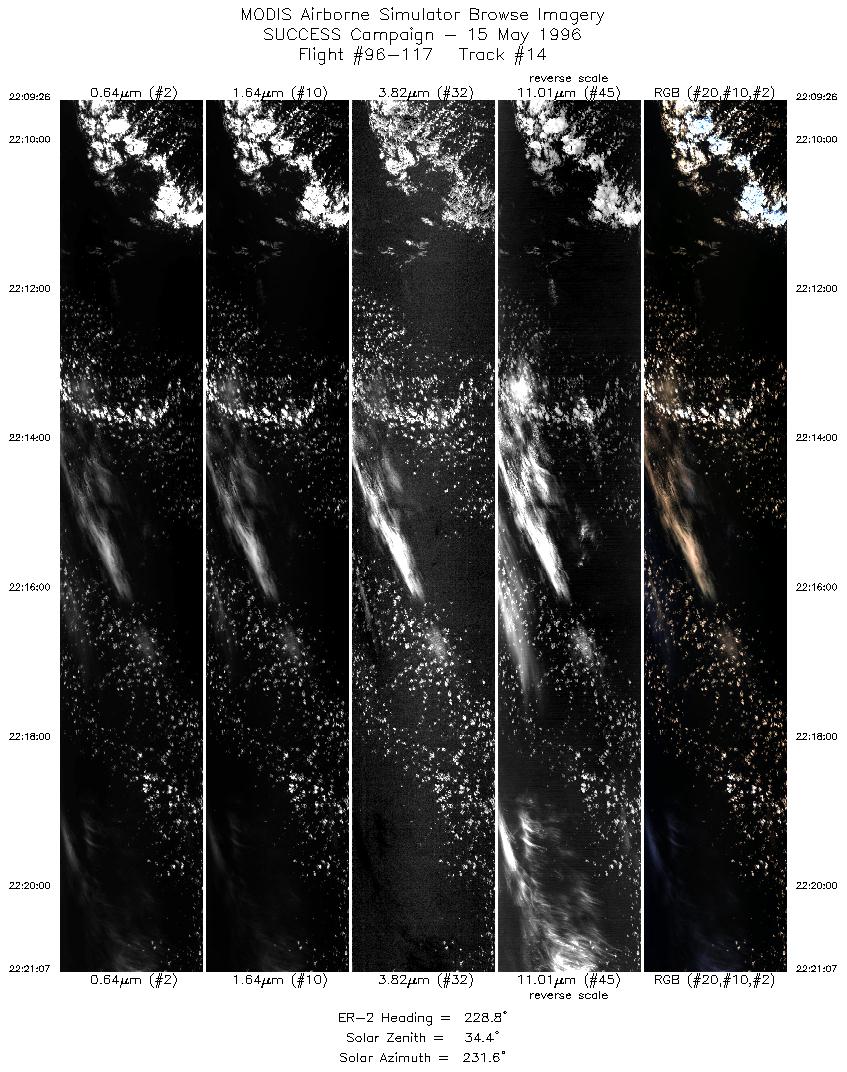
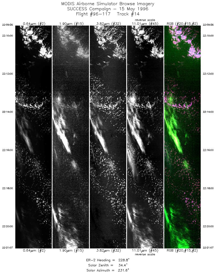
| 14 |
STD |
CIR |
22:09-22:21 |
229 |
44.40-43.59 |
125.20-126.62 |
4363 |
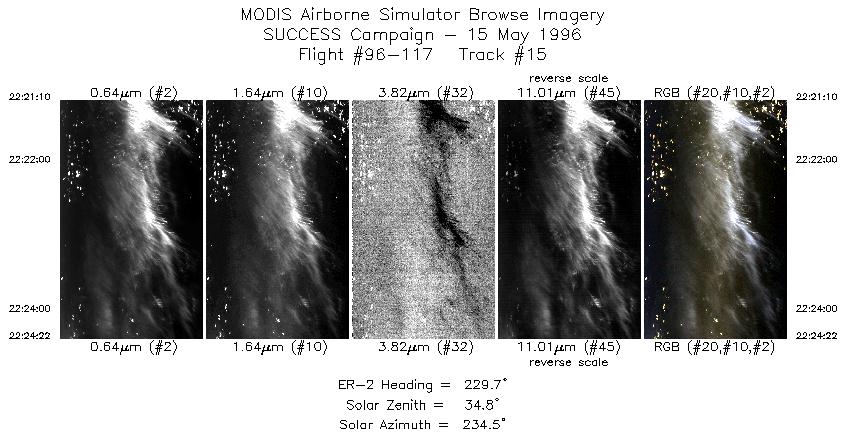
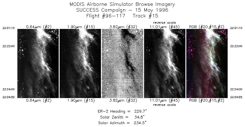
| 15 |
STD |
CIR |
22:21-22:24 |
230 |
43.59-43.36 |
126.62-127.00 |
1196 |
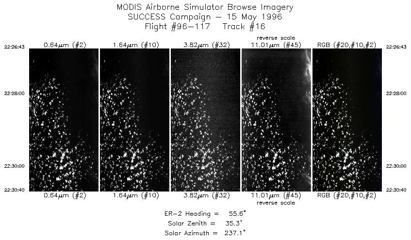
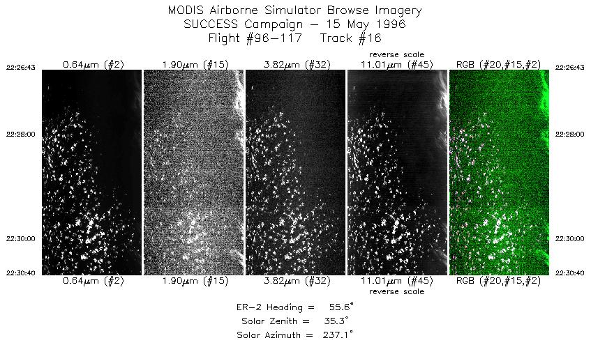
| 16 |
STD |
CIR |
22:26-22:30 |
56 |
43.24-43.52 |
126.86-126.36 |
1476 |
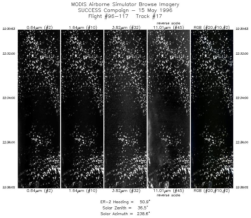
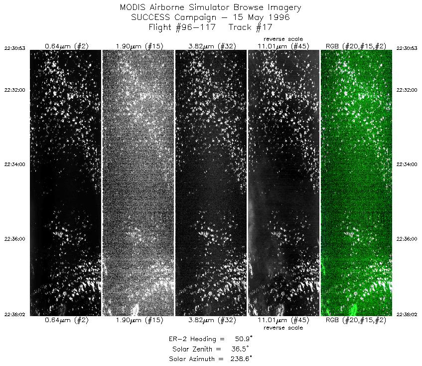
| 17 |
STD |
CIR |
22:30-22:38 |
51 |
43.54-44.09 |
126.33-125.45 |
2670 |
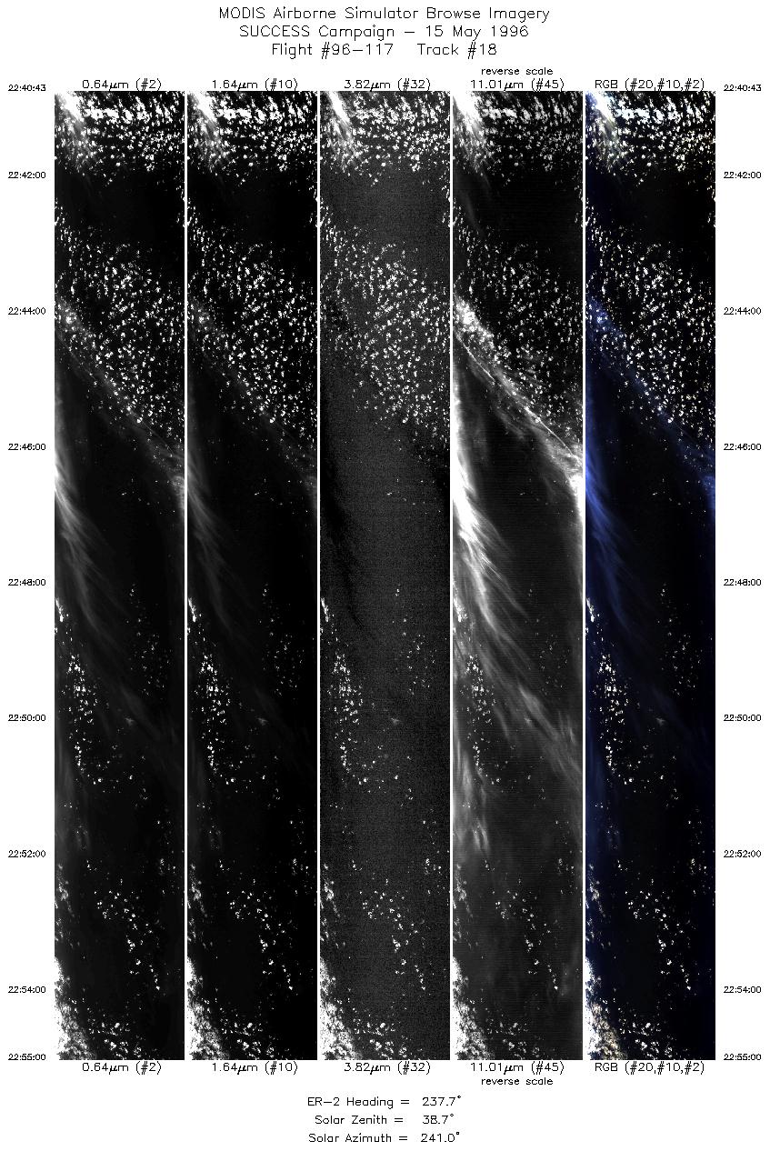
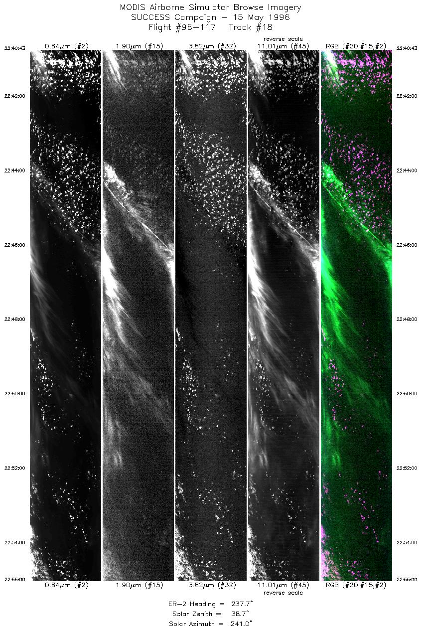
| 18 |
STD |
CIR |
22:40-22:55 |
238 |
44.18-43.38 |
125.65-127.54 |
5333 |
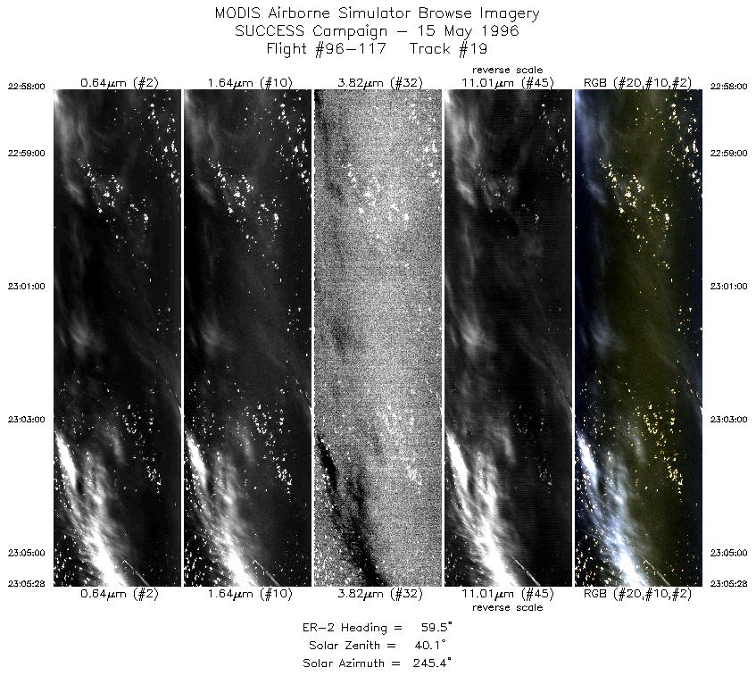
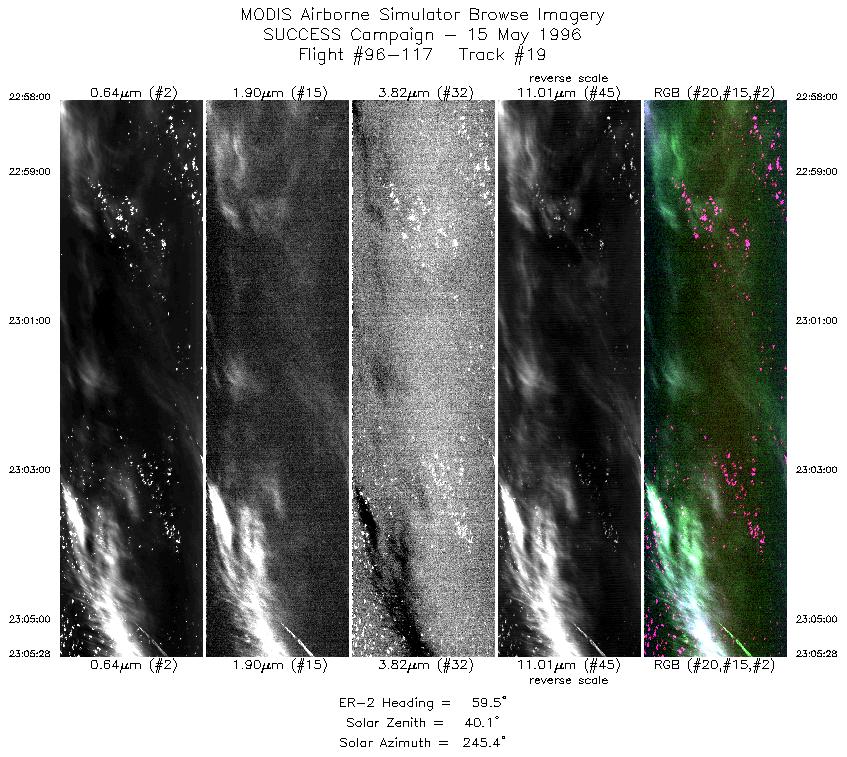
| 19 |
STD |
CIR |
22:58-23:05 |
60 |
43.32-43.79 |
127.32-126.30 |
2789 |
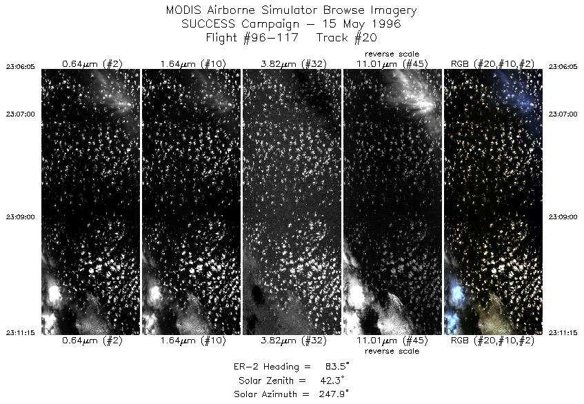
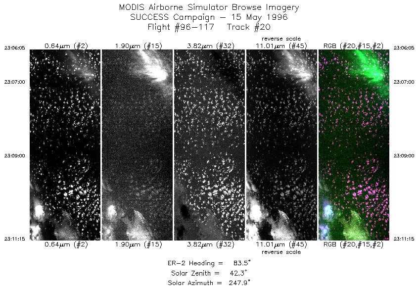
| 20 |
STD |
CIR |
23:06-23:11 |
83 |
43.83-43.91 |
126.21-125.39 |
1930 |
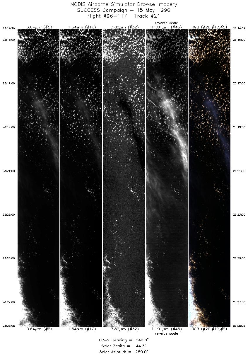
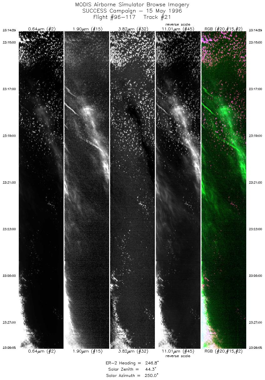
| 21 |
STD |
CIR |
23:14-23:28 |
247 |
44.10-43.54 |
125.50-127.44 |
5079 |
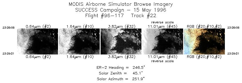
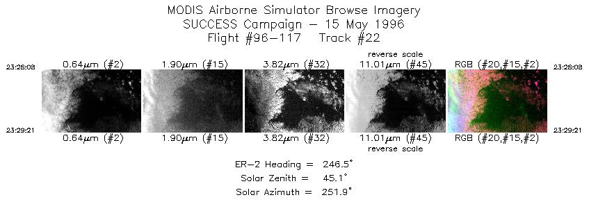
| 22 |
STD |
CIR |
23:28-23:29 |
246 |
43.54-43.49 |
127.44-127.61 |
456 |
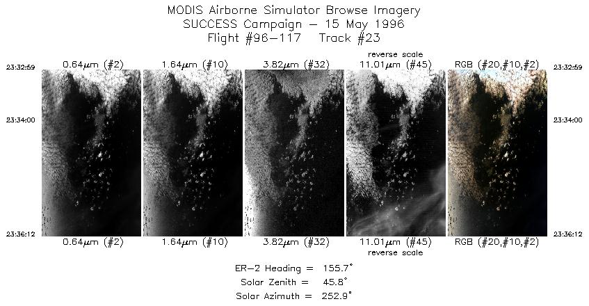
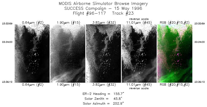
| 23 |
STD |
CIR |
23:32-23:36 |
156 |
43.60-43.28 |
127.54-127.32 |
1202 |
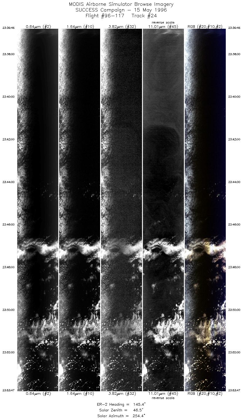
| 24 |
STD |
CIR |
23:36-23:53 |
145 |
43.23-41.69 |
127.26-125.81 |
6312 |
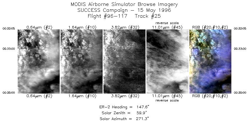
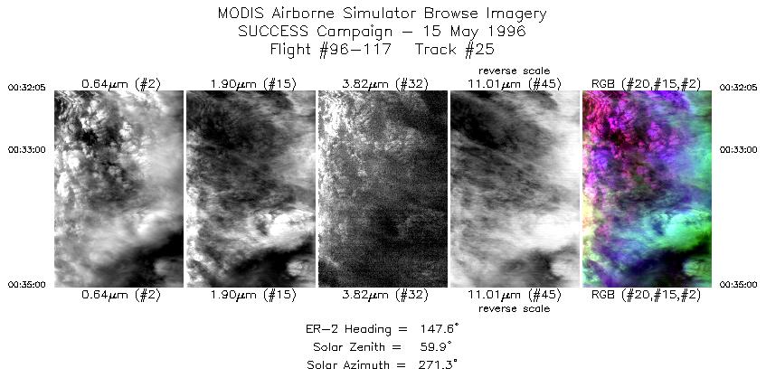
| 25 |
STD |
CIR |
00:32-00:35 |
148 |
38.13-37.85 |
122.76-122.53 |
1090 |
|
Standard Browse Images 01 through 25 in sequence |
|
Cirrus Detection Browse Images 01 through 25 in sequence |
Level-1B HDF Data Distribution Point
NASA GSFC Earth Sciences (GES) Data Center
NASA DAAC's
Additional Information
Coming Soon!
|
|
|
|