
|
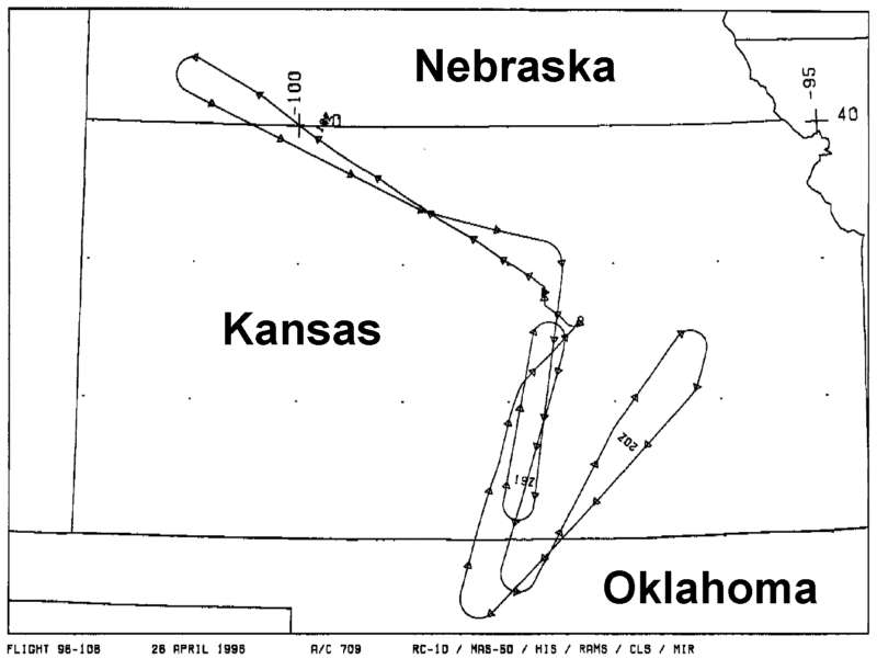
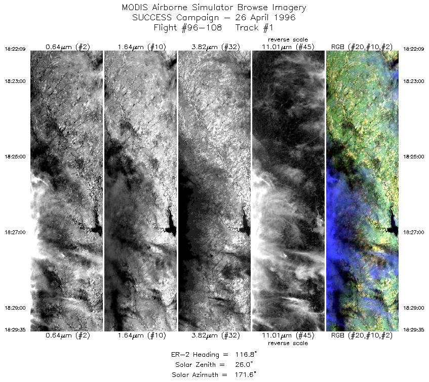
Sample Image

26 April 1996
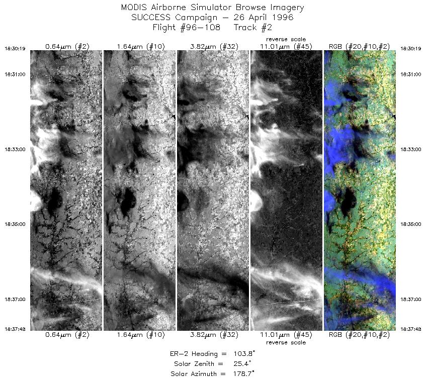
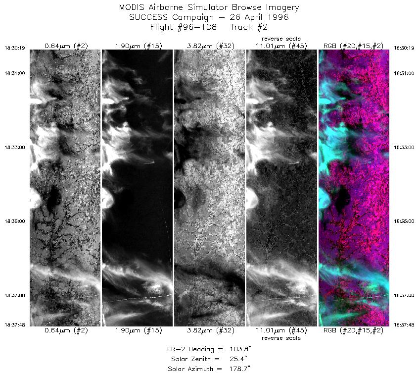
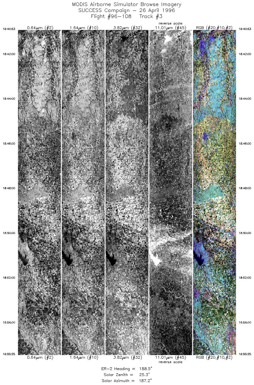
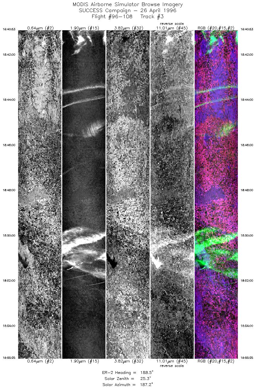
Track #02
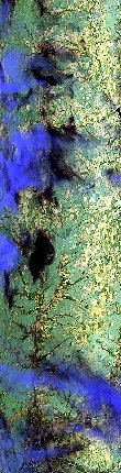

"Fresh contrails over central Kansas"
26 April 1996
Track #07
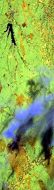
"Cirrus over southern Kansas"
R: 2.15 microns
G: 1.65 microns
B: 0.65 microns
|
|
Summary Information
Date: April 26, 1996
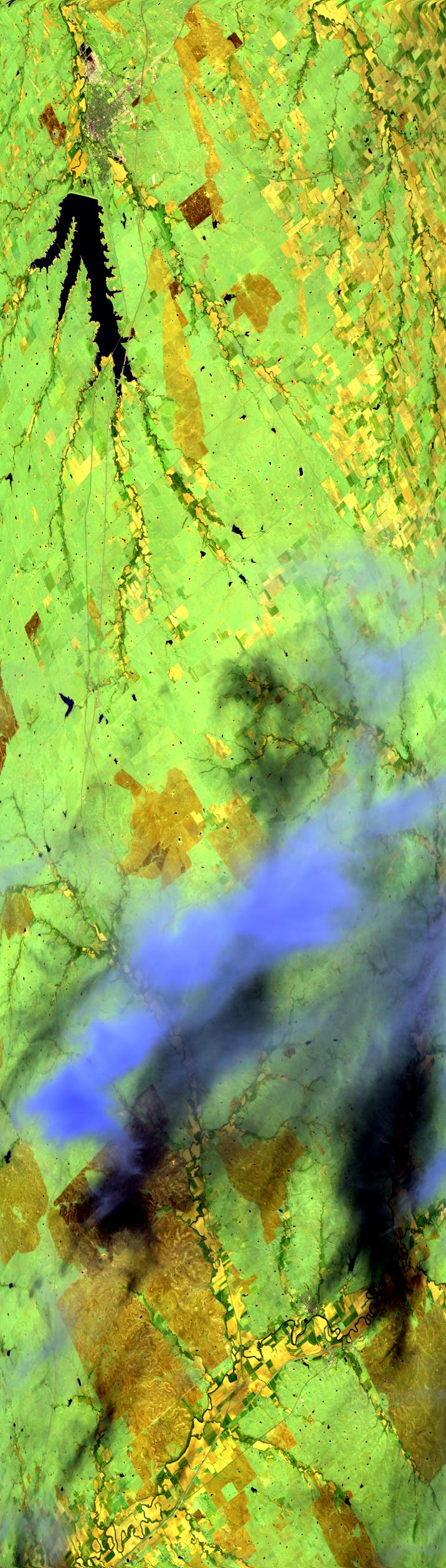
ER-2 Flight Number: 96-108
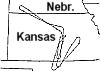
Location: Oklahoma CART Site, Kansas, Nebraska
Principle Investigator: Dr. Brian Toon (NASA Ames)
Additional Sensors: B&W_6"_RC-10, MIR, CLS, RAMS, HIS
Level-1B Processing Information
Level-1B Data Version: #10
Calibration Type: Final
Calibration Version: SUCCESS_Ames 1.0
Temperature Adjustment: No
Status: Final Calibration Done
|
|
Flight Track Map

|
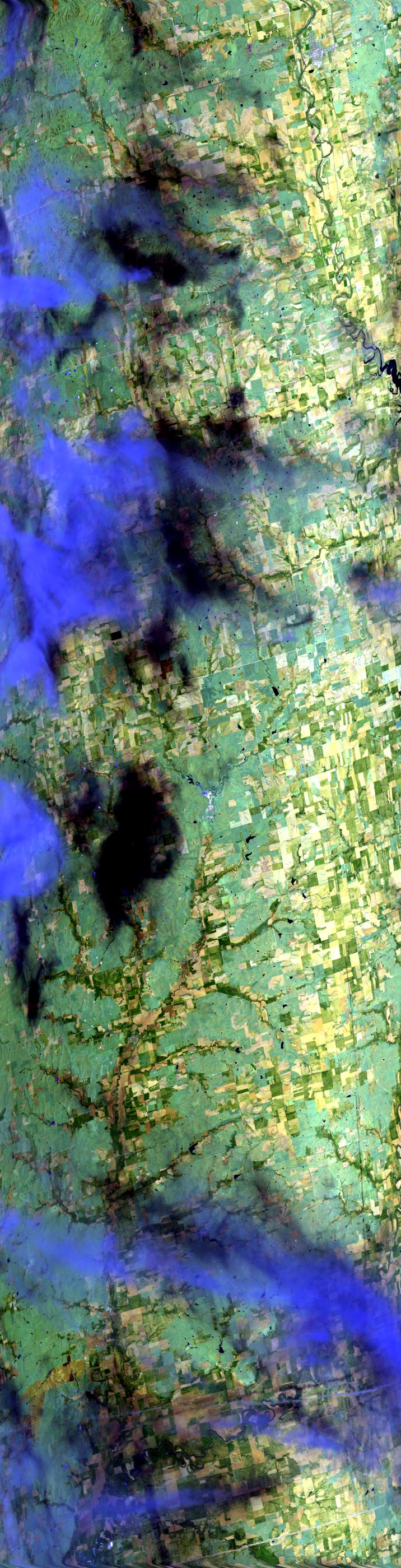
Level-1B Browse Imagery
Straight Line Flight Tracks: 9
Scanlines Processed: 33068
Solar Azimuth and Zenith Angles
|
Browse Images
|
Click on the Flight Track number to load images.
Lat/Lon ranges are for the BEG-END scanline nadir pixels.
|
Flight
Track |
Standard
Images |
Cirrus
Images |
Time_Span
(GMT) |
Heading
(Deg) |
Lat_Range
(Deg_N) |
Lon_Range
(Deg_W) |
Length
(Scanlines) |
| 1 |
STD |
CIR |
18:22-18:29 |
117 |
39.79-39.41 |
99.86- 98.86 |
2776 |
| 2 |
STD |
CIR |
18:30-18:37 |
104 |
39.38-39.17 |
98.76- 97.66 |
2798 |
| 3 |
STD |
CIR |
18:40-18:55 |
188 |
38.90-37.25 |
97.48- 97.76 |
5431 |
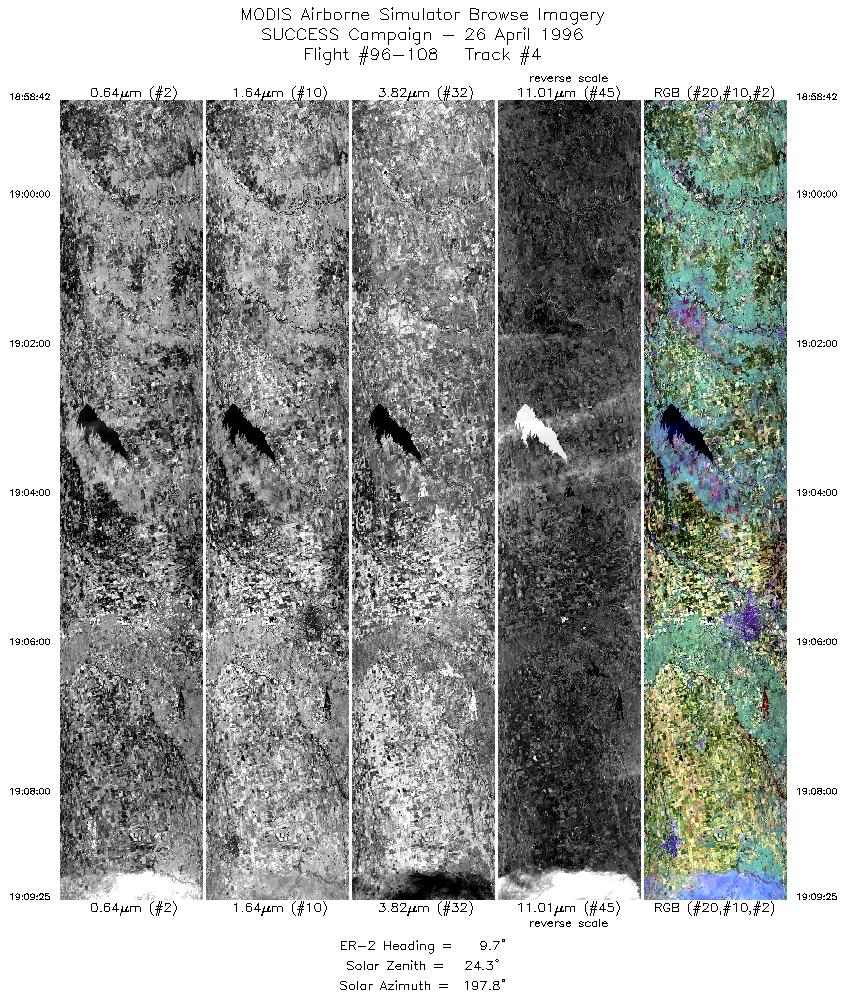
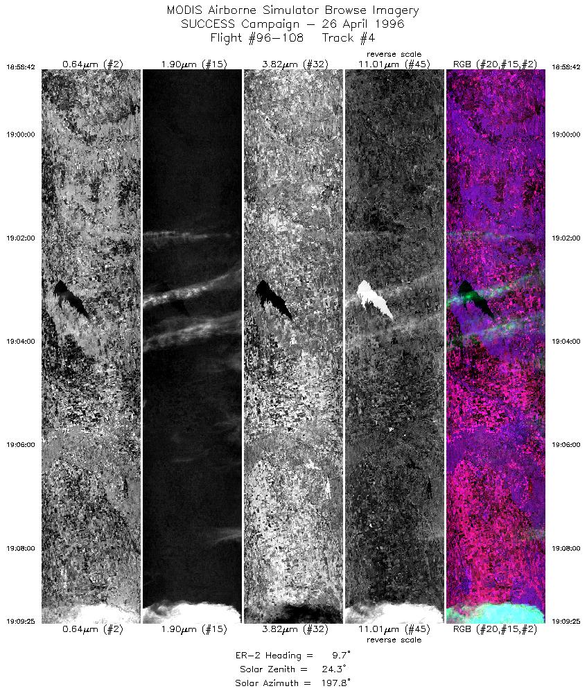
| 4 |
STD |
CIR |
18:58-19:09 |
10 |
37.27-38.47 |
98.04- 97.76 |
4004 |
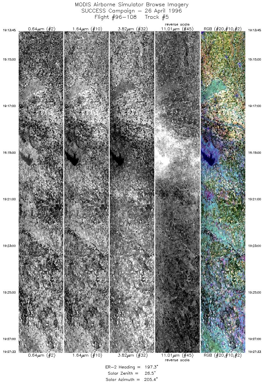
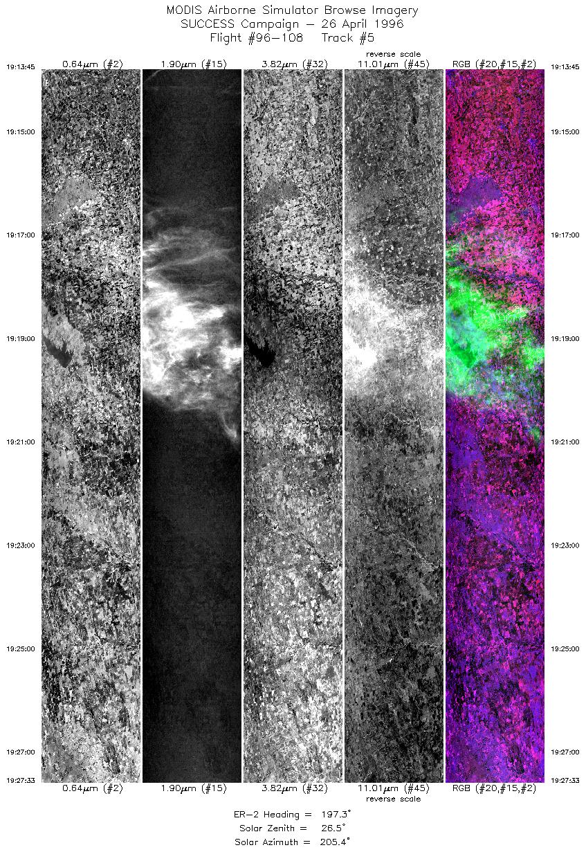
| 5 |
STD |
CIR |
19:13-19:27 |
197 |
38.33-36.81 |
97.48- 98.06 |
5156 |
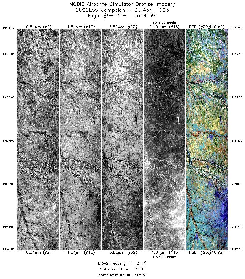
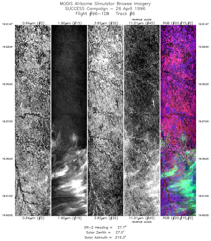
| 6 |
STD |
CIR |
19:31-19:42 |
28 |
36.76-37.78 |
97.71- 97.02 |
3830 |
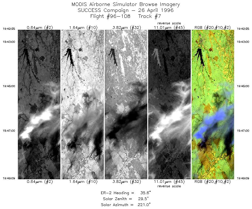
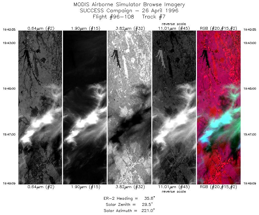
| 7 |
STD |
CIR |
19:42-19:49 |
36 |
37.82-38.45 |
96.99- 96.40 |
2515 |
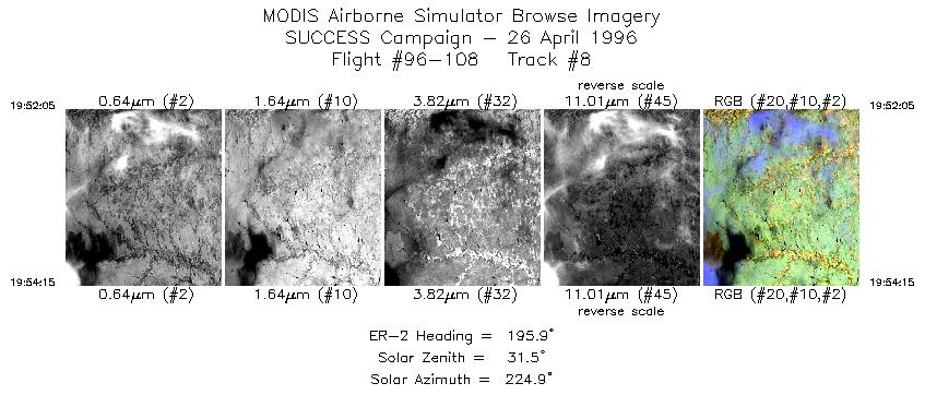
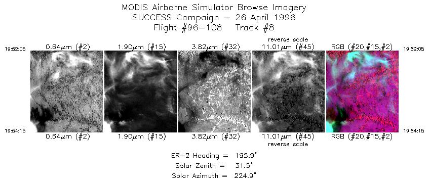
| 8 |
STD |
CIR |
19:52-19:54 |
196 |
38.35-38.12 |
96.12- 96.20 |
810 |
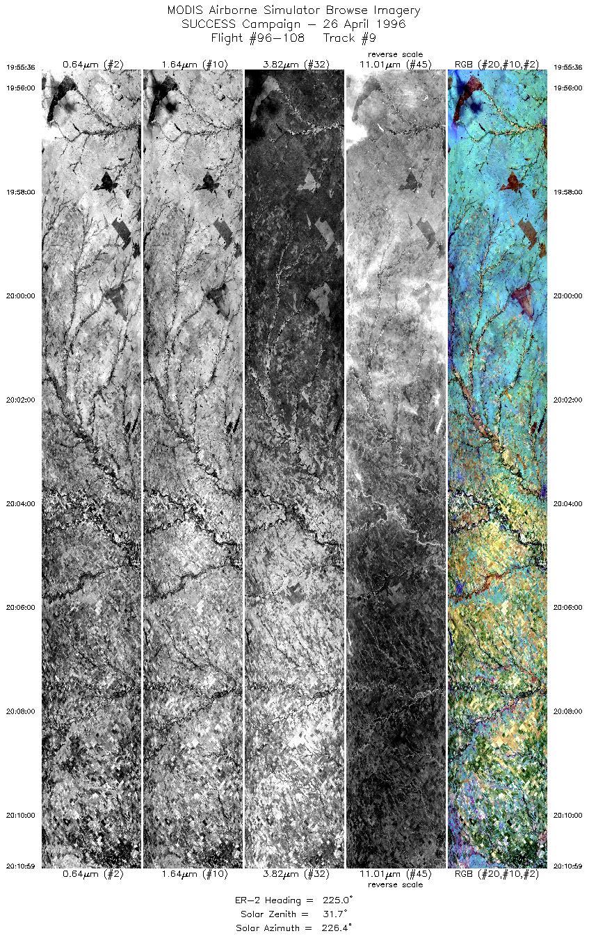
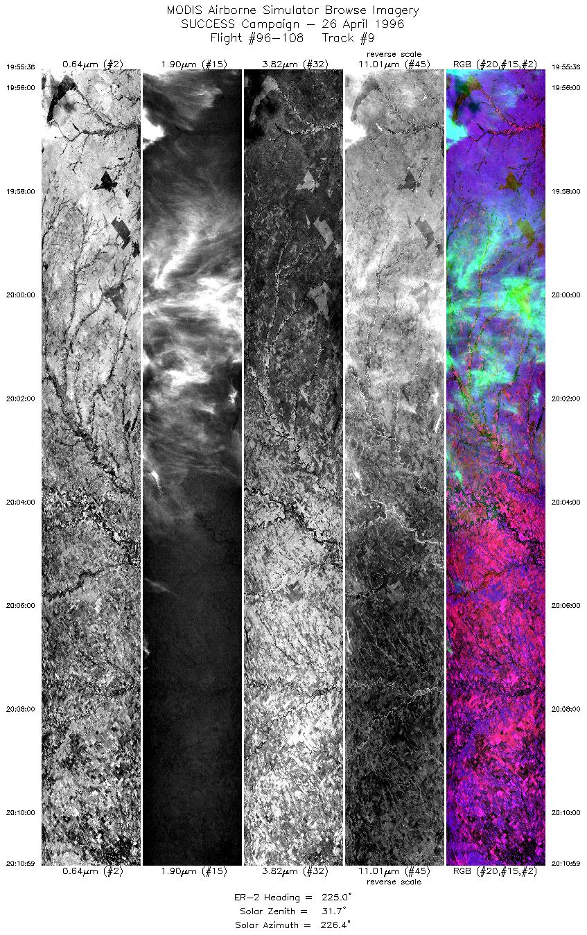
| 9 |
STD |
CIR |
19:55-20:10 |
225 |
38.00-36.74 |
96.31- 97.82 |
5748 |
|
Standard Browse Images 01 through 09 in sequence |
|
Cirrus Detection Browse Images 01 through 09 in sequence |
Level-1B HDF Data Distribution Point
NASA GSFC Earth Sciences (GES) Data Center
NASA DAAC's
Additional Information
The objective of this mission was to
observe cirrus and contrails during overpass
of the NOAA-14 satellite to assist in the development of satellite
remote sensing techniques.
Take-off time was 1730 UTC with landing at 2100 UTC. ER-2 flew
NW to altitude and returned to vicinity of Salina, Kansas. Lee wave mission
was cancelled. ER-2 mission was adjusted accordingly. Pilot was
to visually locate and fly over contrails. ER-2 flew into the
solar principle plane during the NOAA-14 satellite overpass.
The pilot reported
the overflights of a fresh contrail (the commercial aircraft pilot
could visually see the ER-2) during the 1831 to 1834 leg.
The ER-2 flew into the solar plane during
the leg from 38:00N 96:10W and 36:20N 98:10W (between 1956 and 2009 UTC).
A good contrail was observed around 1847. During the leg between
1841 and 1855 UTC pilot observed 7 to 10 contrails. Also overflew
a contrail on the 1952 to 1954 UTC leg. Contrails appeared to
be below the cirrus.
|
|
|
|