
|
Sample Image

27 April 1996
Track #18
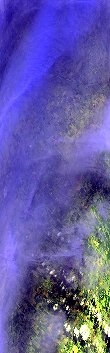

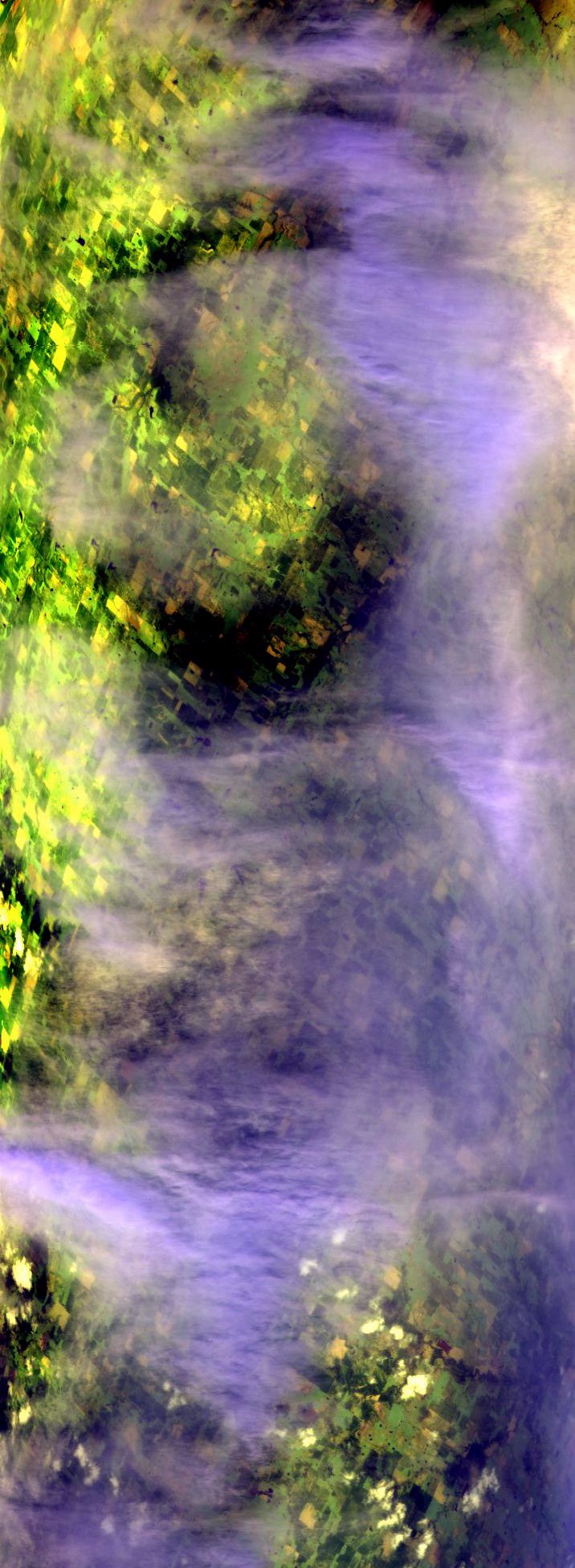
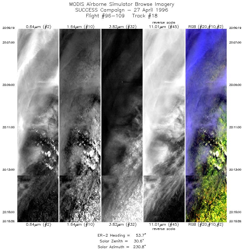
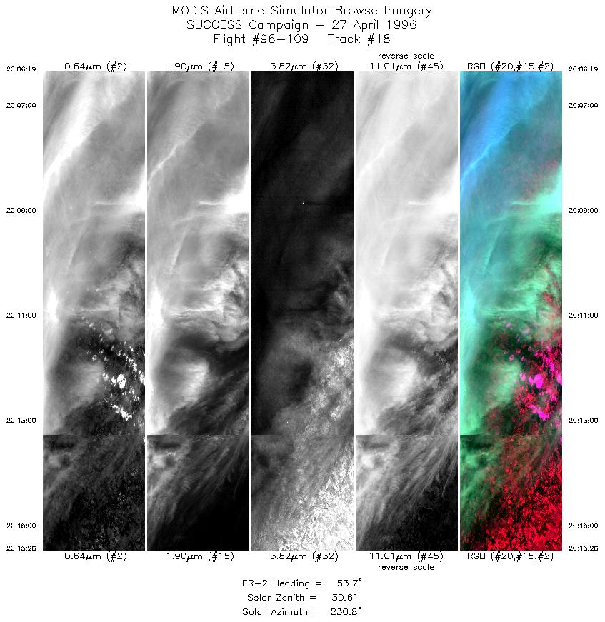
"Thin cirrus over northern Oklahoma"
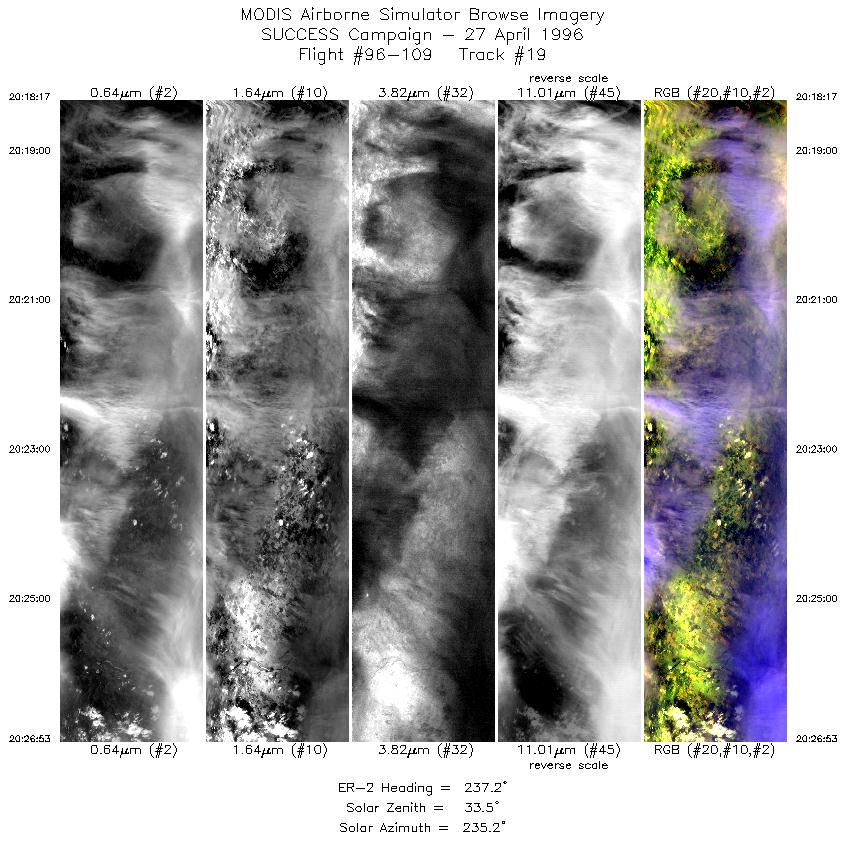
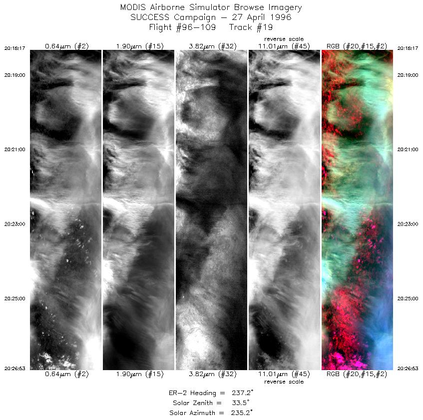
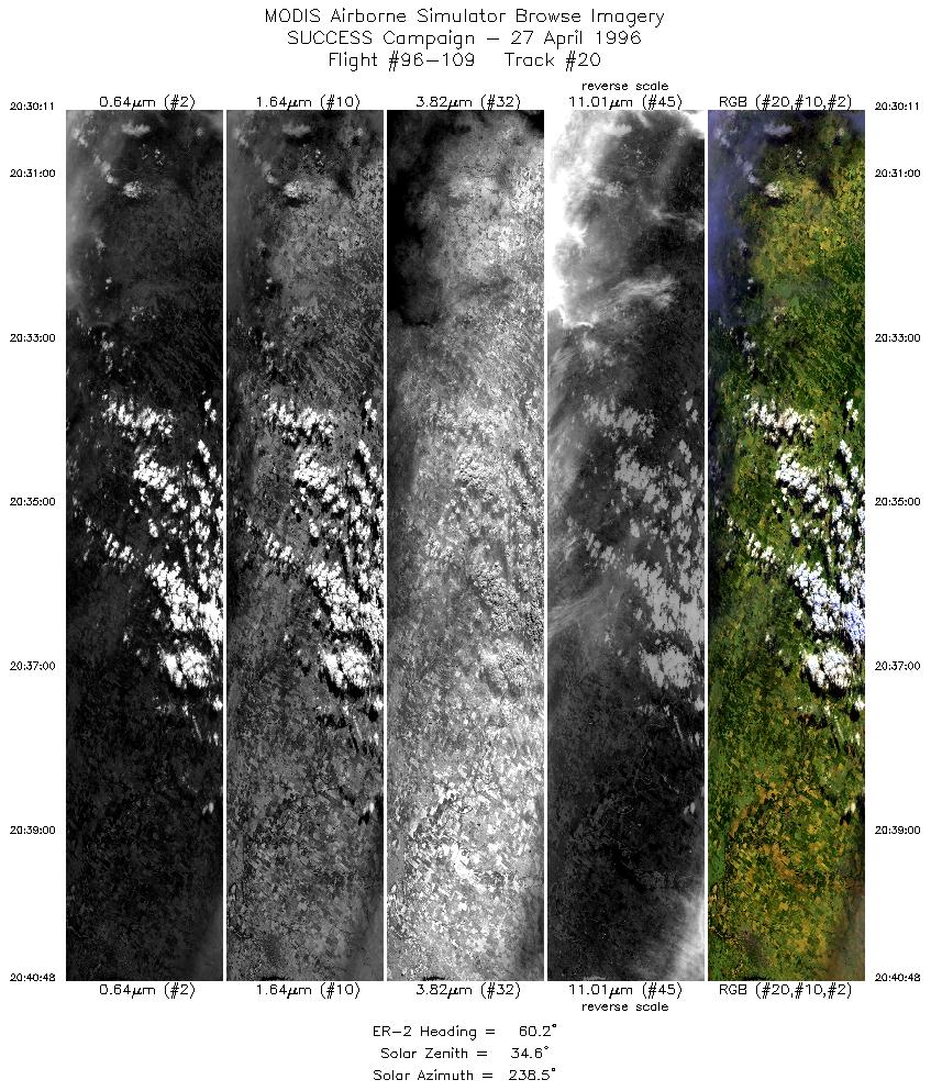
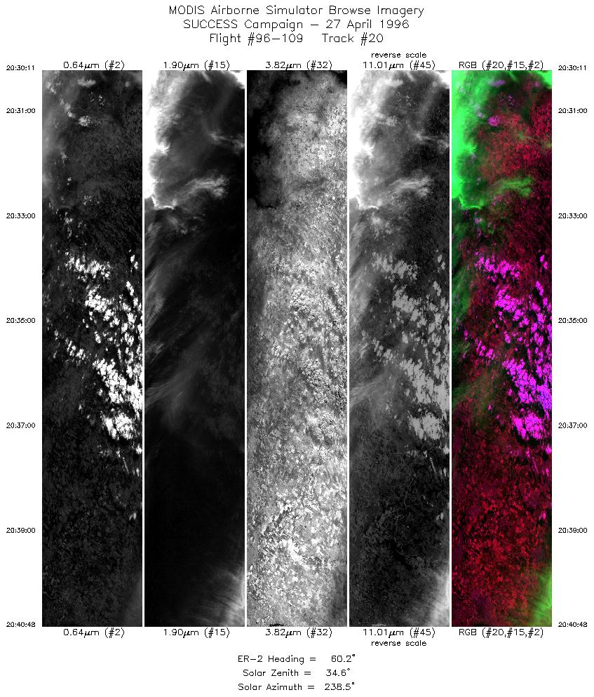
27 April 1996
Track #19

"Chaotic cirrus cloud patterns over Oklahoma CART site"
R: 2.15 microns
G: 1.65 microns
B: 0.65 microns
|
|
Summary Information
Date: April 27, 1996
ER-2 Flight Number: 96-109
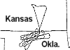
Location: Oklahoma CART Site, Kansas
Principle Investigator: Dr. Brian Toon (NASA Ames)
Additional Sensors: B&W_6"_RC-10, MIR, CLS, RAMS, HIS, EOC
Level-1B Processing Information
Level-1B Data Version: #10
Calibration Type: Final
Calibration Version: SUCCESS_Ames 1.0
Temperature Adjustment: No
Status: Final Calibration Done
|
|
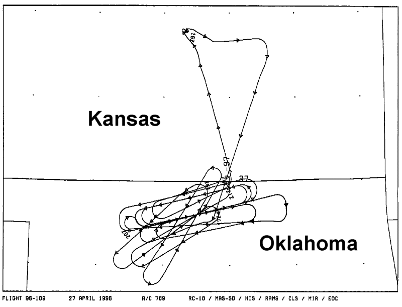
Flight Track Map

|
Level-1B Browse Imagery
Straight Line Flight Tracks: 22
Scanlines Processed: 71174
Solar Azimuth and Zenith Angles
|
Browse Images
|
Click on the Flight Track number to load images.
Lat/Lon ranges are for the BEG-END scanline nadir pixels.
|
Flight
Track |
Standard
Image |
Cirrus
Image |
Time_Span
(GMT) |
Heading
(Deg) |
Lat_Range
(Deg_N) |
Lon_Range
(Deg_W) |
Length
(Scanlines) |
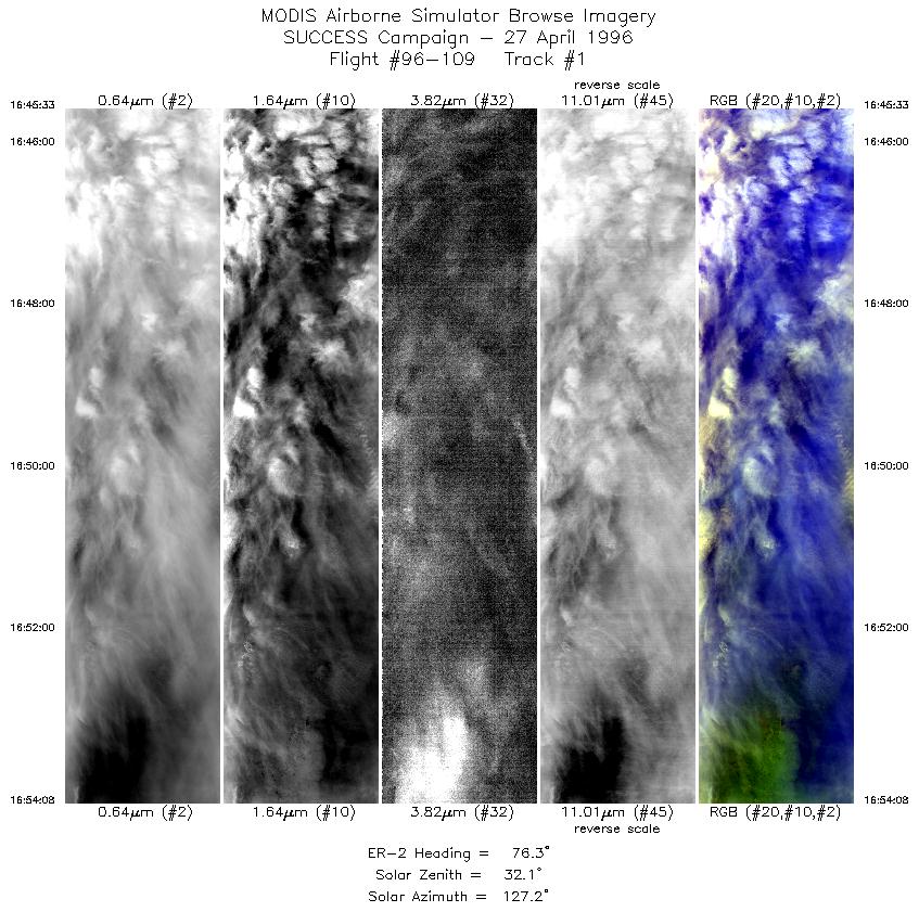
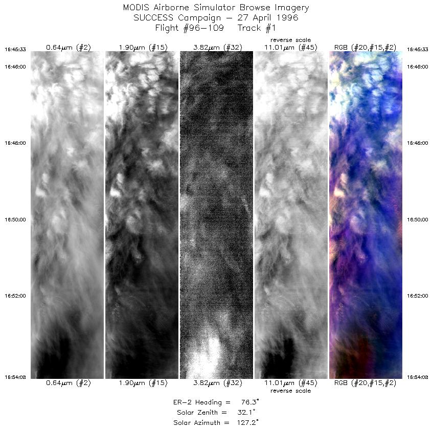
| 1 |
STD |
CIR |
16:45-16:54 |
76 |
36.52-36.72 |
97.97- 96.77 |
3207 |
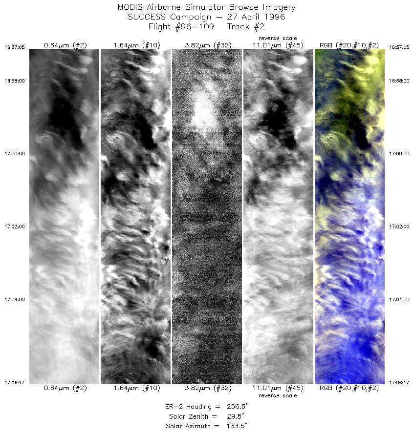
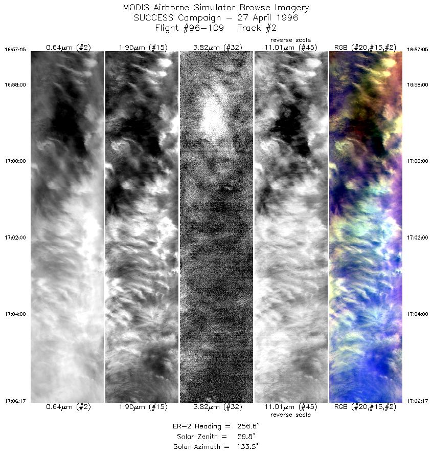
| 2 |
STD |
CIR |
16:57-17:06 |
257 |
36.52-36.31 |
96.70- 97.96 |
3439 |
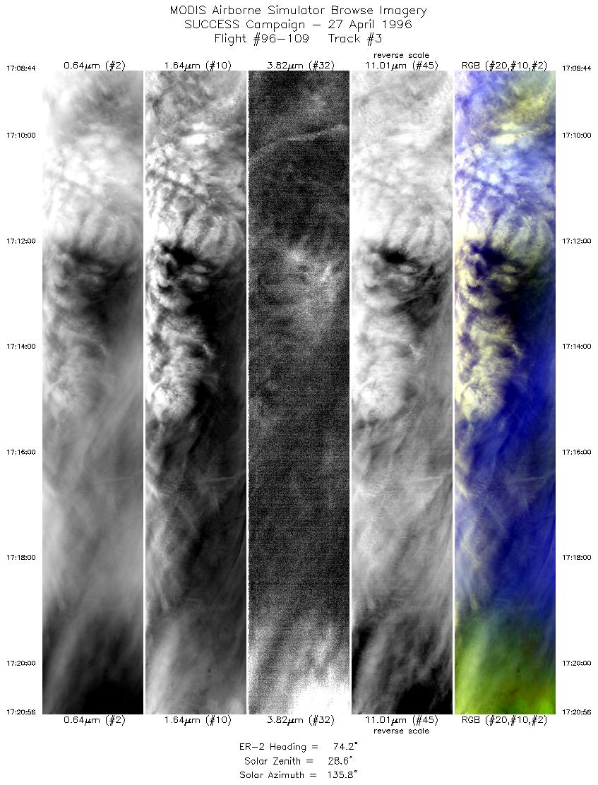
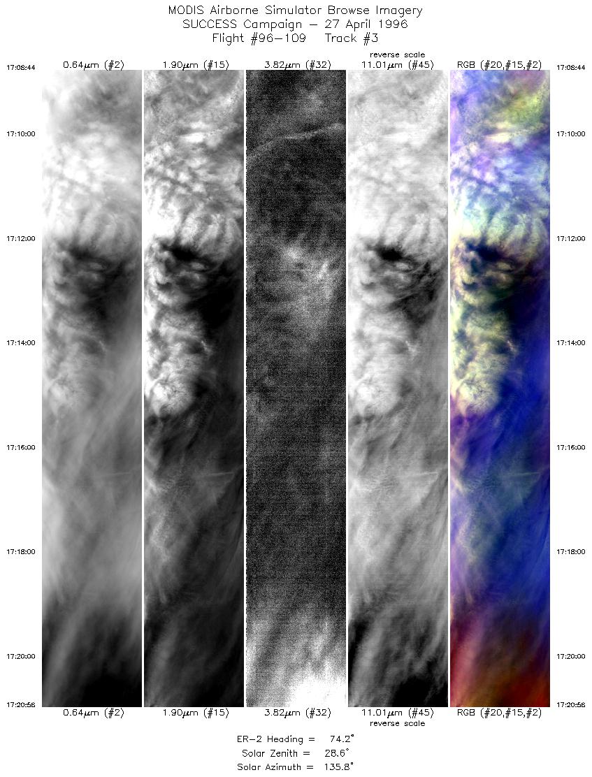
| 3 |
STD |
CIR |
17:08-17:20 |
74 |
36.50-36.84 |
98.01- 96.31 |
4560 |
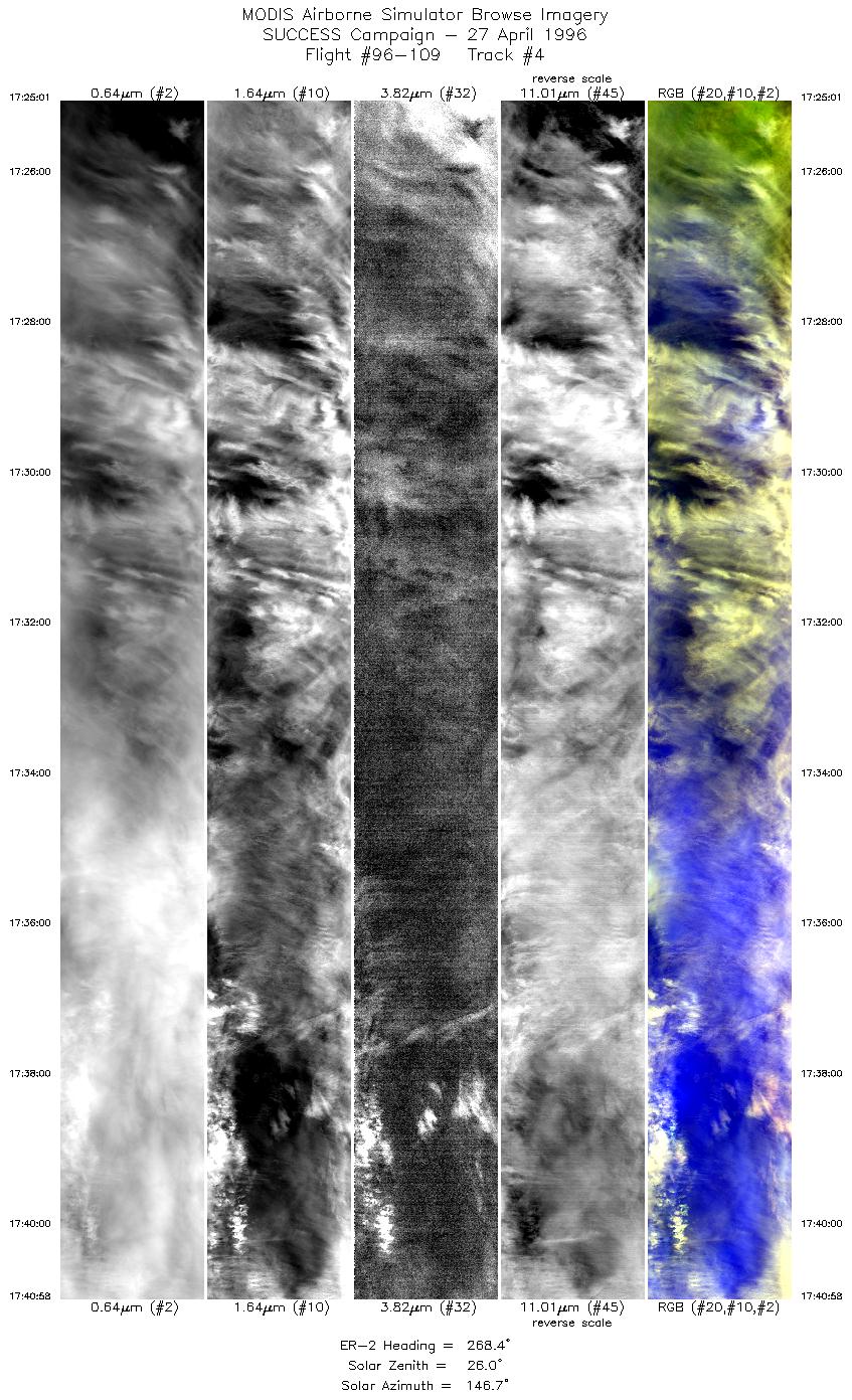
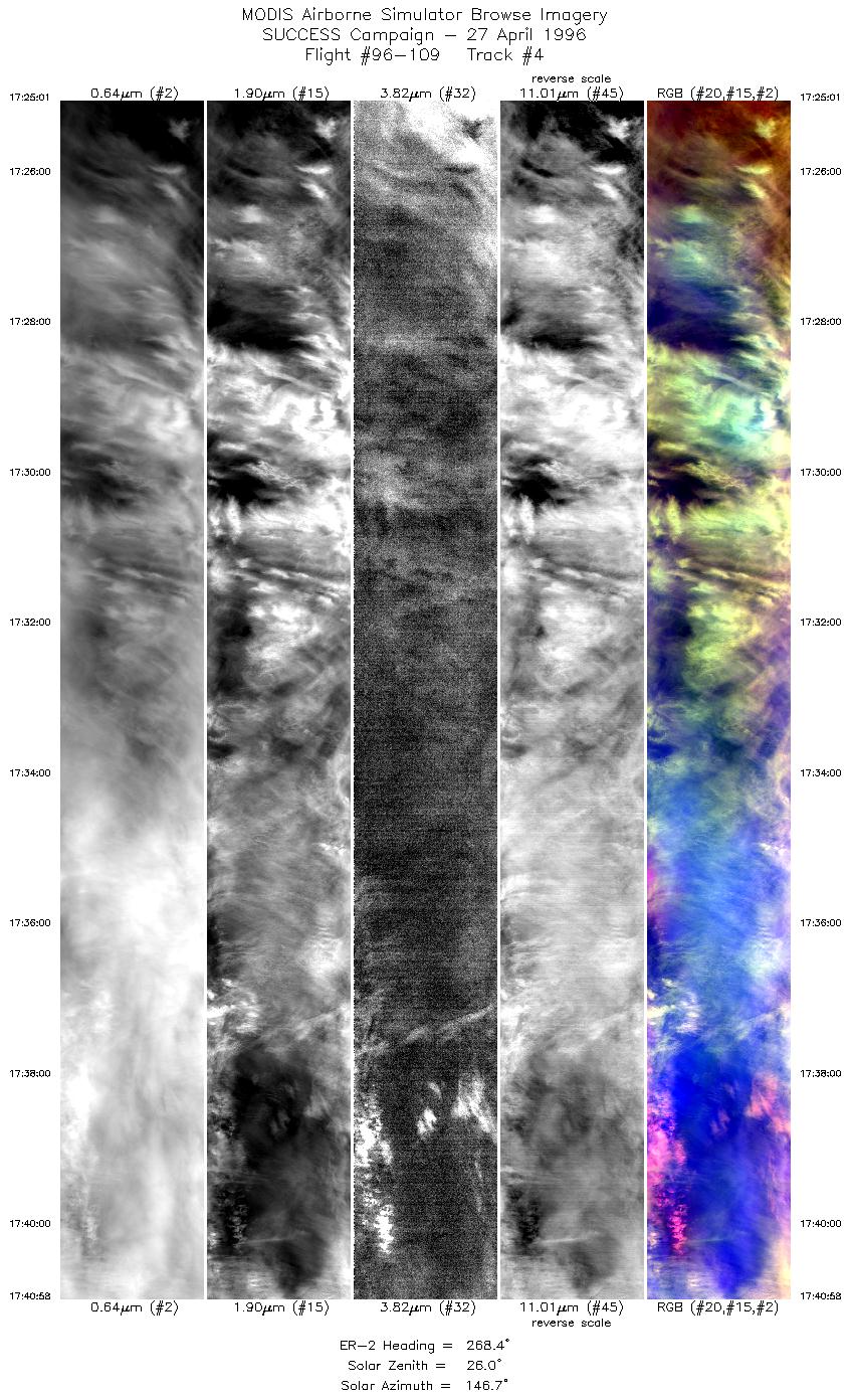
| 4 |
STD |
CIR |
17:25-17:40 |
268 |
36.54-36.43 |
96.27- 98.47 |
5960 |
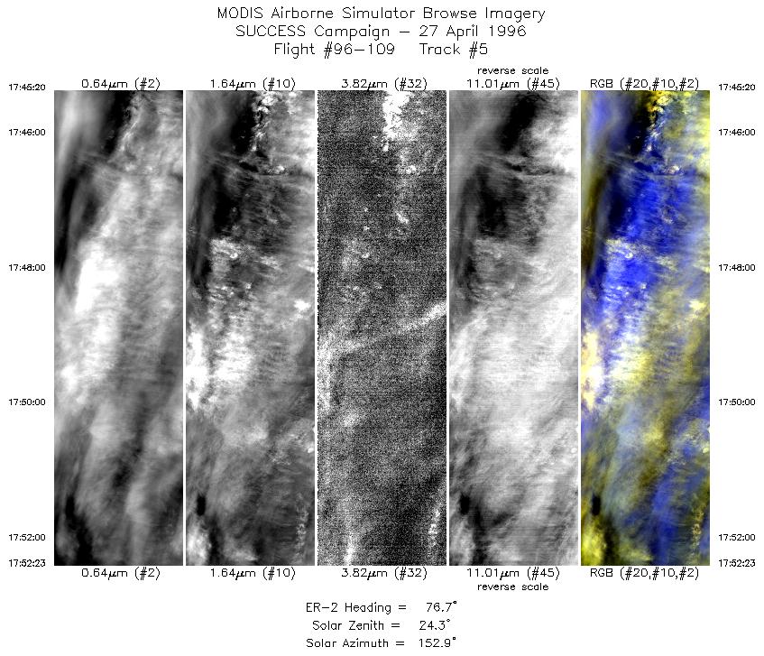
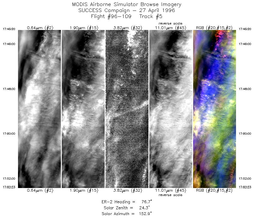
| 5 |
STD |
CIR |
17:45-17:52 |
77 |
36.46-36.65 |
98.22- 97.24 |
2635 |
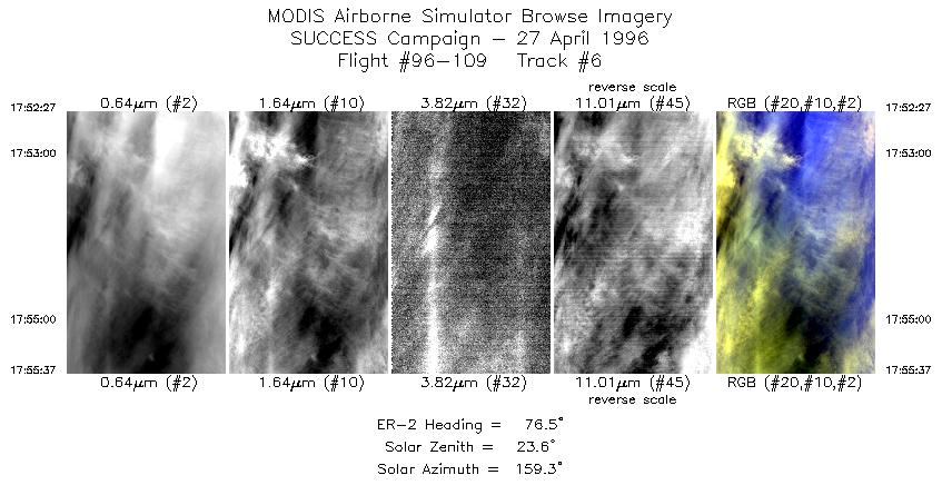
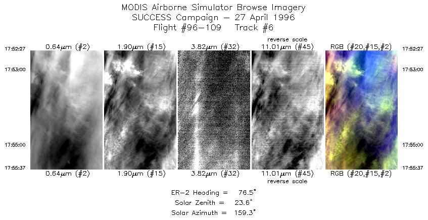
| 6 |
STD |
CIR |
17:52-17:55 |
76 |
36.66-36.74 |
97.22- 96.78 |
1184 |
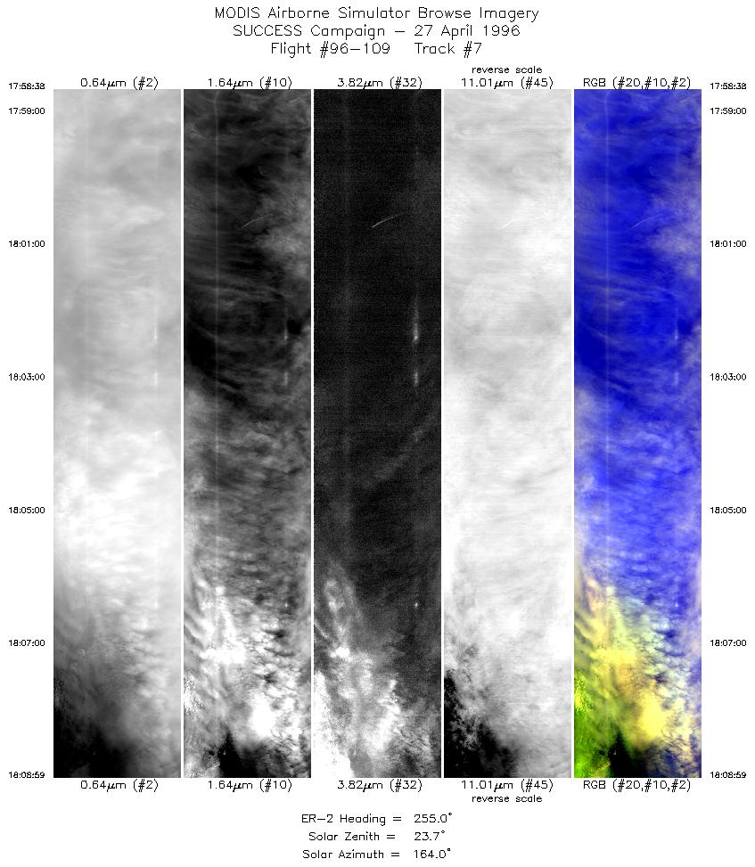
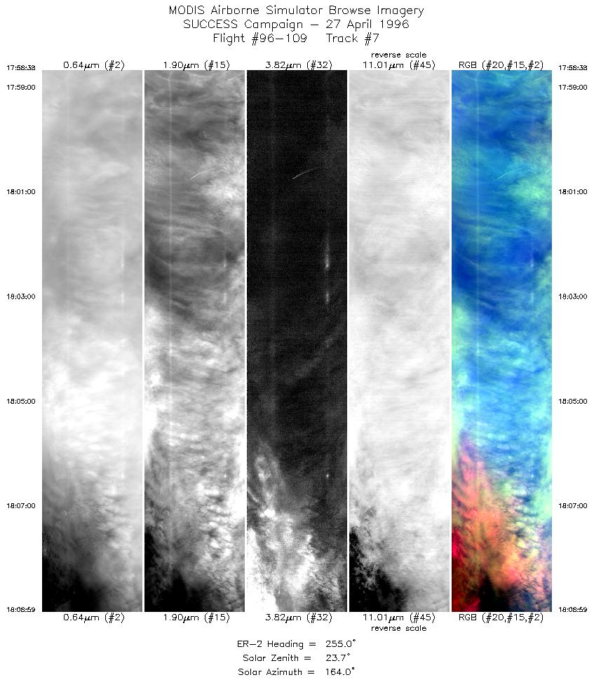
| 7 |
STD |
CIR |
17:58-18:08 |
255 |
36.95-36.68 |
96.83- 98.21 |
3867 |
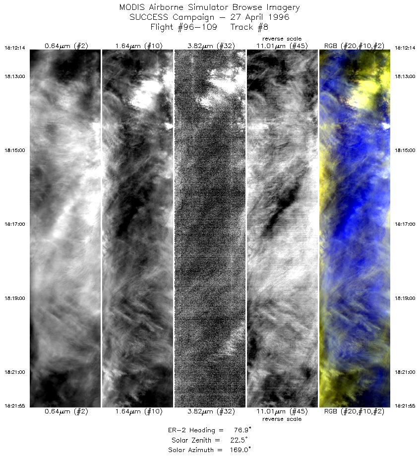
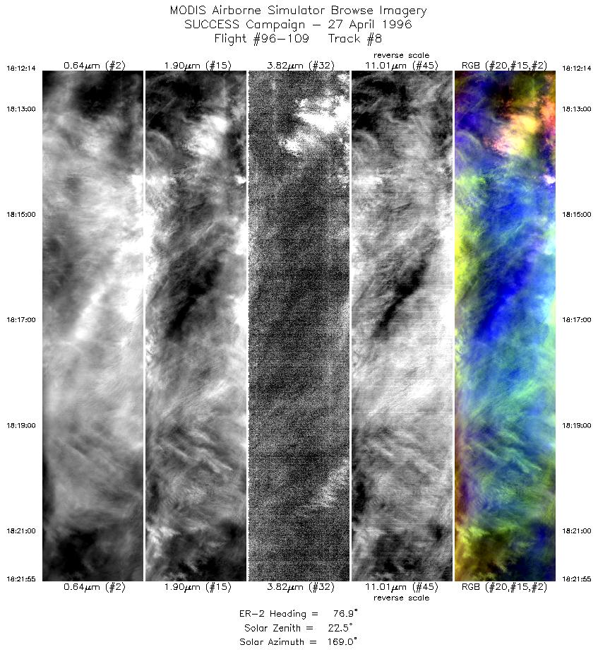
| 8 |
STD |
CIR |
18:12-18:21 |
77 |
36.48-36.75 |
98.10- 96.73 |
3618 |
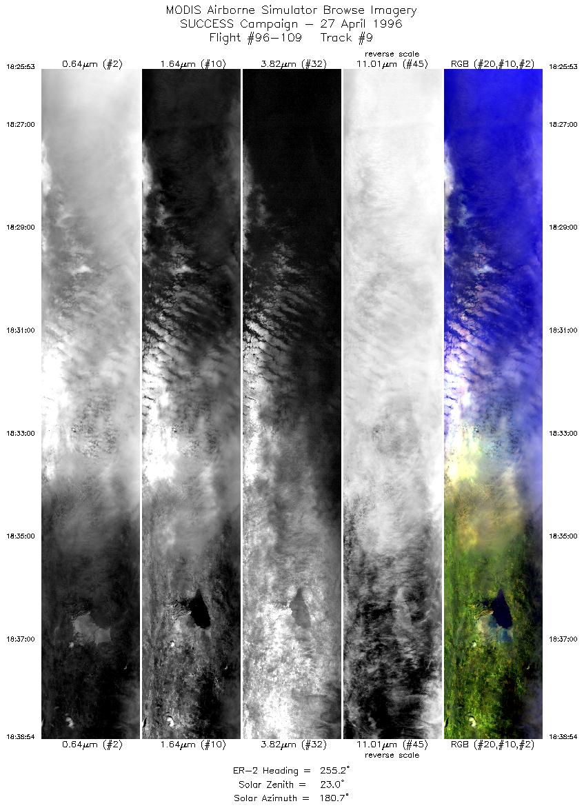
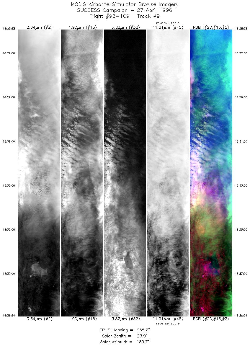
| 9 |
STD |
CIR |
18:25-18:38 |
255 |
37.02-36.68 |
96.81- 98.53 |
4861 |
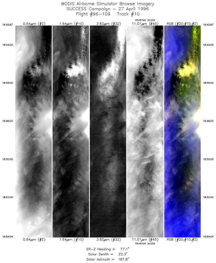
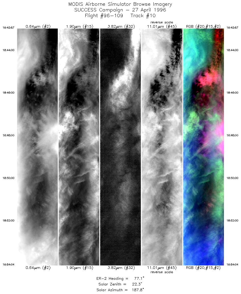
| 10 |
STD |
CIR |
18:42-18:54 |
77 |
36.41-36.73 |
98.43- 96.85 |
4152 |
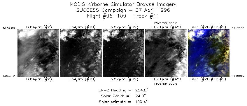
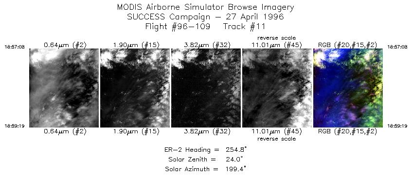
| 11 |
STD |
CIR |
18:57-18:59 |
255 |
36.94-36.88 |
96.89- 97.18 |
817 |
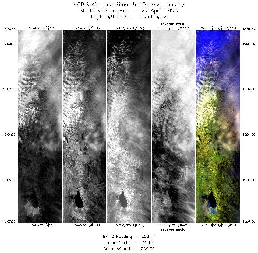
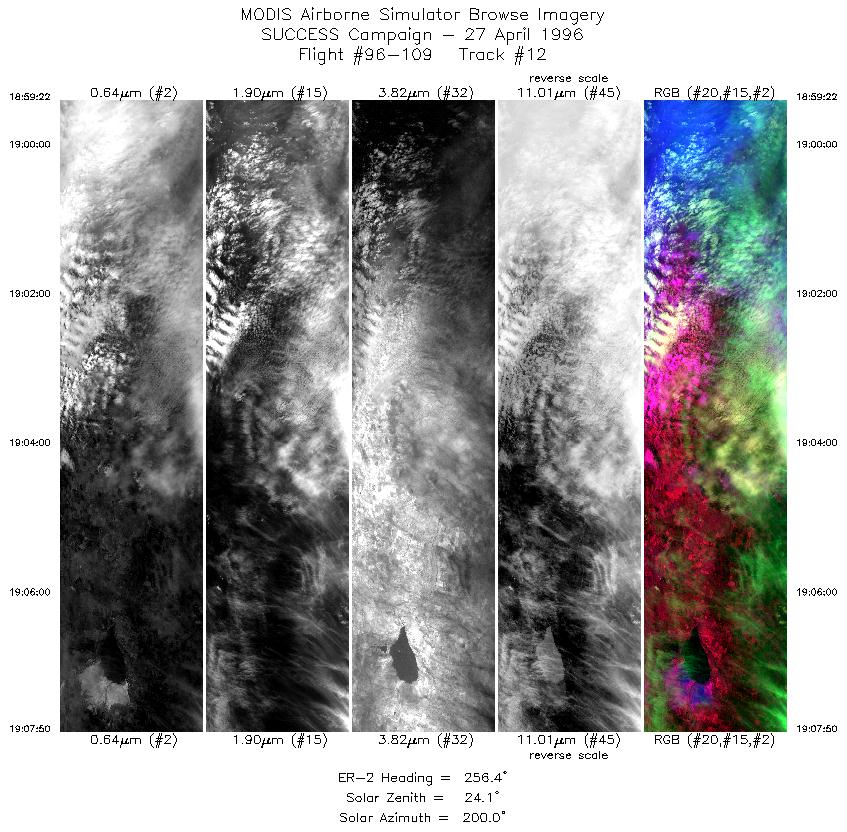
| 12 |
STD |
CIR |
18:59-19:07 |
256 |
36.88-36.66 |
97.19- 98.31 |
3163 |
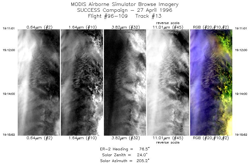
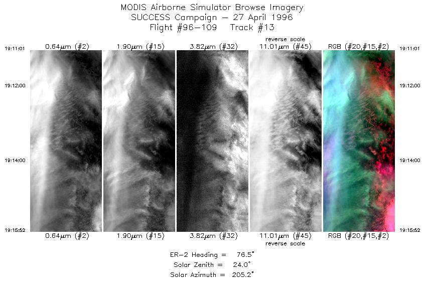
| 13 |
STD |
CIR |
19:11-19:15 |
77 |
36.46-36.60 |
98.21- 97.52 |
1812 |
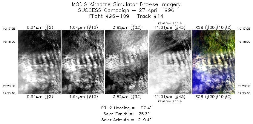
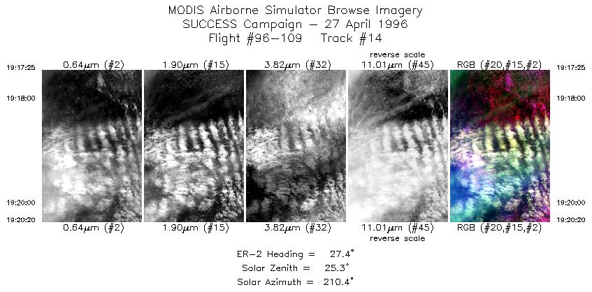
| 14 |
STD |
CIR |
19:17-19:20 |
27 |
36.71-37.01 |
97.35- 97.14 |
1090 |
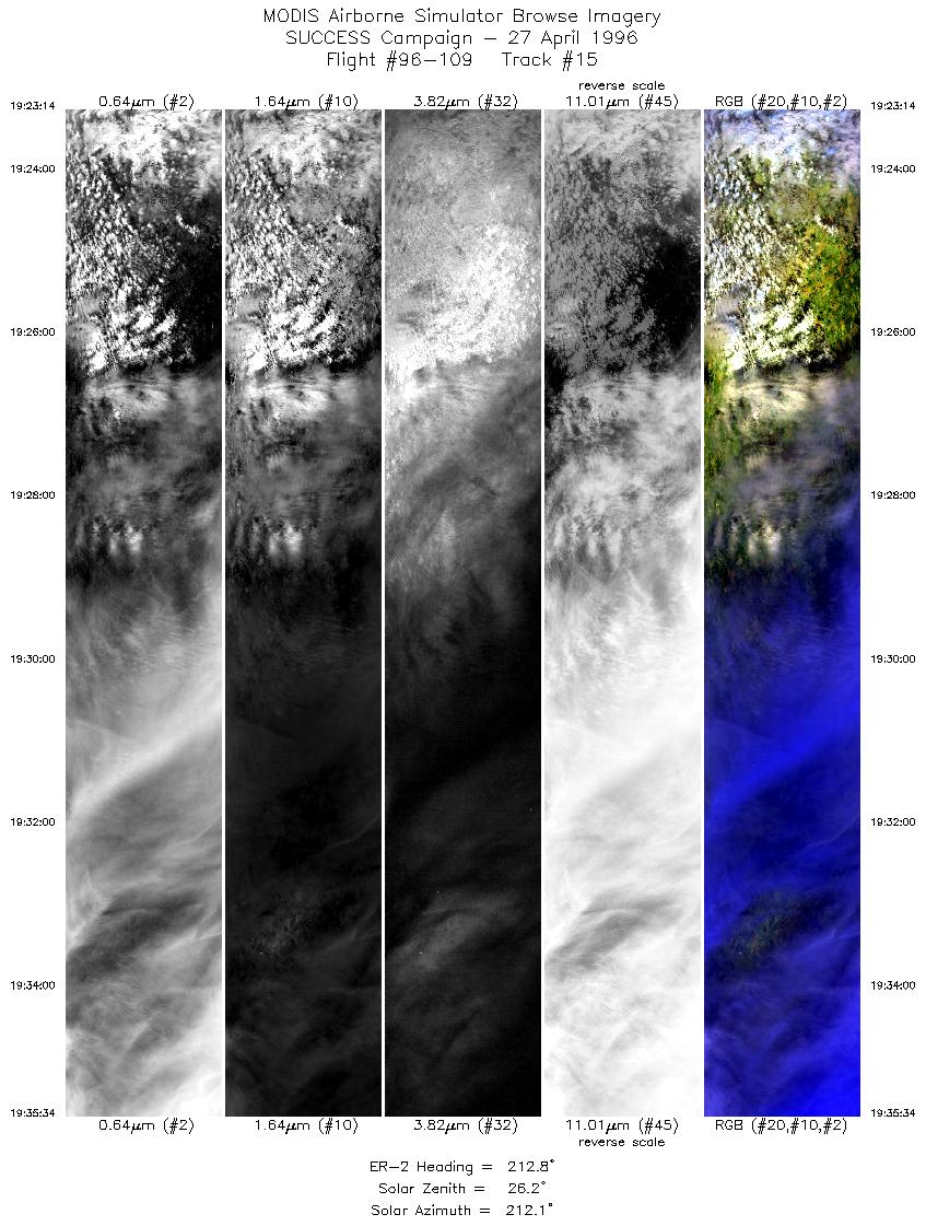
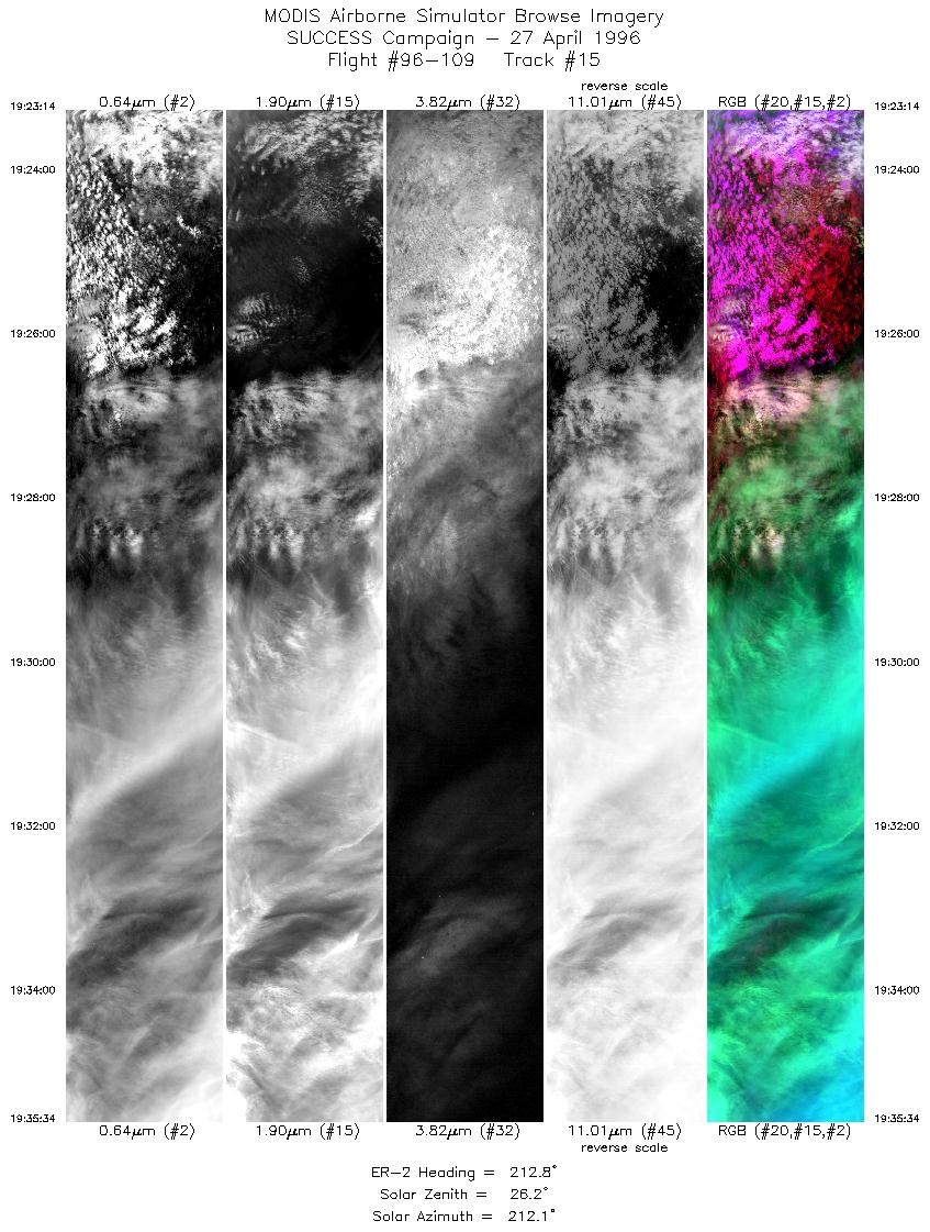
| 15 |
STD |
CIR |
19:23-19:35 |
213 |
37.10-35.94 |
97.33- 98.25 |
4607 |
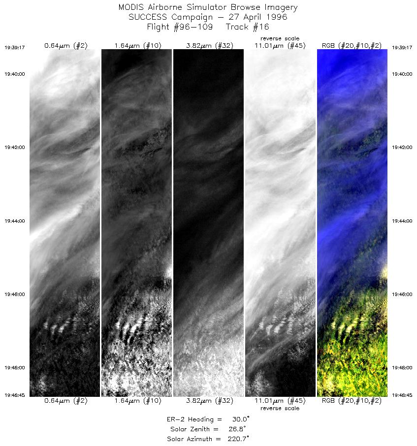
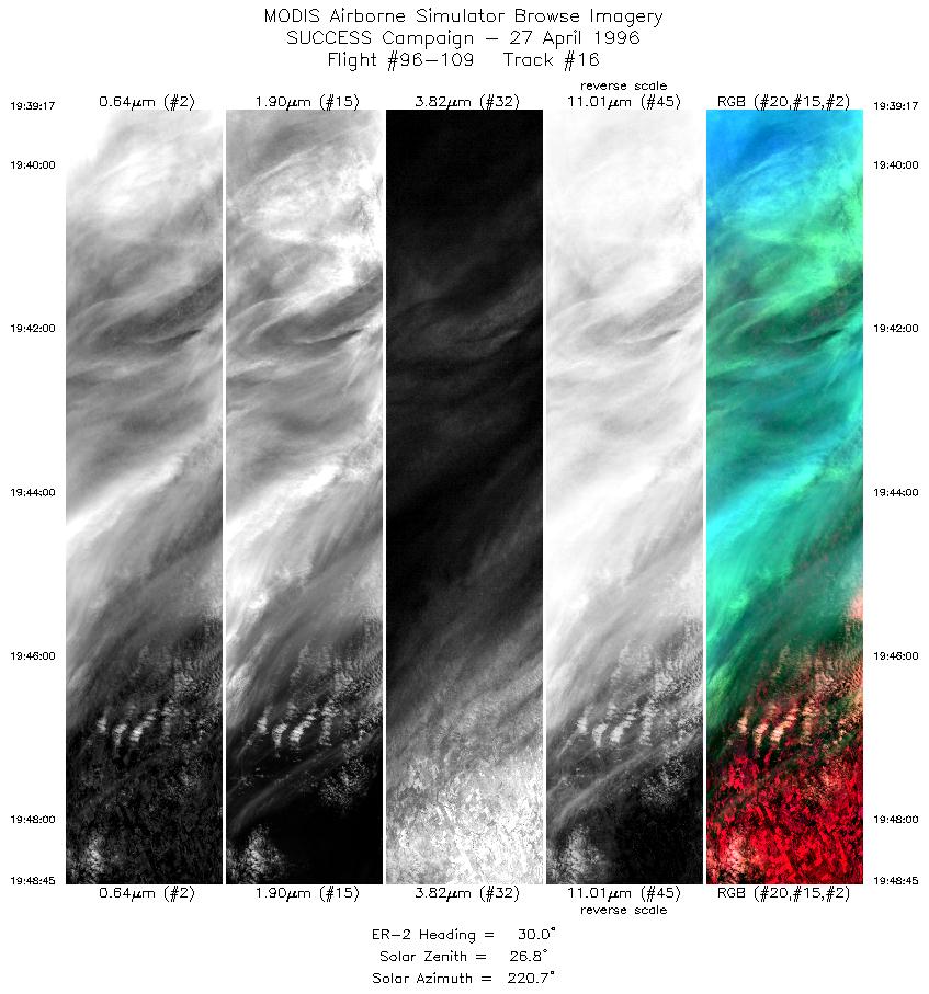
| 16 |
STD |
CIR |
19:39-19:48 |
30 |
35.89-36.80 |
97.98- 97.35 |
3536 |
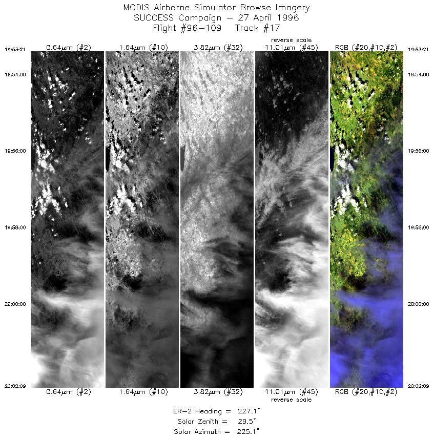
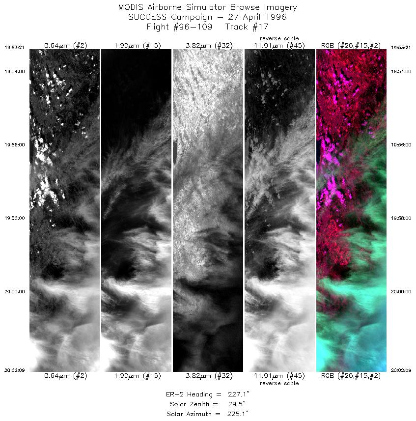
| 17 |
STD |
CIR |
19:53-20:02 |
227 |
36.82-36.15 |
97.76- 98.67 |
3288 |
| 18 |
STD |
CIR |
20:06-20:15 |
54 |
36.06-36.68 |
98.38- 97.36 |
3357 |
| 19 |
STD |
CIR |
20:18-20:26 |
237 |
36.51-36.00 |
97.22- 98.25 |
3213 |
| 20 |
STD |
CIR |
20:30-20:40 |
60 |
36.20-36.79 |
98.36- 97.07 |
3965 |
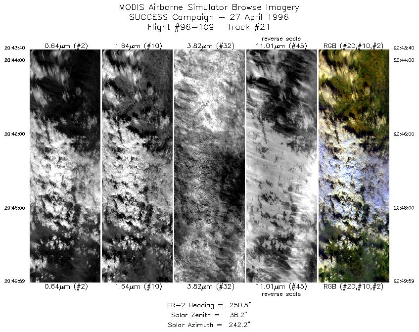
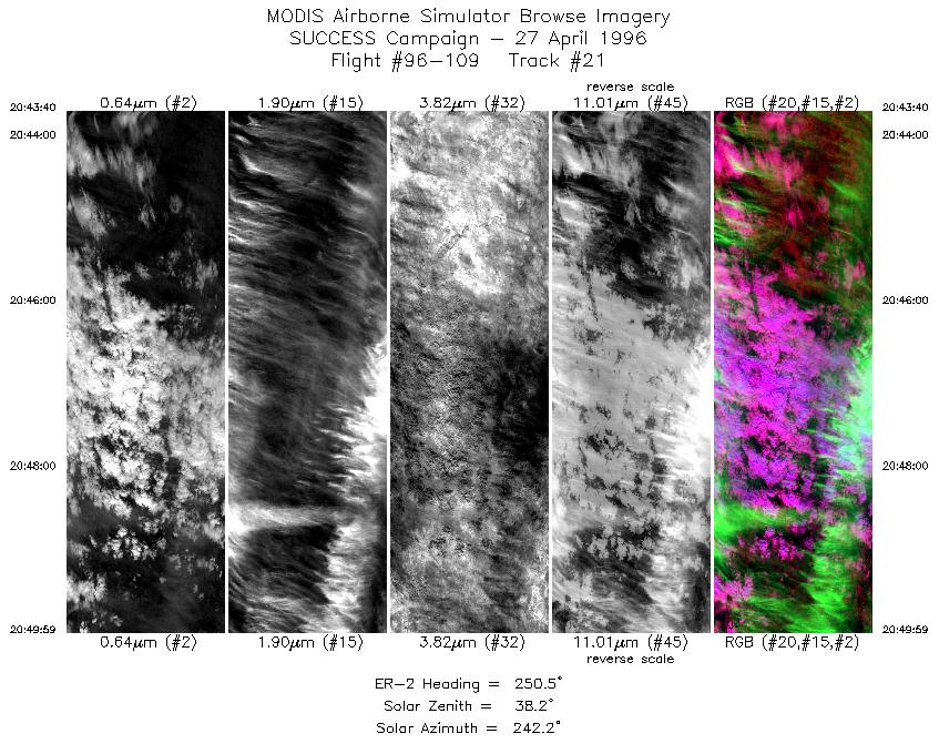
| 21 |
STD |
CIR |
20:43-20:49 |
251 |
36.98-36.76 |
97.19- 98.05 |
2359 |
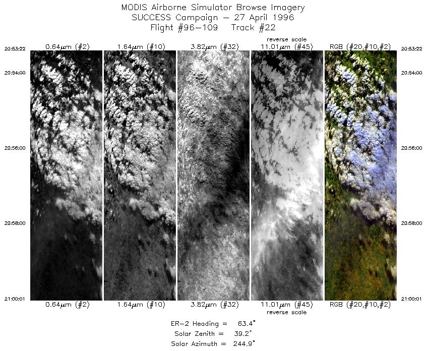
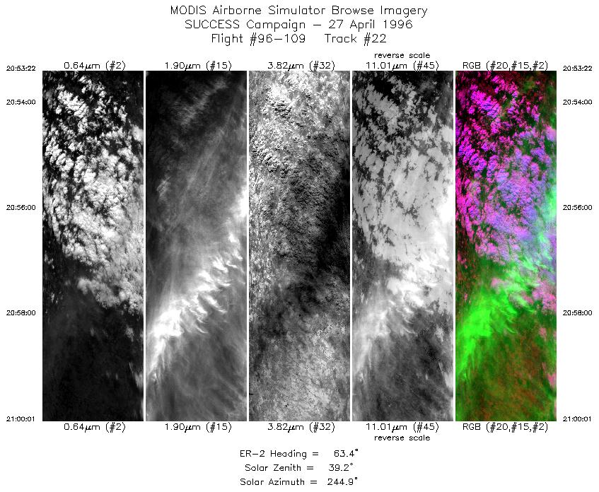
| 22 |
STD |
CIR |
20:53-21:00 |
63 |
36.58-36.92 |
97.93- 97.07 |
2484 |
|
Standard Browse Images 01 through 22 in sequence |
|
Cirrus Detection Browse Images 01 through 22 in sequence |
Level-1B HDF Data Distribution Point
NASA GSFC Earth Sciences (GES) Data Center
NASA DAAC's
Additional Information
The objective of this mission was to
coordinate the ER-2, DC-8 and TC-39 aircraft
over the ARM CART site during time of NOAA-14 satellite satellite
overpass;
observe cirrus and contrails during overpass of the NOAA-14 satellite
to assist in the development of satellite remote sensing techniques.
Also ground-based uplooking and ER-2 based downlooking
were combined for more detailed radiative characterization
of clouds.
Take-off time was 1600 UTC with landing at 2135 UTC. ER-2 flew
to ARM CART site and flew racetrack patterns oriented approximately
10 degrees off the DC-8 orientation and in the opposite direction.
At 1916 UTC ER-2 changed orientation of racetrack to be in the
principle plane of the sun for coordination with the satellite
overpass.
Approximately 20 passes over the ARM CART site including coincident
data with NOAA-14 (ER-2 over CART site at 1946 UTC).
The pilot reported solid overcast conditions over
the ARM CART site until near the end of the mission when clouds
began to break-up north of the site. At 1956 UTC ER-2 passed over
a contrail but pilot wasn't sure if it was generated by the DC-8
or commercial aircraft. Pilot noted that from time to time cirrus
overcast seemed to be casued by commerical acircraft. Pilot observed
contrail remnents during mission.
|
|
|
|
