
|
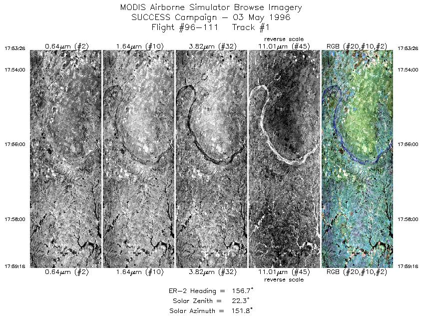
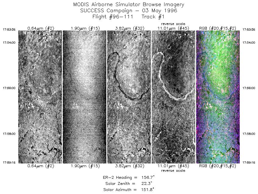
Sample Image

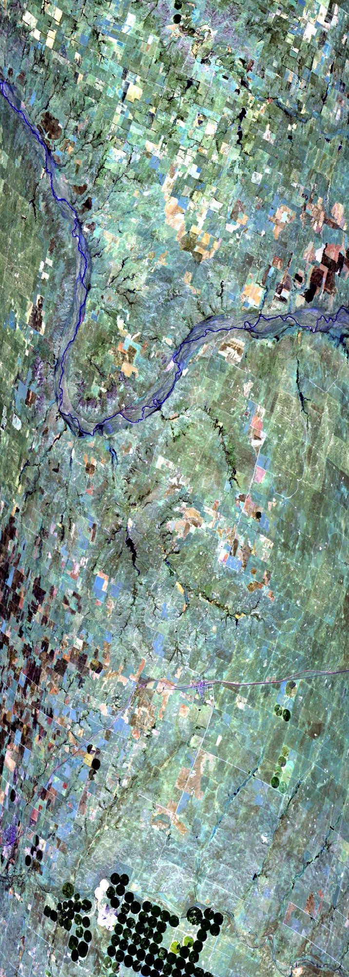
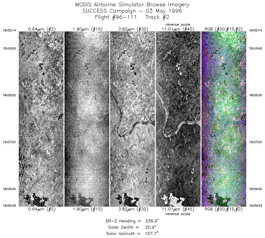
03 May 1996
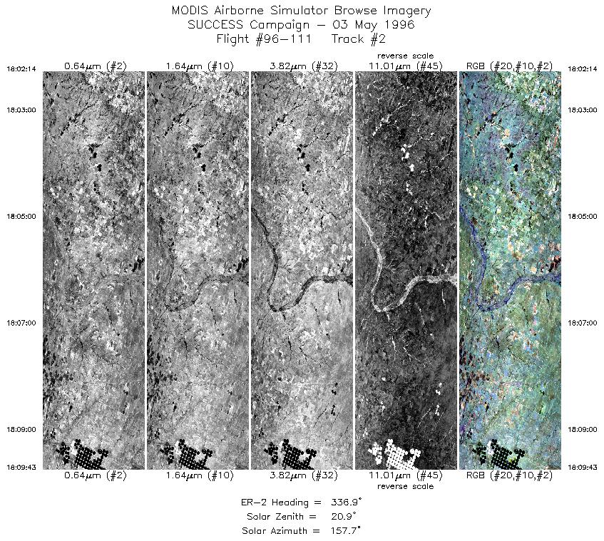
Track #02
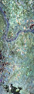

"Canadian River and circular crop fields near Higgins, Texas"
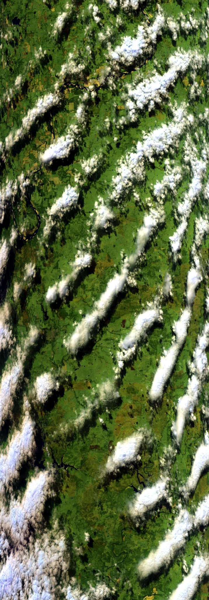
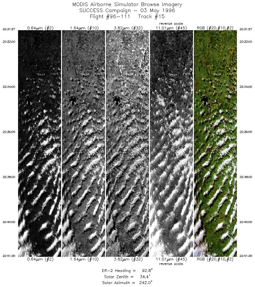
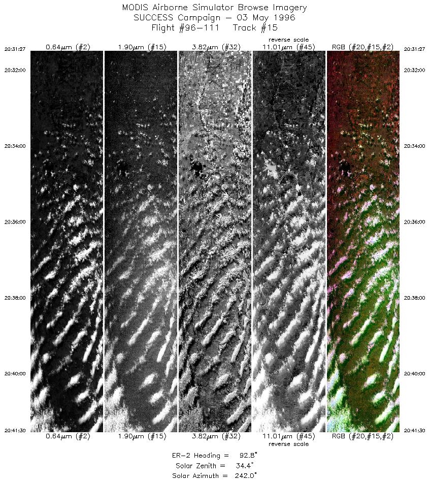
03 May 1996
Track #15

"Roll clouds over the Oklahoma CART site"
R: 2.15 microns
G: 1.65 microns
B: 0.65 microns
|
|
Summary Information
Date: May 03, 1996
ER-2 Flight Number: 96-111
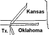
Location: Oklahoma CART Site, Kansas, Texas
Principle Investigator: Dr. Brian Toon (NASA Ames)
Additional Sensors: B&W_6"_RC-10, MIR, CLS, RAMS, HIS
Level-1B Processing Information
Level-1B Data Version: #10
Calibration Type: Final
Calibration Version: SUCCESS_Ames 1.0
Temperature Adjustment: No
Status: Final Calibration Done
|
|
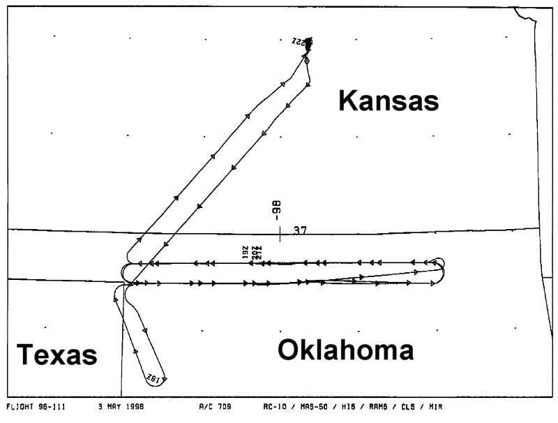
Flight Track Map

|
Level-1B Browse Imagery
Straight Line Flight Tracks: 17
Scanlines Processed: 65167
Solar Azimuth and Zenith Angles
|
Browse Images
|
Click on the Flight Track number to load images.
Lat/Lon ranges are for the BEG-END scanline nadir pixels.
|
Flight
Track |
Standard
Image |
Cirrus
Image |
Time_Span
(GMT) |
Heading
(Deg) |
Lat_Range
(Deg_N) |
Lon_Range
(Deg_W) |
Length
(Scanlines) |
| 1 |
STD |
CIR |
17:53-17:59 |
157 |
36.14-35.56 |
99.80- 99.47 |
2180 |
| 2 |
STD |
CIR |
18:02-18:09 |
337 |
35.50-36.29 |
99.70-100.10 |
2797 |
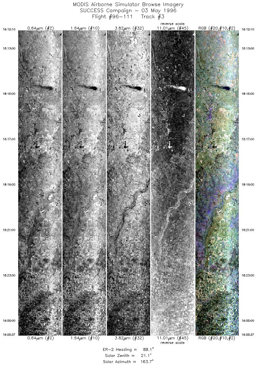
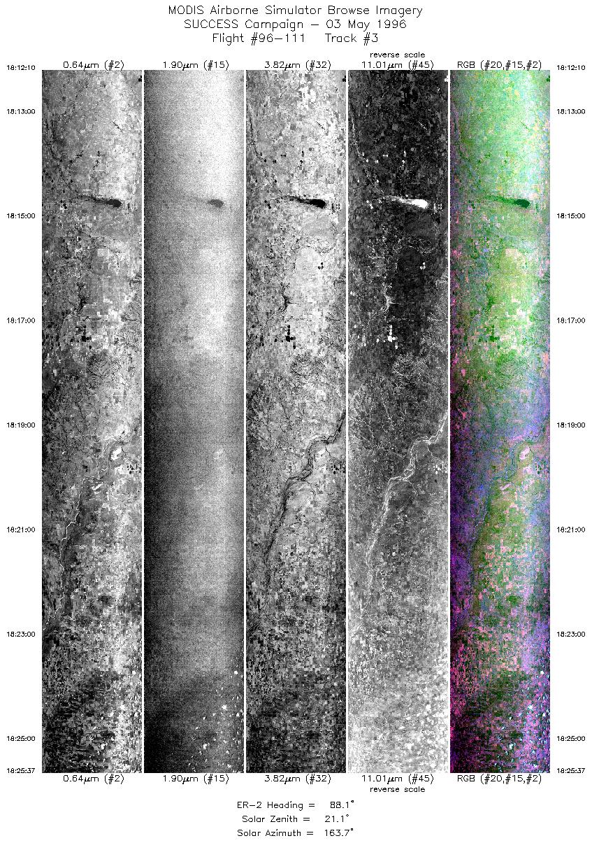
| 3 |
STD |
CIR |
18:12-18:25 |
88 |
36.48-36.50 |
99.93- 98.03 |
5027 |
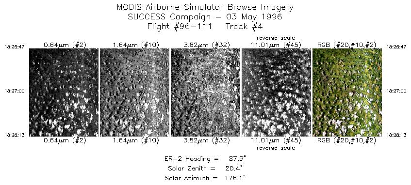
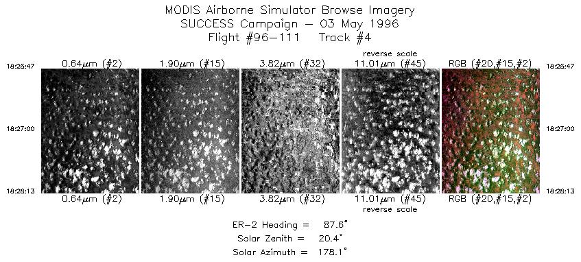
| 4 |
STD |
CIR |
18:25-18:28 |
88 |
36.49-36.51 |
98.01- 97.67 |
910 |
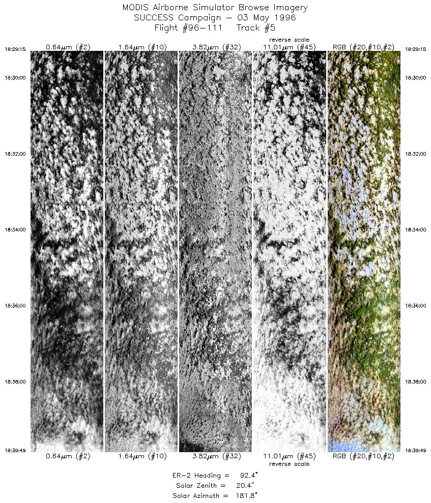
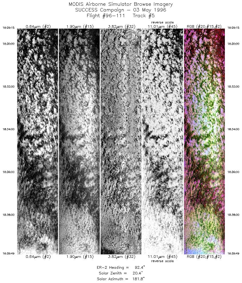
| 5 |
STD |
CIR |
18:29-18:39 |
92 |
36.50-36.48 |
97.53- 96.04 |
3948 |
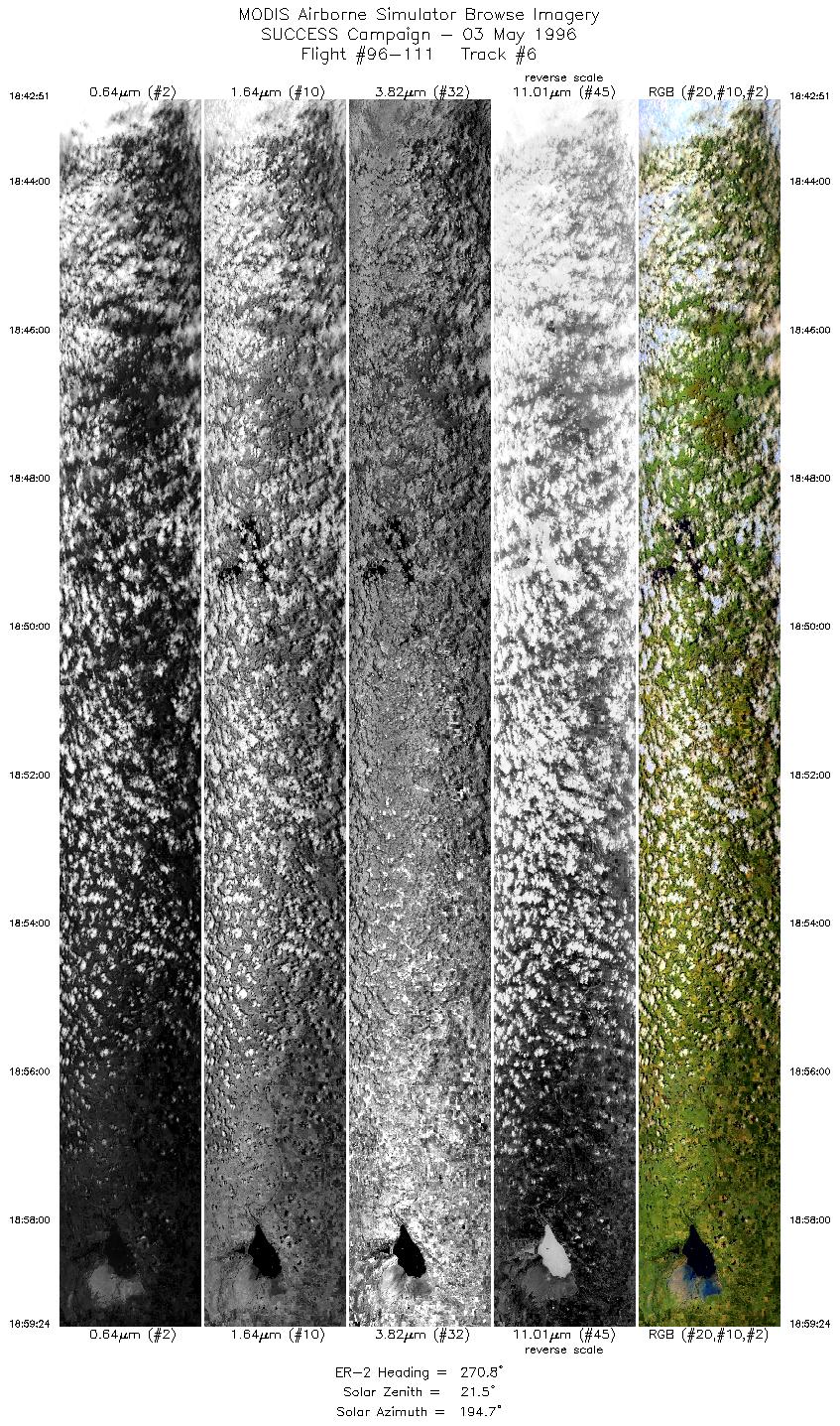
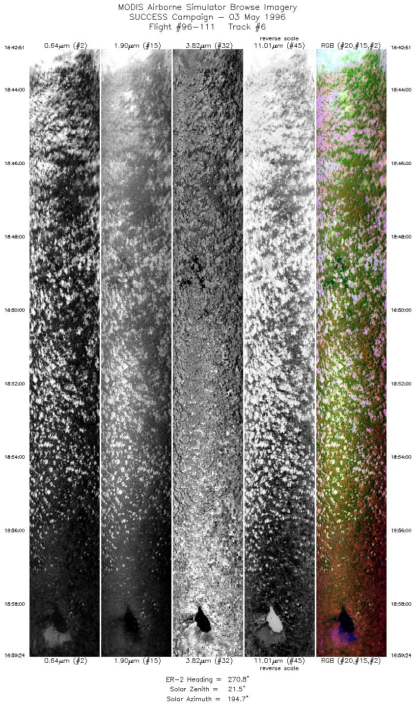
| 6 |
STD |
CIR |
18:42-18:59 |
271 |
36.70-36.71 |
96.02- 98.33 |
6184 |
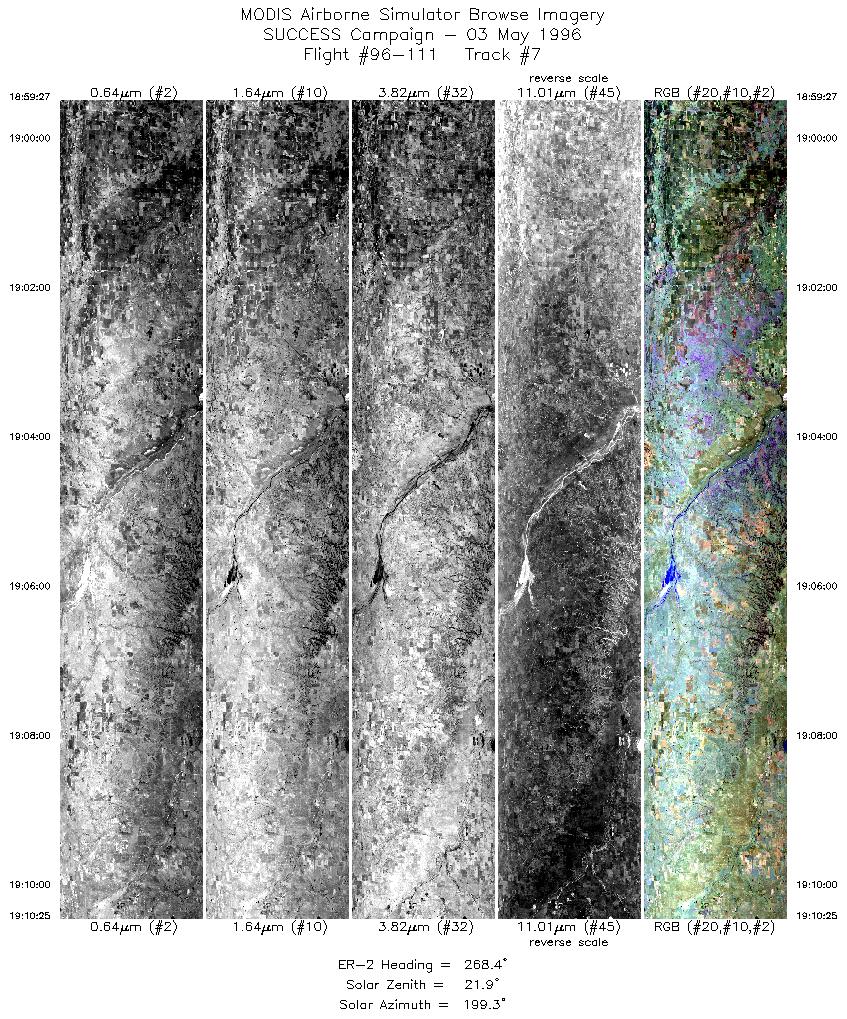
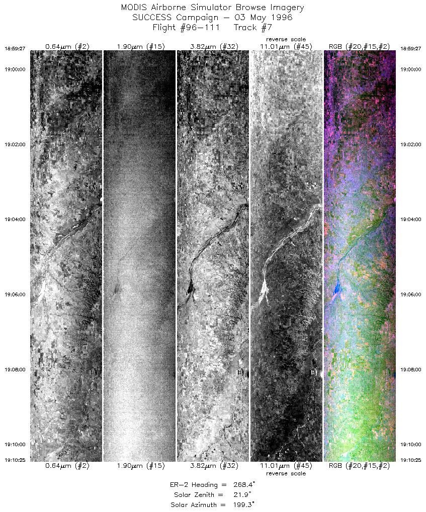
| 7 |
STD |
CIR |
18:59-19:10 |
268 |
36.71-36.68 |
98.33- 99.90 |
4098 |
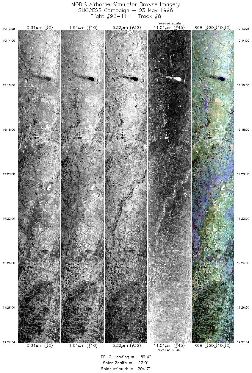
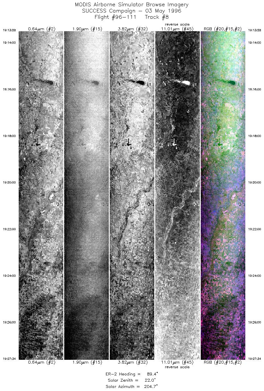
| 8 |
STD |
CIR |
19:13-19:27 |
89 |
36.49-36.50 |
99.88- 97.92 |
5267 |
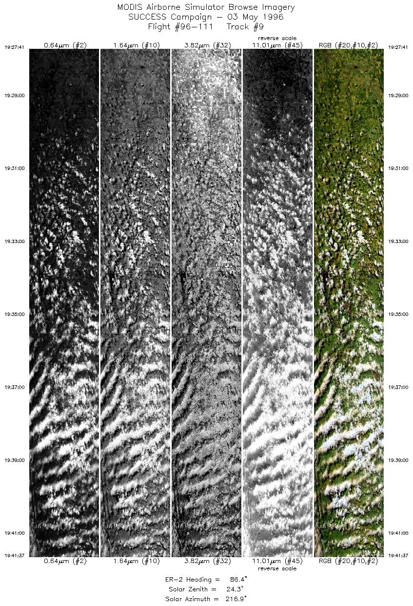
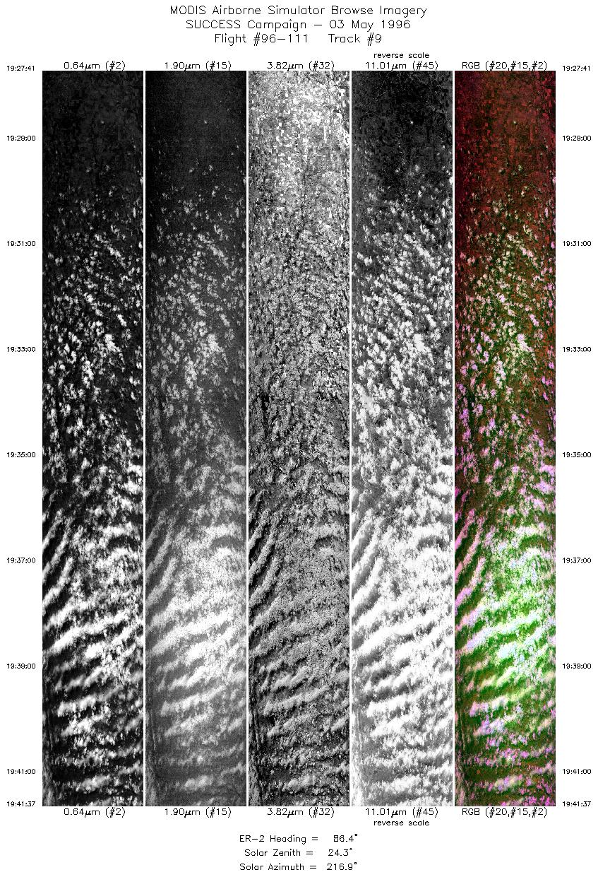
| 9 |
STD |
CIR |
19:27-19:41 |
86 |
36.49-36.62 |
97.91- 95.96 |
5205 |
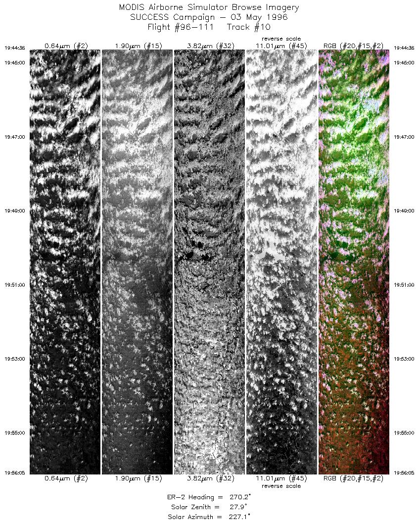
| 10 |
STD |
CIR |
19:44-19:56 |
270 |
36.70-36.71 |
96.13- 97.73 |
4291 |
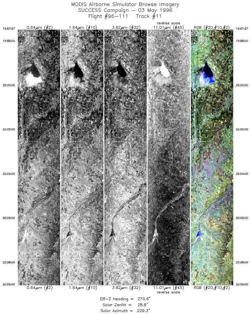
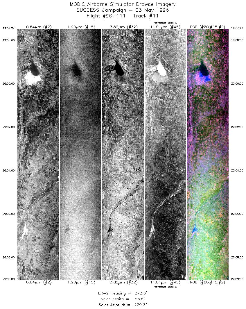
| 11 |
STD |
CIR |
19:57-20:09 |
271 |
36.70-36.69 |
97.93- 99.58 |
4315 |
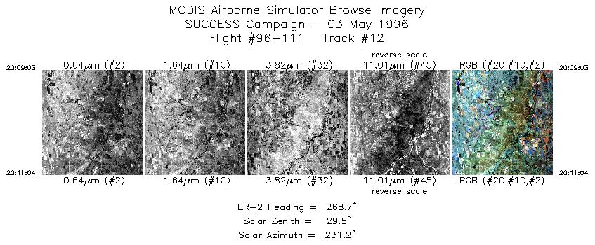
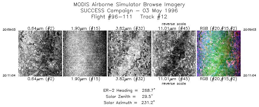
| 12 |
STD |
CIR |
20:09-20:11 |
269 |
36.69-36.68 |
99.59- 99.88 |
754 |
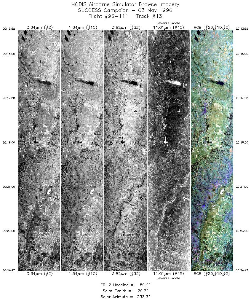
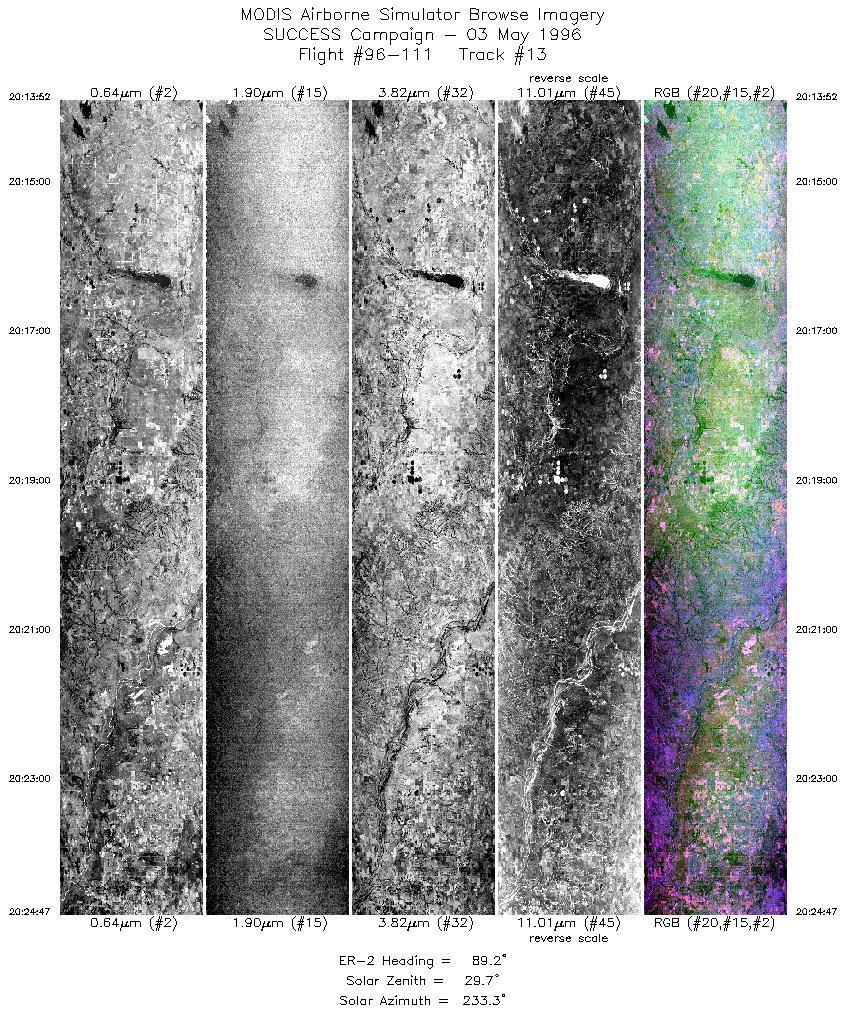
| 13 |
STD |
CIR |
20:13-20:24 |
89 |
36.48-36.50 |
99.91- 98.39 |
4078 |
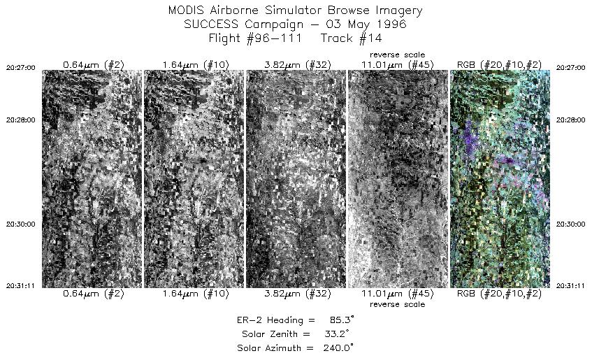
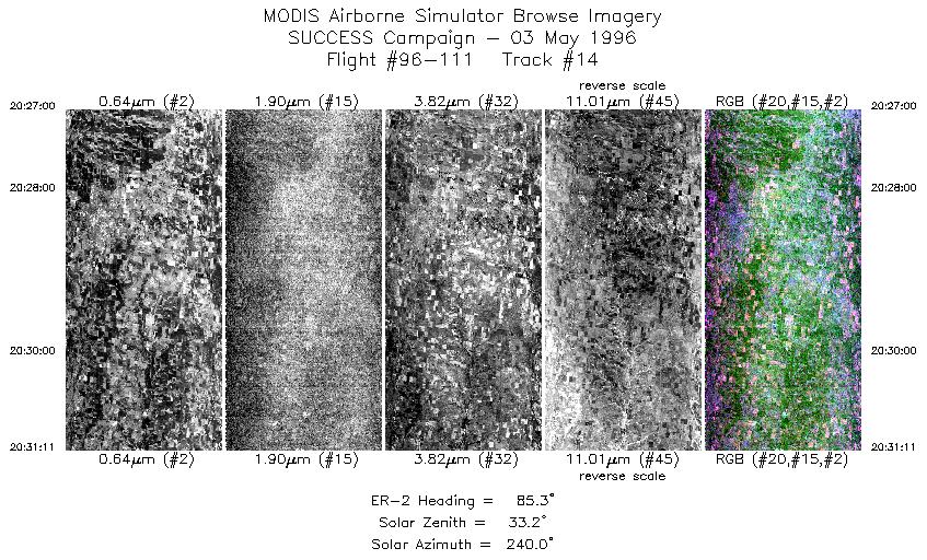
| 14 |
STD |
CIR |
20:27-20:31 |
85 |
36.49-36.53 |
98.08- 97.50 |
1563 |
| 15 |
STD |
CIR |
20:31-20:41 |
93 |
36.53-36.48 |
97.46- 96.04 |
3755 |
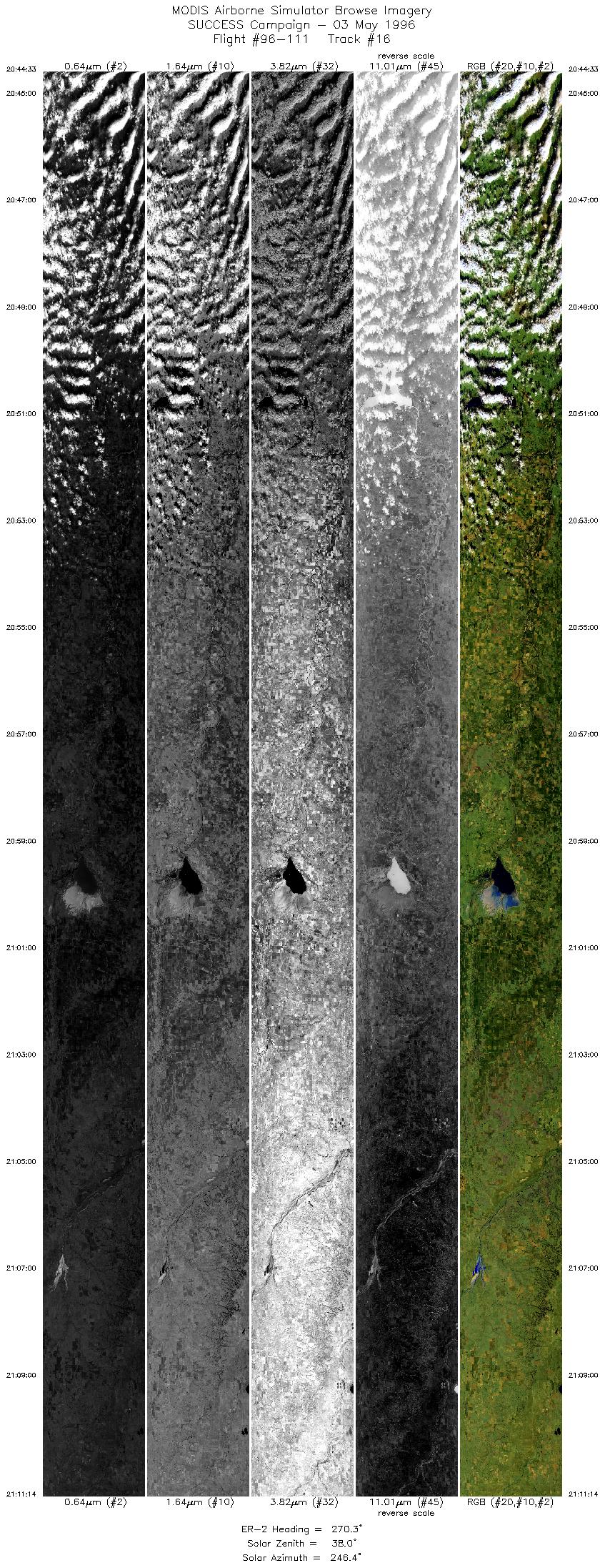
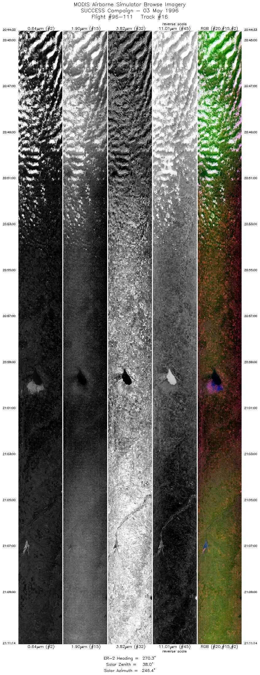
| 16 |
STD |
CIR |
20:44-21:11 |
270 |
36.71-36.69 |
96.03- 99.86 |
9967 |
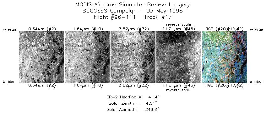
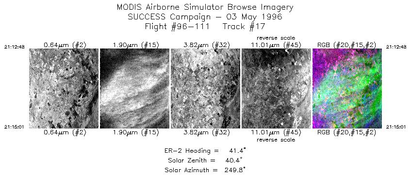
| 17 |
STD |
CIR |
21:12-21:15 |
41 |
36.81-37.00 |
99.95- 99.74 |
828 |
|
Standard Browse Images 01 through 17 in sequence |
|
Cirrus Detection Browse Images 01 through 17 in sequence |
Level-1B HDF Data Distribution Point
NASA GSFC Earth Sciences (GES) Data Center
NASA DAAC's
Additional Information
The objective of this mission was to observe
Boeing 757 contrails; and to determine
coupling between radiative and microphysical properties of clouds.
The DC-8 and B-757 flew an E-W racetrack in Oklahoma near the ARM
CART site. The tracks were 30 minutes long with a 20 mile separation.
Ther ER-2 flew the same track but in the opposite direction of
the DC-8. One flight track was flown in the solar plane at the
beginning of the mission. Most of the E-W track was cloud free.
There may have been short non-persitent contrails generated by
the 757 and DC-8. On the eastern side of the racetrack there was
some broken to solid low stratus clouds.
The NOAA-14 satellite made its overpass at 2025 UTC.
|
|
|
|