


MODIS Airborne Simulator (MAS)
CAMPAIGN SUMMARY INFORMATION
|
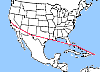
Smoke, Clouds, and Radiation - Brazil Dates: 13 August - 11 September 1995 Location: Central Brazil Principal Investigators: Dr. Yoram Kaufman (NASA GSFC) Additional Sensors: AVIRIS & CLS Objective: Characterize the the relationship between sulfate particles and cloud reflective properties. Study the impact of biomass burning and urban/industrial aerosol on the atmosphere and climate by measuring the properties of urban and industrial pollution dominated by sulfate particles. |
|||||||||||||||||||||||||||||
|
Processing Information Flights Processed: 12 of 12 Total Flight Tracks: Total Scanlines: Level-1B Version: #9 Calibration Type: Final Calibration Version: SCAR-B_King 1.0 Temperature Adjustment: 24C Status: Level-1B Data in HDF format is available. Noted Irregularities |

|
||||||||||||||||||||||||||||
|
Spectral Information Spectral Band Configuration Spectral Response Function Table |
|||||||||||||||||||||||||||||
|
Level-1B Data Distribution Langley Research Center (LaRC) Level 1 / Atmosphere Archive and Distribution System (LAADS) NASA Distributive Active Archive Centers (DAACs) |
|||||||||||||||||||||||||||||
|
|||||||||||||||||||||||||||||
|
Related Web Sites Official SCAR-B Home Page AVIRIS Home Page CLS Home Page NASA Airborne Science Program |
|||||||||||||||||||||||||||||
Noted Irregularities
|
|||||||||||||||||||||||||||||
 Flight: 95-158
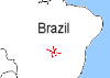 Flight: 95-160
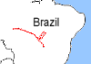 Flight: 95-161
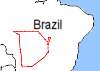 Flight: 95-162
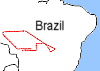 Flight: 95-163
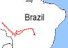 Flight: 95-164
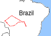 Flight: 95-165
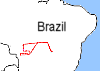 Flight: 95-166
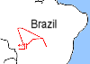 Flight: 95-167
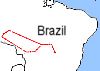 Flight: 95-168
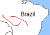 Flight: 95-169
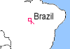 Flight: 95-170
SCAR-B


| Sample Imagery |
| Click image for full resolution |
|
Flight: 95-163, Track #17 Central Brazil |


|
|
R: 2.14µm G: 1.62µm B: 0.55µm |
- NASA Official: Matt Fladeland
- Project Manager: James Jacobson
- Website Editor: Eric Fraim
- Last Updated: March 21, 2024


