
|
Sample Image

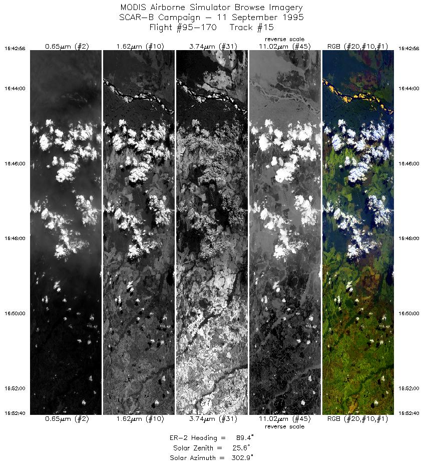
11 September 1995
Track #15
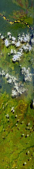

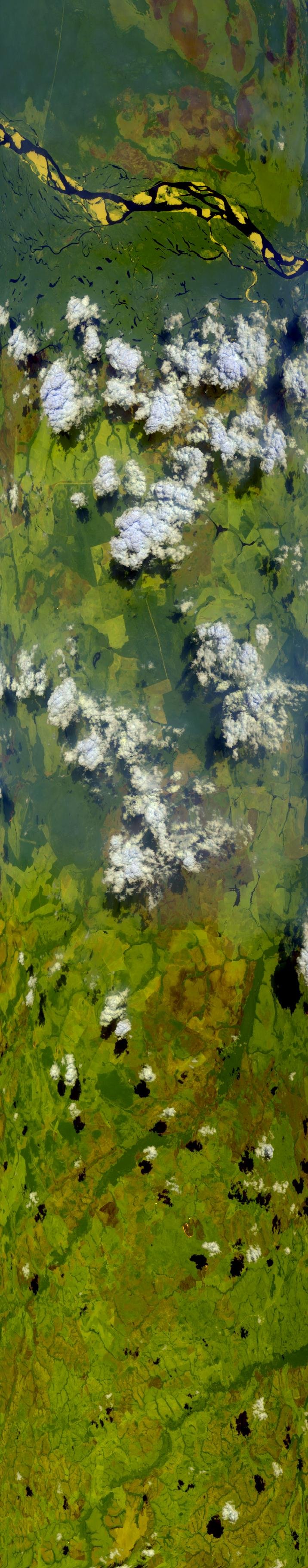
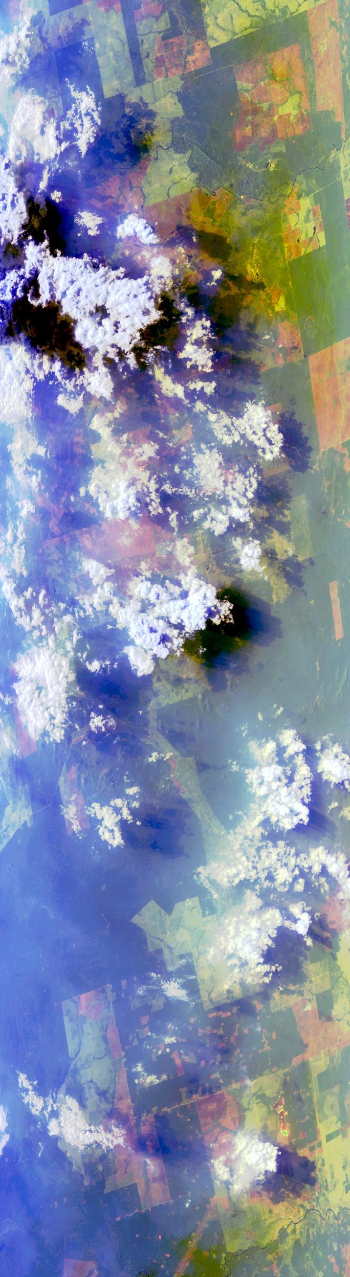
"Convective clouds near
Miracema do Tocantins, Brazil"
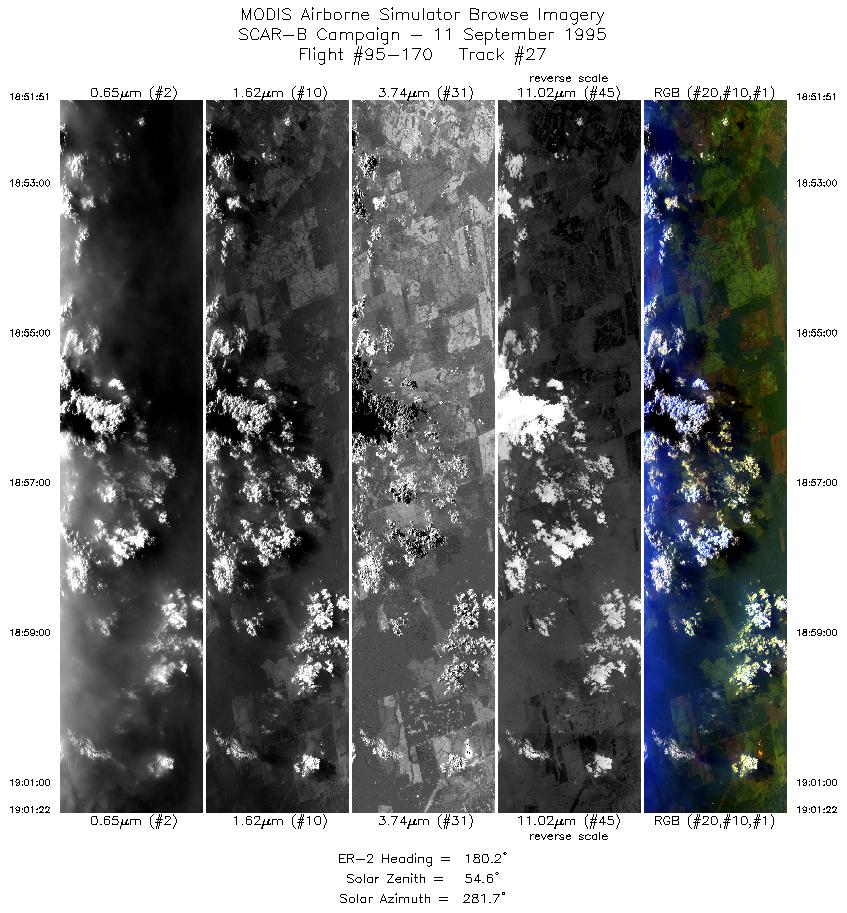
11 September 1995
Track #27
"Biomass burning and smoke near Araguacema, Brazil"
R: 2.14 microns
G: 1.62 microns
B: 0.55 microns
|
|
Summary Information
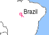
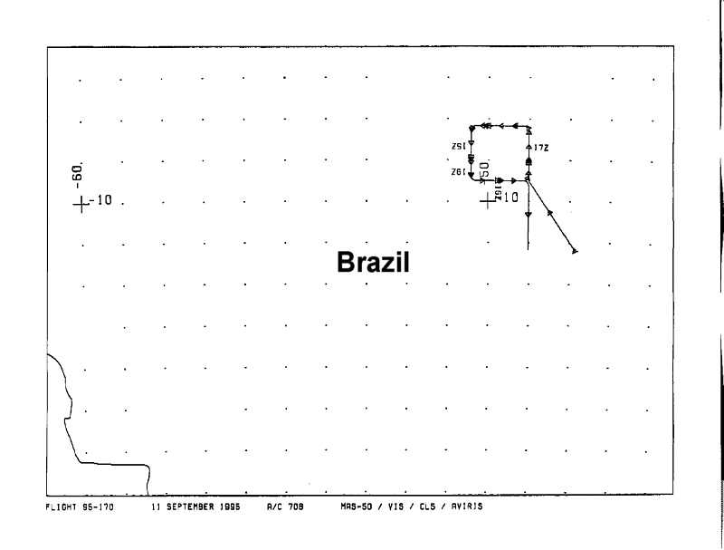
Date: September 11, 1995
ER-2 Flight Number: 95-170
Location: Central Brazil
Principle Investigator: Yorum Kaufman
Additional Sensors: VIS,CLS,AVIRIS
Level-1B Processing Information
Level-1B Data Version: #09
Calibration Type: Final
Calibration Version: SCAR-B_King 1.0
Temperature Adjustment: Yes (24C)
Status: Done!
|
|
Flight Track Map

|
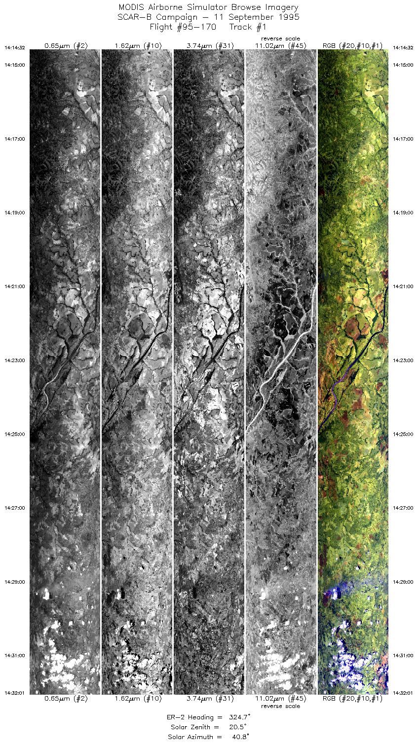
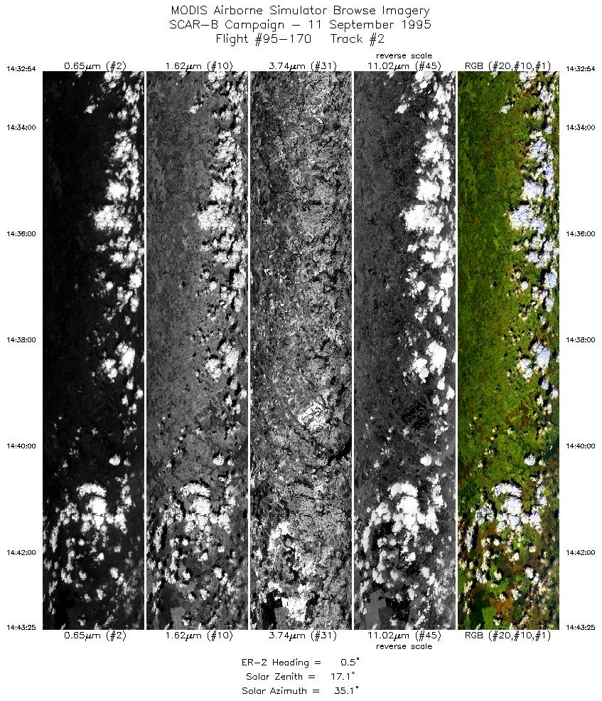
Level-1B Browse Imagery
Straight Line Flight Tracks: 30
Scanlines Processed: 99425
Solar Zenith and Azimuth Angles
|
Browse Images
|
Click on the Flight Track number to load images.
Lat/Lon ranges are for the BEG-END scanline nadir pixels.
|
Flight
Track |
Time_Span
(GMT) |
Heading
(Deg) |
Lat_Range
(Deg_S) |
Lon_Range
(Deg_W) |
Length
(Scanlines) |
Altitude
(Meters) |
| 1 |
14:14-14:32 |
325 |
11.14-9.53 |
47.87-48.98 |
6541 |
~20000 |
| 2 |
14:32-14:43 |
1 |
9.44-8.28 |
49.00-49.00 |
3929 |
~20000 |
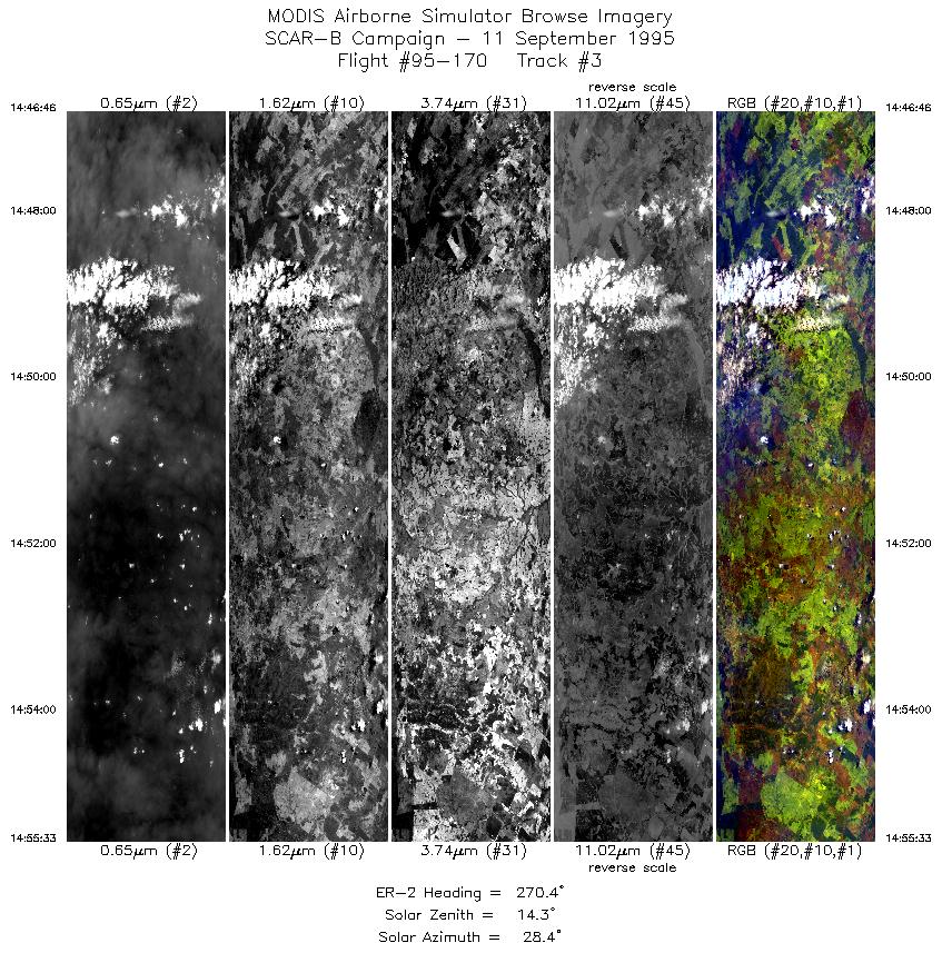
| 3 |
14:46-14:55 |
270 |
8.17-8.17 |
49.32-50.30 |
3289 |
~20000 |
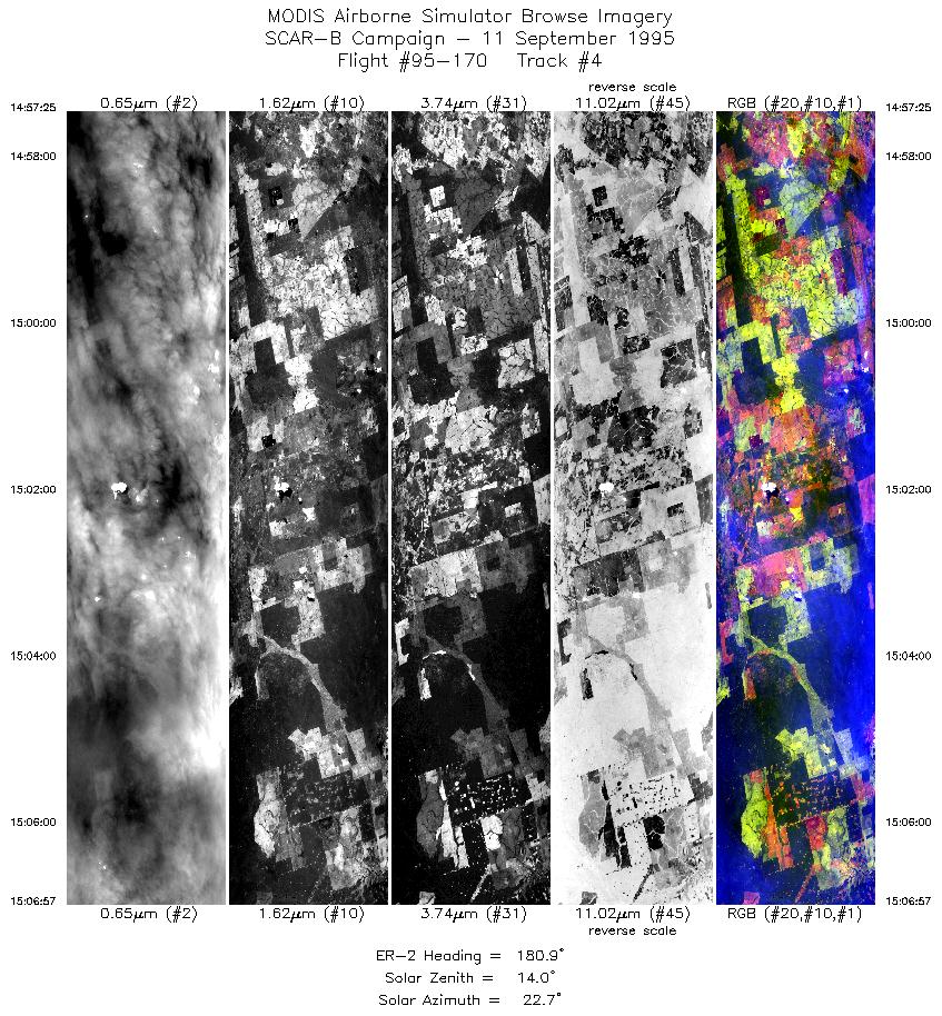
| 4 |
14:57-15:06 |
181 |
8.31-9.38 |
50.41-50.42 |
3572 |
~20000 |
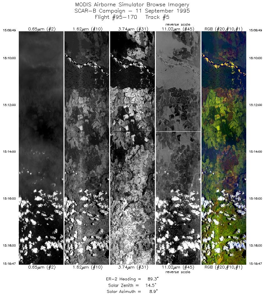
| 5 |
15:08-15:18 |
89 |
9.50-9.50 |
50.27-49.12 |
3730 |
~20000 |
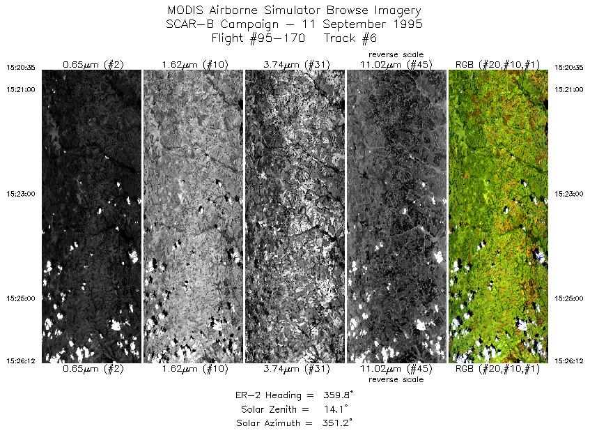
| 6 |
15:20-15:26 |
360 |
9.36-8.73 |
49.00-49.00 |
2106 |
~20000 |
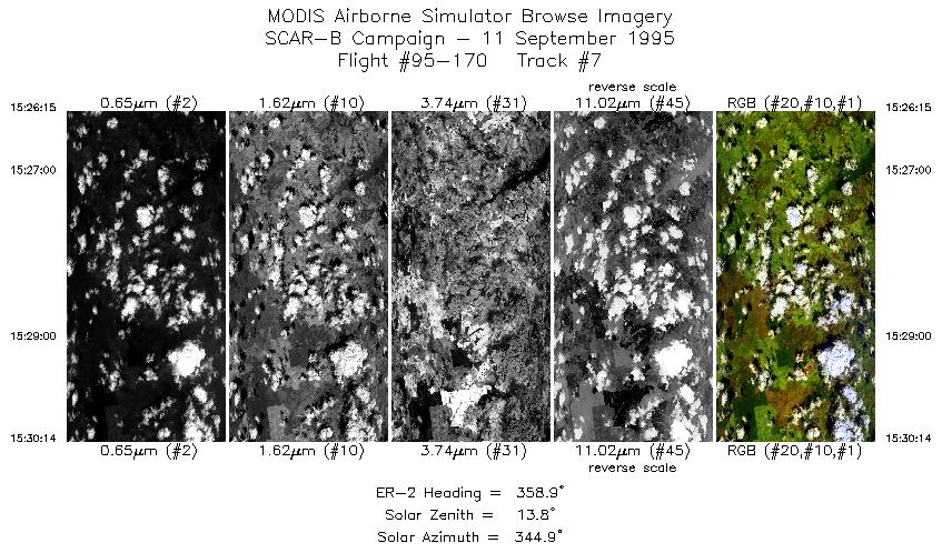
| 7 |
15:26-15:30 |
359 |
8.73-8.28 |
49.00-49.00 |
1493 |
~20000 |
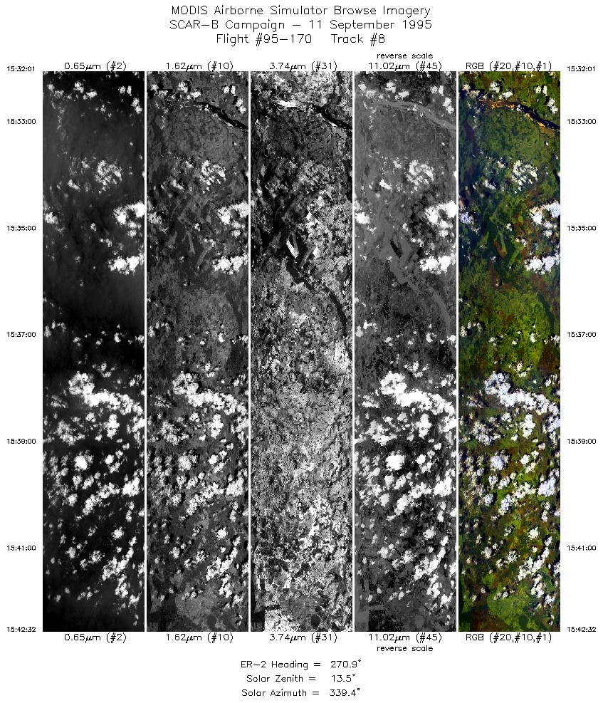
| 8 |
15:32-15:42 |
271 |
8.17-8.17 |
49.14-50.30 |
3935 |
~20000 |
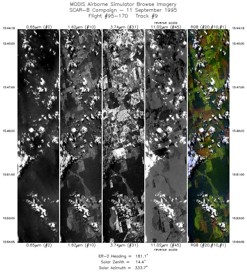
| 9 |
15:44-15:54 |
181 |
8.30-9.38 |
50.41-50.42 |
3666 |
~20000 |
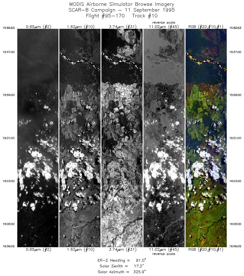
| 10 |
15:55-16:06 |
91 |
9.50-9.50 |
50.28-49.12 |
3790 |
~20000 |
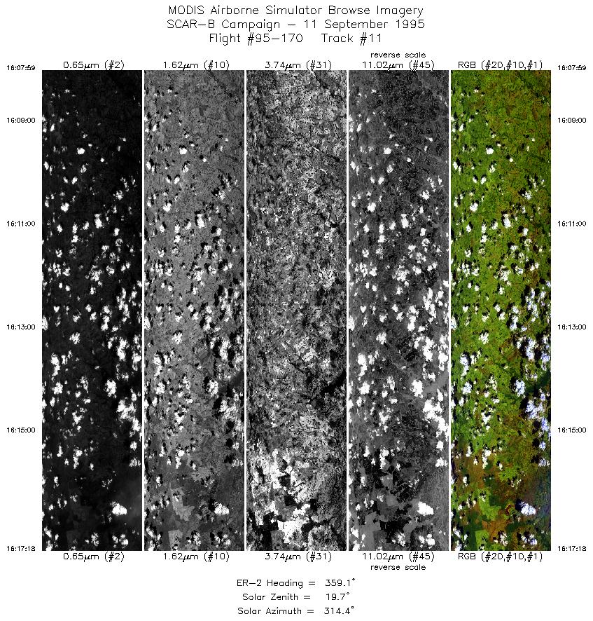
| 11 |
16:07-16:17 |
359 |
9.34-8.29 |
49.00-49.00 |
3430 |
~20000 |
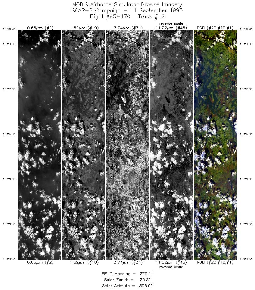
| 12 |
16:19-16:29 |
270 |
8.17-8.17 |
49.16-50.30 |
3821 |
~20000 |
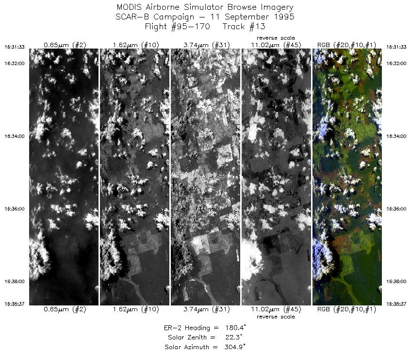
| 13 |
16:31-16:38 |
180 |
8.32-9.12 |
50.42-50.42 |
2645 |
~20000 |
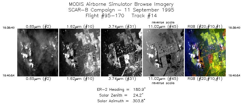
| 14 |
16:38-16:40 |
181 |
9.12-9.38 |
50.42-50.42 |
836 |
~20000 |
| 15 |
16:42-16:52 |
89 |
9.50-9.50 |
50.25-49.12 |
3643 |
~20000 |
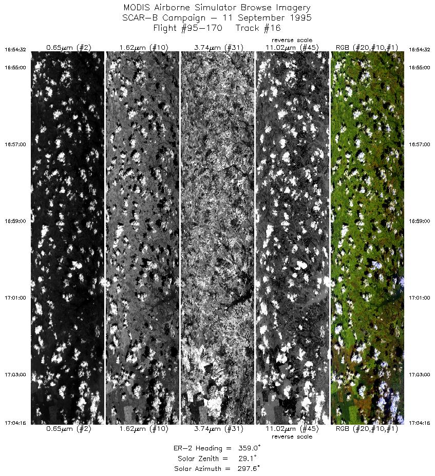
| 16 |
16:54-17:04 |
359 |
9.35-8.28 |
49.00-49.00 |
3641 |
~20000 |
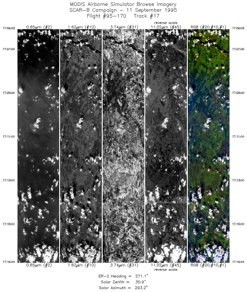
| 17 |
17:06-17:16 |
271 |
8.17-8.17 |
49.14-50.31 |
4005 |
~20000 |
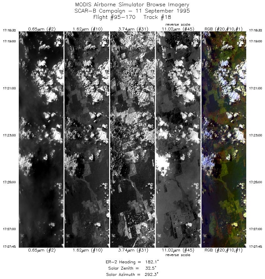
| 18 |
17:18-17:27 |
182 |
8.31-9.38 |
50.41-50.42 |
3451 |
~20000 |
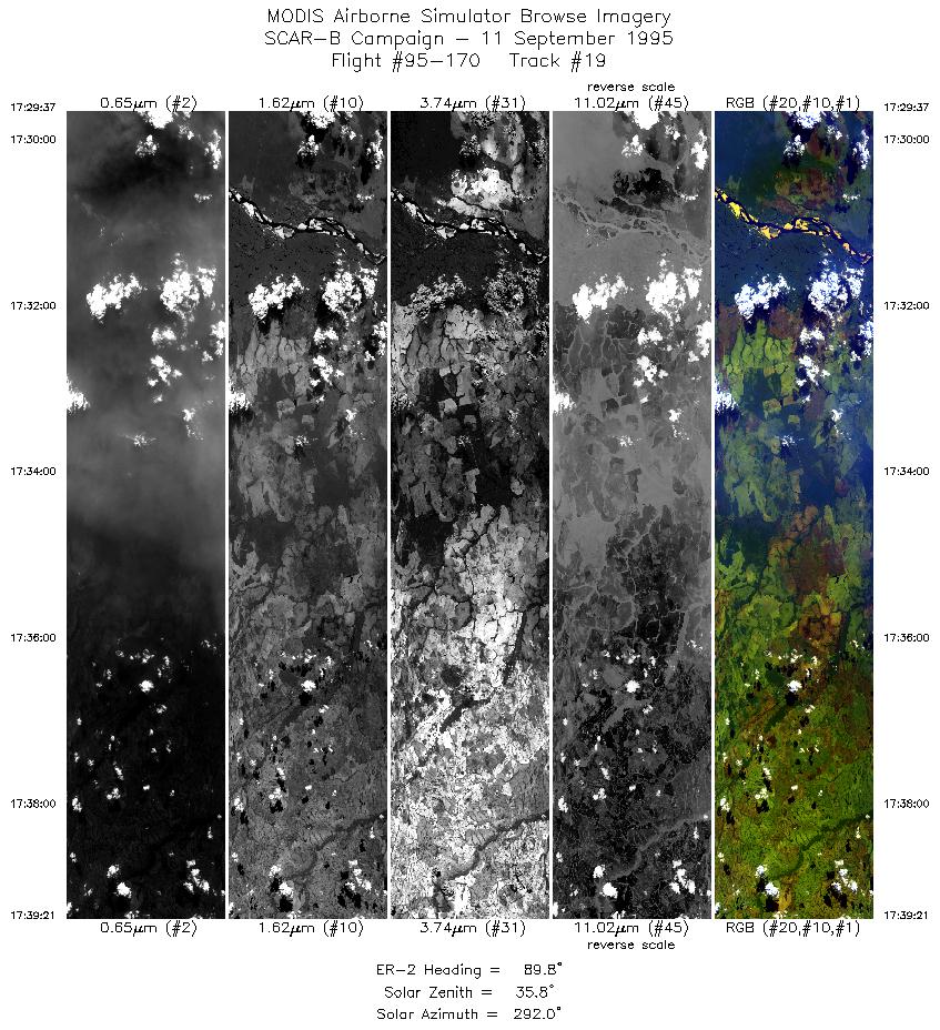
| 19 |
17:29-17:39 |
90 |
9.50-9.50 |
50.27-49.13 |
3641 |
~20000 |
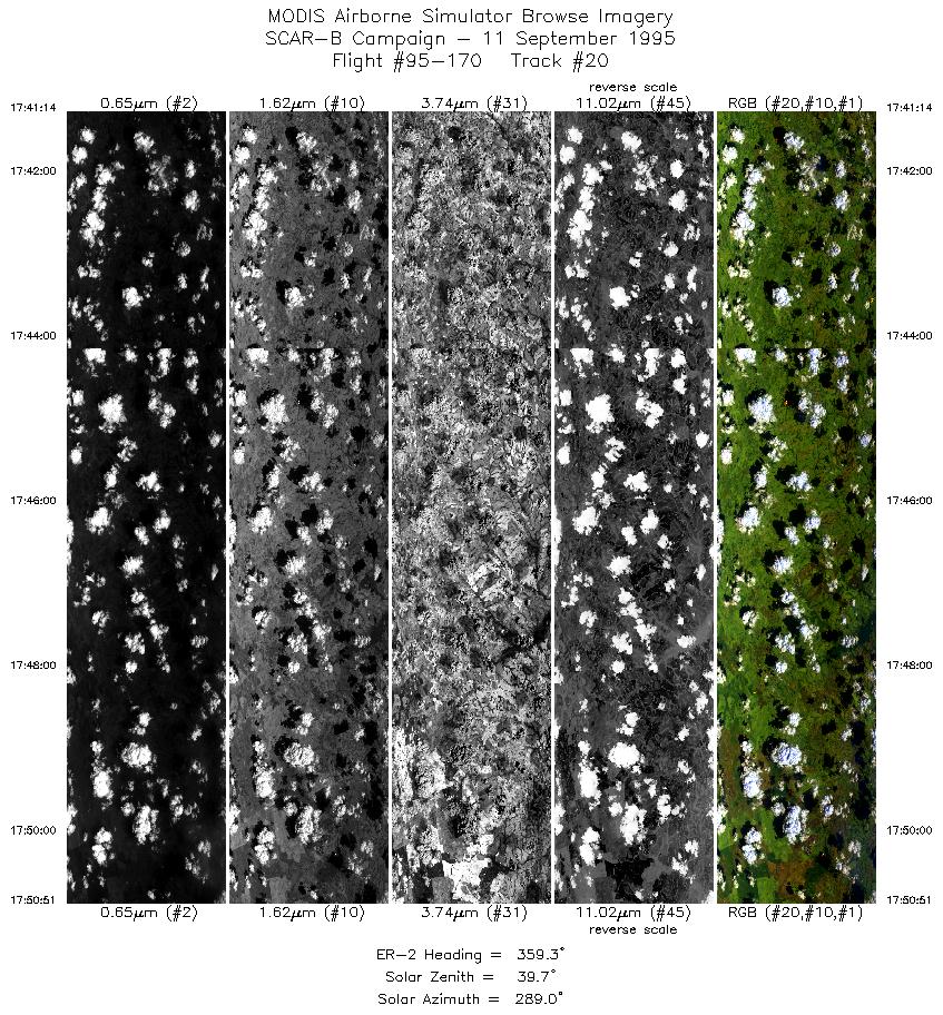
| 20 |
17:41-17:50 |
359 |
9.35-8.30 |
49.00-49.00 |
3562 |
~20000 |
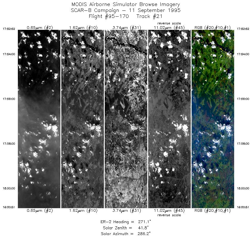
| 21 |
17:52-18:00 |
271 |
8.17-8.17 |
49.14-50.01 |
2992 |
~20000 |
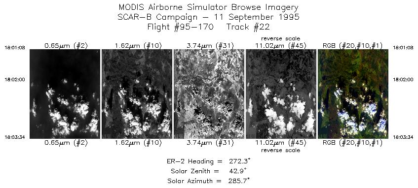
| 22 |
18:01-18:03 |
272 |
8.17-8.17 |
50.04-50.31 |
913 |
~20000 |
| 23 |
18:05-18:14 |
181 |
8.31-9.38 |
50.42-50.42 |
3423 |
~20000 |
| 24 |
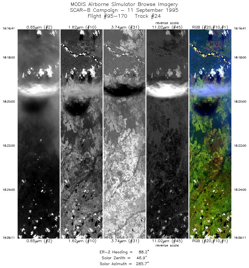
18:16-18:26 |
88 |
9.50-9.50 |
50.24-49.12 |
3561 |
~20000 |
| 25 |
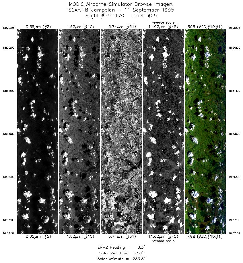
18:28-18:37 |
0 |
9.36-8.29 |
49.00-49.00 |
3574 |
~20000 |
| 26 |
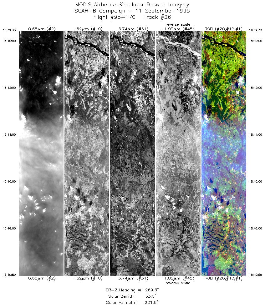
18:39-18:49 |
269 |
8.17-8.17 |
49.15-50.30 |
3912 |
~20000 |
| 27 |
18:51-19:01 |
180 |
8.31-9.38 |
50.42-50.42 |
3569 |
~20000 |
| 28 |
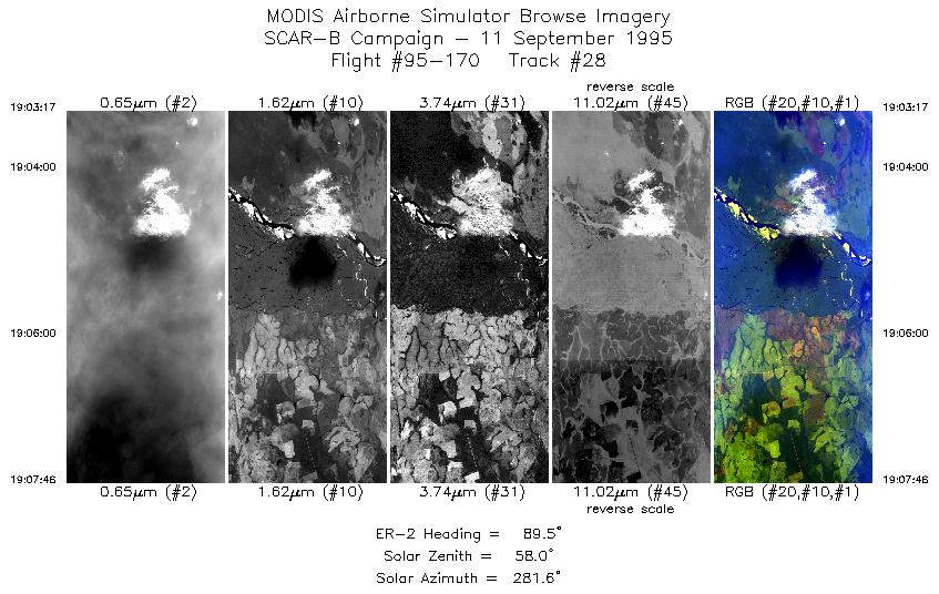
19:03-19:07 |
90 |
9.50-9.50 |
50.27-49.75 |
1681 |
~20000 |
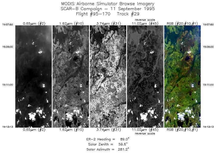
| 29 |
19:07-19:13 |
89 |
9.50-9.50 |
49.74-49.12 |
2019 |
~20000 |
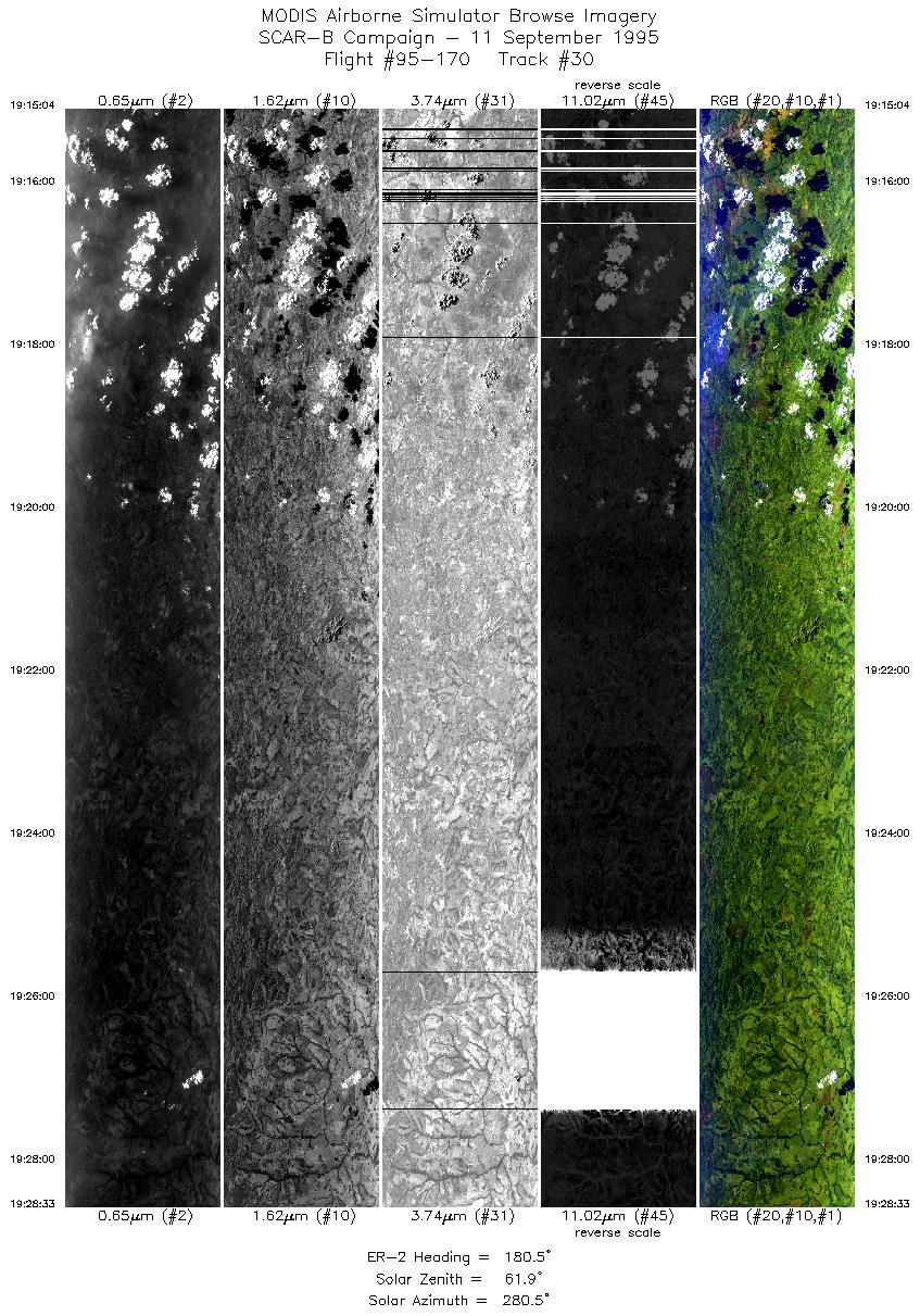
| 30 |
19:15-19:28 |
180 |
9.64-11.16 |
49.00-49.00 |
5055 |
~20000 |
| Images 01 through 30 in sequence |
Level-1B HDF Data Acquisition
Order Form (NASA LaRC Atmospheric Sciences Data Center)
Additional Information
The objective of this flight was to study the diurnal cycle of fires and
their emission of smoke; to measure the properties of clouds embedded in
various smoke concentrations with uniform meteorological conditions; and
to provide data for testing of remote sensing of smoke over water.
The pilot reported various amounts of smoke and clouds, with more smoke
to the north. The aircraft cycled through numerous perpendicular flight legs in a
predetermined "box". The box crossed, in two places, a 5km wide river.
The box was selected based on GOES observations of the fire belt
and observations from the Bandeirante the day before.
|
|
|
|