
|
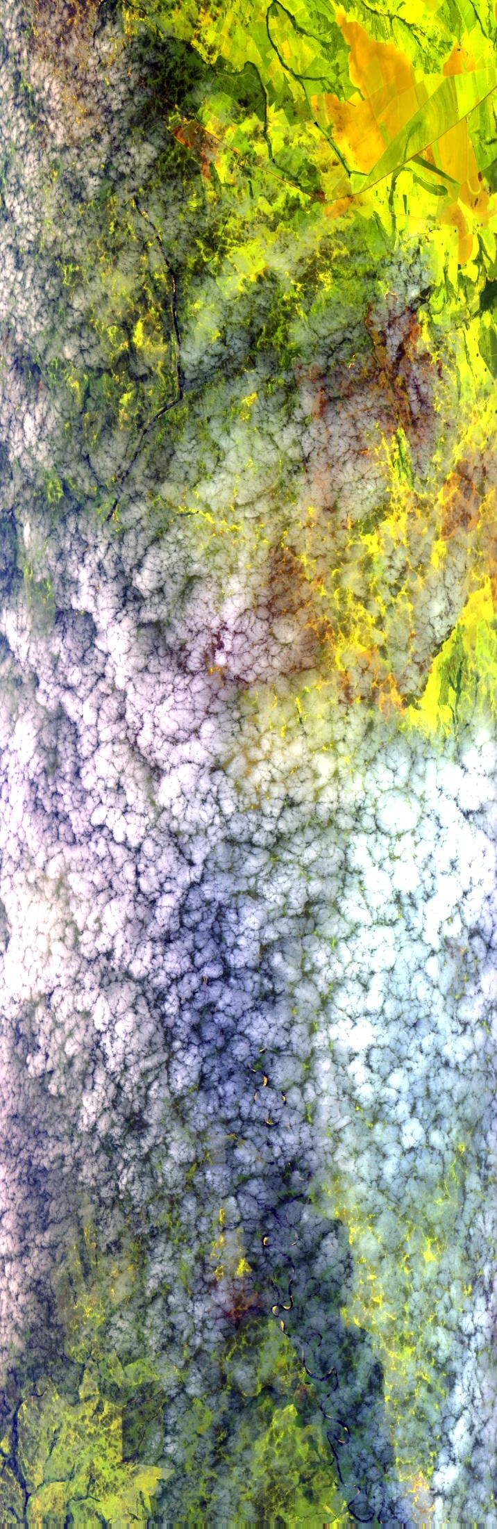
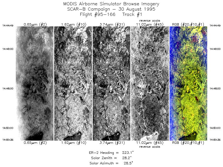
Sample Image

30 August 1995
Track #02


"Altocumulus clouds over agricultural areas east of Cuiaba, Brazil"
R: 2.14 microns
G: 1.62 microns
B: 0.55 microns
|
|
Summary Information
Date: August 30, 1995
ER-2 Flight Number: 95-166
Location: Central Brazil
Principle Investigator: Yorum Kaufman
Additional Sensors: VIS,CLS,AVIRIS
Level-1B Processing Information
Level-1B Data Version: #09
Calibration Type: Final
Calibration Version: SCAR-B_King 1.0
Temperature Adjustment: Yes (24C)
Status: Done!
|
|
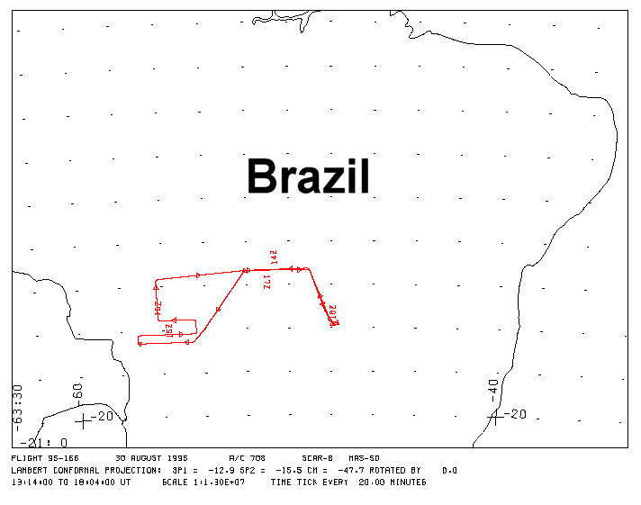
Flight Track Map

|
Level-1B Browse Imagery
Straight Line Flight Tracks: 06
Scanlines Processed: 21785
Solar Azimuth and Zenith Angles
|
Browse Images
|
Click on the Flight Track number to load images.
Lat/Lon ranges are for the BEG-END scanline nadir pixels.
|
Flight
Track |
Time_Span
(GMT) |
Heading
(Deg) |
Lat_Range
(Deg_S) |
Lon_Range
(Deg_W) |
Length
(Scanlines) |
Altitude
(Meters) |
| 1 |
14:44-14:50 |
223 |
16.07-16.54 |
54.06-54.50 |
2165 |
~20000 |
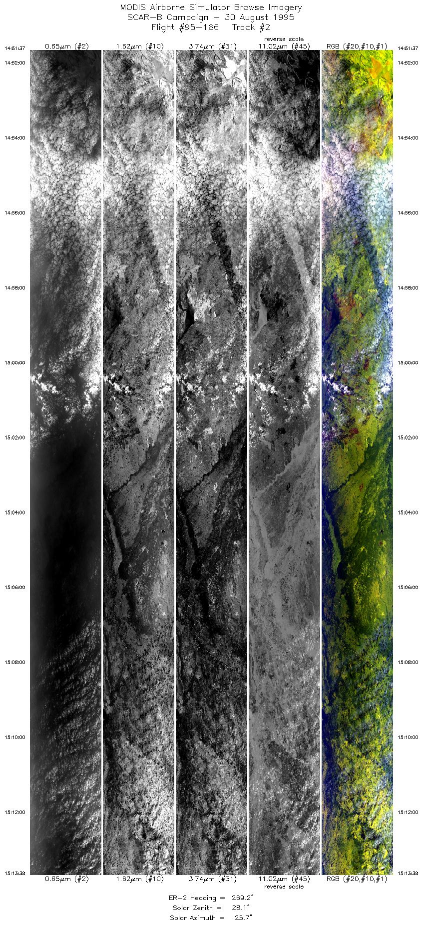
| 2 |
14:51-15:13 |
269 |
16.58-16.59 |
54.60-57.08 |
8250 |
~20000 |
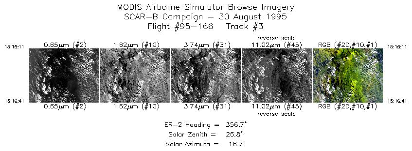
| 3 |
15:15-15:16 |
357 |
16.47-16.30 |
57.18-57.18 |
563 |
~20000 |
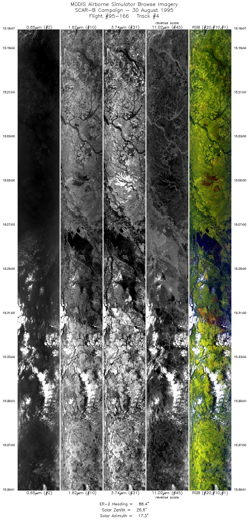
| 4 |
15:18-15:39 |
88 |
16.20-16.20 |
57.07-54.51 |
7832 |
~20000 |
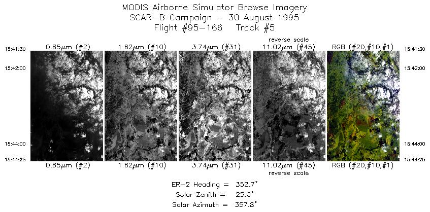
| 5 |
15:41-15:44 |
353 |
15.98-15.66 |
54.39-54.42 |
1094 |
~20000 |
| 6 |
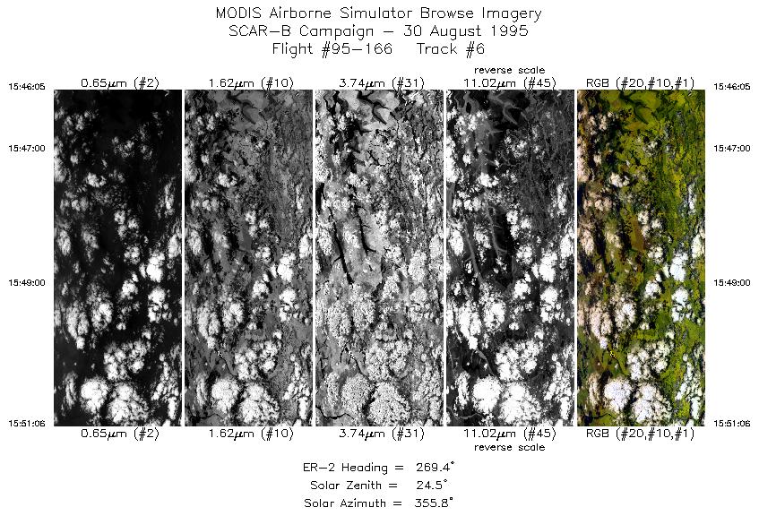
15:46-15:51 |
269 |
15.55-15.55 |
54.54-55.11 |
1881 |
~20000 |
| Images 01 through 06 in sequence |
Level-1B HDF Data Acquisition
Order Form (NASA LaRC Atmospheric Sciences Data Center)
Additional Information
The objective of this flight was to fly a coordinated mission in the Cuiaba
area measuring regional aerosol remotely from the ER-2, from the ground
radiometers, and in situ from the C-131A; to measure cloud-aerosol interaction;
and to overfly the sunphotometer site in Alta Floresta and coordinate with
the AVHRR overpass.
|
|
|
|