
|
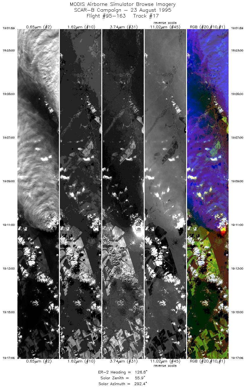
Sample Image

23 August 1995
Track #17
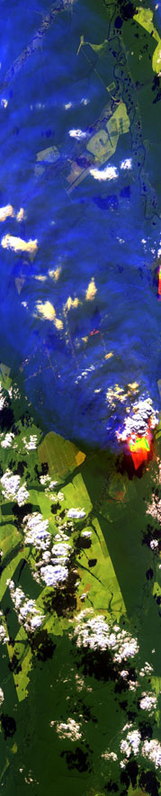

"Biomass burning and smoke plume
near the Xingu River in central Brazil"
R: 2.14 microns
G: 1.62 microns
B: 0.55 microns
|
|
Summary Information
Date: August 23, 1995
ER-2 Flight Number: 95-163
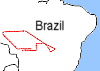
Location: Central Brazil
Principle Investigator: Yorum Kaufman
Additional Sensors: VIS,CLS,AVIRIS
Level-1B Processing Information
Level-1B Data Version: #09
Calibration Type: Final
Calibration Version: SCAR-B_King 1.0
Temperature Adjustment: Yes (24C)
Status: Done!
|
|
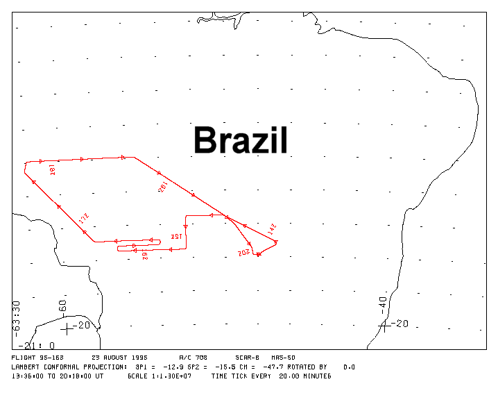
Flight Track Map

|
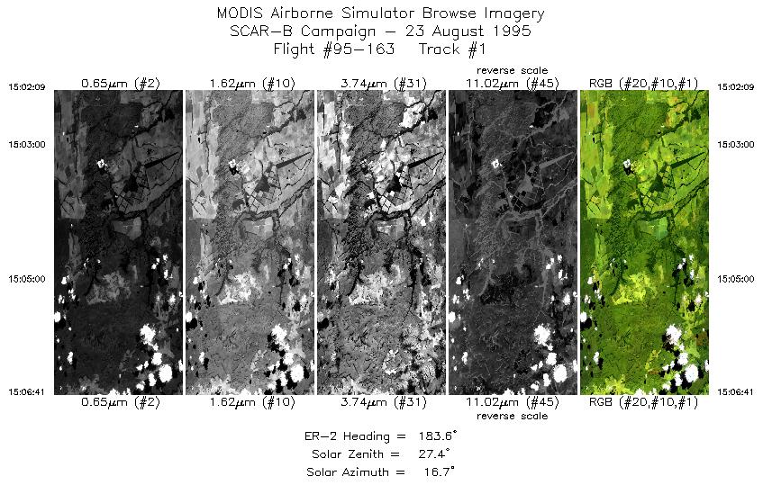
Level-1B Browse Imagery
Straight Line Flight Tracks: 17
Scanlines Processed: 89547
Solar Azimuth and Zenith Angles
|
Browse Images
|
Click on the Flight Track number to load images.
Lat/Lon ranges are for the BEG-END scanline nadir pixels.
|
Flight
Track |
Time_Span
(GMT) |
Heading
(Deg) |
Lat_Range
(Deg_S) |
Lon_Range
(Deg_W) |
Length
(Scanlines) |
Altitude
(Meters) |
| 1 |
15:02-15:06 |
184 |
14.86-15.38 |
52.40-52.40 |
1698 |
~20000 |
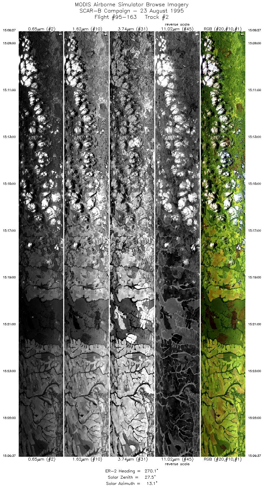
| 2 |
15:08-15:26 |
270 |
15.50-15.50 |
52.53-54.51 |
6810 |
~20000 |
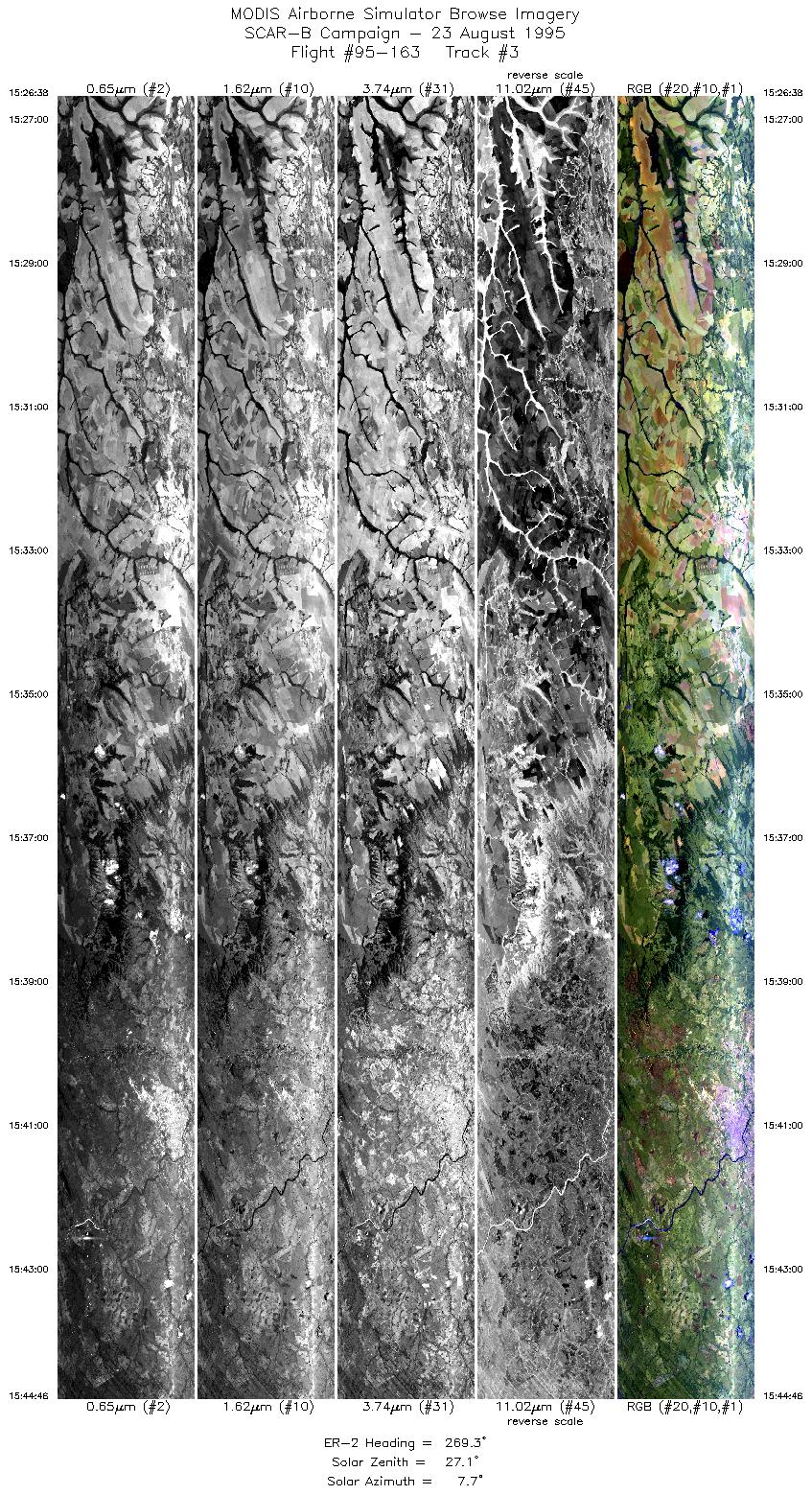
| 3 |
15:26-15:44 |
269 |
15.50-15.50 |
54.52-56.50 |
6796 |
~20000 |
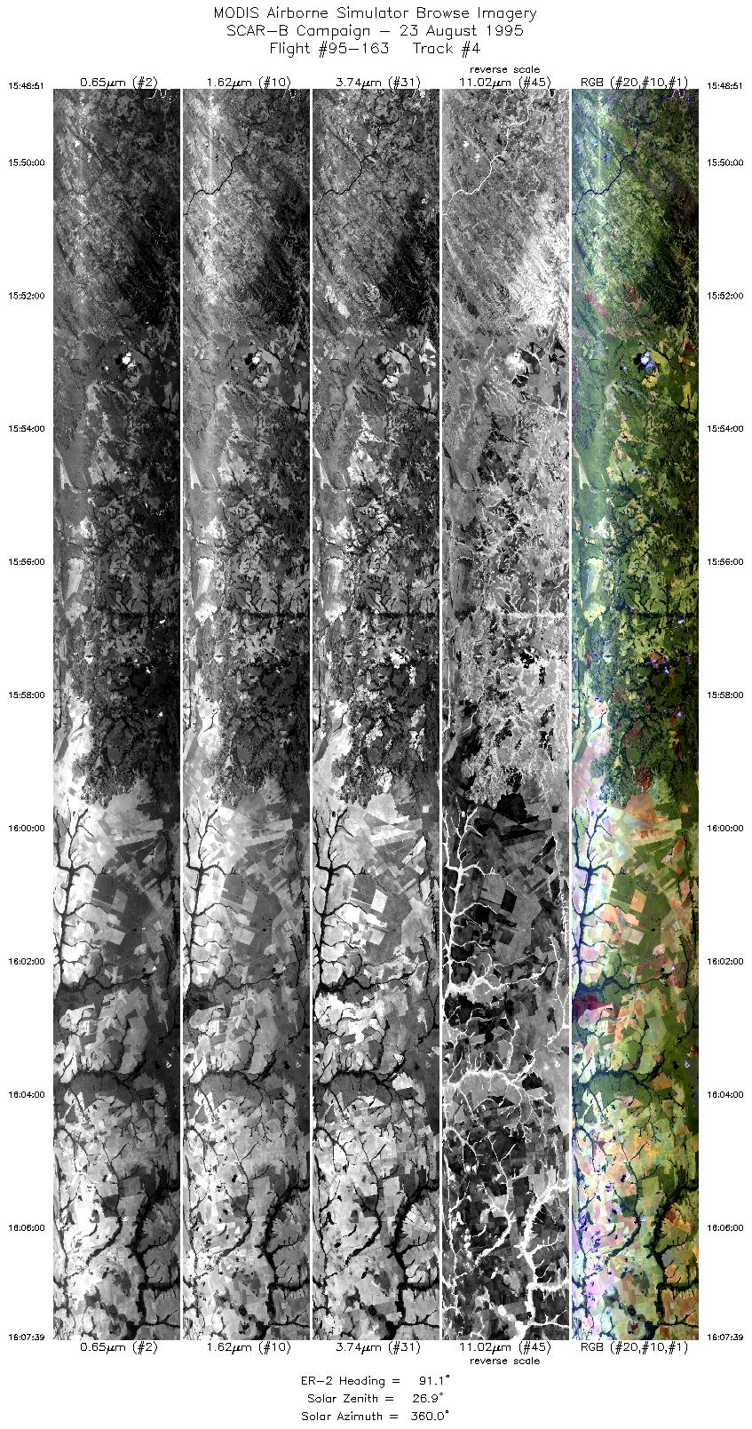
| 4 |
15:48-16:07 |
91 |
15.20-15.20 |
56.47-54.17 |
7046 |
~20000 |
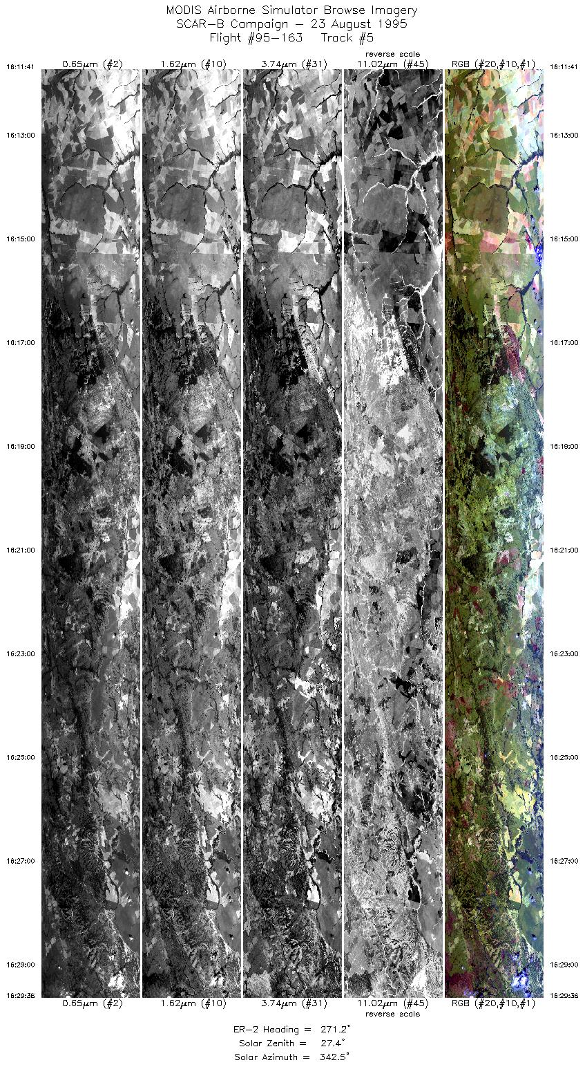
| 5 |
16:11-16:29 |
271 |
14.90-14.90 |
54.09-56.02 |
6716 |
~20000 |
| 6 |
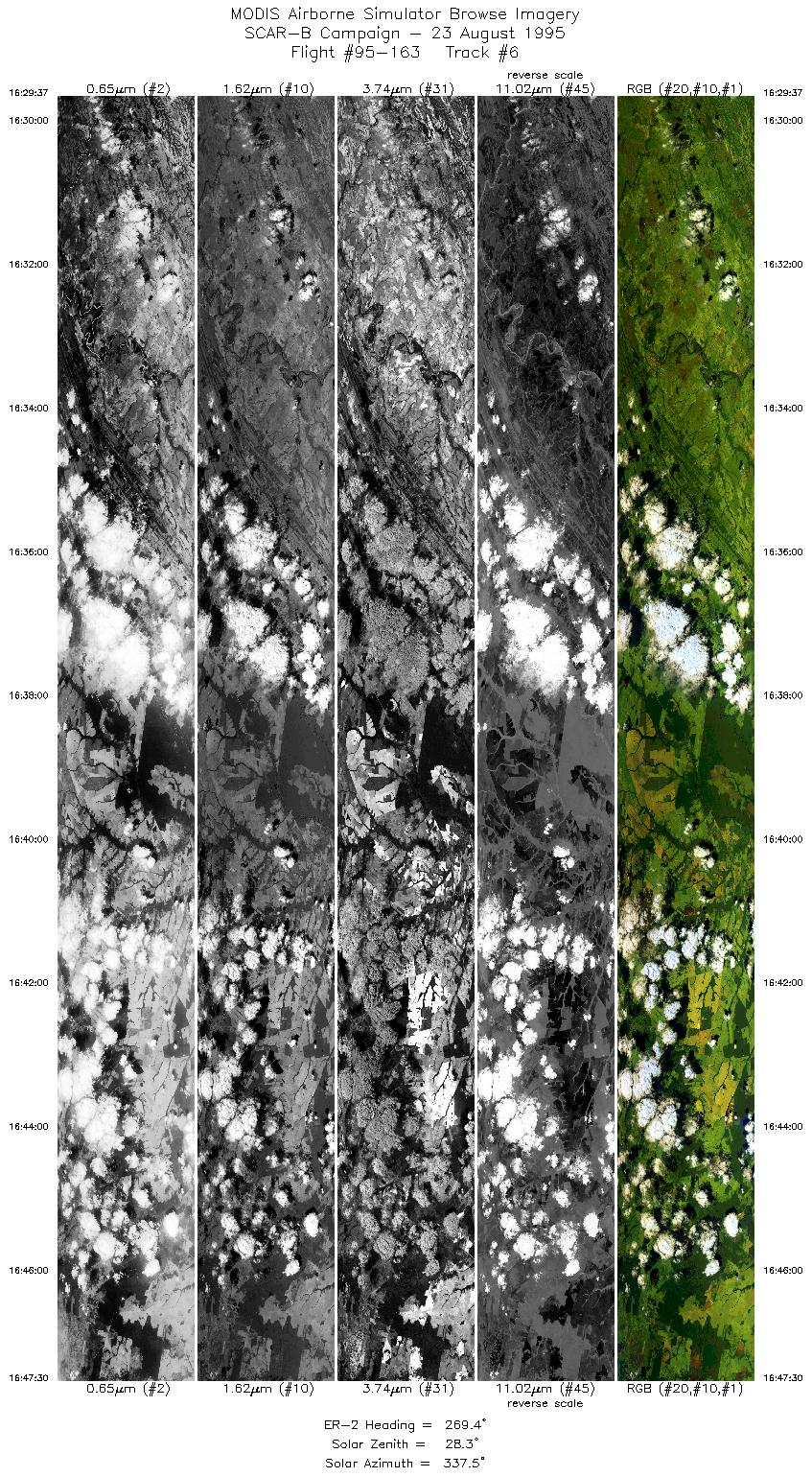
16:29-16:47 |
269 |
14.90-14.90 |
56.02-57.96 |
6702 |
~20000 |
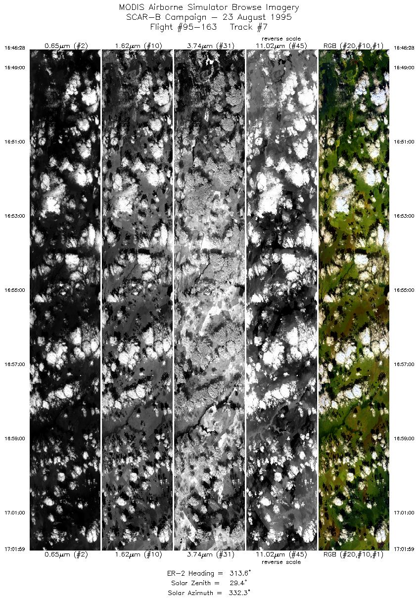
| 7 |
16:48-17:01 |
314 |
14.86-13.79 |
58.06-59.07 |
5067 |
~20000 |
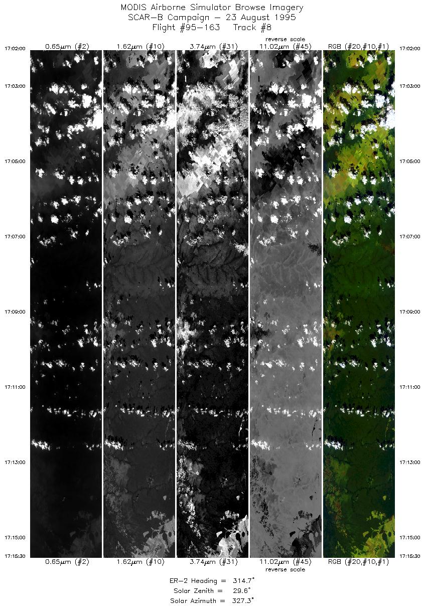
| 8 |
17:01-17:15 |
315 |
13.79-12.71 |
59.08-60.08 |
5061 |
~20000 |
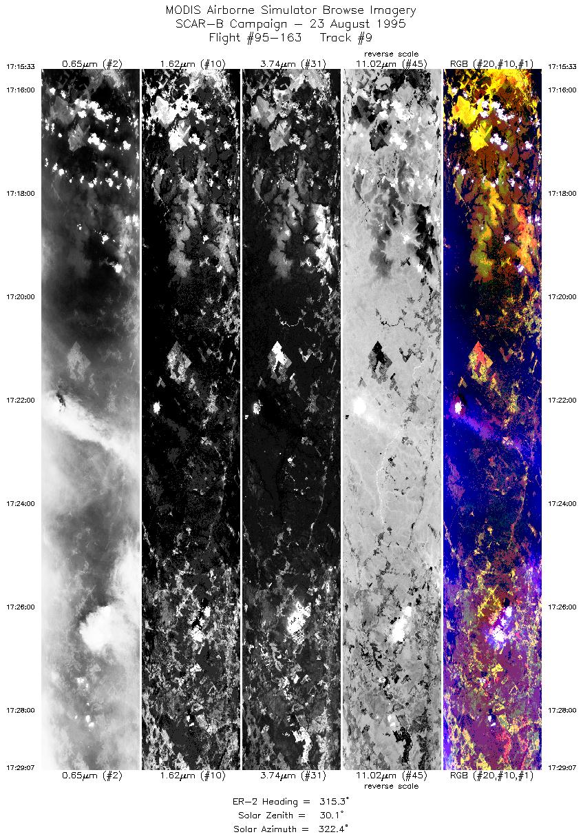
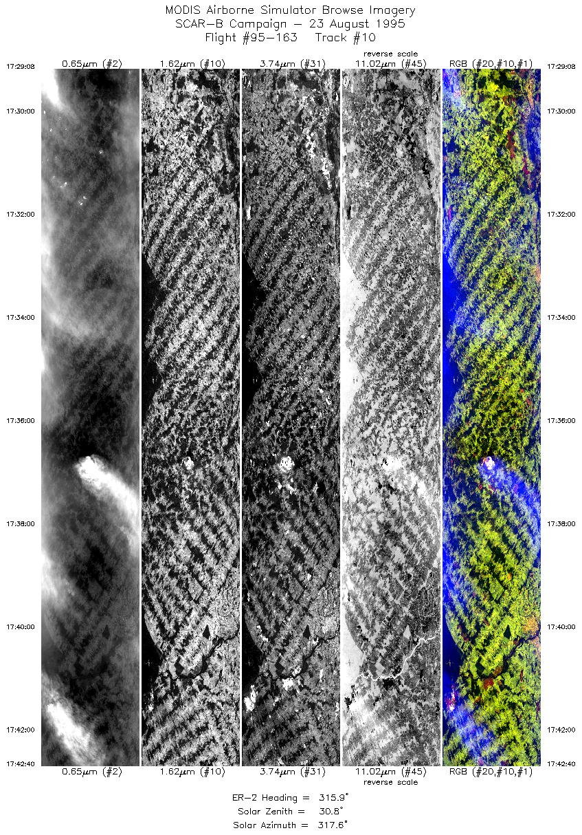
| 9 |
17:15-17:29 |
315 |
12.71-11.65 |
60.08-61.06 |
5085 |
~20000 |
| 10 |
17:29-17:42 |
316 |
11.65-10.60 |
61.06-62.02 |
5073 |
~20000 |
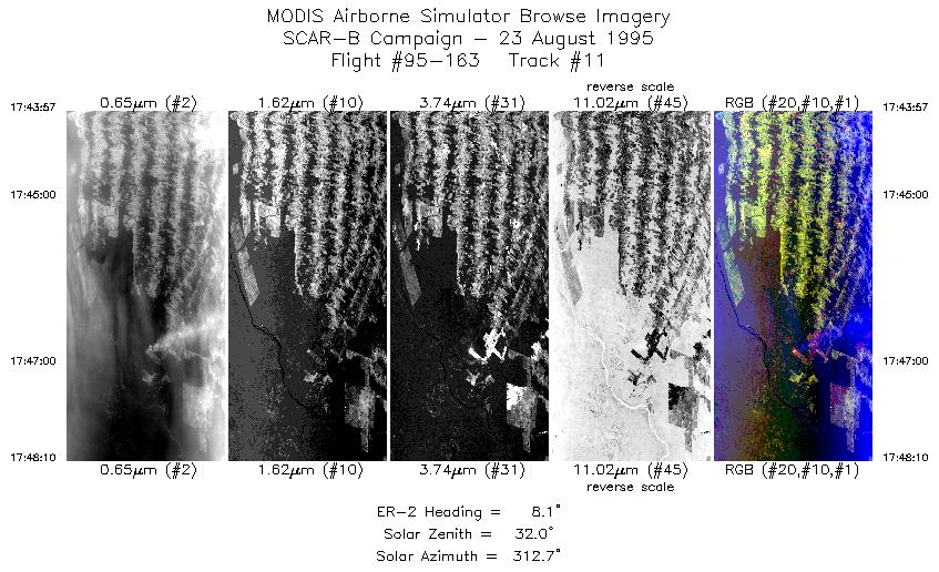
| 11 |
17:43-17:48 |
8 |
10.47-10.01 |
62.04-61.94 |
1581 |
~20000 |
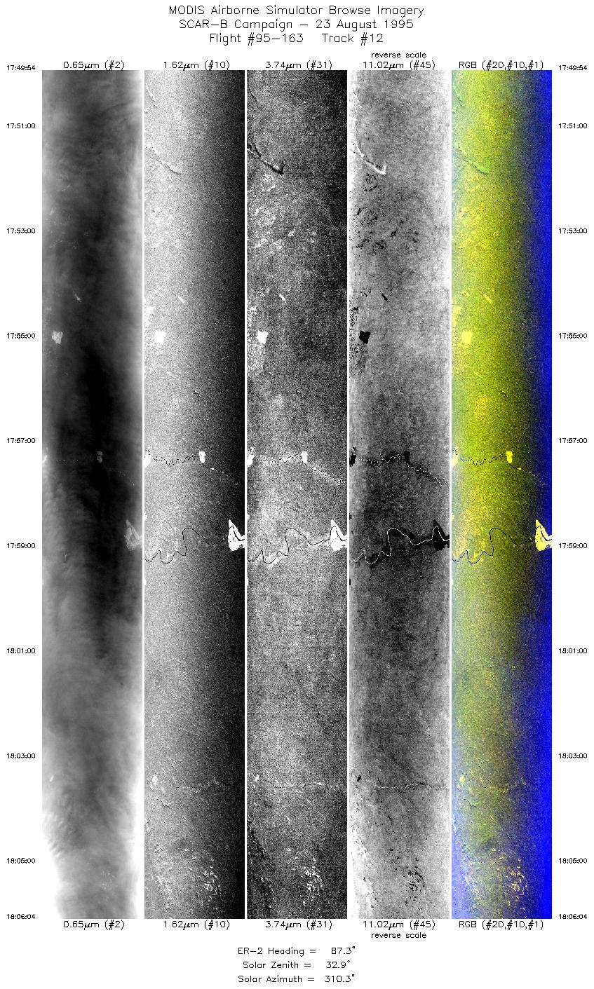
| 12 |
17:49-18:06 |
87 |
9.92-9.93 |
61.77-59.78 |
6059 |
~20000 |
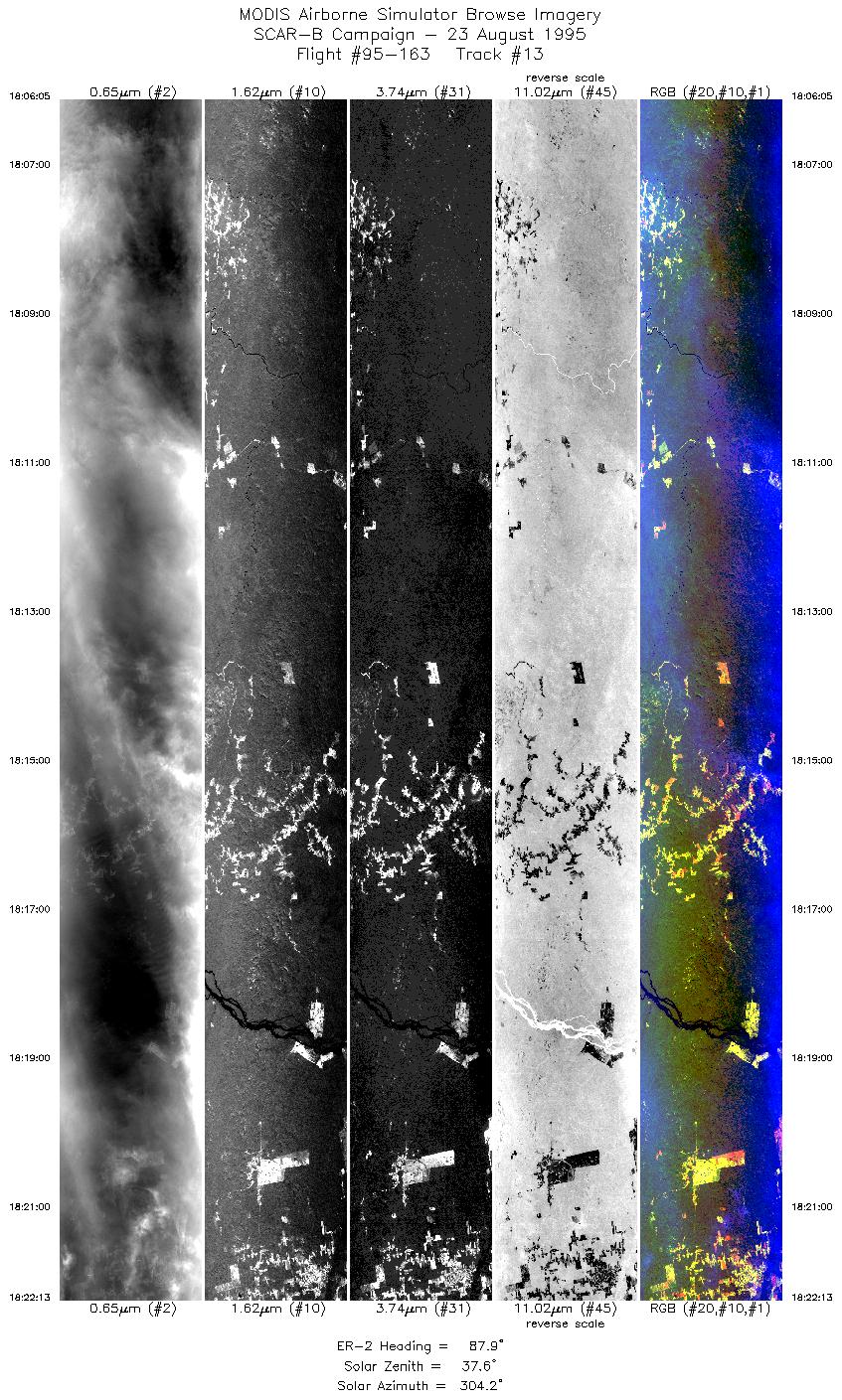
| 13 |
18:06-18:22 |
88 |
9.93-9.93 |
59.78-57.78 |
6048 |
~20000 |
| 14 |
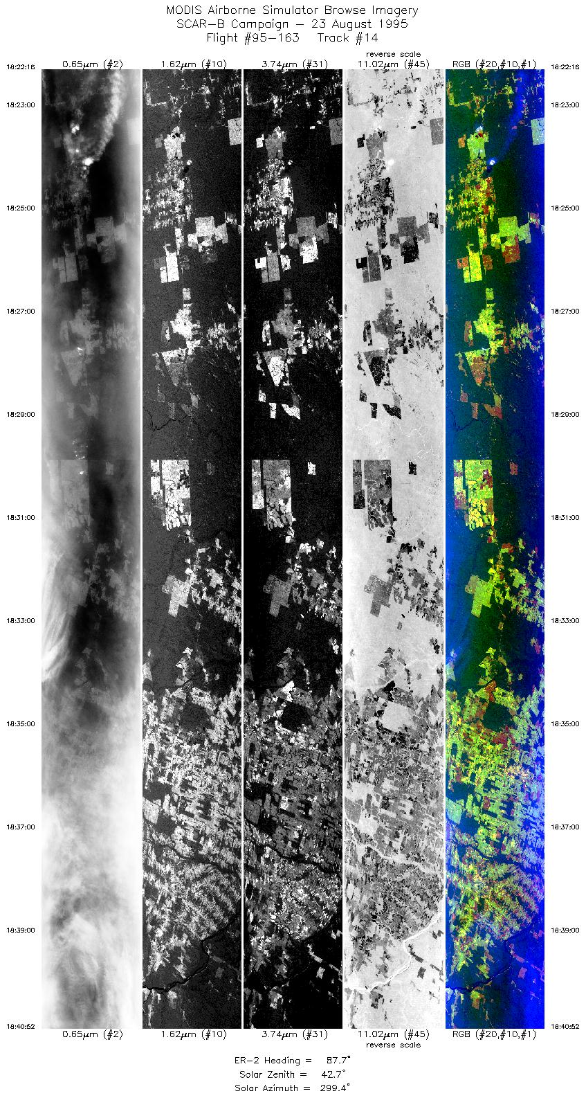
18:22-18:40 |
88 |
9.93-9.92 |
57.77-55.47 |
6932 |
~20000 |
| 15 |
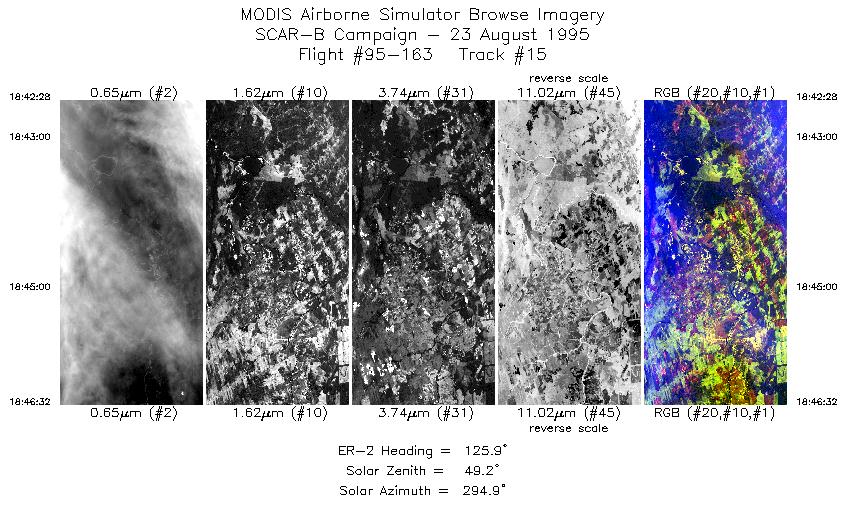
18:42-18:46 |
126 |
10.01-10.29 |
55.30-54.89 |
1525 |
~20000 |
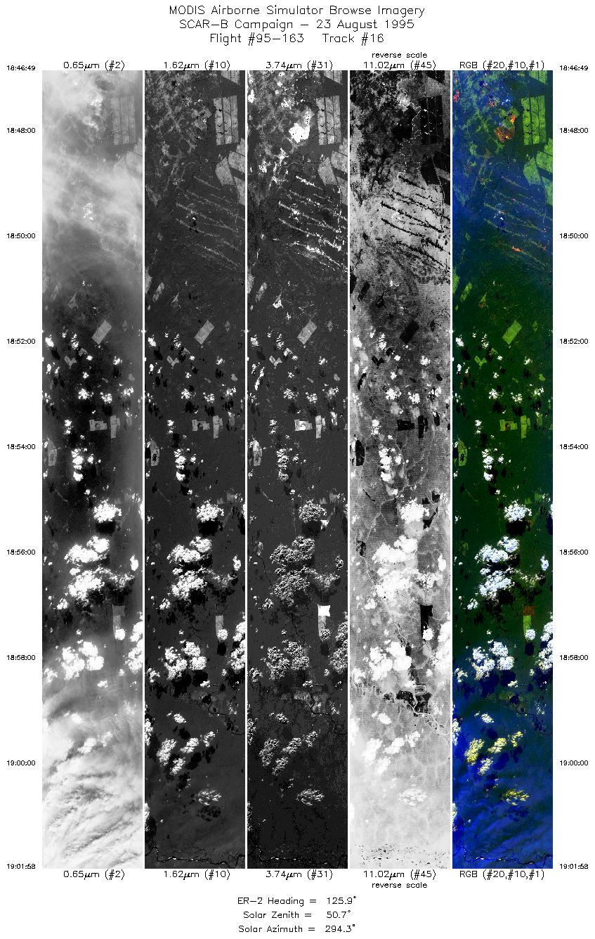
| 16 |
18:46-19:01 |
126 |
10.31-11.35 |
54.86-53.31 |
5680 |
~20000 |
| 17 |
19:01-19:17 |
127 |
11.35-12.39 |
53.32-51.76 |
5668 |
~20000 |
| Images 01 through 17 in sequence |
Level-1B HDF Data Acquisition
Order Form (NASA LaRC Atmospheric Sciences Data Center)
Additional Information
The objective of this flight was to measure smoke across a cross-section
perpendicular to the general transport direction in order to establish
its characteristics and to measure fluxes.
The pilot reported a large fire near Alta Floresta. A strong capping
inversion was also noted.
|
|
|
|
