
|
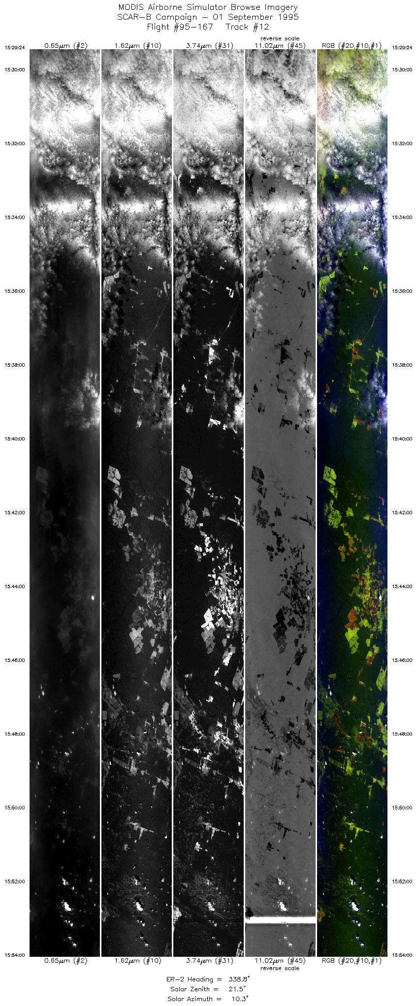
Sample Image

01 September 1995
Track #12
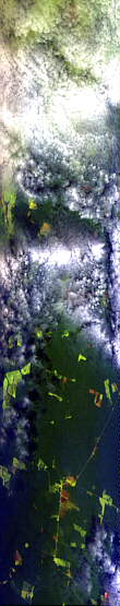

"Multi-layer altocumulus clouds
and small fires near the
Arinos River, Brazil"
R: 2.14 microns
G: 1.62 microns
B: 0.55 microns
|
|
Summary Information
Date: September 01, 1995
ER-2 Flight Number: 95-167
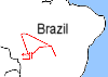
Location: Central Brazil
Principle Investigator: Yorum Kaufman
Additional Sensors: VIS,CLS,AVIRIS
Level-1B Processing Information
Level-1B Data Version: #09
Calibration Type: Final
Calibration Version: SCAR-B_King 1.0
Temperature Adjustment: Yes (24C)
Status: Done!
|
|
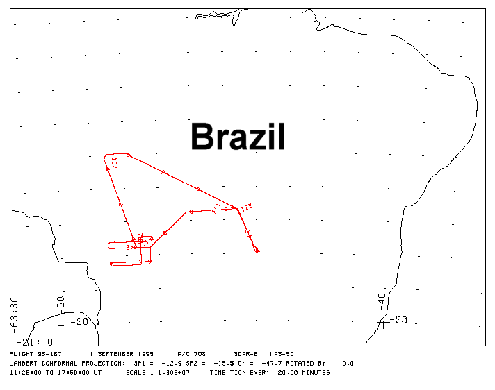
Flight Track Map

|
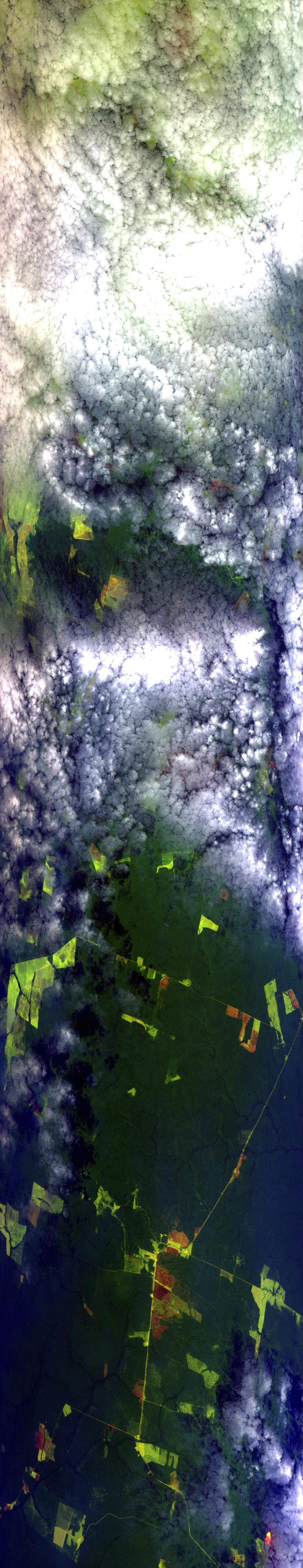
Level-1B Browse Imagery
Straight Line Flight Tracks: 17
Scanlines Processed: 76013
Solar Azimuth and Zenith Angles
|
Browse Images
|
Click on the Flight Track number to load images.
Lat/Lon ranges are for the BEG-END scanline nadir pixels.
|
Flight
Track |
Time_Span
(GMT) |
Heading
(Deg) |
Lat_Range
(Deg_S) |
Lon_Range
(Deg_W) |
Length
(Scanlines) |
Altitude
(Meters) |
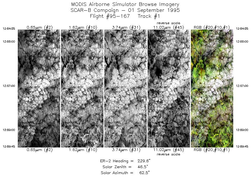
| 1 |
12:54-12:59 |
230 |
15.14-15.52 |
54.04-54.46 |
1998 |
~20000 |
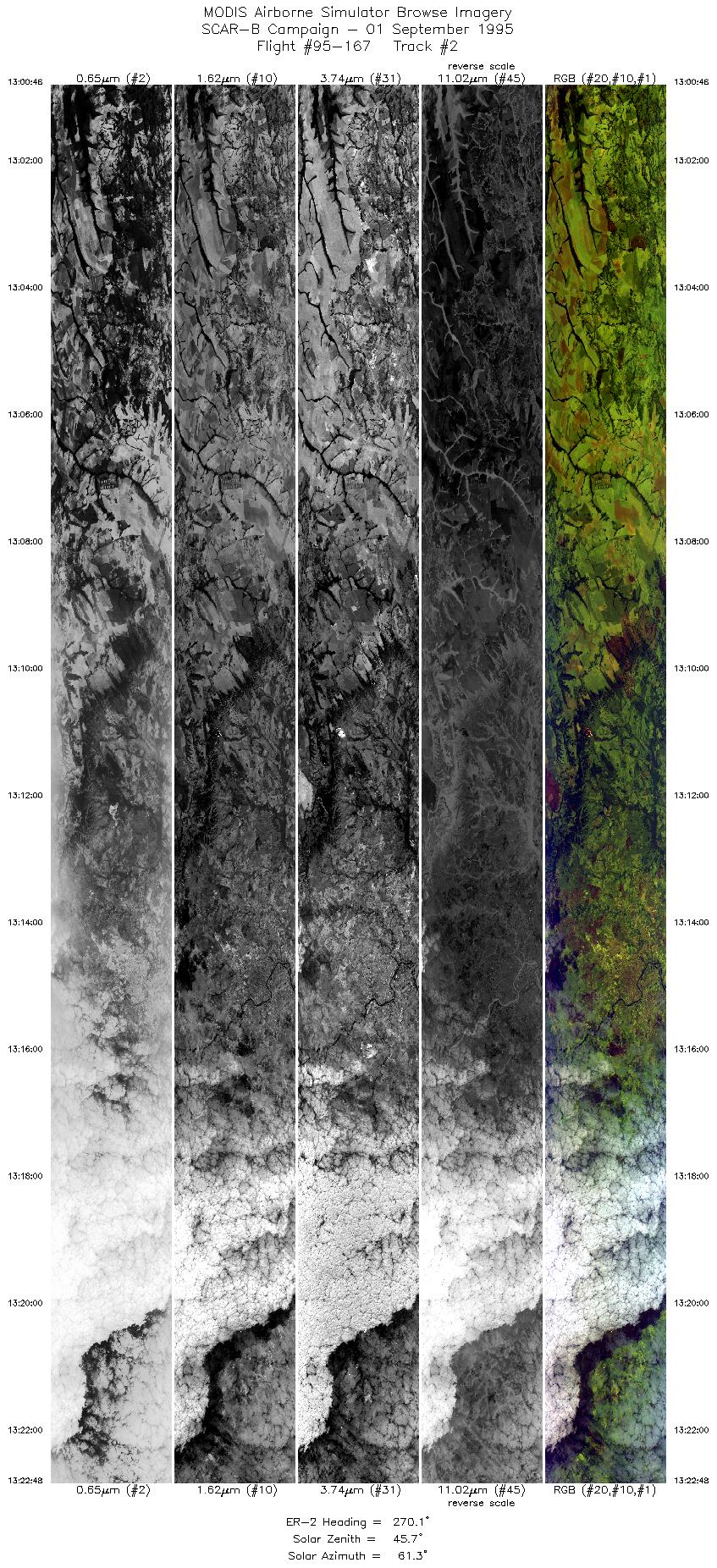
| 2 |
13:00-13:22 |
270 |
15.55-15.55 |
54.56-56.97 |
8261 |
~20000 |
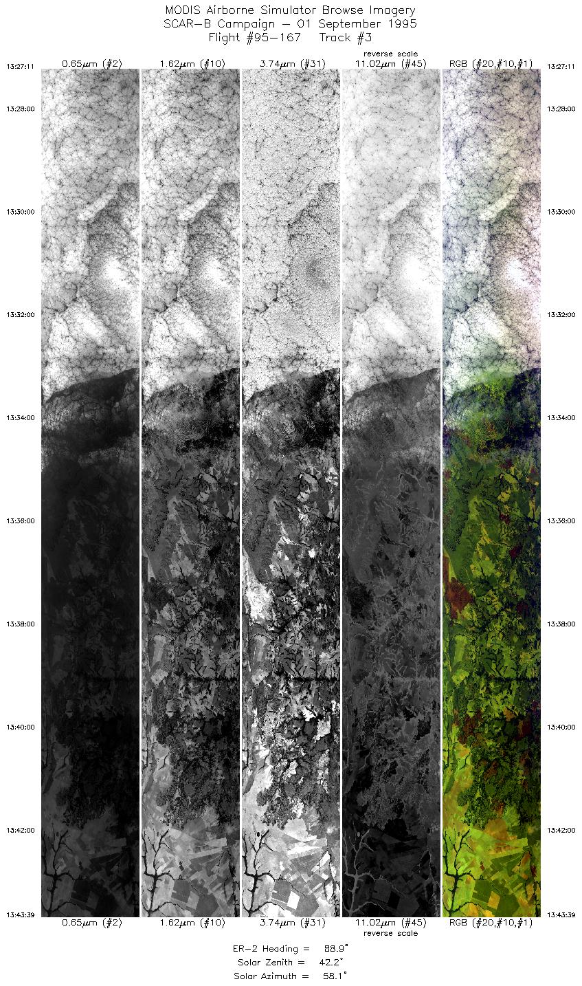
| 3 |
13:27-13:43 |
89 |
15.20-15.20 |
56.94-54.94 |
6174 |
~20000 |
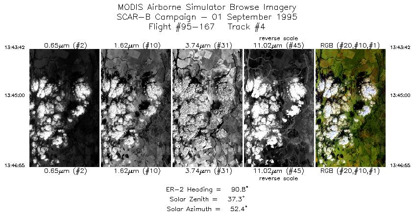
| 4 |
13:43-13:46 |
91 |
15.20-15.20 |
54.92-54.54 |
1206 |
~20000 |
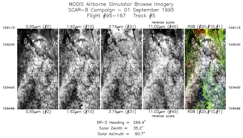
| 5 |
13:51-13:54 |
266 |
14.90-14.90 |
54.56-54.97 |
1413 |
~20000 |
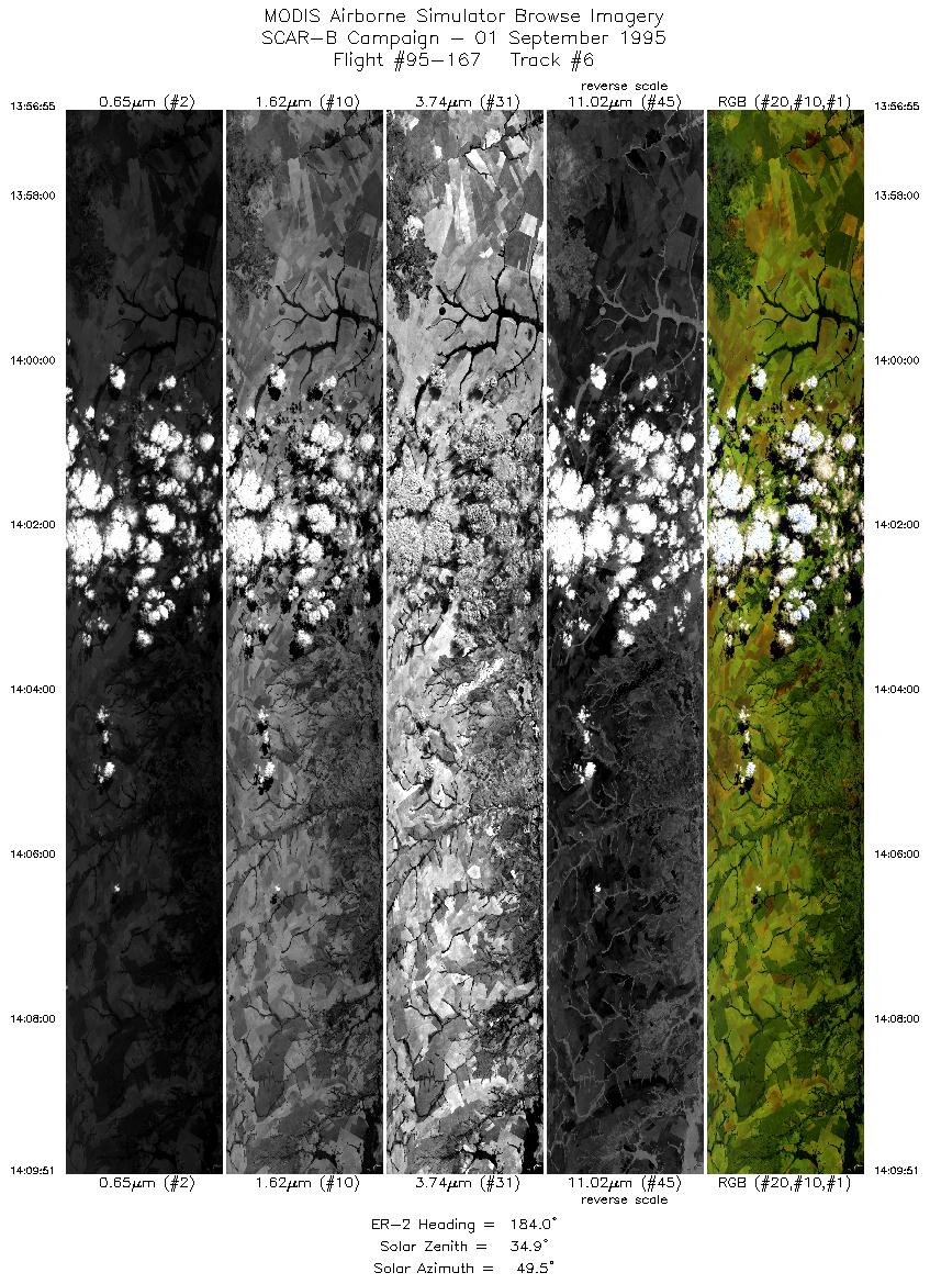
| 6 |
13:56-14:09 |
184 |
15.04-16.47 |
55.08-55.08 |
4849 |
~20000 |
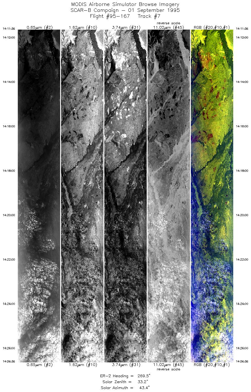
| 7 |
14:11-14:26 |
270 |
16.58-16.58 |
55.22-56.89 |
5623 |
~20000 |
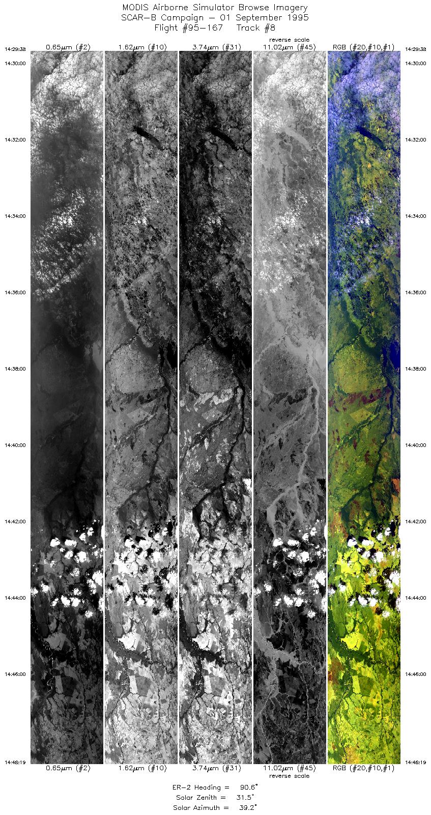
| 8 |
14:29-14:48 |
91 |
16.40-16.40 |
56.85-54.63 |
7005 |
~20000 |
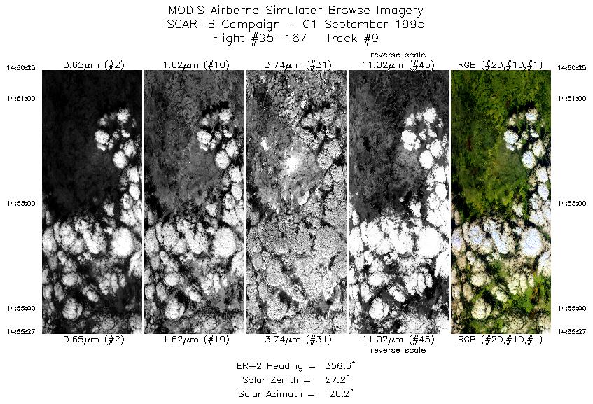
| 9 |
14:50-14:55 |
357 |
16.24-15.68 |
54.50-54.50 |
1888 |
~20000 |
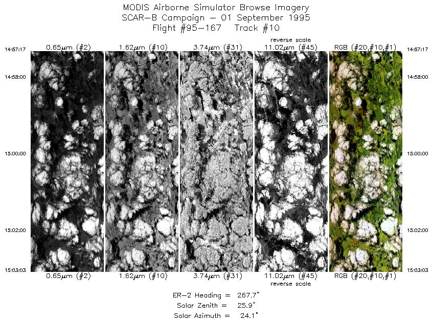
| 10 |
14:57-15:03 |
268 |
15.56-15.58 |
54.63-55.26 |
2163 |
~20000 |
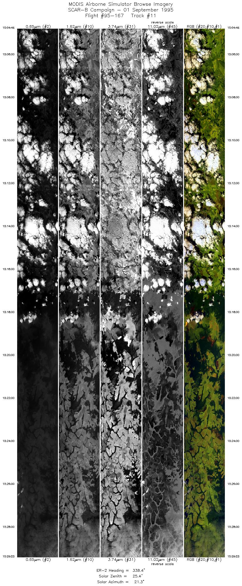
| 11 |
15:04-15:29 |
338 |
15.46-12.85 |
55.38-56.26 |
9230 |
~20000 |
| 12 |
15:29-15:53 |
339 |
12.85-10.25 |
56.26-57.12 |
9222 |
~20000 |
| 13 |
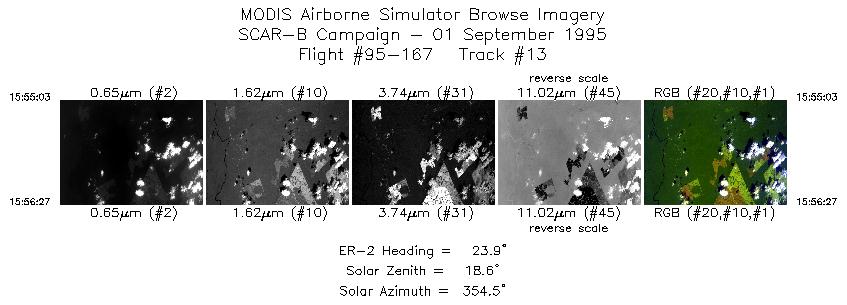
15:55-15:56 |
24 |
10.13-9.99 |
57.10-57.03 |
525 |
~20000 |
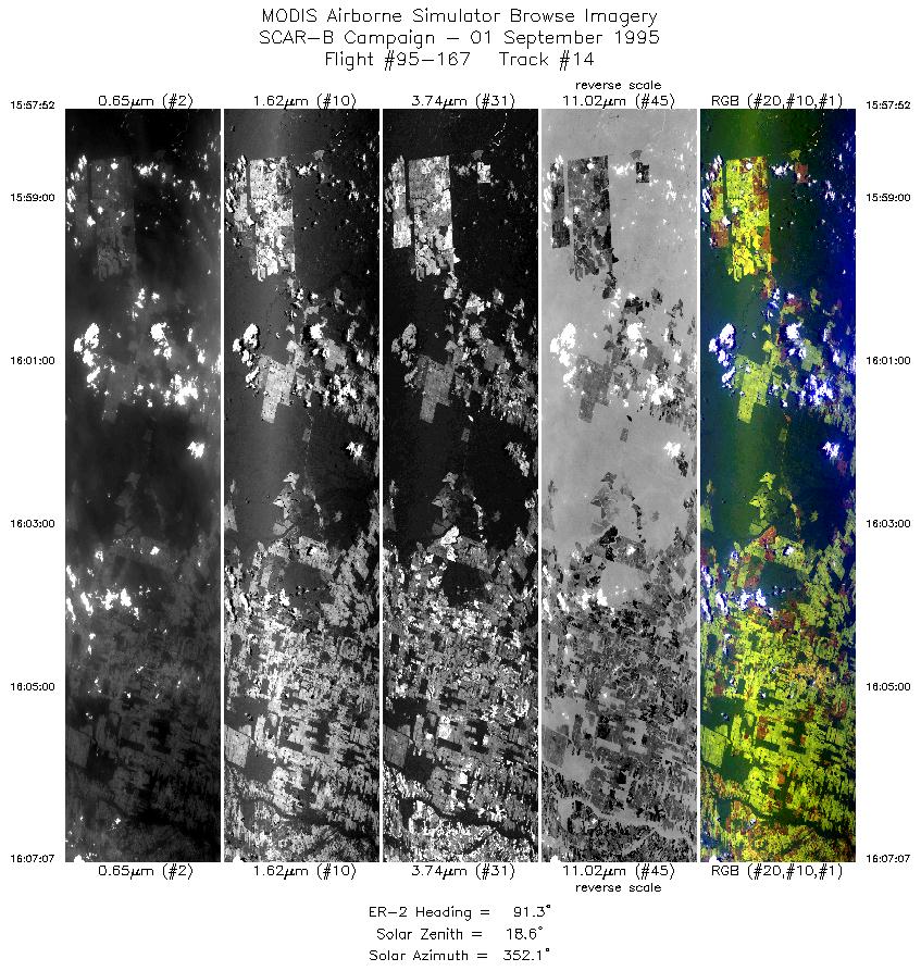
| 14 |
15:57-16:07 |
91 |
9.92-9.92 |
56.90-55.81 |
3469 |
~20000 |
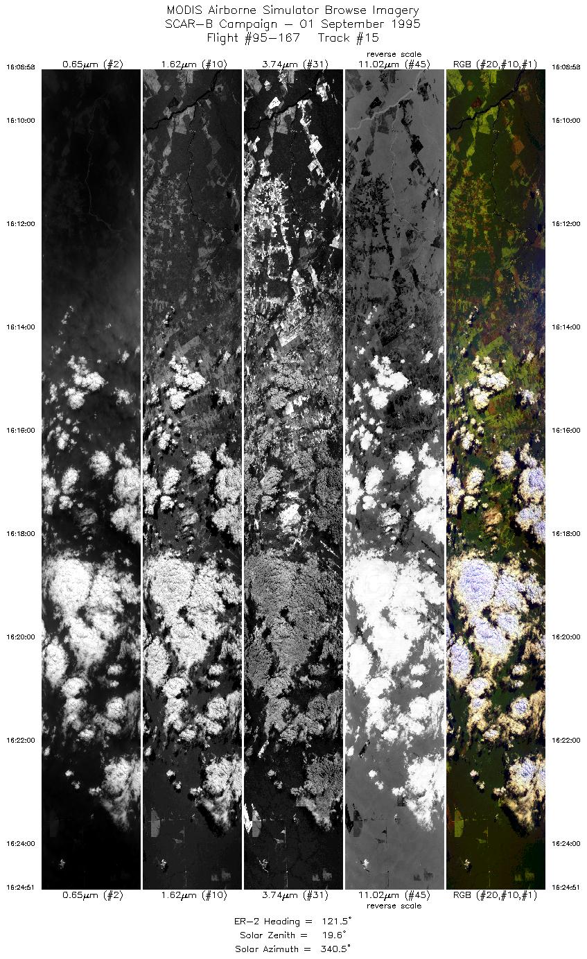
| 15 |
16:08-16:24 |
122 |
10.03-10.89 |
55.63-53.99 |
5918 |
~20000 |
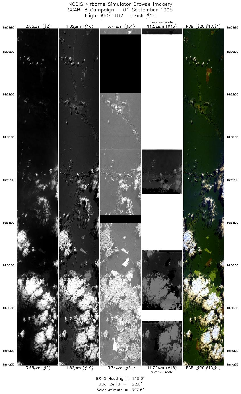
| 16 |
16:24-16:40 |
120 |
10.89-11.73 |
53.99-52.35 |
5918 |
~20000 |
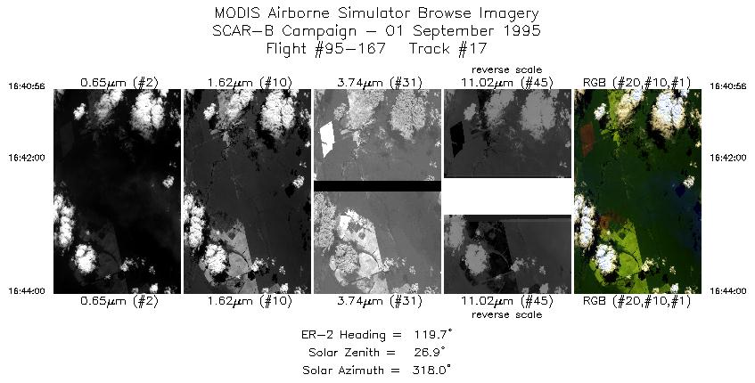
| 17 |
16:40-16:44 |
120 |
11.75-11.91 |
52.32-52.00 |
1151 |
~20000 |
| Images 01 through 17 in sequence |
Level-1B HDF Data Acquisition
Order Form (NASA LaRC Atmospheric Sciences Data Center)
Additional Information
Aircraft flew 6.6 hours over Cuiaba, mapping over the Pantanel,
then over the sunphotometers at Alta Floresta. The pilot reported
hazy conditions with capping clouds.
Problems:
-
Slice 4 / Line 1:
There are broad areas of poorly calibrated data
(which can be seen as broad dark and light bands
in the browse imagery) in the port 4 bands (bands 42-50).
|
|
|
|