
|
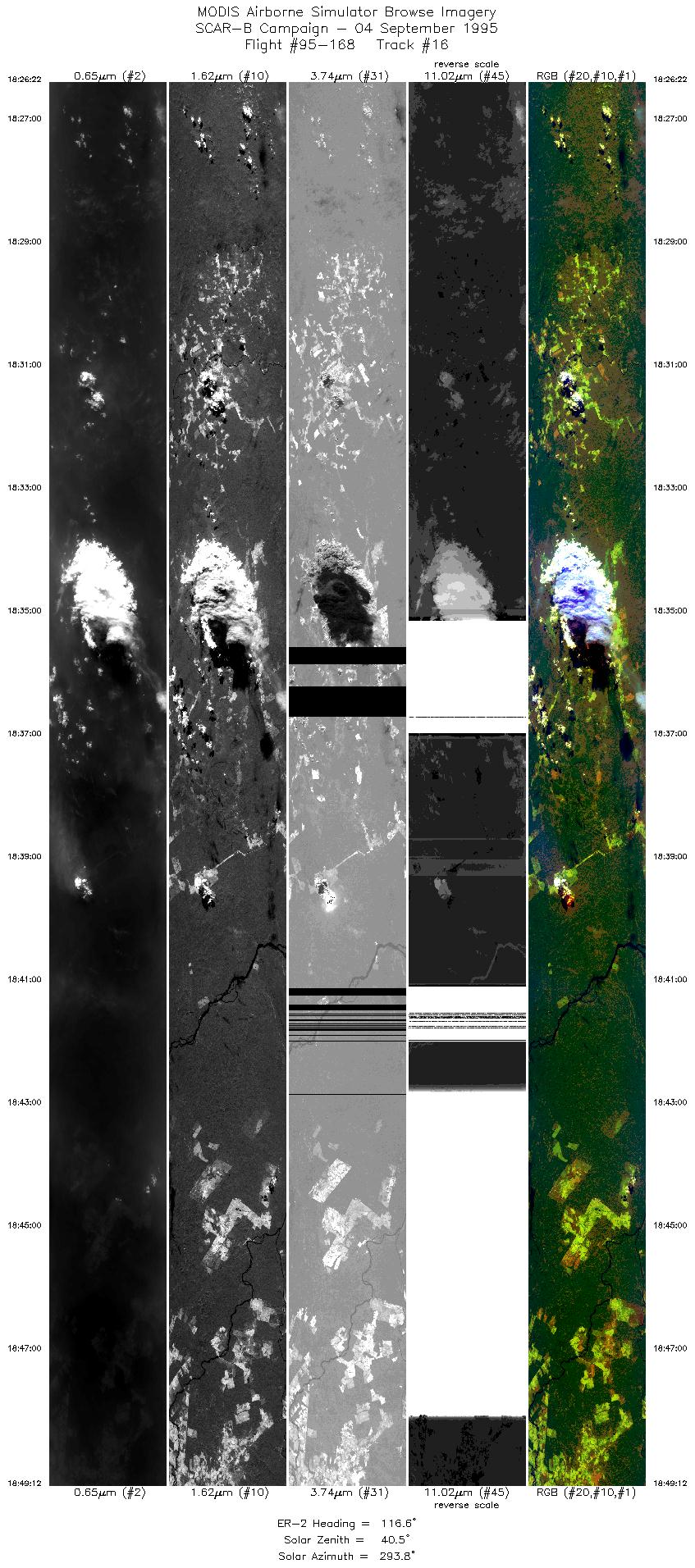
Sample Image

04 September 1995
Track #16
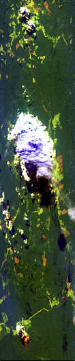

"Fire induced convective cloud over
Serra Do Norte, Brazil"
R: 2.14 microns
G: 1.62 microns
B: 0.55 microns
|
|
Summary Information
Date: September 04, 1995
ER-2 Flight Number: 95-168
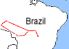
Location: Central Brazil
Principle Investigator: Yorum Kaufman
Additional Sensors: VIS,CLS,AVIRIS
Level-1B Processing Information
Level-1B Data Version: #09
Calibration Type: Final
Calibration Version: SCAR-B_King 1.0
Temperature Adjustment: Yes (24C)
Status: Done
|
|
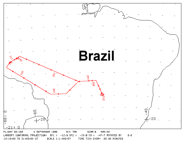
Flight Track Map

|
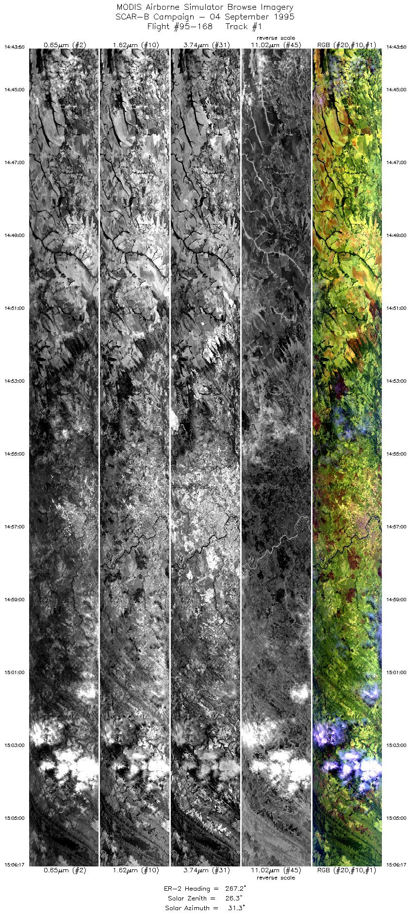
Level-1B Browse Imagery
Straight Line Flight Tracks: 17
Scanlines Processed: 87723
Solar Azimuth and Zenith Angles
|
Browse Images
|
Click on the Flight Track number to load images.
Lat/Lon ranges are for the BEG-END scanline nadir pixels.
|
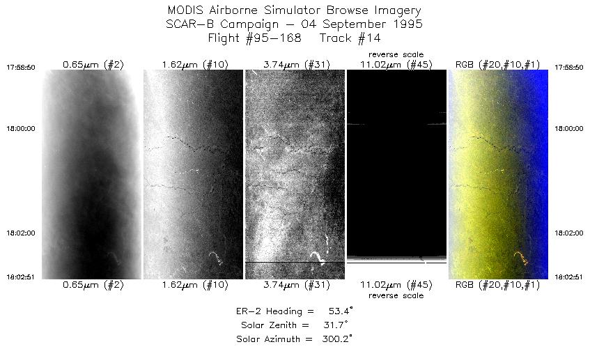
Flight
Track |
Time_Span
(GMT) |
Heading
(Deg) |
Lat_Range
(Deg_S) |
Lon_Range
(Deg_W) |
Length
(Scanlines) |
Altitude
(Meters) |
| 1 |
14:43-15:06 |
267 |
15.55-15.55 |
54.56-57.20 |
8420 |
~20000 |
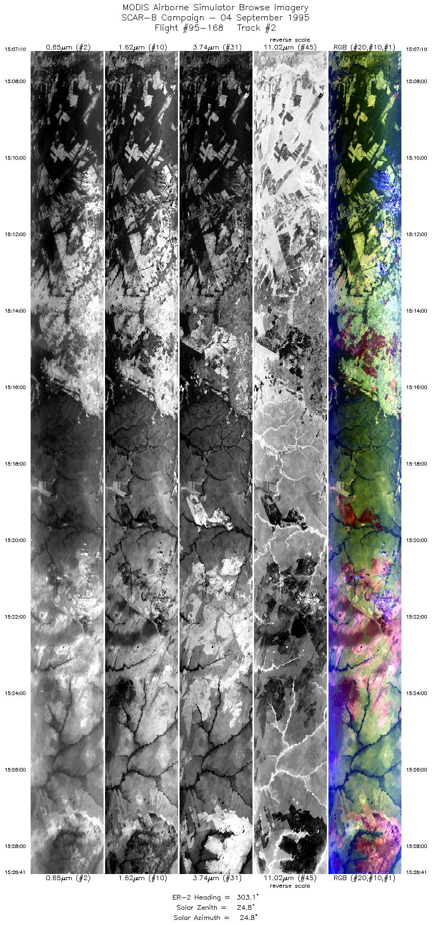
| 2 |
15:07-15:28 |
303 |
15.51-14.16 |
57.31-59.38 |
8071 |
~20000 |
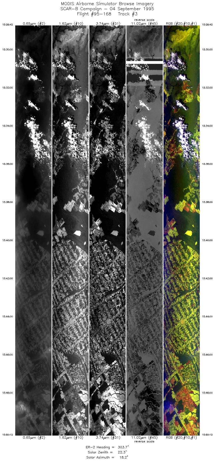
| 3 |
15:28-15:50 |
304 |
14.17-12.82 |
59.37-61.38 |
8064 |
~20000 |
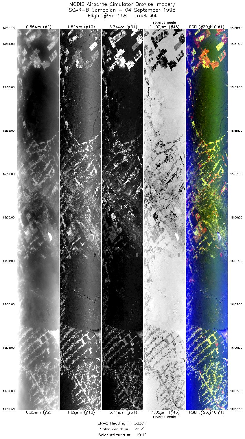
| 4 |
15:50-16:07 |
303 |
12.82-11.70 |
61.39-63.03 |
6589 |
~20000 |
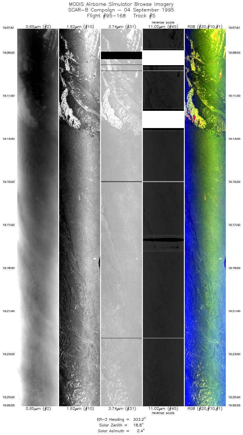
| 5 |
16:07-16:25 |
303 |
11.69-10.57 |
63.03-64.65 |
6576 |
~20000 |
| 6 |
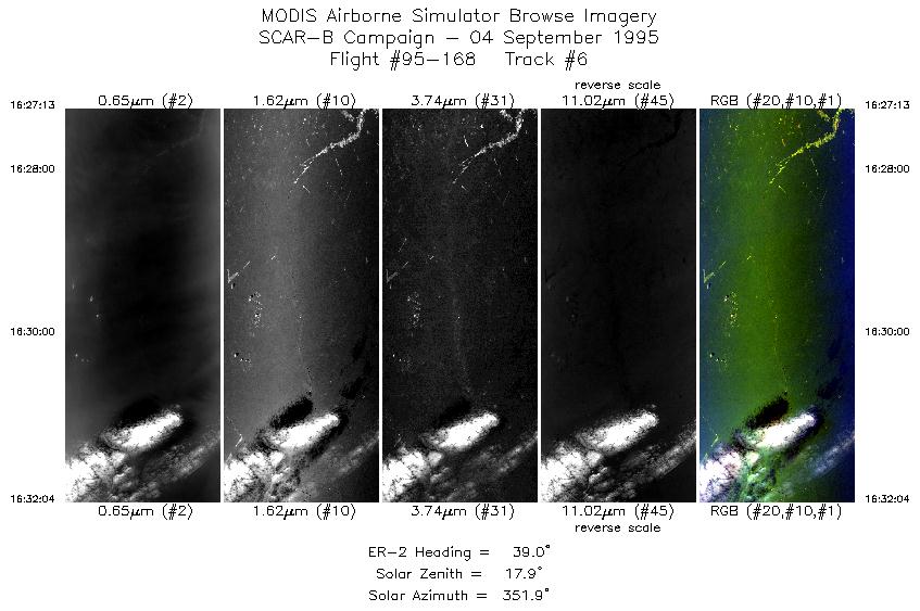
16:27-16:32 |
39 |
10.39-9.96 |
64.65-64.28 |
1819 |
~20000 |
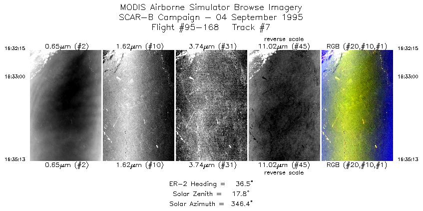
| 7 |
16:32-16:35 |
36 |
9.94-9.67 |
64.26-64.05 |
1113 |
~20000 |
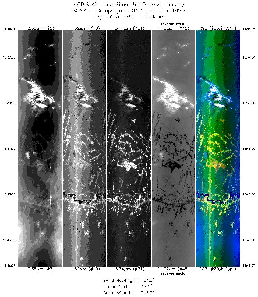
| 8 |
16:35-16:46 |
64 |
9.63-9.09 |
63.99-62.89 |
3874 |
~20000 |
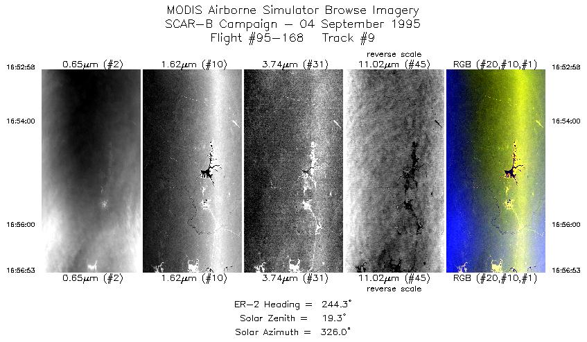
| 9 |
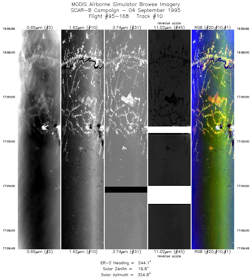
16:52-16:56 |
244 |
8.98-9.17 |
62.67-63.05 |
1469 |
~20000 |
| 10 |
16:56-17:06 |
244 |
9.17-9.64 |
63.05-64.01 |
3700 |
~20000 |
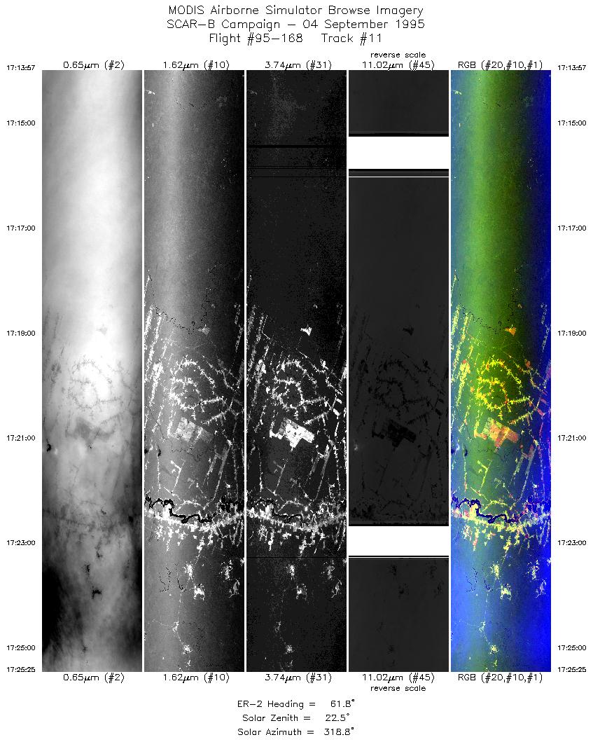
| 11 |
17:13-17:25 |
62 |
9.69-9.08 |
64.10-62.88 |
4299 |
~20000 |
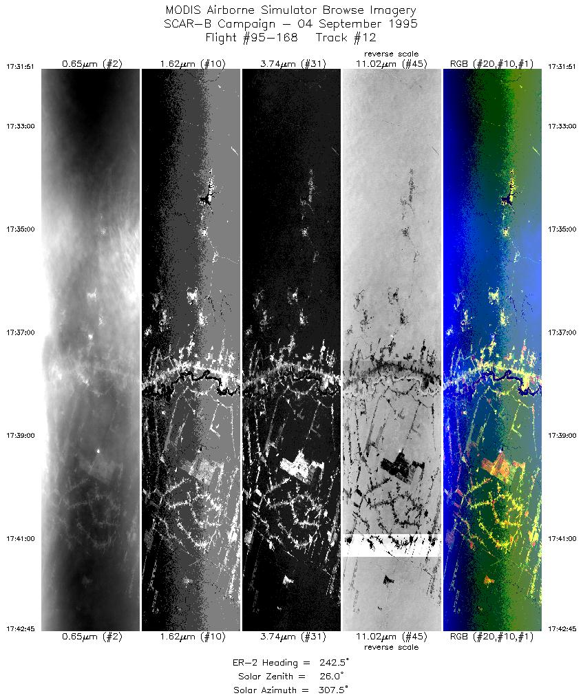
| 12 |
17:31-17:42 |
243 |
8.95-9.47 |
62.62-63.66 |
4087 |
~20000 |
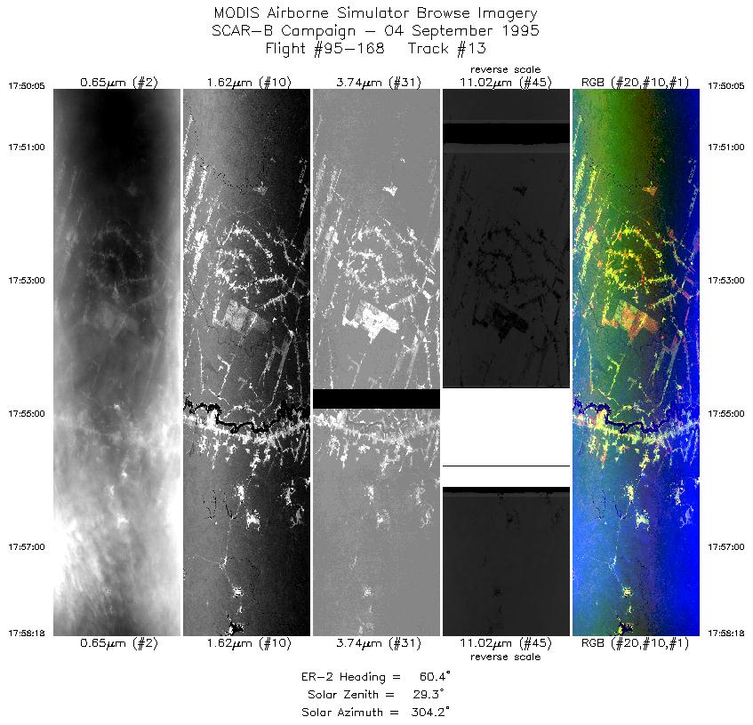
| 13 |
17:50-17:58 |
60 |
9.51-9.07 |
63.74-62.86 |
3081 |
~20000 |
| 14 |
17:58-18:02 |
53 |
9.04-8.76 |
62.80-62.40 |
1507 |
~20000 |
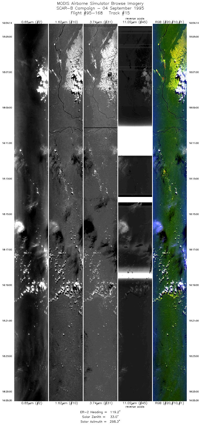
| 15 |
18:04-18:25 |
119 |
8.76-9.88 |
62.24-60.00 |
7937 |
~20000 |
| 16 |
18:26-18:49 |
117 |
9.92-11.07 |
59.92-57.53 |
8562 |
~20000 |
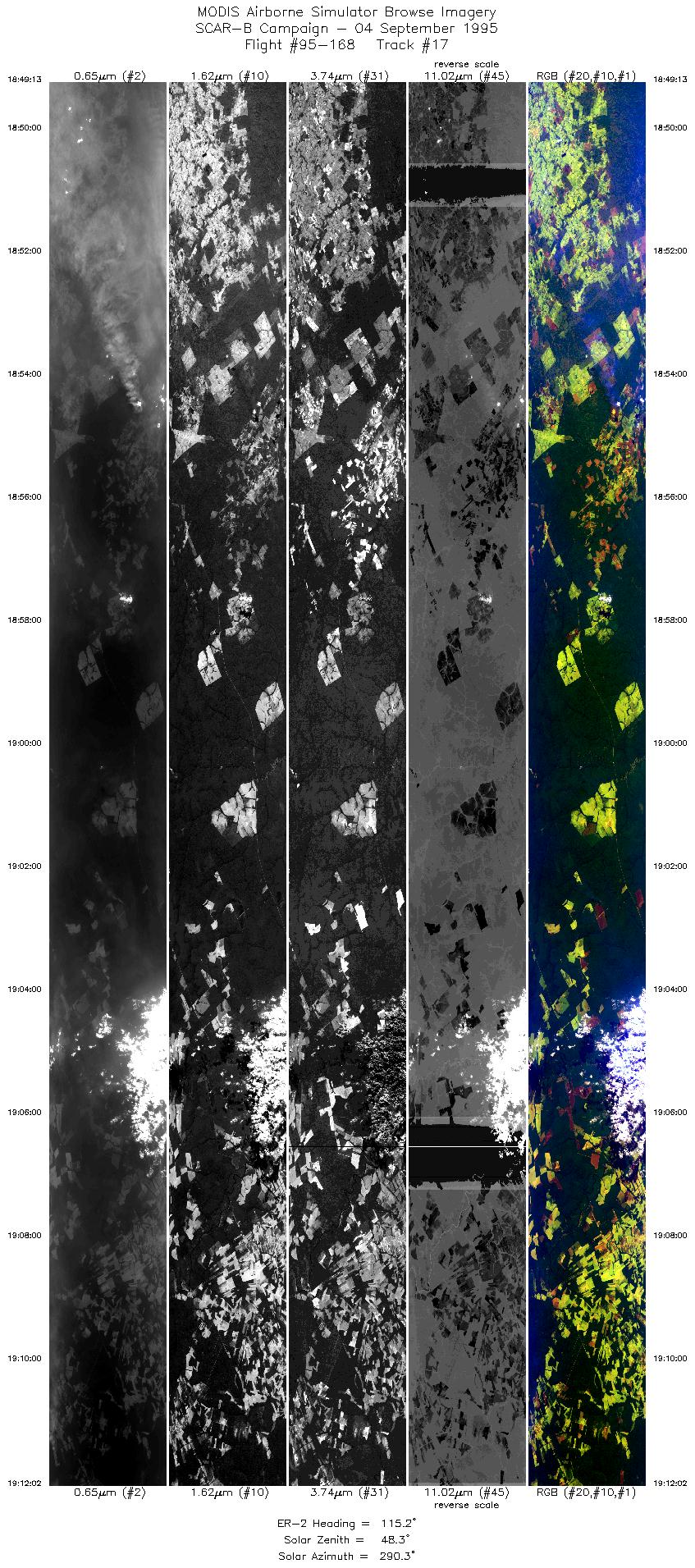
| 17 |
18:49-19:12 |
115 |
11.08-12.21 |
57.53-55.15 |
8555 |
~20000 |
| Images 01 through 17 in sequence |
Level-1B HDF Data Acquisition
Order Form (NASA LaRC Atmospheric Sciences Data Center)
Additional Information
The objective of this flight was to measure concentrations of aerosol
across the study area for flux calculations; as well as capture
smoke and cloud properties.
Fluxes were measured near Bolivia and Porto Velho. In Rondonia
the optical thickness was 2, in Cuiaba 0.4, and Alta Floresta 1.0.
Problems:
-
Slice 2 / Line 5:
There are broad areas of poorly calibrated data
(which can be seen as broad dark and light bands
in the browse imagery) in the port 4 bands (bands 42-50).
-
Slice 3 / Lines 2,3,4:
Large areas where data from the 11 and 12 uM bands
are missing, also many areas where banding was noted
across the image. In slice 2 the 3.7 uM band gives
a very different response than 3.9. In slice 4, sections
of 3.9 and 3.7 are missing.
|
|
|
|
