
|
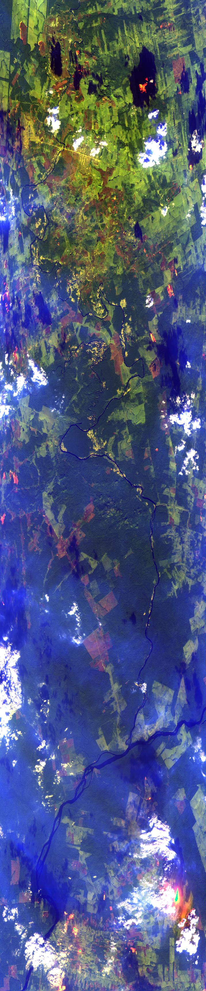
Sample Image

18 August 1995
Track #10


"Multiple fires and smoke
near the Sao Manuel River, Brazil"
R: 2.14 microns
G: 1.62 microns
B: 0.55 microns
|
|
Summary Information
Date: August 18, 1995
ER-2 Flight Number: 95-161
Location: Central Brazil
Principle Investigator: Yorum Kaufman
Additional Sensors: VIS,CLS,AVIRIS
Level-1B Processing Information
Level-1B Data Version: #09
Calibration Type: Final
Calibration Version: SCAR-B_King 1.0
Temperature Adjustment: Yes (24C)
Status: Done!
|
|
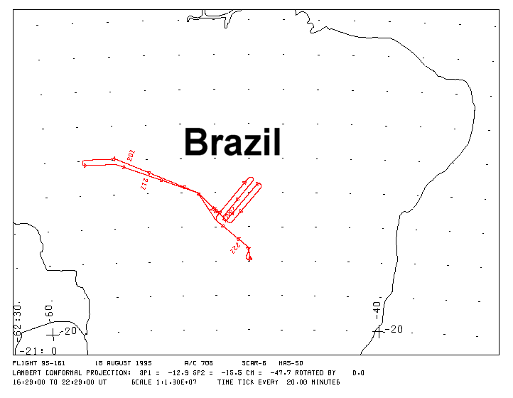
Flight Track Map

|
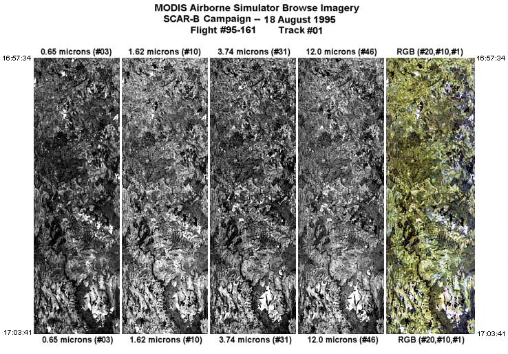
Level-1B Browse Imagery
Straight Line Flight Tracks: 17
Scanlines Processed: 97738
Solar Azimuth and Zenith Angles
|
Browse Images
|
Click on the Flight Track number to load images.
Lat/Lon_Ranges are for the BEG-END scanline nadir pixels.
|
Flight
Track |
Time_Span
(GMT) |
Heading
(Deg) |
Lat_Range
(Deg_S) |
Lon_Range
(Deg_W) |
Length
(Scanlines) |
Altitude
(Meters) |
| 1 |
16:57-17:03 |
306 |
14.11-13.66 |
49.33-49.88 |
2297 |
~20000 |
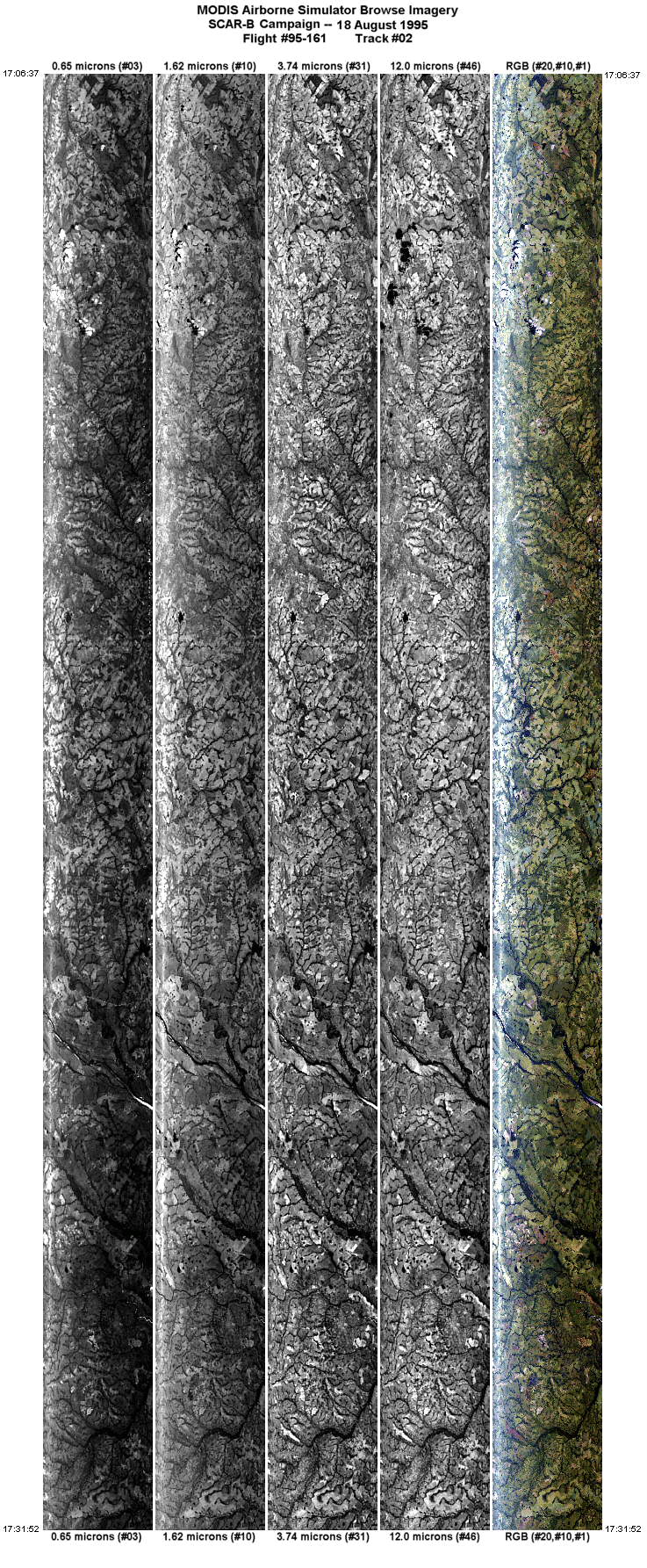
| 2 |
17:06-17:31 |
40 |
13.36-11.16 |
49.87-48.00 |
9472 |
~20000 |
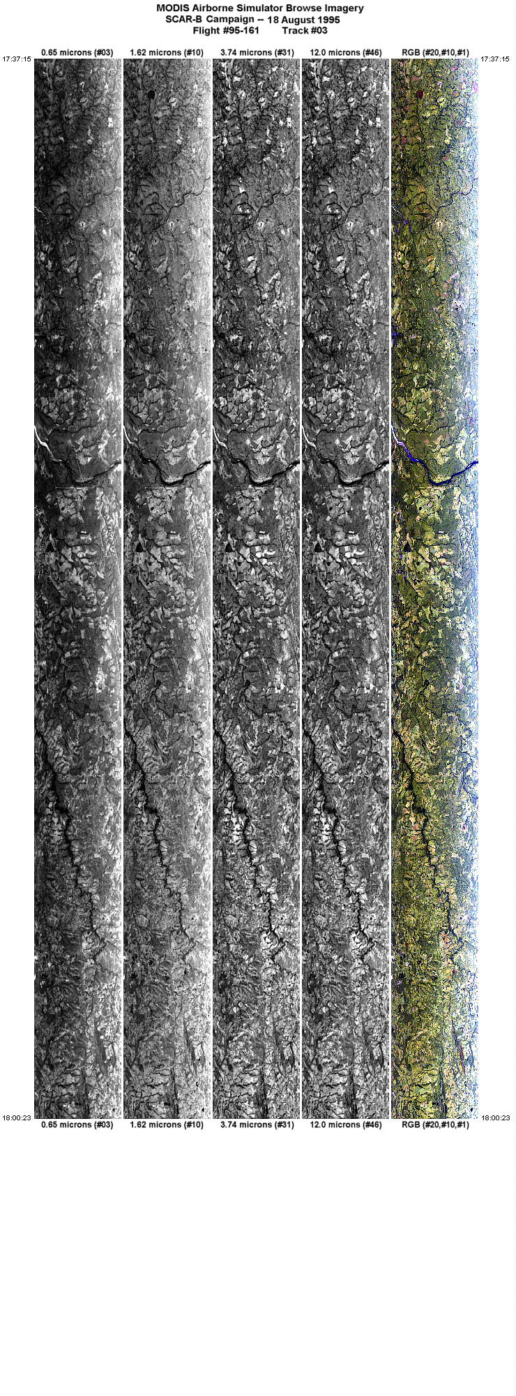
| 3 |
17:37-18:00 |
219 |
11.43-13.37 |
47.81-49.46 |
8677 |
~20000 |
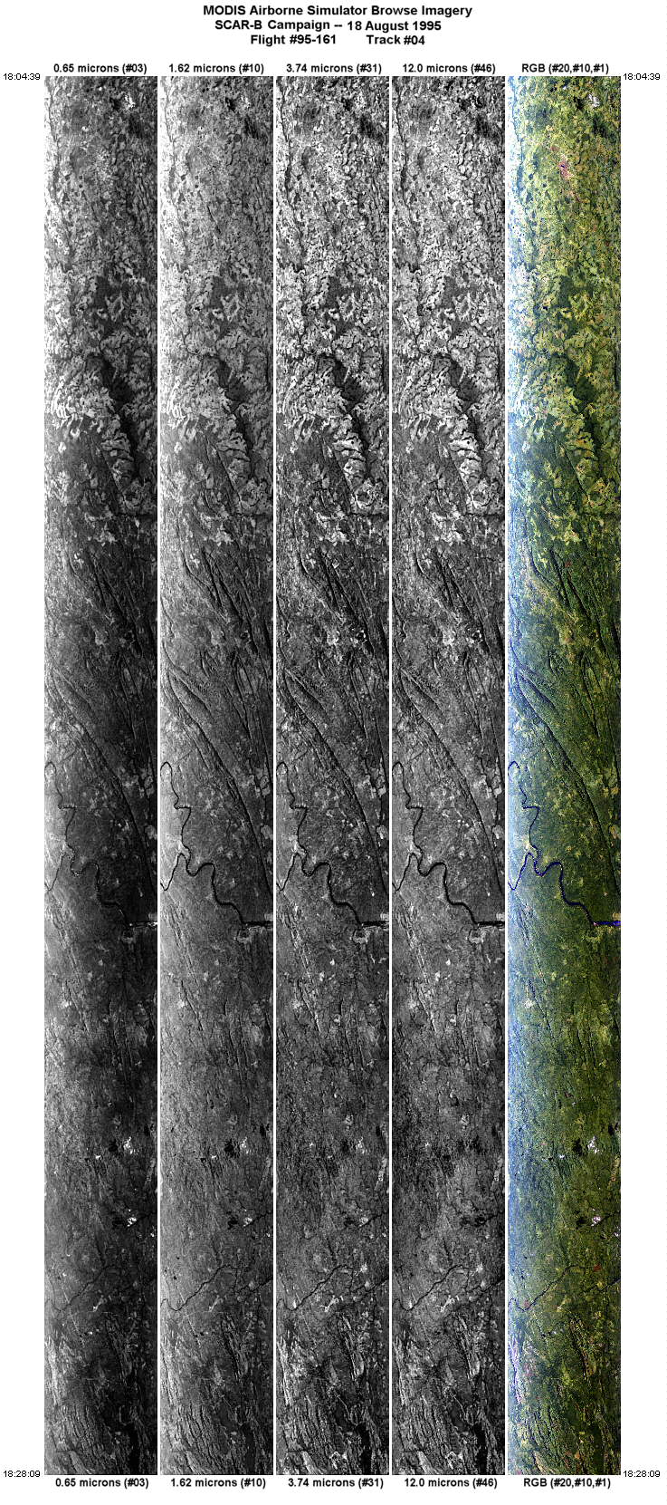
| 4 |
18:04-18:28 |
38 |
13.57-11.55 |
49.27-47.52 |
8817 |
~20000 |
| 5 |
18:32-18:43 |
221 |
11.73-12.68 |
47.26-48.08 |
4320 |
~20000 |
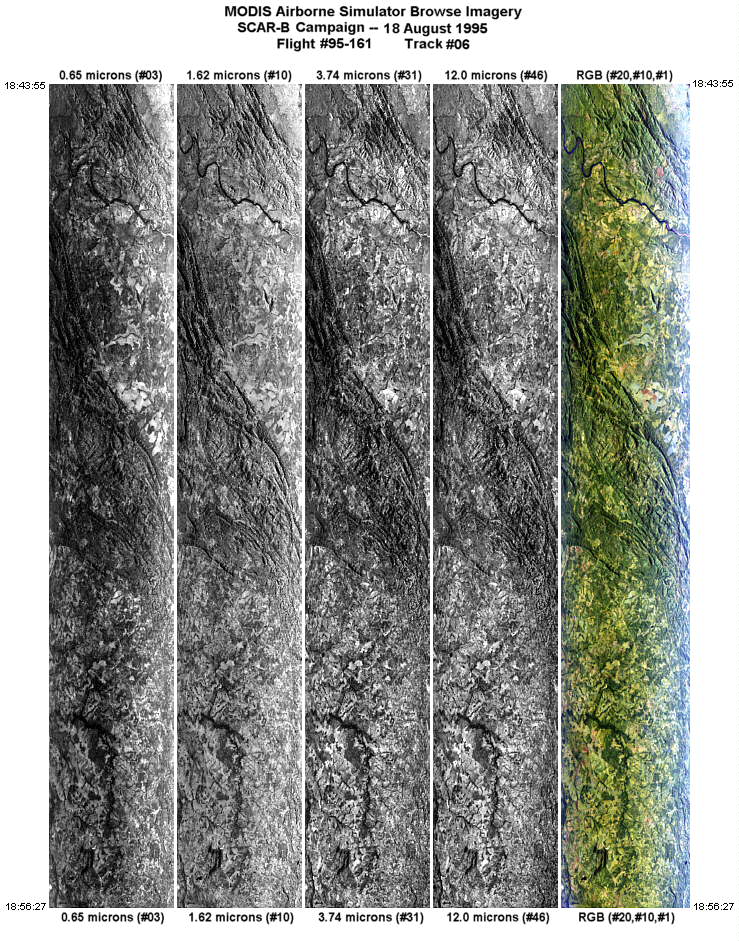
| 6 |
18:43-18:56 |
220 |
12.69-13.74 |
48.09-49.00 |
4707 |
~20000 |
| 7 |
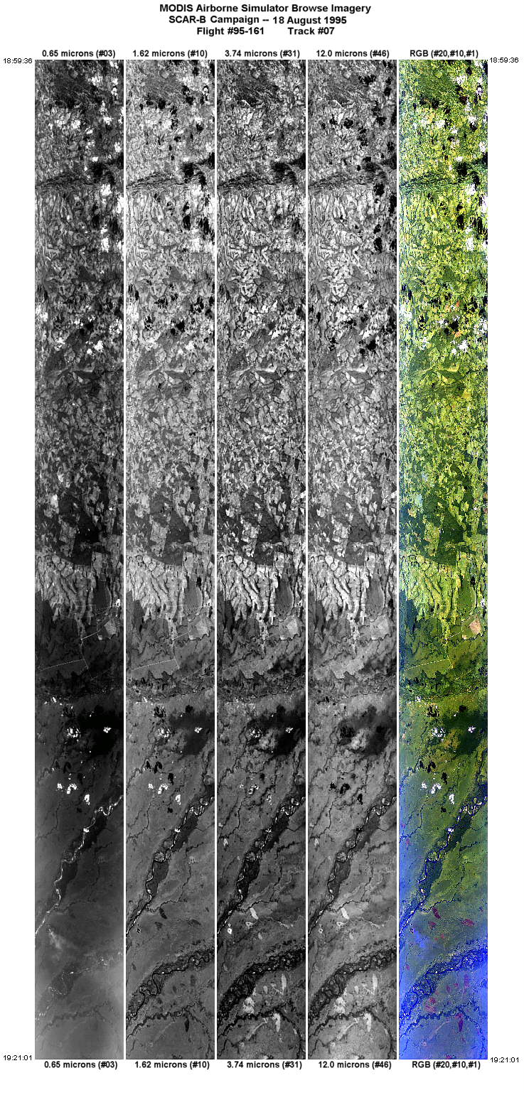
18:59-19:21 |
313 |
13.65-12.00 |
49.30-51.01 |
8038 |
~20000 |
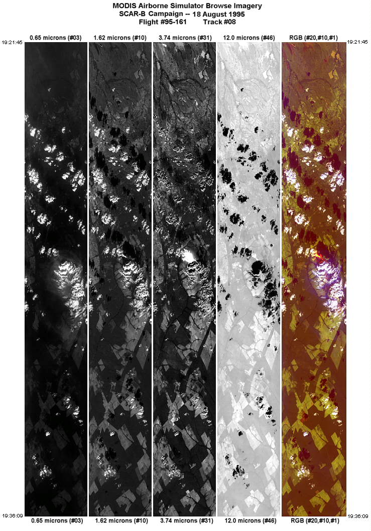
| 8 |
19:21-19:36 |
291 |
11.96-11.34 |
51.08-52.56 |
5401 |
~20000 |
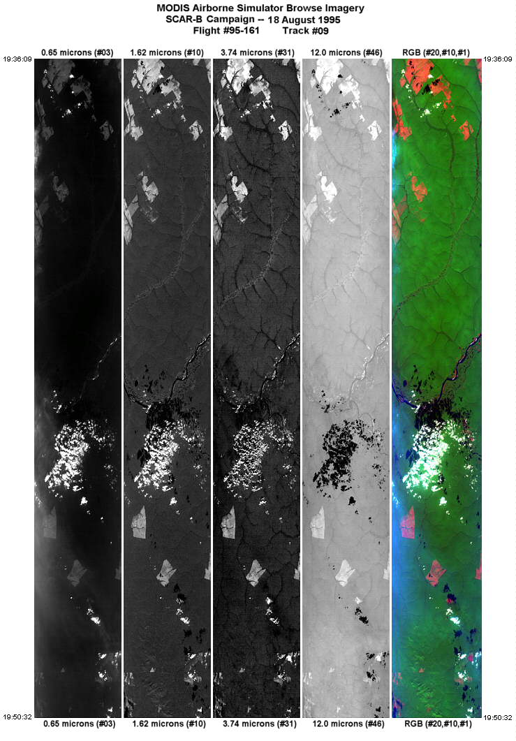
| 9 |
19:36-19:50 |
294 |
11.34-10.70 |
52.56-54.03 |
5390 |
~20000 |
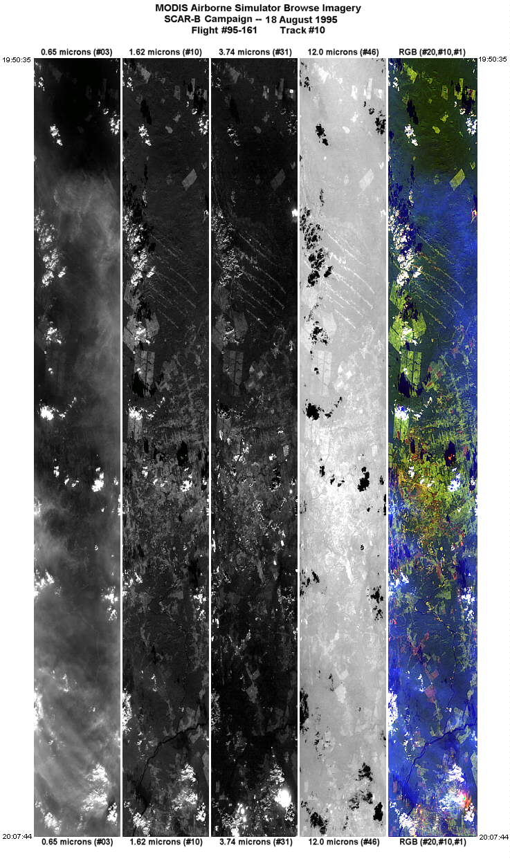
| 10 |
19:50-20:07 |
294 |
10.69-9.93 |
54.04-55.78 |
6433 |
~20000 |
| 11 |
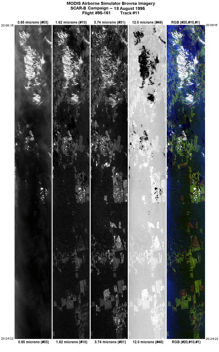
20:08-20:24 |
270 |
9.92-9.92 |
55.83-57.59 |
6039 |
~20000 |
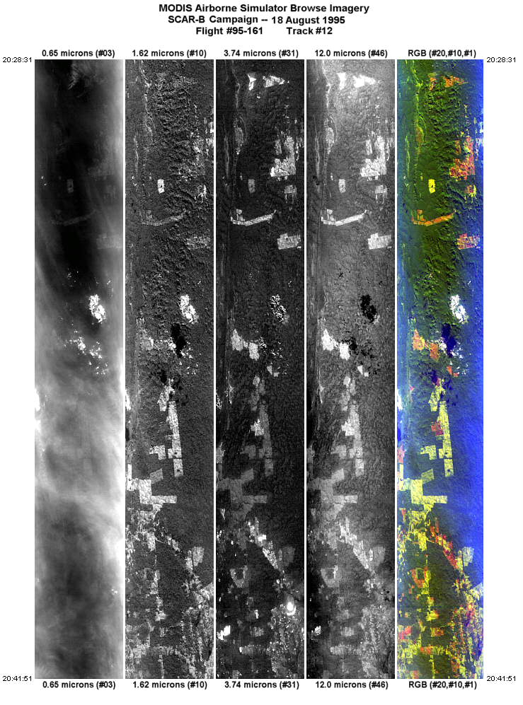
| 12 |
20:28-20:41 |
88 |
10.23-10.23 |
57.63-56.09 |
5007 |
~20000 |
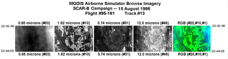
| 13 |
20:42-20:44 |
88 |
10.23-10.23 |
55.98-55.83 |
488 |
~20000 |
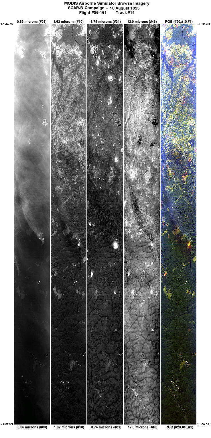
| 14 |
20:44-21:06 |
110 |
10.26-11.13 |
55.75-53.42 |
7964 |
~20000 |
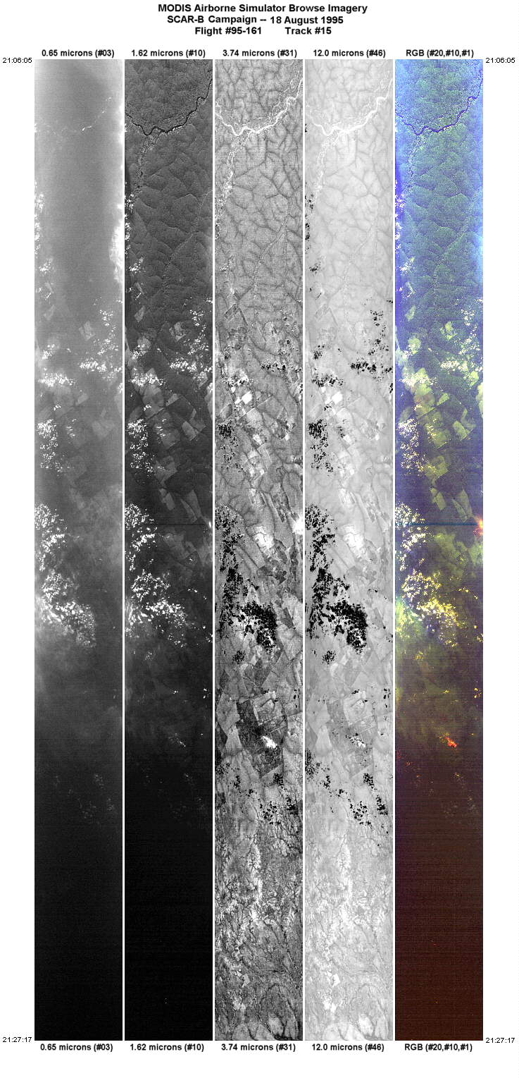
| 15 |
21:06-21:27 |
107 |
11.13-11.98 |
53.42-51.05 |
7953 |
~20000 |
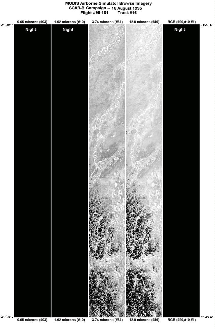
| 16 |
21:28-21:43 |
147 |
12.07-13.58 |
50.96-49.97 |
5765 |
~20000 |
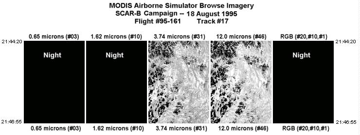
| 17 |
21:44-21:46 |
131 |
13.63-13.82 |
49.92-49.68 |
970 |
~20000 |
| Images 01 through 17 in sequence (2.0Mb) |
Level-1B HDF Data Acquisition
Order Form (NASA LaRC Atmospheric Sciences Data Center)
Additional Information
The objective of this flight was to
coordinate the ER-2 and C-131A airraft in the region of the cerrado
northwest of Brasilia, in the direction of Porto Nacional.
Following the coordination, and mapping of the bi-directional reflectance function
of the cerrado, the ER-2 flew to Alta Floresta, in the vicinity of more
numerous fires and smoke. The ER-2 aircraft also overflew a cloudy sunphotometer
site at Alta Floresta before returning home after sunset.
The ER-2 pilot observed a large fire, smoke, and capping cumulonimbus
at 19:28 GMT. Data from the ER-2 showed the fire temperature exceeded 500K
and generated a great deal of smoke which entered the cloud. The cloud
top temperature was around -3C.
|
|
|
|