
|
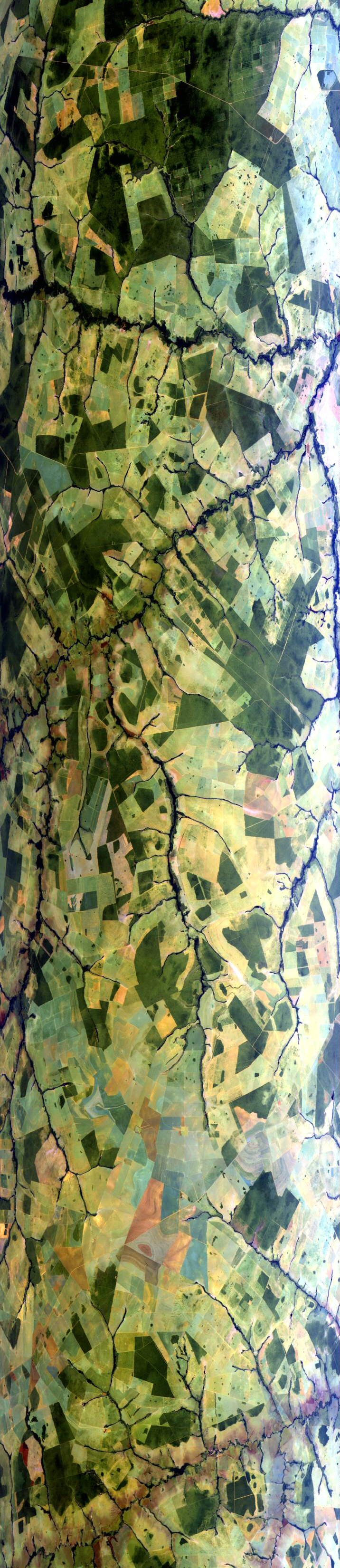
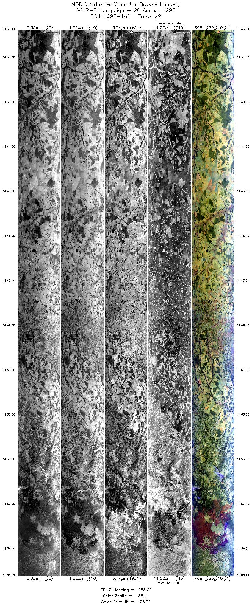
Sample Image

20 August 1995
Track #02
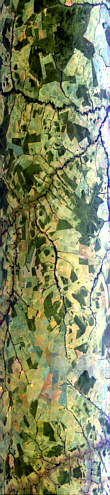

"Agricultural areas north of
Campo Grande, Brazil"
R: 2.14 microns
G: 1.62 microns
B: 0.55 microns
|
|
Summary Information
Date: August 20, 1995
ER-2 Flight Number: 95-162
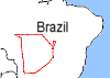
Location: Central Brazil
Principle Investigator: Yorum Kaufman
Additional Sensors: VIS,CLS,AVIRIS
Level-1B Processing Information
Level-1B Data Version: #09
Calibration Type: Final
Calibration Version: SCAR-B_King 1.0
Temperature Adjustment: Yes (24C)
Status: Done!
|
|
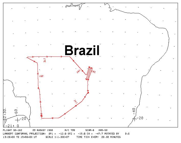
Flight Track Map

|
Level-1B Browse Imagery
Straight Line Flight Tracks: 19
Scanlines Processed: 104094
Solar Azimuth and Zenith Angles
|
Browse Images
|
Click on the Flight Track number to load images.
Lat/Lon ranges are for the BEG-END scanline nadir pixels.
|
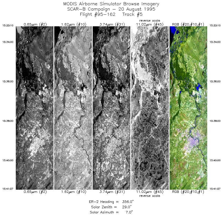
Flight
Track |
Time_Span
(GMT) |
Heading
(Deg) |
Lat_Range
(Deg_S) |
Lon_Range
(Deg_W) |
Length
(Scanlines) |
Altitude
(Meters) |
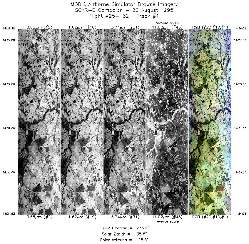
| 1 |
14:26-14:34 |
236 |
19.36-19.88 |
52.05-52.87 |
3150 |
~20000 |
| 2 |
14:35-15:00 |
268 |
19.91-19.92 |
52.96-55.78 |
9169 |
~20000 |
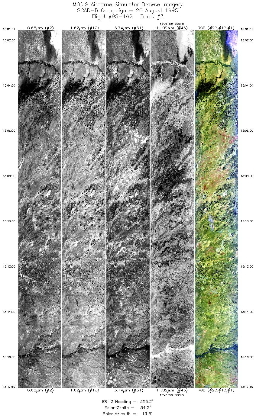
| 3 |
15:01-15:17 |
355 |
19.83-18.08 |
55.87-55.96 |
5923 |
~20000 |
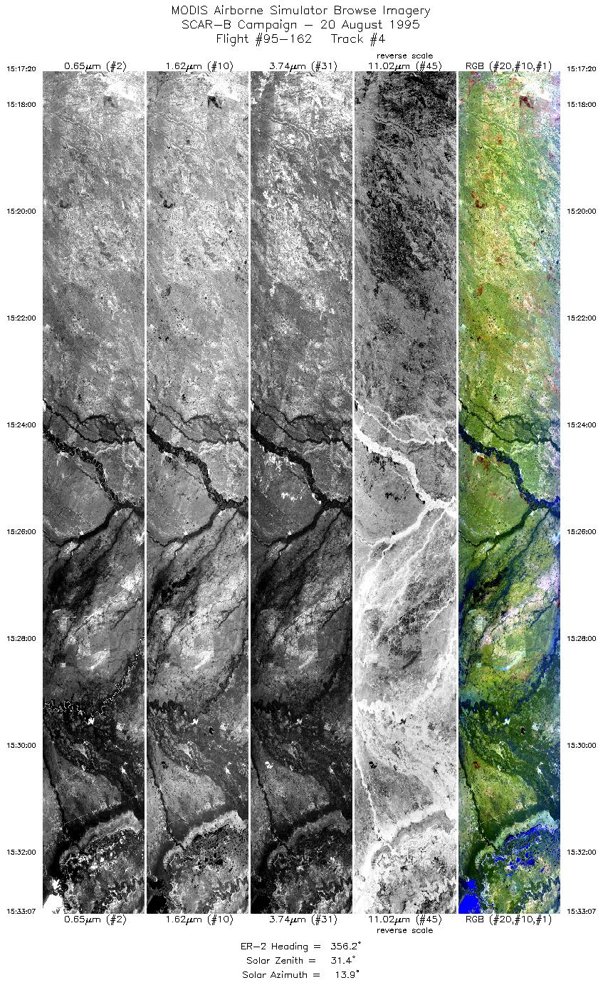
| 4 |
15:17-15:33 |
356 |
18.08-16.29 |
55.96-56.04 |
5916 |
~20000 |
| 5 |
15:33-15:41 |
356 |
16.27-15.32 |
56.04-56.08 |
3106 |
~20000 |
| 6 |
15:42-15:44 |
328 |
15.22-15.02 |
56.12-56.24 |
757 |
~20000 |
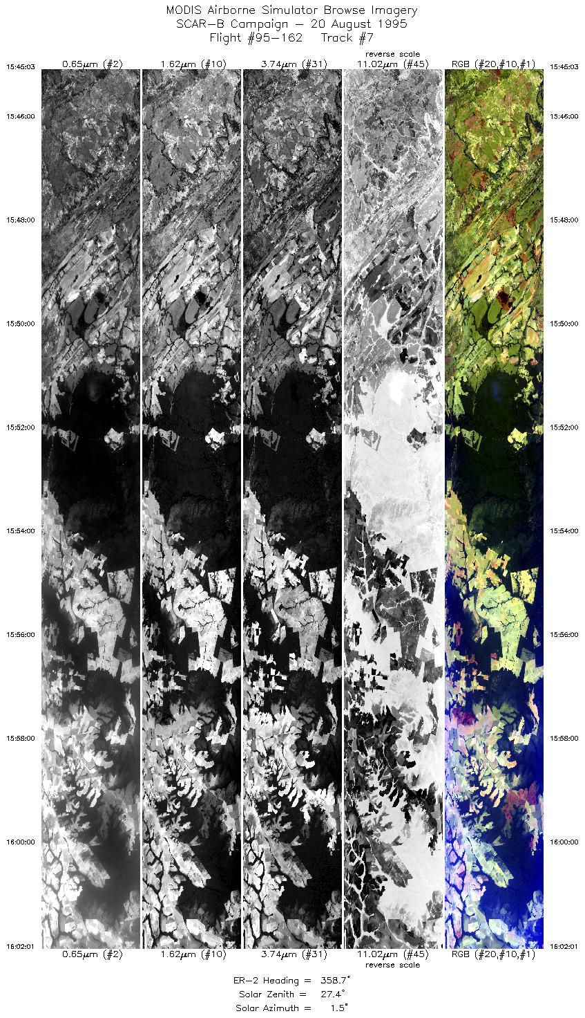
| 7 |
15:45-16:02 |
359 |
14.95-12.97 |
56.25-56.25 |
6361 |
~20000 |
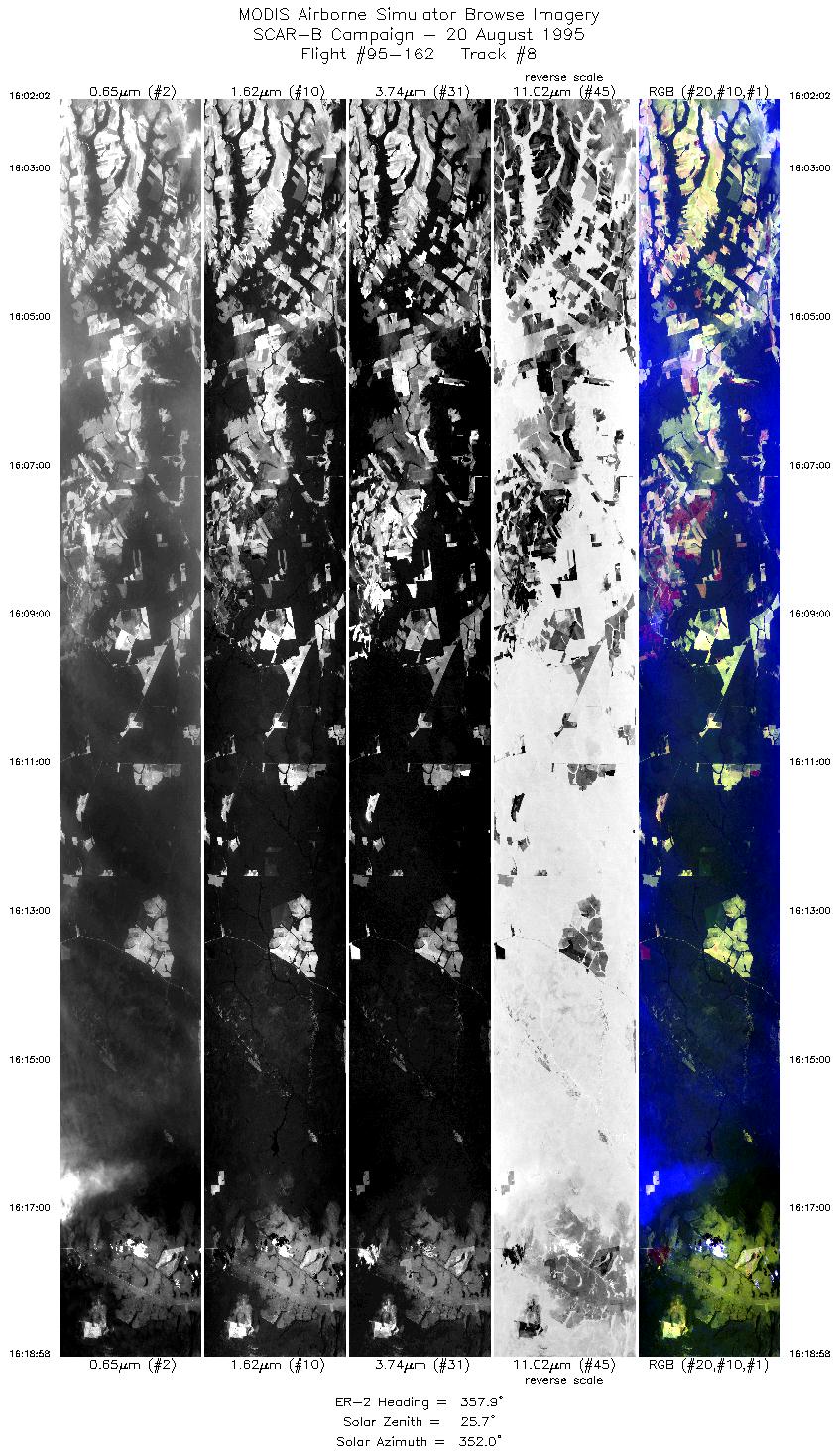
| 8 |
16:02-16:18 |
358 |
12.95-11.00 |
56.25-56.25 |
6348 |
~20000 |
| 9 |
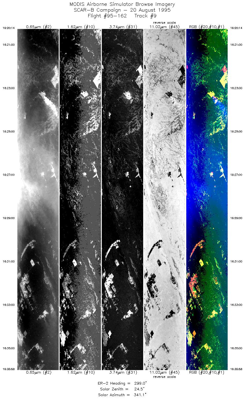
16:20-16:35 |
299 |
10.90-10.03 |
56.32-57.80 |
5896 |
~20000 |
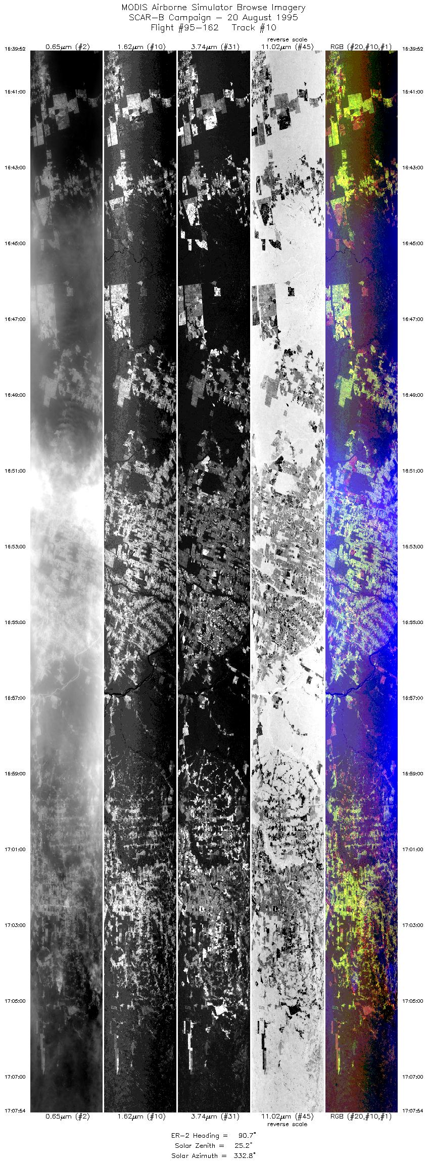
| 10 |
16:39-17:07 |
91 |
9.87-9.96 |
57.55-54.27 |
10507 |
~20000 |
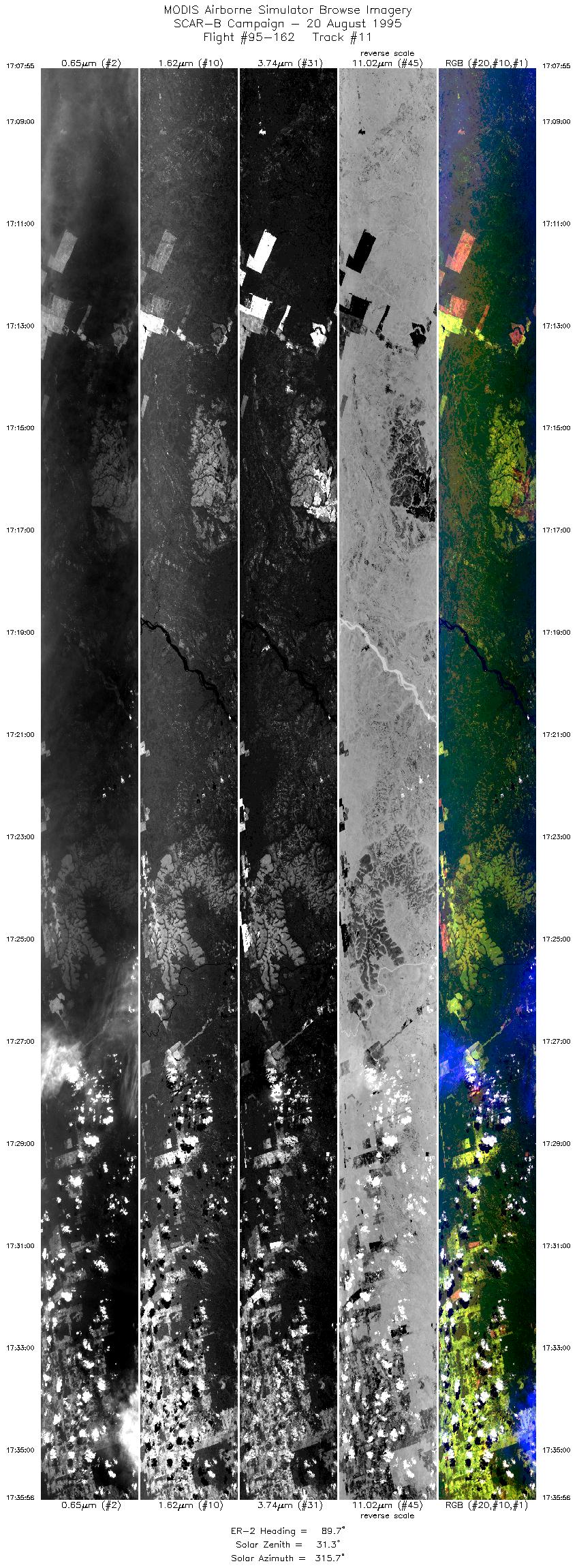
| 11 |
17:07-17:35 |
90 |
9.97-10.00 |
54.27-51.00 |
10501 |
~20000 |
| 12 |
17:36-17:46 |
140 |
10.04-10.85 |
50.91-50.20 |
3667 |
~20000 |
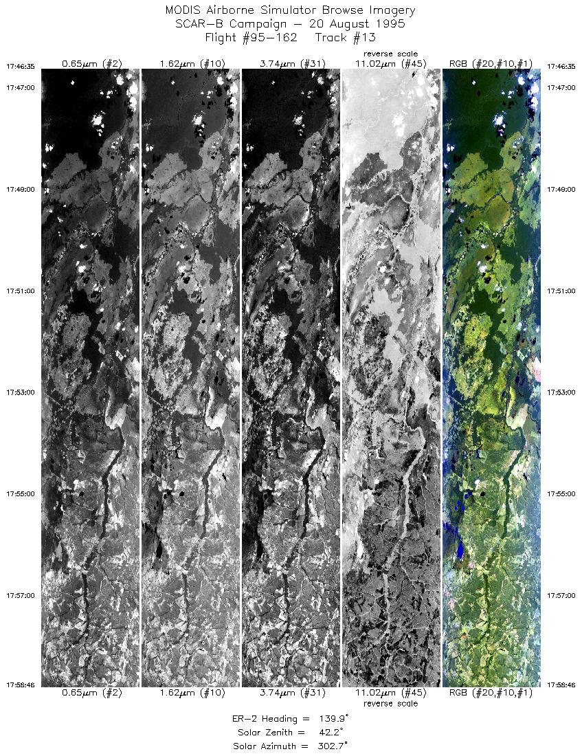
| 13 |
17:46-17:58 |
140 |
10.85-11.86 |
50.19-49.30 |
4504 |
~20000 |
| 14 |
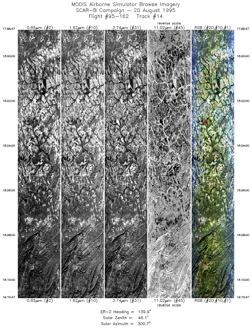
17:58-18:10 |
140 |
11.86-12.85 |
49.30-48.41 |
4500 |
~20000 |
| 15 |
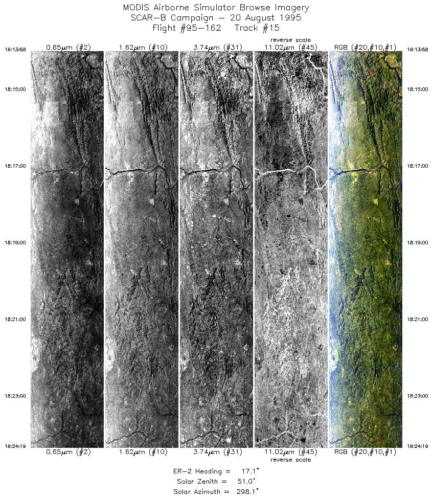
18:13-18:24 |
17 |
12.91-11.80 |
48.14-47.79 |
3882 |
~20000 |
| 16 |
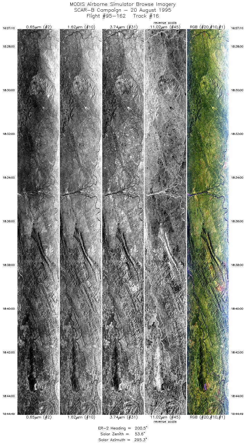
18:27-18:44 |
201 |
11.85-13.67 |
47.60-48.26 |
6620 |
~20000 |
| 17 |
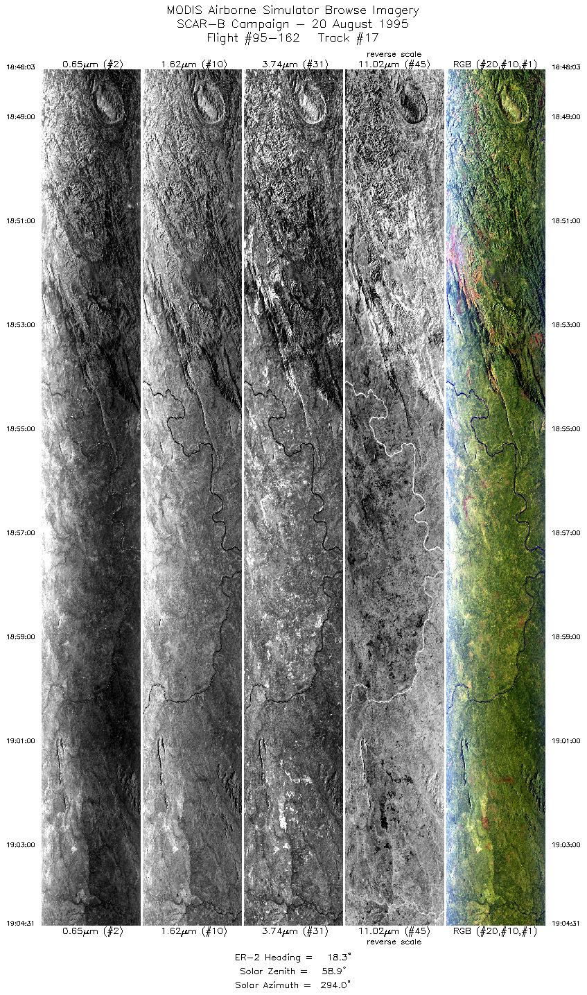
18:48-19:04 |
18 |
13.69-11.92 |
48.05-47.43 |
6177 |
~20000 |
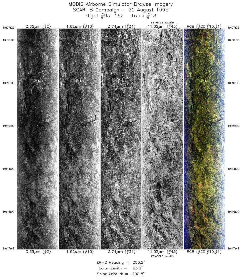
| 18 |
19:07-19:17 |
200 |
11.98-13.04 |
47.24-47.64 |
3865 |
~20000 |
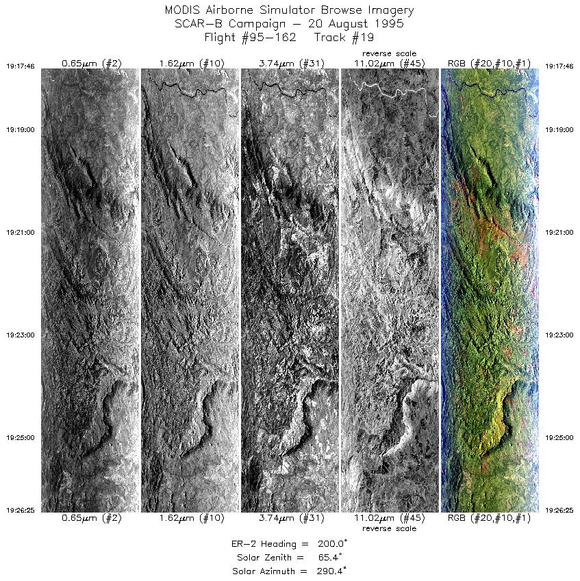
| 19 |
19:17-19:26 |
200 |
13.05-13.93 |
47.64-47.97 |
3245 |
~20000 |
| Images 01 through 19 in sequence |
Level-1B HDF Data Acquisition
Order Form (NASA LaRC Atmospheric Sciences Data Center)
Additional Information
The objective of this flight was to measure clouds, smoke and fires in different
regions of the cerrado and Amazon basin; and to collect large statistics
of 150,000 square km of fire-smoke and smoke-cloud interactions and relationships.
Less fire activity was anticipated and observed due to it being Sunday. There
was still are large fraction of smoldering fires in the north from the previous day.
The pilot reported heavy smoke near Alta Floresta, and clearer conditions
towards Cuiaba and Porto National.
|
|
|
|