
|
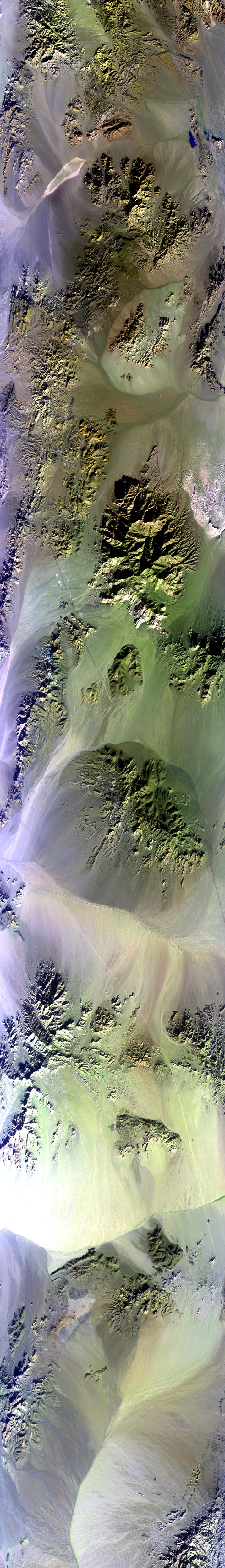
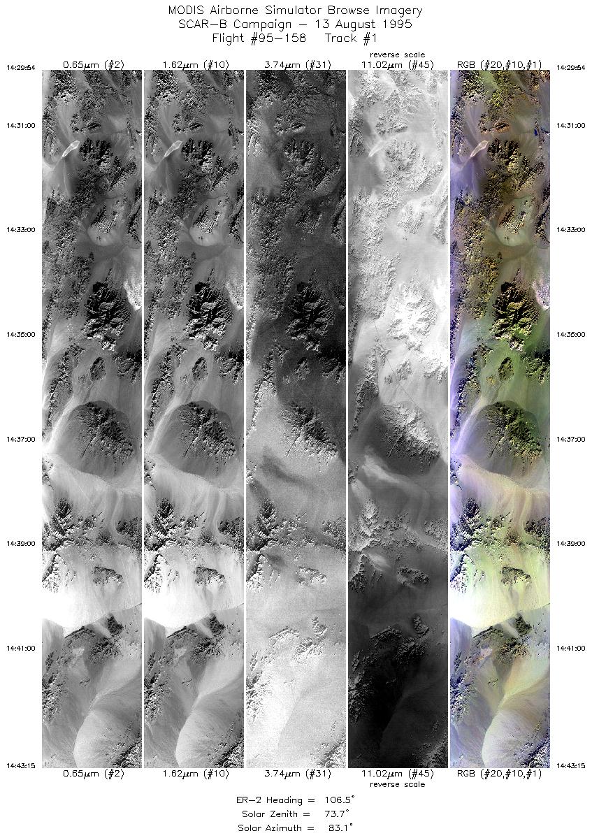
Sample Image

13 August 1995
Track #01
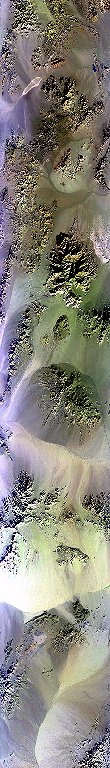

"Sunlight dances across erosion patterns
created by several Washes
in the Mojave Desert, California"
R: 2.14 microns
G: 1.62 microns
B: 0.55 microns
|
|
Summary Information
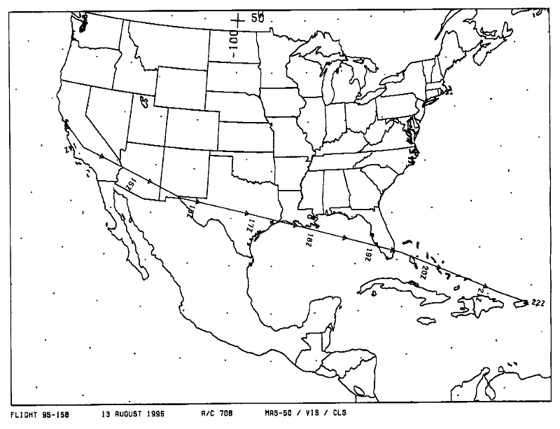
Date: August 13, 1995
ER-2 Flight Number: 95-158
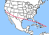
Location: California to Puerto Rico
Principle Investigator: Yorum Kaufman (NASA GSFC)
Additional Sensors: VIS,CLS
Level-1B Processing Information
Level-1B Data Version: Not Available
Calibration Type: Final
Calibration Version: SCAR-B_King 1.0
Temperature Adjustment: Yes (24C)
Status: Done!
|
|
Flight Track Map

|
Level-1B Browse Imagery
Straight Line Flight Tracks: 33
Scanlines Processed: 157654
Solar Azimuth and Zenith Angles
|
Browse Images
|
Click on the Flight Track number to load images.
Lat/Lon ranges are for the BEG-END scanline nadir pixels.
|
Flight
Track |
Time_Span
(GMT) |
Heading
(Deg) |
Lat_Range
(Deg_N) |
Lon_Range
(Deg_W) |
Length
(Scanlines) |
Altitude
(Meters) |
| 1 |
14:29-14:43 |
106 |
34.96-34.47 |
116.36-114.57 |
4998 |
~20000 |
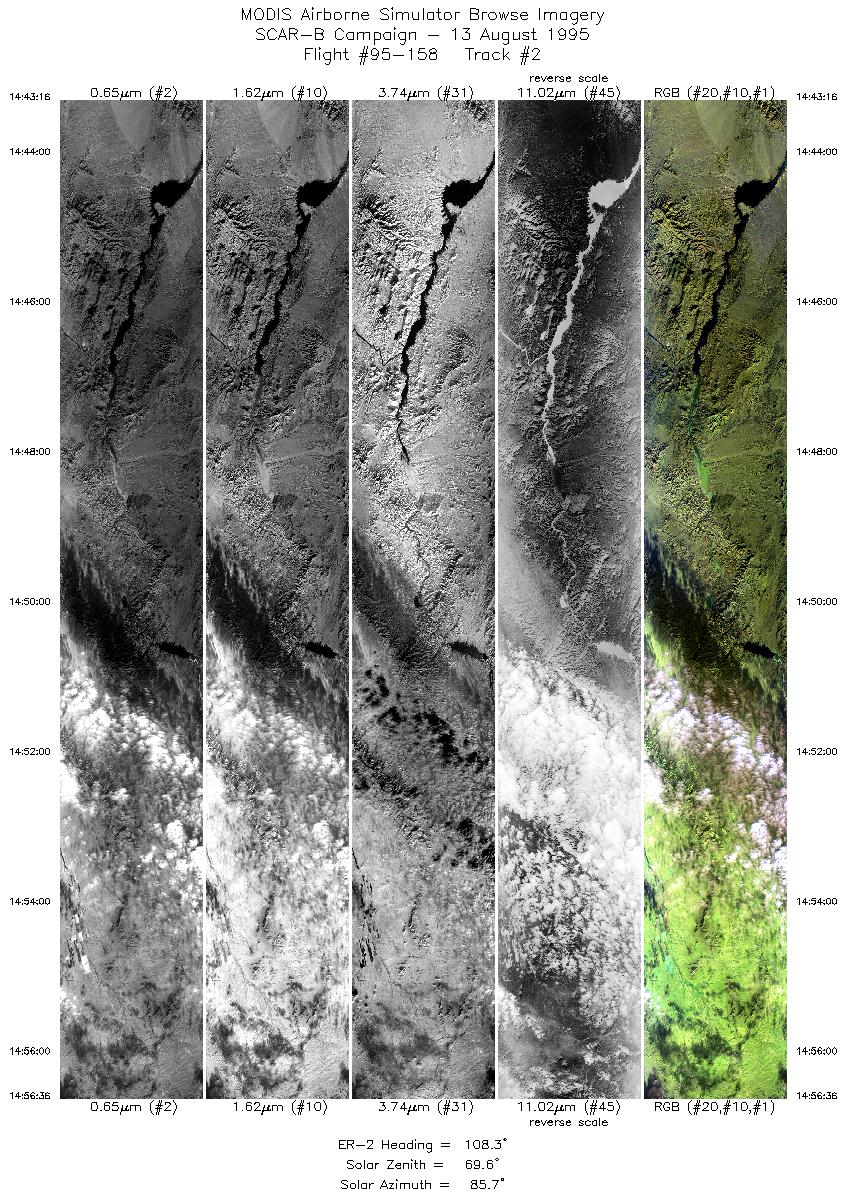
| 2 |
14:43-14:56 |
108 |
34.47-33.97 |
114.56-112.82 |
4995 |
~20000 |
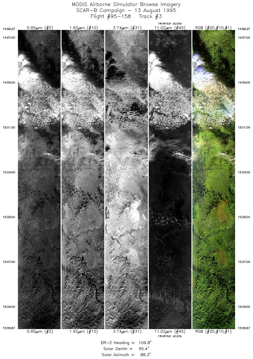
| 3 |
14:56-15:09 |
110 |
33.97-33.45 |
112.83-111.12 |
4996 |
~20000 |
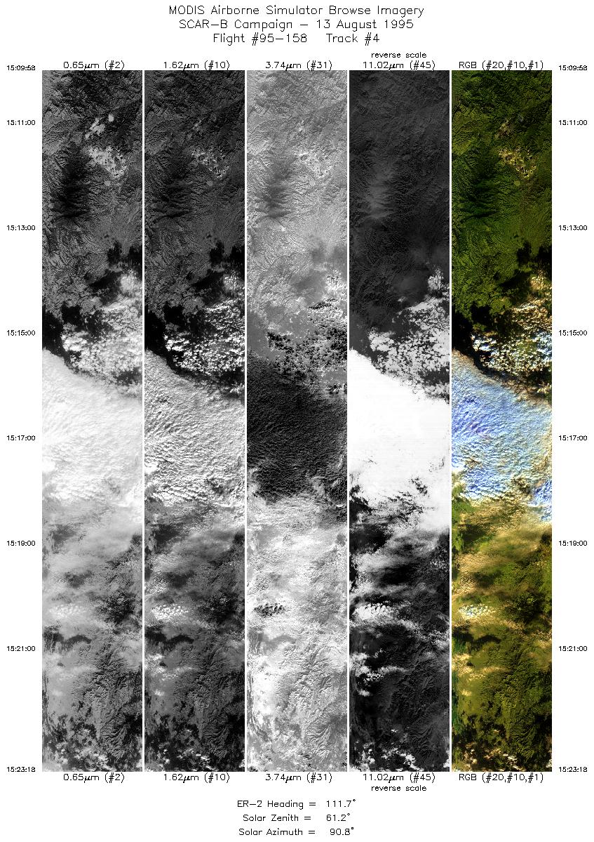
| 4 |
15:09-15:23 |
112 |
33.45-32.91 |
111.11-109.43 |
4997 |
~20000 |
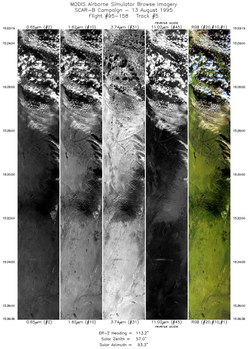
| 5 |
15:23-15:36 |
113 |
32.91-32.37 |
109.43-107.83 |
4968 |
~20000 |
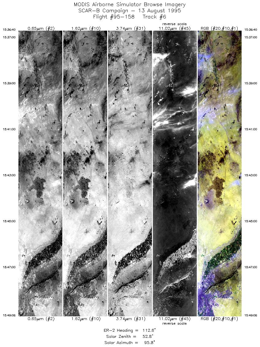
| 6 |
15:36-15:49 |
113 |
32.37-31.83 |
107.82-106.32 |
4661 |
~20000 |
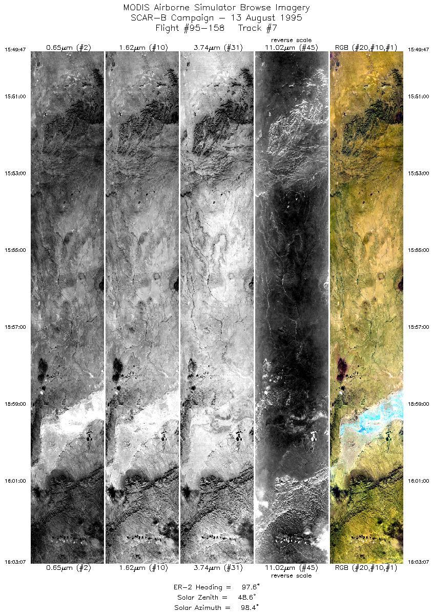
| 7 |
15:49-16:03 |
98 |
31.81-31.60 |
106.23-104.50 |
4998 |
~20000 |
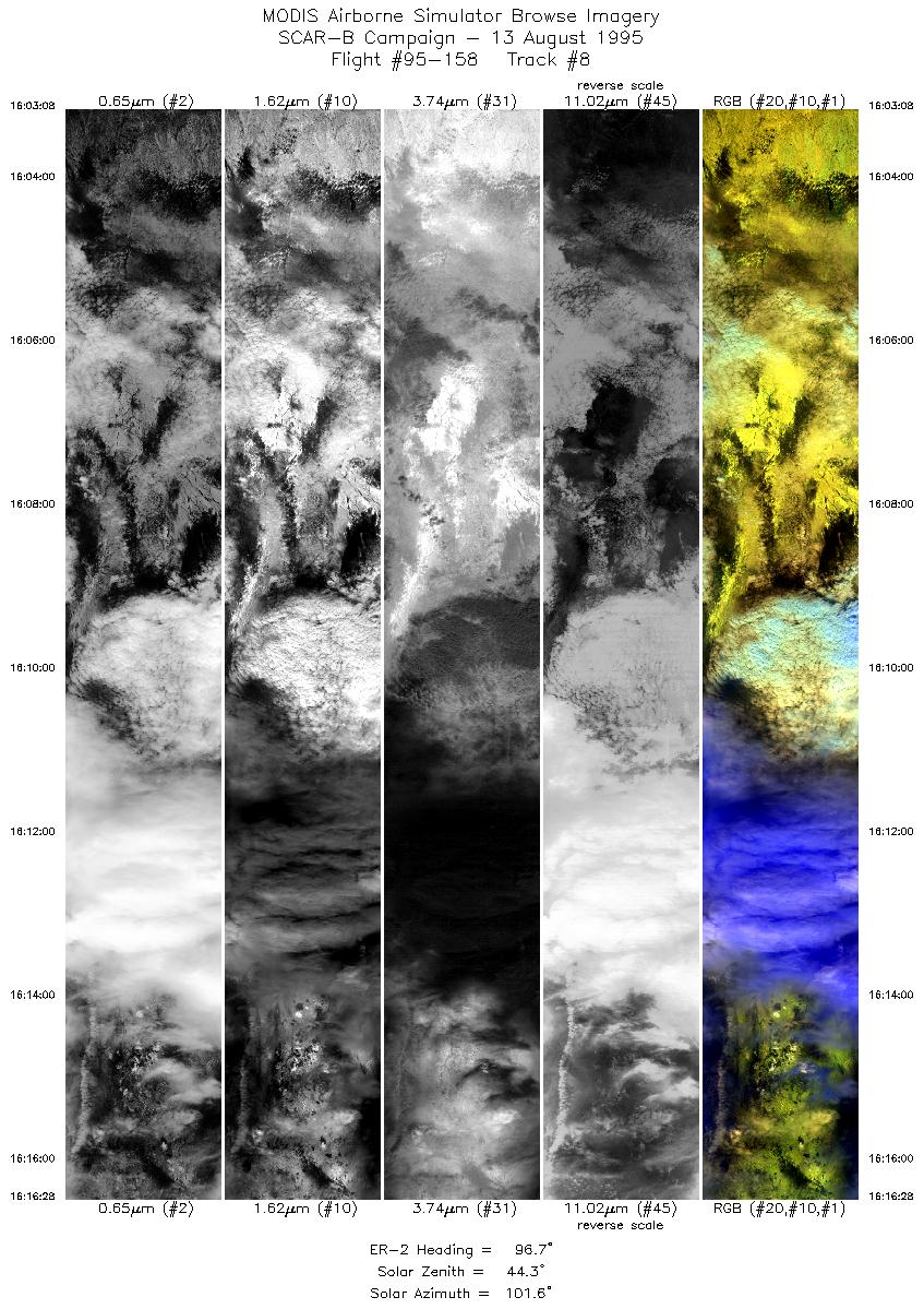
| 8 |
16:03-16:16 |
97 |
31.60-31.37 |
104.50-102.78 |
4998 |
~20000 |
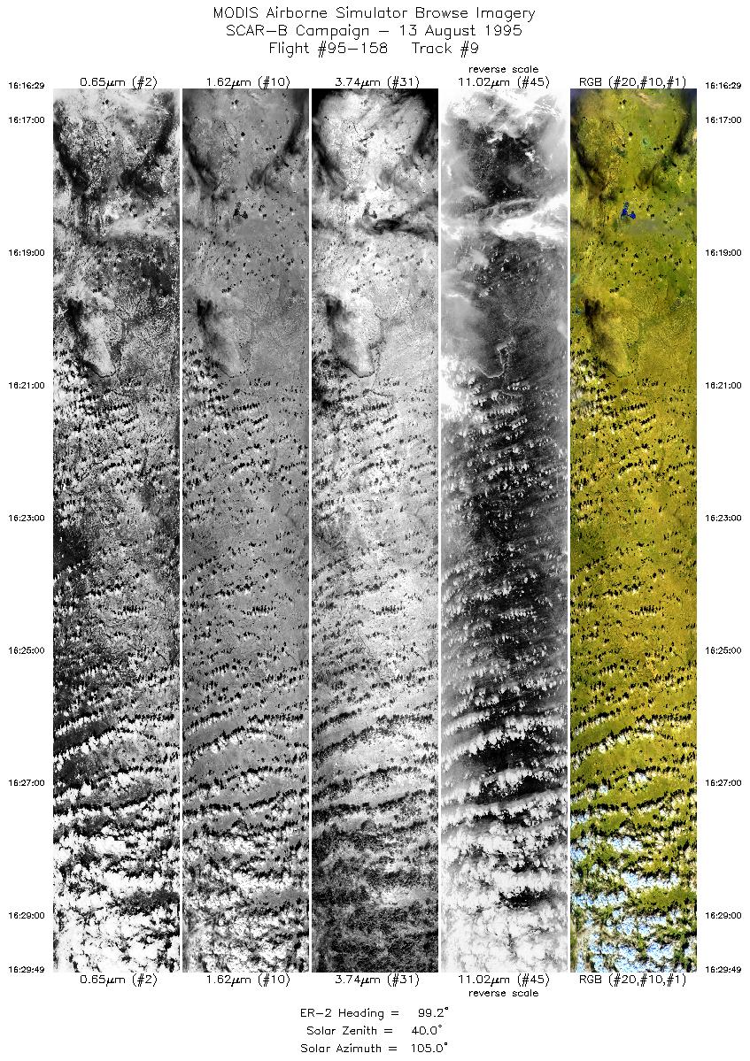
| 9 |
16:16-16:29 |
99 |
31.37-31.12 |
102.78-101.09 |
4998 |
~20000 |
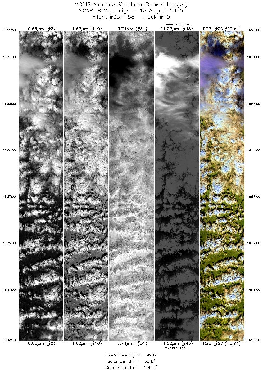
| 10 |
16:29-16:43 |
99 |
31.11-30.85 |
101.07-99.43 |
4997 |
~20000 |
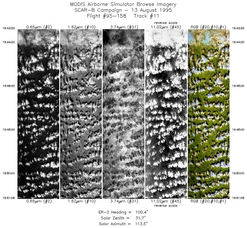
| 11 |
16:43-16:51 |
100 |
30.84-30.68 |
99.42-98.47 |
2912 |
~20000 |
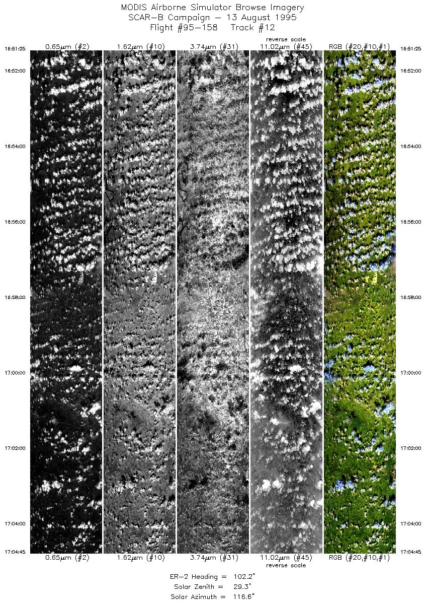
| 12 |
16:51-17:04 |
102 |
30.68-30.38 |
98.44-96.85 |
4997 |
~20000 |
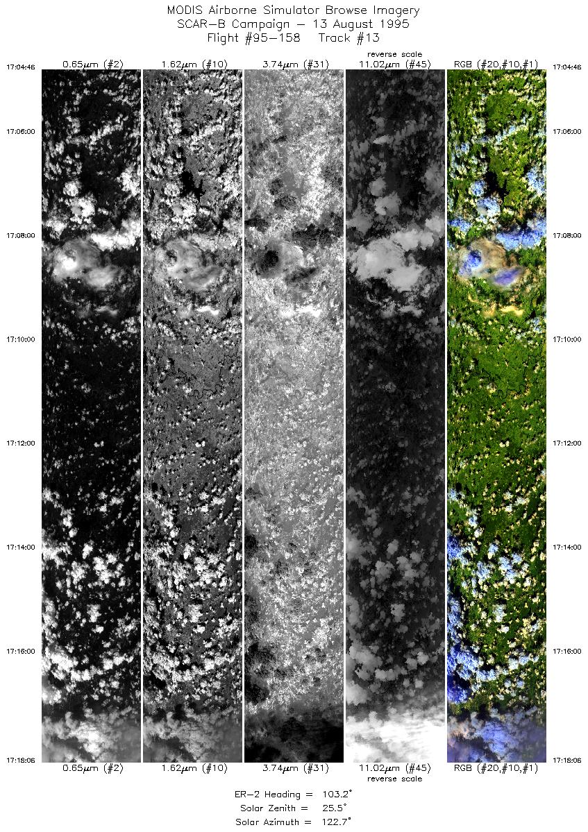
| 13 |
17:04-17:18 |
103 |
30.38-30.06 |
96.85-95.23 |
4996 |
~20000 |
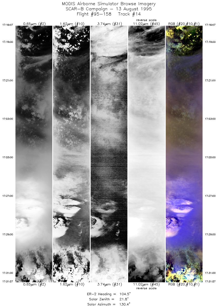
| 14 |
17:18-17:31 |
105 |
30.06-29.72 |
95.23-93.62 |
4997 |
~20000 |
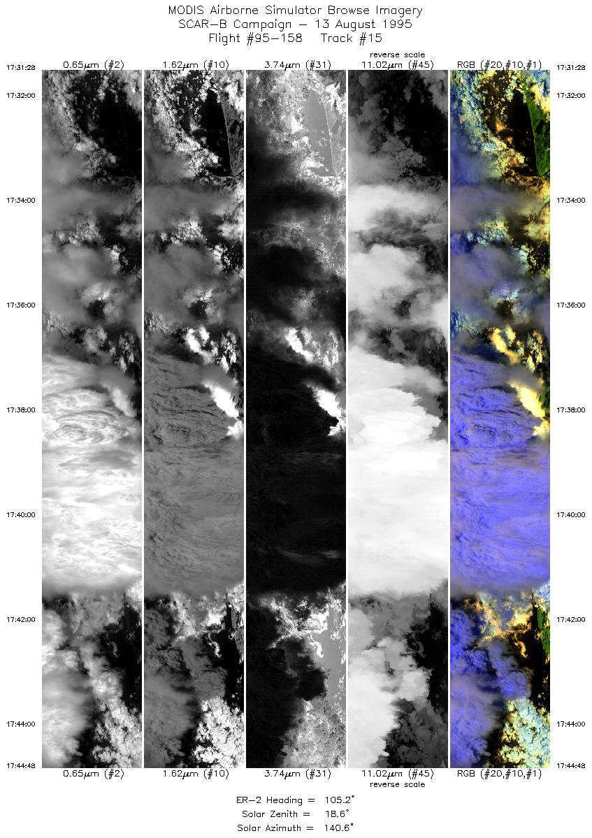
| 15 |
17:31-17:44 |
105 |
29.72-29.36 |
93.62-92.02 |
4997 |
~20000 |
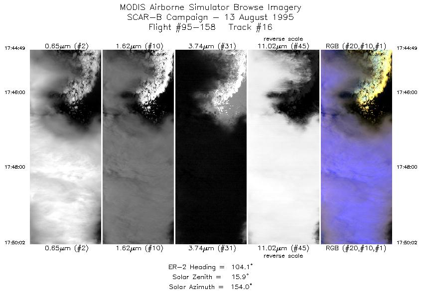
| 16 |
17:44-17:50 |
104 |
29.36-29.21 |
92.02-91.39 |
1956 |
~20000 |
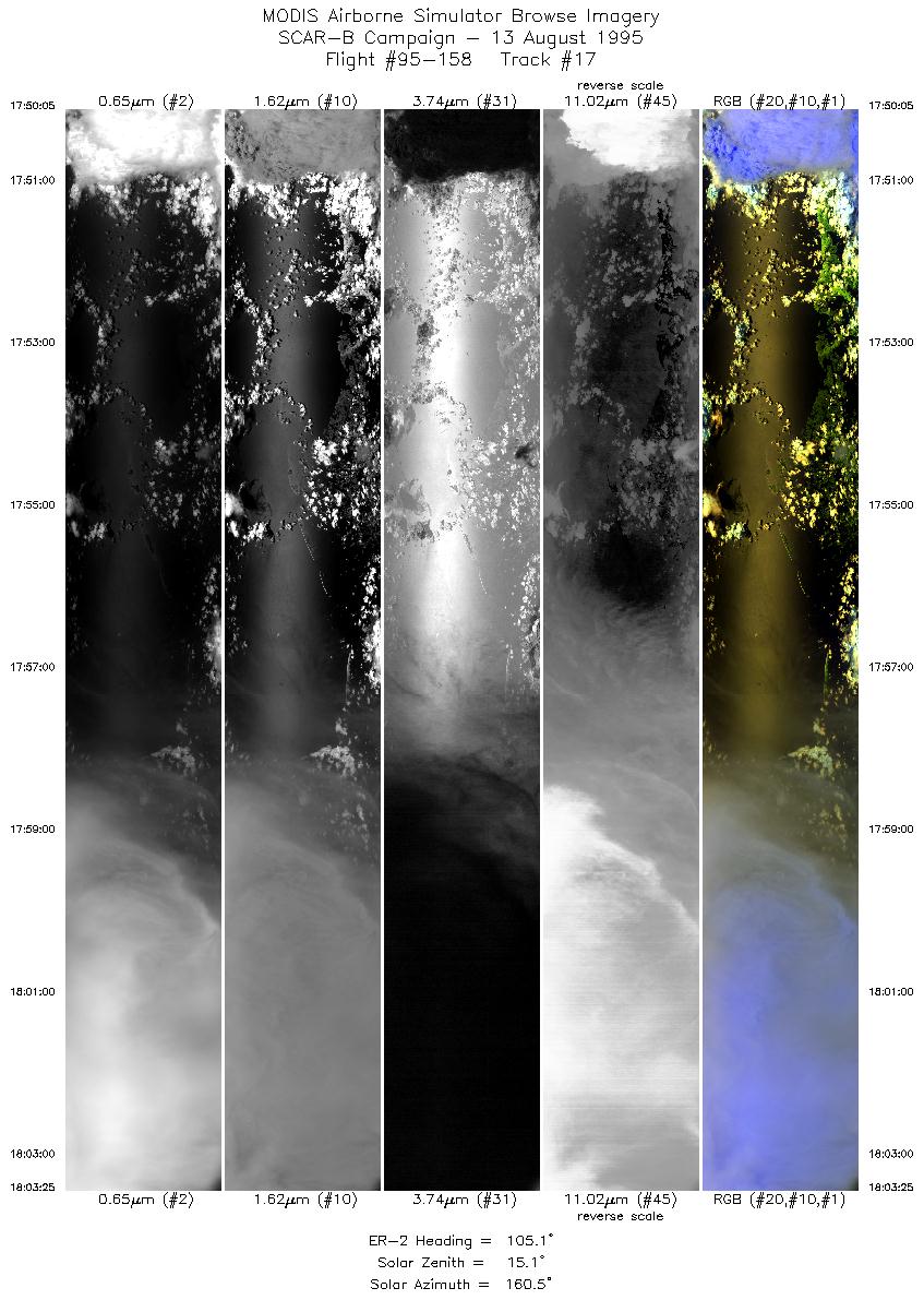
| 17 |
17:50-18:03 |
105 |
29.21-28.81 |
91.37-89.75 |
4956 |
~20000 |
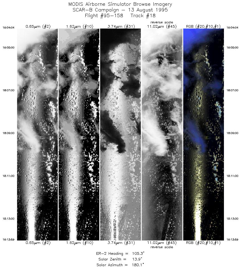
| 18 |
18:04-18:13 |
105 |
28.79-28.49 |
89.67-88.48 |
3717 |
~20000 |
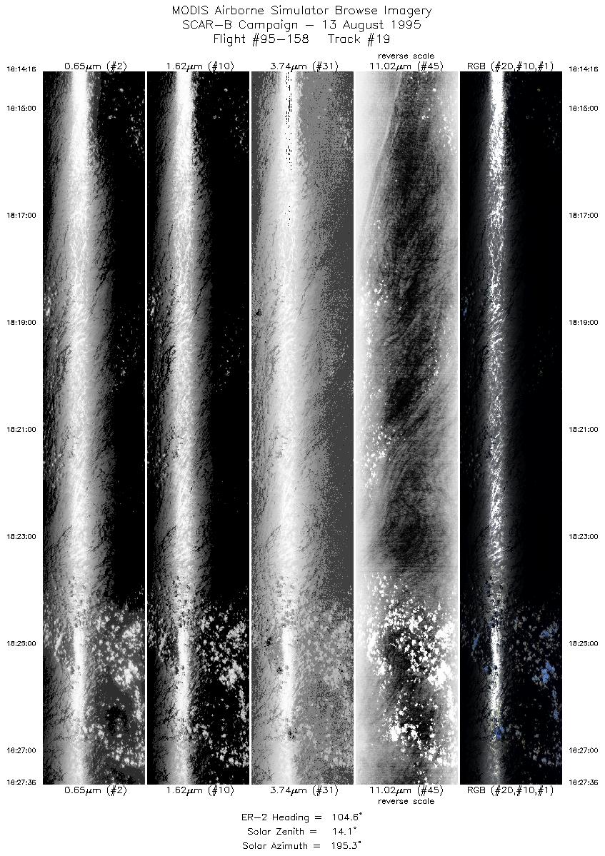
| 19 |
18:14-18:27 |
105 |
28.48-28.05 |
88.44-86.88 |
4997 |
~20000 |
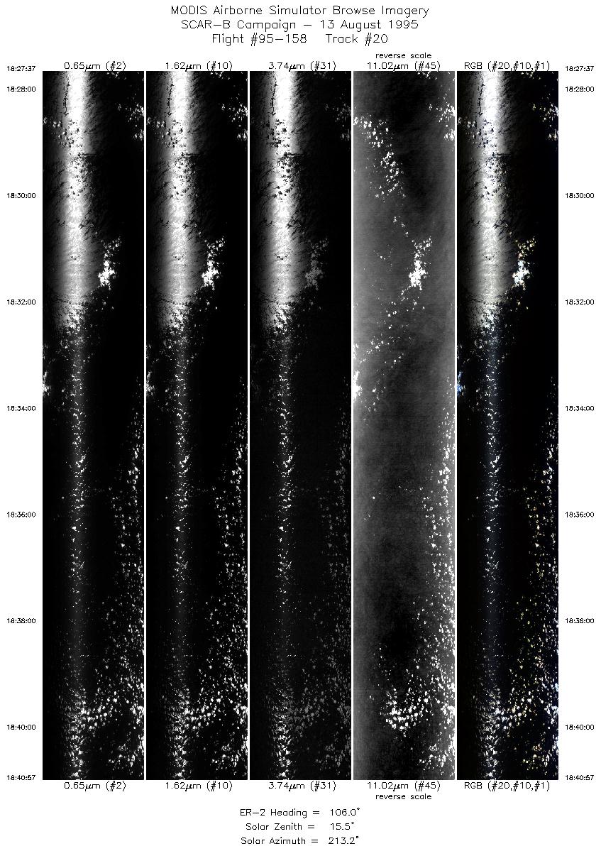
| 20 |
18:27-18:40 |
106 |
28.05-27.61 |
86.88-85.32 |
4997 |
~20000 |
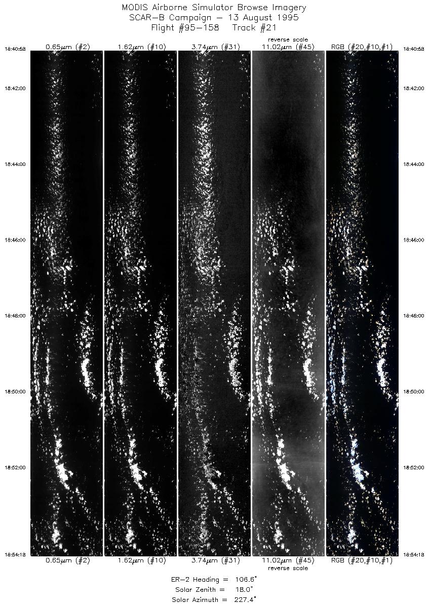
| 21 |
18:40-18:54 |
107 |
27.61-27.16 |
85.33-83.81 |
4997 |
~20000 |
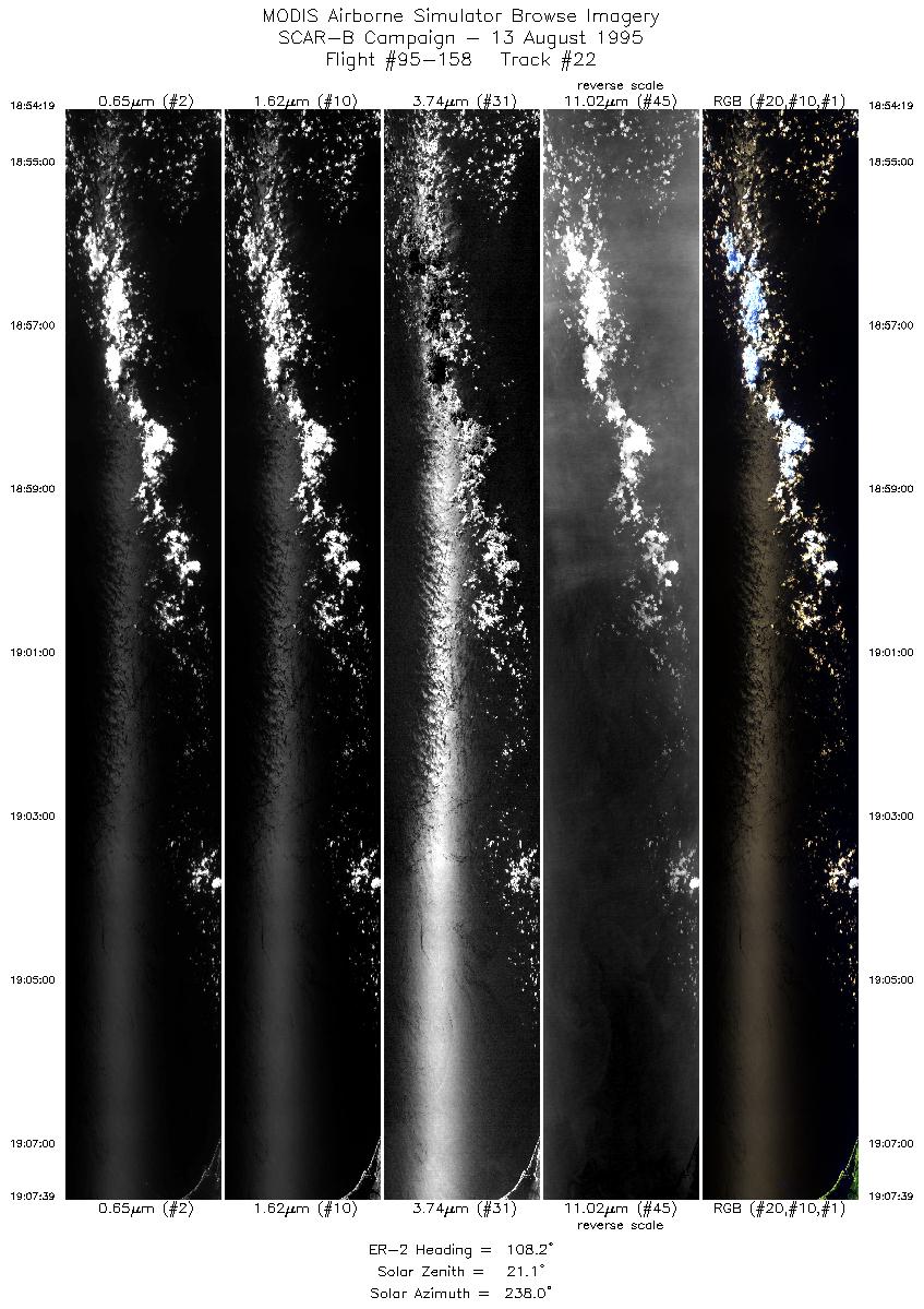
| 22 |
18:54-19:07 |
108 |
27.16-26.69 |
83.80-82.28 |
4998 |
~20000 |
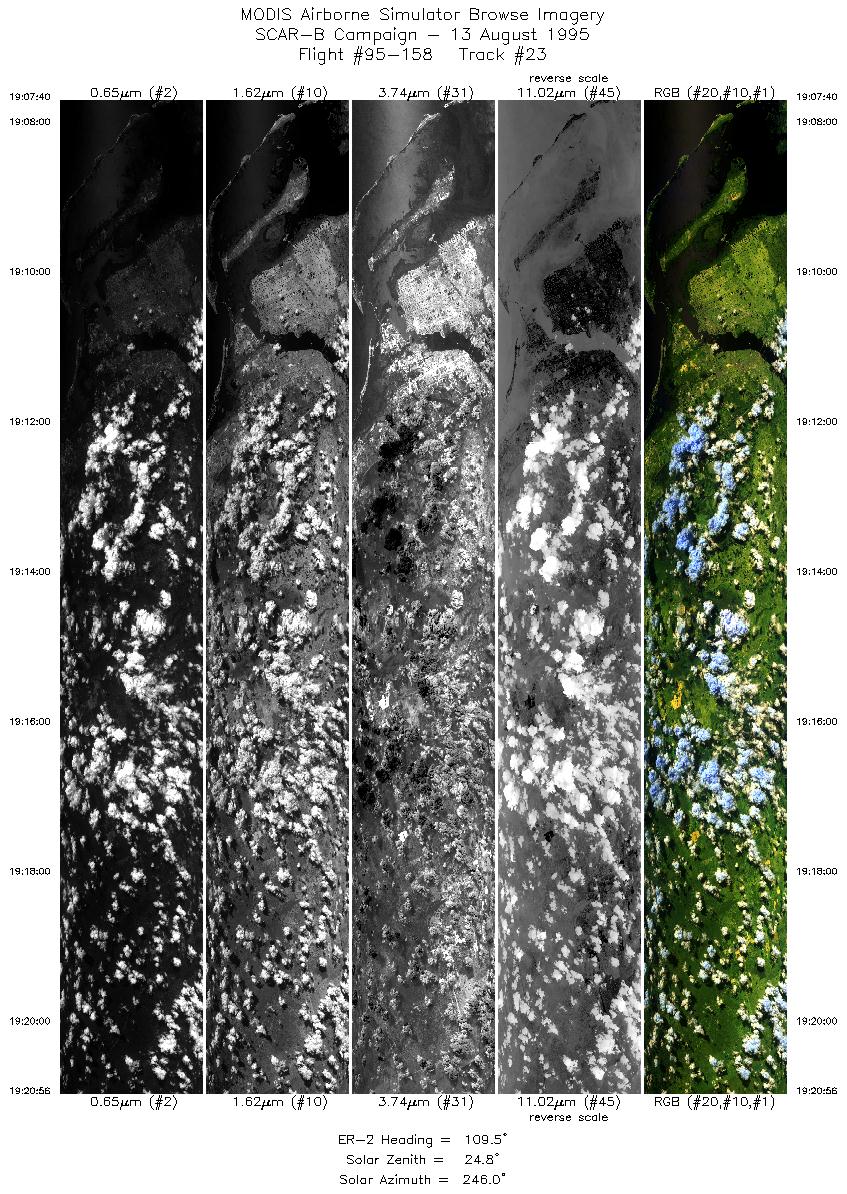
| 23 |
19:07-19:20 |
110 |
26.69-26.22 |
82.28-80.81 |
4972 |
~20000 |
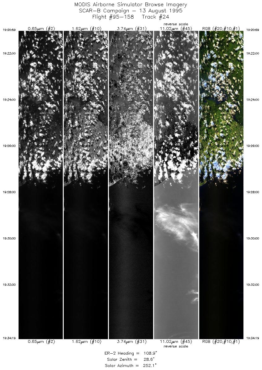
| 24 |
19:20-19:34 |
109 |
26.22-25.72 |
80.81-79.32 |
4997 |
~20000 |
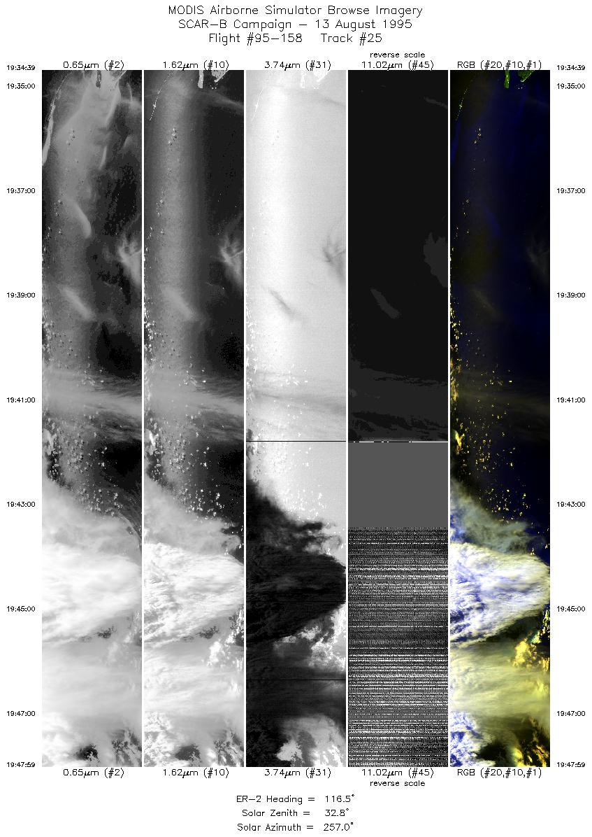
| 25 |
19:34-19:47 |
116 |
25.70-25.02 |
79.28-77.89 |
4984 |
~20000 |
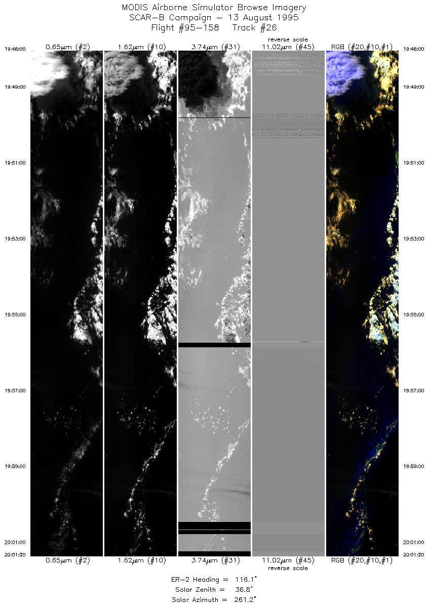
| 26 |
19:48-20:01 |
116 |
25.02-24.33 |
77.89-76.51 |
4997 |
~20000 |
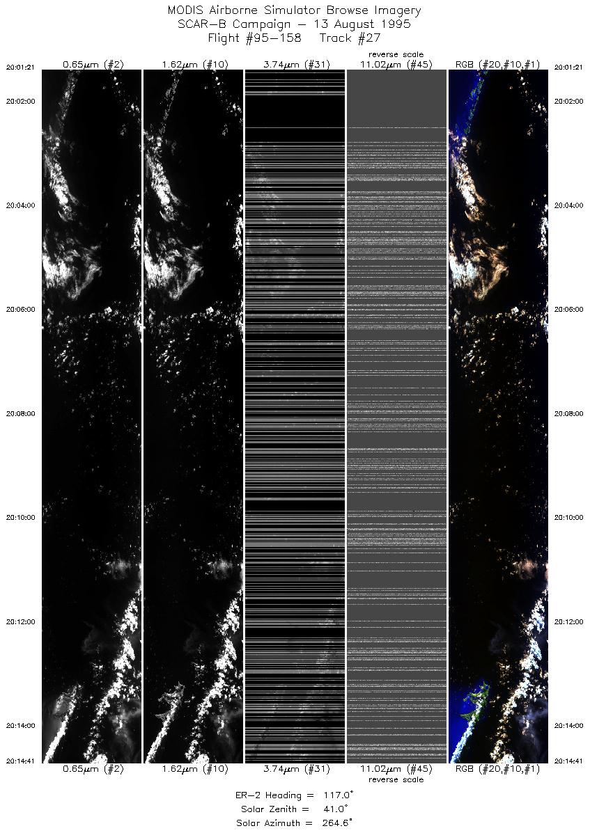
| 27 |
20:01-20:14 |
117 |
24.34-23.64 |
76.52-75.16 |
4987 |
~20000 |
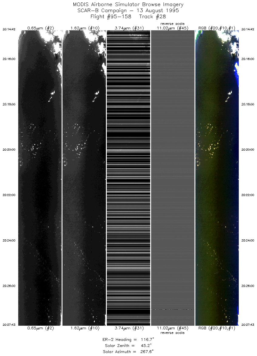
| 28 |
20:14-20:27 |
117 |
23.63-22.93 |
75.15-73.84 |
4878 |
~20000 |
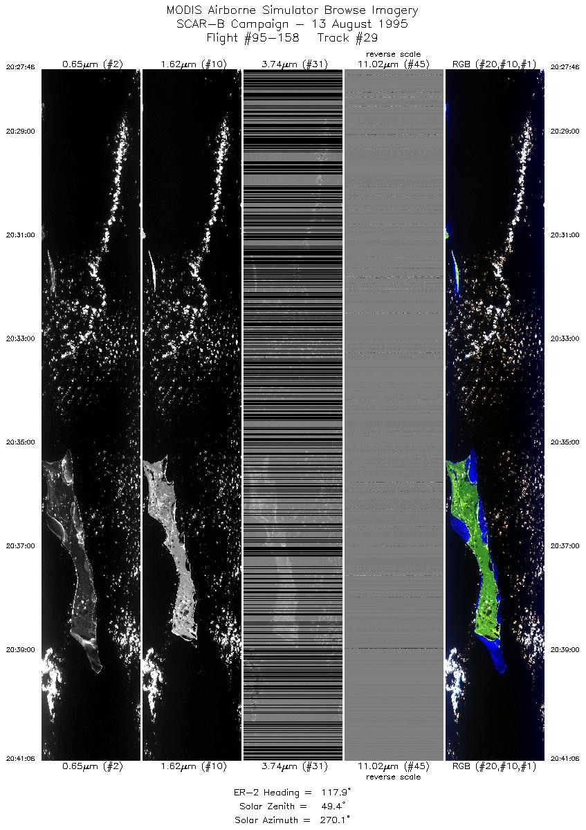
| 29 |
20:27-20:41 |
118 |
22.93-22.20 |
73.84-72.49 |
4998 |
~20000 |
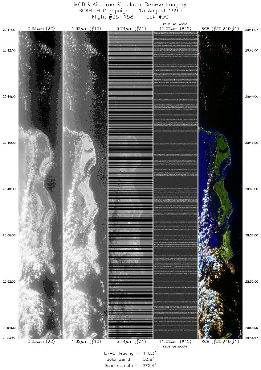
| 30 |
20:41-20:54 |
118 |
22.20-21.44 |
72.49-71.14 |
4998 |
~20000 |
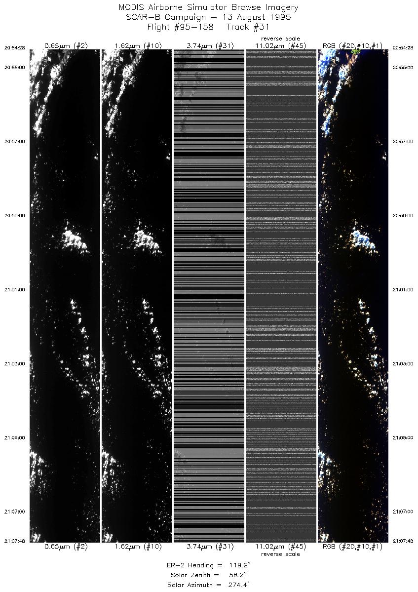
| 31 |
20:54-21:07 |
120 |
21.44-20.64 |
71.14-69.83 |
4998 |
~20000 |
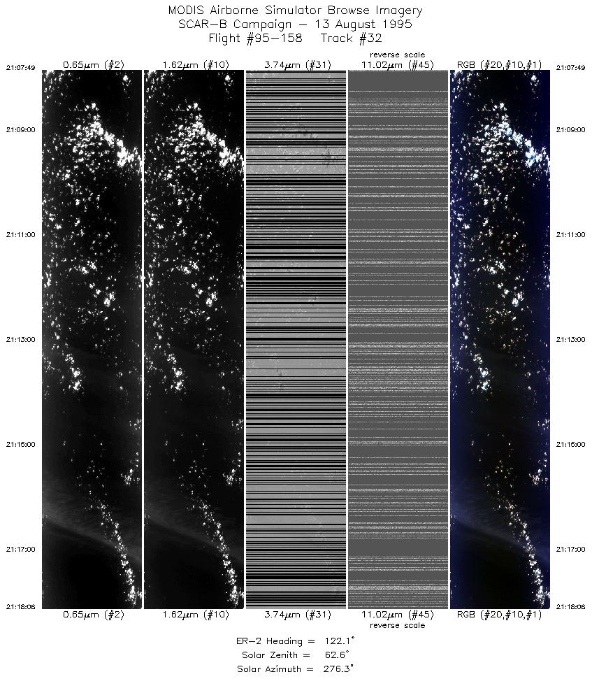
| 32 |
21:07-21:18 |
122 |
20.64-20.02 |
69.83-68.84 |
3855 |
~20000 |
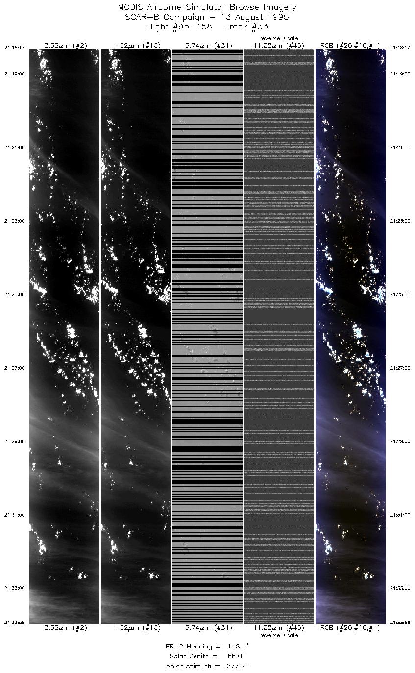
| 33 |
21:18-21:33 |
118 |
20.00-19.15 |
68.82-67.27 |
5867 |
~20000 |
| Images 01 through 33 in sequence |
Level-1B HDF Data Acquisition
Order Form (NASA LaRC Atmospheric Sciences Data Center)
|
|