
|
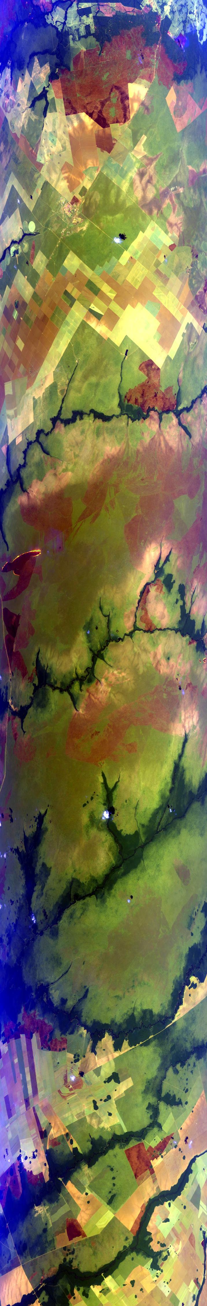
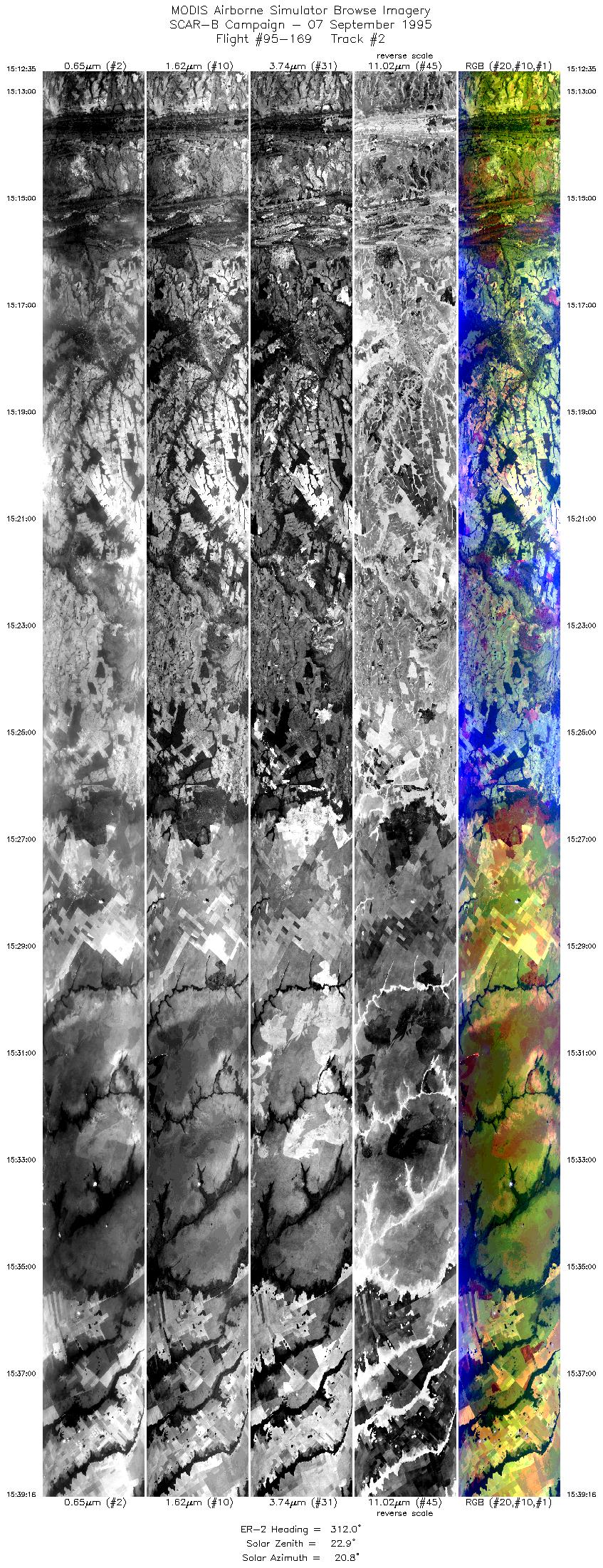
Sample Image

07 September 1995
Track #02
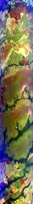

"Small fires and smoke near the Juruena River
in Mato Grosso province, Brazil"
R: 2.14 microns
G: 1.62 microns
B: 0.55 microns
|
|
Summary Information
Date: September 07, 1995
ER-2 Flight Number: 95-169
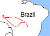
Location: Central Brazil
Principle Investigator: Yorum Kaufman
Additional Sensors: VIS,CLS,AVIRIS
Level-1B Processing Information
Level-1B Data Version: #09
Calibration Type: Final
Calibration Version: SCAR-B_King 1.0
Temperature Adjustment: Yes (24C)
Status: Done
|
|
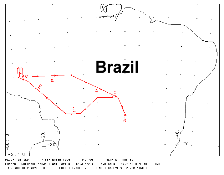
Flight Track Map

|
Level-1B Browse Imagery
Straight Line Flight Tracks: 14
Scanlines Processed: 72888
Solar Azimuth and Zenith Angles
|
Browse Images
|
Click on the Flight Track number to load images.
Lat/Lon ranges are for the BEG-END scanline nadir pixels.
|
Flight
Track |
Time_Span
(GMT) |
Heading
(Deg) |
Lat_Range
(Deg_S) |
Lon_Range
(Deg_W) |
Length
(Scanlines) |
Altitude
(Meters) |
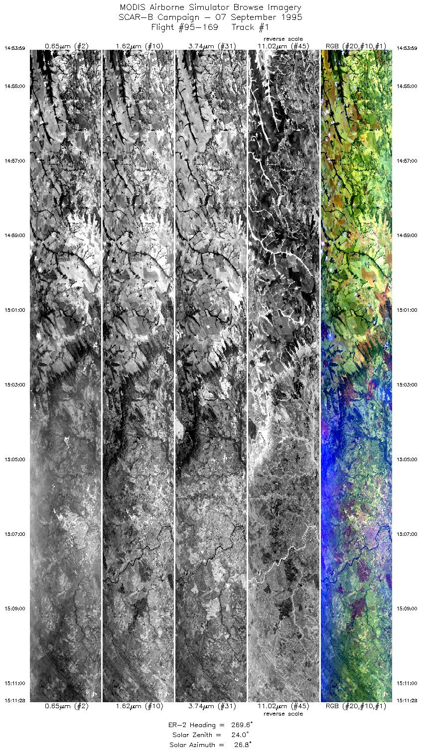
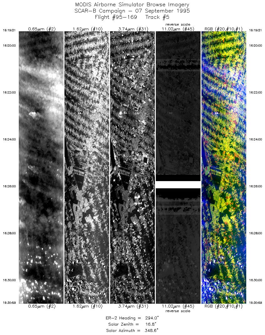
| 1 |
14:53-15:11 |
270 |
15.55-15.55 |
54.60-56.61 |
6554 |
~20000 |
| 2 |
15:12-15:39 |
312 |
15.49-13.51 |
56.73-58.92 |
10007 |
~20000 |
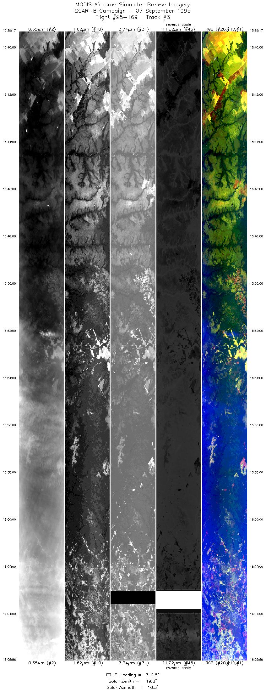
| 3 |
15:39-16:05 |
313 |
13.51-11.54 |
58.92-61.03 |
9993 |
~20000 |
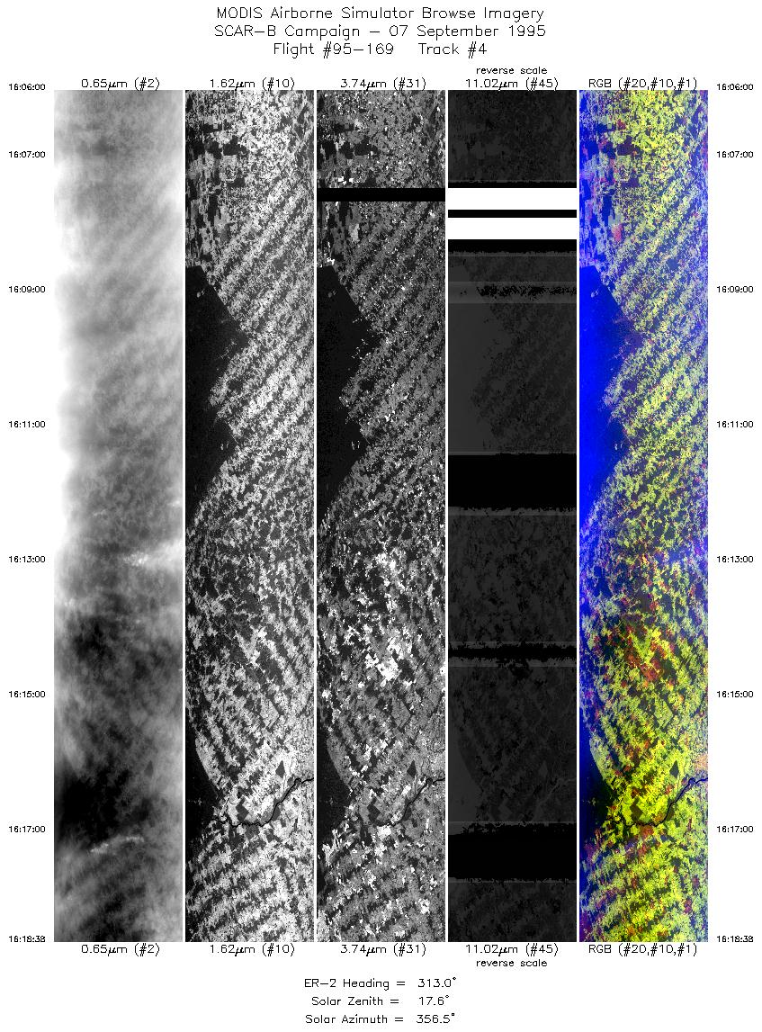
| 4 |
16:06-16:18 |
313 |
11.53-10.59 |
61.03-62.03 |
4738 |
~20000 |
| 5 |
16:19-16:30 |
294 |
10.55-10.04 |
62.09-63.24 |
4355 |
~20000 |
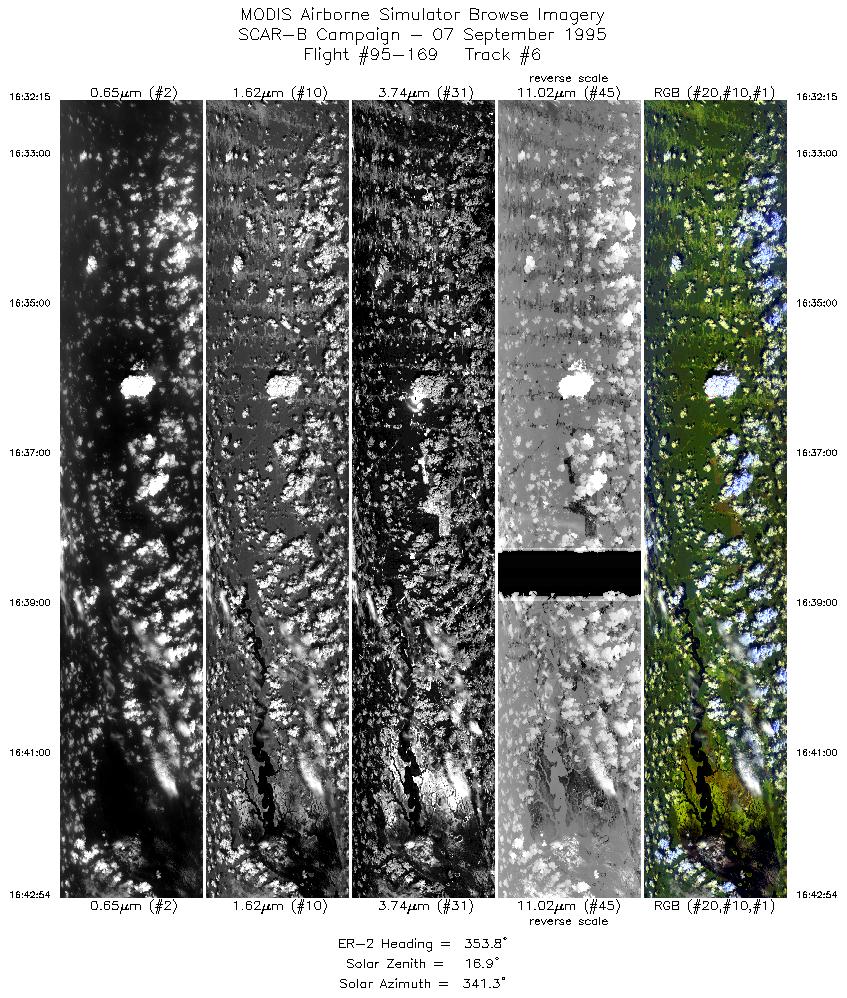
| 6 |
16:32-16:42 |
354 |
9.93-8.75 |
63.33-63.34 |
3993 |
~20000 |
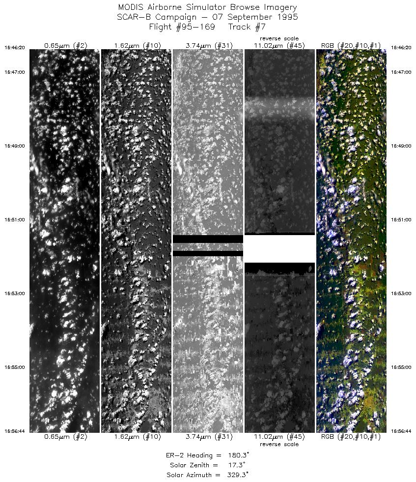
| 7 |
16:46-16:56 |
180 |
8.82-10.00 |
63.10-63.10 |
3900 |
~20000 |
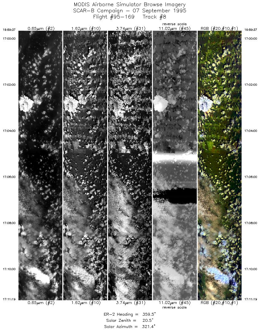
| 8 |
16:59-17:11 |
359 |
10.04-8.74 |
62.87-62.87 |
4387 |
~20000 |
| 9 |
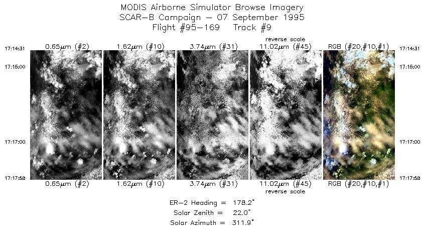
17:14-17:17 |
178 |
8.77-9.16 |
62.64-62.63 |
1293 |
~20000 |
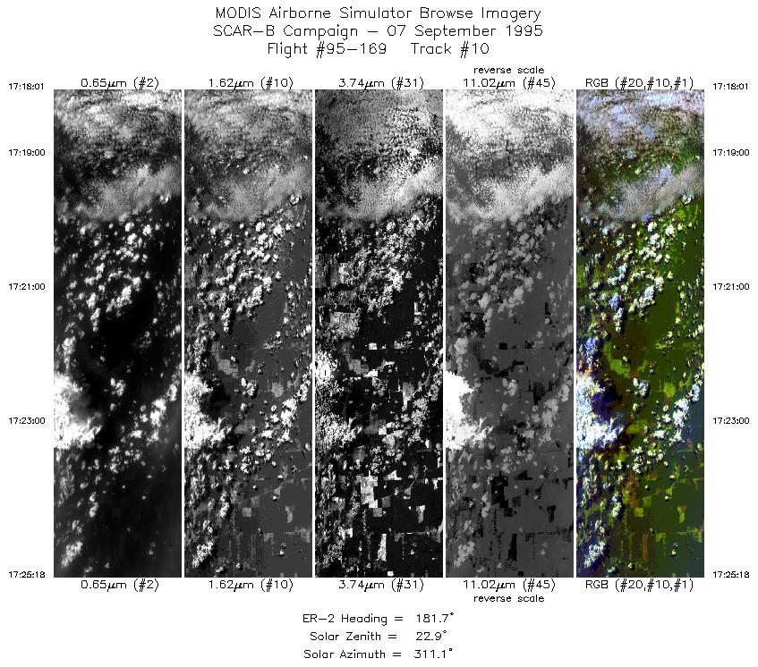
| 10 |
17:18-17:25 |
182 |
9.17-10.01 |
62.63-62.63 |
2731 |
~20000 |
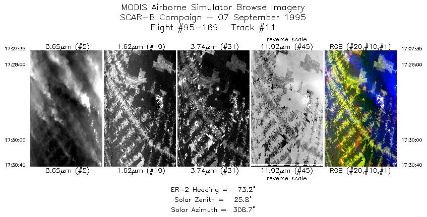
| 11 |
17:27-17:30 |
73 |
10.15-10.05 |
62.45-62.10 |
1157 |
~20000 |
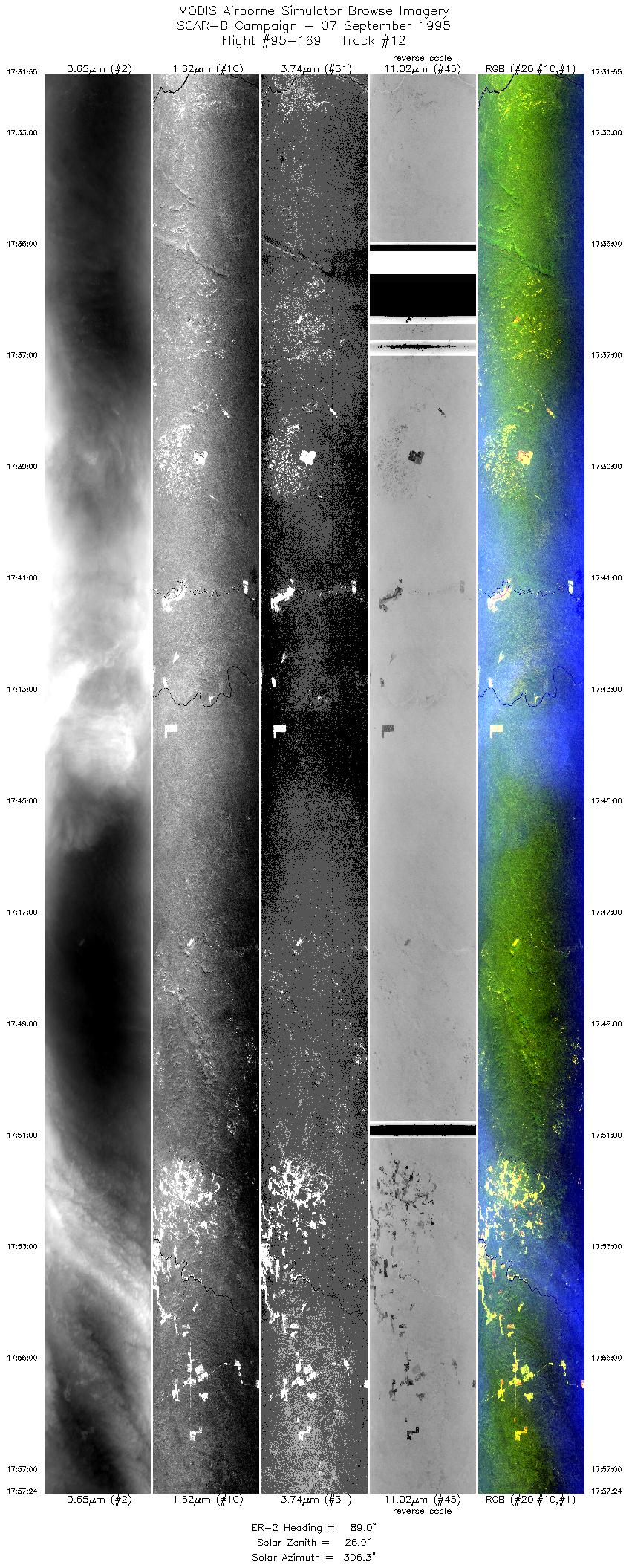
| 12 |
17:31-17:57 |
89 |
10.01-10.02 |
61.96-58.93 |
9553 |
~20000 |
| 13 |
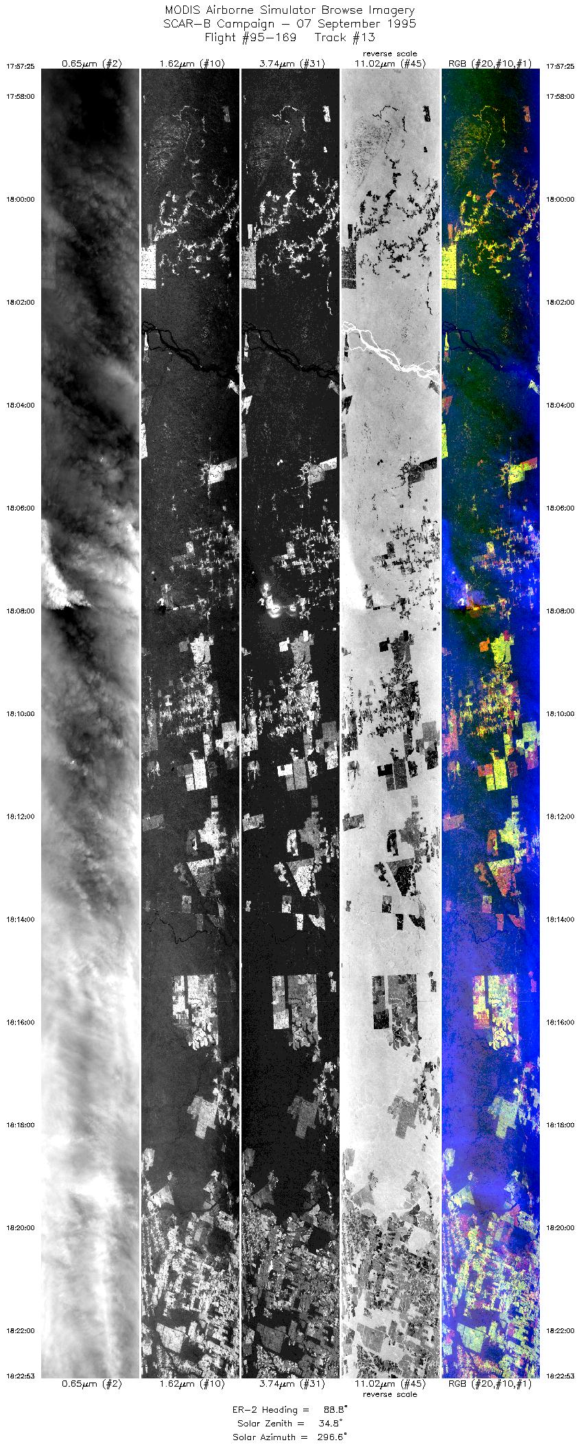
17:57-18:22 |
89 |
10.02-10.00 |
58.93-55.89 |
9546 |
~20000 |
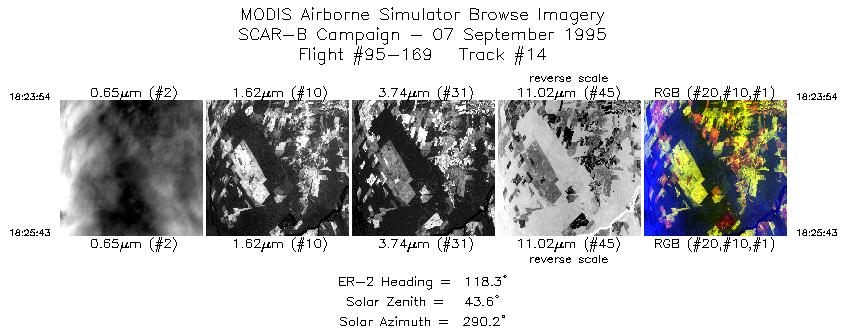
| 14 |
18:23-18:25 |
118 |
10.03-10.13 |
55.77-55.58 |
681 |
~20000 |
| Images 01 through 14 in sequence |
Level-1B HDF Data Acquisition
Order Form (NASA LaRC Atmospheric Sciences Data Center)
Additional Information
The objective of this flight was to measure the properties of smoke and
its effect on clouds; to measure smoke and cloud properties with sunphotometers;
and calibrate AVIRIS over a site east of Cuiaba.
Pilot reported increasingly hazy conditions over the calibration site and sunphotometers.
From Cuiaba, through Rondonia, and back through Alta Floresta, the pilot did not see
the ground. Stratus and cumulus clouds were reported in the northeast portion and
cumulus including some thunderstorms in the rest. Most clouds capped at 12,000 feet,
however some thunderstorms penetrated to 20,000 feet.
Problems:
-
Slice 2 / Line 3:
A large area of data missing for the 11 and 12 uM bands.
-
Slice 2 / Line 4:
A large area of data missing for the 3.7, 3.9, 11 and
12 uM bands.
-
Slice 2 / Line 5:
Large areas of data missing in the 11 uM band.
|
|
|
|