


MODIS Airborne Simulator (MAS)
CAMPAIGN SUMMARY INFORMATION
|
TERRA / AQUA Experiment 2002 Dates: 20 November - 13 December 2002 Location: Gulf of Mexico & Oklahoma CART Site Principal Investigators: Drs. Paul Menzel & Chris Moeller (UWisc) Additional Sensors: CPL, MVIS, NAST-I, RC-10 (dual), S-HIS, VIS Objective: This campaign was designed to assist in the validation and calibration of science products from instruments onboard the TERRA and AQUA satellites, whose goals are to further study and define the earth's radiation budget and global climate change. |
||||||||||||||||||||||||||||||||
|
Processing Information Flights Processed: 13 of 13 Total Flight Tracks: Total Scanlines: Level-1B Version: #2 Calibration Type: Final Calibration Version: TX-2002 ARC 1.0 Temperature Adjustment: None Status: Level-1B Data in HDF format is available. |
||||||||||||||||||||||||||||||||
|
Spectral Information Spectral Band Configuration Spectral Response Function Table |
||||||||||||||||||||||||||||||||
|
Level-1B Data Distribution Level 1 / Atmosphere Archive and Distribution System (LAADS) NASA Distributive Active Archive Centers (DAACs) |
||||||||||||||||||||||||||||||||
|
||||||||||||||||||||||||||||||||
|
Related Web Sites Official TX-2002 Home Page CPL Home Page NAST-I Home Page S-HIS Home Page NASA Airborne Science Program |
||||||||||||||||||||||||||||||||
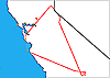 Flight: 03-911
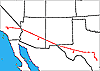 Flight: 03-912
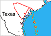 Flight: 03-913
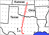 Flight: 03-914
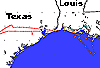 Flight: 03-915
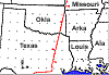 Flight: 03-916
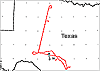 Flight: 03-917
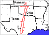 Flight: 03-918
 Flight: 03-919
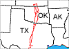 Flight: 03-920
 Flight: 03-921
 Flight: 03-922
 Flight: 03-923
TX-2002


| Sample Imagery |
| Click image for full resolution |
|
Flight: 03-914, Track #02 Oklahoma CART Site |


|
|
R: 2.20µm G: 1.64µm B: 0.55µm |
- NASA Official: Matt Fladeland
- Project Manager: James Jacobson
- Website Editor: Eric Fraim
- Last Updated: March 21, 2024


