


MODIS Airborne Simulator (MAS)
FLIGHT SUMMARY INFORMATION


|
Flight: 03-922 Date: 11 December 2002 Location: Texas / Louisiana / Gulf of Mexico Deployment: TX-2002 Principal Investigators: Drs. Paul Menzel & Chris Moeller (UWISC) Additional Sensors: CPL, MVIS, RC-10 (dual), SHIS, VIS |
|||||||||||||||||||||||||||||||||||||||||||||||||||||||||||||||||||||||||||||||||||||||||||||||||||||||||||||||||||||||
|
Data Evaluation Overall quality is good AQUA Underflight @19:16 |
|||||||||||||||||||||||||||||||||||||||||||||||||||||||||||||||||||||||||||||||||||||||||||||||||||||||||||||||||||||||
|
Processing Information Level-1B Data in HDF format is available Flight Line Summary Spectral Band Configuration Spectral Response Function Table |
|||||||||||||||||||||||||||||||||||||||||||||||||||||||||||||||||||||||||||||||||||||||||||||||||||||||||||||||||||||||
|
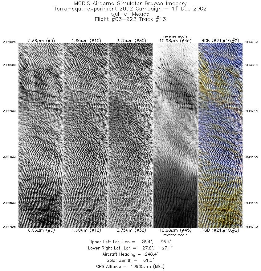
Browse Imagery Flight Tracks: 13 Scanlines: 65883 |
|||||||||||||||||||||||||||||||||||||||||||||||||||||||||||||||||||||||||||||||||||||||||||||||||||||||||||||||||||||||
|
|||||||||||||||||||||||||||||||||||||||||||||||||||||||||||||||||||||||||||||||||||||||||||||||||||||||||||||||||||||||
|
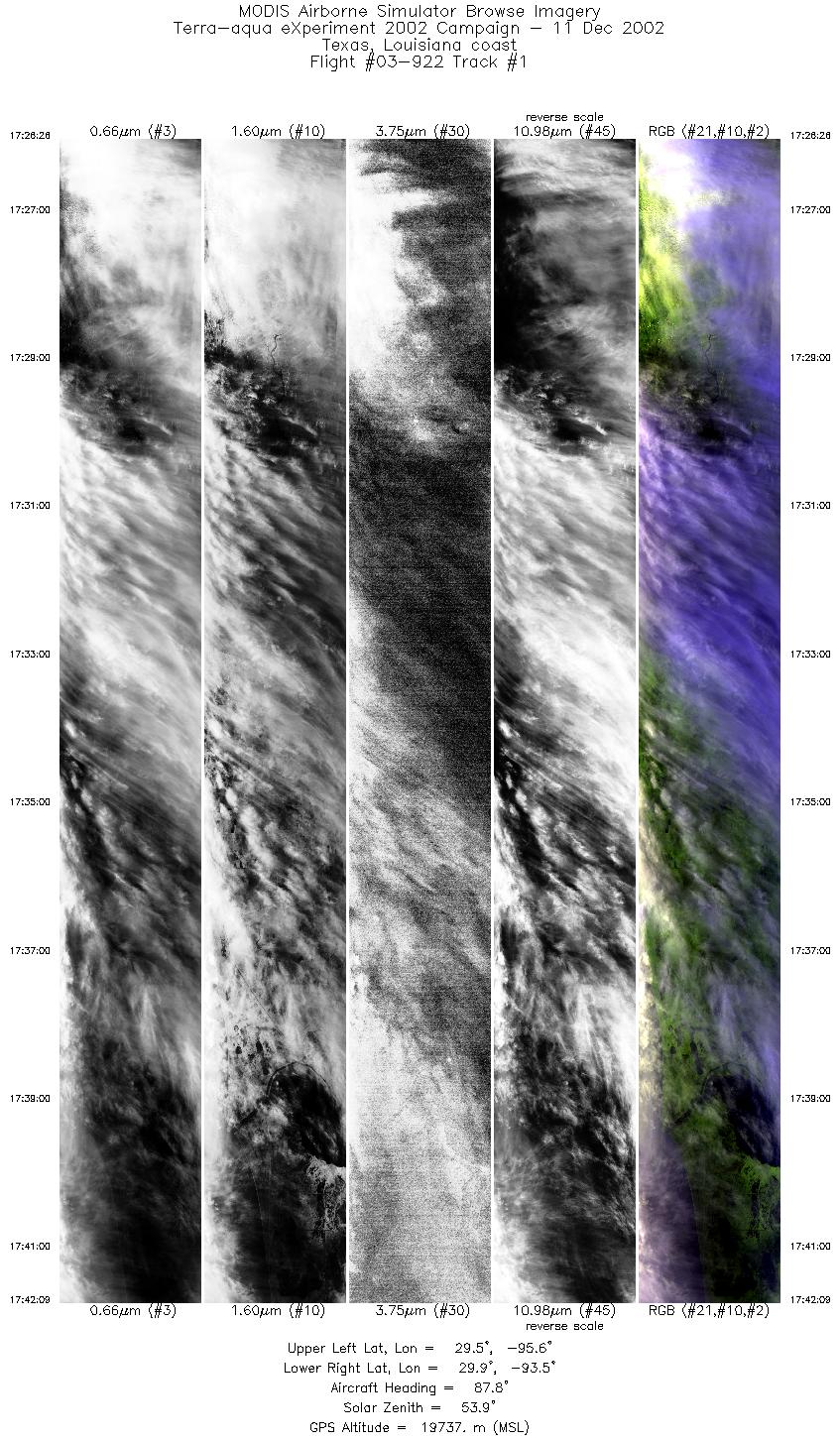
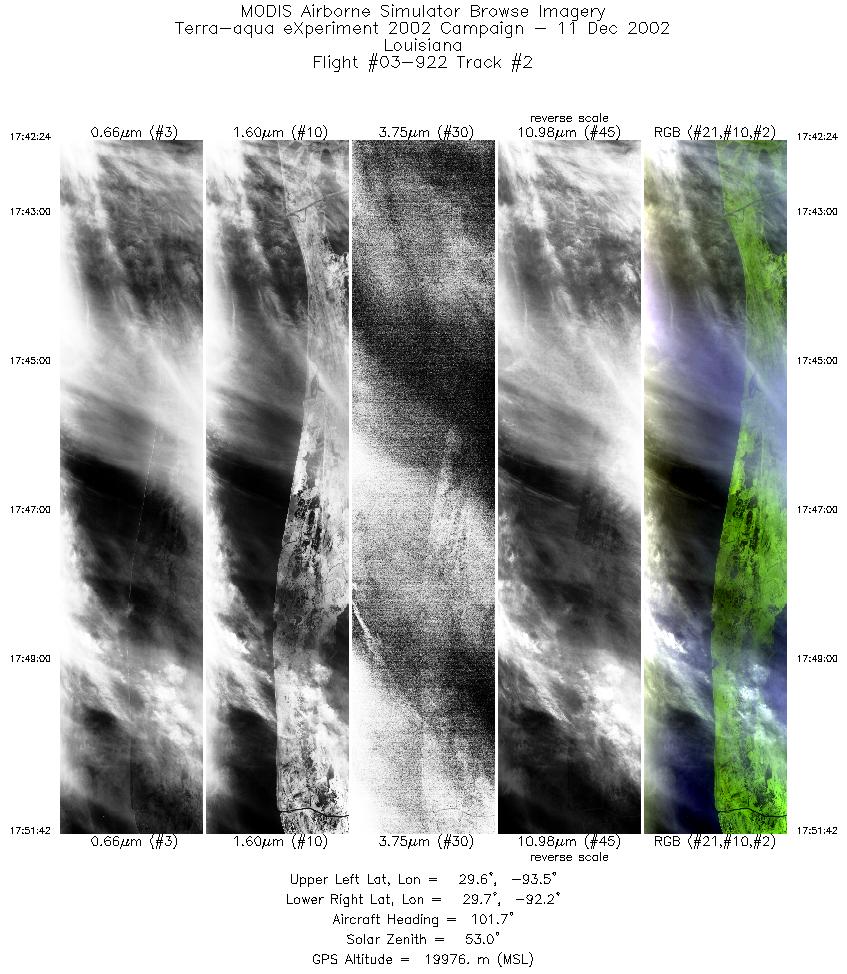
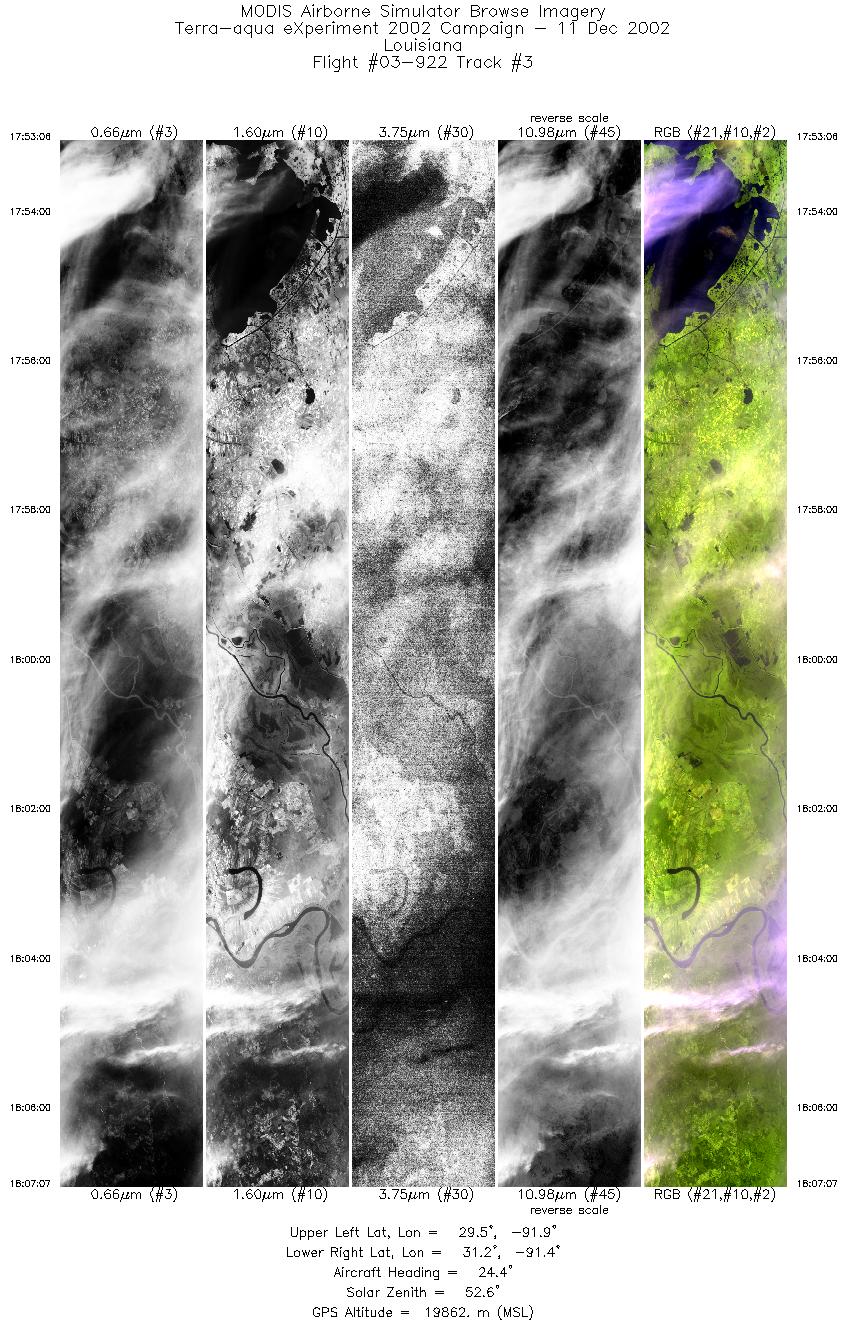
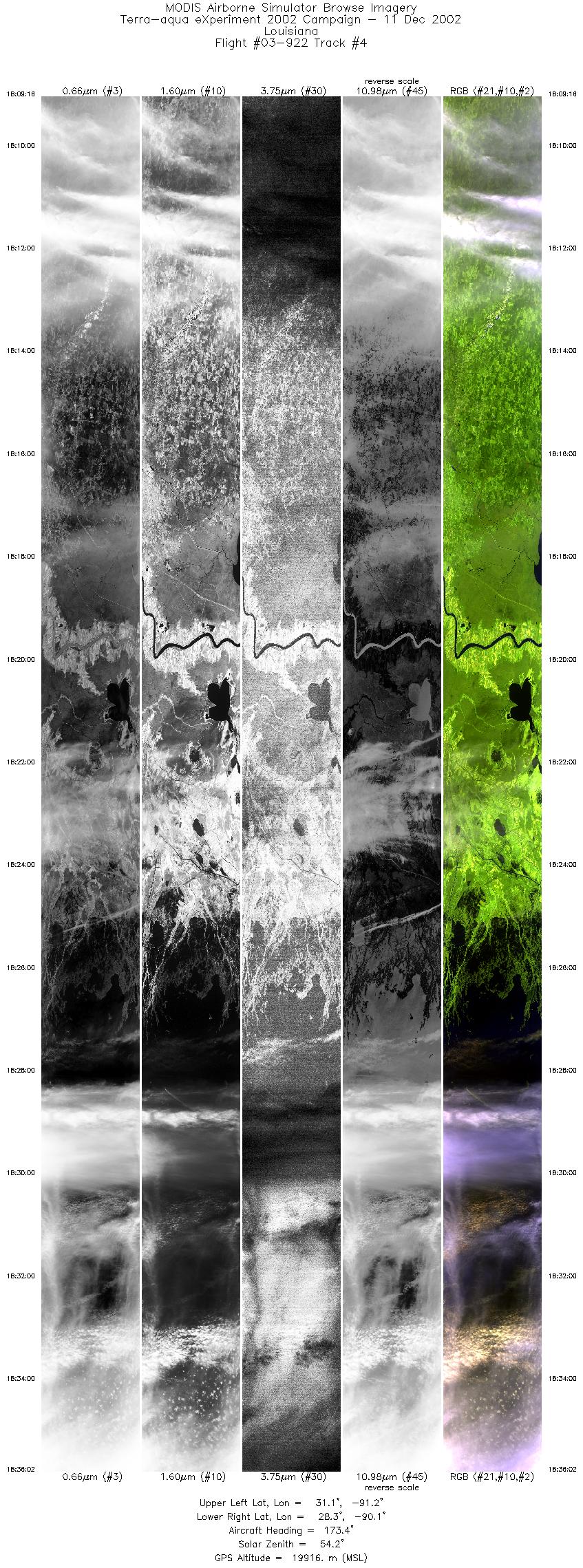
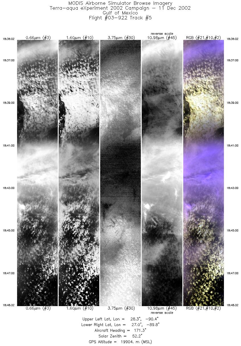
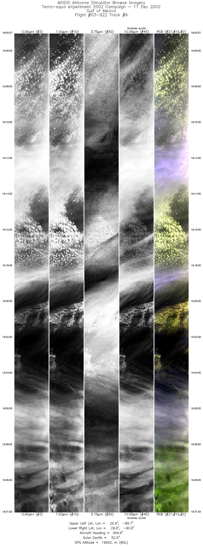
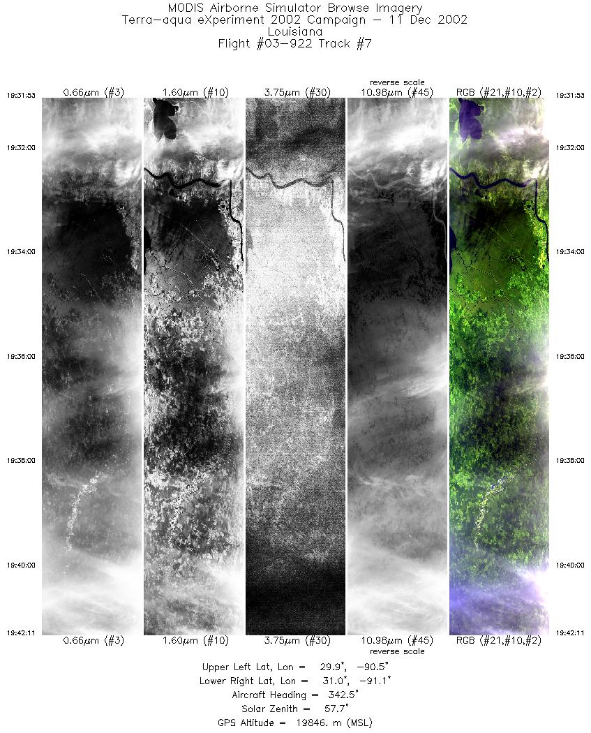
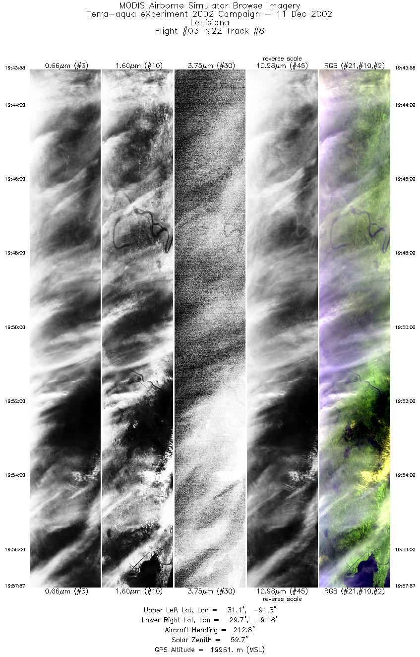
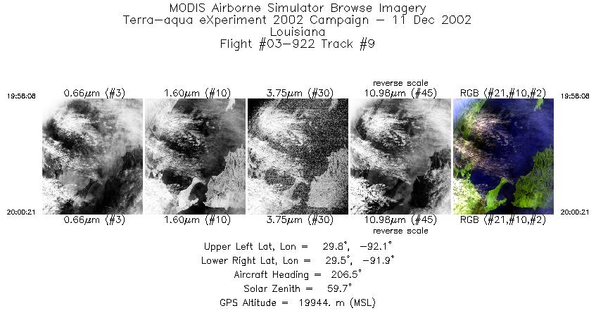
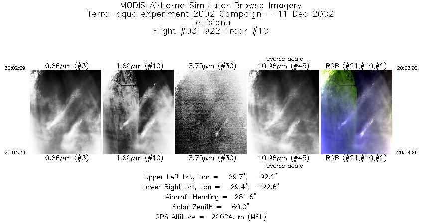
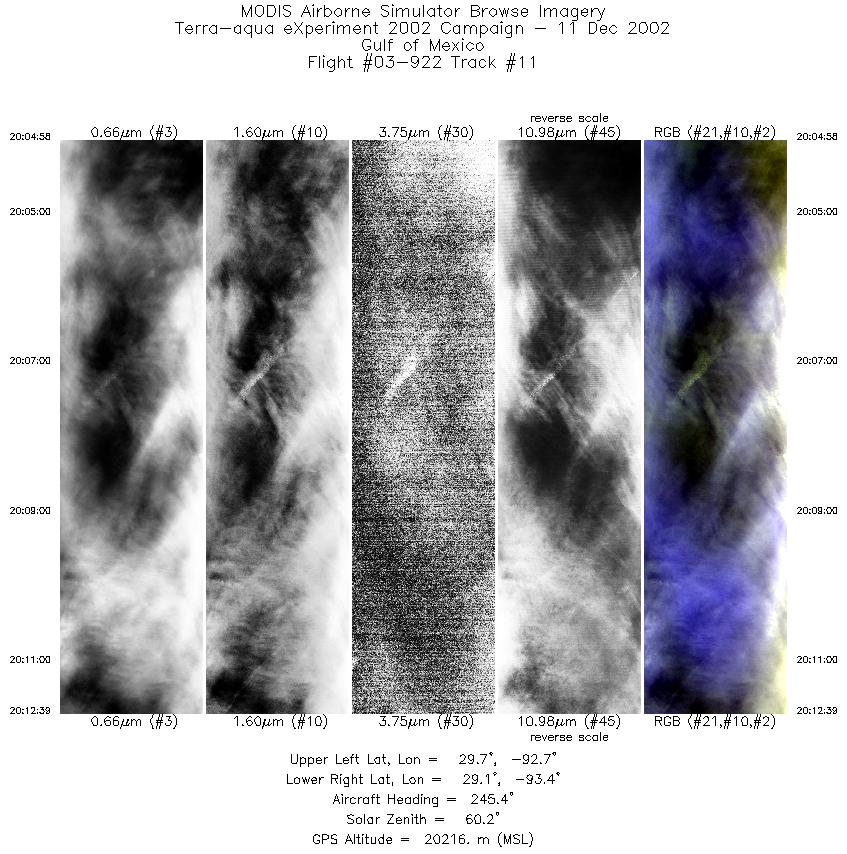
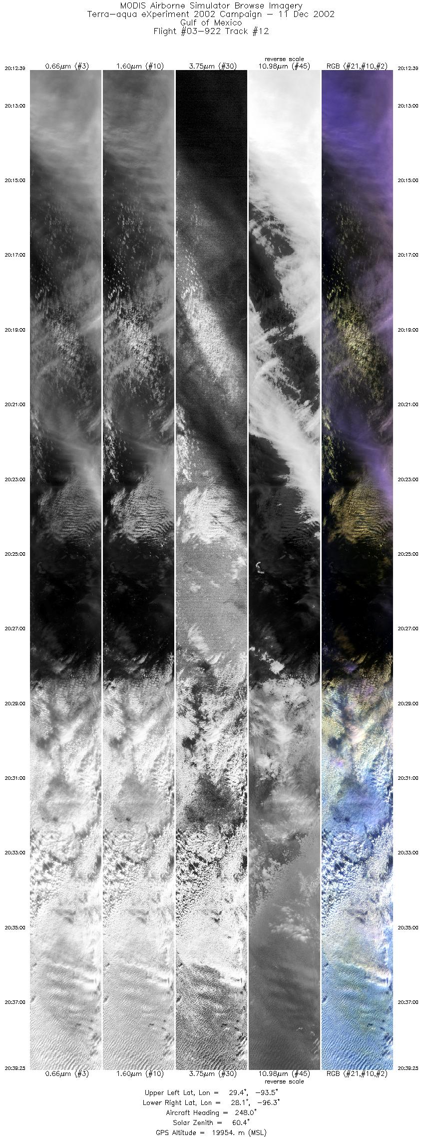
Flight Summary Report Mission Objectives Collect subtropical cirrus scenes over southern Louisiana and the Gulf of Mexico w/Aqua (1916 UTC) to evaluate MODIS Cloud products, collect photo of LA coast for geomorphology, and coordinate with WB-57 for MAS/MASTER L1B comparisons. Flight SummaryTake-off at 1700 UTC. ER-2 landed at 2130 UTC. ER-2 flew east from SAT to western Louisiana muddy coast photo line (mostly cloudy with cirrus so no photo shoot), then on east to eastern Louisiana to pick up Aqua orbital track on a SSE bound 38 minute leg down to about 27 deg N in the Gulf of Mexico (GOM). Skies on this line were single layer thin cirrus over Louisiana then thin and thick cirrus overcast over patches of low and mid level cumulus overcast interspersed with patches of single layer cirrus over water. ER-2 reversed course to return on same line with similar sky conditions. Met the Aqua satellite with cirrus over patches of low and mid level cumulus. From northern end flew to western Louisiana coast for another run of photo line (mostly cloudy with cirrus so no photo shoot). WB-57 did not get airborne so rendevous over buoy 42019 in western GOM was canceled and ER-2 returned to SAT. HighlightsSingle layer cirrus over land near Aqua overpass. Cirrus over mid and low cloud w/Aqua. Instrument Status
Westerly crosswinds strong (20 to 40 knots) causing ER-2 heading to be off aircraft track, about 2deg at southern end up to 5 deg at northern end. Elevated haze layer again observed above clouds (clouds to haze to clear to haze going up from horizon) on northbound leg.  |
|||||||||||||||||||||||||||||||||||||||||||||||||||||||||||||||||||||||||||||||||||||||||||||||||||||||||||||||||||||||

Flight 03-922


| Sample Imagery |
| Click image for full resolution |
|
Track #06 Gulf of Mexico (South of Louisiana) |


|
|
R: 2.15µm G: 1.64µm B: 0.55µm |
- NASA Official: Matt Fladeland
- Project Manager: James Jacobson
- Website Editor: Eric Fraim
- Last Updated: November 16, 2021


