


MODIS Airborne Simulator (MAS)
FLIGHT SUMMARY INFORMATION
Flight Track Map


|
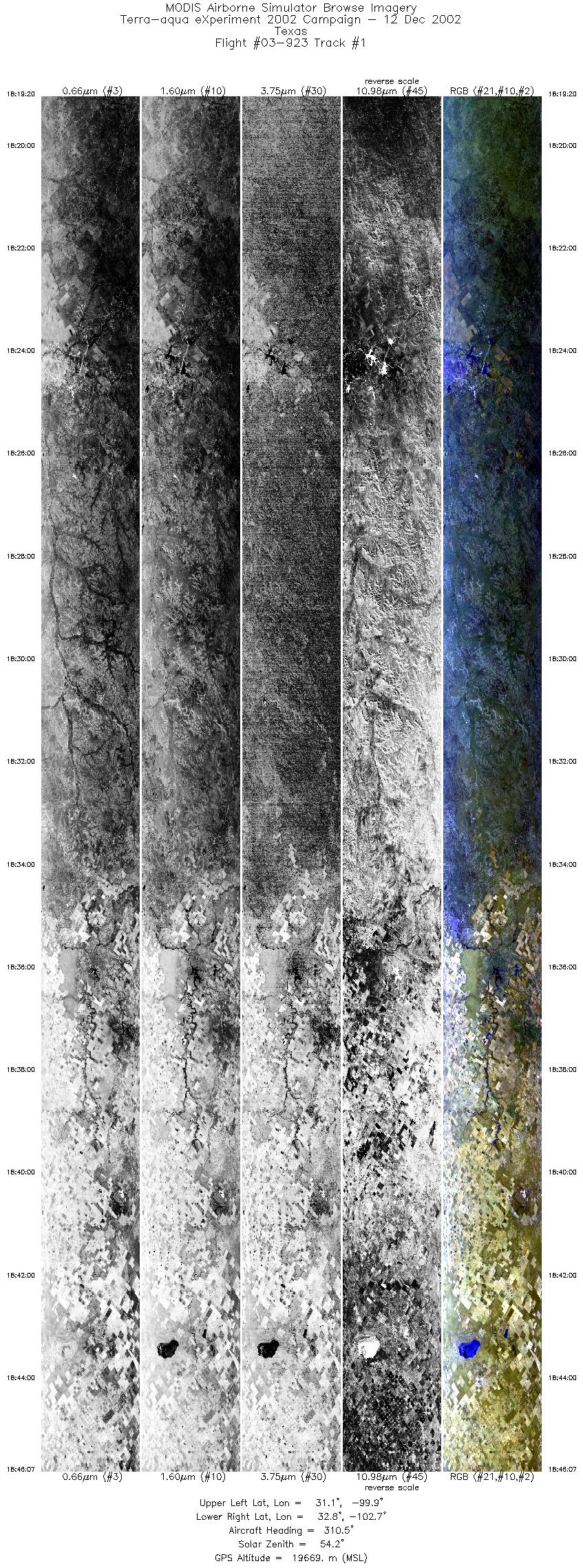
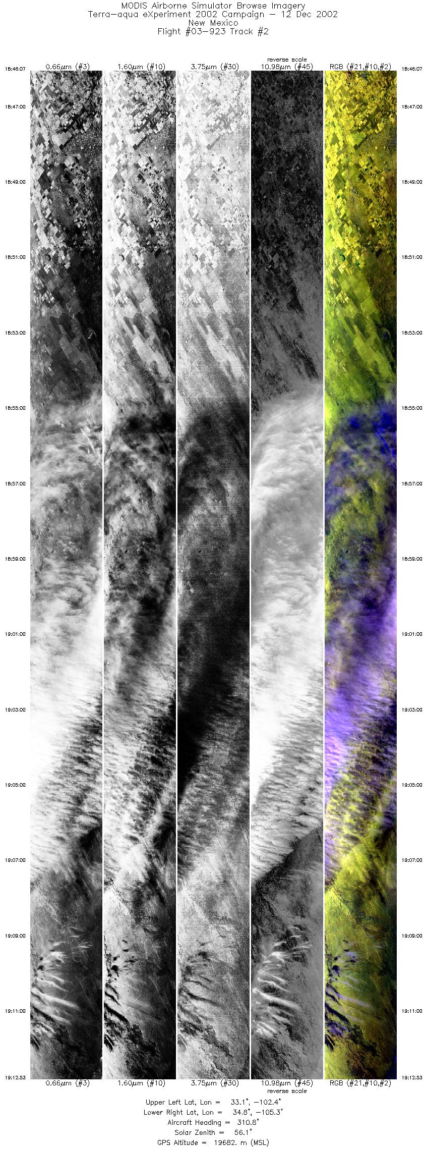
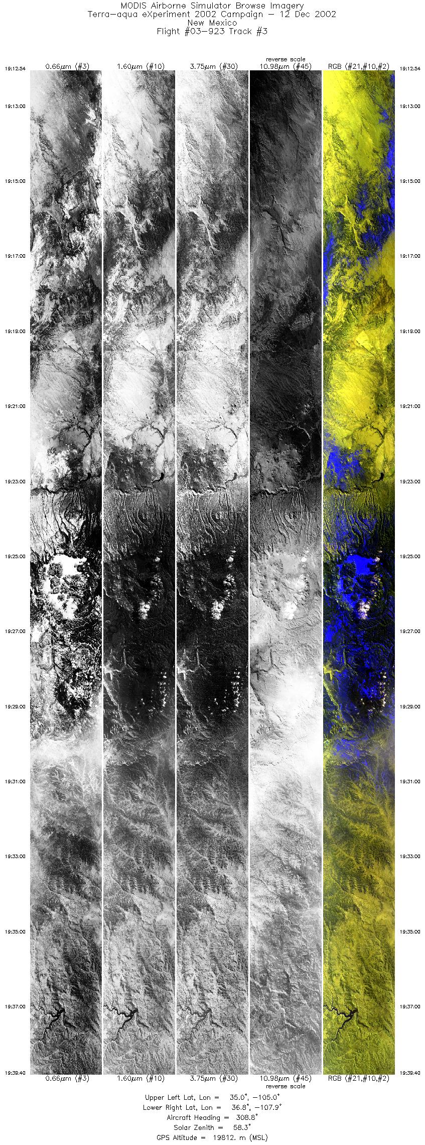
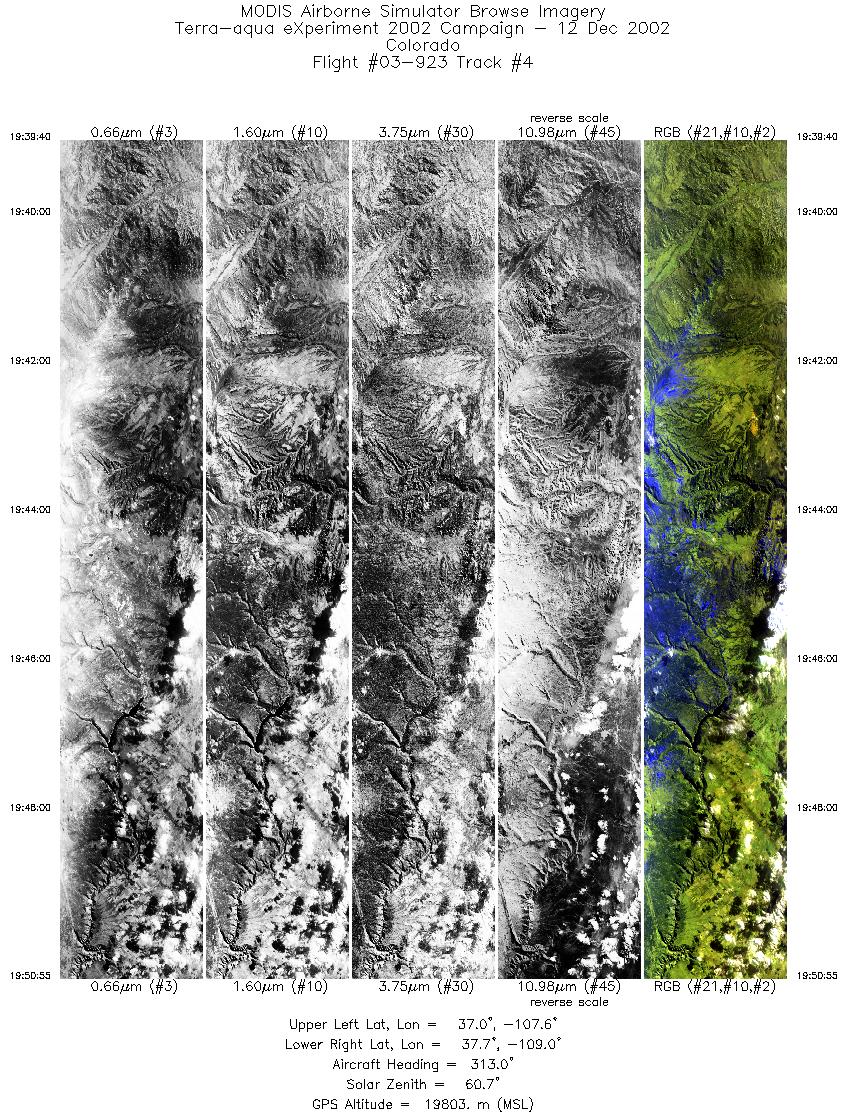
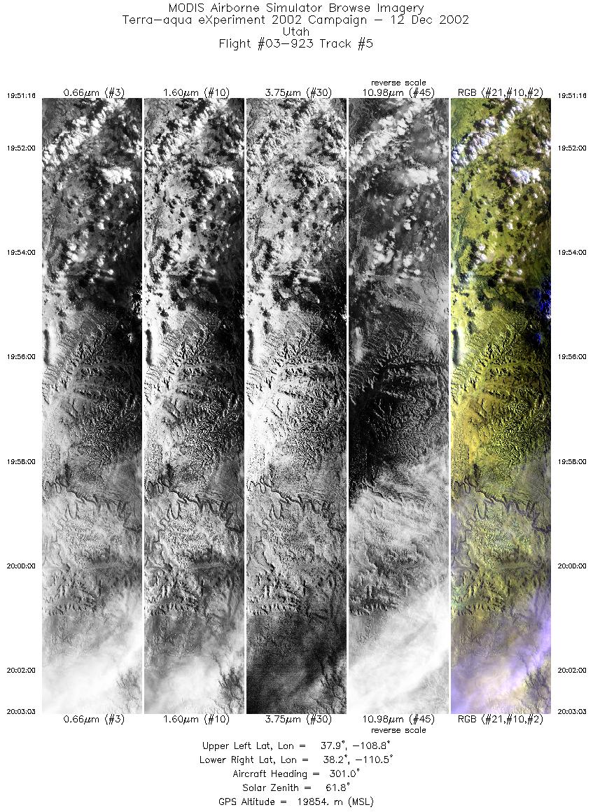
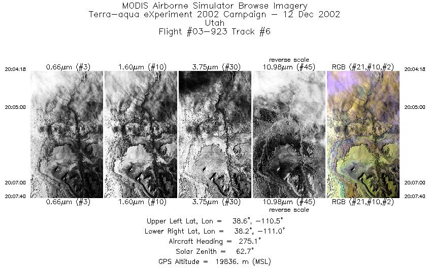
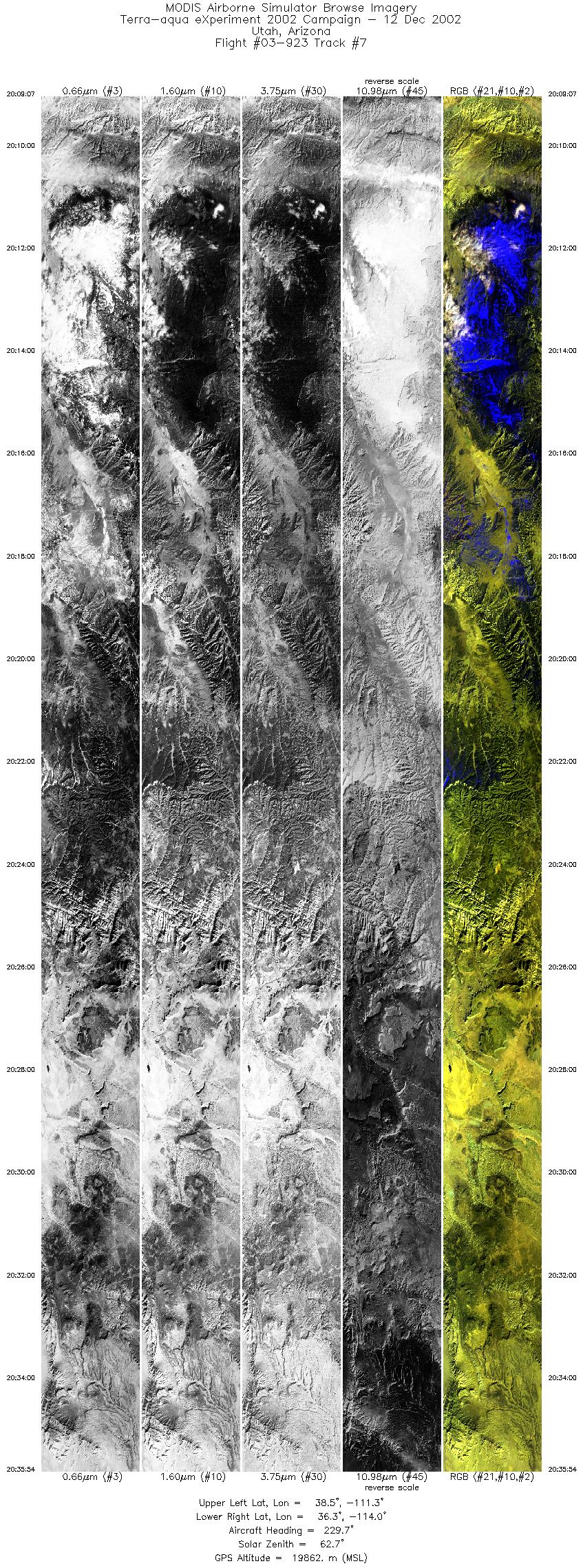
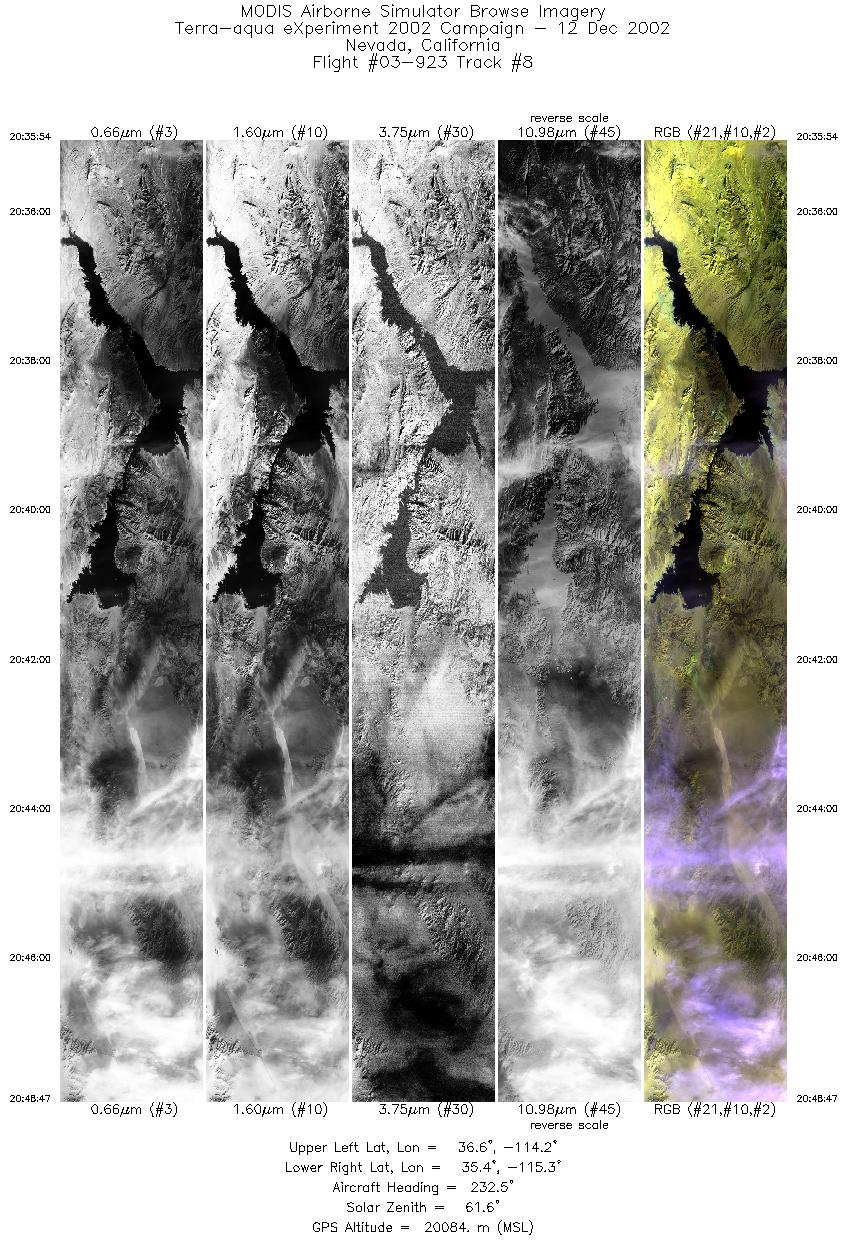
Flight: 03-923 Date: 12 December 2002 Location: Texas to California Deployment: TX-2002 Principal Investigators: Drs. Paul Menzel & Chris Moeller (UWISC) Additional Sensors: CPL, MVIS, RC-10 (dual), VIS |
||||||||||||||||||||||||||||||||||||||||||||||||||||||||||||||||||||||||||||||||||||
|
Data Evaluation Overall quality is good |
||||||||||||||||||||||||||||||||||||||||||||||||||||||||||||||||||||||||||||||||||||
|
Processing Information Level-1B Data in HDF format is available Flight Line Summary Spectral Band Configuration Spectral Response Function Table |
||||||||||||||||||||||||||||||||||||||||||||||||||||||||||||||||||||||||||||||||||||
|
Browse Imagery Flight Tracks: 8 Scanlines: 54669 |
||||||||||||||||||||||||||||||||||||||||||||||||||||||||||||||||||||||||||||||||||||
|
||||||||||||||||||||||||||||||||||||||||||||||||||||||||||||||||||||||||||||||||||||
|
Flight Summary Report Mission Objectives Ferry the ER-2 aircraft back to DFRC, with MAS and CPL instruments. Non EOS photo work in Utah. Flight SummaryTake-off at 1800 UTC. ER-2 landed at about 2130 UTC. ER-2 flew from SAT towards Utah for photo lines in Southern Utah. Skies on this transit were partly to mostly cloudy though some clear sky land scenes in NW TX. Photo lines contained some thin cloud. ER-2 then proceeded to DFRC. Scenes on transit to Utah for photo work were primarily partly cloudy over land. Some clear scenes over land in NV. Some cirrus scenes in CA. HighlightsNone. Instrument Status
None  |
||||||||||||||||||||||||||||||||||||||||||||||||||||||||||||||||||||||||||||||||||||

Flight 03-923


| Sample Imagery |
| Click image for full resolution |
|
Track #02 Texas / New Mexico |


|
|
R: 2.15µm G: 1.64µm B: 0.55µm |
- NASA Official: Matt Fladeland
- Project Manager: James Jacobson
- Website Editor: Eric Fraim
- Last Updated: November 16, 2021


