


MODIS Airborne Simulator (MAS)
FLIGHT SUMMARY INFORMATION


|
Flight: 03-921 Date: 10 December 2002 Location: Gulf of Mexico Deployment: TX-2002 Principal Investigators: Drs. Paul Menzel & Chris Moeller (UWISC) Additional Sensors: CPL, MVIS, RC-10 (dual), SHIS, VIS |
||||||||||||||||||||||||||||||||||||||||||||||||||||||||||||||||||||||
|
Data Evaluation Overall quality is good TERRA Underflight @17:04 ER-2 Navigation Recorder failed |
||||||||||||||||||||||||||||||||||||||||||||||||||||||||||||||||||||||
|
Processing Information Level-1B Data in HDF format is available Flight Line Summary Spectral Band Configuration Spectral Response Function Table |
||||||||||||||||||||||||||||||||||||||||||||||||||||||||||||||||||||||
|
Browse Imagery Flight Tracks: 6 Scanlines: 33939 |
||||||||||||||||||||||||||||||||||||||||||||||||||||||||||||||||||||||
|
||||||||||||||||||||||||||||||||||||||||||||||||||||||||||||||||||||||
|
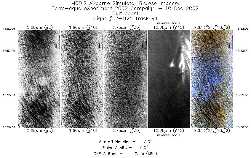
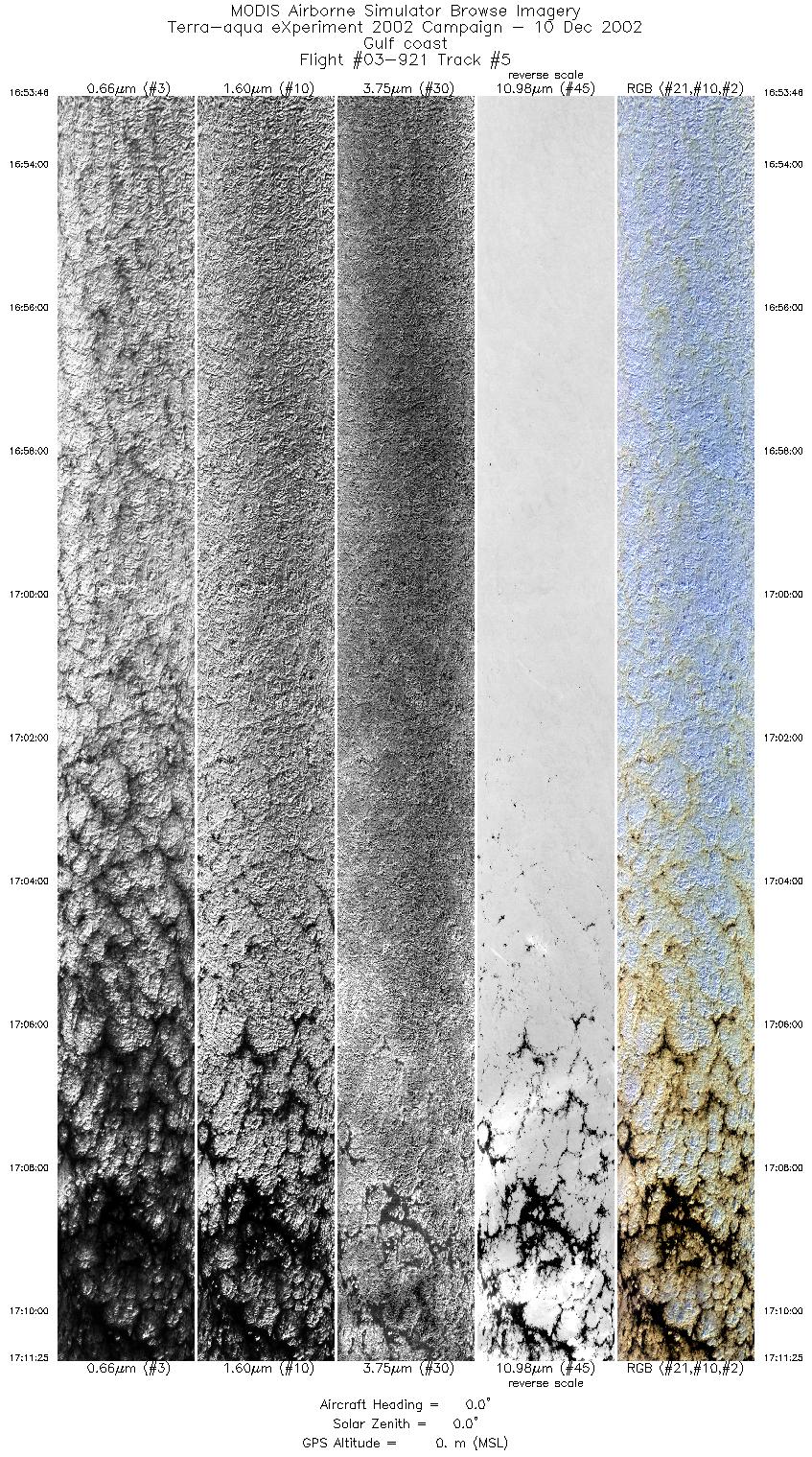
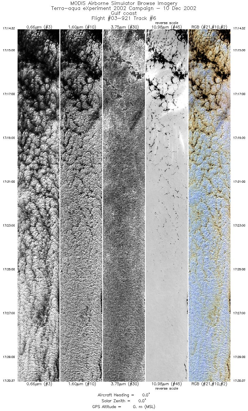
Flight Summary Report Mission Objectives Collect thin cirrus scenes over Gulf of Mexico w/Terra (1704 UTC) to assess MODIS Cloud Product performance. Flight SummaryTake-off at 1530 UTC. ER-2 landed at 1825 UTC. ER-2 flew east from SAT to Houston then south to racetrack in the western Gulf of Mexico. Racetrack consisted of two 16 minute legs separated by 12 nm and oriented parallel to Terra orbital track. Flew eastern leg on southbound, then returned on western leg. Skies are undercast strato-cumulus on both legs with some cirrus wisps at southern quarter of western leg (few at bottom of eastern leg too). On 2nd orbit, cirrus coverage increased on both legs but still limited mostly to southern third of western leg. Met Terra (1704 UTC) on southbound (eastern) leg of 2nd orbit (about 9 deg offnadir view away from sun) with low overcast and cirrus wisp as shown by CPL. CPL also documented larger cirrus wisp at 1706 UTC. After finishing 2nd orbit of racetrack, ER-2 turned to return to SAT. HighlightsWispy cirrus over uniform stratus w/Terra. Single layer stratus w/Terra over water. Instrument Status
Strong crosswinds at altitude. No turbulence. Elevated haze layer apparent when looking from oblique angle.  |
||||||||||||||||||||||||||||||||||||||||||||||||||||||||||||||||||||||

Flight 03-921


| Sample Imagery |
| Click image for full resolution |
|
Track #05 Gulf of Mexico (South of Texas) |


|
|
R: 2.15µm G: 1.64µm B: 0.55µm |
- NASA Official: Matt Fladeland
- Project Manager: James Jacobson
- Website Editor: Eric Fraim
- Last Updated: November 16, 2021


