
|
Sample Image

19 Oct 1995
Track #03
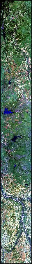

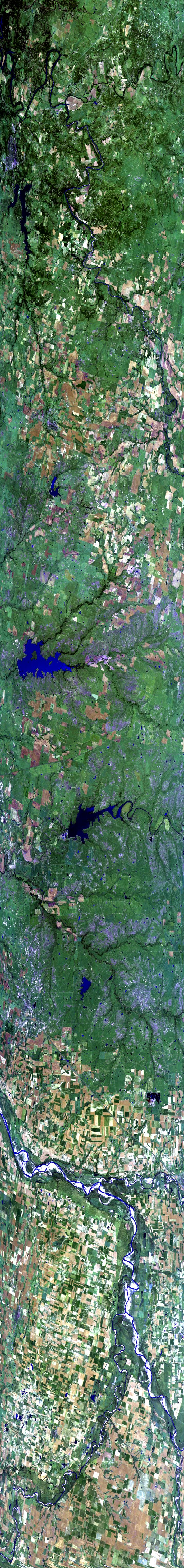
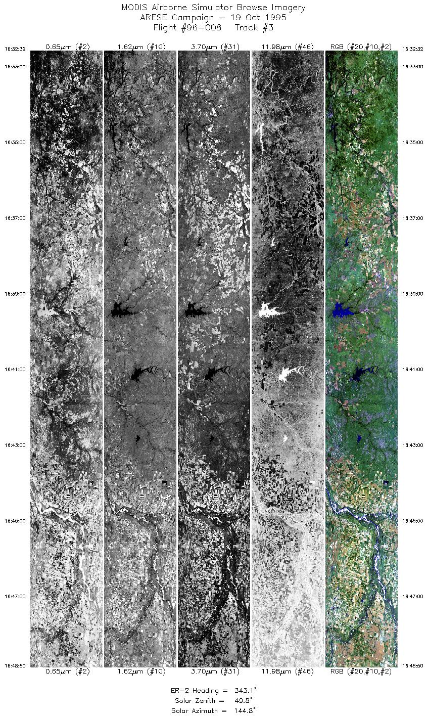
The flight track image to the left begins over the Brazos River, north of Breckenridg
e, Texas. Proceeds north, overflying tiny Lake Cooper and the larger Lake Kickapoo, w
ith its two islands in clear view. Further north is Lake Diversion and the east/west
flowing Wichita River. Ends over farm-fields on the banks of the Red River and its co
nfluence with the smaller Pease River (south) and North Fork Red River (north).
R: 2.14 microns
G: 1.62 microns
B: 0.55 microns
|
|
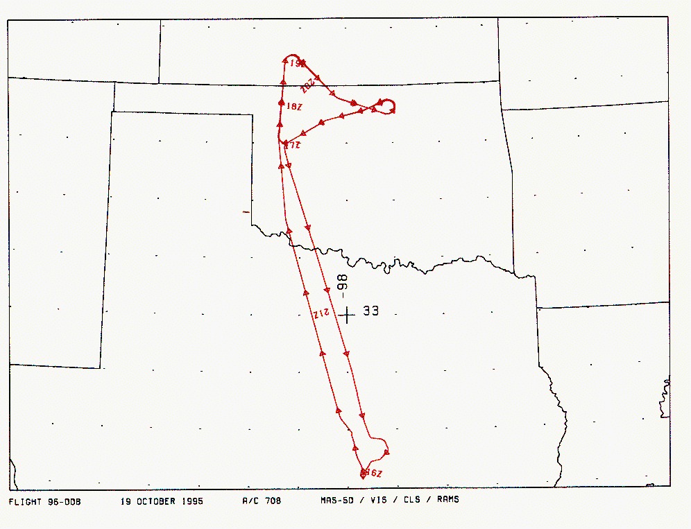
Mission Summary
Date: October 19, 1995
ER-2 Flight Number: 96-008
Flight Location: Oklahoma
Principal Investigator: Dr. Francisco Valero (Scripps)
Additional Sensors: RAMS, CLS, VIS
Objective: Investigate the absorption of solar radiation by clouds, aerosols, and atmospheric gases.
Level-1B Processing Information
Level-1B Data processed by: Ames Research Center
Level-1B Data Version: #09
Level-1B Configuration: (sample file)
Calibration Type: Final
Calibration Version: ARESE 1.0
Temperature Adjustment: 35C
Status: Completed with final calibration
|
|
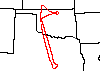
Flight Track Map

|
Level-1B Browse Imagery
Straight Line Flight Tracks: 33
Scanlines Processed: 88121
Solar Azimuth and Zenith Angles
|
Browse Images
|
Click on the Flight Track number to load images.
Lat/Lon ranges are for the BEG-END scanline nadir pixels.
|
Flight
Track |
Time_Span
(GMT) |
Heading
(Deg) |
Lat_Range
(Deg_N) |
Lon_Range
(Deg_W) |
Length
(Scanlines) |
Altitude
(Meters) |
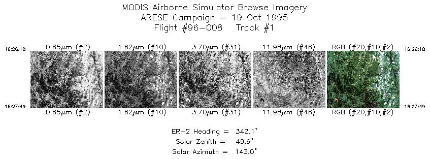
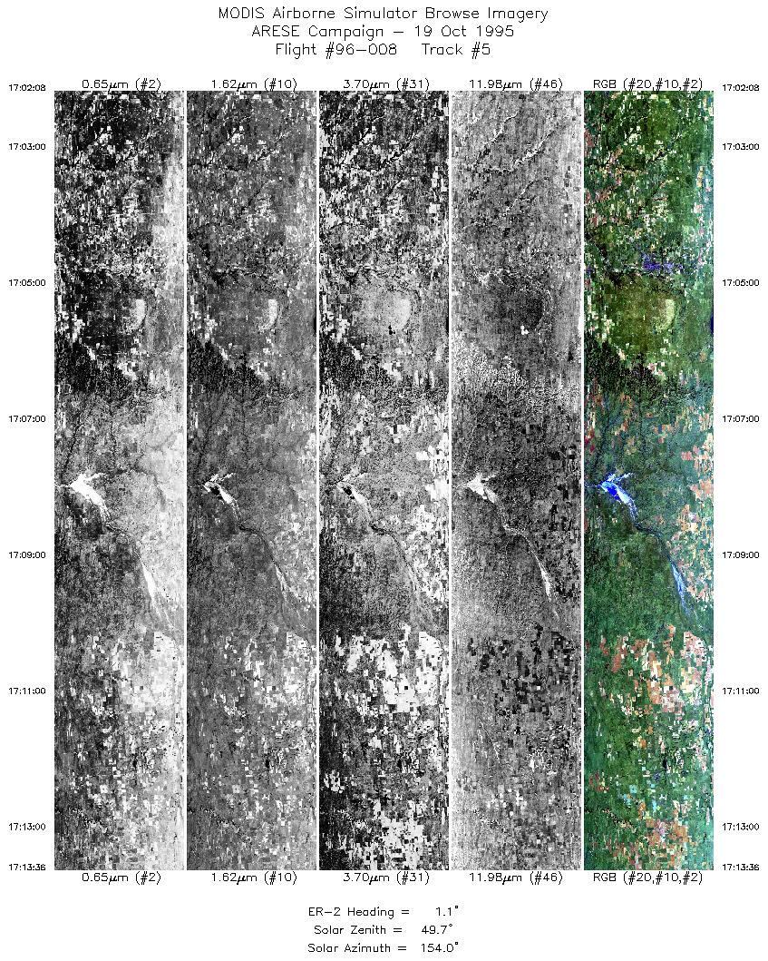
| 1 |
16:26-16:27 |
342 |
32.23-32.39 |
98.47-98.52 |
566 |
~20000 |
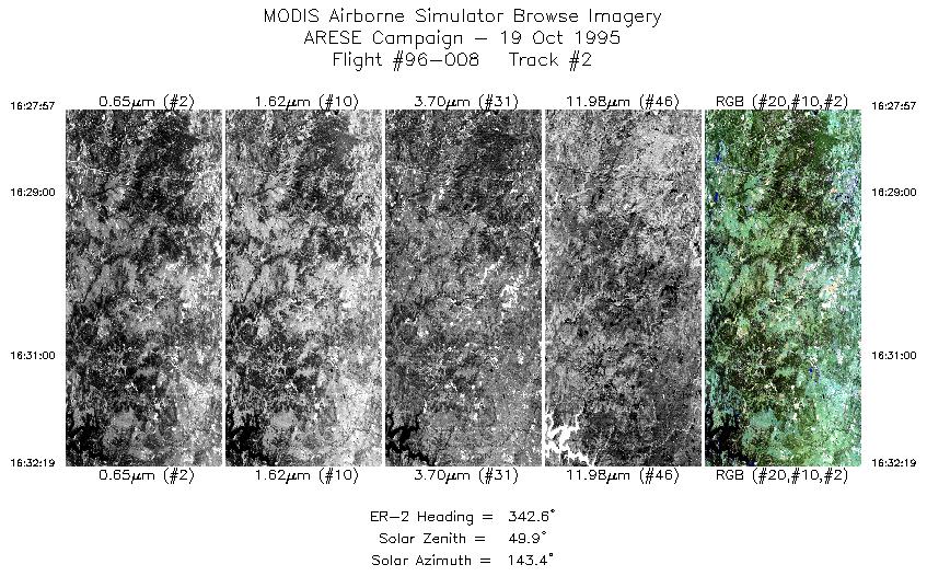
| 2 |
16:27-16:32 |
343 |
32.40-32.87 |
98.53-98.68 |
1634 |
~20000 |
| 3 |
16:32-16:48 |
343 |
32.88-34.62 |
98.68-99.26 |
6100 |
~20000 |
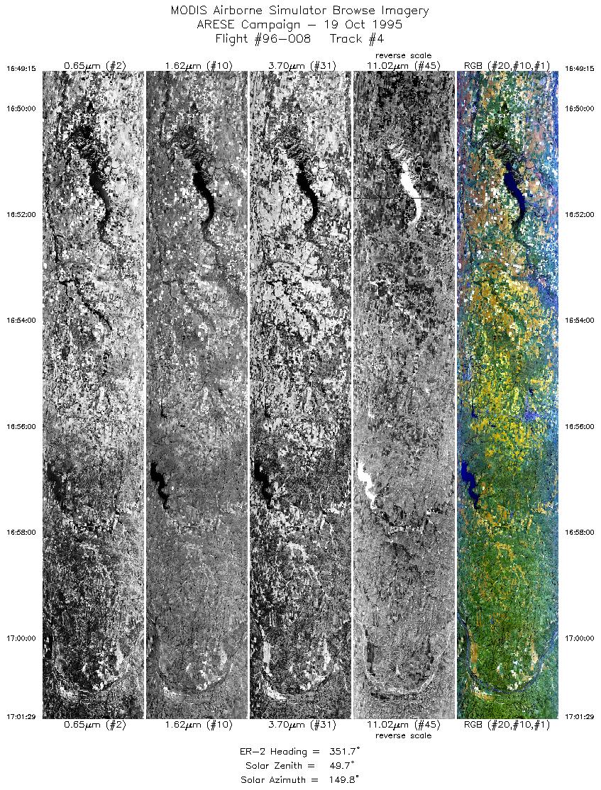
| 4 |
16:49-17:01 |
352 |
34.68-36.07 |
99.27-99.43 |
4571 |
~20000 |
| 5 |
17:02-17:13 |
1 |
36.14-37.42 |
99.43-99.30 |
4296 |
~20000 |
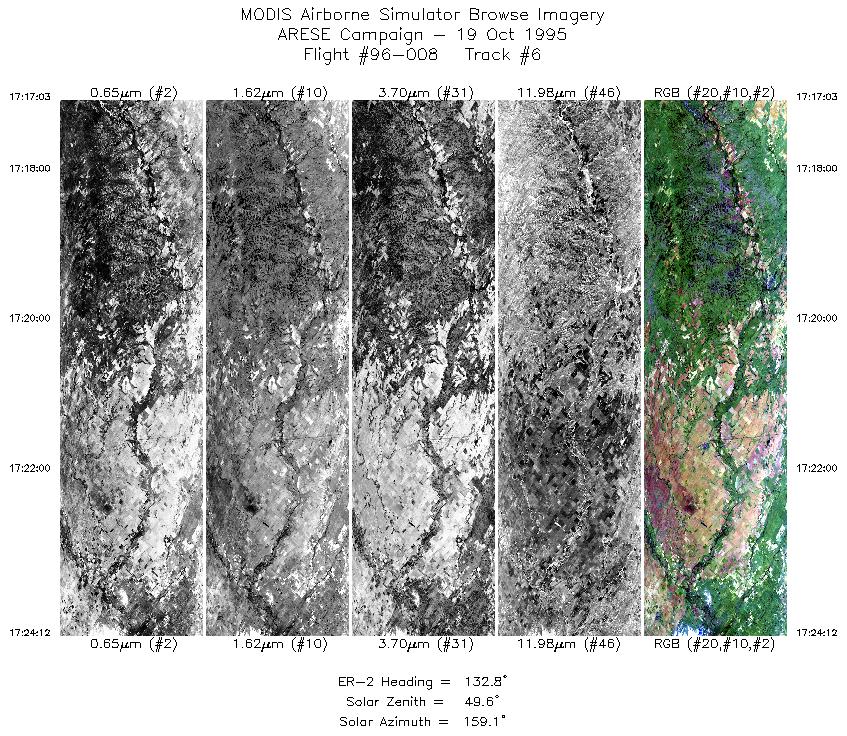
| 6 |
17:17-17:24 |
133 |
37.42-36.82 |
98.92-98.21 |
2680 |
~20000 |
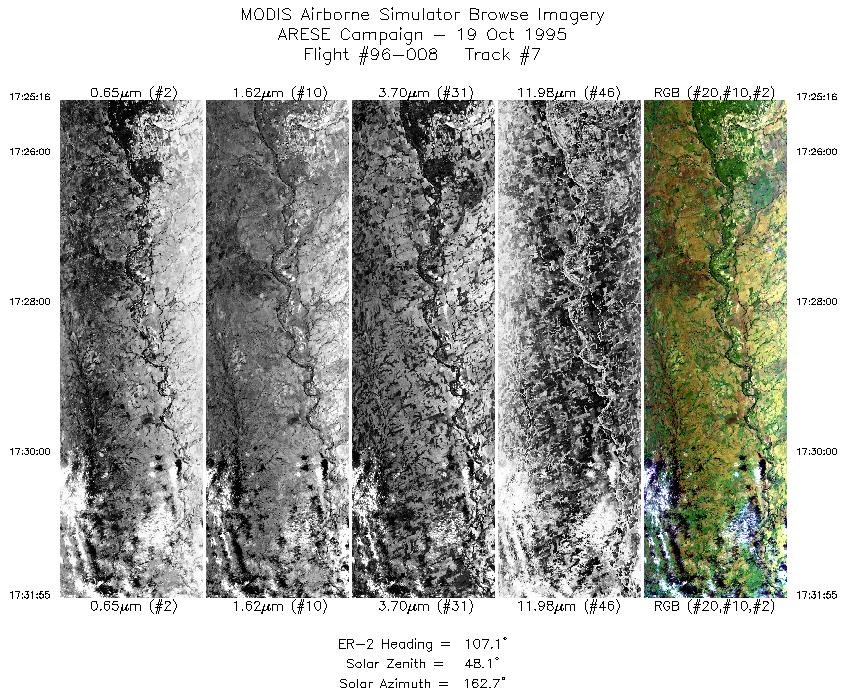
| 7 |
17:25-17:31 |
107 |
36.76-36.51 |
98.07-97.15 |
2493 |
~20000 |
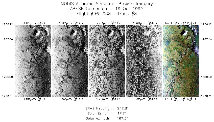
| 8 |
17:36-17:40 |
248 |
36.73-36.57 |
97.12-97.59 |
1431 |
~20000 |
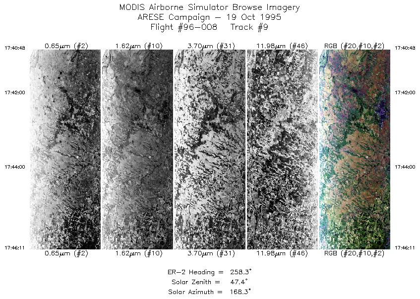
| 9 |
17:40-17:46 |
258 |
36.54-36.41 |
97.69-98.39 |
2017 |
~20000 |
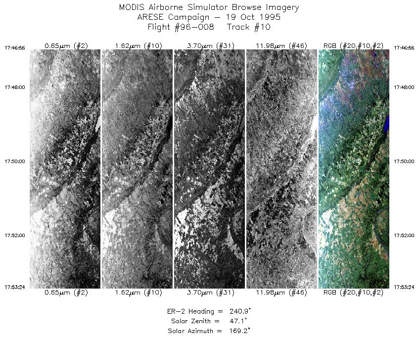
| 10 |
17:46-17:53 |
241 |
36.37-36.02 |
98.48-99.23 |
2424 |
~20000 |
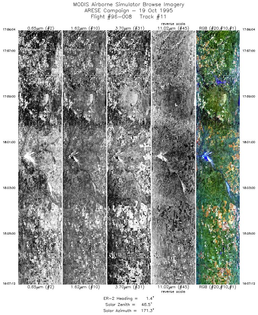
| 11 |
17:56-18:07 |
1 |
36.18-37.42 |
99.42-99.30 |
4173 |
~20000 |
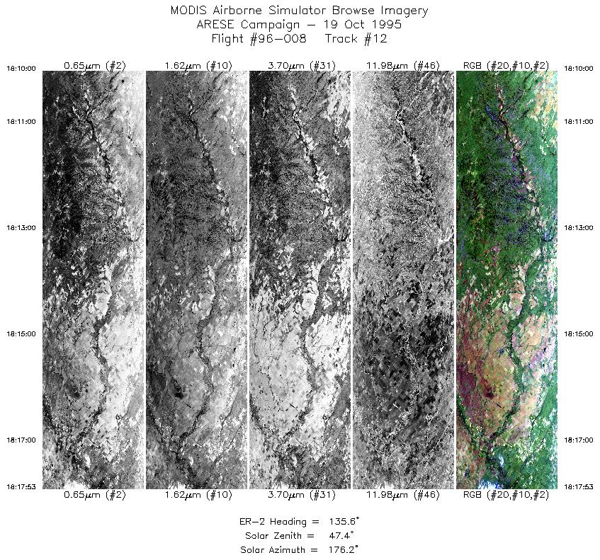
| 12 |
18:09-18:17 |
136 |
37.47-36.82 |
98.99-98.21 |
2955 |
~20000 |
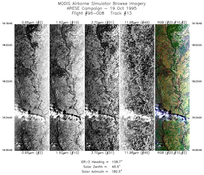
| 13 |
18:18-18:25 |
109 |
36.77-36.51 |
98.10-97.16 |
2624 |
~20000 |
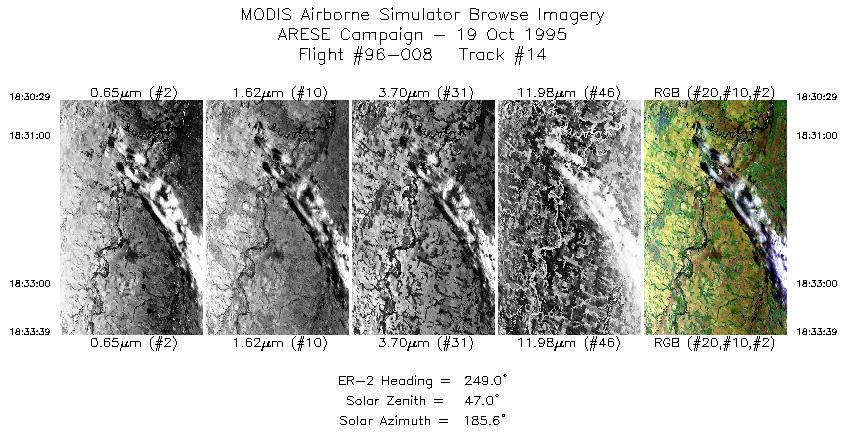
| 14 |
18:30-18:33 |
249 |
36.70-36.57 |
97.20-97.60 |
1176 |
~20000 |
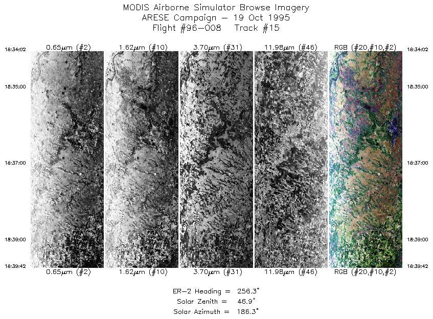
| 15 |
18:34-18:39 |
256 |
36.56-36.40 |
97.64-98.39 |
2124 |
~20000 |
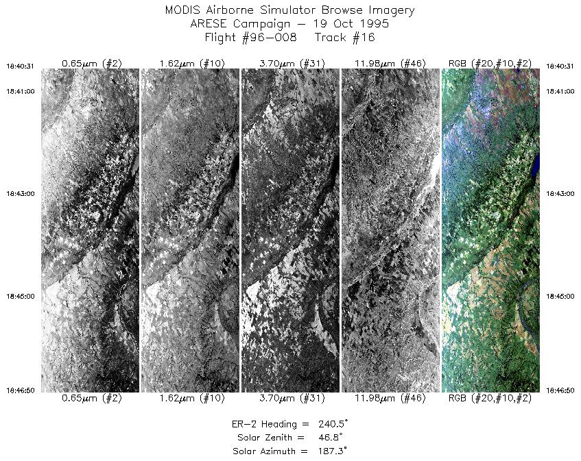
| 16 |
18:40-18:46 |
240 |
36.36-36.02 |
98.49-99.23 |
2368 |
~20000 |
| 17 |
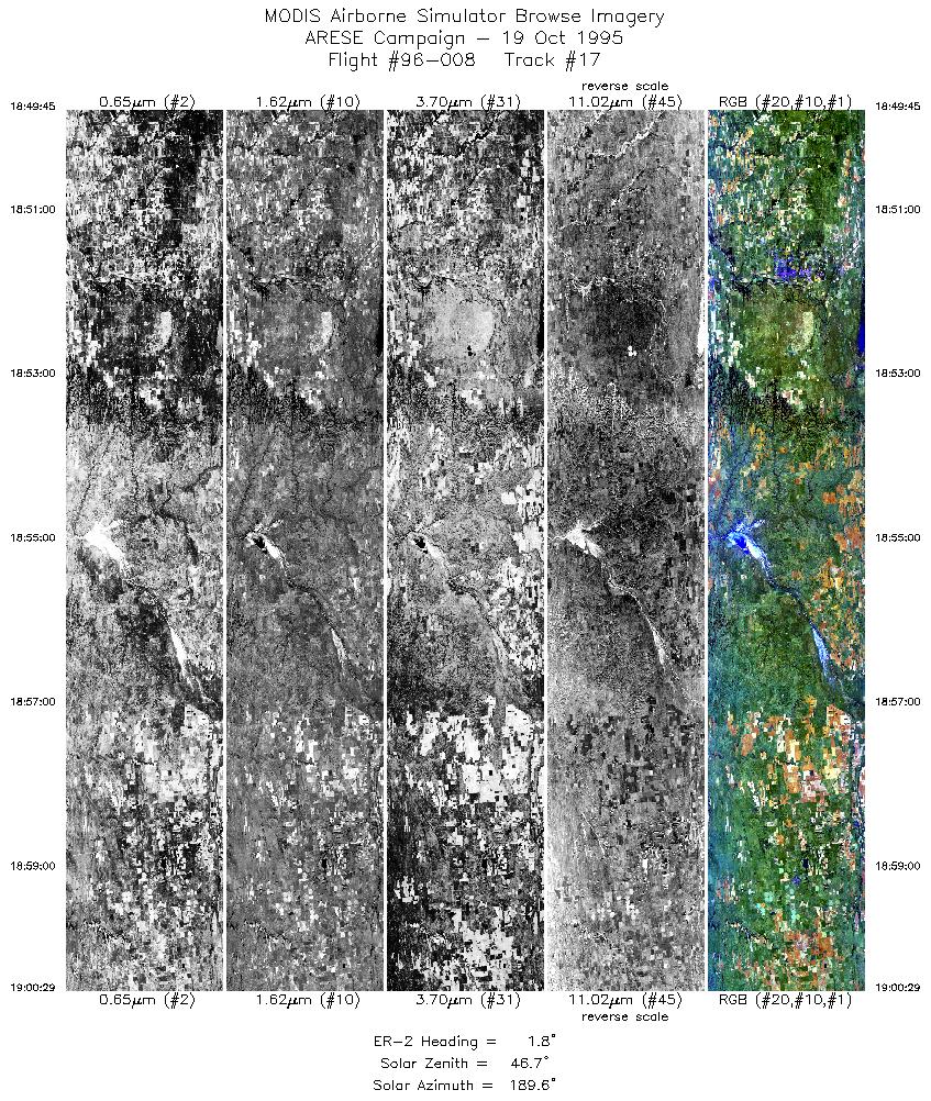
18:49-19:00 |
2 |
36.20-37.42 |
99.43-99.30 |
4012 |
~20000 |
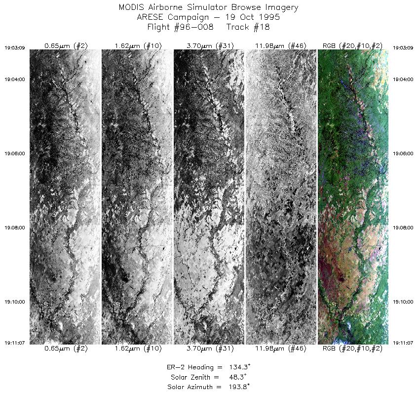
| 18 |
19:03-19:11 |
134 |
37.47-36.82 |
99.01-98.21 |
2987 |
~20000 |
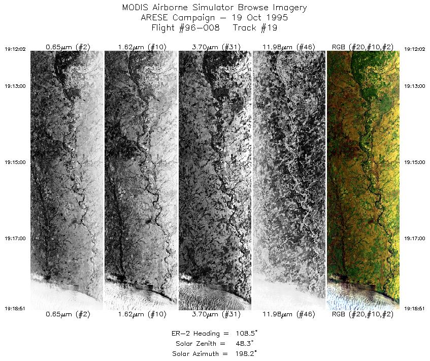
| 19 |
19:12-19:18 |
108 |
36.77-36.51 |
98.10-97.16 |
2555 |
~20000 |
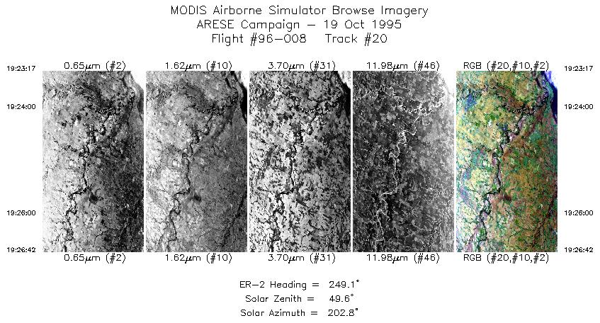
| 20 |
19:23-19:26 |
249 |
36.71-36.57 |
97.16-97.59 |
1281 |
~20000 |
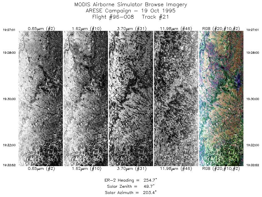
| 21 |
19:27-19:32 |
255 |
36.56-36.40 |
97.63-98.39 |
2192 |
~20000 |
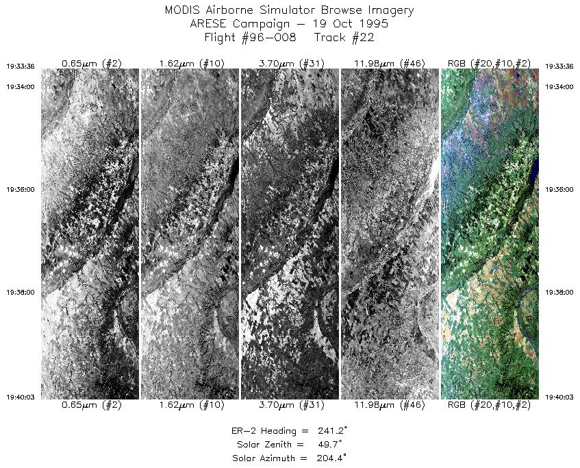
| 22 |
19:33-19:40 |
241 |
36.37-36.02 |
98.48-99.22 |
2418 |
~20000 |
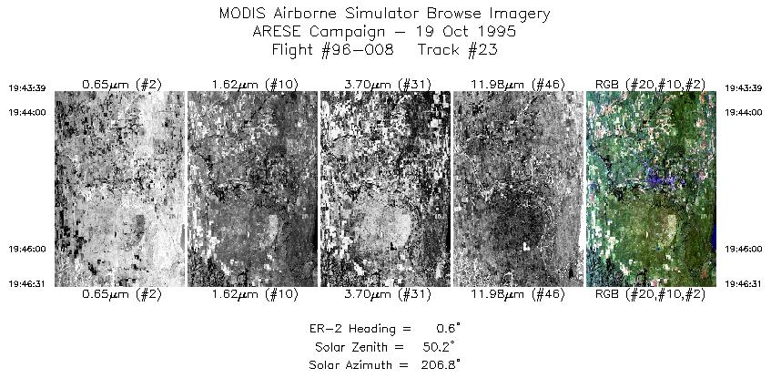
| 23 |
19:43-19:46 |
1 |
36.28-36.61 |
99.41-99.38 |
1075 |
~20000 |
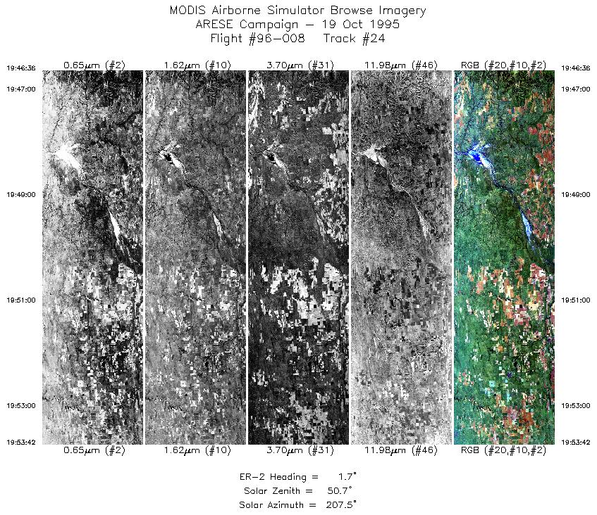
| 24 |
19:46-19:53 |
2 |
36.61-37.42 |
99.38-99.30 |
2661 |
~20000 |
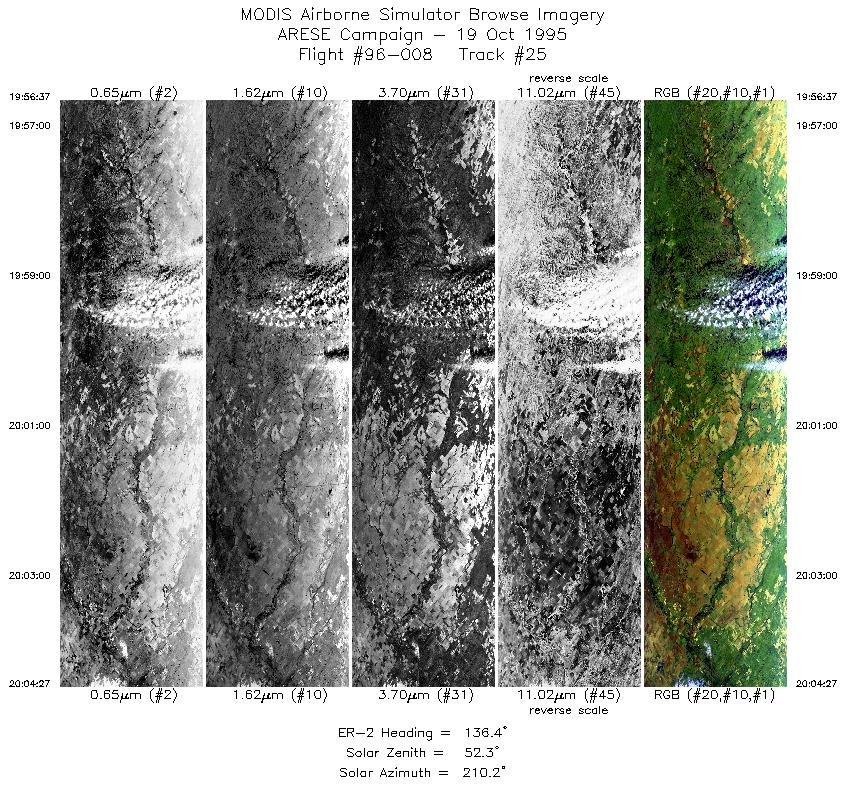
| 25 |
19:56-20:04 |
136 |
37.46-36.82 |
98.99-98.21 |
2936 |
~20000 |
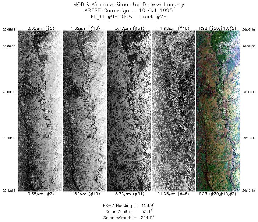
| 26 |
20:05-20:12 |
109 |
36.77-36.51 |
98.11-97.15 |
2637 |
~20000 |
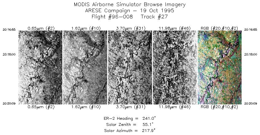
| 27 |
20:16-20:20 |
241 |
36.73-36.57 |
97.19-97.59 |
1213 |
~20000 |
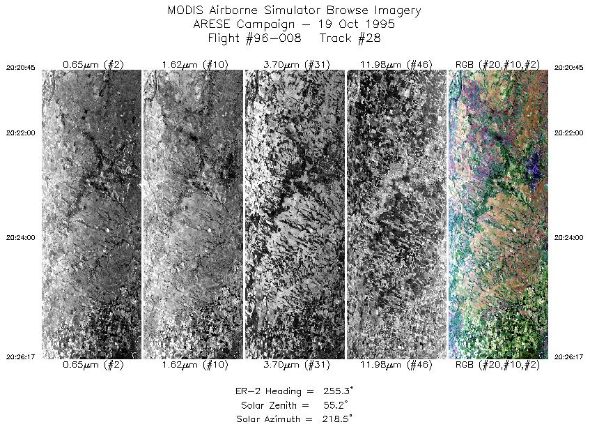
| 28 |
20:20-20:26 |
255 |
36.55-36.41 |
97.66-98.39 |
2075 |
~20000 |
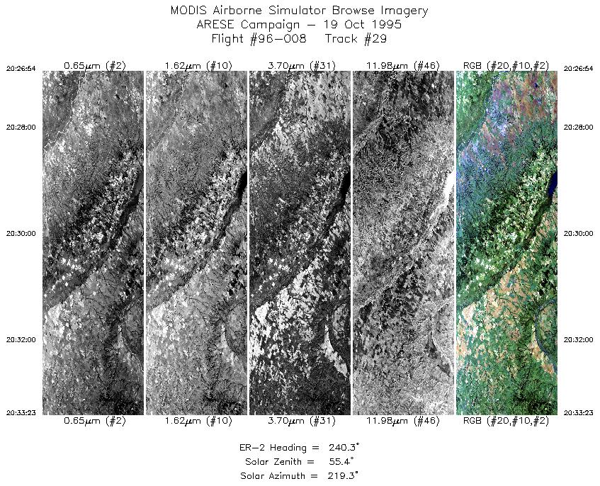
| 29 |
20:26-20:33 |
240 |
36.38-36.02 |
98.46-99.23 |
2430 |
~20000 |
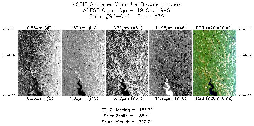
| 30 |
20:34-20:37 |
167 |
35.88-35.56 |
99.30-99.20 |
1100 |
~20000 |
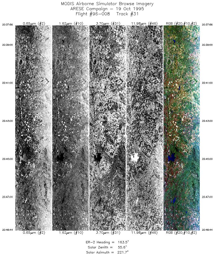
| 31 |
20:37-20:48 |
163 |
35.54-34.38 |
99.19-98.74 |
4048 |
~20000 |
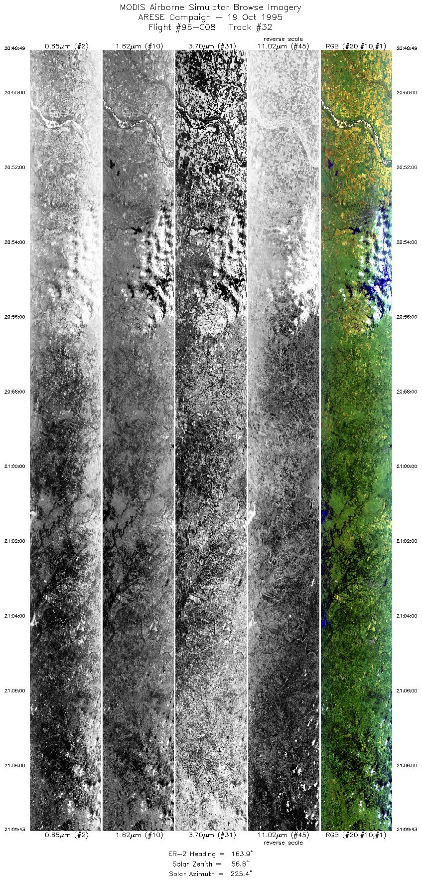
| 32 |
20:48-21:09 |
164 |
34.37-32.06 |
98.73-97.90 |
7832 |
~20000 |
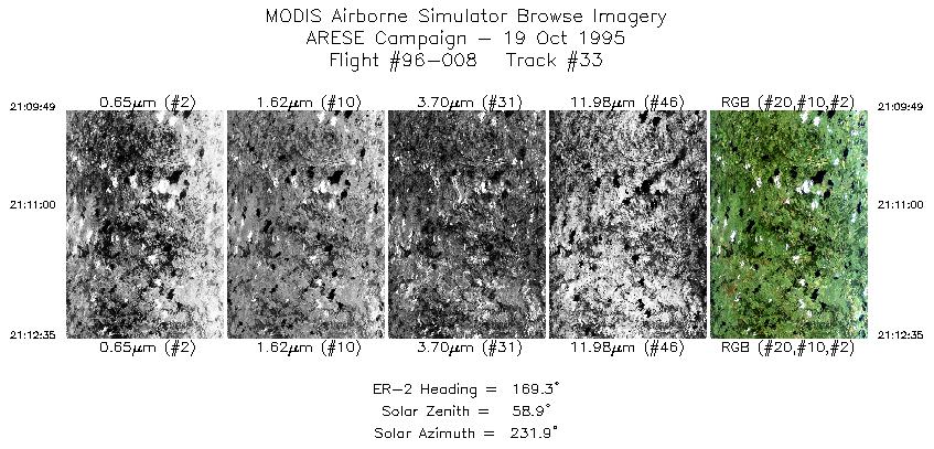
| 33 |
21:09-21:12 |
169 |
32.05-31.75 |
97.90-97.82 |
1037 |
~20000 |
|
Images 01 through 33 in sequence |
Level-1B Data Distribution
NASA LaRC Atmospheric Sciences Data Center
|
|