
|
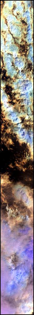
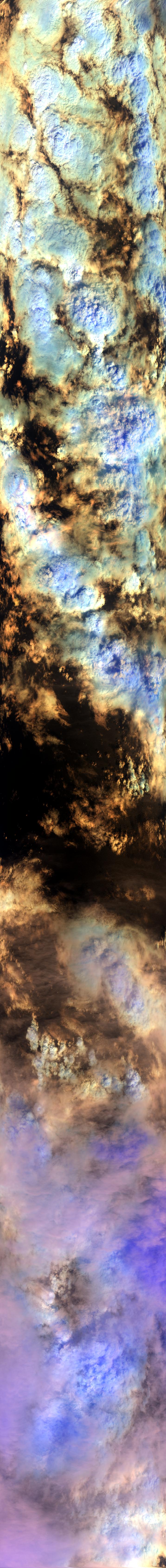
Sample Image

12 Oct 1995
Track #15

|
|
Mission Summary
Date: October 12, 1995
ER-2 Flight Number: 96-004
Flight Location: Hurricane Roxanne
Principal Investigator: Dr. Francisco Valero (Scripps)
Additional Sensors: RAMS, CLS, VIS
Objective: Investigate the absorption of solar radiation by clouds, aerosols, and atmospheric gases.
Level-1B Processing Information
Level-1B Data processed by: Ames Research Center
Level-1B Data Version: #09
Level-1B Configuration: (sample file)
Calibration Type: Final
Calibration Version: ARESE 1.0
Temperature Adjustment: 35C
Status: Completed with final calibration
|
|
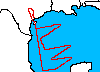
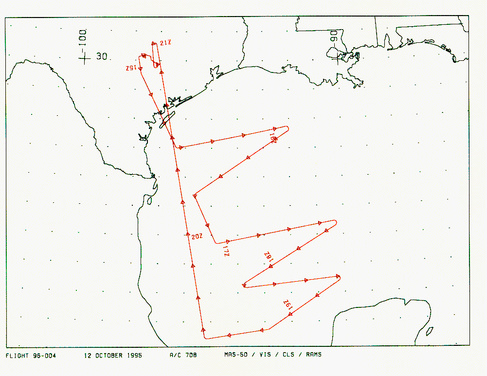
Flight Track Map

|
Level-1B Browse Imagery
Straight Line Flight Tracks: 18
Scanlines Processed: 120324
Solar Azimuth and Zenith Angles
|
Browse Images
|
Click on the Flight Track number to load images.
Lat/Lon ranges are for the BEG-END scanline nadir pixels.
|
Flight
Track |
Time_Span
(GMT) |
Heading
(Deg) |
Lat_Range
(Deg_N) |
Lon_Range
(Deg_W) |
Length
(Scanlines) |
Altitude
(Meters) |
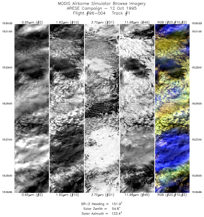
| 1 |
15:20-15:29 |
152 |
27.96-27.05 |
96.86-96.36 |
3503 |
~20000 |
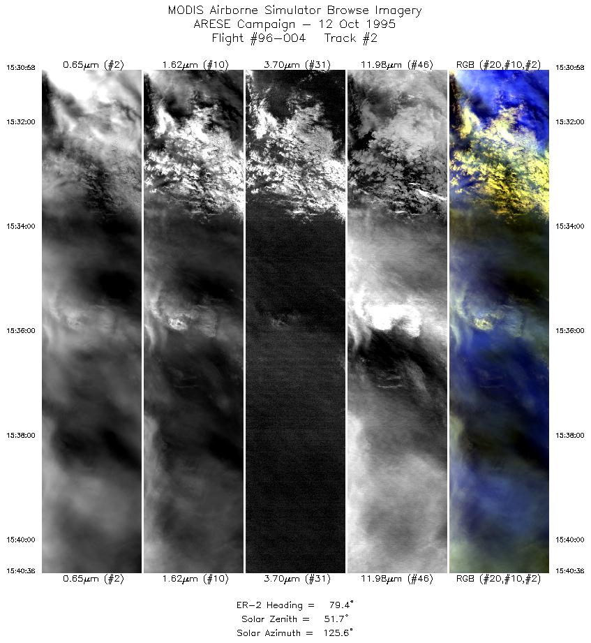
| 2 |
15:30-15:40 |
79 |
27.00-27.21 |
96.25-95.08 |
3607 |
~20000 |
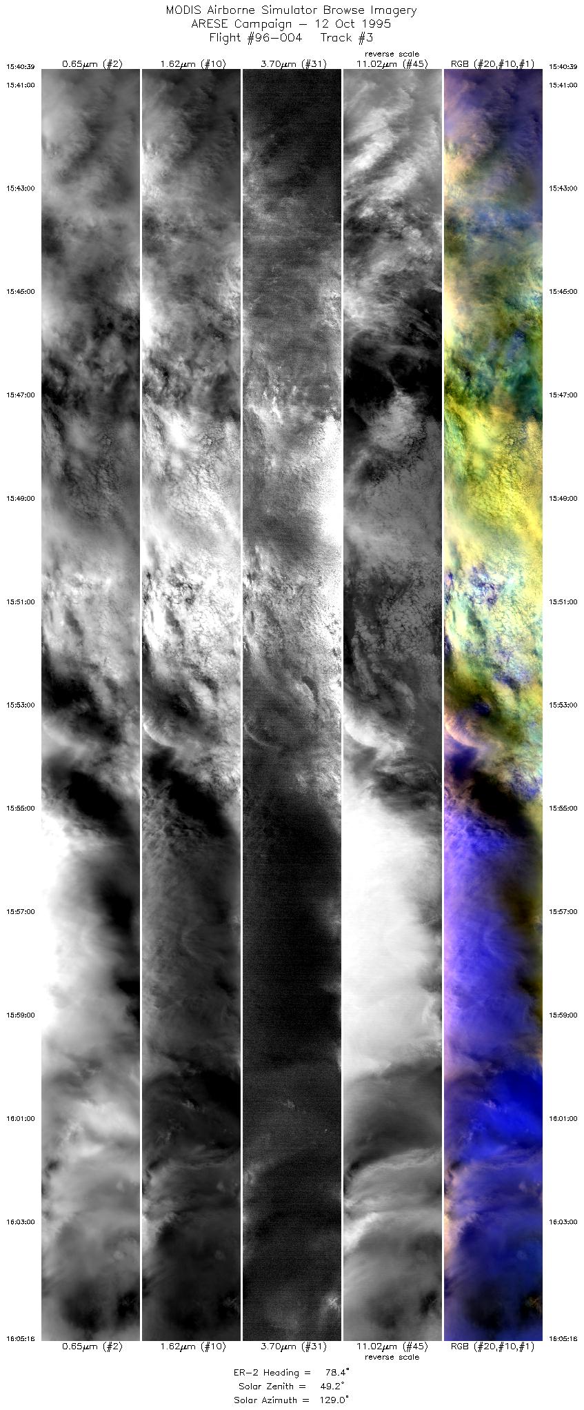
| 3 |
15:40-16:05 |
78 |
27.21-27.73 |
95.07-92.11 |
9222 |
~20000 |
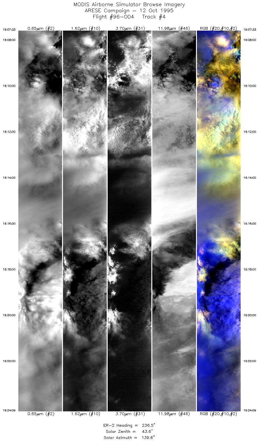
| 4 |
16:07-16:24 |
236 |
27.57-26.52 |
92.04-93.82 |
6223 |
~20000 |
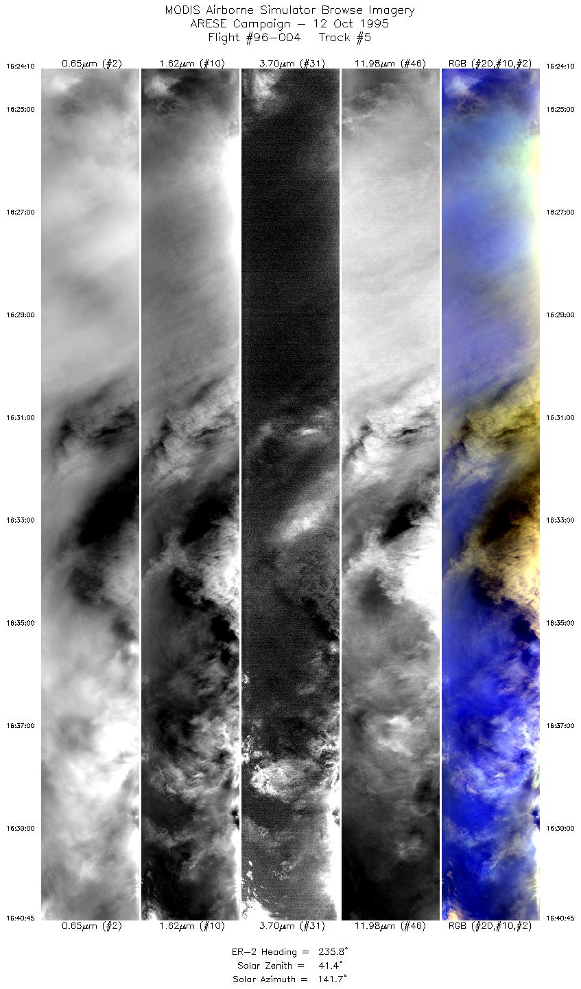
| 5 |
16:24-16:40 |
236 |
26.51-25.45 |
93.83-95.55 |
6217 |
~20000 |
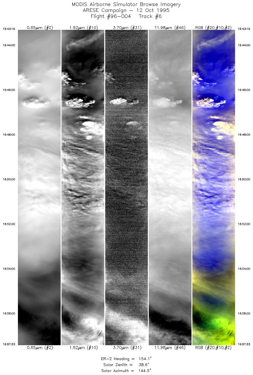
| 6 |
16:43-16:57 |
154 |
25.20-23.78 |
95.53-94.83 |
5292 |
~20000 |
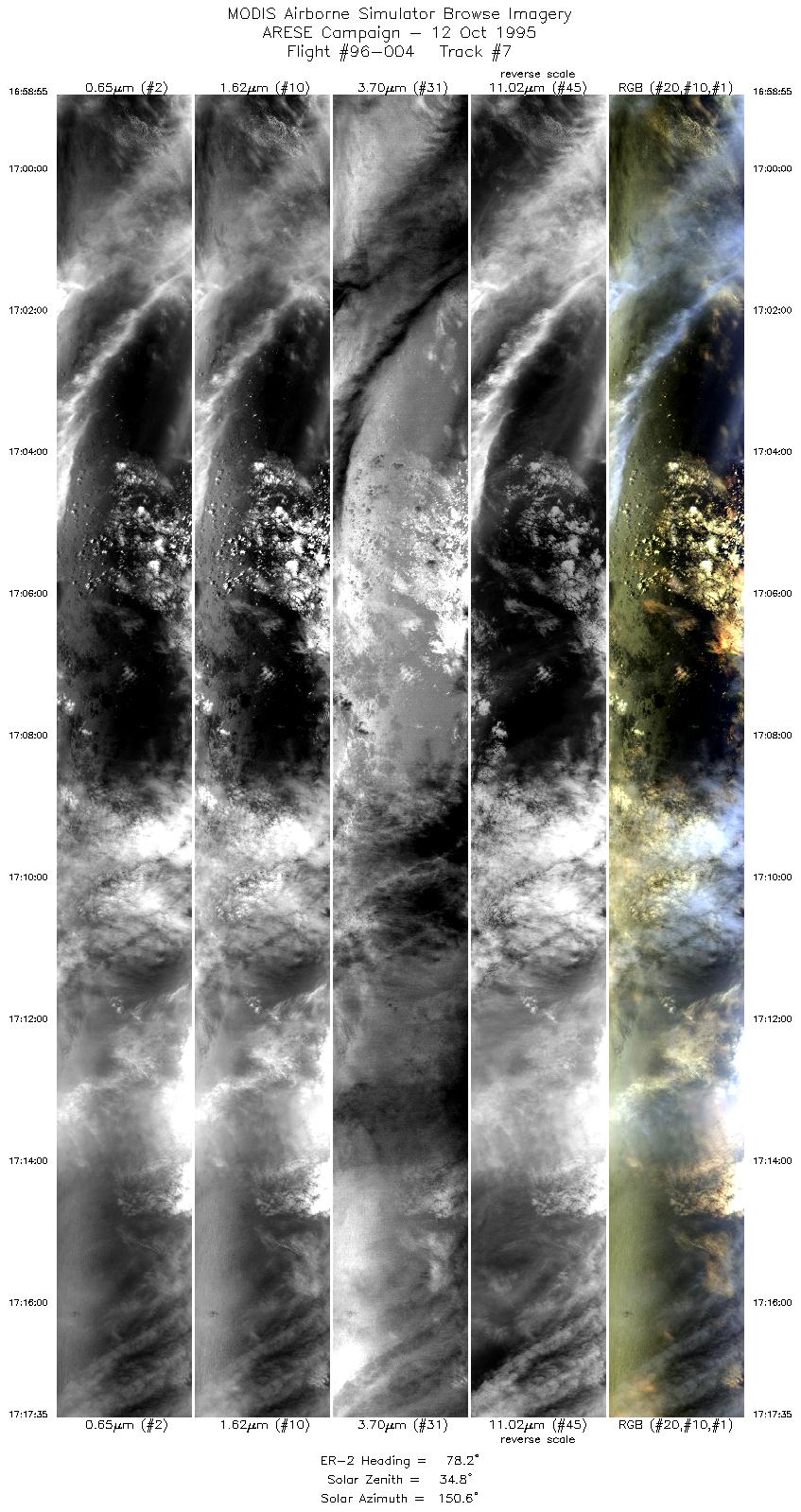
| 7 |
16:58-17:17 |
78 |
23.72-24.11 |
94.68-92.52 |
6999 |
~20000 |
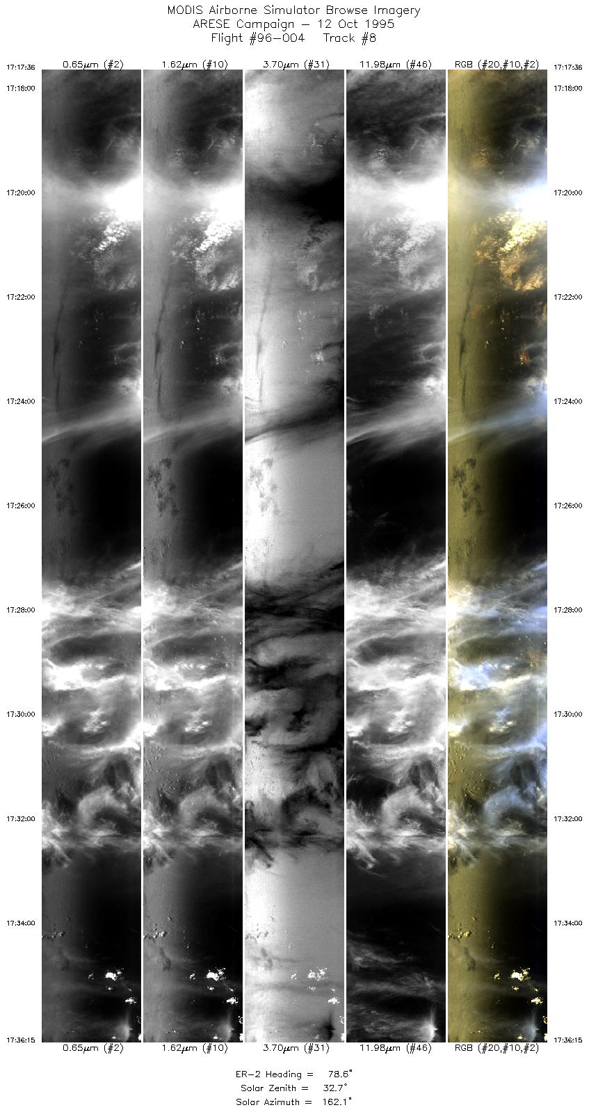
| 8 |
17:17-17:36 |
79 |
24.10-24.46 |
92.53-90.35 |
6995 |
~20000 |
| 9 |
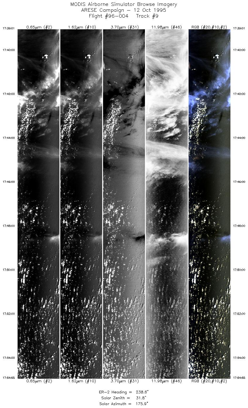
17:39-17:54 |
239 |
24.26-23.32 |
90.34-92.03 |
5965 |
~20000 |
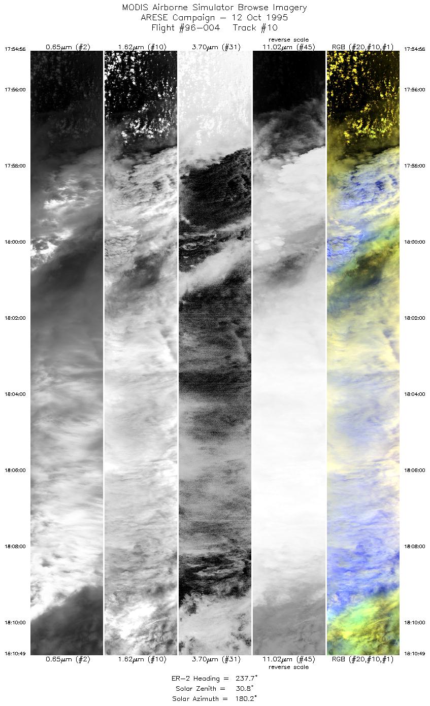
| 10 |
17:54-18:10 |
238 |
23.32-22.36 |
92.03-93.69 |
5959 |
~20000 |
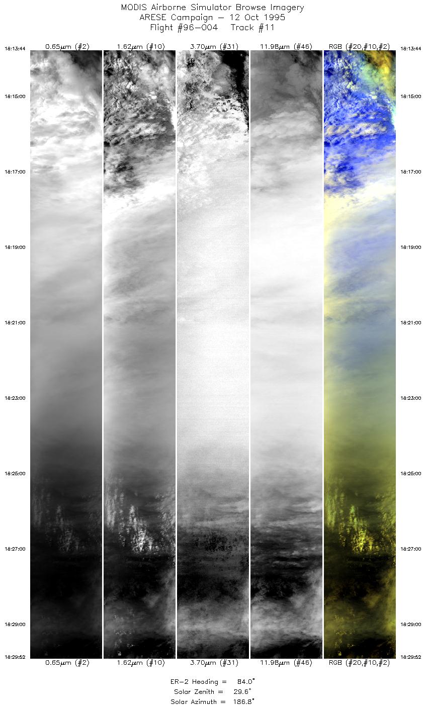
| 11 |
18:13-18:29 |
84 |
22.20-22.39 |
93.56-91.66 |
6053 |
~20000 |
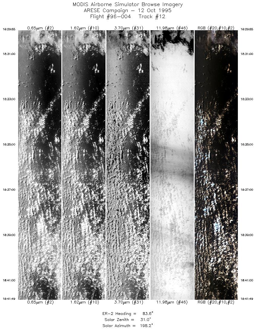
| 12 |
18:29-18:41 |
84 |
22.39-22.52 |
91.65-90.25 |
4464 |
~20000 |
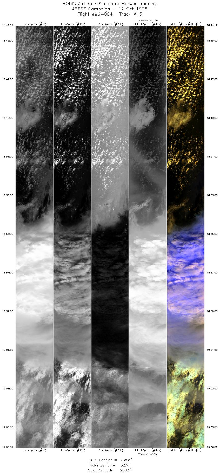
| 13 |
18:44-19:06 |
236 |
22.35-20.97 |
90.26-92.47 |
8135 |
~20000 |
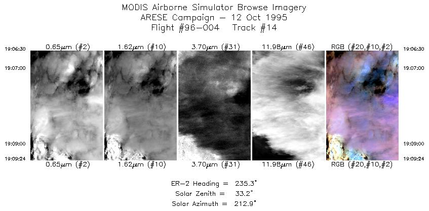
| 14 |
19:06-19:09 |
235 |
20.94-20.75 |
92.51-92.81 |
1089 |
~20000 |
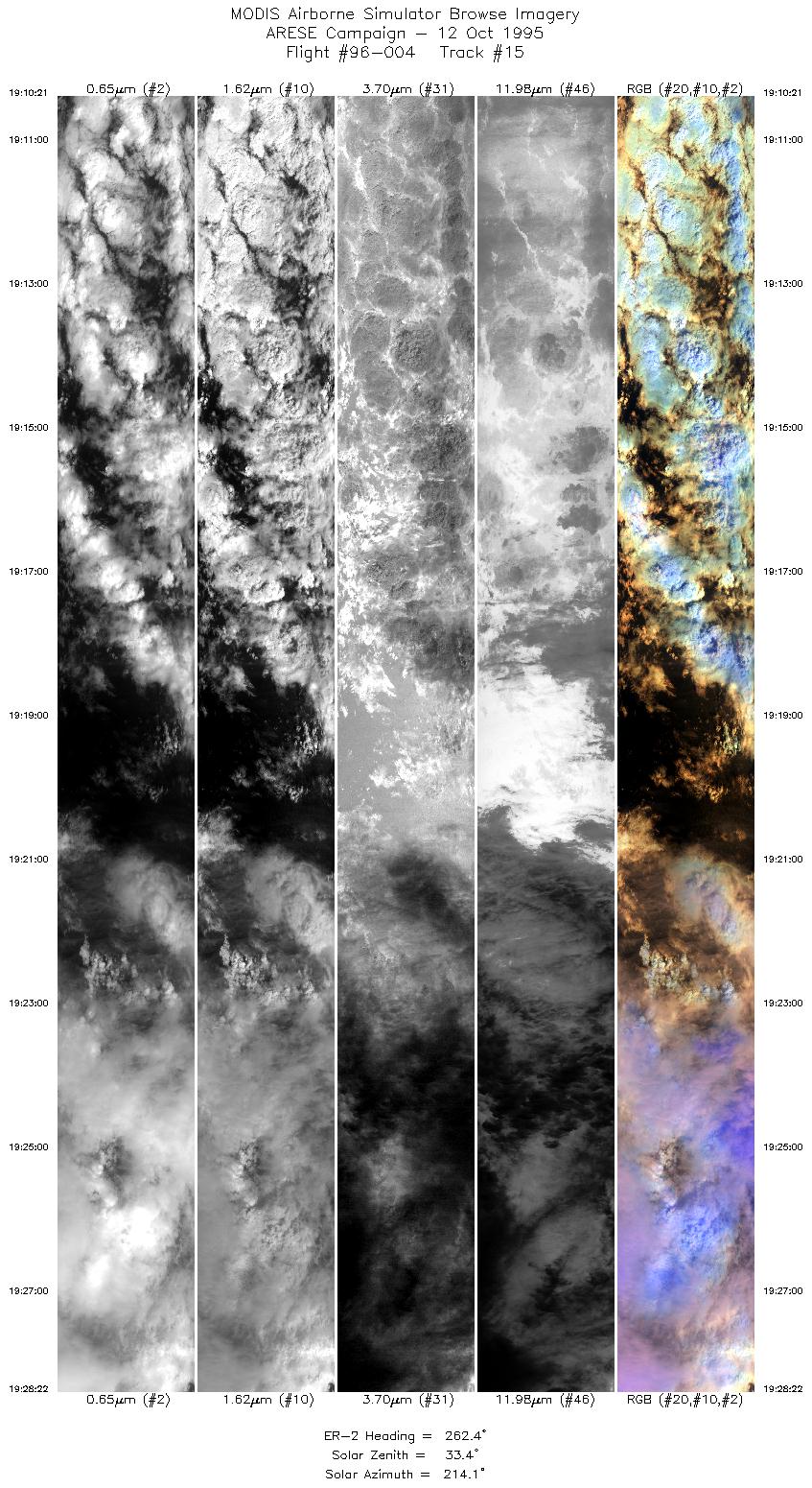
| 15 |
19:10-19:28 |
262 |
20.73-20.42 |
92.92-95.09 |
6758 |
~20000 |
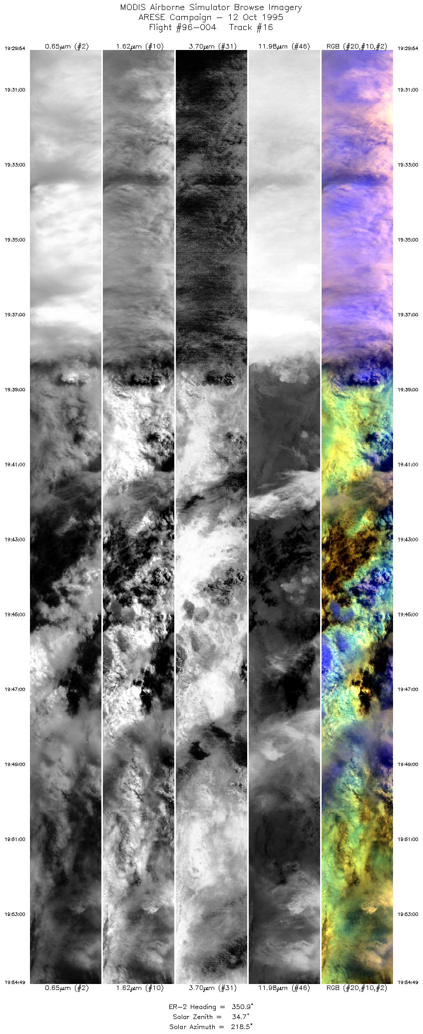
| 16 |
19:29-19:54 |
351 |
20.52-23.27 |
95.21-95.71 |
9344 |
~20000 |
| 17 |
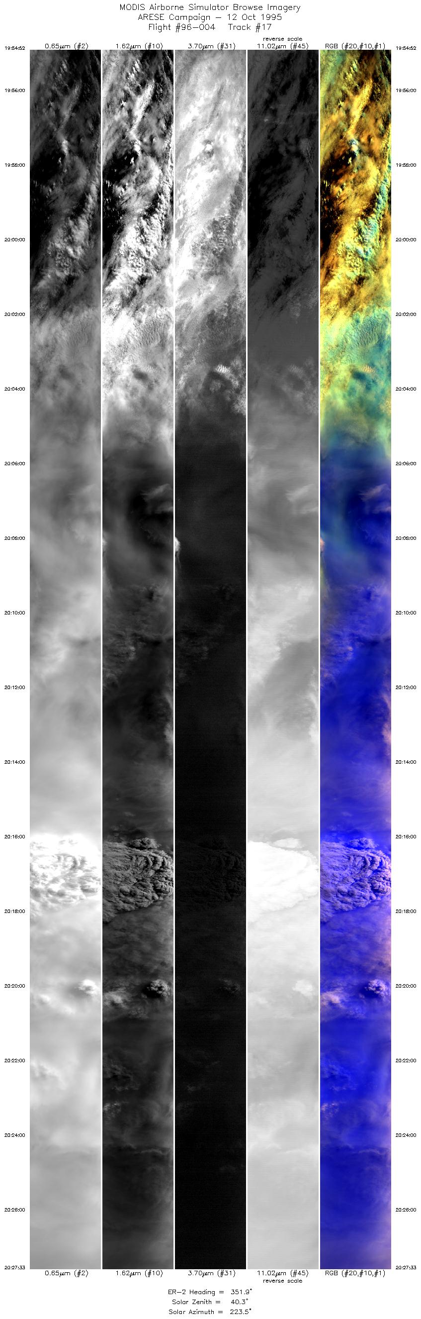
19:54-20:27 |
352 |
23.27-26.87 |
95.71-96.39 |
12256 |
~20000 |
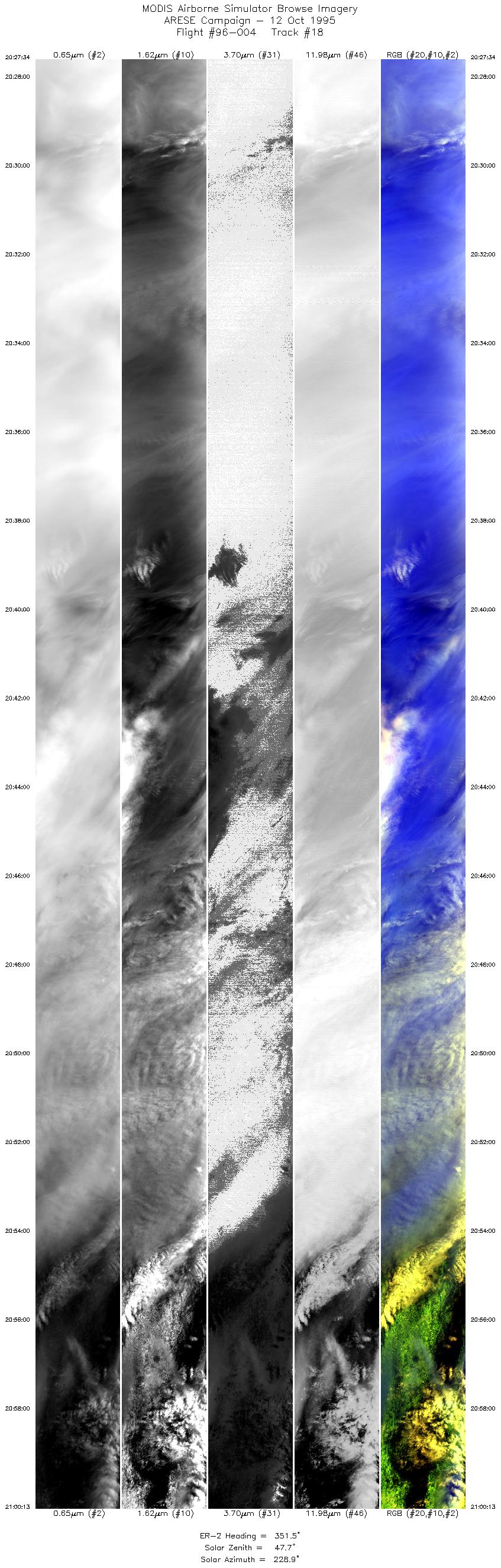
| 18 |
20:27-21:00 |
351 |
26.87-30.54 |
96.39-97.14 |
12243 |
~20000 |
|
Images 01 through 18 in sequence |
Level-1B Data Distribution
NASA LaRC Atmospheric Sciences Data Center
Sample Image
The image to the left is of cloud formations of Hurricane Roxanne over the Gulf of Mexico.
R: 2.14 microns
G: 1.62 microns
B: 0.55 microns
|
|