
|
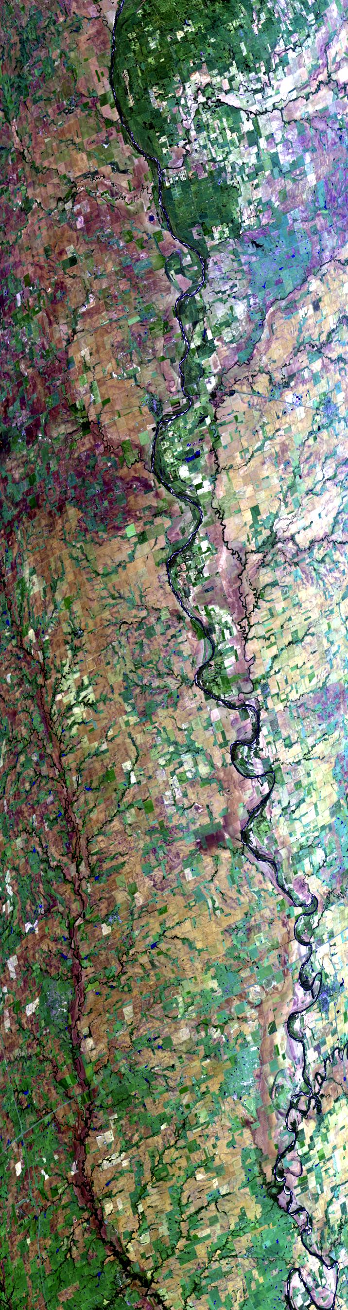
Sample Image

17 Oct 1995
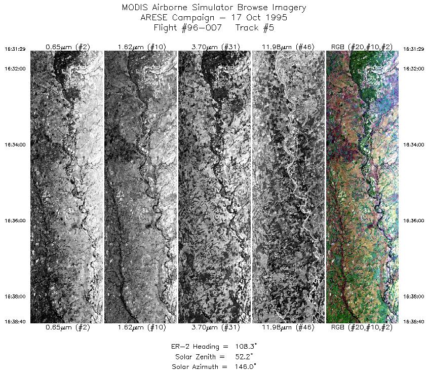
Track #05


Following the Salt Fork Arkansas River east through Oklahoma, to its confluence with the Chikaskia River, south of Ponca City.
R: 2.14 microns
G: 1.62 microns
B: 0.55 microns
|
|
Mission Summary
Date: October 17, 1995
ER-2 Flight Number: 96-007
Flight Location: Oklahoma
Principal Investigator: Dr. Francisco Valero (Scripps)
Additional Sensors: RAMS, CLS, VIS
Objective: Investigate the absorption of solar radiation by clouds, aerosols, and atmospheric gases.
Level-1B Processing Information
Level-1B Data processed by: Ames Research Center
Level-1B Data Version: #09
Level-1B Configuration: (sample file)
Calibration Type: Final
Calibration Version: ARESE 1.0
Temperature Adjustment: 35C
Status: Completed with final calibration
|
|
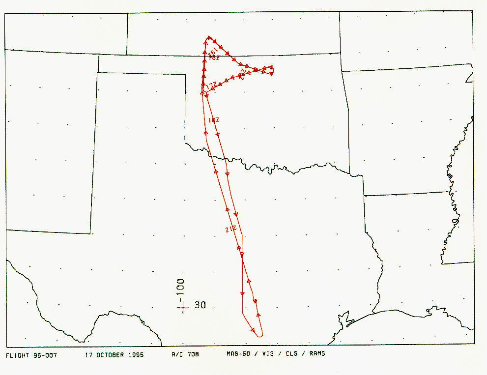
Flight Track Map

|
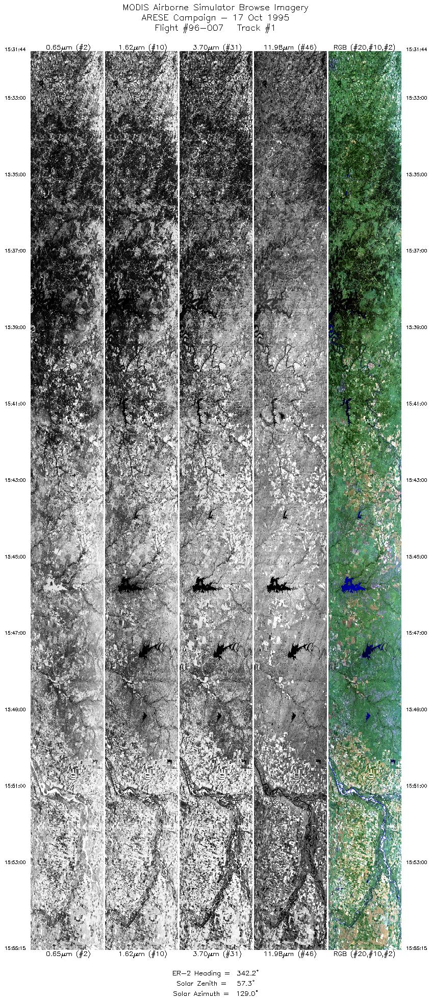
Level-1B Browse Imagery
Straight Line Flight Tracks: 26
Scanlines Processed: 78611
Solar Azimuth and Zenith Angles
|
Browse Images
|
Click on the Flight Track number to load images.
Lat/Lon ranges are for the BEG-END scanline nadir pixels.
|
Flight
Track |
Time_Span
(GMT) |
Heading
(Deg) |
Lat_Range
(Deg_N) |
Lon_Range
(Deg_W) |
Length
(Scanlines) |
Altitude
(Meters) |
| 1 |
15:31-15:55 |
342 |
32.14-34.63 |
98.35-99.25 |
8799 |
~20000 |
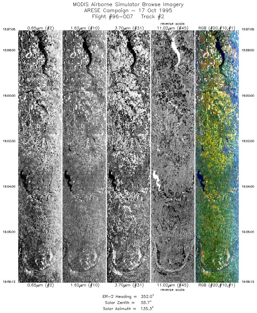
| 2 |
15:57-16:08 |
352 |
34.83-36.06 |
99.29-99.43 |
4165 |
~20000 |
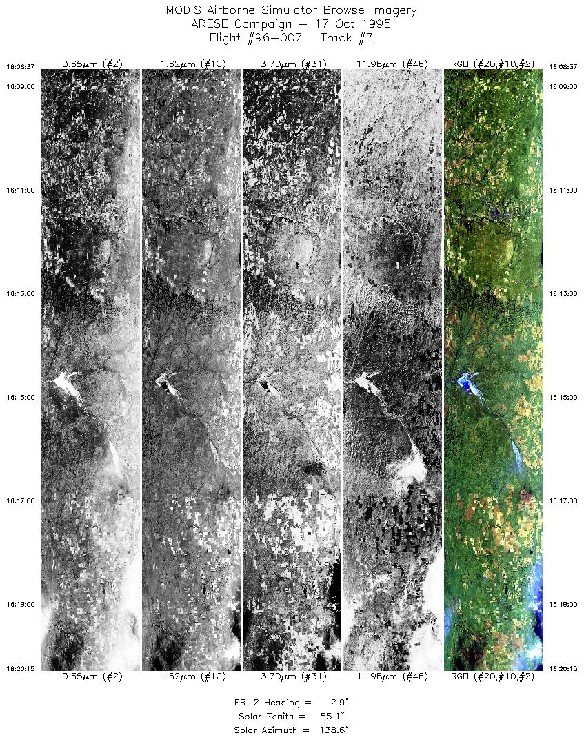
| 3 |
16:08-16:20 |
3 |
36.11-37.42 |
99.43-99.30 |
4360 |
~20000 |
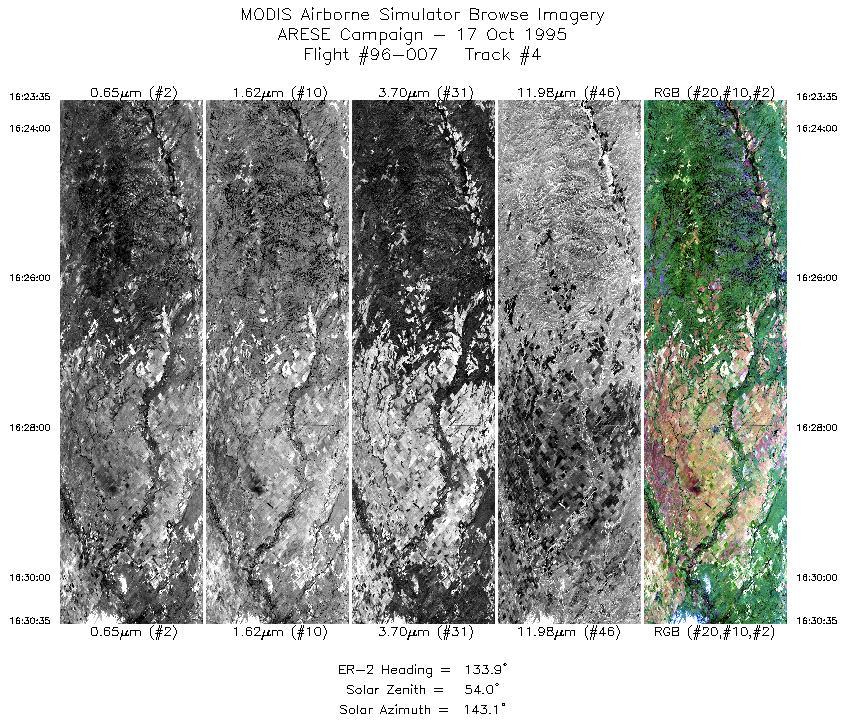
| 4 |
16:23-16:30 |
134 |
37.37-36.82 |
98.95-98.21 |
2624 |
~20000 |
| 5 |
16:31-16:38 |
108 |
36.77-36.50 |
98.09-97.14 |
2694 |
~20000 |
| 6 |
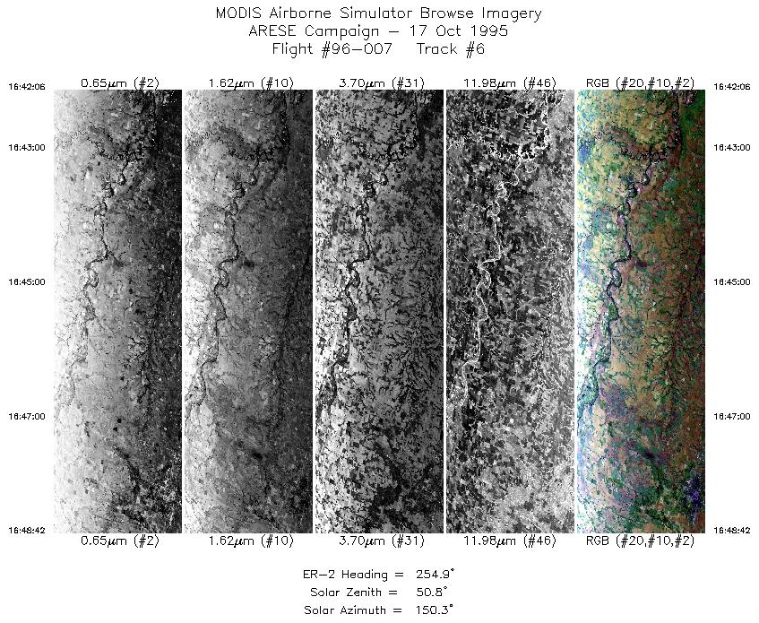
16:42-16:48 |
255 |
36.69-36.49 |
97.11-97.99 |
2475 |
~20000 |
| 7 |
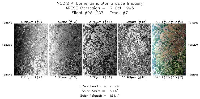
16:48-16:51 |
253 |
36.49-36.40 |
98.00-98.39 |
1106 |
~20000 |
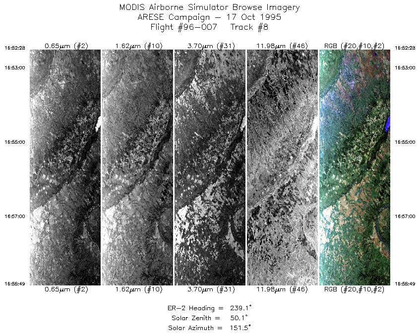
| 8 |
16:52-16:58 |
239 |
36.37-36.02 |
98.48-99.23 |
2381 |
~20000 |
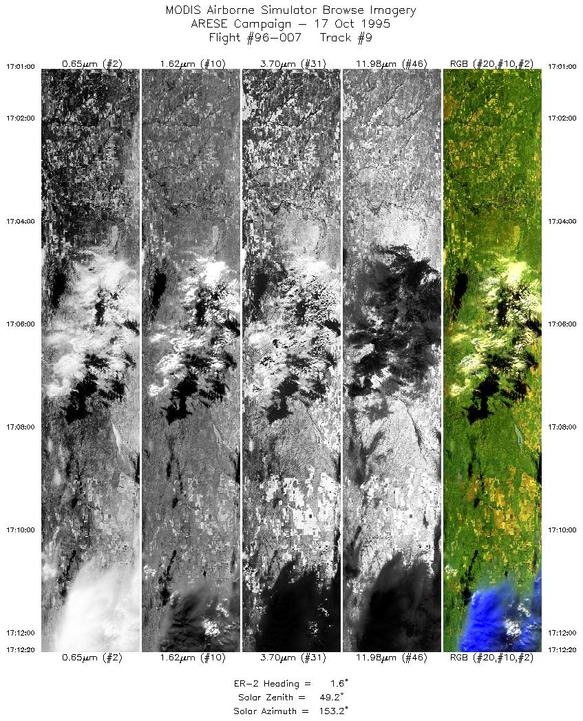
| 9 |
17:00-17:12 |
2 |
36.15-37.42 |
99.39-99.30 |
4238 |
~20000 |
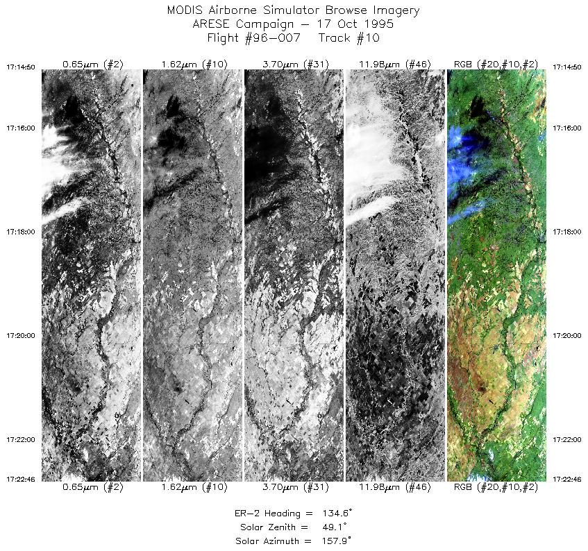
| 10 |
17:14-17:22 |
135 |
37.44-36.82 |
99.04-98.21 |
2974 |
~20000 |
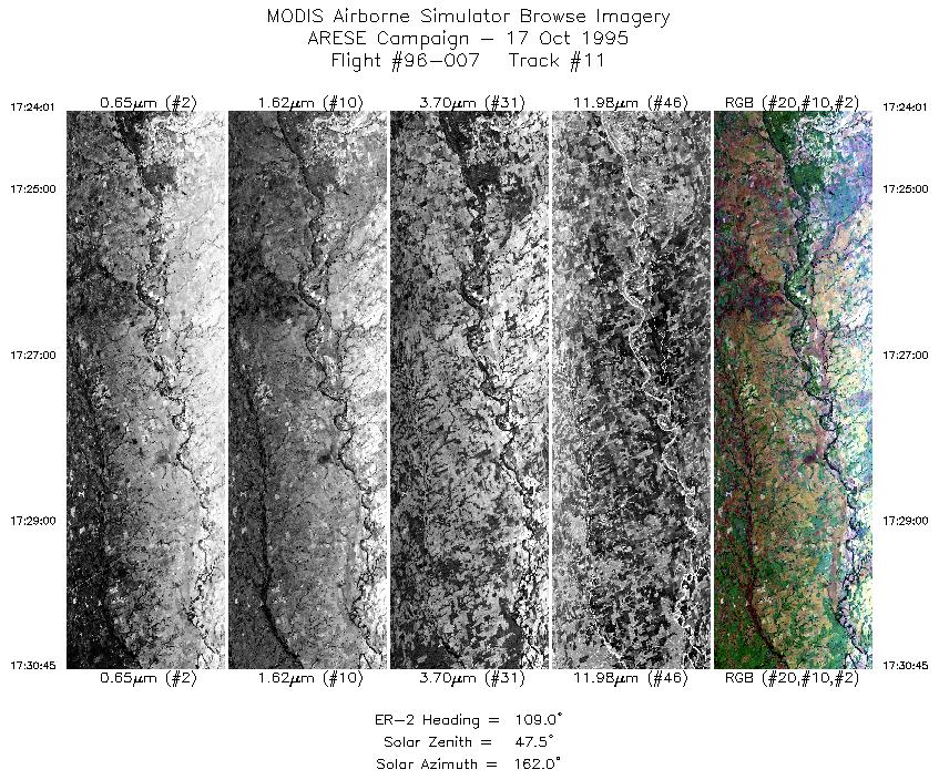
| 11 |
17:24-17:30 |
109 |
36.76-36.50 |
98.05-97.13 |
2524 |
~20000 |
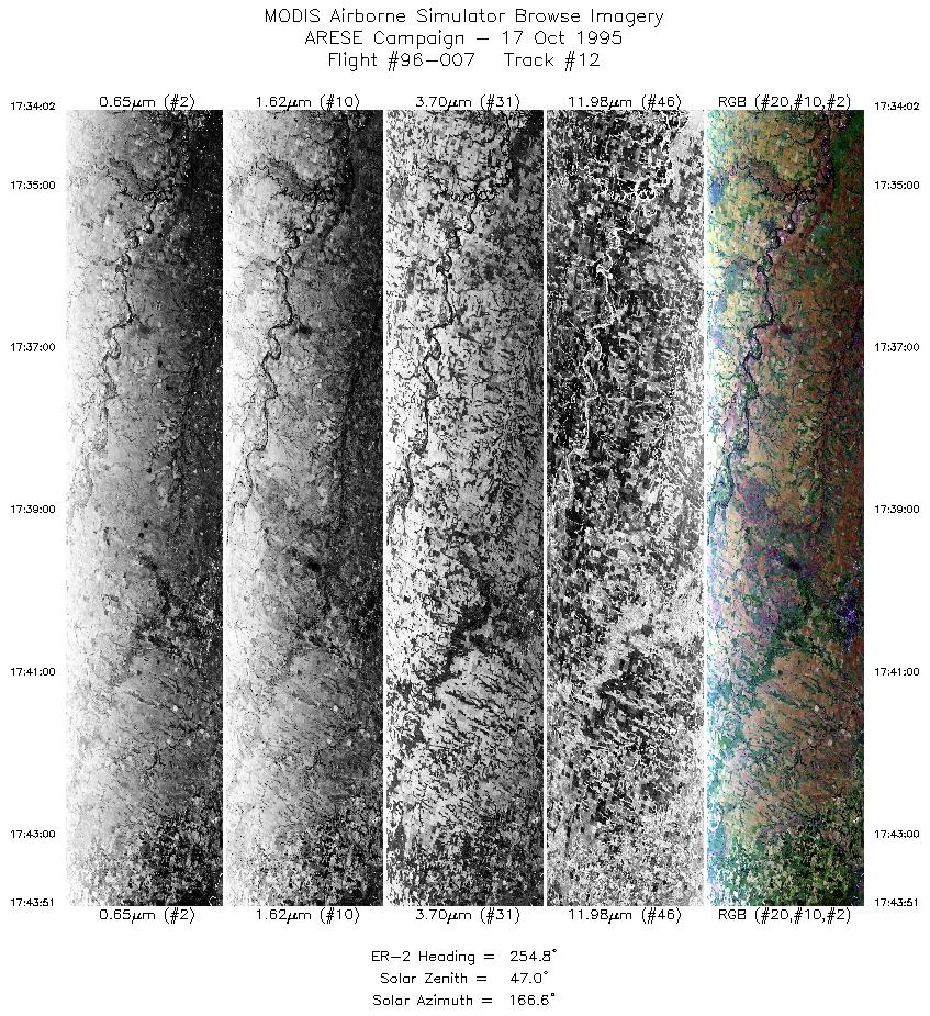
| 12 |
17:34-17:43 |
255 |
36.69-36.40 |
97.11-98.39 |
3626 |
~20000 |
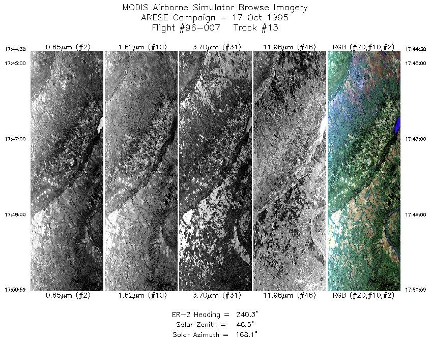
| 13 |
17:44-17:50 |
240 |
36.37-36.02 |
98.48-99.22 |
2369 |
~20000 |
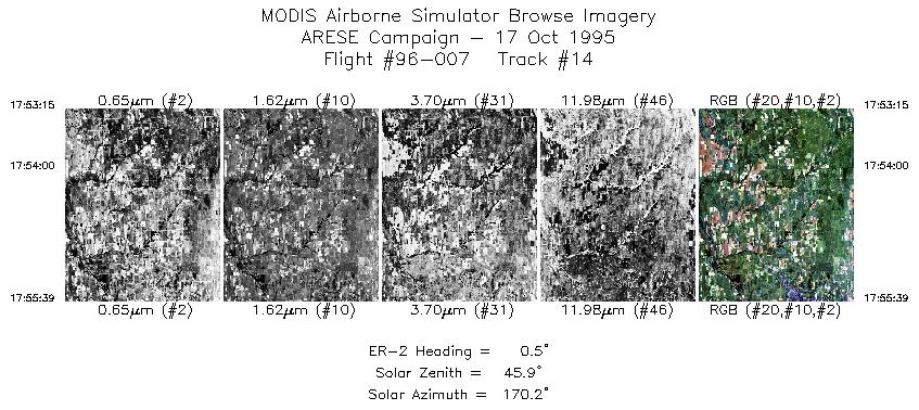
| 14 |
17:53-17:55 |
0 |
36.16-36.43 |
99.38-99.36 |
890 |
~20000 |
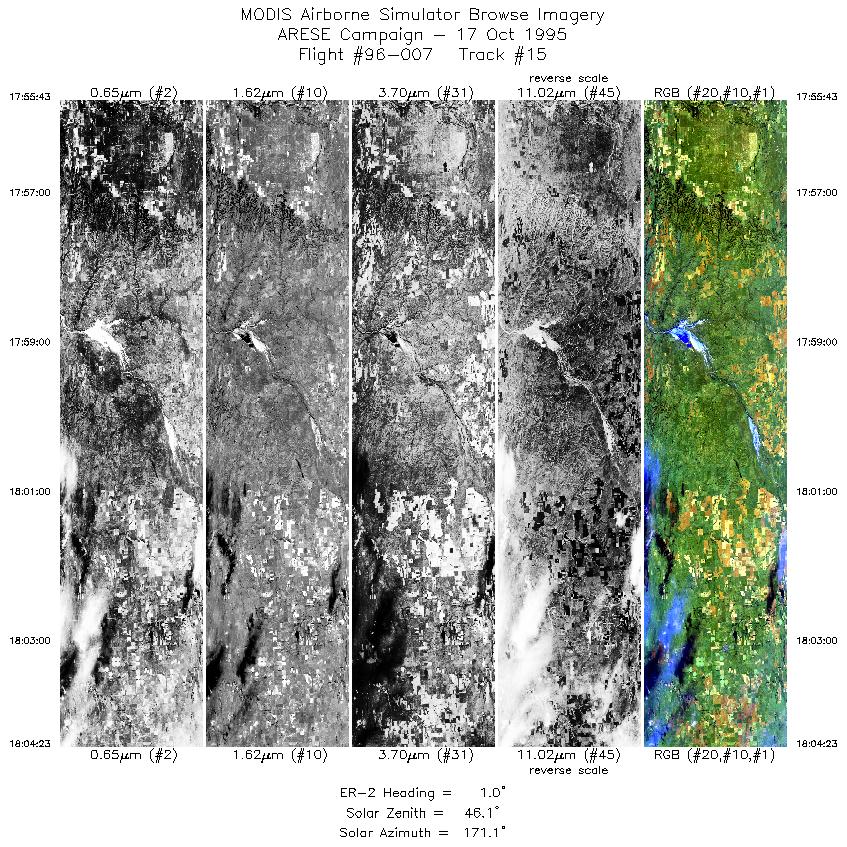
| 15 |
17:55-18:04 |
1 |
36.44-37.42 |
99.36-99.30 |
3238 |
~20000 |
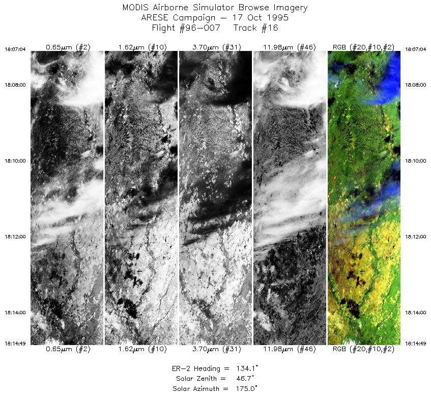
| 16 |
18:07-18:14 |
134 |
37.43-36.82 |
99.02-98.21 |
2885 |
~20000 |
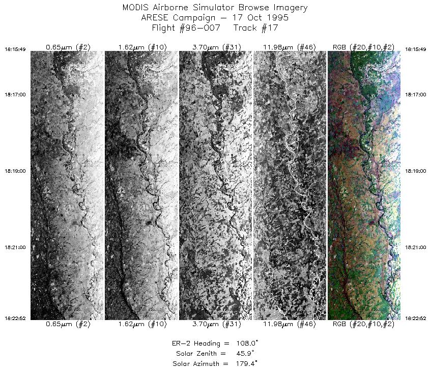
| 17 |
18:15-18:22 |
108 |
36.77-36.50 |
98.08-97.14 |
2643 |
~20000 |
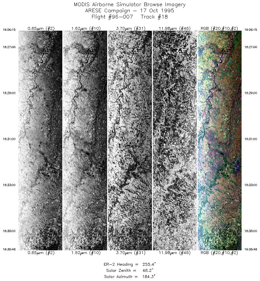
| 18 |
18:26-18:35 |
255 |
36.69-36.40 |
97.12-98.40 |
3580 |
~20000 |
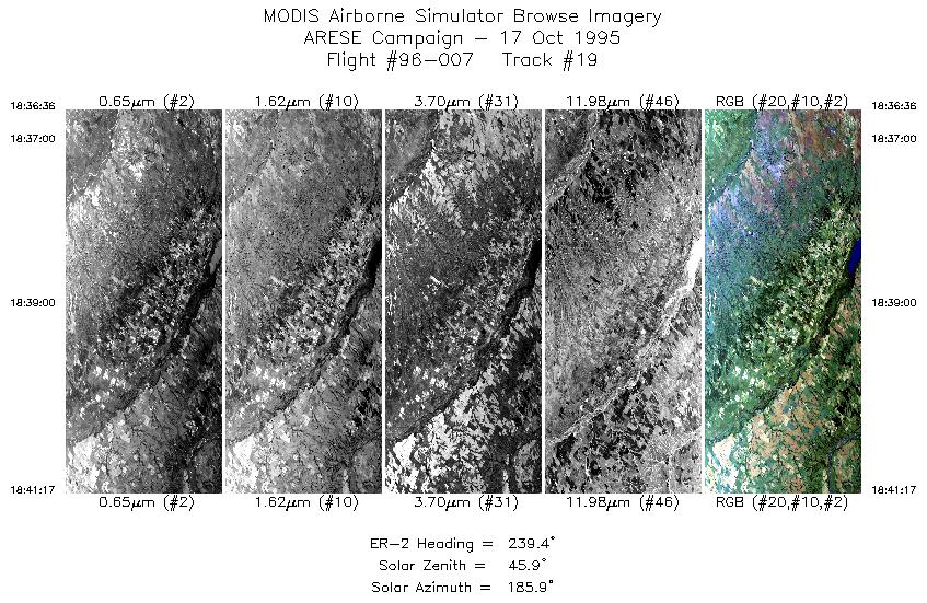
| 19 |
18:36-18:41 |
239 |
36.36-36.10 |
98.50-99.06 |
1756 |
~20000 |
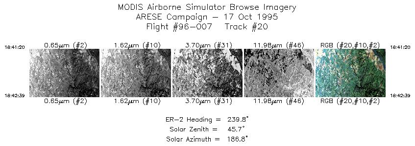
| 20 |
18:41-18:42 |
240 |
36.09-36.02 |
99.07-99.22 |
495 |
~20000 |
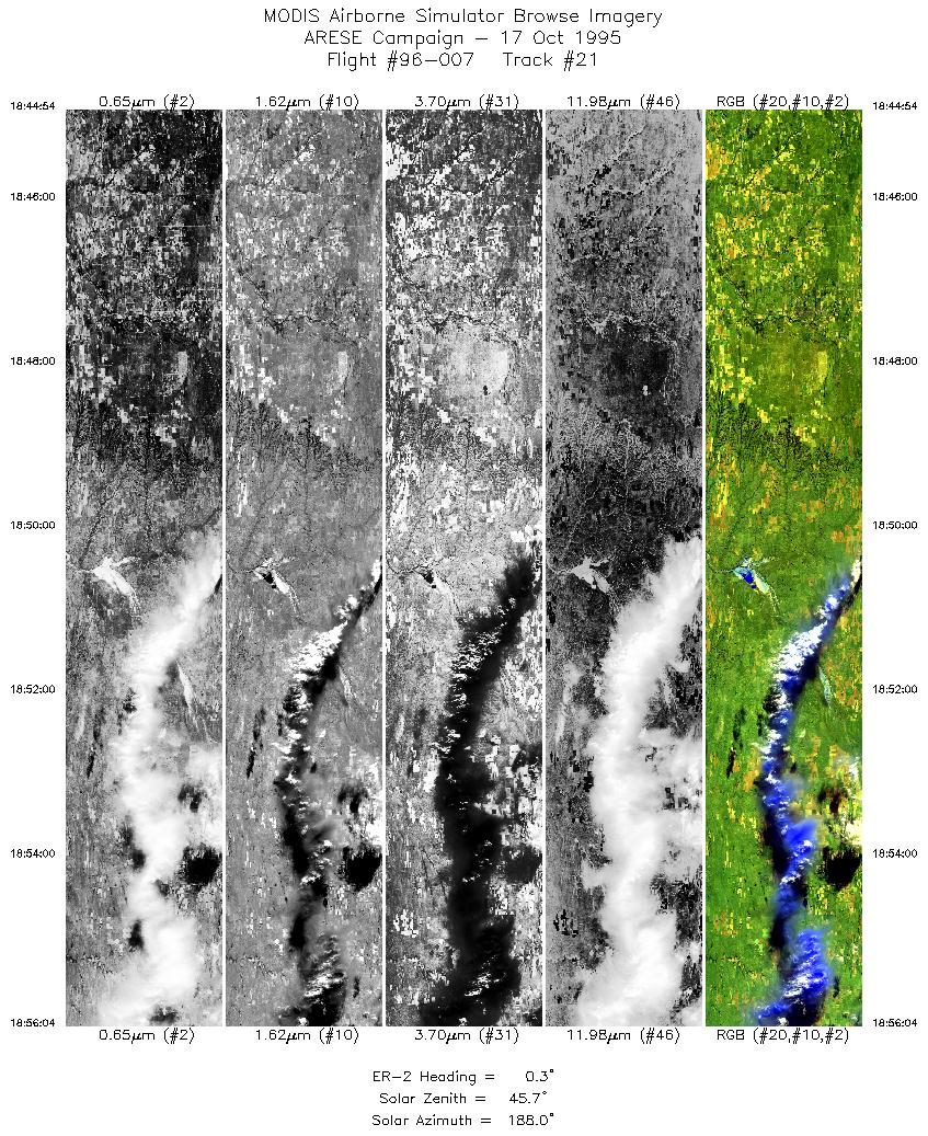
| 21 |
18:44-18:56 |
0 |
36.15-37.42 |
99.38-99.30 |
4185 |
~20000 |
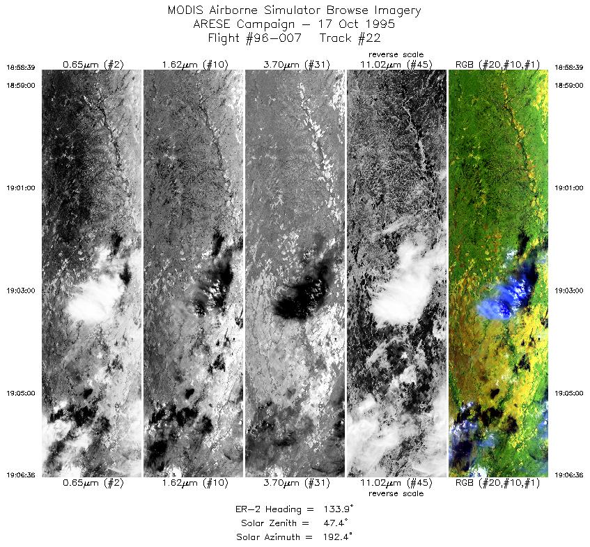
| 22 |
18:58-19:06 |
134 |
37.43-36.82 |
99.03-98.20 |
2925 |
~20000 |
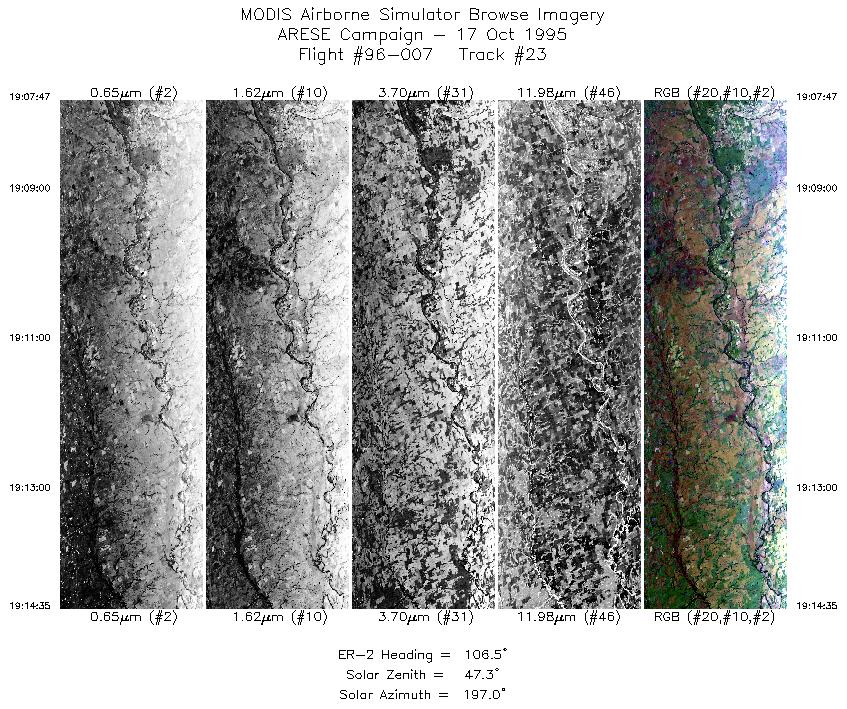
| 23 |
19:07-19:14 |
107 |
36.76-36.51 |
98.05-97.14 |
2548 |
~20000 |
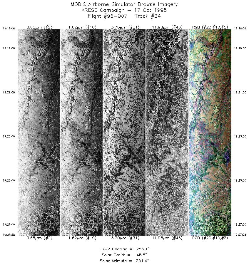
| 24 |
19:18-19:27 |
256 |
36.68-36.40 |
97.15-98.39 |
3511 |
~20000 |
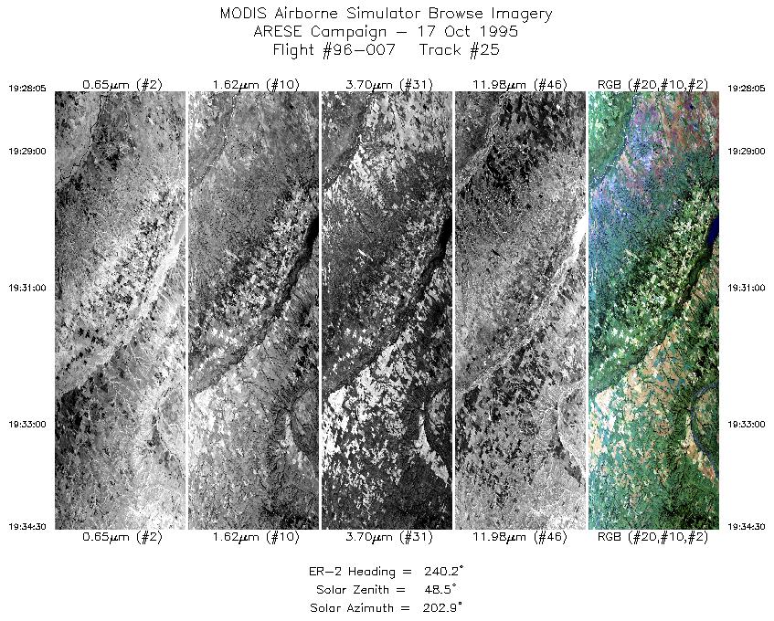
| 25 |
19:28-19:34 |
240 |
36.37-36.02 |
98.47-99.22 |
2403 |
~20000 |
| 26 |
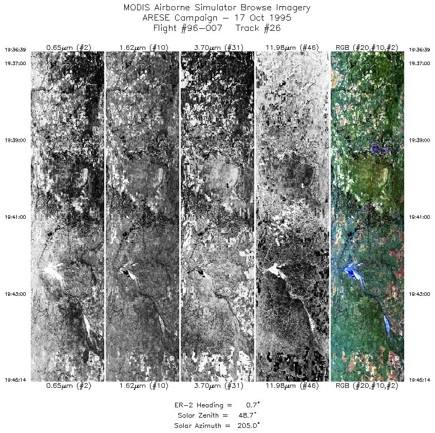
19:36-19:45 |
1 |
36.15-37.12 |
99.38-99.32 |
3217 |
~20000 |
|
Images 01 through 26 in sequence |
Level-1B Data Distribution
NASA LaRC Atmospheric Sciences Data Center
|
|