
|
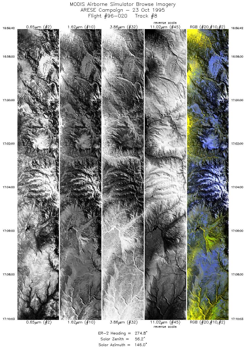
Sample Image

23 Oct 1995
Track #08

|
|
Mission Summary
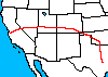
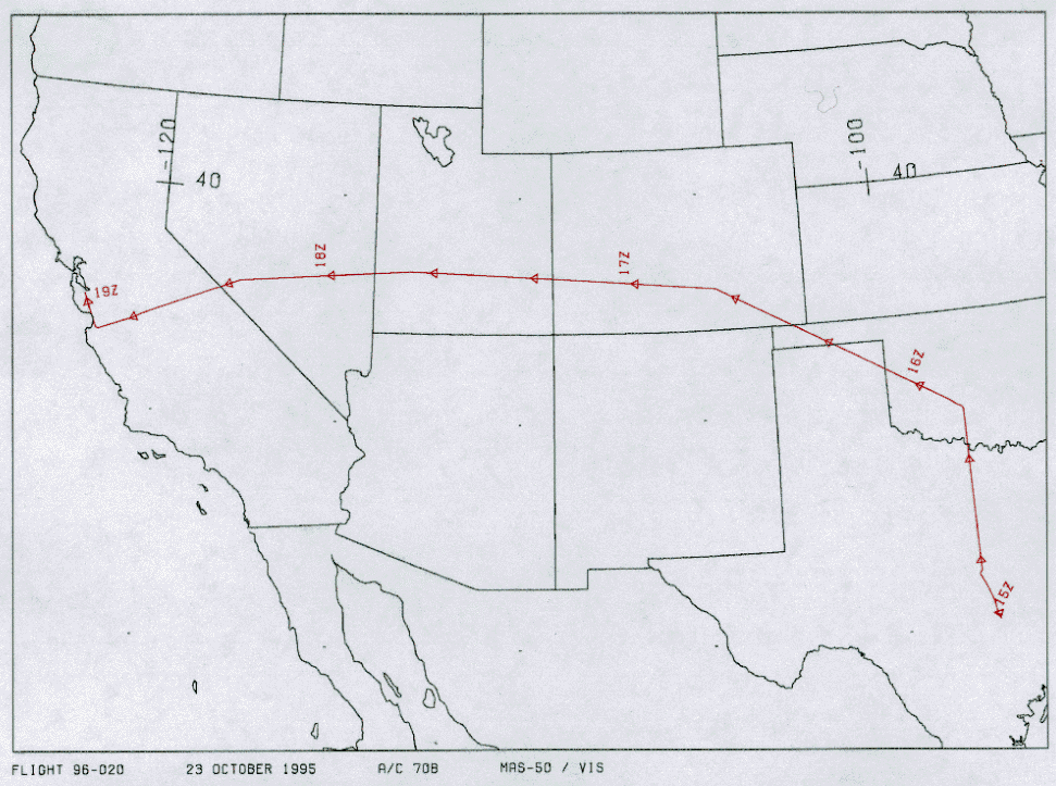
Date: October 23, 1995
ER-2 Flight Number: 96-020
Flight Location: Ferry: Austin, TX to Moffett Field
Principal Investigator: Dr. Francisco Valero (Scripps)
Additional Sensors: none
Objective: Investigate the absorption of solar radiation by clouds, aerosols, and atmospheric gases.
Level-1B Processing Information
Level-1B Data processed by: Ames Research Center
Level-1B Data Version: #09
Level-1B Configuration: (sample file)
Calibration Type: Final
Calibration Version: ARESE 1.0
Temperature Adjustment: 35C
Status: Completed with final calibration
|
|
Flight Track Map

|
Level-1B Browse Imagery
Straight Line Flight Tracks: 14
Scanlines Processed: 65624
Solar Azimuth and Zenith Angles
|
Browse Images
|
Click on the Flight Track number to load images.
Lat/Lon ranges are for the BEG-END scanline nadir pixels.
|
Flight
Track |
Time_Span
(GMT) |
Heading
(Deg) |
Lat_Range
(Deg_N) |
Lon_Range
(Deg_W) |
Length
(Scanlines) |
Altitude
(Meters) |
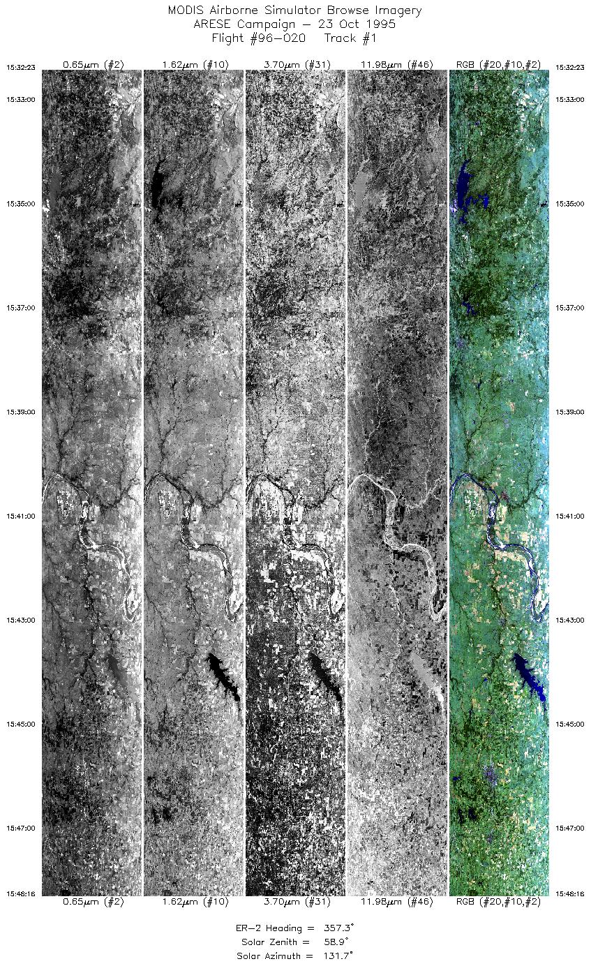
| 1 |
15:32-15:48 |
357 |
32.94-34.77 |
97.99-98.00 |
5922 |
~20000 |
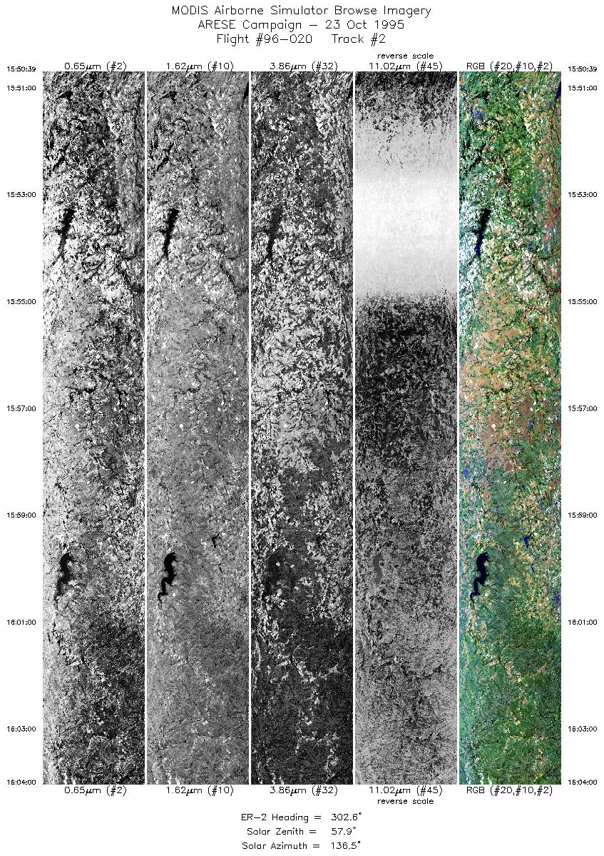
| 2 |
15:50-16:03 |
303 |
34.95-35.72 |
98.20-99.73 |
4998 |
~20000 |
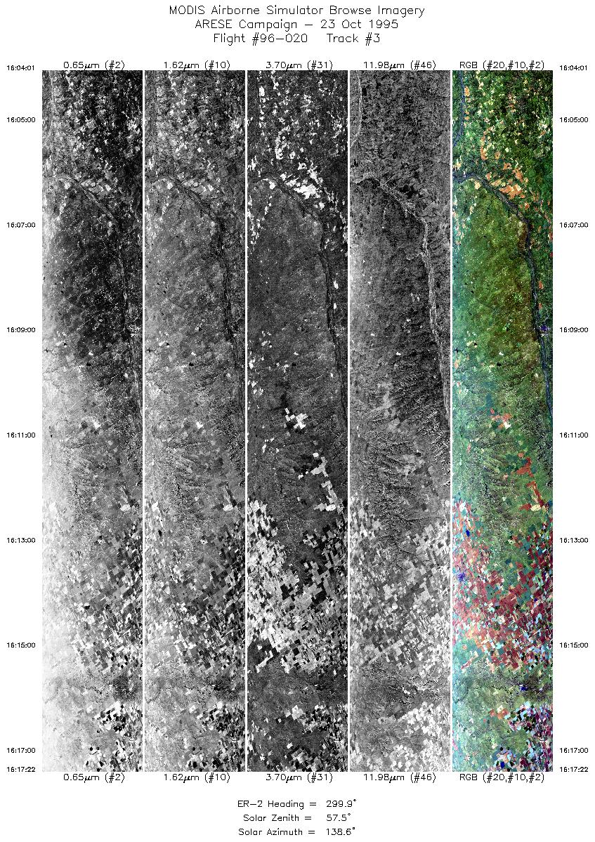
| 3 |
16:04-16:17 |
300 |
35.72-36.49 |
99.74-101.32 |
4997 |
~20000 |
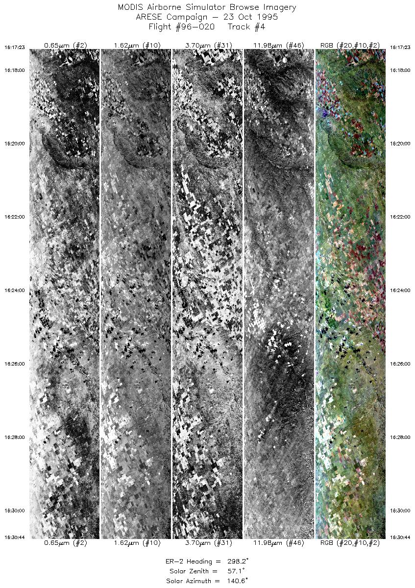
| 4 |
16:17-16:30 |
298 |
36.49-37.24 |
101.32-102.97 |
5000 |
~20000 |
| 5 |
16:30-16:39 |
297 |
37.24-37.70 |
102.98-104.04 |
3159 |
~20000 |
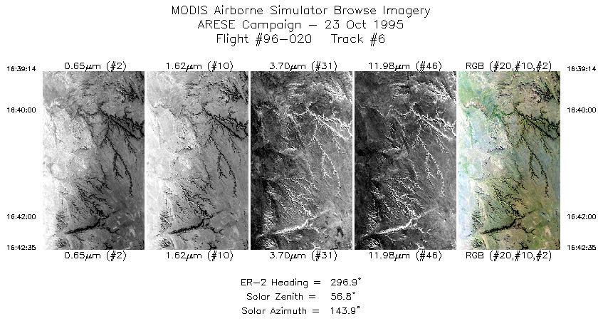
| 6 |
16:39-16:42 |
297 |
37.70-37.88 |
104.04-104.47 |
1256 |
~20000 |
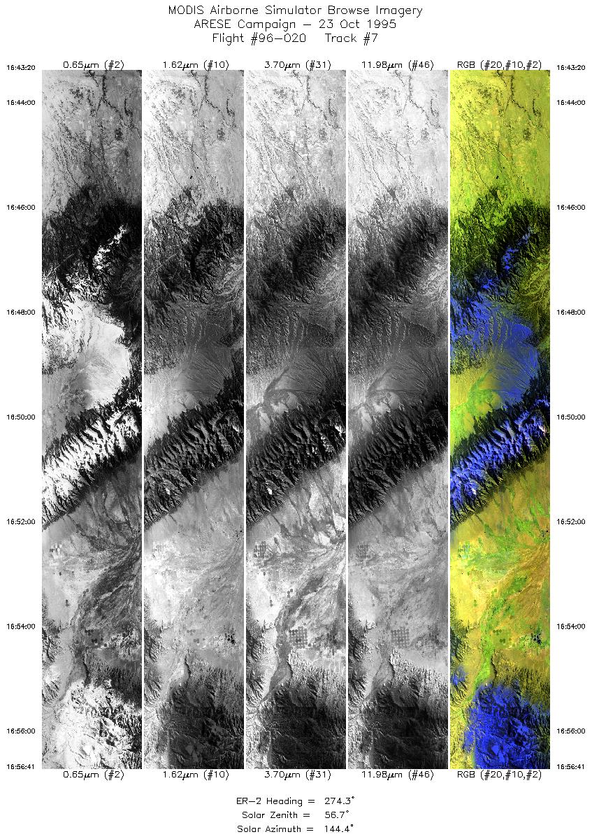
| 7 |
16:43-16:56 |
274 |
37.91-38.06 |
104.57-106.46 |
5000 |
~20000 |
| 8 |
16:56-17:10 |
275 |
38.06-38.19 |
106.47-108.33 |
5000 |
~20000 |
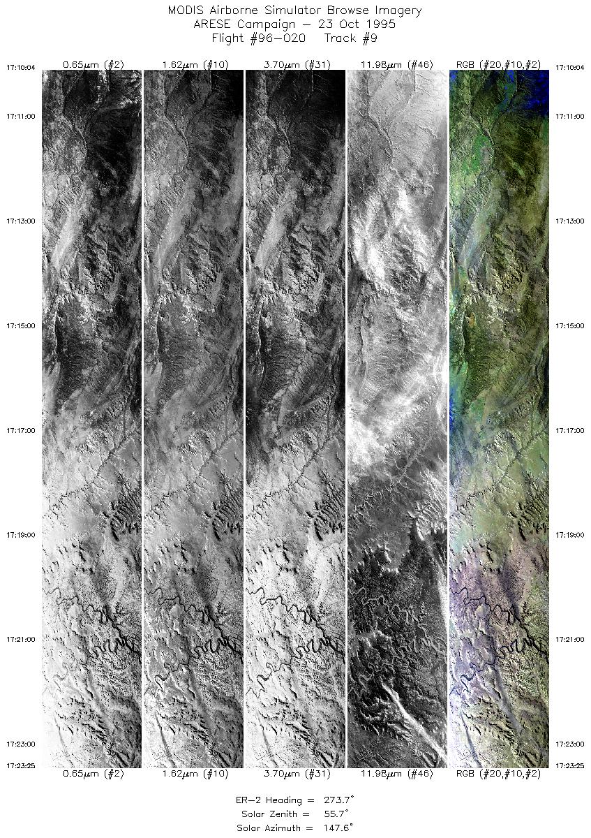
| 9 |
17:10-17:23 |
274 |
38.19-38.28 |
108.33-110.23 |
5001 |
~20000 |
| 10 |
17:23-17:42 |
273 |
38.28-38.37 |
110.23-112.96 |
7239 |
~20000 |
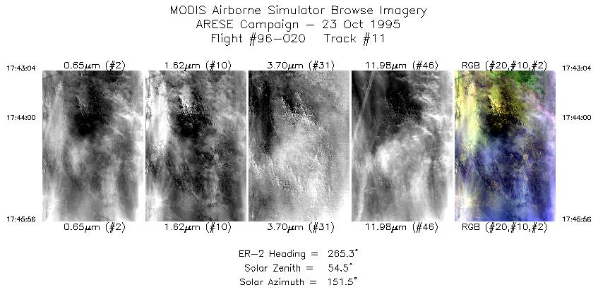
| 11 |
17:43-17:45 |
265 |
38.36-38.34 |
113.02-113.42 |
1073 |
~20000 |
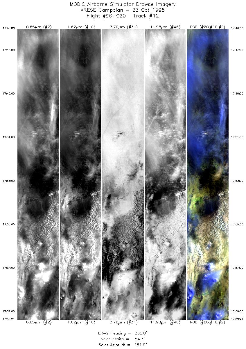
| 12 |
17:45-17:59 |
265 |
38.34-38.21 |
113.43-115.34 |
5000 |
~20000 |
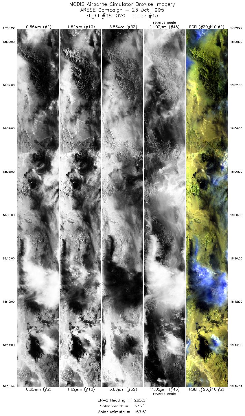
| 13 |
17:59-18:15 |
265 |
38.22-38.01 |
115.34-117.74 |
6193 |
~20000 |
| 14 |
18:16-18:31 |
247 |
37.99-37.31 |
117.82-119.84 |
5786 |
~20000 |
|
Images 01 through 14 in sequence |
Level-1B Data Distribution
NASA LaRC Atmospheric Sciences Data Center
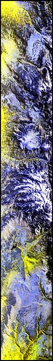
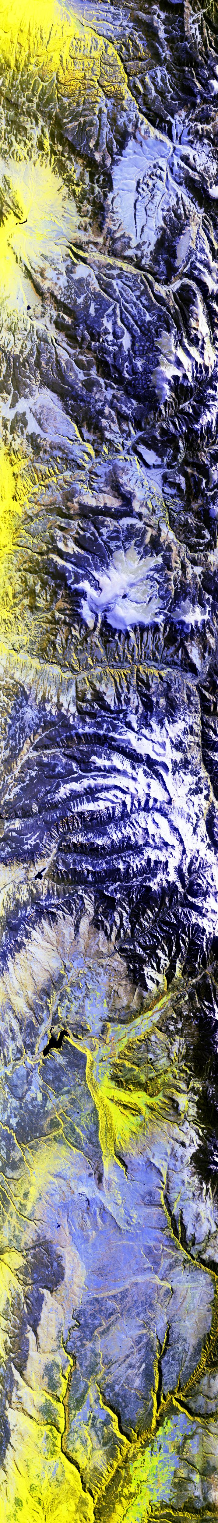
Sample Image
The flightline image to the left roughly follows the Continential Divide, begining over the Cochetopa Hills. Traveling almost due west, the snowcovered Cannibal and Calf Creek Plateaus, with their small lakes, are evident. Further west is the San Juan Mountains with distinctive north/south ridges. Flight track ends over San Miguel Canyon and the Uncompahgre Palteau.
R: 2.14 microns
G: 1.62 microns
B: 0.55 microns
|
|