
|
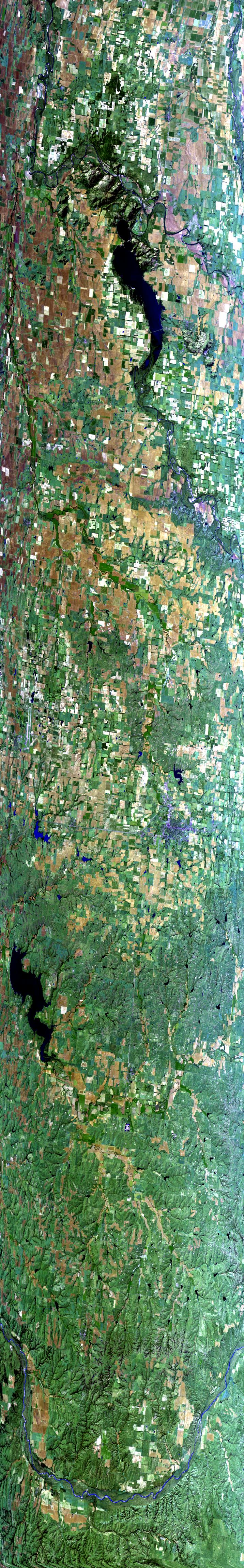
Sample Image

22 Oct 1995
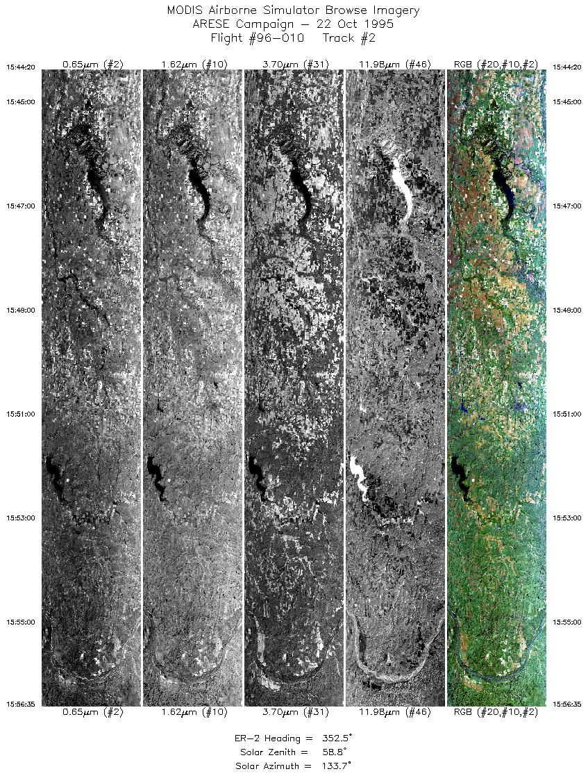
Track #02
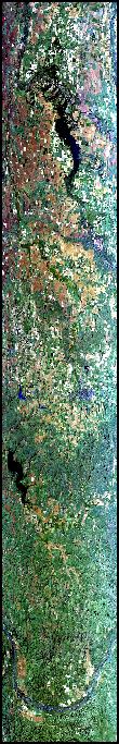

Flightline begins north of Altus, Oklahoma, over the North Fork Red River. Proceeds over Lake Altus, with Elm Fork Red River to the west (right in this image). Moves northwest over Elk City, Oklahoma, and Foss Reservoir, ending over a sweeping bend in the Canadian River.
R: 2.14 microns
G: 1.62 microns
B: 0.55 microns
|
|
Mission Summary
Date: October 22, 1995
ER-2 Flight Number: 96-010
Flight Location: Oklahoma
Principal Investigator: Dr. Francisco Valero (Scripps)
Additional Sensors: RAMS, CLS, VIS
Objective: Investigate the absorption of solar radiation by clouds, aerosols, and atmospheric gases.
Level-1B Processing Information
Level-1B Data processed by: Ames Research Center
Level-1B Data Version: #09
Level-1B Configuration: (sample file)
Calibration Type: Final
Calibration Version: ARESE 1.0
Temperature Adjustment: 35C
Status: Completed with final calibration
|
|
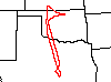
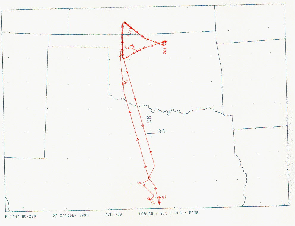
Flight Track Map

|
Level-1B Browse Imagery
Straight Line Flight Tracks: 34
Scanlines Processed: 100052
Solar Azimuth and Zenith Angles
|
Browse Images
|
Click on the Flight Track number to load images.
Lat/Lon ranges are for the BEG-END scanline nadir pixels.
|
Flight
Track |
Time_Span
(GMT) |
Heading
(Deg) |
Lat_Range
(Deg_N) |
Lon_Range
(Deg_W) |
Length
(Scanlines) |
Altitude
(Meters) |
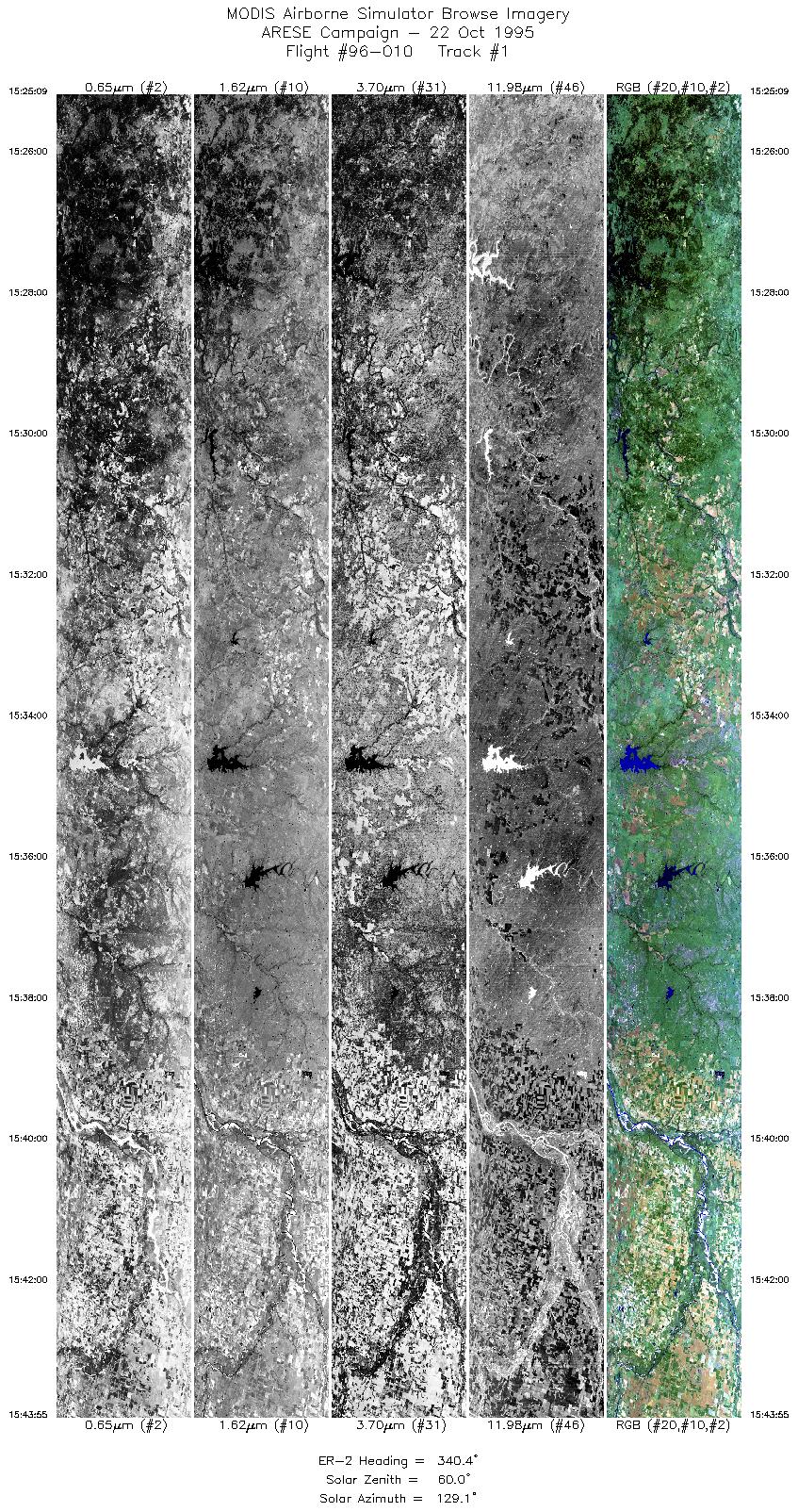
| 1 |
15:25-15:43 |
340 |
32.57-34.63 |
98.58-99.26 |
7020 |
~20000 |
| 2 |
15:44-15:56 |
352 |
34.68-36.07 |
99.27-99.43 |
4587 |
~20000 |
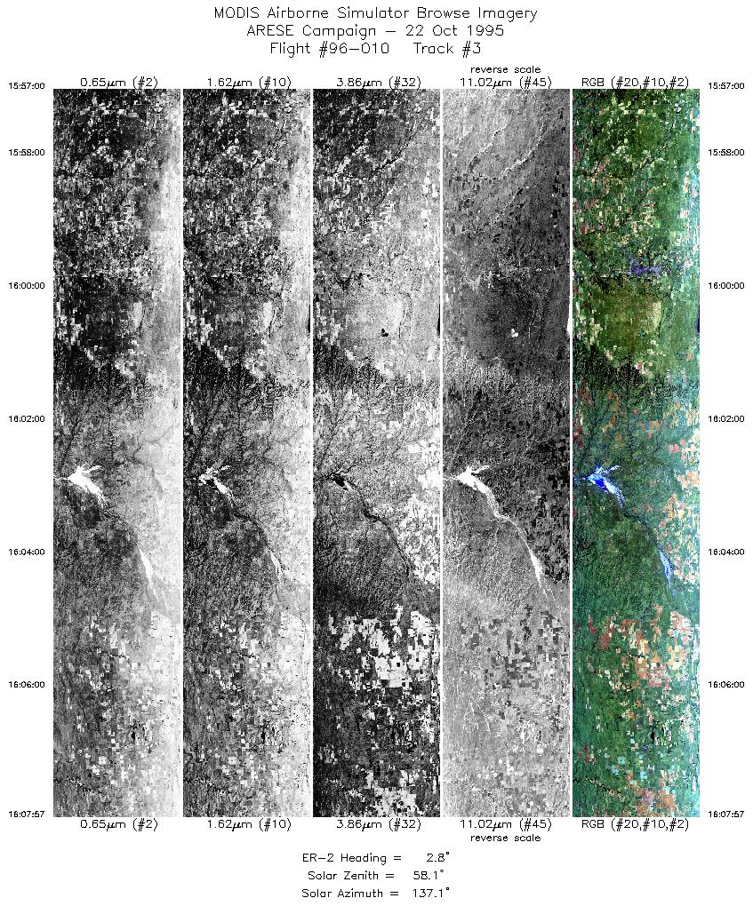
| 3 |
15:56-16:07 |
3 |
36.11-37.39 |
99.43-99.30 |
4101 |
~20000 |
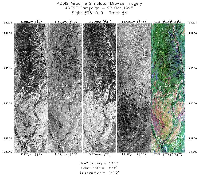
| 4 |
16:10-16:17 |
134 |
37.40-36.85 |
99.03-98.24 |
2751 |
~20000 |
| 5 |
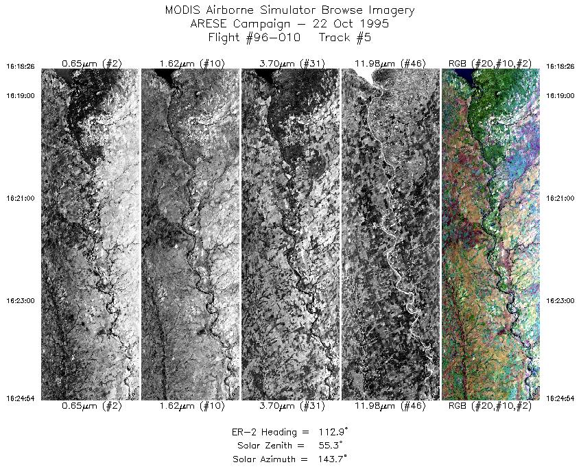
16:18-16:24 |
113 |
36.81-36.54 |
98.15-97.30 |
2423 |
~20000 |
| 6 |
16:28-16:31 |
250 |
36.64-36.54 |
97.36-97.80 |
1237 |
~20000 |
| 7 |
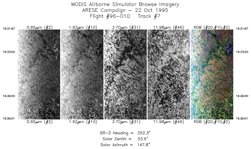
16:31-16:36 |
252 |
36.54-36.41 |
97.80-98.34 |
1524 |
~20000 |
| 8 |
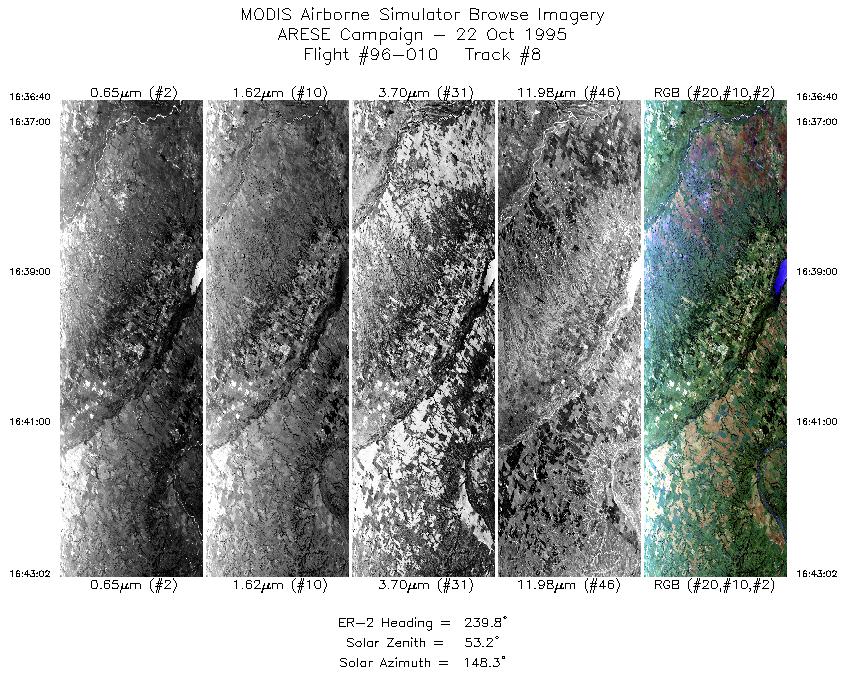
16:36-16:43 |
240 |
36.38-36.04 |
98.42-99.19 |
2385 |
~20000 |
| 9 |
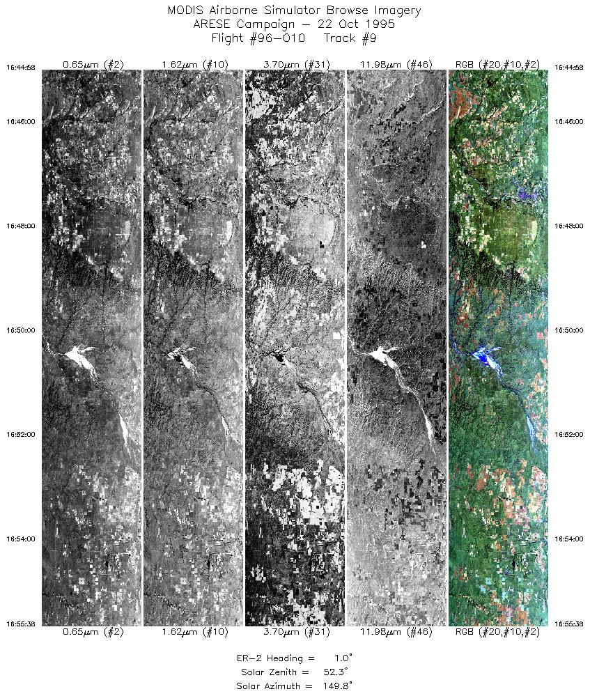
16:44-16:55 |
1 |
36.15-37.39 |
99.33-99.30 |
3996 |
~20000 |
| 10 |
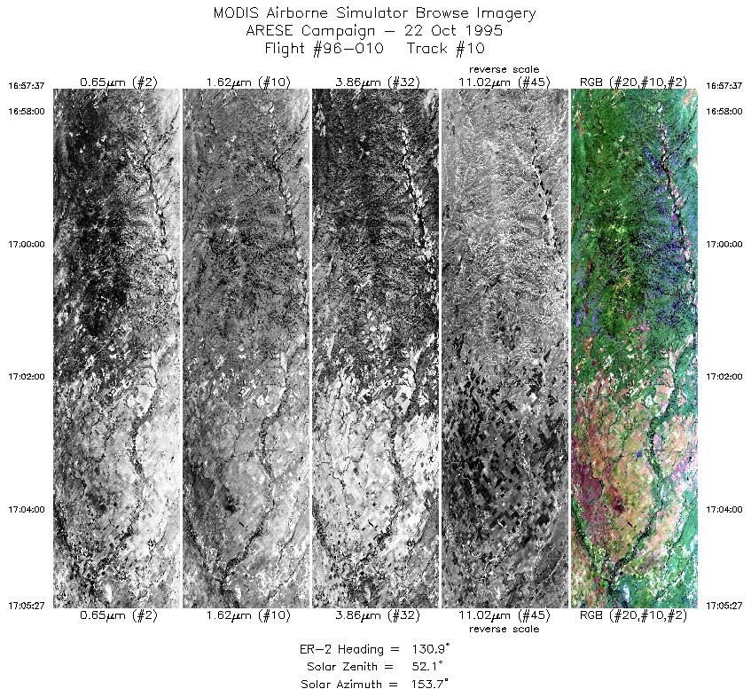
16:57-17:05 |
131 |
37.42-36.85 |
99.10-98.24 |
2934 |
~20000 |
| 11 |
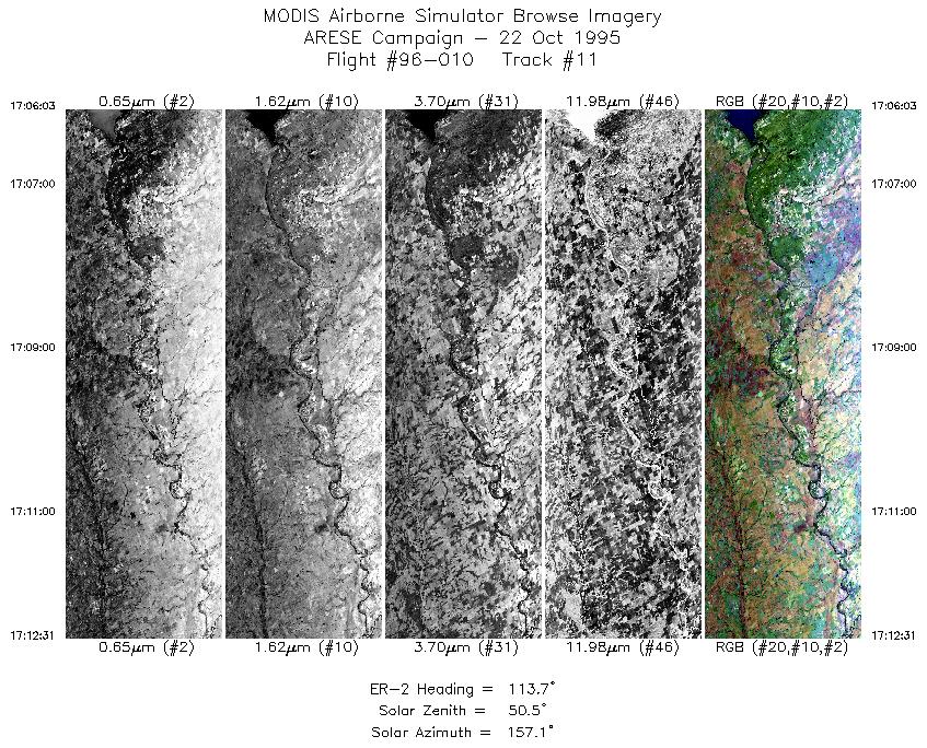
17:06-17:12 |
114 |
36.82-36.54 |
98.16-97.30 |
2422 |
~20000 |
| 12 |
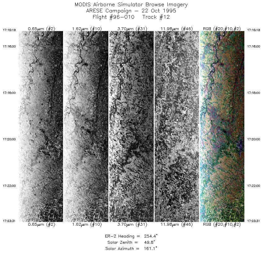
17:15-17:23 |
254 |
36.65-36.41 |
97.28-98.35 |
3078 |
~20000 |
| 13 |
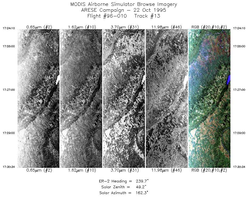
17:24-17:30 |
240 |
36.38-36.04 |
98.43-99.19 |
2377 |
~20000 |
| 14 |
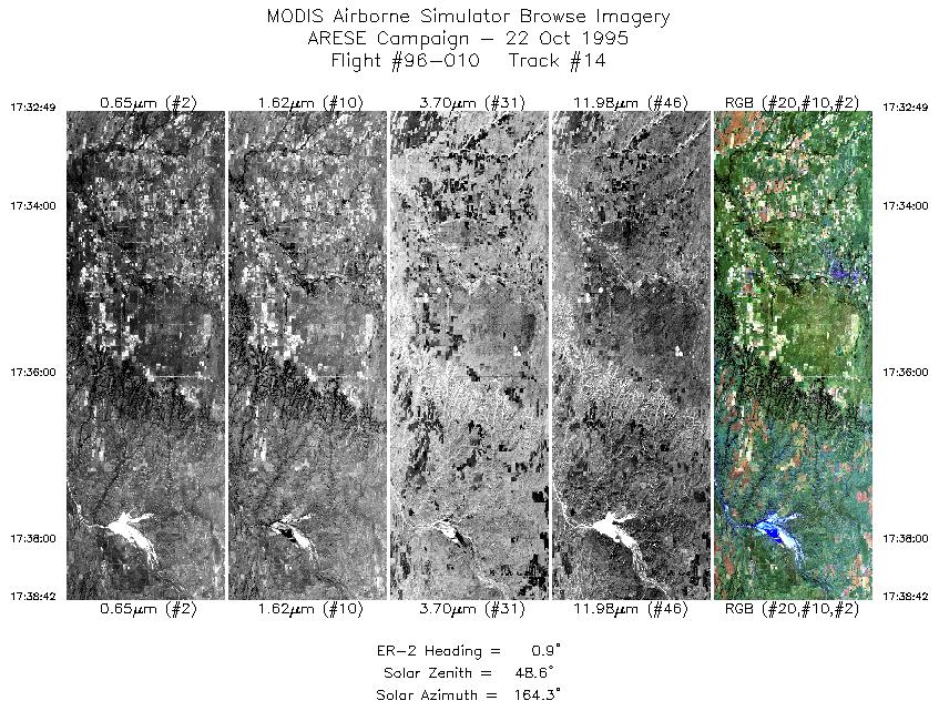
17:32-17:38 |
1 |
36.21-36.89 |
99.31-99.30 |
2205 |
~20000 |
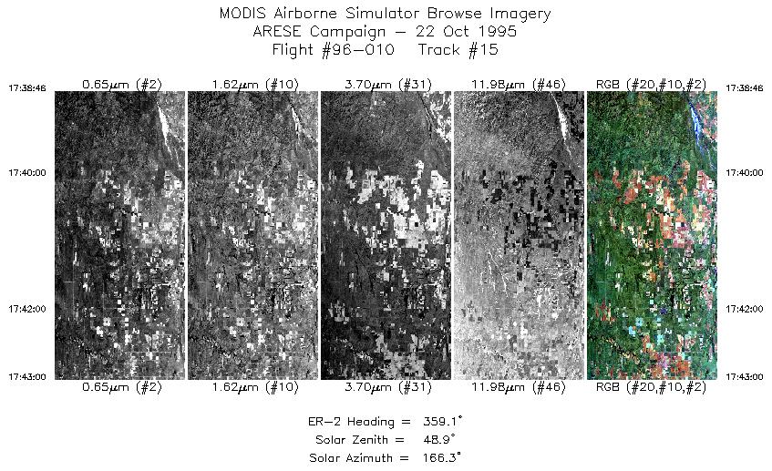
| 15 |
17:38-17:42 |
359 |
36.90-37.38 |
99.31-99.31 |
1587 |
~20000 |
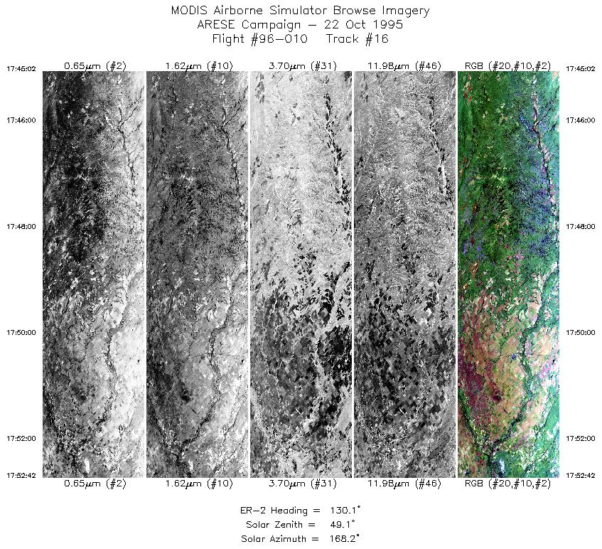
| 16 |
17:45-17:52 |
130 |
37.40-36.85 |
99.10-98.24 |
2862 |
~20000 |
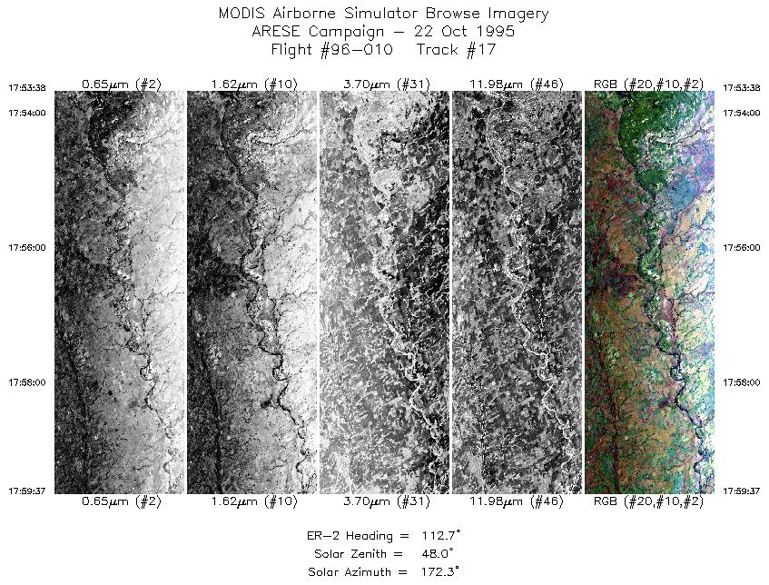
| 17 |
17:53-17:59 |
113 |
36.80-36.54 |
98.11-97.30 |
2221 |
~20000 |
| 18 |
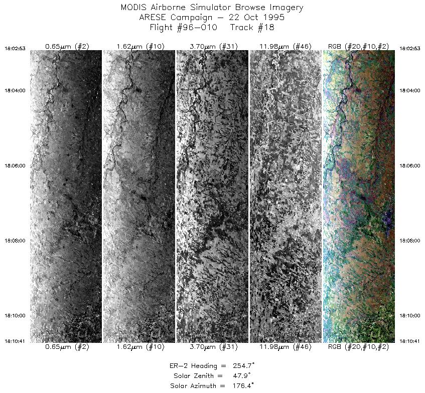
18:02-18:10 |
255 |
36.64-36.41 |
97.32-98.35 |
2922 |
~20000 |
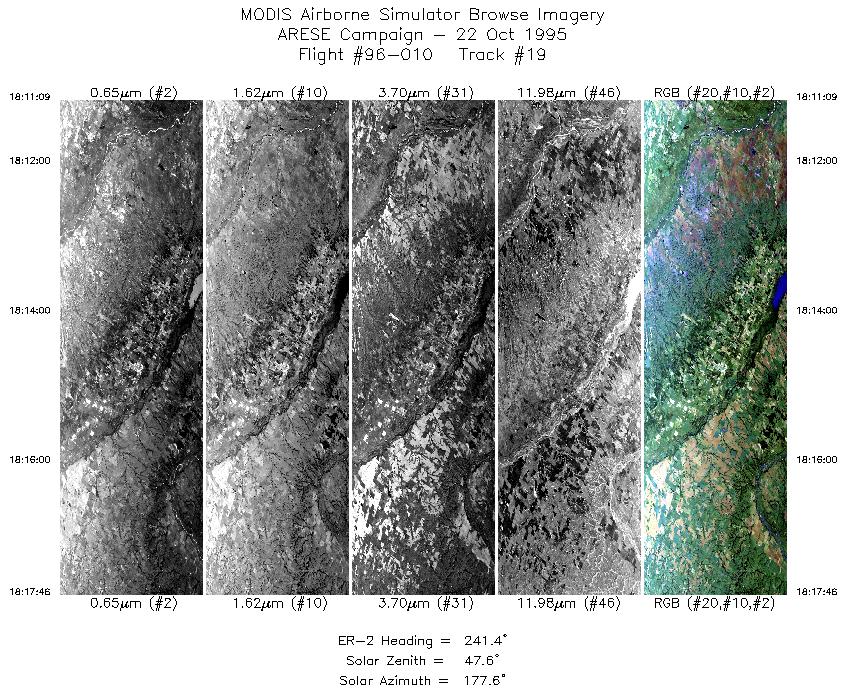
| 19 |
18:11-18:17 |
241 |
36.39-36.04 |
98.40-99.19 |
2478 |
~20000 |
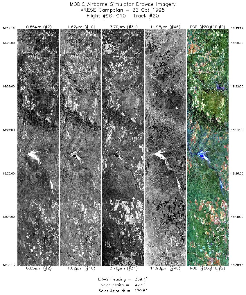
| 20 |
18:19-18:30 |
359 |
36.12-37.38 |
99.32-99.31 |
4083 |
~20000 |
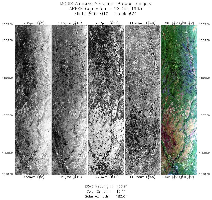
| 21 |
18:32-18:40 |
131 |
37.42-36.84 |
99.11-98.22 |
2990 |
~20000 |
| 22 |
18:40-18:45 |
112 |
36.81-36.60 |
98.14-97.48 |
1824 |
~20000 |
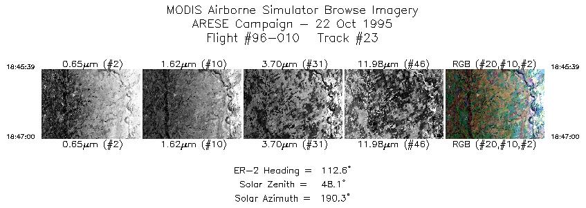
| 23 |
18:45-18:46 |
113 |
36.60-36.54 |
97.48-97.30 |
506 |
~20000 |
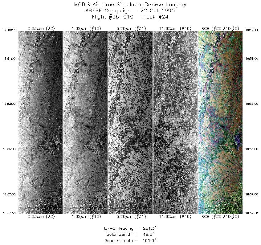
| 24 |
18:49-18:57 |
251 |
36.66-36.41 |
97.27-98.34 |
2976 |
~20000 |
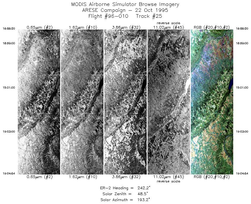
| 25 |
18:58-19:04 |
242 |
36.39-36.04 |
98.41-99.19 |
2459 |
~20000 |
| 26 |
19:06-19:10 |
358 |
36.13-36.56 |
99.31-99.31 |
1418 |
~20000 |
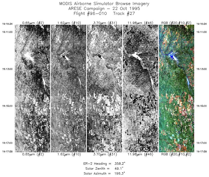
| 27 |
19:10-19:17 |
358 |
36.60-37.39 |
99.31-99.31 |
2586 |
~20000 |
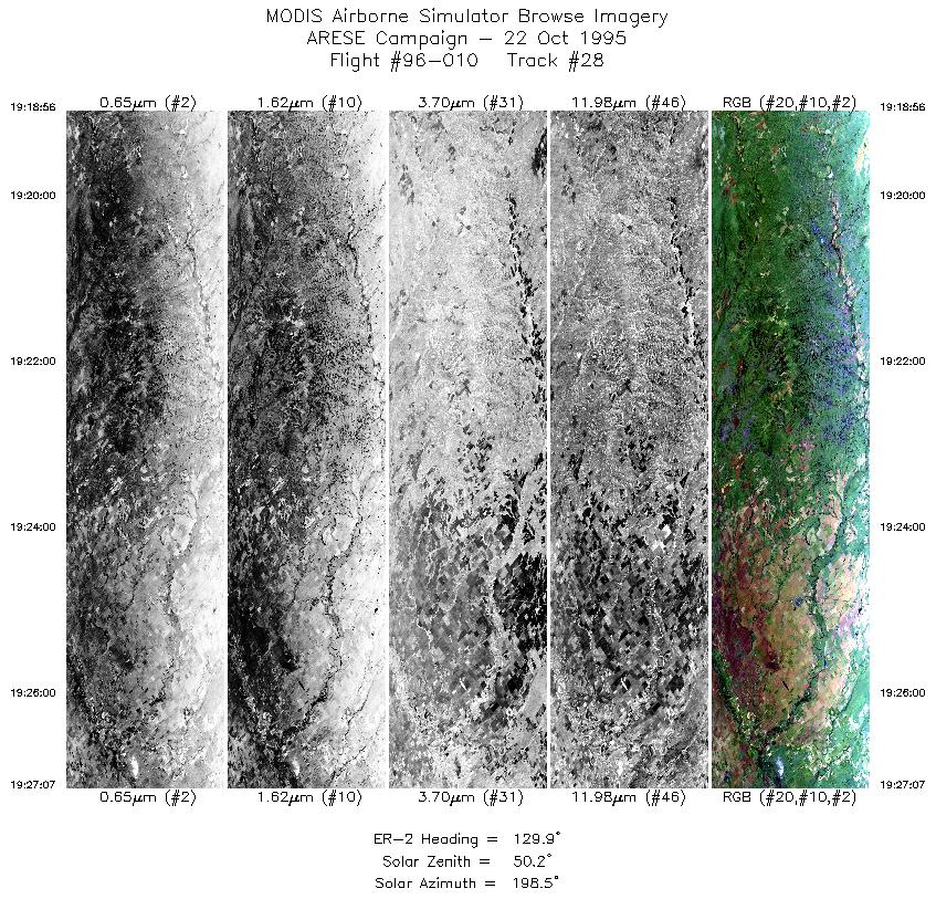
| 28 |
19:18-19:27 |
130 |
37.44-36.85 |
99.16-98.24 |
3065 |
~20000 |
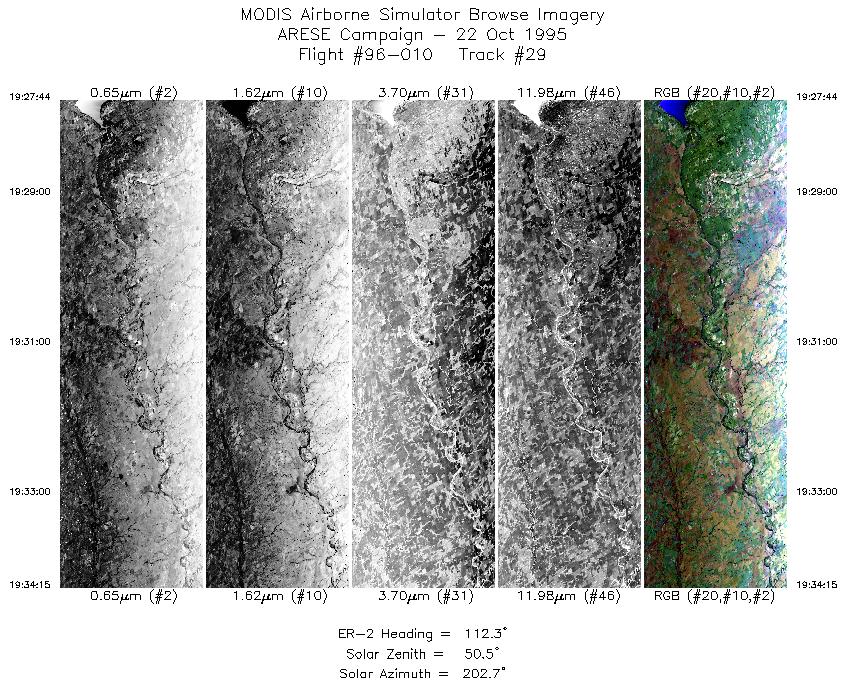
| 29 |
19:27-19:34 |
112 |
36.82-36.54 |
98.16-97.31 |
2440 |
~20000 |
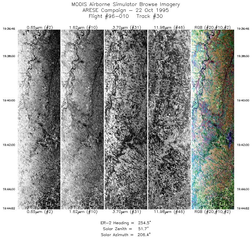
| 30 |
19:36-19:44 |
255 |
36.65-36.41 |
97.27-98.35 |
3034 |
~20000 |
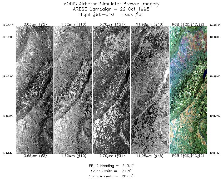
| 31 |
19:45-19:51 |
240 |
36.38-36.04 |
98.42-99.19 |
2423 |
~20000 |
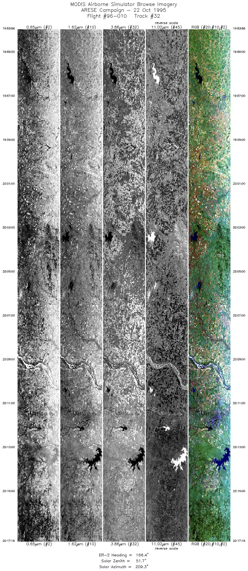
| 32 |
19:53-20:17 |
166 |
35.83-33.28 |
99.20-98.36 |
8739 |
~20000 |
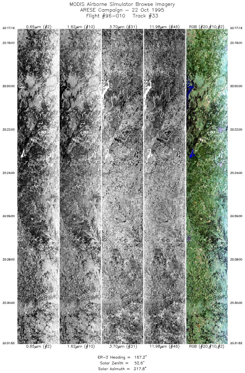
| 33 |
20:17-20:31 |
167 |
33.29-31.73 |
98.37-97.87 |
5449 |
~20000 |
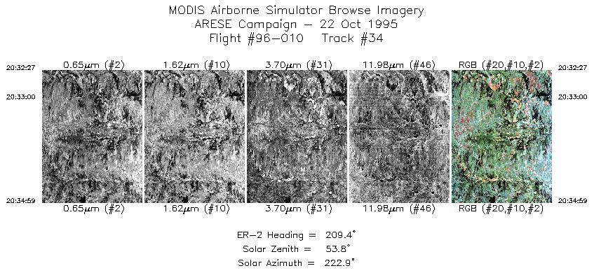
| 34 |
20:32-20:34 |
209 |
31.66-31.42 |
97.87-98.02 |
950 |
~20000 |
|
Images 01 through 34 in sequence |
Level-1B Data Distribution
NASA LaRC Atmospheric Sciences Data Center
|
|