
|
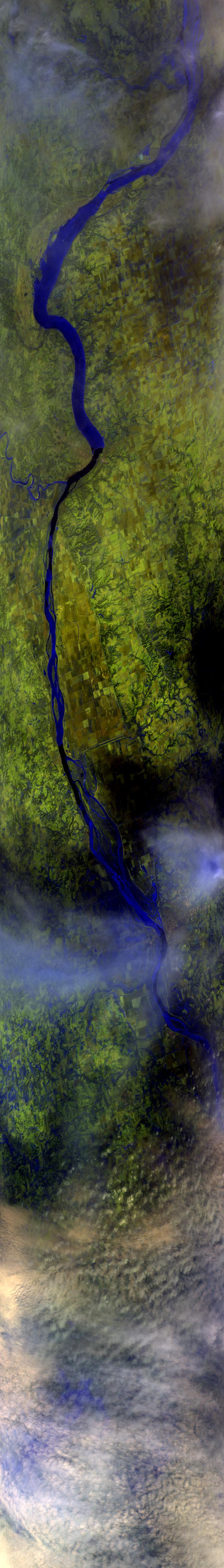
Sample Image

13 February 1997
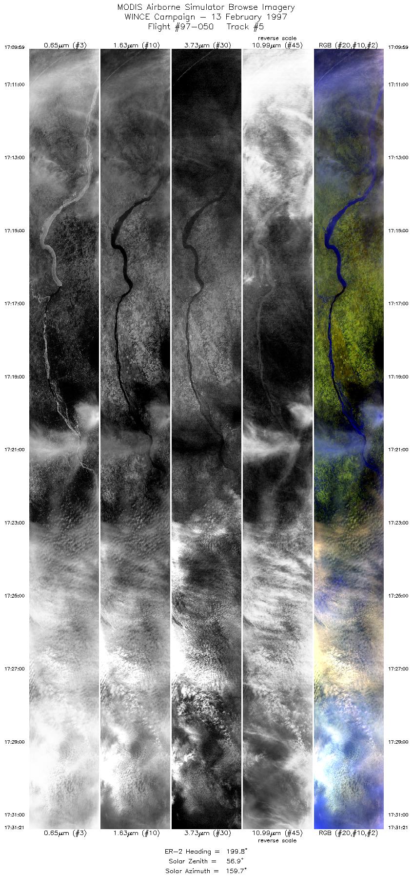
Track #05
Scanlines 1000 - 6000


This segment of the flightline begins over Burlington, Iowa, at the confluence of the Skunk and Mississippi Rivers. Following the Mississippi southward, the confluence of the Moines and Mississippi Rivers comes into view. Flight path leaves the Mighty Mississippi just south of the Mark Twain National Wildlife Refuge, and proceeds into a cloud bank over Hannibal, Missouri.
R: 2.15 microns
G: 1.64 microns
B: 0.55 microns
|
|
Summary Information
Date: February 13, 1997
ER-2 Flight Number: 97-050
Location: ferry: Madison, Wisconsin to Moffett Field, California
Principal Investigator: Dr. Paul Menzel (Univ of Wisconsin)
Additional Sensors: 12" RC-10 (NC), APS, EOC
Mission Objectives: Compare OCTS to MAS by flying ADEOS orbital track (1716UTC overpass). Compare MAS depiction of thin cirrus to uplooking lidar
and interferometer located at SSEC. Overfly clear snow scenes along WY/CO border for snow detection interests. Overfly Lake Tahoe
for U. Arizona visible reflectance interests. Land at Moffett Field, CA.
Level-1B Processing Information
Level-1B Data processed by: Ames Research Center
Level-1B Data Version: #10
Level-1B Configuration: (sample file)
Calibration Type: Final
Calibration Version: WINCE 1.0
Temperature Adjustment: No
Status: Completed with final calibration
|
|
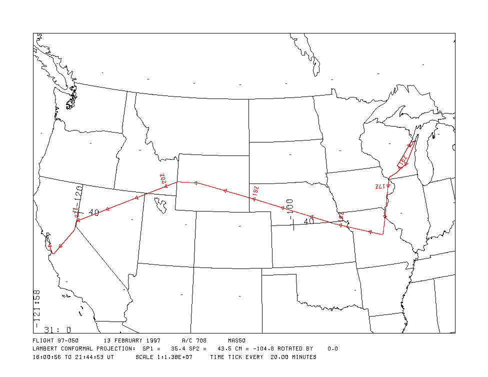
Flight Track Map

|
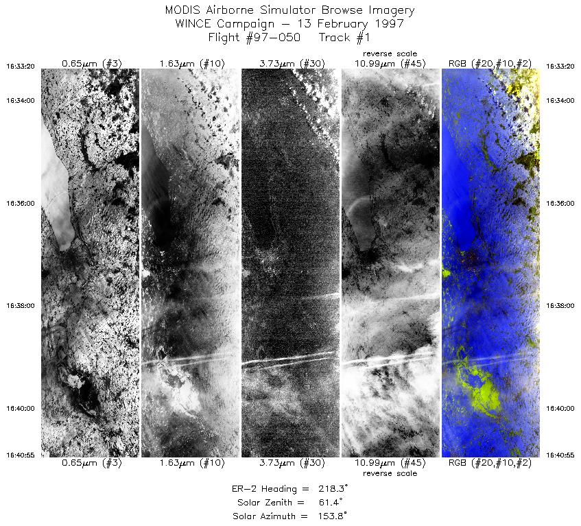
Level-1B Browse Imagery
Straight Line Flight Tracks: 26
Scanlines Processed: 103414
Solar Azimuth and Zenith Angles
|
Browse Images
|
Click on the Flight Track number to load images.
Lat/Lon ranges are for the BEG-END scanline nadir pixels.
|
Flight
Track |
Time_Span
(GMT) |
Heading
(Deg) |
Lat_Range
(Deg_N) |
Lon_Range
(Deg_W) |
Length
(Scanlines) |
Altitude
(Meters) |
| 1 |
16:33-16:40 |
218 |
44.07-43.39 |
88.08-88.71 |
2835 |
~20000 |
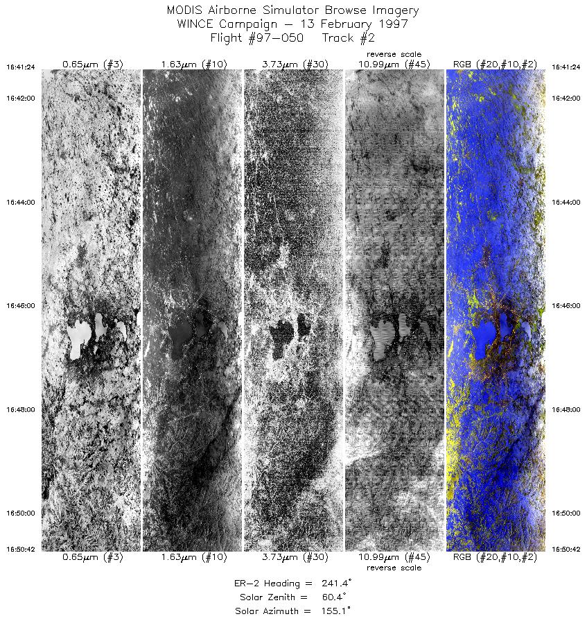
| 2 |
16:41-16:50 |
241 |
43.36-42.84 |
88.76-89.89 |
3478 |
~20000 |
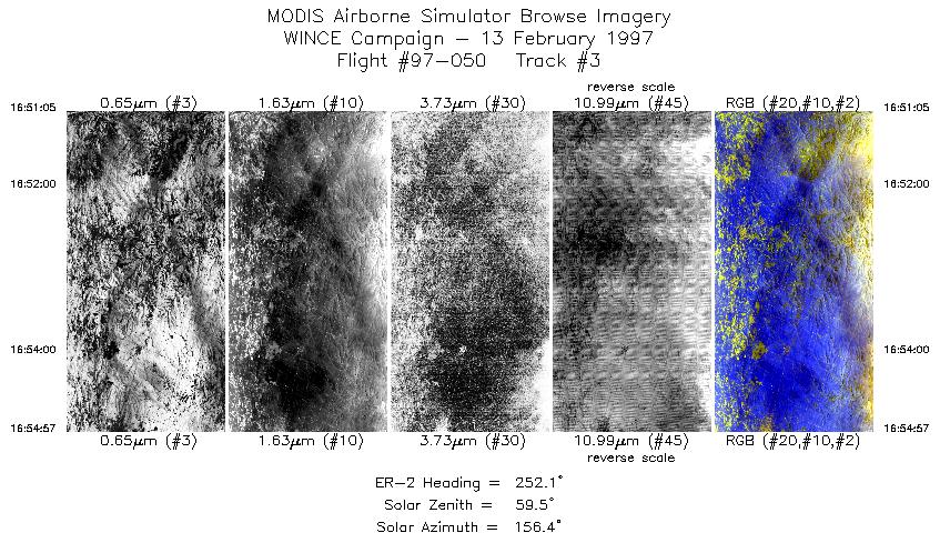
| 3 |
16:51-16:54 |
252 |
42.82-42.68 |
89.94-90.46 |
1447 |
~20000 |
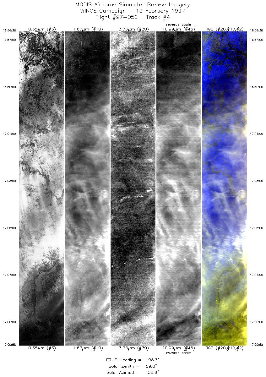
| 4 |
16:56-17:09 |
198 |
42.54-41.09 |
90.59-91.10 |
5000 |
~20000 |
| 5 |
17:09-17:31 |
200 |
41.09-38.79 |
91.10-91.87 |
7991 |
~20000 |
| 6 |
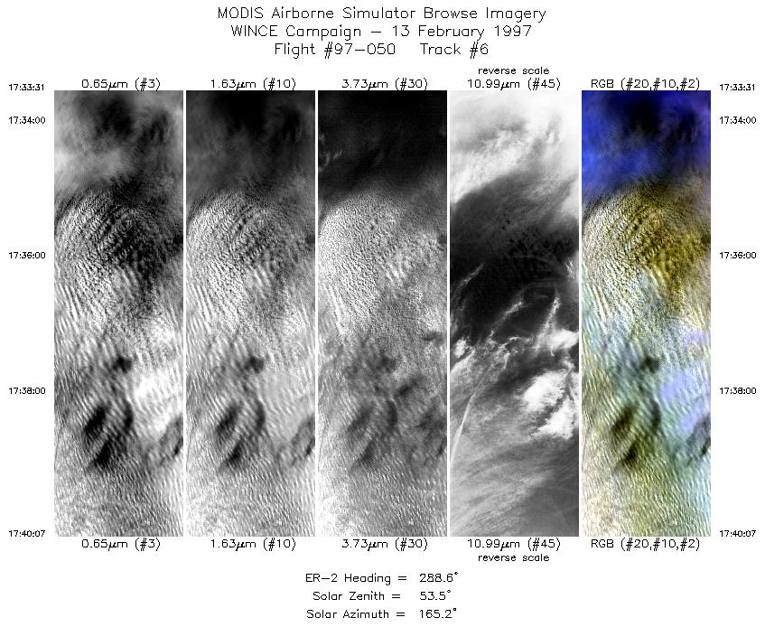
17:33-17:40 |
289 |
38.73-38.97 |
92.11-92.94 |
2470 |
~20000 |
| 7 |
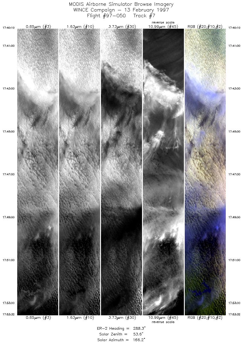
17:40-17:53 |
288 |
38.98-39.46 |
92.95-94.68 |
4999 |
~20000 |
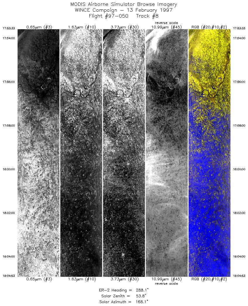
| 8 |
17:53-18:04 |
288 |
39.46-39.86 |
94.69-96.21 |
4238 |
~20000 |
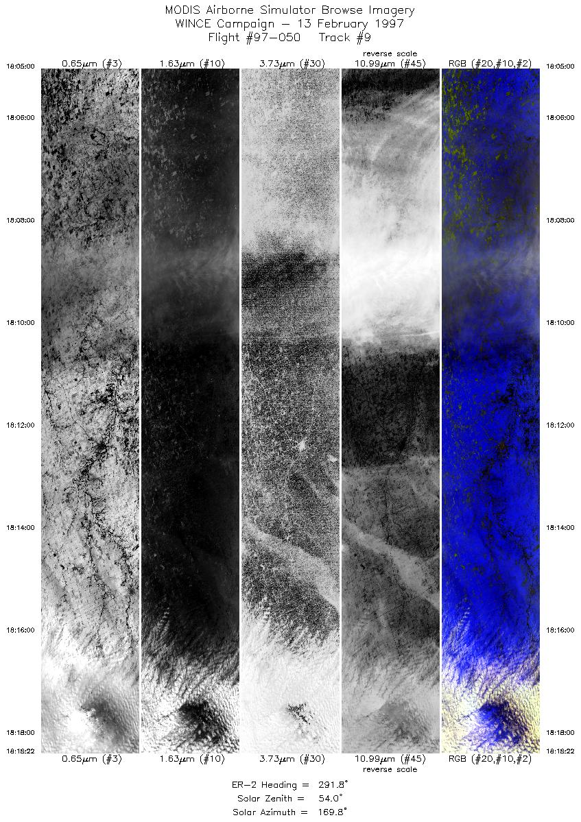
| 9 |
18:05-18:18 |
292 |
39.87-40.40 |
96.22-97.94 |
4998 |
~20000 |
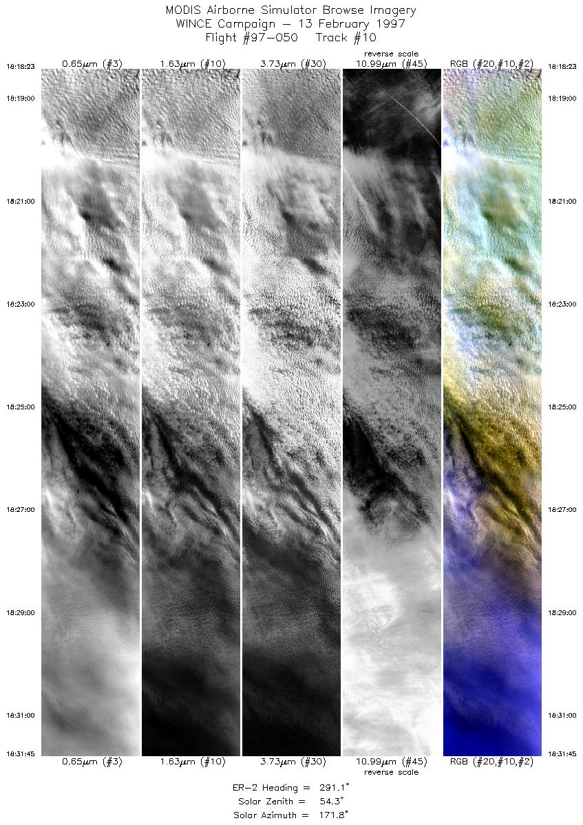
| 10 |
18:18-18:31 |
291 |
40.40-40.92 |
97.94-99.71 |
4998 |
~20000 |
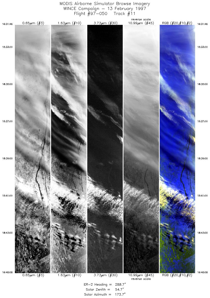
| 11 |
18:31-18:45 |
289 |
40.92-41.41 |
99.72-101.52 |
4998 |
~20000 |
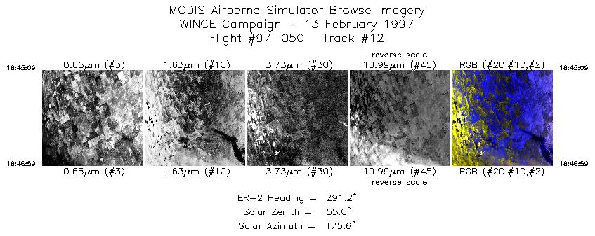
| 12 |
18:45-18:46 |
291 |
41.40-41.47 |
101.52-101.77 |
686 |
~20000 |
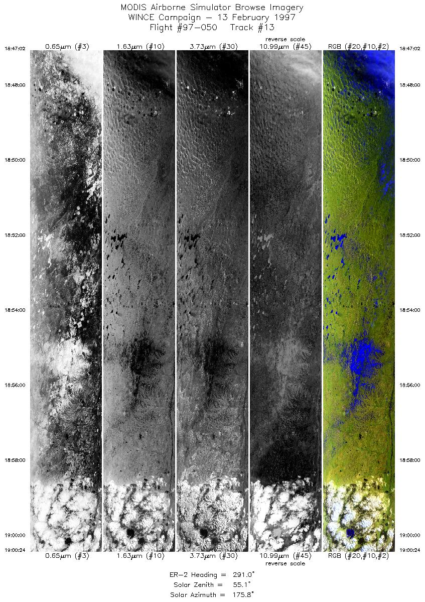
| 13 |
18:47-19:00 |
291 |
41.47-41.92 |
101.77-103.57 |
4998 |
~20000 |
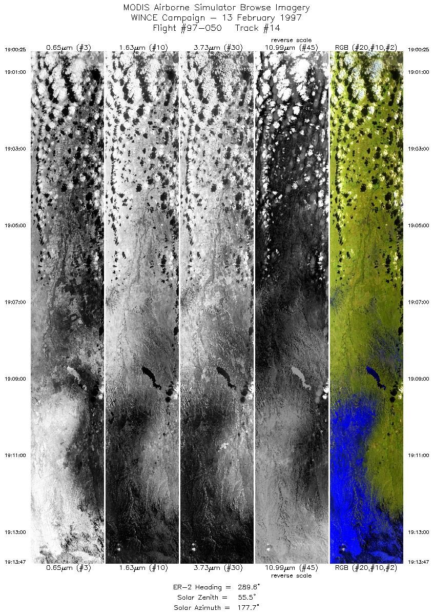
| 14 |
19:00-19:13 |
290 |
41.92-42.31 |
103.58-105.39 |
4997 |
~20000 |
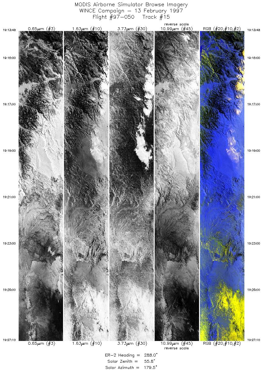
| 15 |
19:13-19:27 |
288 |
42.31-42.69 |
105.39-107.28 |
4996 |
~20000 |
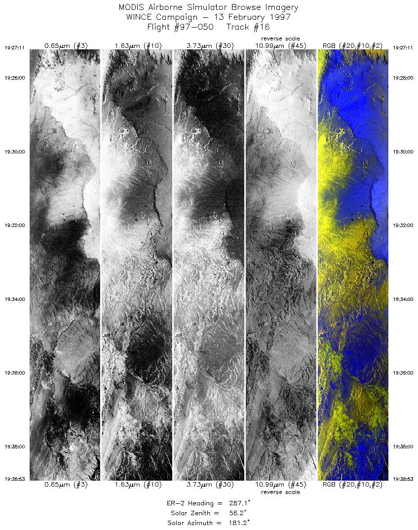
| 16 |
19:27-19:38 |
287 |
42.69-42.99 |
107.28-108.95 |
4374 |
~20000 |
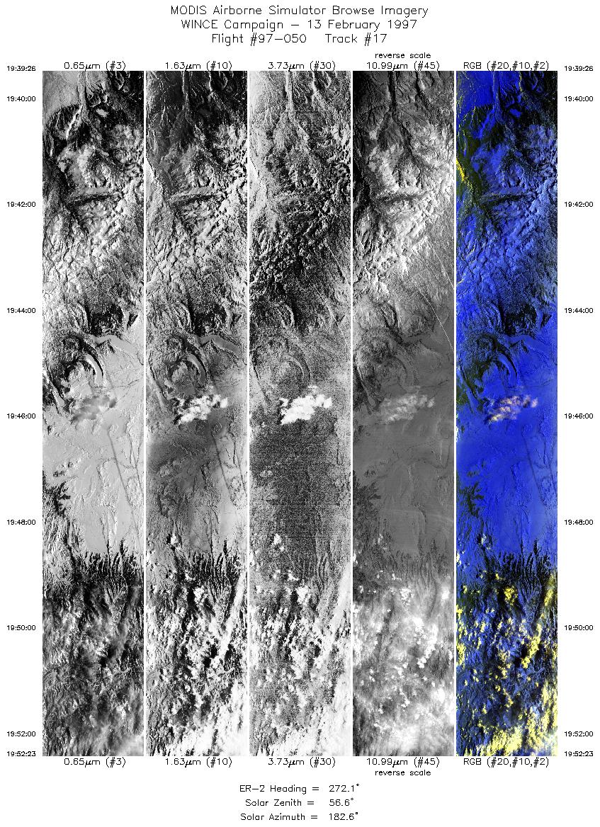
| 17 |
19:39-19:52 |
272 |
43.00-43.01 |
109.04-110.96 |
4842 |
~20000 |
| 18 |
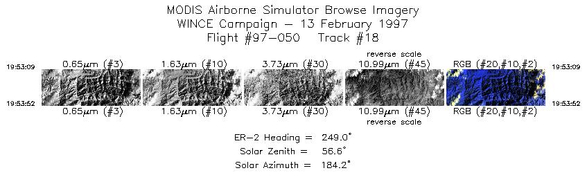
19:53-19:53 |
249 |
42.98-42.95 |
111.07-111.17 |
269 |
~20000 |
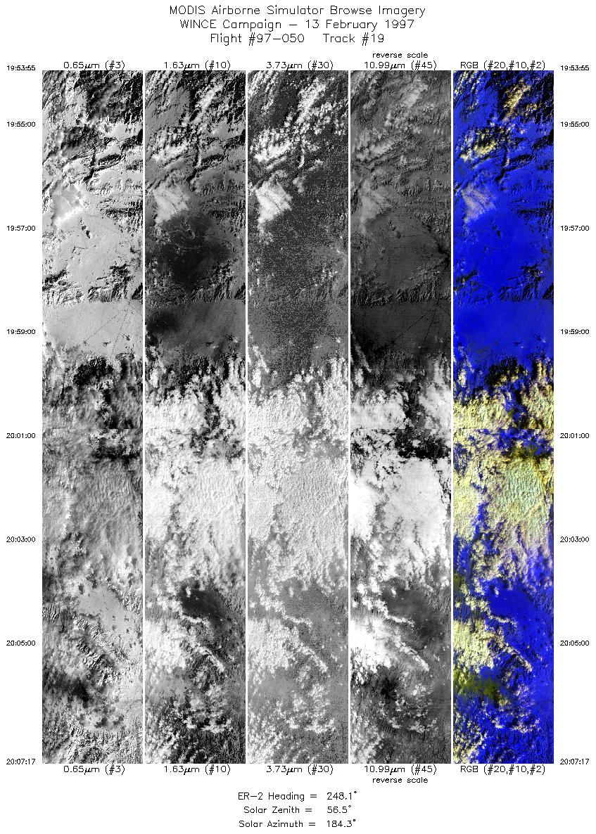
| 19 |
19:53-20:07 |
248 |
42.95-42.30 |
111.17-112.99 |
4934 |
~20000 |
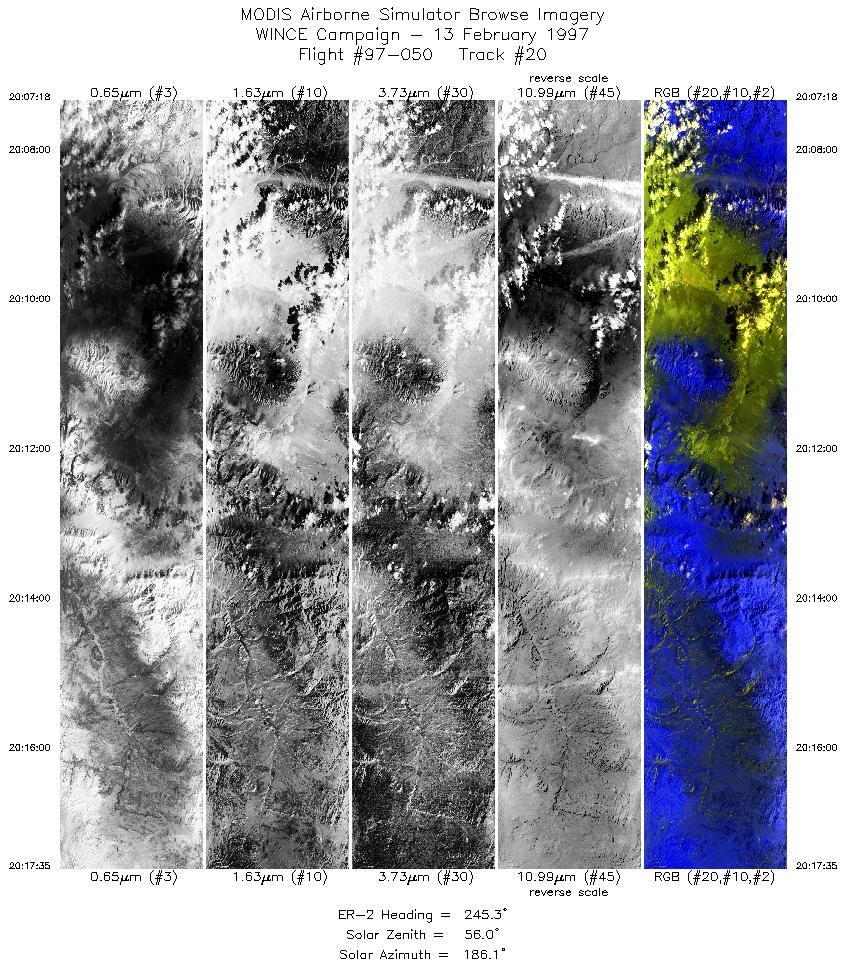
| 20 |
20:07-20:17 |
245 |
42.30-41.78 |
112.99-114.36 |
3845 |
~20000 |
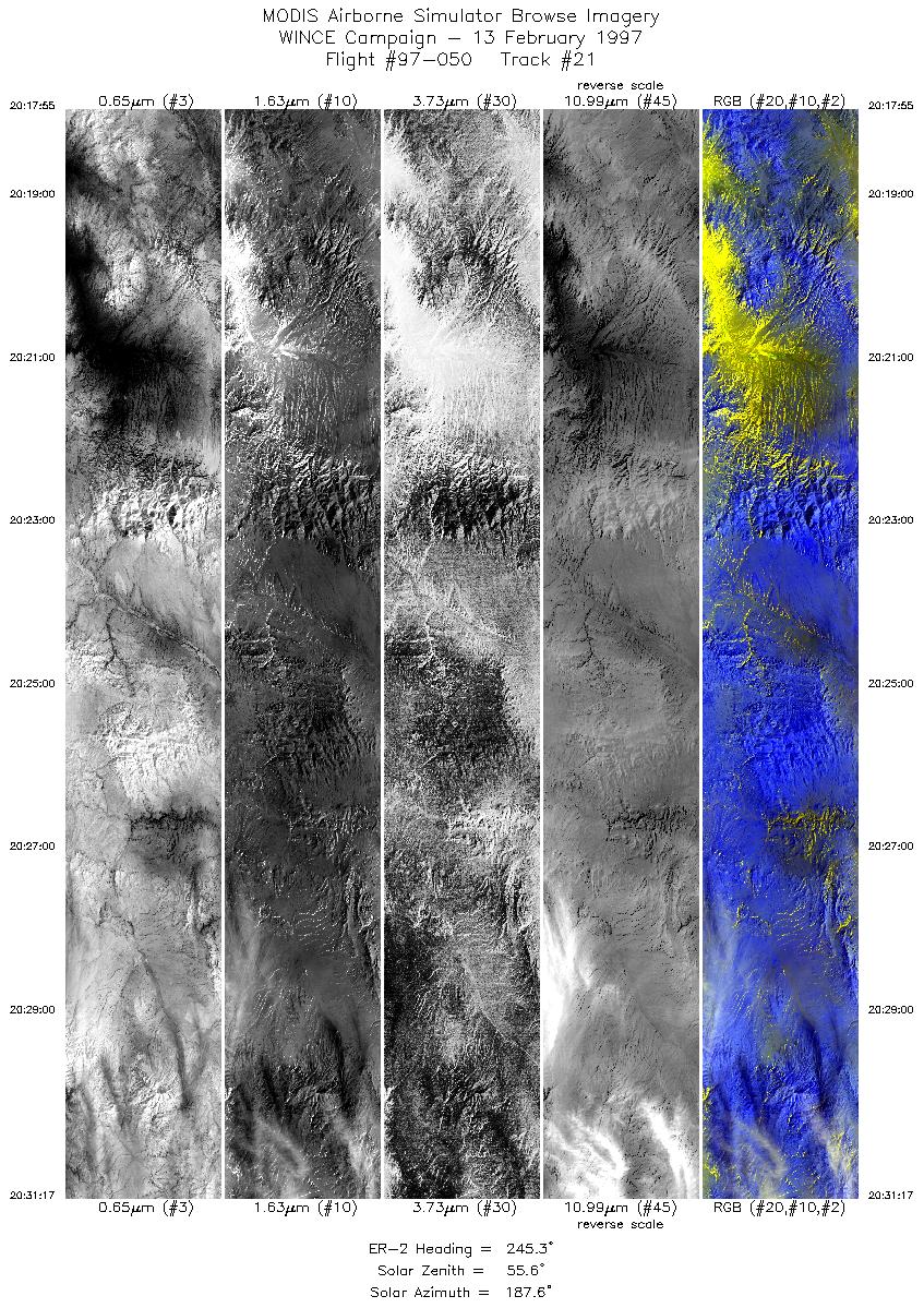
| 21 |
20:17-20:31 |
245 |
41.76-41.06 |
114.41-116.16 |
4998 |
~20000 |
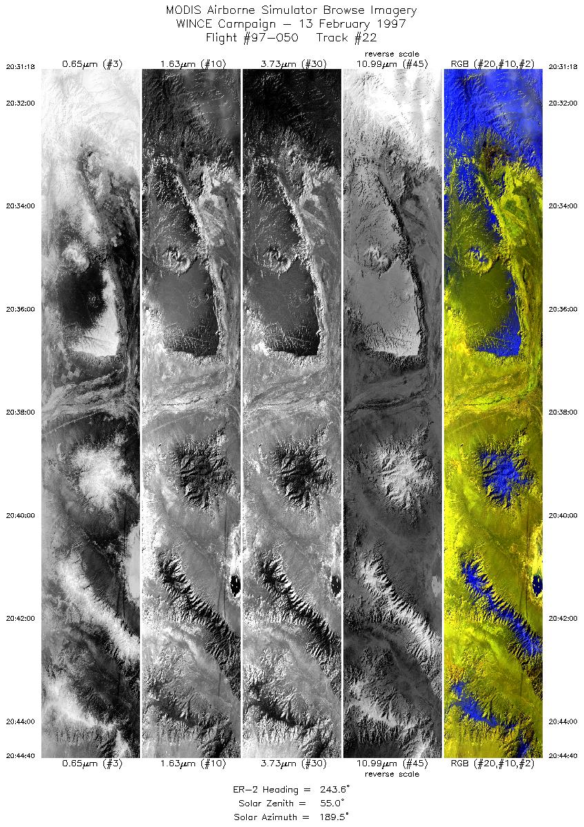
| 22 |
20:31-20:44 |
244 |
41.06-40.34 |
116.16-117.86 |
4998 |
~20000 |
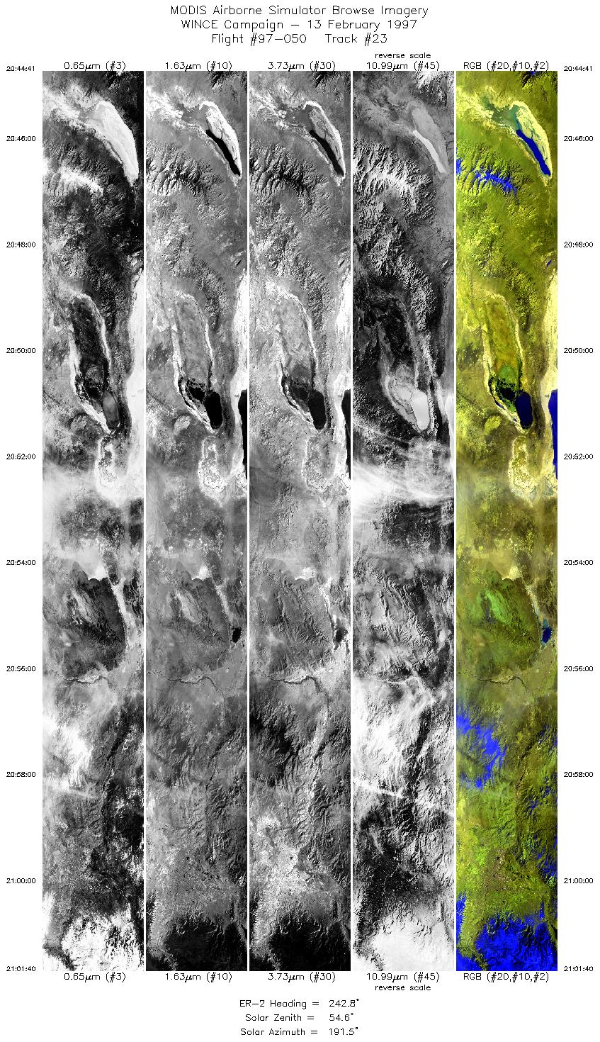
| 23 |
20:44-21:01 |
243 |
40.34-39.39 |
117.86-119.98 |
6351 |
~20000 |
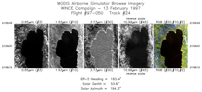
| 24 |
21:02-21:05 |
183 |
39.28-38.99 |
120.04-120.05 |
930 |
~20000 |
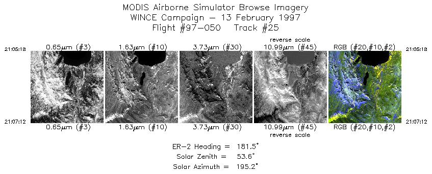
| 25 |
21:05-21:07 |
182 |
38.98-38.76 |
120.06-120.07 |
711 |
~20000 |
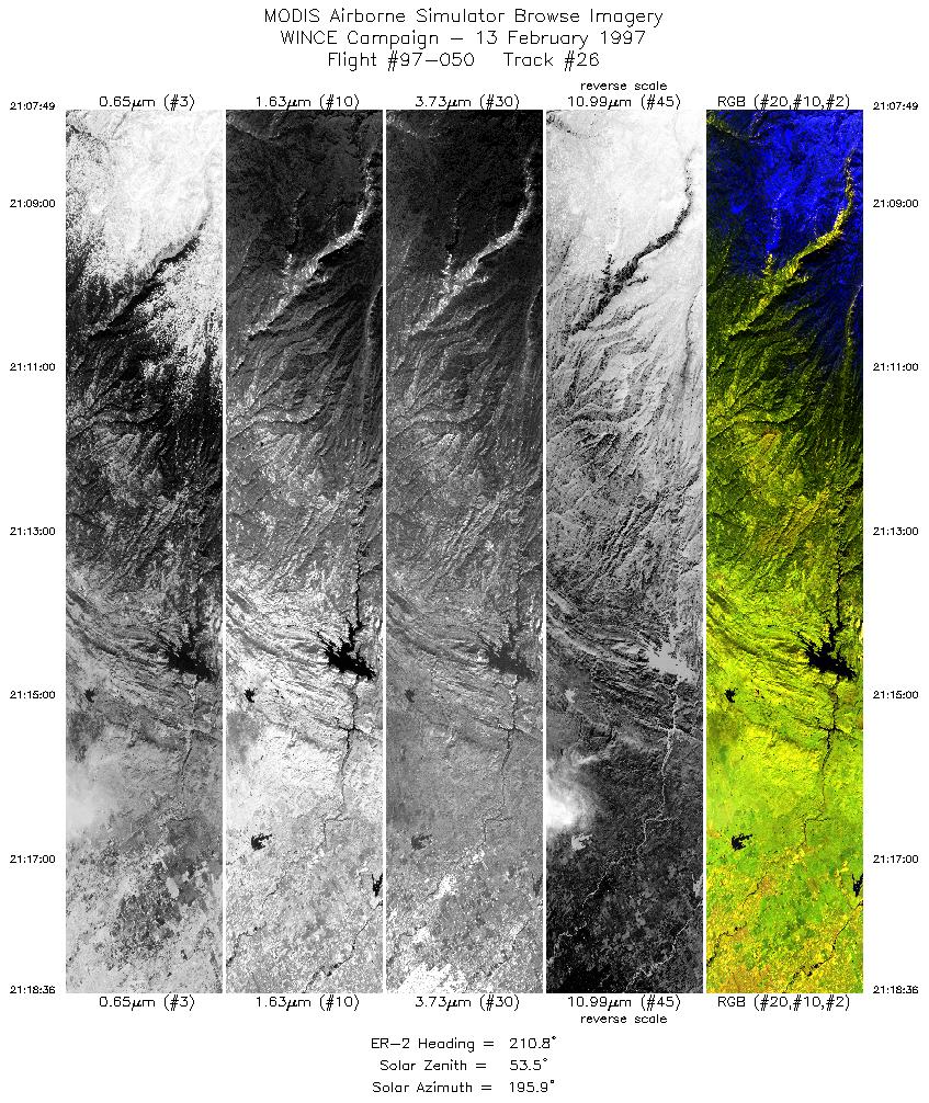
| 26 |
21:07-21:18 |
211 |
38.69-37.61 |
120.09-120.91 |
4033 |
~20000 |
|
Images 01 through 26 in sequence |
Level-1B Data Distribution
NASA GSFC Earth Sciences (GES) Data Center
NASA DAAC's
Additional Information
|
Take-off was at 1600 UTC. ER-2 landed in California at about 2200 UTC.
ER-2 climbed out of Madison and aligned on a 240 degree heading to overpass HSRL and AERI instruments based at Space Science
with thin cirrus overcast sky conditions. The ER-2 then flew SW to meet ADEOS overpass at about 1657 UTC over the Iowa,
Wisconsin border and flew the orbital track until about 1733 UTC (1716 UTC overpass). Skies were filled with mostly high thin to thick
cloud. ER-2 then turned westward and flew to CO/WY border track (43n, 109w to 43n, 111w) and then on to overfly Lake Tahoe from
NE to SW. Flight finishes with ER-2 landing at Moffett Field, CA.
Channel 5 has excessive noise, signal does not appear to be usable.
Channel 26 has numerous bad scanlines thoughout the mission. Fairly significant noise in channels 26-50 thoughout mission.
|
|
|
|