
|
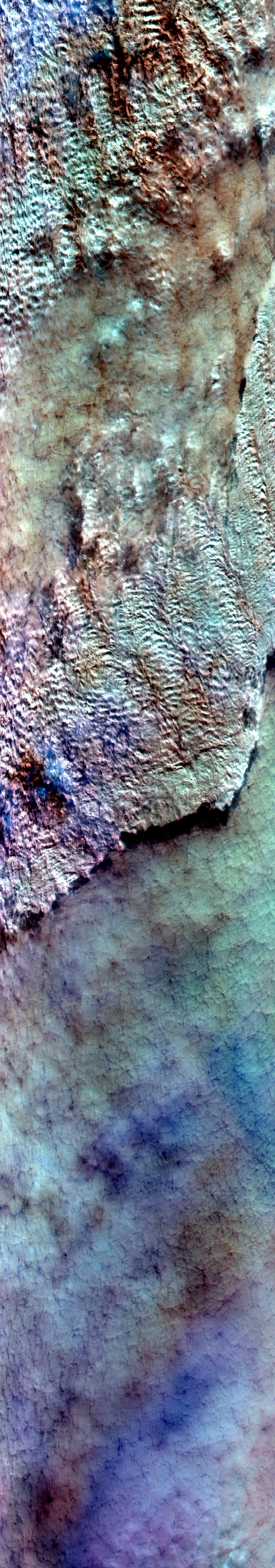
Sample Image

02 February 1997
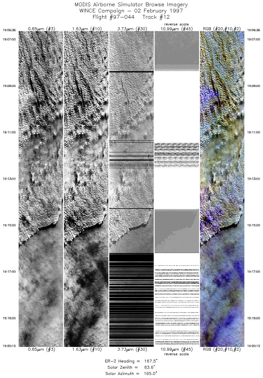
Track #12
Scanlines 1000 - 5080
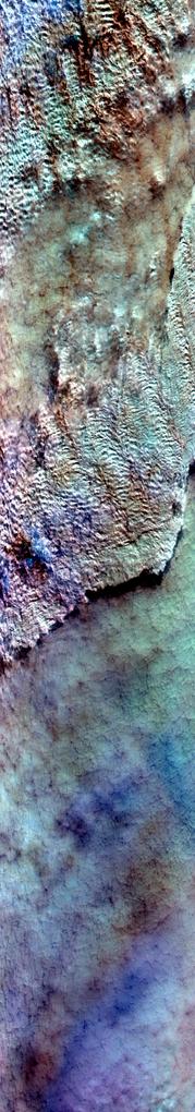

Although completely obscued by clouds, this flightline begins over the Nicolet National Forest, Wisconsin. Proceeds approximately southeast over the Menominee Indian Reservation and Lake Winnebago.
R: 2.15 microns
G: 0.95 microns
B: 0.65 microns
|
|
Summary Information
Date: February 02, 1997
ER-2 Flight Number: 97-044
Location: Canada and Upper Midwest
Principal Investigator: Dr. Paul Menzel (Univ of Wisconsin)
Additional Sensors: HIS, CLS, MIR, APS, 6" RC-10 (NC)
Mission Objectives: Collect data for cross-calirbration of ADEOS instruments. Pass over Park Falls, Trout Lake, and Lake Winnebago ground sites on the
way to the Bondville, IL ground site for figure-8 patterns centered over the AERI. Overflight of SSEC instrumentation at end of flight.
Level-1B Processing Information
Level-1B Data processed by: Ames Research Center
Level-1B Data Version: #10
Level-1B Configuration: (sample file)
Calibration Type: Final
Calibration Version: WINCE 1.0
Temperature Adjustment: No
Status: Completed with final calibration
|
|
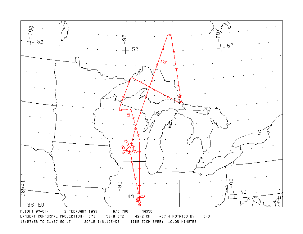
Flight Track Map

|
Level-1B Browse Imagery
Straight Line Flight Tracks: 20
Scanlines Processed: 82726
Solar Azimuth and Zenith Angles
|
Browse Images
|
Click on the Flight Track number to load images.
Lat/Lon ranges are for the BEG-END scanline nadir pixels.
|
Flight
Track |
Time_Span
(GMT) |
Heading
(Deg) |
Lat_Range
(Deg_N) |
Lon_Range
(Deg_W) |
Length
(Scanlines) |
Altitude
(Meters) |
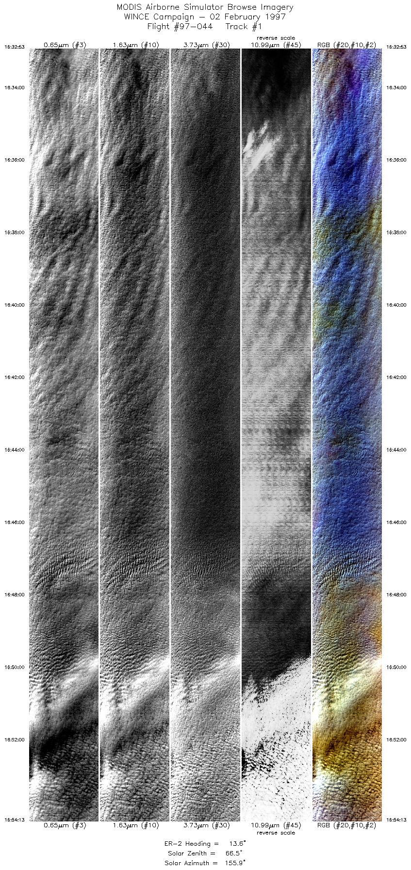
| 1 |
16:32-16:54 |
14 |
46.37-48.68 |
88.10-86.92 |
7968 |
~20000 |
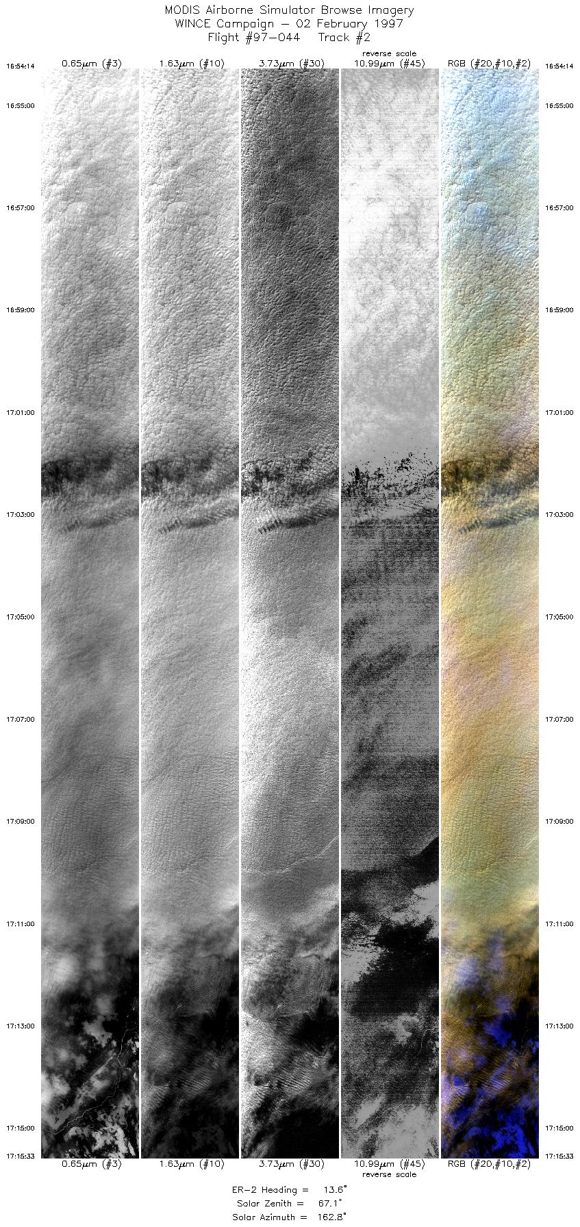
| 2 |
16:54-17:15 |
14 |
48.68-51.00 |
86.92-85.61 |
7964 |
~20000 |
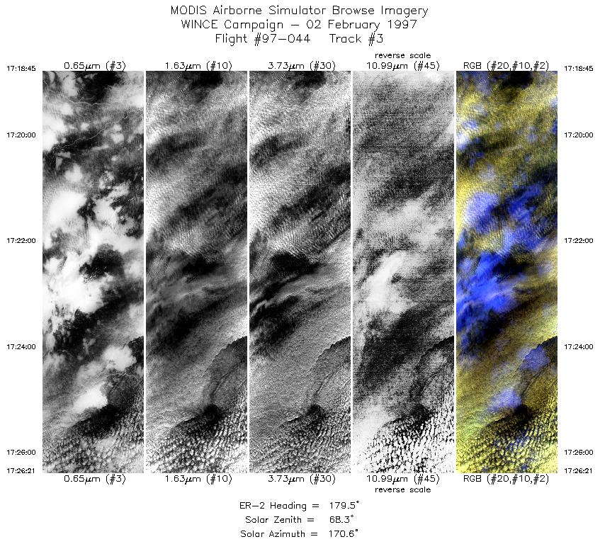
| 3 |
17:18-17:26 |
180 |
50.94-50.07 |
85.17-84.99 |
2840 |
~20000 |
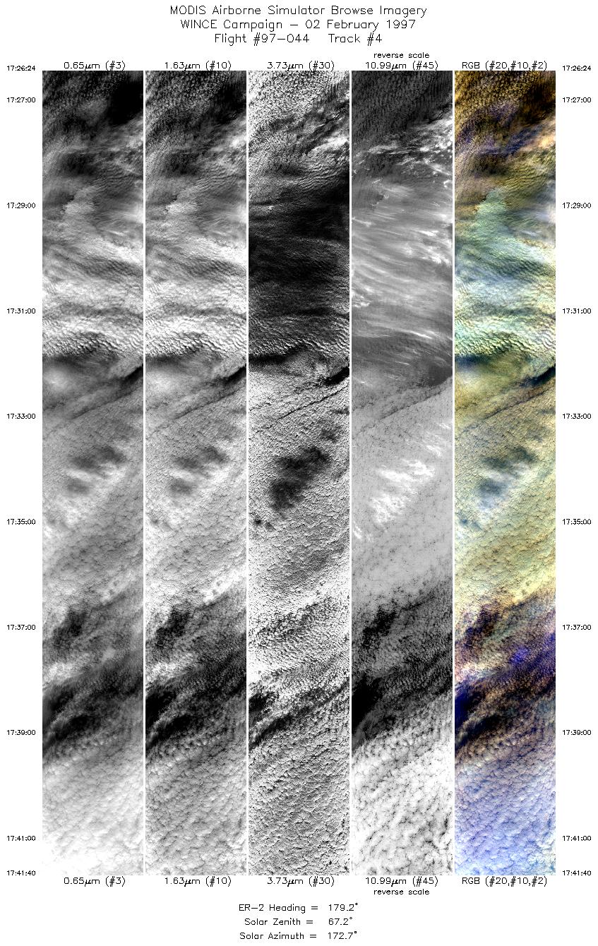
| 4 |
17:26-17:41 |
179 |
50.06-48.32 |
84.99-84.65 |
5704 |
~20000 |
| 5 |
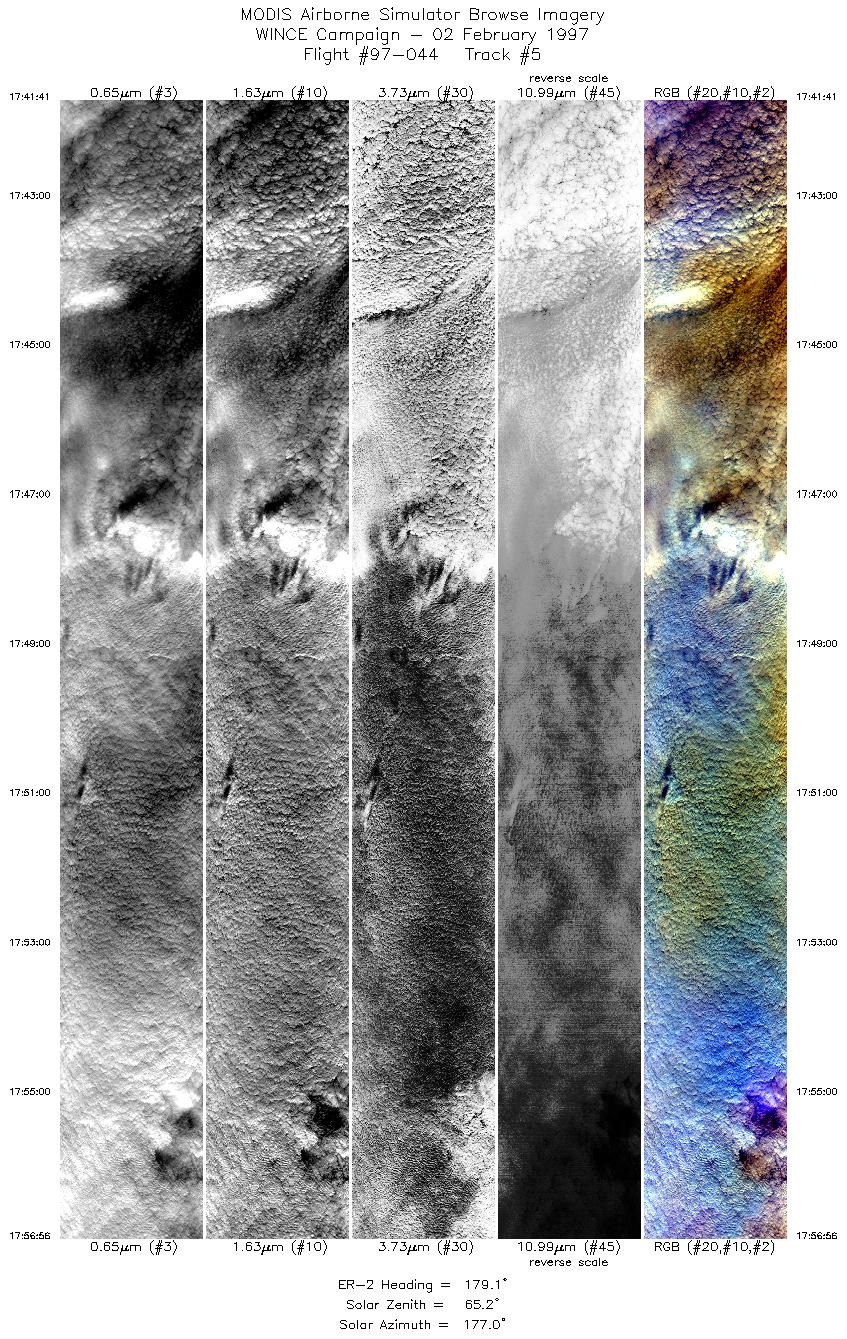
17:41-17:56 |
179 |
48.31-46.56 |
84.65-84.34 |
5699 |
~20000 |
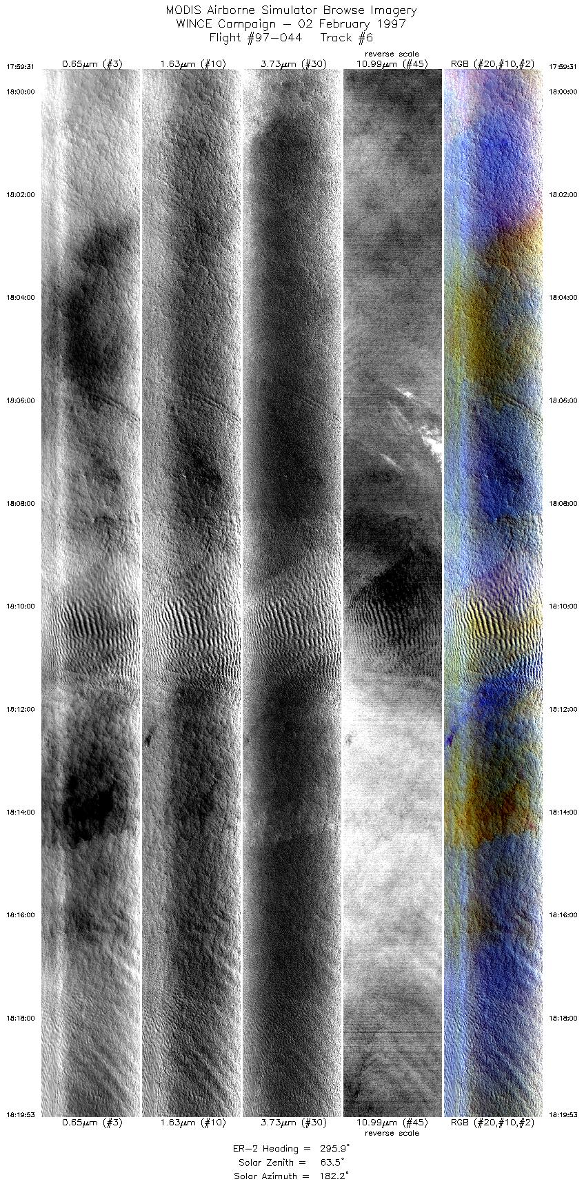
| 6 |
17:59-18:19 |
296 |
46.49-47.51 |
84.60-87.29 |
7609 |
~20000 |
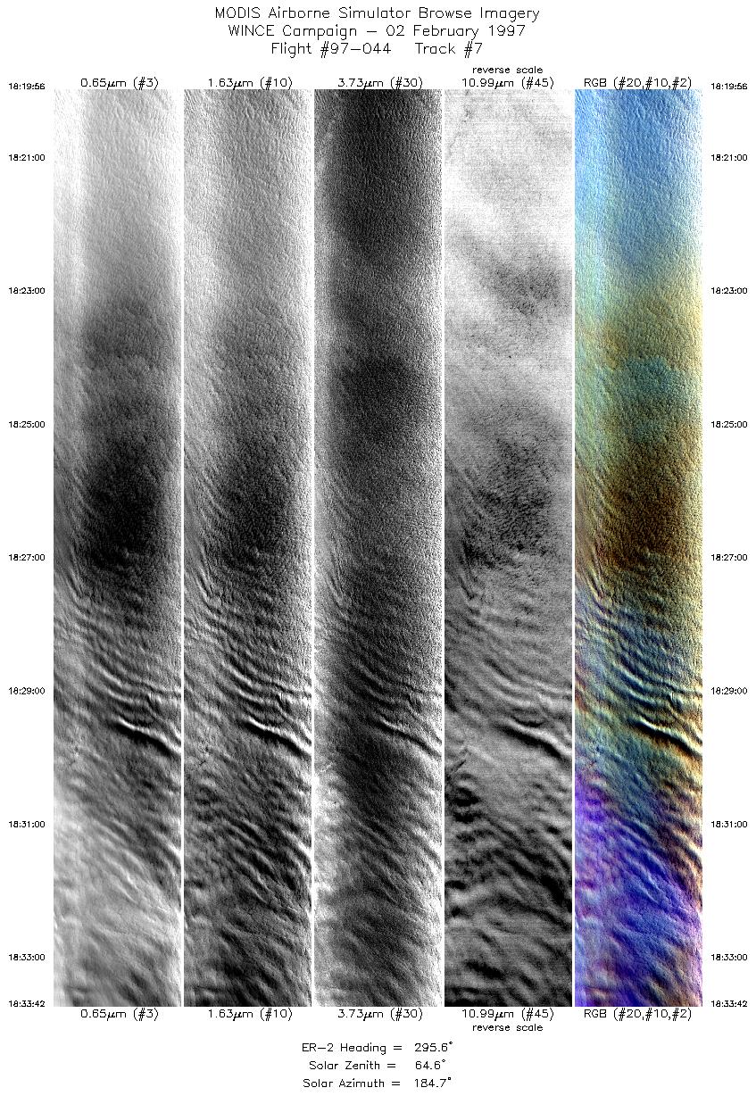
| 7 |
18:19-18:33 |
296 |
47.51-48.17 |
87.31-89.19 |
5143 |
~20000 |
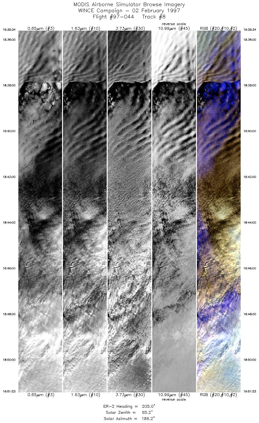
| 8 |
18:35-18:51 |
205 |
48.10-46.45 |
89.42-90.26 |
5909 |
~20000 |
| 9 |
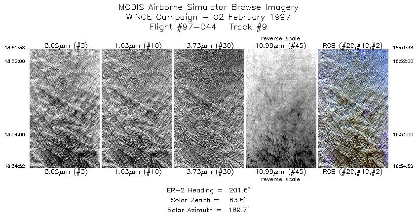
18:51-18:54 |
202 |
46.42-46.07 |
90.27-90.43 |
1208 |
~20000 |
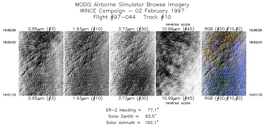
| 10 |
18:58-19:01 |
77 |
45.99-46.05 |
89.98-89.50 |
1035 |
~20000 |
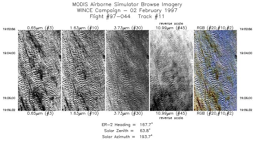
| 11 |
19:02-19:06 |
168 |
45.96-45.55 |
89.26-89.08 |
1345 |
~20000 |
| 12 |
19:06-19:20 |
168 |
45.54-43.99 |
89.07-88.41 |
5080 |
~20000 |
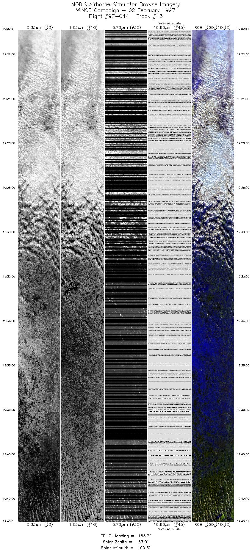
| 13 |
19:20-19:43 |
184 |
43.91-41.35 |
88.40-88.38 |
8282 |
~20000 |
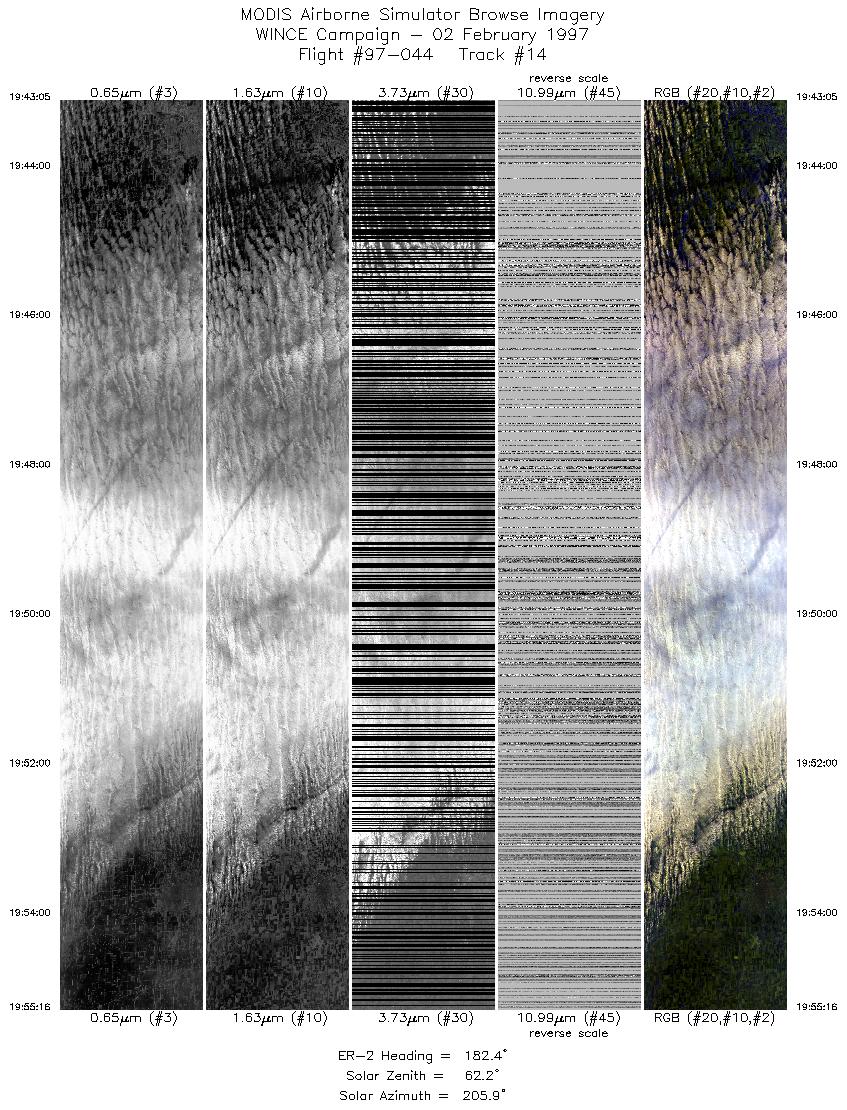
| 14 |
19:43-19:55 |
182 |
41.33-39.94 |
88.38-88.37 |
4551 |
~20000 |
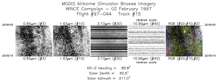
| 15 |
20:00-20:02 |
86 |
40.04-40.04 |
88.32-88.07 |
605 |
~20000 |
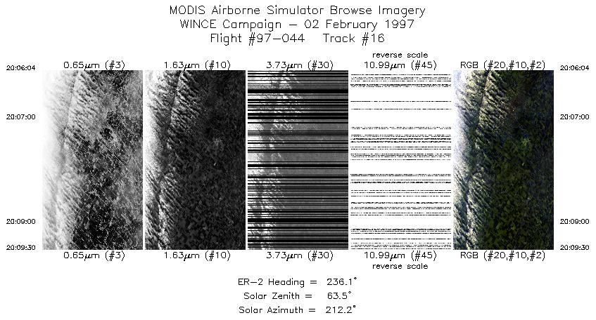
| 16 |
20:06-20:09 |
236 |
40.17-39.95 |
88.16-88.55 |
1284 |
~20000 |
| 17 |
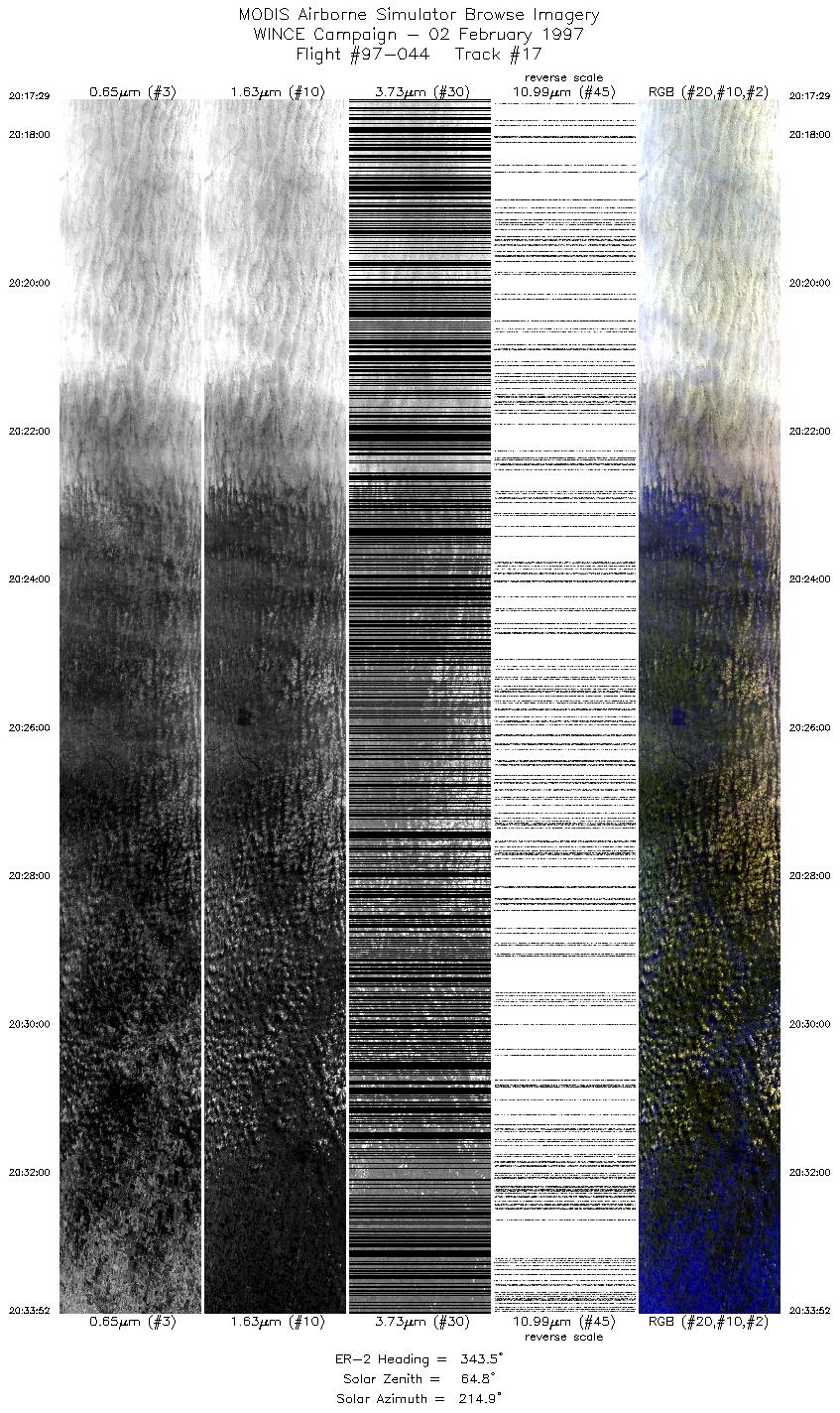
20:17-20:33 |
344 |
40.35-42.10 |
88.44-88.99 |
6121 |
~20000 |
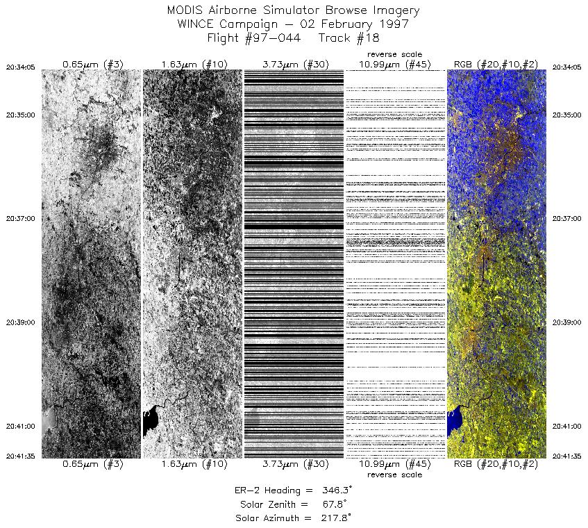
| 18 |
20:34-20:41 |
346 |
42.12-42.91 |
89.00-89.18 |
2803 |
~20000 |
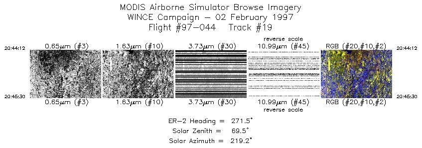
| 19 |
20:44-20:45 |
272 |
43.06-43.06 |
89.47-89.65 |
486 |
~20000 |
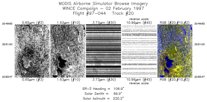
| 20 |
20:49-20:52 |
107 |
43.23-43.13 |
89.73-89.26 |
1090 |
~20000 |
|
Images 01 through 20 in sequence |
Level-1B Data Distribution
NASA GSFC Earth Sciences (GES) Data Center
NASA DAAC's
Additional Information
|
Take off at 1600 UTC. ER-2 landed at MSN at 2125 UTC.
ER-2 left Madison and set up for an underflight of ADEOS (1710 UTC overpass). Complete undercast during underflight of ADEOS.
Some thin cirrus (clear below) during 1719 to 1721 UTC. Lake Superior was total overcast except at the northern end where some lake
ice was observed (approximate time, 1905 UTC). Overcast conditions at Park Falls, Trout Lake and Lake Winnebago during overpass.
Figure-8s flown over AERI at Bondville with overpasses at 1954, 2001, 2007, and 2014 UTC. Pattern over Bondville was shortened due
to stratus clouds moving in from the northwest. Clear-sky conditions during Madison overpasses at 2045 and 2052 UTC. All ground
instrumentation operative during SSEC overpass.
Tracks 12 through 20 (midflight through end) are lost for ports 3 and 4 due to loss of LN2 pressure in the dewars.
|
|
|
|