
|
Sample Image

06 February 1997
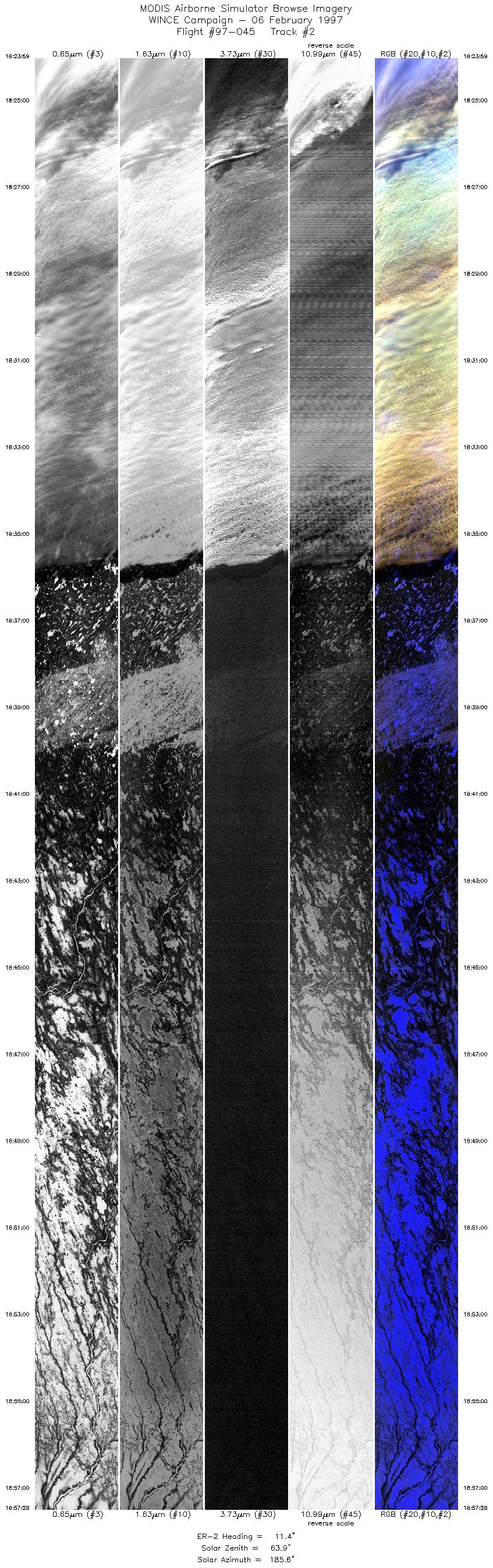
Track #02


Cloud obscured Lake Michigan northeast of Milwaukee, Wisconsin.
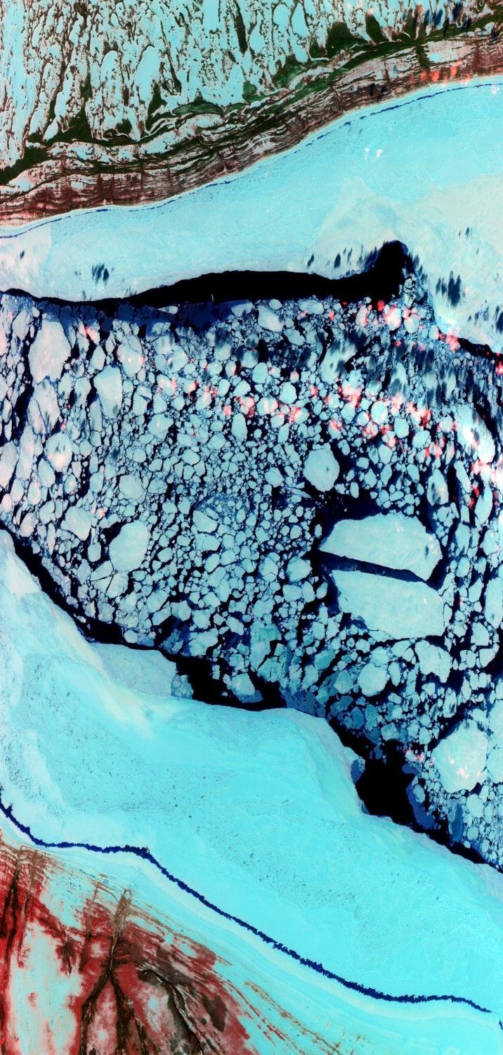
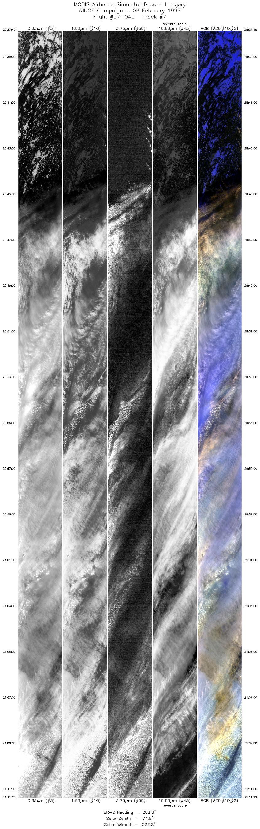
06 February 1997
Track #07


Partially frozen James Bay, Canada.
R: 2.15 microns
G: 0.95 microns
B: 0.65 microns
|
|
Summary Information
Date: February 06, 1997
ER-2 Flight Number: 97-045
Location: Wisconsin to Hudson Bay, Canada
Principal Investigator: Dr. Paul Menzel (Univ of Wisconsin)
Additional Sensors: HIS, CLS, MIR, EOC, APS, 12" RC-10 (NC)
Mission Objectives: Overfly thin to thick clouds over snow. Monitor transition from clouds over snow to clear snow to lake ice of Hudson Bay. Collect data for
cross-calibration of MAS and HIS instruments. Underfly ADEOS for cross-calibration between POLDER and TSCC. Overfly ground
instrumentation, including snow emissivity measurements with AERI at Madison and instruments at SSEC.
Level-1B Processing Information
Level-1B Data processed by: Ames Research Center
Level-1B Data Version: #10
Level-1B Configuration: (sample file)
Calibration Type: Final
Calibration Version: WINCE 1.0
Temperature Adjustment: No
Status: Completed with final calibration
|
|
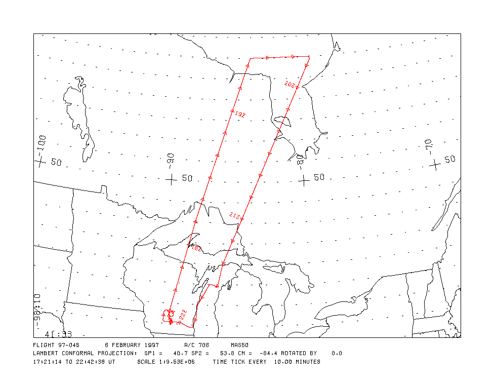
Flight Track Map

|
Level-1B Browse Imagery
Straight Line Flight Tracks: 16
Scanlines Processed: 91203
Solar Azimuth and Zenith Angles
|
Browse Images
|
Click on the Flight Track number to load images.
Lat/Lon ranges are for the BEG-END scanline nadir pixels.
|
Flight
Track |
Time_Span
(GMT) |
Heading
(Deg) |
Lat_Range
(Deg_N) |
Lon_Range
(Deg_W) |
Length
(Scanlines) |
Altitude
(Meters) |
| 1 |
17:50-18:23 |
8 |
45.72-49.46 |
88.88-87.49 |
12495 |
~20000 |
| 2 |
18:24-18:57 |
11 |
49.43-53.08 |
87.47-85.69 |
12475 |
~20000 |
| 3 |
18:57-19:23 |
14 |
53.09-55.95 |
85.68-84.05 |
9794 |
~20000 |
| 4 |
19:25-19:46 |
82 |
56.02-56.02 |
83.81-79.13 |
7926 |
~20000 |
| 5 |
19:48-20:04 |
213 |
55.85-54.17 |
78.97-80.42 |
6059 |
~20000 |
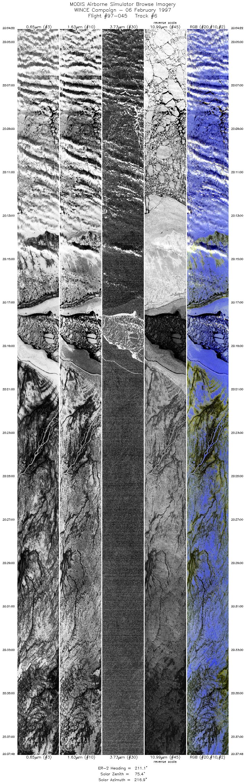
| 6 |
20:04-20:37 |
211 |
54.17-50.66 |
80.45-83.10 |
12490 |
~20000 |
| 7 |
20:37-21:11 |
208 |
50.65-47.07 |
83.10-85.39 |
12478 |
~20000 |
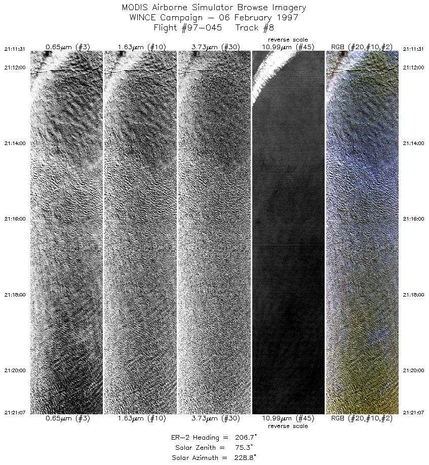
| 8 |
21:11-21:21 |
207 |
47.06-46.03 |
85.38-85.98 |
3531 |
~20000 |
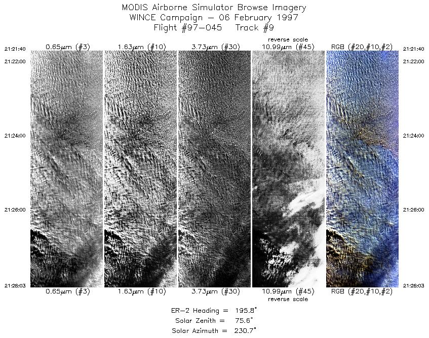
| 9 |
21:21-21:28 |
196 |
45.98-45.24 |
86.01-86.23 |
1843 |
~20000 |
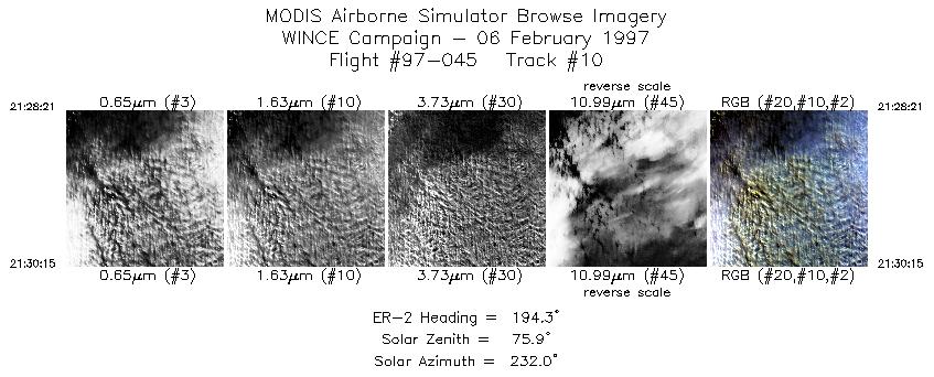
| 10 |
21:28-21:30 |
194 |
45.20-44.98 |
86.24-86.30 |
711 |
~20000 |
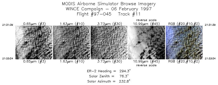
| 11 |
21:31-21:33 |
294 |
44.92-44.99 |
86.47-86.70 |
655 |
~20000 |
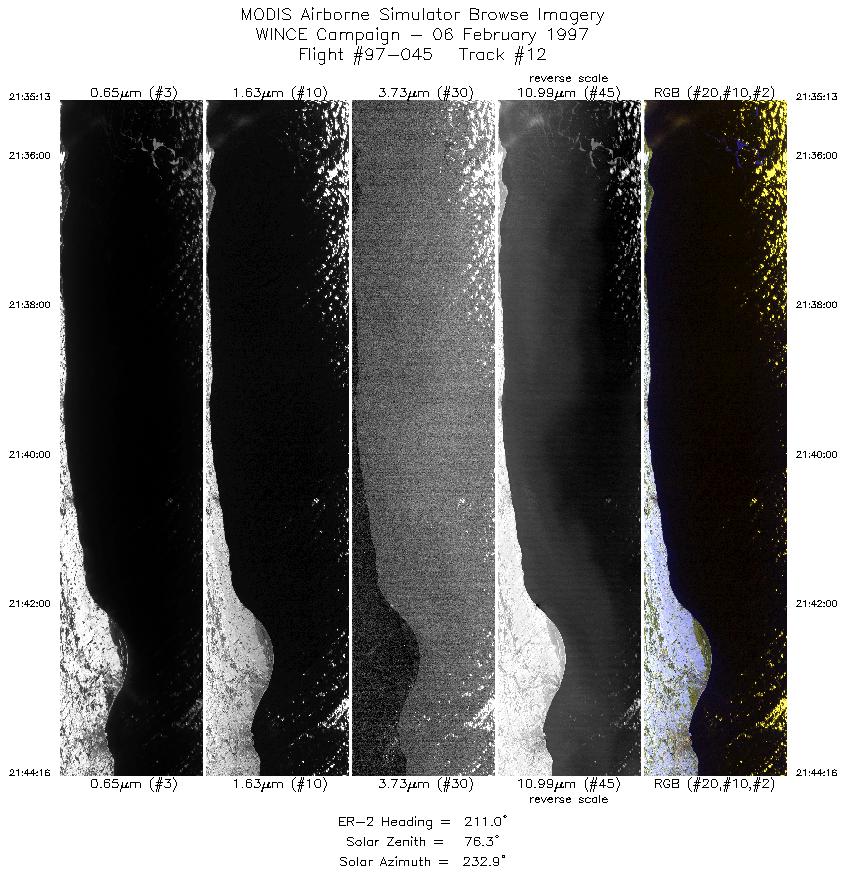
| 12 |
21:35-21:44 |
211 |
44.92-44.01 |
86.94-87.62 |
3382 |
~20000 |
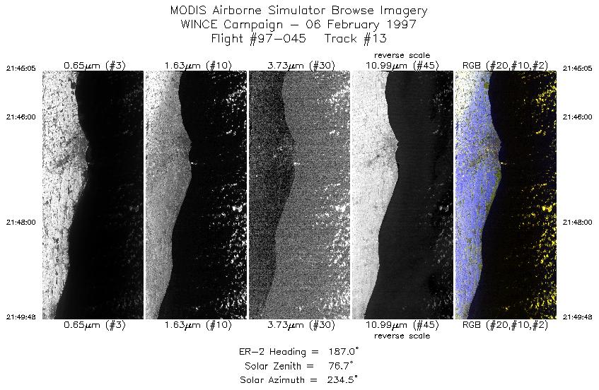
| 13 |
21:45-21:49 |
187 |
43.92-43.36 |
87.66-87.71 |
1763 |
~20000 |
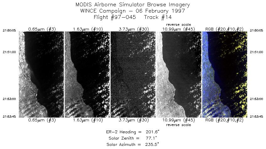
| 14 |
21:50-21:53 |
202 |
43.33-42.93 |
87.71-87.89 |
1370 |
~20000 |
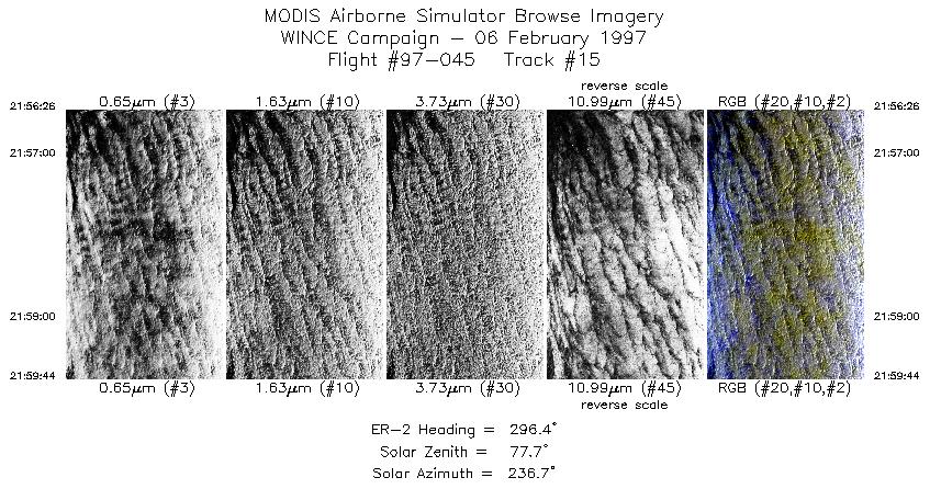
| 15 |
21:56-21:59 |
296 |
42.91-43.07 |
88.23-88.66 |
1234 |
~20000 |
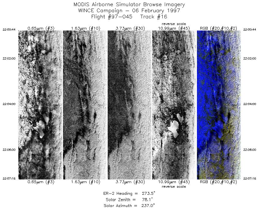
| 16 |
22:00-22:07 |
274 |
43.10-43.10 |
88.79-89.75 |
2442 |
~20000 |
|
Images 01 through 16 in sequence |
Level-1B Data Distribution
NASA GSFC Earth Sciences (GES) Data Center
NASA DAAC's
Additional Information
|
The objective of this flight was to
overfly thin to thick clouds over snow, monitor transition from clouds over snow to clear snow to lake ice of
Hudson Bay, collect data for cross-calibration of MAS and HIS instruments, underfly ADEOS for
cross-calibration between POLDER and TSCC, overfly ground instrumentation including snow emissivity
measurements with AERI at Madison and instruments at SSEC.
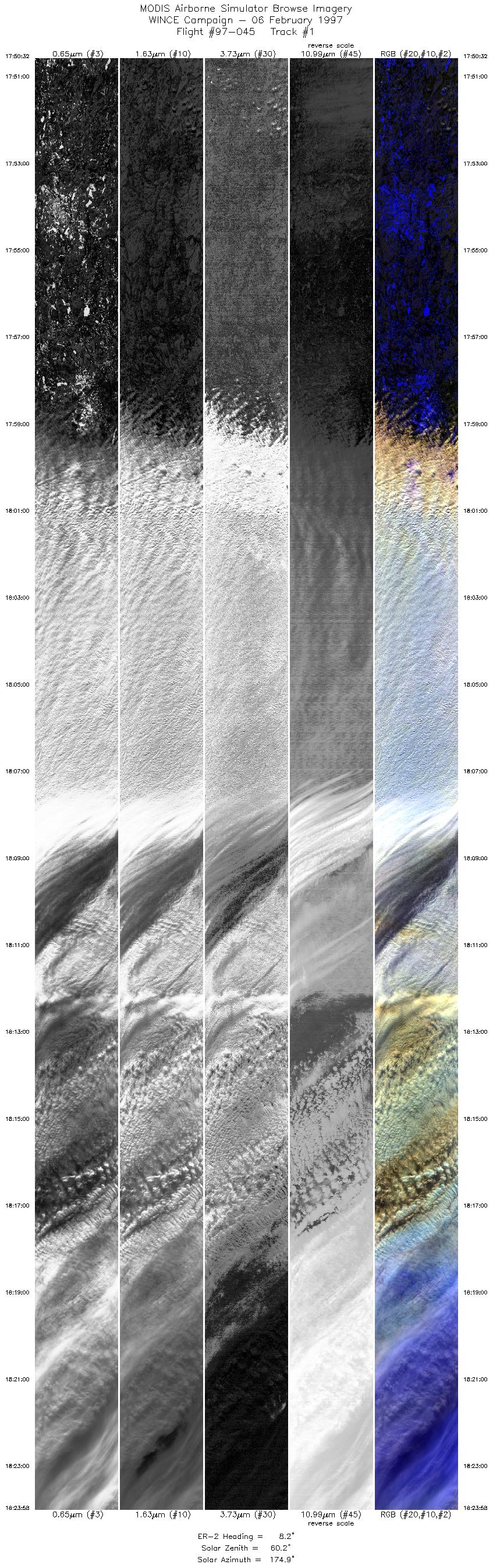
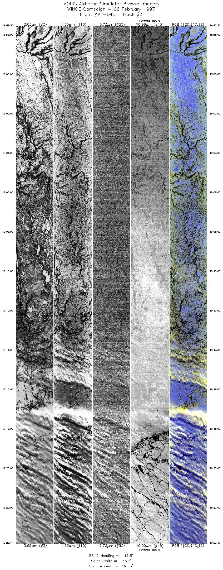
The ER-2 aircraft left Madison and flew northward to Hudson Bay.
On that transit, it flew over dissipating clouds over nothern Wisconsin
(with snow cover below), through a weak cold front over Lake Superior, and then into clear snow covered conditions in
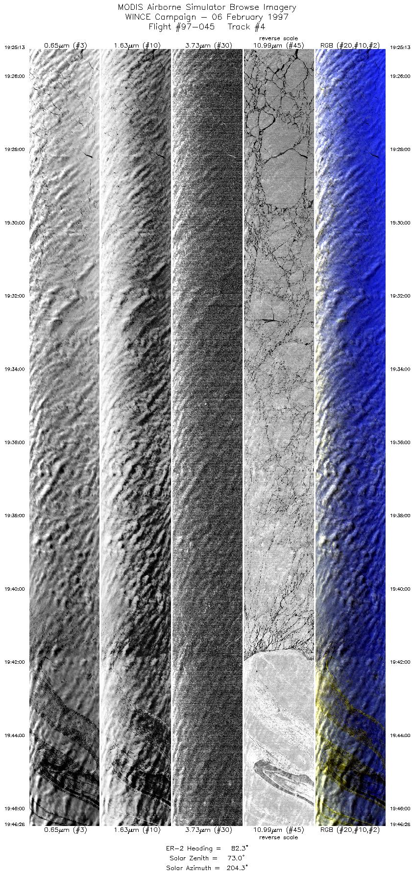
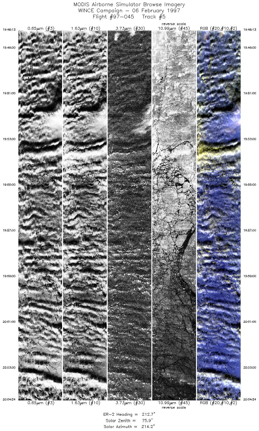
southern Canada. Hudson Bay had about 50% broken low cloud cover. After flying eastward across Hudson Bay, the
ER-2 flew southward towards the north end of Lake Michigan. The pilot (Jim Barrilleaux) adjusted the flight pattern
to cover clear water over the western shore of the Lake. Probably also picked up some shoreline as well. From
there, pilot turned west and flew to Madison where he lined up on a 270 degree heading to overfly Lake
Mendota. At this time cloud cover was dissipating over southern Wisconsin and Madison had broken, dissipating cloud.
Pilot reported he could not see any cloud shadows over Madison on overpass,but
reported cloud shadows over Hudson Bay. Interesting data over Hudson Bay for cloud mask testing.
Some lake ice at northern end of Lake Michigan. At 21:35 GMT visible water with very thin low cloud
was noted.
There is incoherent line to line noise (cabeling) in channel 5 throughout the flight. Very poor data quality in this channel.(EXAMPLE)
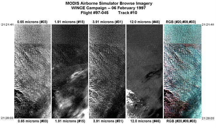
>There were numerous MAS Level-0 data gaps, which occurred between 21:22:37 GMT and 21:24:06 GMT during Flight Track #10. These gaps appear as a discontinuity streak in the browse imagery (EXAMPLE).
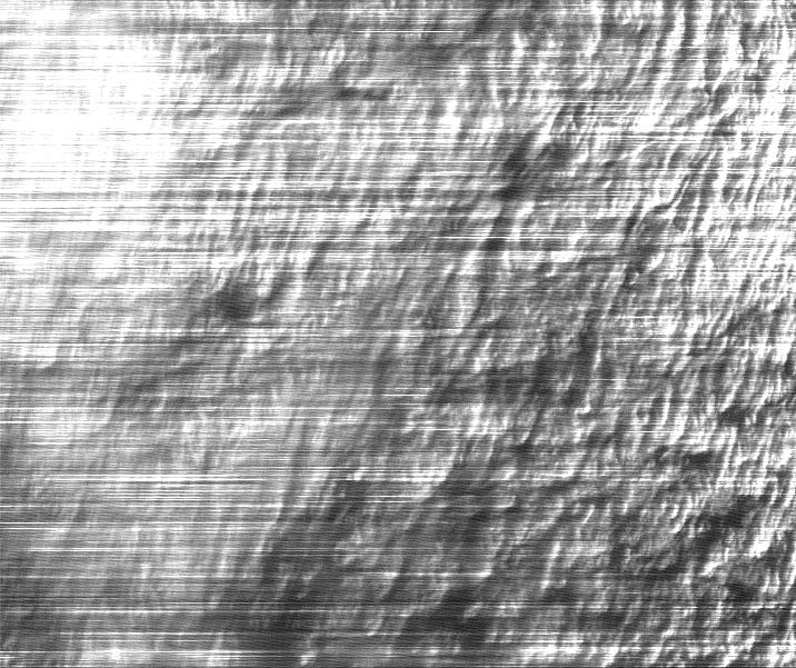
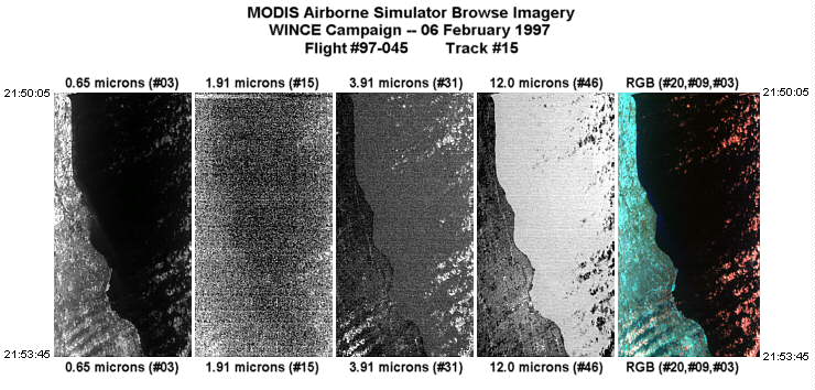
Band #15 (1.91 microns) slowly degraded during this flight. Towards the end of the flight, this band exhibited excessive noise (EXAMPLE). Note that this effect may be present in other MAS port#2 bands.
|
|
|
|
