
|
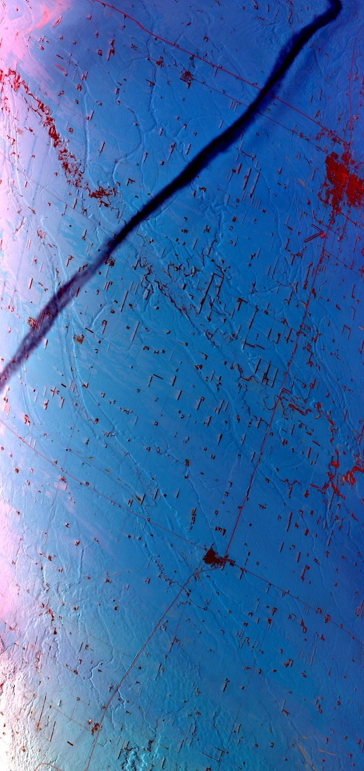
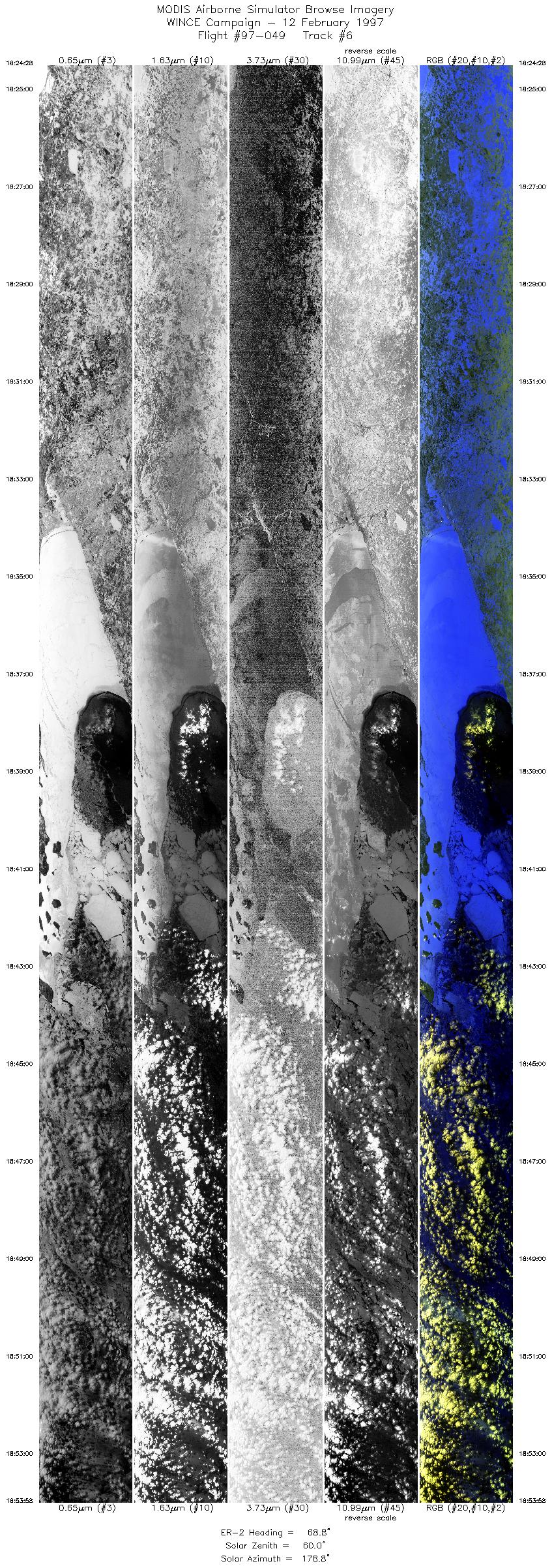
Sample Image

12 February 1997
Track #06


Cloud obscured Lake Michigan northeast of Milwaukee, Wisconsin.
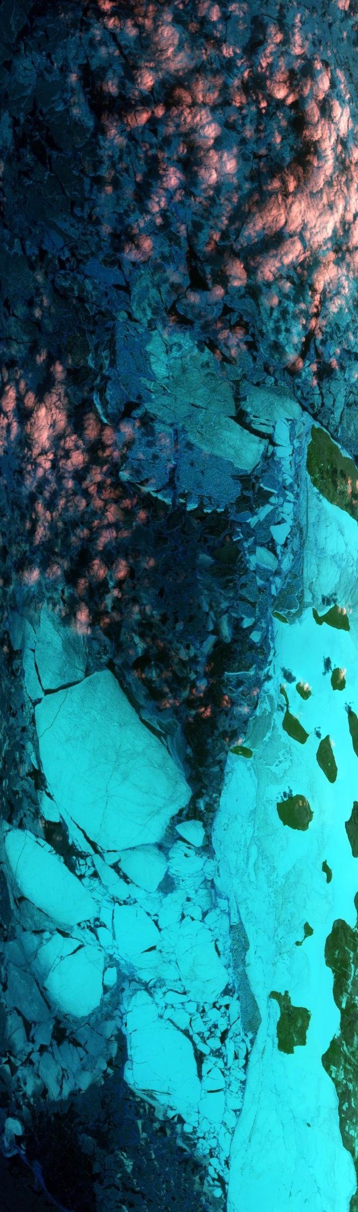
06 February 1997
Track #04


Partially frozen James Bay, Canada.
R: 2.15 microns
G: 0.95 microns
B: 0.65 microns
|
|
Summary Information
Date: February 12, 1997
ER-2 Flight Number: 97-049
Location: Upper Midwest
Principal Investigator: Dr. Paul Menzel (Univ of Wisconsin)
Additional Sensors: HIS, CLS, MIR, EOC, APS
Mission Objectives: ER-2 will position itself into solar plane and overfly thin cirrus for POLDER instrument comparison on ADEOS (overpass at 1742 UTC).
Approximately 10 minutes of data collection before and 10 minutes after the overpass. Thin cirrus also useful for cloud detection over
snow/ice. Overfly Lake Superior for lake effect snow band characterization. Overfly Hall/Foster snow site in west central WI on a N-S
transect at 90.5w meridian for snow detection. Overfly SSEC instrumentation and Lake Mendota on SW to NE leg that should put HIS
instrument right over center of lake for snow emissivity characterization.
Level-1B Processing Information
Level-1B Data processed by: Ames Research Center
Level-1B Data Version: #10
Level-1B Configuration: (sample file)
Calibration Type: Final
Calibration Version: WINCE 1.0
Temperature Adjustment: No
Status: Completed with final calibration
|
|
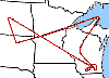
Flight Track Map

|
Level-1B Browse Imagery
Straight Line Flight Tracks: 14
Scanlines Processed: 65181
Solar Azimuth and Zenith Angles
|
Browse Images
|
Click on the Flight Track number to load images.
Lat/Lon ranges are for the BEG-END scanline nadir pixels.
|
Flight
Track |
Time_Span
(GMT) |
Heading
(Deg) |
Lat_Range
(Deg_N) |
Lon_Range
(Deg_W) |
Length
(Scanlines) |
Altitude
(Meters) |
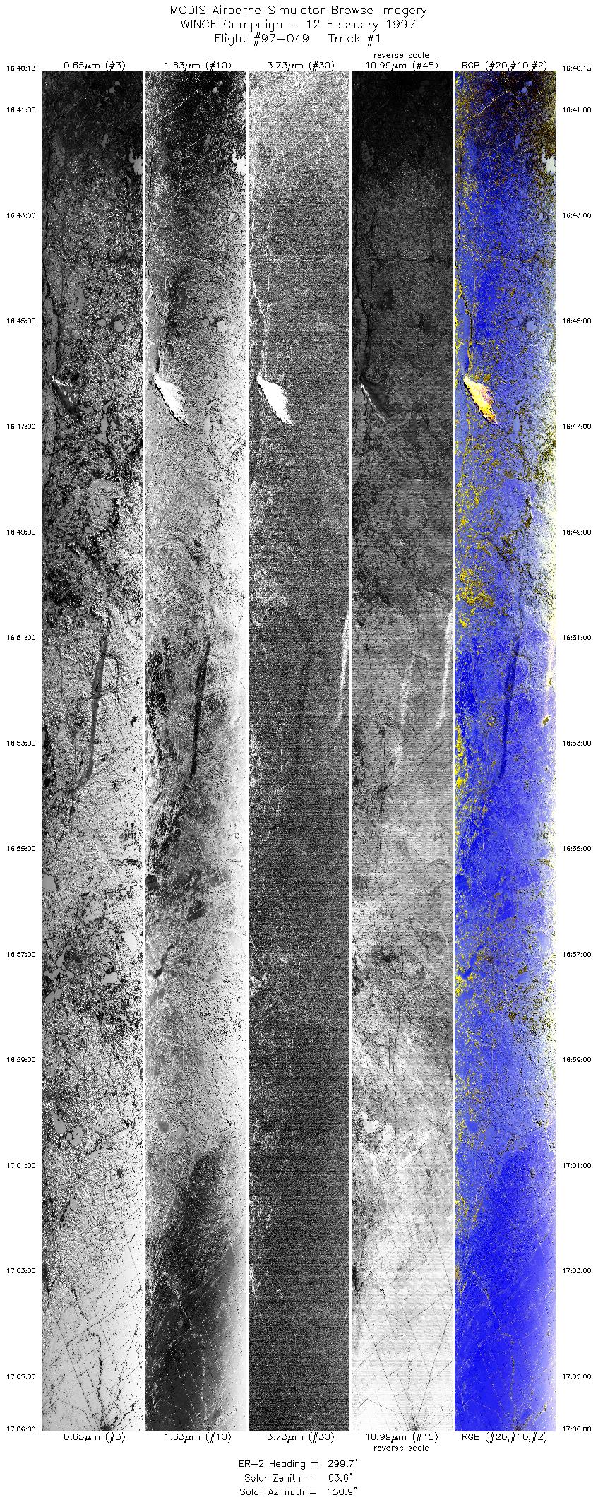
| 1 |
16:40-17:06 |
300 |
44.97-46.30 |
93.22-96.57 |
9635 |
~20000 |
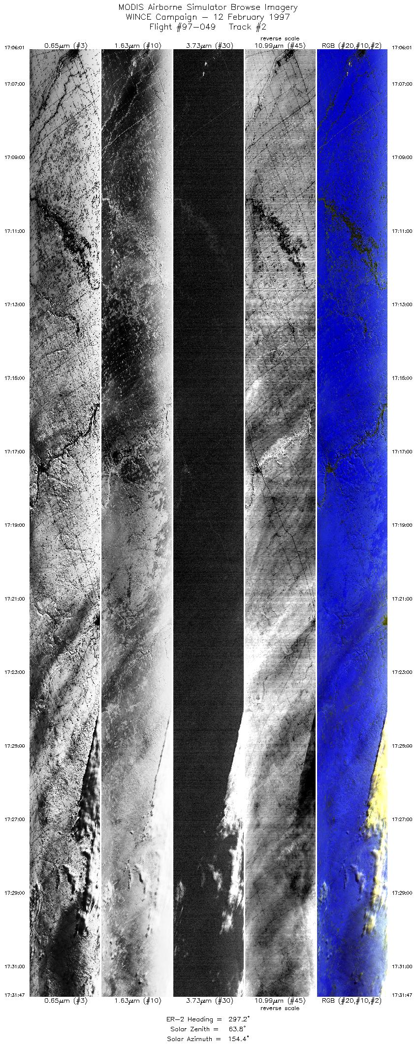
| 2 |
17:06-17:31 |
297 |
46.30-47.51 |
96.56-99.98 |
9628 |
~20000 |
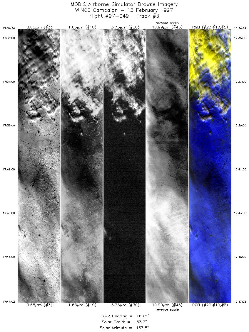
| 3 |
17:34-17:47 |
160 |
47.32-45.91 |
100.22-99.34 |
4664 |
~20000 |
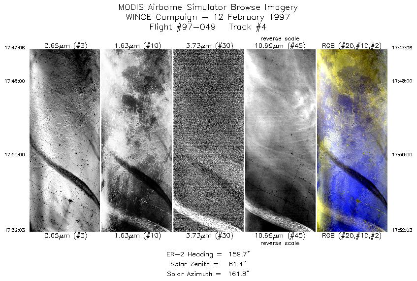
| 4 |
17:47-17:52 |
160 |
45.90-45.35 |
99.34-98.99 |
1850 |
~20000 |
| 5 |
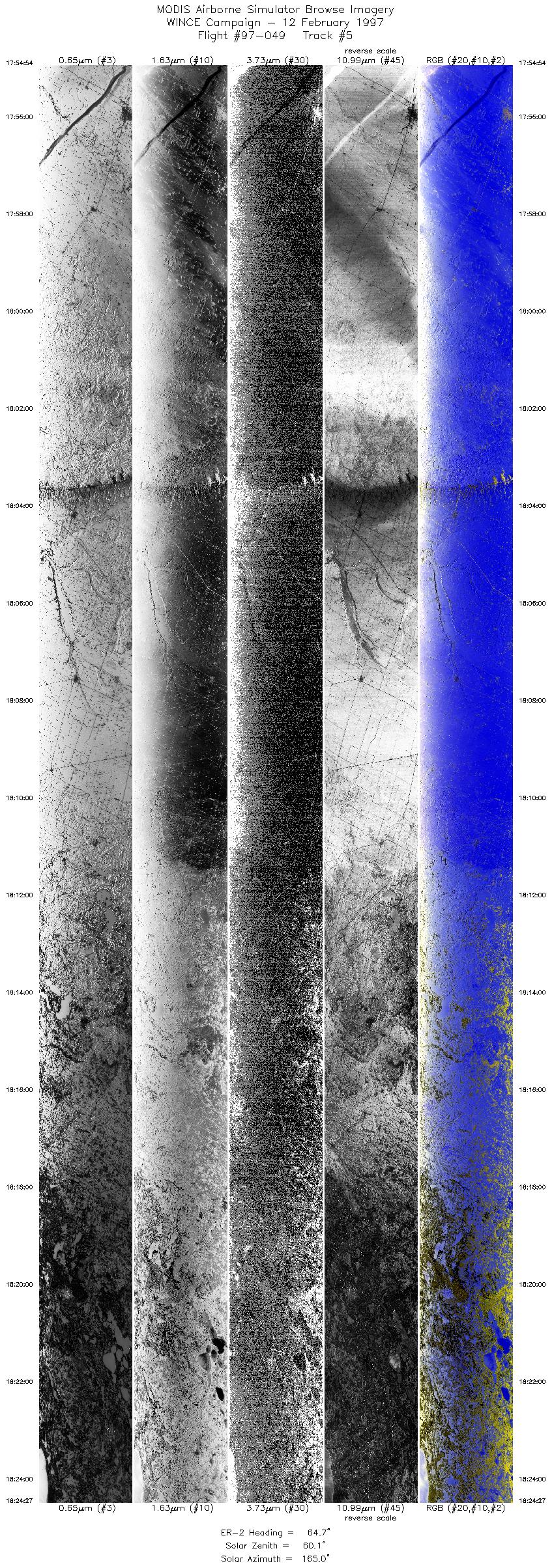
17:54-18:24 |
65 |
45.33-46.50 |
98.58-93.73 |
11041 |
~20000 |
| 6 |
18:24-18:53 |
69 |
46.48-47.55 |
93.74-88.69 |
11022 |
~20000 |
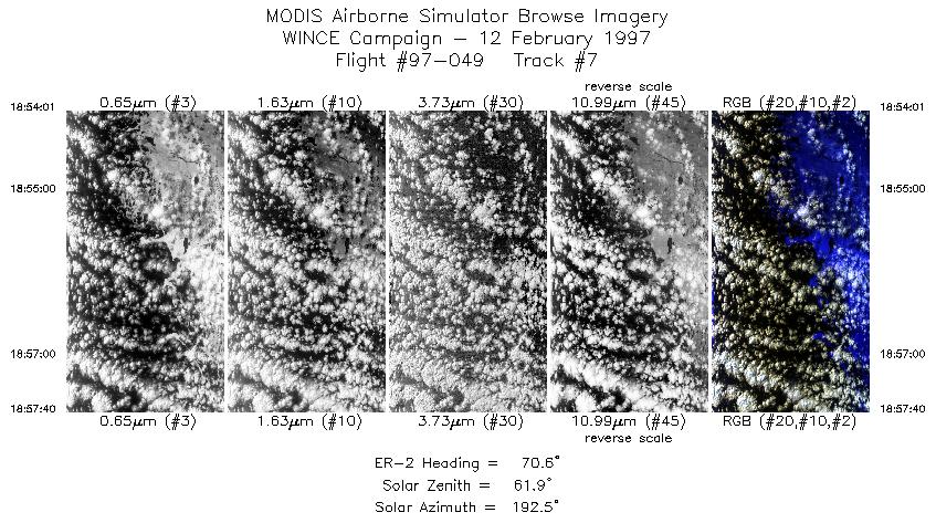
| 7 |
18:54-18:57 |
71 |
47.54-47.67 |
88.65-88.00 |
1365 |
~20000 |
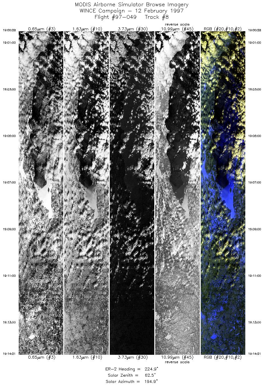
| 8 |
19:00-19:14 |
225 |
47.47-46.29 |
87.76-89.11 |
5186 |
~20000 |
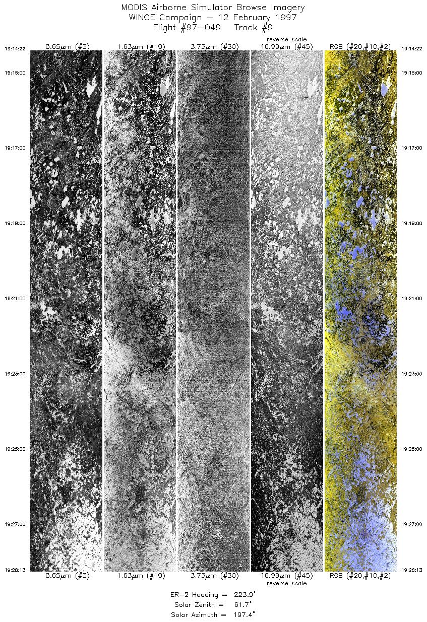
| 9 |
19:14-19:28 |
224 |
46.28-45.05 |
89.12-90.46 |
5175 |
~20000 |
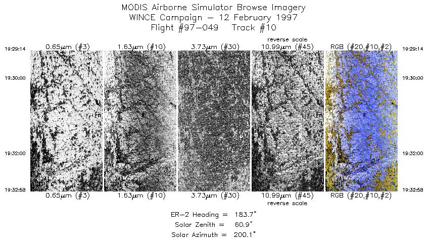
| 10 |
19:29-19:32 |
184 |
44.94-44.50 |
90.50-90.50 |
1396 |
~20000 |
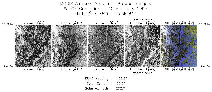
| 11 |
19:39-19:41 |
140 |
43.86-43.65 |
89.96-89.69 |
854 |
~20000 |
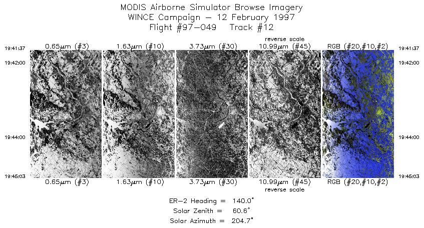
| 12 |
19:41-19:45 |
140 |
43.64-43.32 |
89.68-89.29 |
1284 |
~20000 |
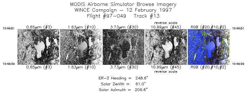
| 13 |
19:46-19:48 |
249 |
43.15-43.07 |
89.30-89.52 |
611 |
~20000 |
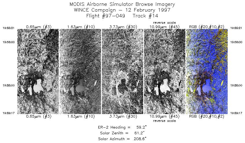
| 14 |
19:55-19:59 |
59 |
42.96-43.18 |
89.82-89.24 |
1470 |
~20000 |
|
Images 01 through 14 in sequence |
Level-1B Data Distribution
NASA GSFC Earth Sciences (GES) Data Center
NASA DAAC's
Additional Information
|
The objective of this flight was to have the ER-2 aircraft position itself into solar plane and overfly thin cirrus for POLDER instrument comparison on ADEOS (overpass at 1742 UTC) approximately 10 minutes of data was to be collected before and 10 minutes after the overpass, overfly Lake Superior for lake effect snow band characterization, overfly the Hall/Foster snow site in west central WI on a N-S transect at 90.5W meridian for snow detection. Overfly SSEC instrumentation and Lake Mendota on SW to NE leg that should put HIS instrument right over center of lake for snow emissivity characterization. The ER-2 aircraft flew from Madison to central N. Dakota (47.5N, 100W) to get over thin cirrus with POLDER overhead (1742UTC overpass). Collected 18 minutes of data flying into the sun (1734-1752UTC). Pilot reported banded cirrus sky conditions during the pass with primarily snow-covered ground backdrop. Then flew to western end of Lake Superior for Lake effect snow bands. ER-2 also flew N-S track over snow measurement site (Hall/Foster) in west central WI with clear skies. Flight finished with ER-2 doing 2 overpasses of Lake Mendota at 1946UTC and 1954UTC. The highlights of this flight were the underflight of POLDER with ER-2 oriented into the sun and flying over banded cirrus, and the clear overpass of Lake Mendota with AERI instrumentation measuring snow emissivity at surface. The pilot noted thin banded cirrus w/patchy (10%) low clouds during POLDER underflight with primarily a snow backdrop.
|
|
|
|