
|
Sample Image

30 January 1997
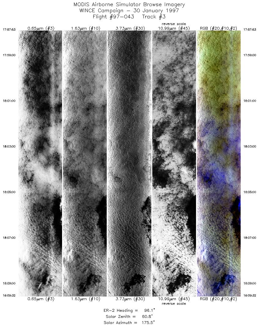
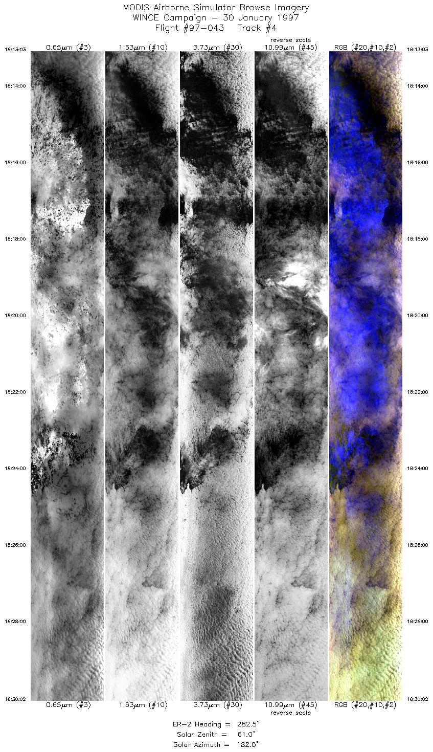
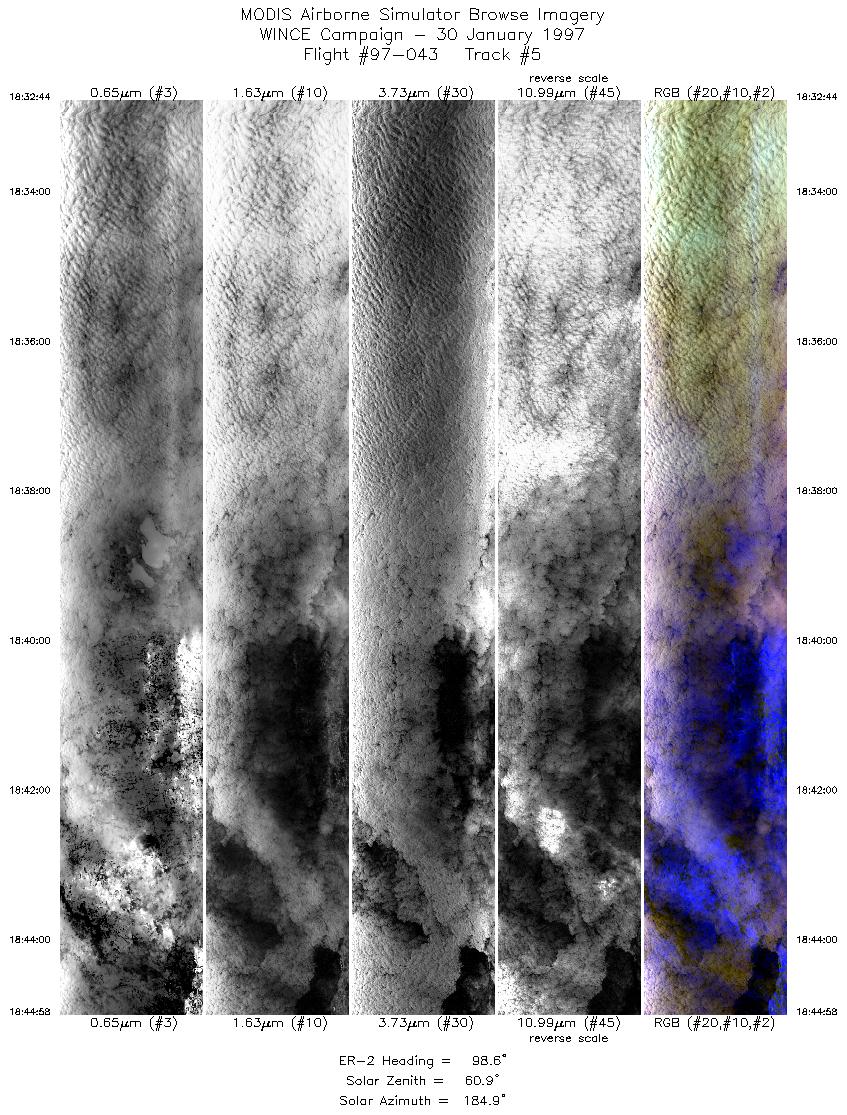
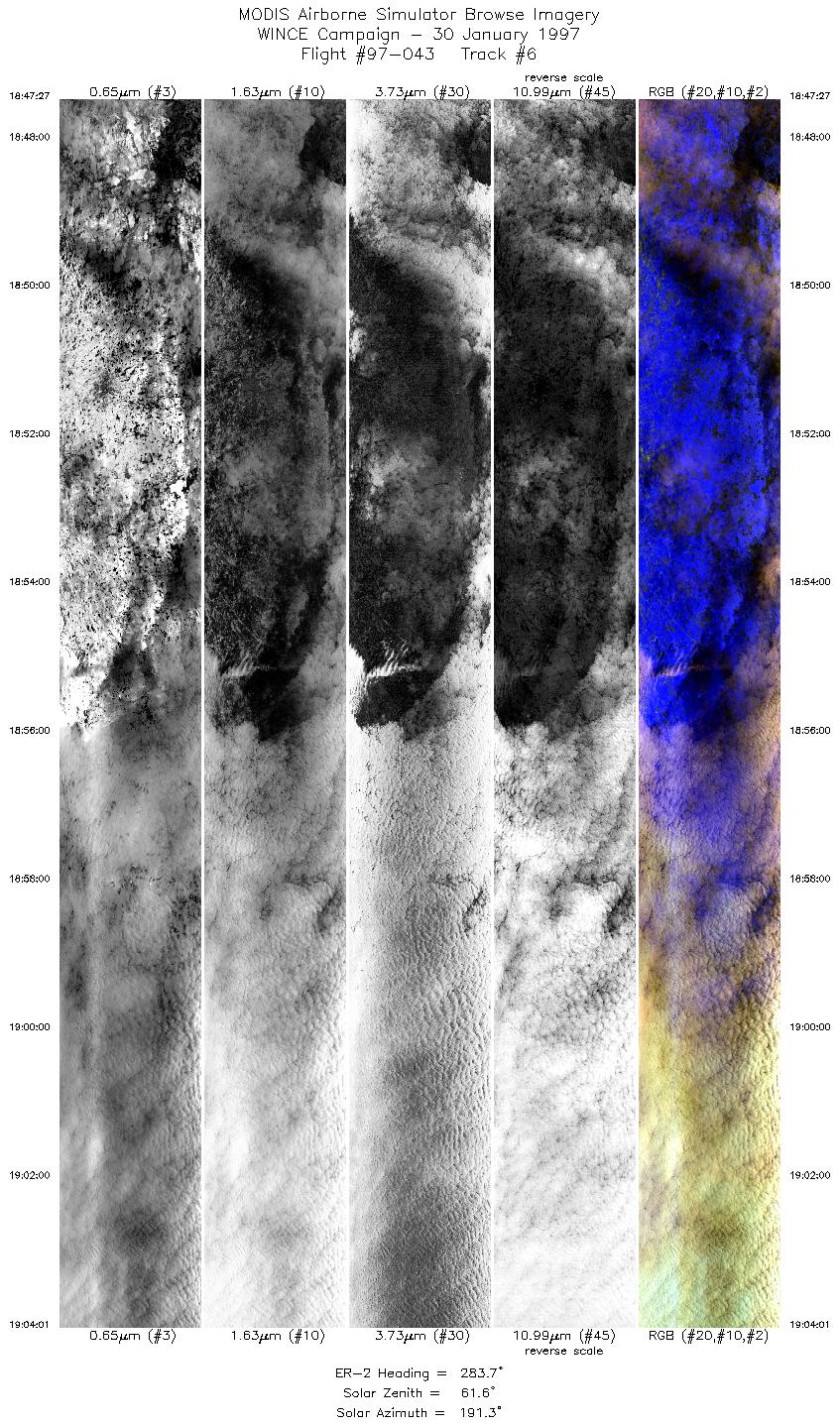
Track #05
Scanlines 1 - 4000


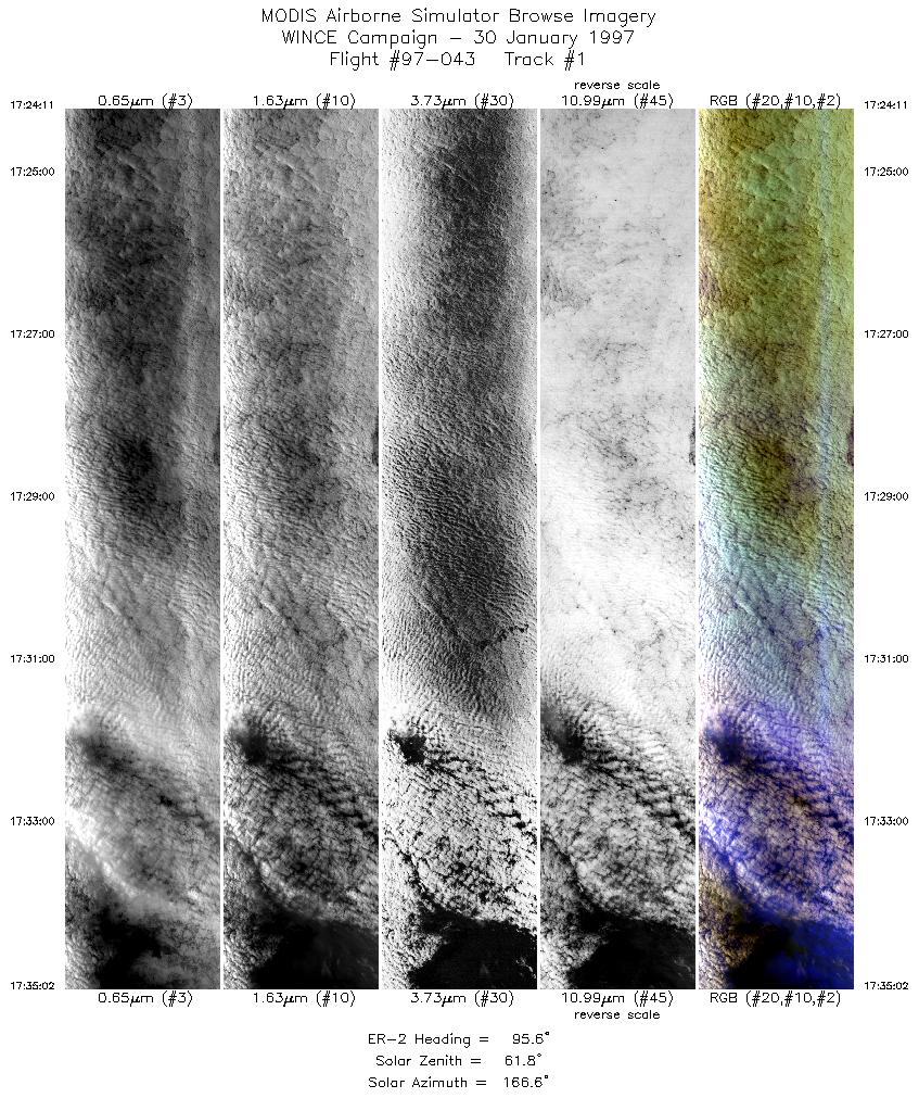
The flightpath begins over a cloudbank, which is obscuring the Wisconsin River, east of its confluence with the Mississippi River. Flightline proceeds eastward toward Madison, Wisconsin. The faint outlines of Mendota, Monona, Waubesa, and Kegonsa Lakes can be seen through the clouds.
R: 2.15 microns
G: 0.95 microns
B: 0.65 microns
|
|
Summary Information
Date: January 30, 1997
ER-2 Flight Number: 97-043
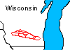
Location: Upper Midwest
Principal Investigator: Dr. Paul Menzel (Univ of Wisconsin)
Additional Sensors: HIS, CLS, MIR, 12" RC-10 (NC)
Mission Objectives: 2 hour data collection flight for HIS performance checkout. Overflight of SSEC instrumentation for cloud property comparisons.
Level-1B Processing Information
Level-1B Data processed by: Ames Research Center
Level-1B Data Version: #10
Level-1B Configuration: (sample file)
Calibration Type: Final
Calibration Version: WINCE 1.0
Temperature Adjustment: No
Status: Completed with final calibration
|
|
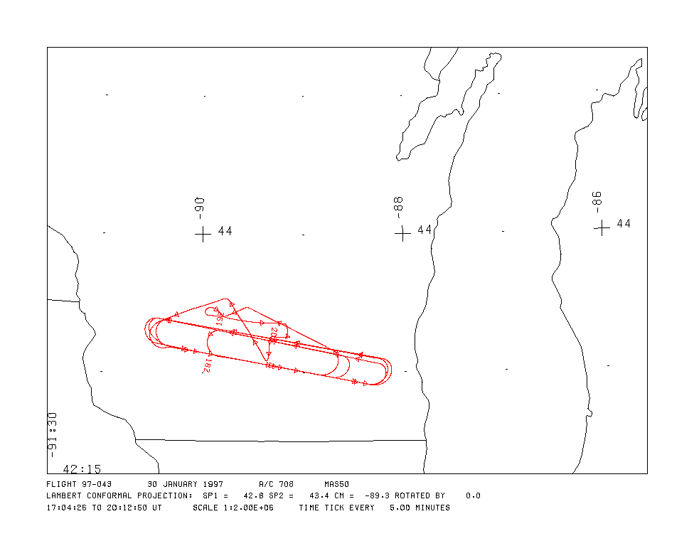
Flight Track Map

|
Level-1B Browse Imagery
Straight Line Flight Tracks: 9
Scanlines Processed: 40719
Solar Azimuth and Zenith Angles
|
Browse Images
|
Click on the Flight Track number to load images.
Lat/Lon ranges are for the BEG-END scanline nadir pixels.
|
Flight
Track |
Time_Span
(GMT) |
Heading
(Deg) |
Lat_Range
(Deg_N) |
Lon_Range
(Deg_W) |
Length
(Scanlines) |
Altitude
(Meters) |
| 1 |
17:24-17:35 |
96 |
43.17-42.92 |
90.19-88.37 |
4056 |
~20000 |
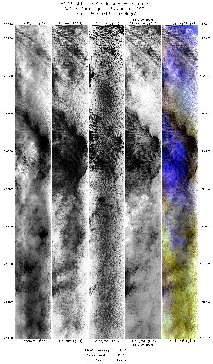
| 2 |
17:38-17:54 |
283 |
43.11-43.39 |
88.29-90.42 |
6232 |
~20000 |
| 3 |
17:57-18:09 |
96 |
43.19-42.91 |
90.30-88.34 |
4357 |
~20000 |
| 4 |
18:13-18:30 |
282 |
43.11-43.39 |
88.27-90.43 |
6352 |
~20000 |
| 5 |
18:32-18:44 |
99 |
43.21-42.92 |
90.43-88.36 |
4576 |
~20000 |
| 6 |
18:47-19:04 |
284 |
43.07-43.38 |
88.25-90.33 |
6196 |
~20000 |
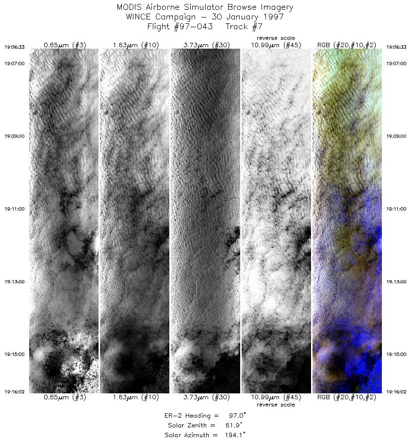
| 7 |
19:06-19:16 |
97 |
43.19-42.97 |
90.34-88.73 |
3549 |
~20000 |
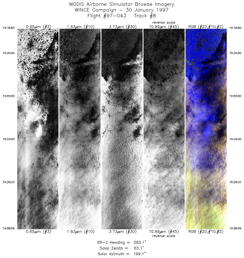
| 8 |
19:18-19:28 |
283 |
43.13-43.30 |
88.65-89.82 |
3486 |
~20000 |
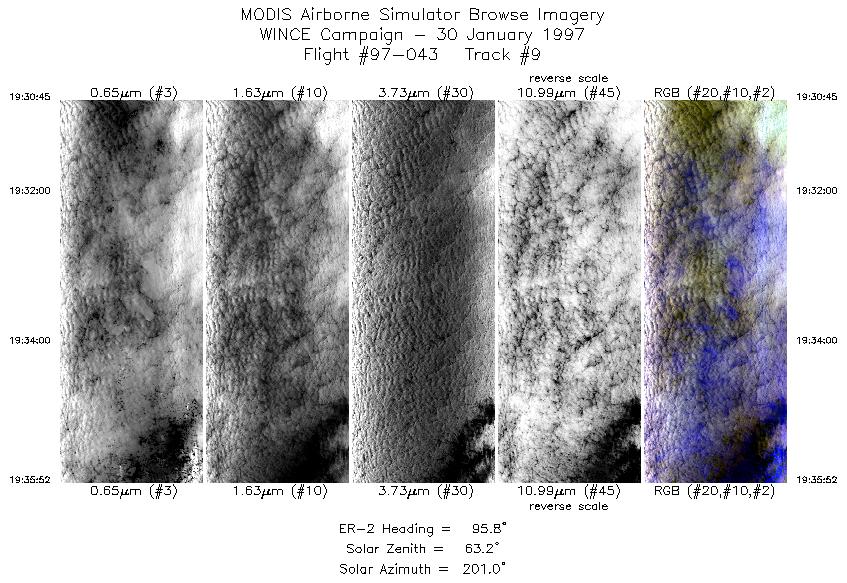
| 9 |
19:30-19:35 |
96 |
43.12-43.00 |
89.83-88.96 |
1915 |
~20000 |
|
Images 01 through 09 in sequence |
Level-1B Data Distribution
NASA GSFC Earth Sciences (GES) Data Center
NASA DAAC's
Additional Information
|
Take off at 1704 UTC. ER-2 landed at MSN at 2015UTC.
ER-2 left Madison and set up for racetrack pattern (oriented 280/100) with Madison positioned at eastern end of southern leg. Tracks
about 90nm long. 4 racetracks flown with SSEC overpasses at 1729, 1803, 1839, 1912 and 1933 UTC. Last overpass was a shortened
track just before descent. Sky conditions ranged from overcast to thin and patchy. All ground instrumentation operative during SSEC
overpass.
|
|
|
|
