
|
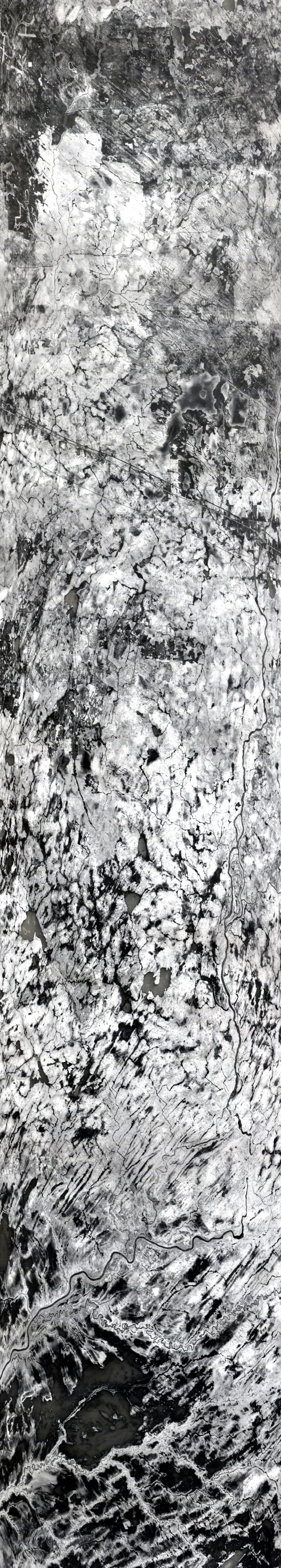
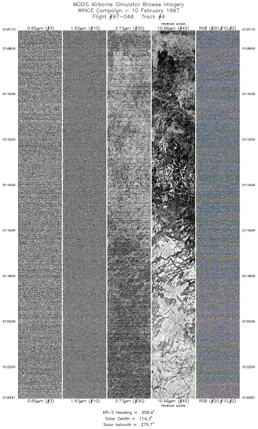
Sample Image

10 February 1997
Track #04
scanlines 1 - 4000


R: 10.50 microns
G: 11.00 microns
B: 12.00 microns
|
|
Summary Information
Date: February 10, 1997
ER-2 Flight Number: 97-048
Location: Upper Midwest and Canada (night flight)
Principal Investigator: Dr. Paul Menzel (Univ of Wisconsin)
Additional Sensors: HIS, CLS, MIR, APS
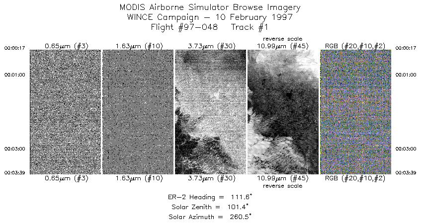
Mission Objectives: Overfly thin high cloud and broken low cloud for testing MODIS nighttime cloud detection using 4 micron MAS channels. Underfly the
ADEOS instrument (0405 UTC) with IMG turned on for comparisons to the HIS instrument in uniform background conditions.
Level-1B Processing Information
Level-1B Data processed by: Ames Research Center
Level-1B Data Version: #10
Level-1B Configuration: (sample file)
Calibration Type: Final
Calibration Version: WINCE 1.0
Temperature Adjustment: No
Status: Completed with final calibration
|
|
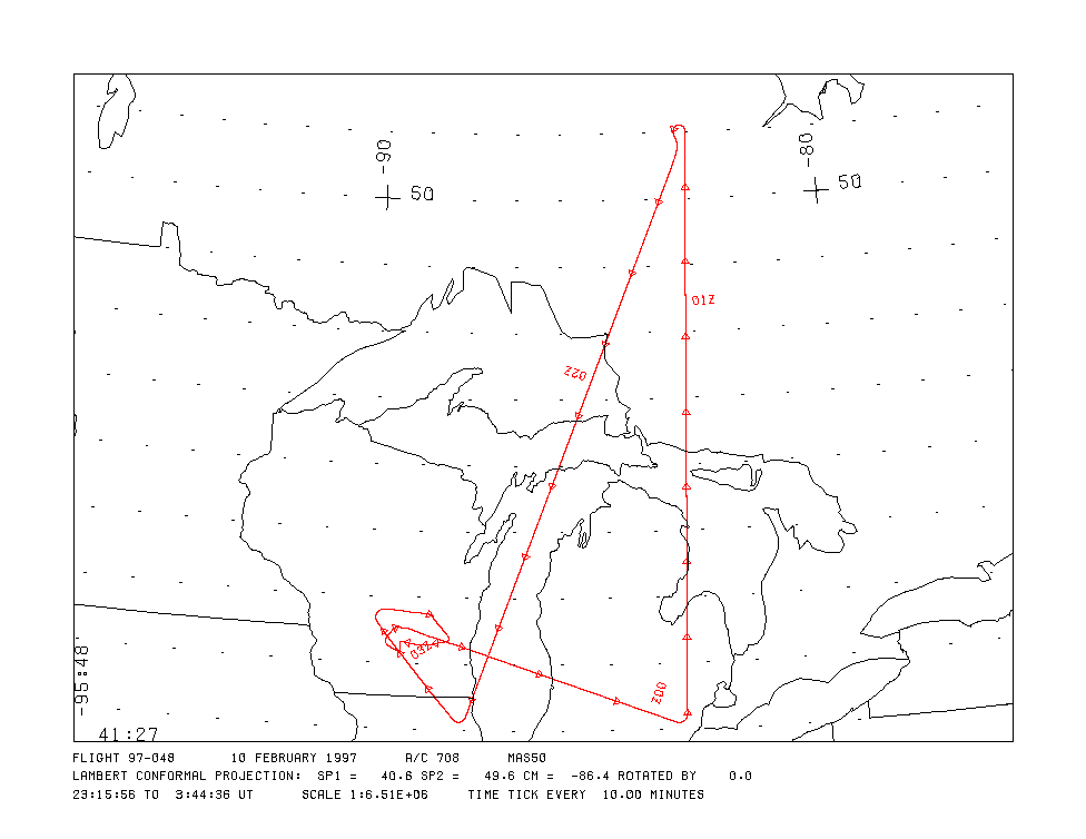
Flight Track Map

|
Level-1B Browse Imagery
Straight Line Flight Tracks: 9
Scanlines Processed: 63328
Solar Azimuth and Zenith Angles
|
Browse Images
|
Click on the Flight Track number to load images.
Lat/Lon ranges are for the BEG-END scanline nadir pixels.
|
Flight
Track |
Time_Span
(GMT) |
Heading
(Deg) |
Lat_Range
(Deg_N) |
Lon_Range
(Deg_W) |
Length
(Scanlines) |
Altitude
(Meters) |
| 1 |
00:00-00:03 |
112 |
42.26-42.11 |
84.20-83.69 |
1256 |
~20000 |
| 2 |
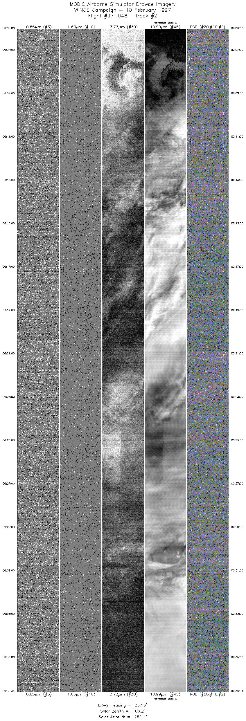
00:06-00:36 |
358 |
42.26-45.74 |
83.45-83.29 |
11421 |
~20000 |
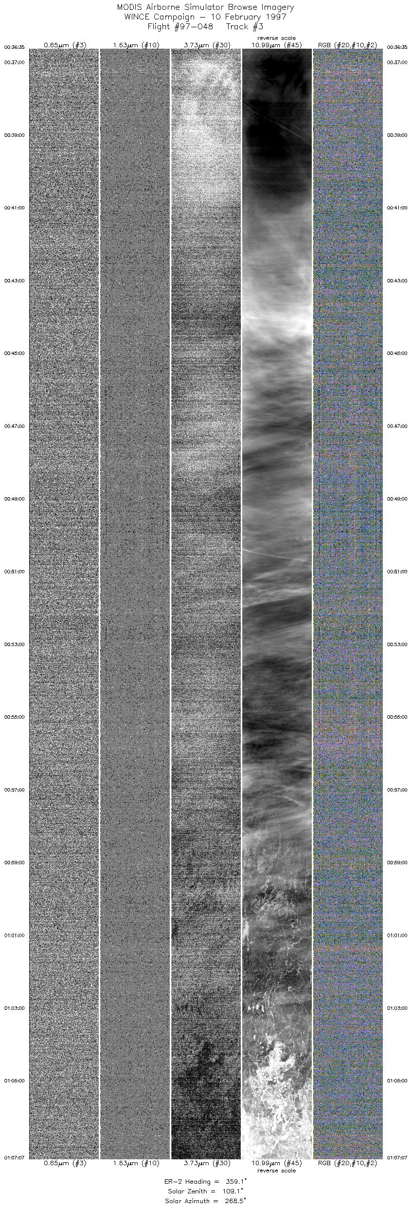
| 3 |
00:36-01:07 |
359 |
45.74-49.20 |
83.29-83.11 |
11408 |
~20000 |
| 4 |
01:07-01:23 |
358 |
49.21-51.01 |
83.11-83.00 |
6046 |
~20000 |
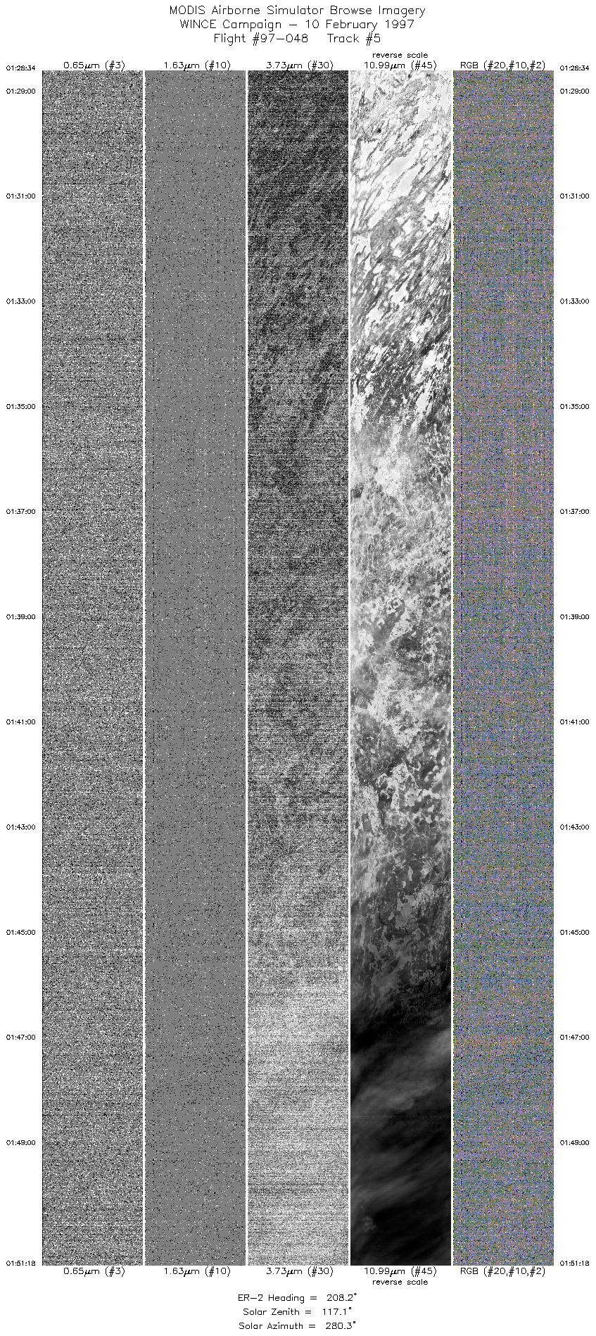
| 5 |
01:28-01:51 |
208 |
50.71-48.31 |
83.21-84.72 |
8492 |
~20000 |
| 6 |
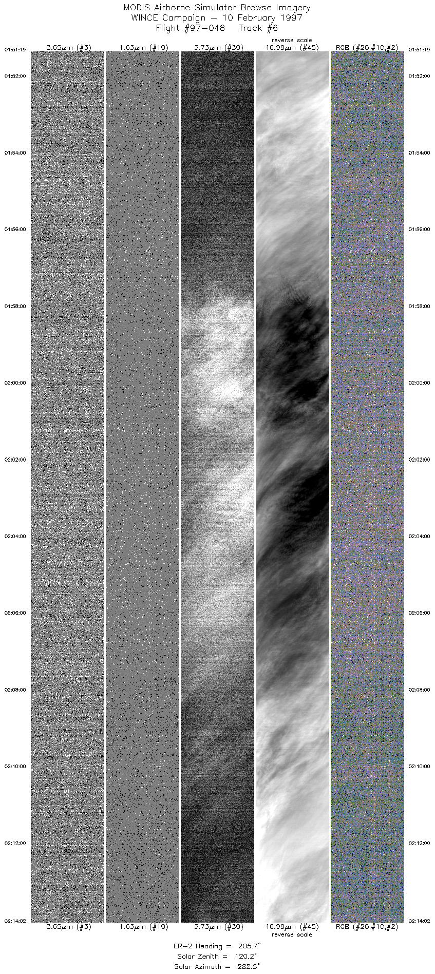
01:51-02:14 |
206 |
48.30-45.87 |
84.72-86.11 |
8486 |
~20000 |
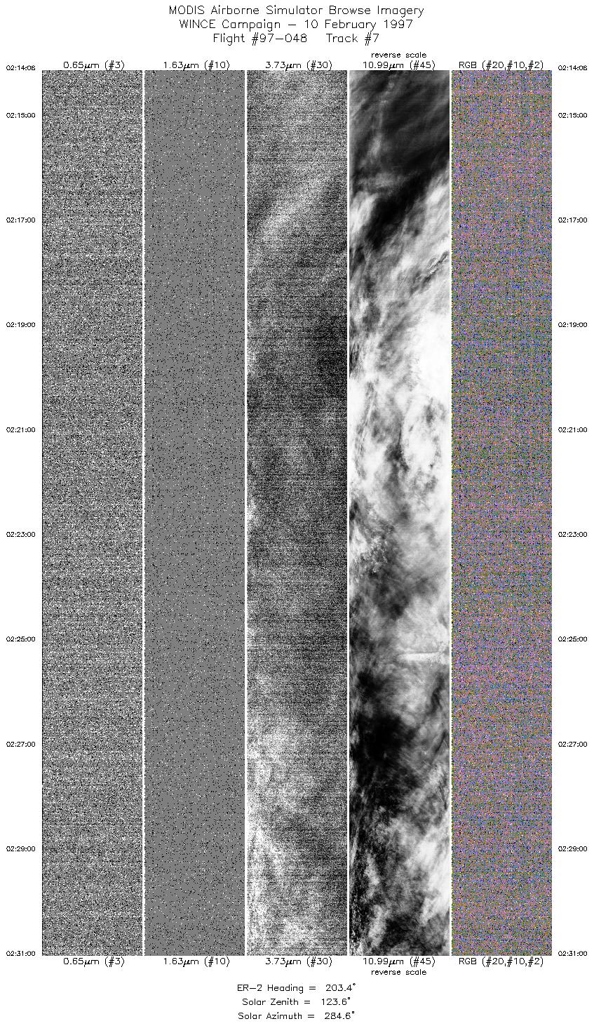
| 7 |
02:14-02:31 |
203 |
45.88-44.06 |
86.10-87.06 |
6314 |
~20000 |
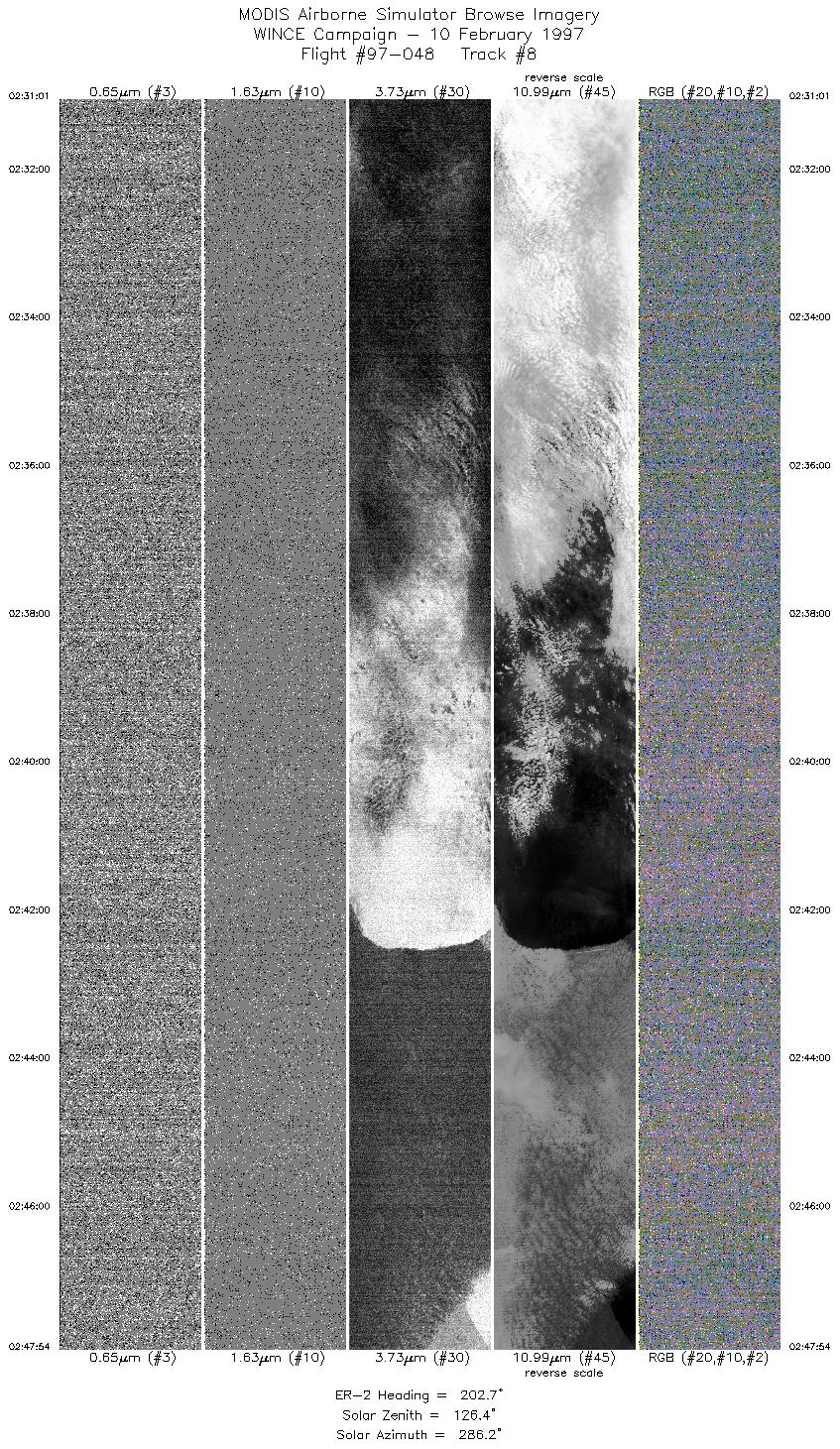
| 8 |
02:31-02:47 |
203 |
44.05-42.22 |
87.06-87.96 |
6307 |
~20000 |
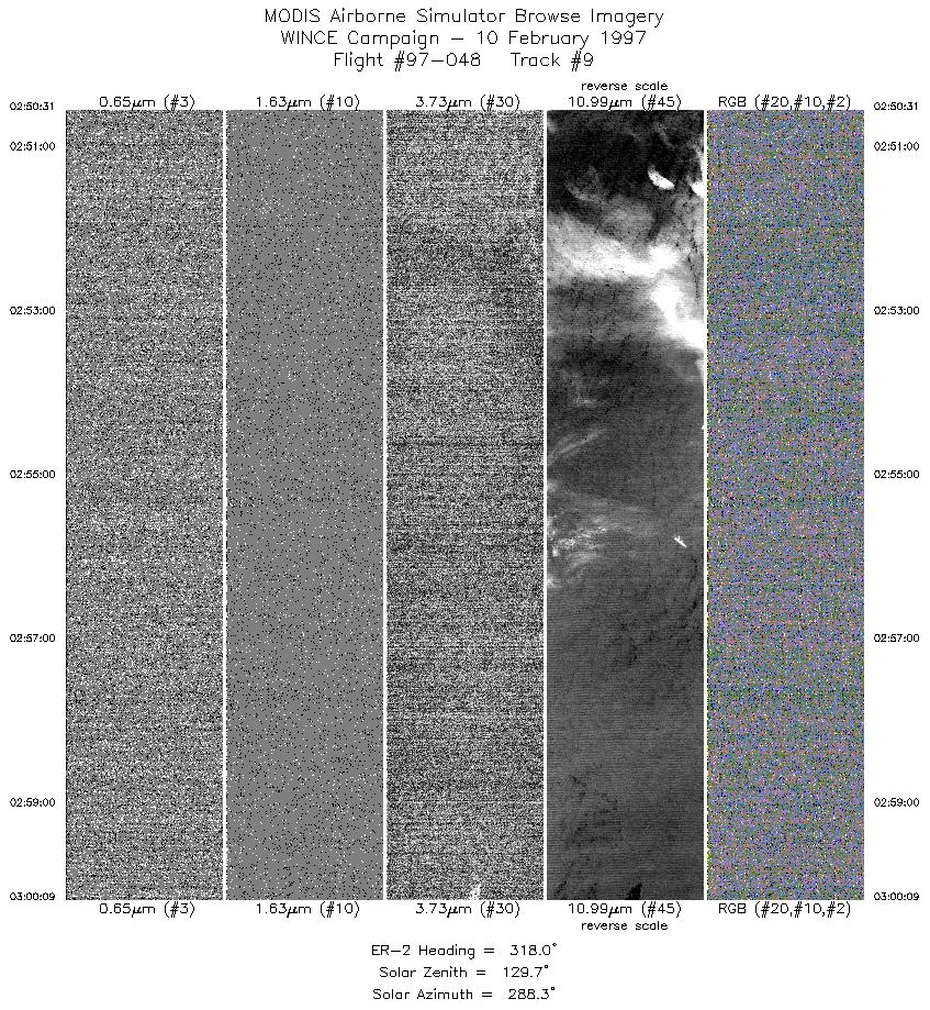
| 9 |
02:50-03:00 |
318 |
42.19-43.01 |
88.25-89.17 |
3598 |
~20000 |
|
Images 01 through 09 in sequence |
Level-1B Data Distribution
NASA GSFC Earth Sciences (GES) Data Center
NASA DAAC's
Additional Information
|
Take-off was delayed on the apron until 2320 UTC. ER-2 landing at 0345 (early because of deteriorating local weather conditions).
ER-2 flew from Madison to western end of Lake Superior, with MAS recording data on the 2nd half of that leg. Sky conditions reported
by pilot to be clear to high cirrus. Then flew northward to S. Canada (51n, 83w), overflying bkn cloud of varying thicknesses. Pilot
reported he didn't see much high cirrus (probably because of night conditions) but CLS data show abundant thick to thin high cloud. ER-2
then flew to Chicago, again flying across a lot of bkn thin to thick high cloud, likely with low undercast. At Chicago, pilot decided to break
off flight due to reducing ceiling/visibility in Madison with snow. This precluded an ADEOS underflight.
|
|
|
|