Fire Influence on Regional to Global Environments Experiment - Air Quality
Dates: 2 - 21 August, 2019
Location: Western USA
eMAS Principal Investigator: Dr. Steven Platnick (NASA GSFC)
Configuration: 38 Channel
Additional Sensors: AirMSPI / AVIRIS / SHIS / CPL / GCAS / NAST-I / HyTES / DC-8 Payload
Objective: The overarching objective of FIREX-AQ is to provide measurements of trace gas and aerosol
emissions for wildfires and prescribed fires in great detail, relate them to fuel and fire
conditions at the point of emission, characterize the conditions relating to plume rise, follow
plumes downwind to understand chemical transformation and air quality impacts, and assess the
efficacy of satellite detections for estimating the emissions from sampled fires.
|
|
Processing Information
Flights Processed: 10
Total Flight Tracks: 168
Total Scanlines: 866802
Level-1B Version: 3.0
Calibration Type: Final
Calibration Version: 3.0
Temperature Adjustment: None
Status: Level-1B Data in HDF format is available upon request
|
eMAS Spectral Information
Spectral Band Configuration
Spectral Response Function Table
|
Level-2 Data Distribution
Level 2 Cloud Retrieval Imagery
|
Overpass Information
Wildfires
Satellites
|
|
|
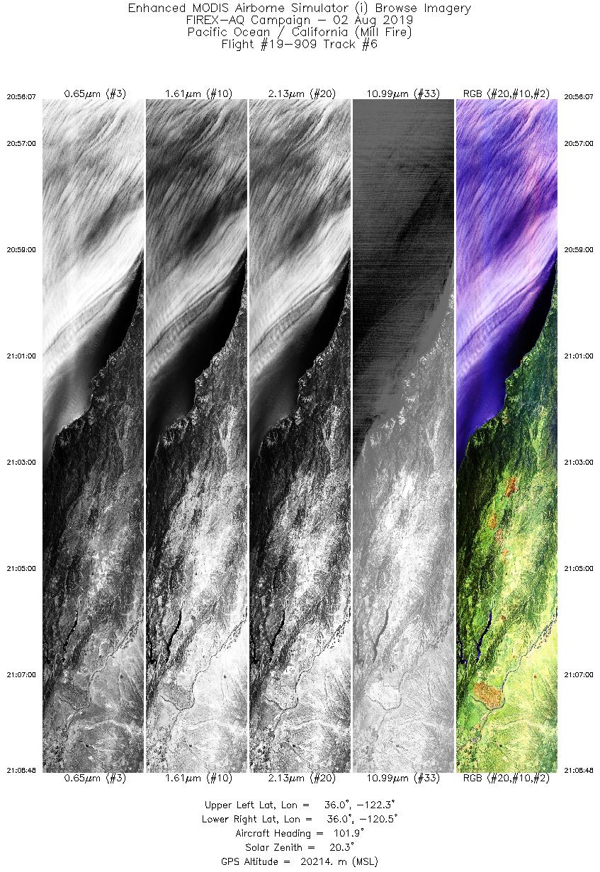
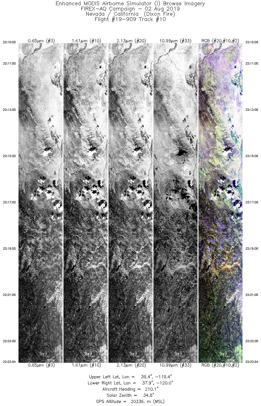
Wildfire Imagery
|
| Wildfire |
Date |
Time (UTC) |
Flight: Track |
Lat |
Lon |
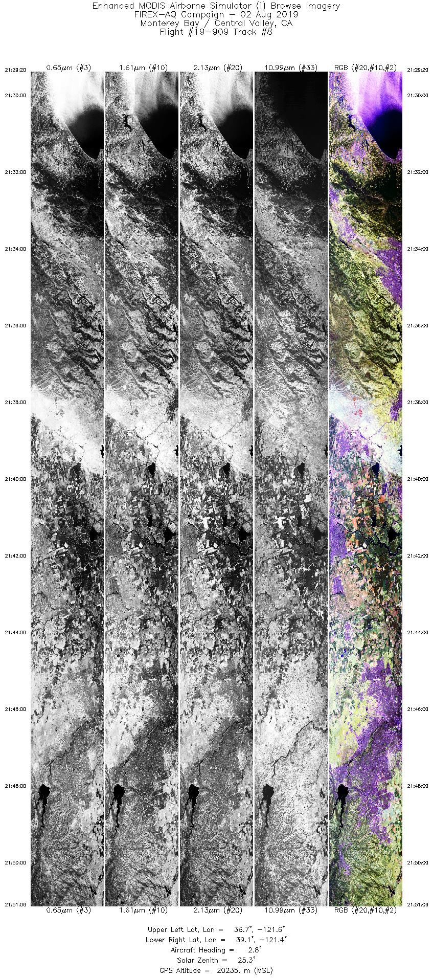
| Dixon |
8/2/2019 |
19:53 |
19-909: 02 |
38.567 |
-119.739 |
| Mill |
8/2/2019 |
21:02 |
19-909: 06 |
36.009 |
-121.467 |
| Mill |
8/2/2019 |
21:22 |
19-909: 07 |
36.009 |
-121.467 |
| Dixon |
8/2/2019 |
22:18 |
19-909: 10 |
38.567 |
-119.739 |
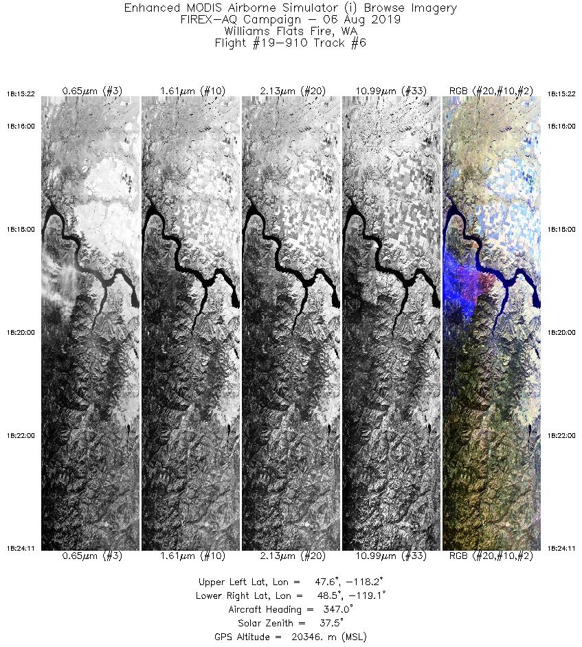
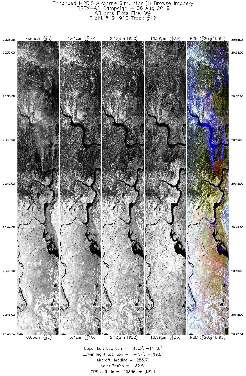
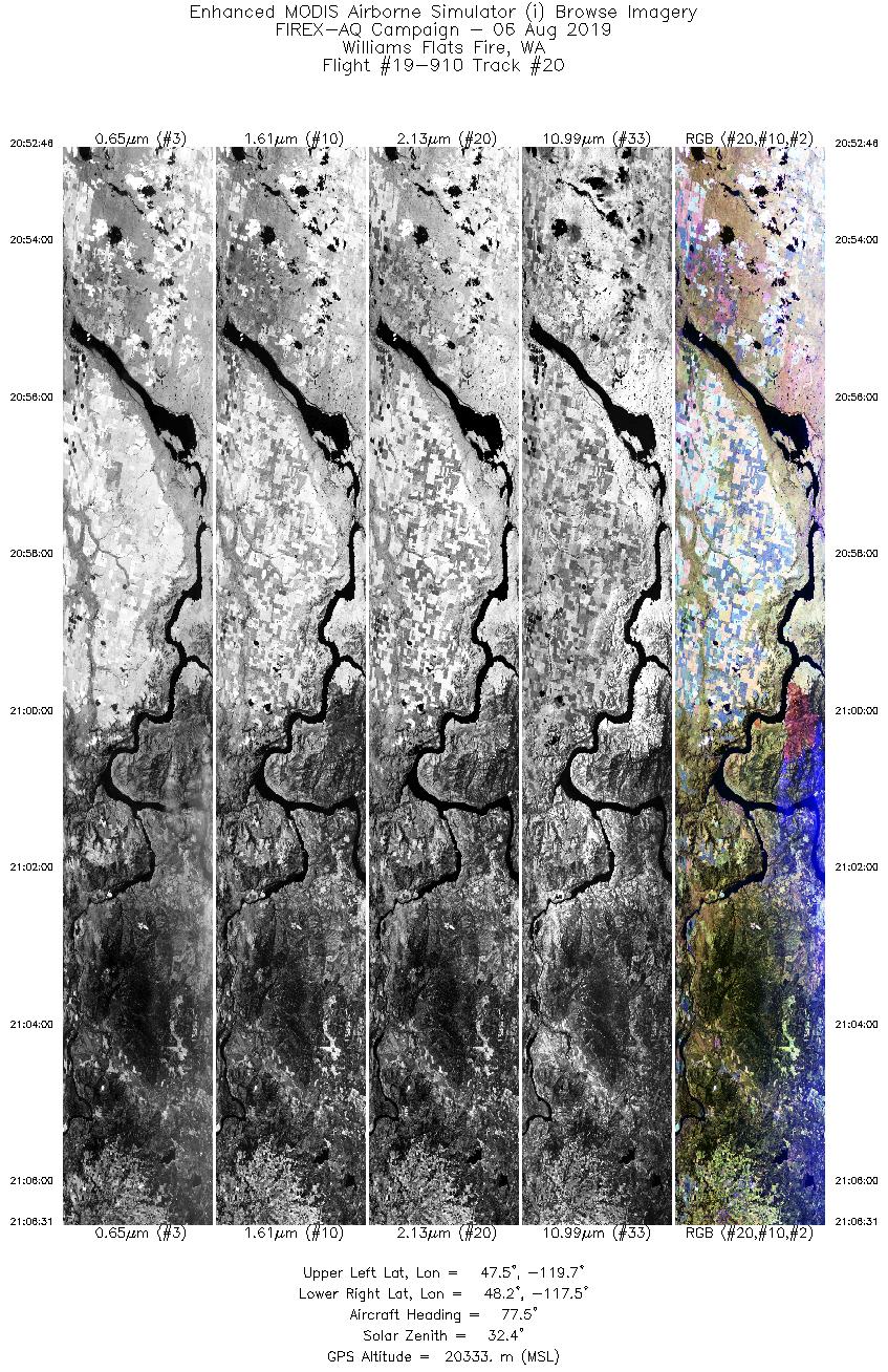
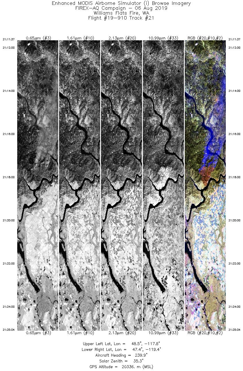
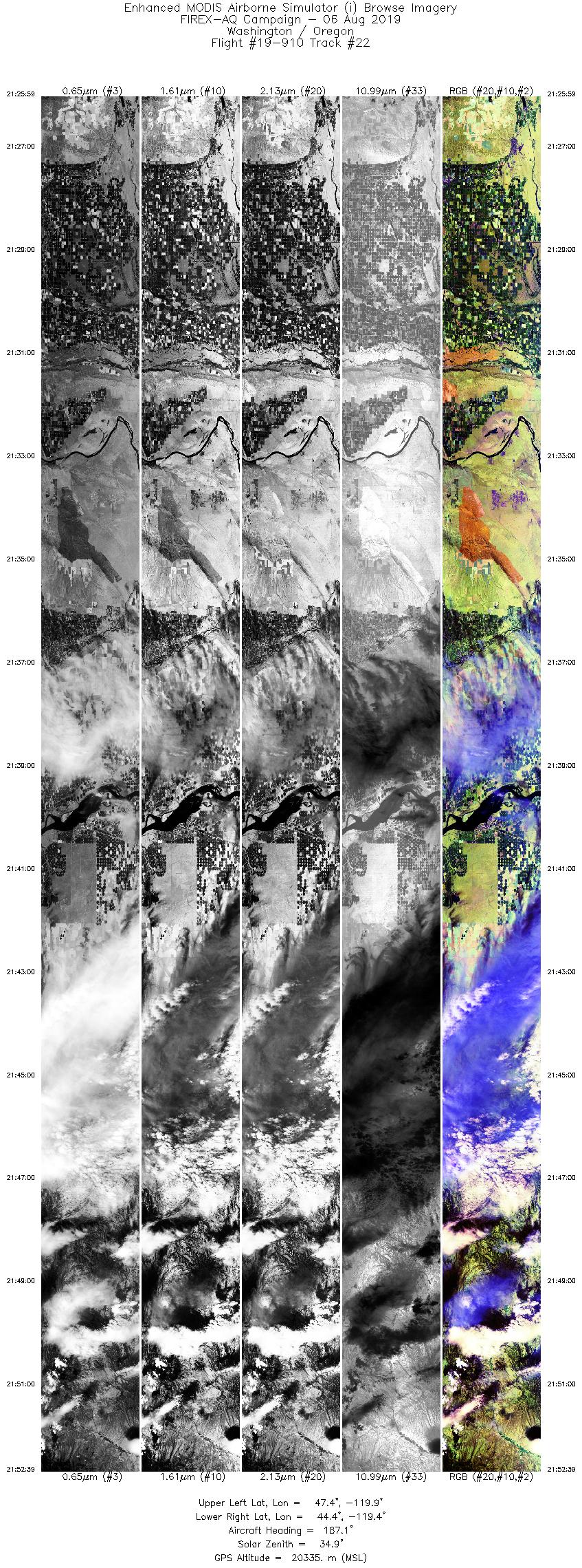
| Williams Flat |
8/6/2019 |
18:19 |
19-910: 06 |
47.93917 |
-118.61833 |
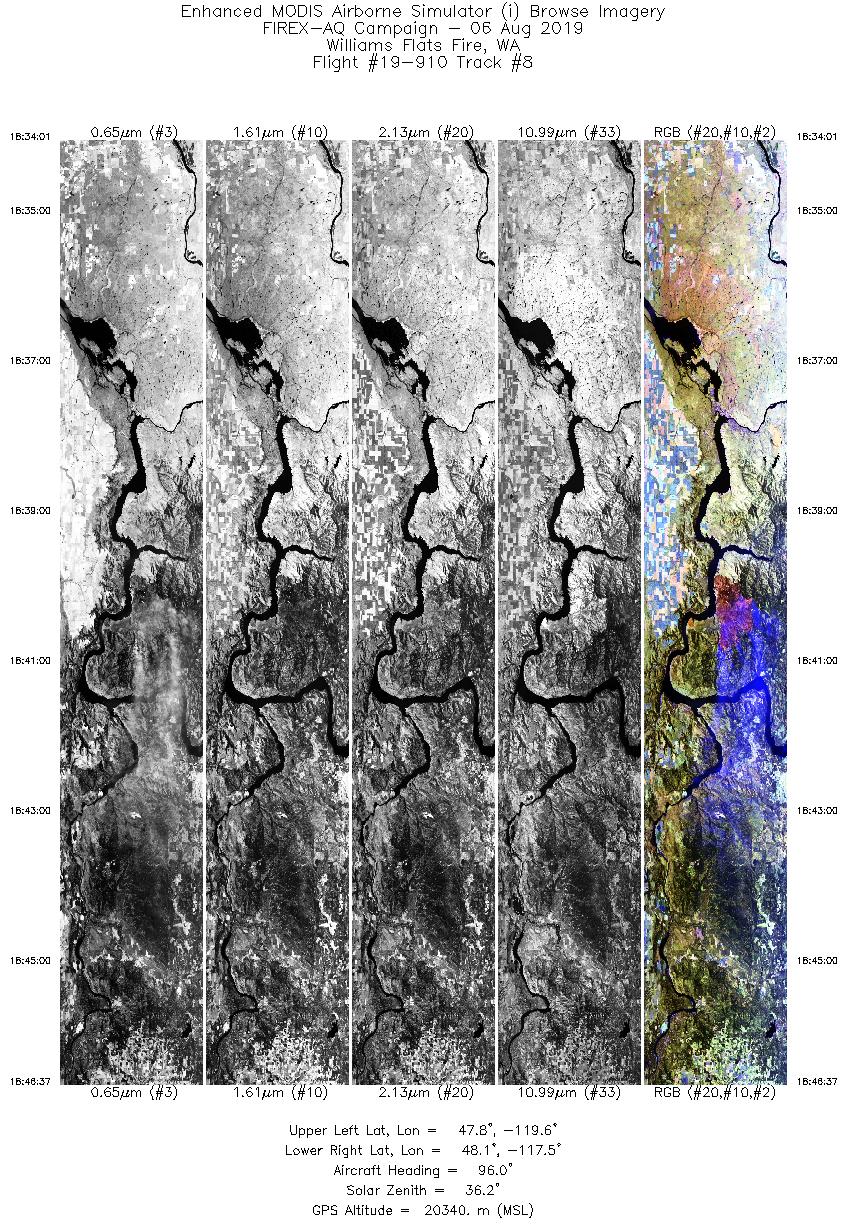
| Williams Flat |
8/6/2019 |
18:40 |
19-910: 08 |
47.93917 |
-118.61833 |
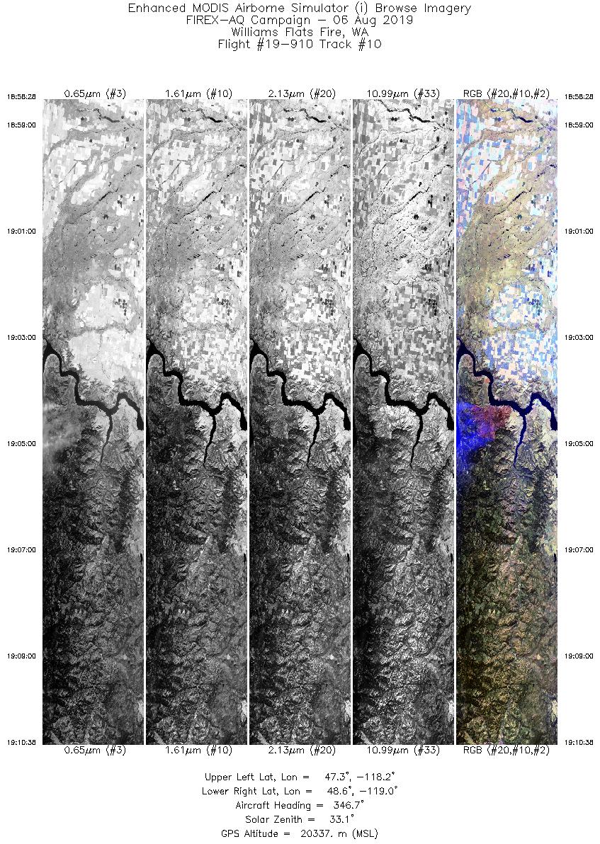
| Williams Flat |
8/6/2019 |
19:04 |
19-910: 10 |
47.93917 |
-118.61833 |
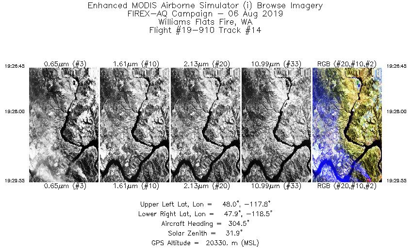
| Williams Flat |
8/6/2019 |
19:30 |
19-910: 14 |
47.93917 |
-118.61833 |
| Williams Flat |
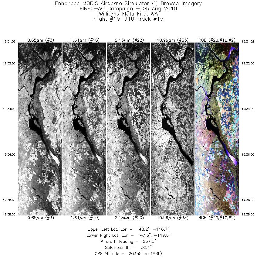
8/6/2019 |
19:30 |
19-910: 15 |
47.93917 |
-118.61833 |
| Williams Flat |
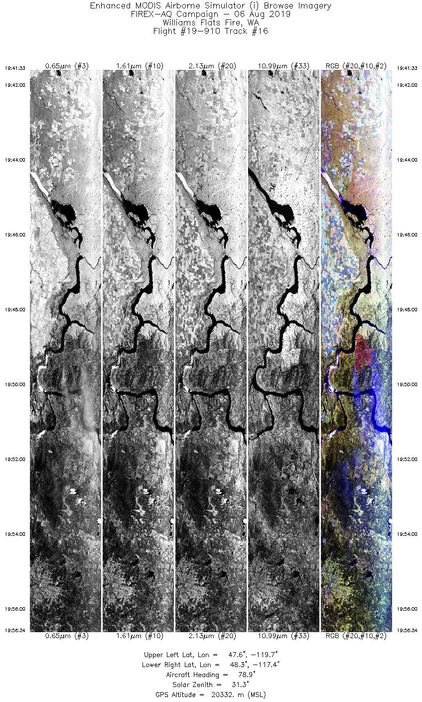
8/6/2019 |
19:49 |
19-910: 16 |
47.93917 |
-118.61833 |
| Williams Flat |
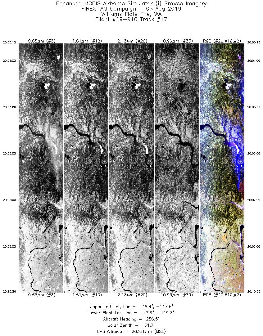
8/6/2019 |
20:06 |
19-910: 17 |
47.93917 |
-118.61833 |
| Williams Flat |
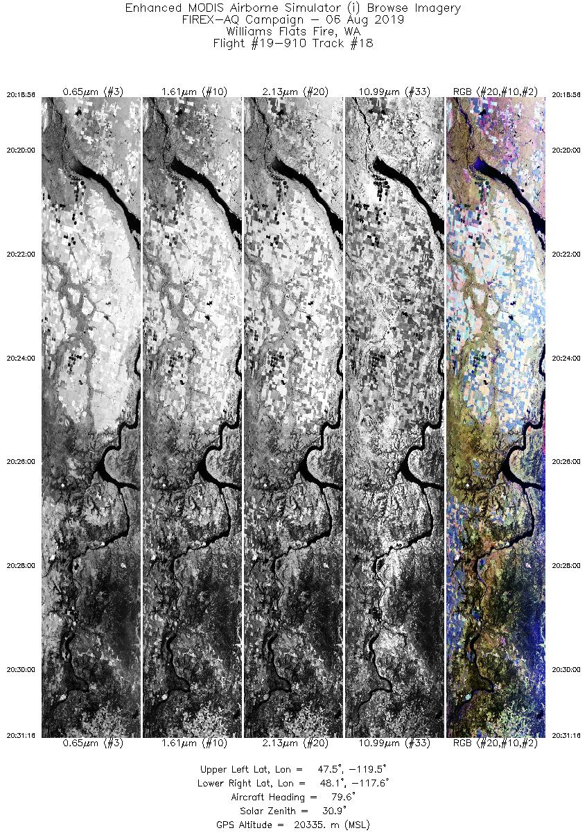
8/6/2019 |
20:26 |
19-910: 18 |
47.93917 |
-118.61833 |
| Williams Flat |
8/6/2019 |
20:42 |
19-910: 19 |
47.93917 |
-118.61833 |
| Williams Flat |
8/6/2019 |
21:00 |
19-910: 20 |
47.93917 |
-118.61833 |
| Williams Flat |
8/6/2019 |
21:18 |
19-910: 21 |
47.93917 |
-118.61833 |
| Williams Flat |
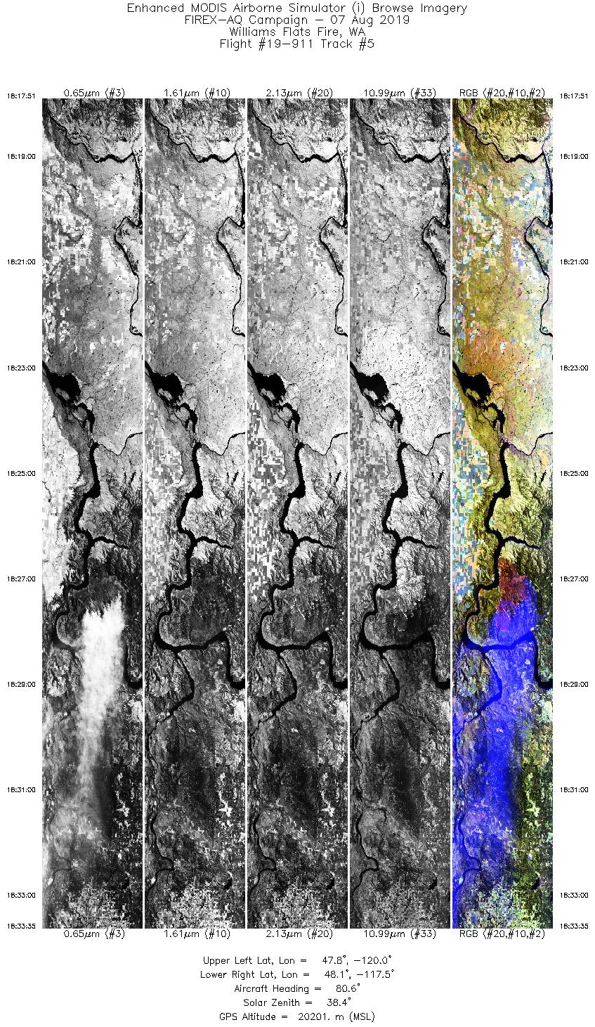
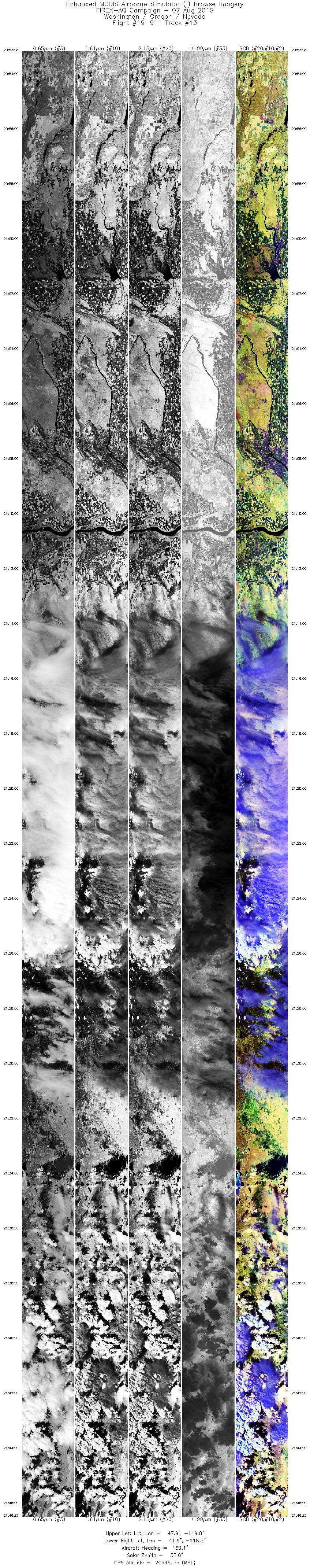
8/7/2019 |
18:27 |
19-911: 05 |
47.93917 |
-118.61833 |
| Williams Flat |
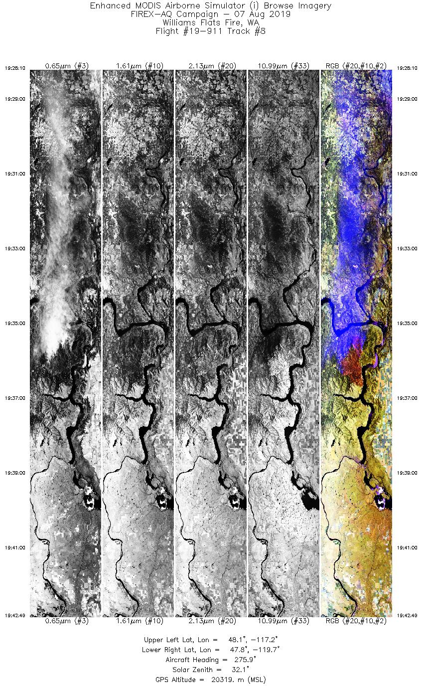
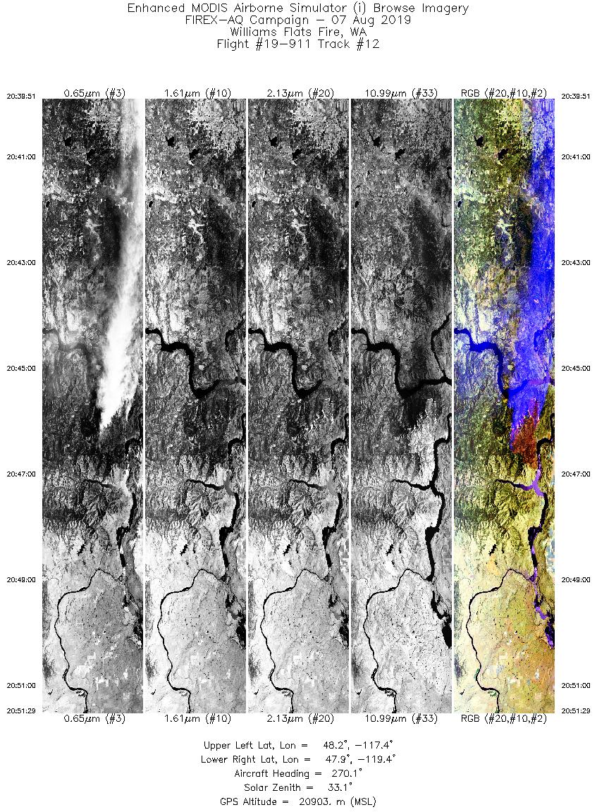
8/7/2019 |
19:36 |
19-911: 08 |
47.93917 |
-118.61833 |
| Williams Flat |
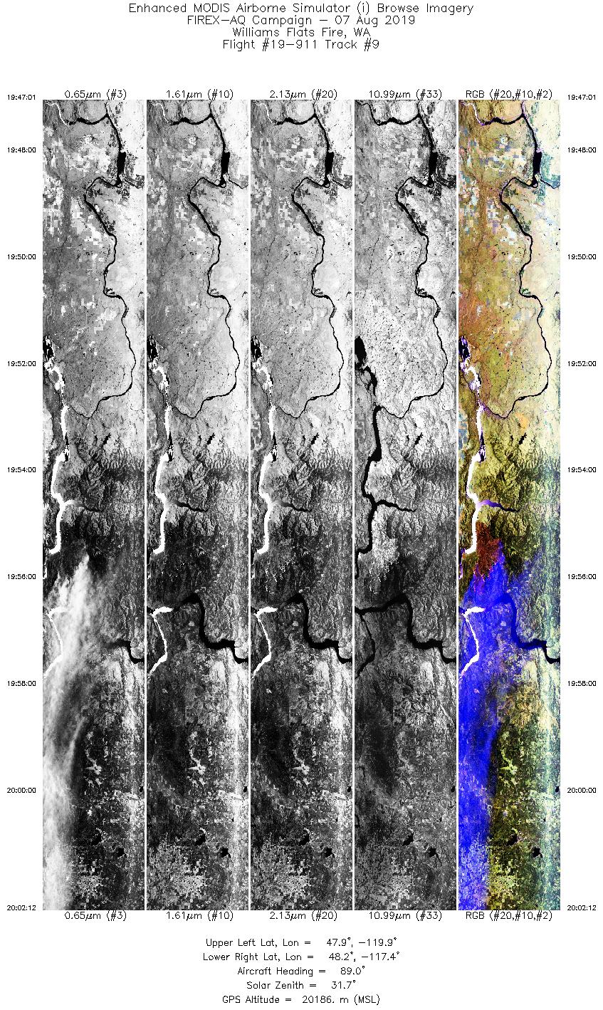
8/7/2019 |
19:55 |
19-911: 09 |
47.93917 |
-118.61833 |
| Williams Flat |
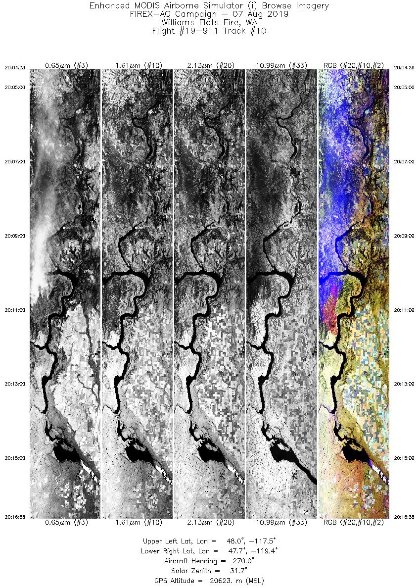
8/7/2019 |
20:11 |
19-911: 10 |
47.93917 |
-118.61833 |
| Williams Flat |
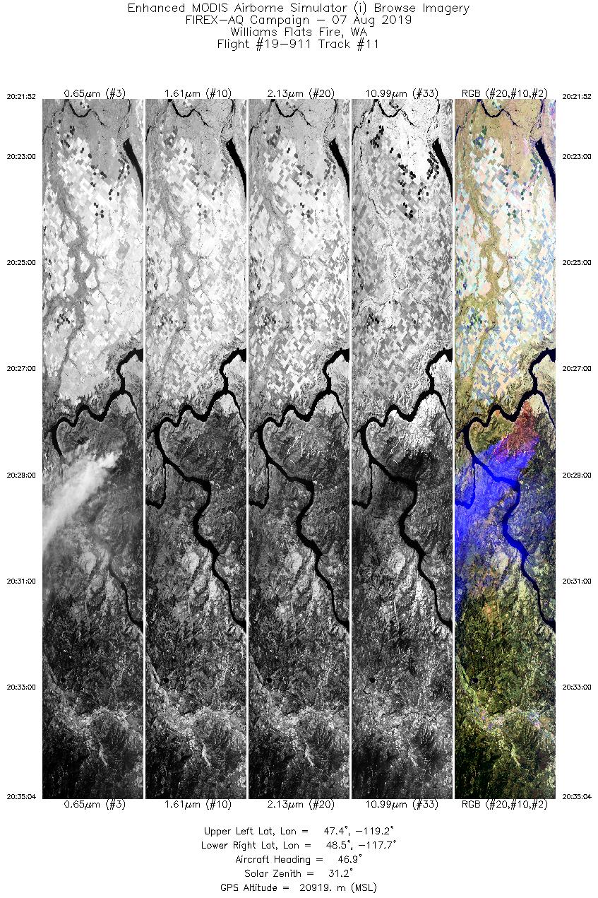
8/7/2019 |
20:28 |
19-911: 11 |
47.93917 |
-118.61833 |
| Williams Flat |
8/7/2019 |
20:46 |
19-911: 12 |
47.93917 |
-118.61833 |
| Williams Flat |
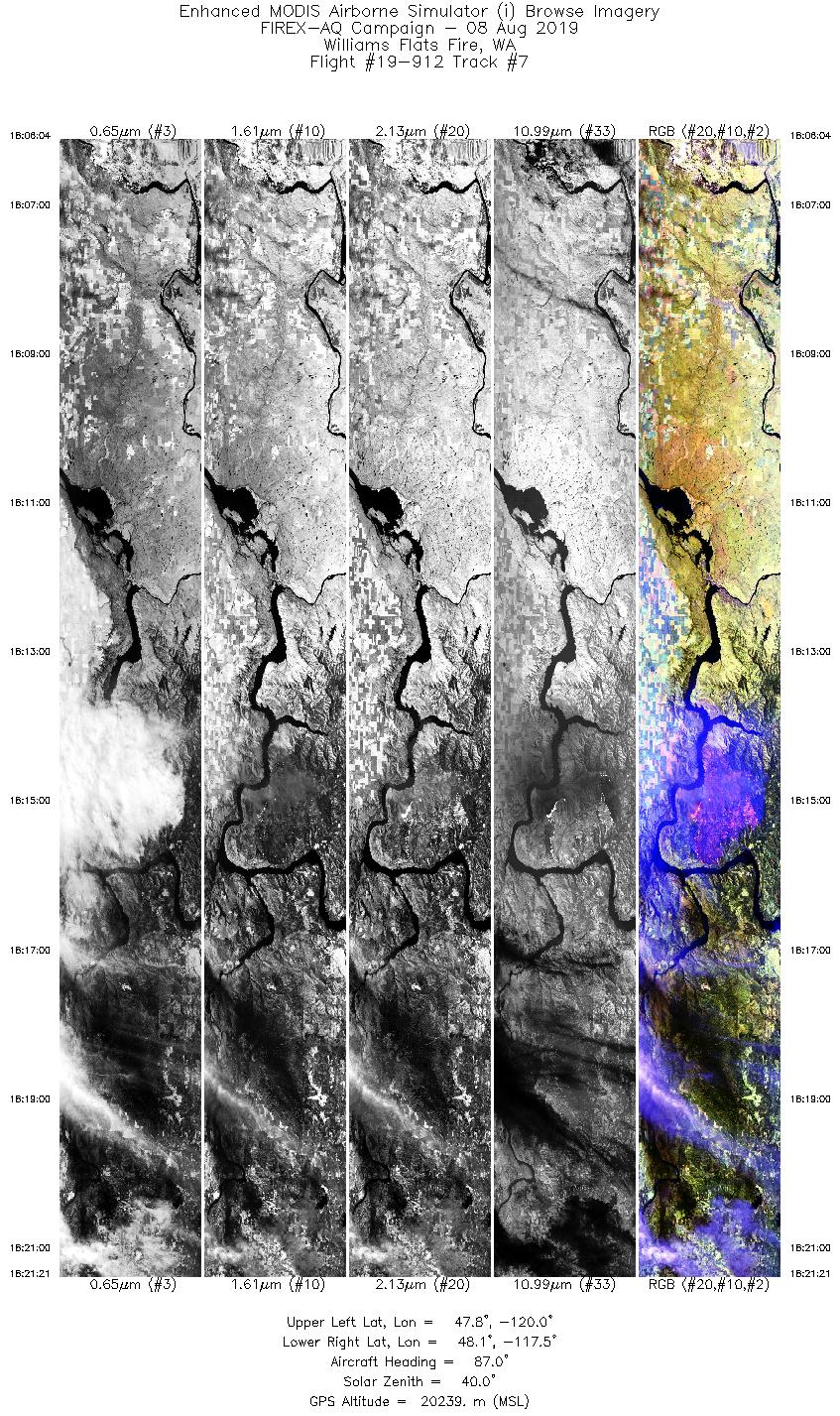
8/8/2019 |
18:15 |
19-912: 07 |
47.93917 |
-118.61833 |
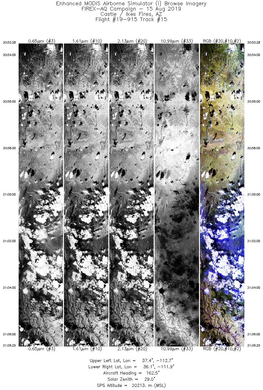
| Castle Fire |
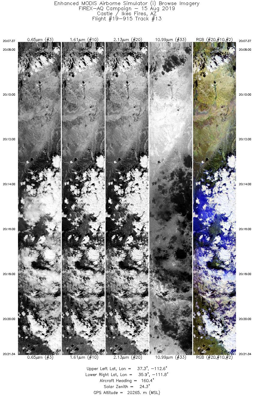
8/15/2019 |
20:15 |
19-915: 13 |
36.53116 |
-112.22810 |
| Castle Fire |
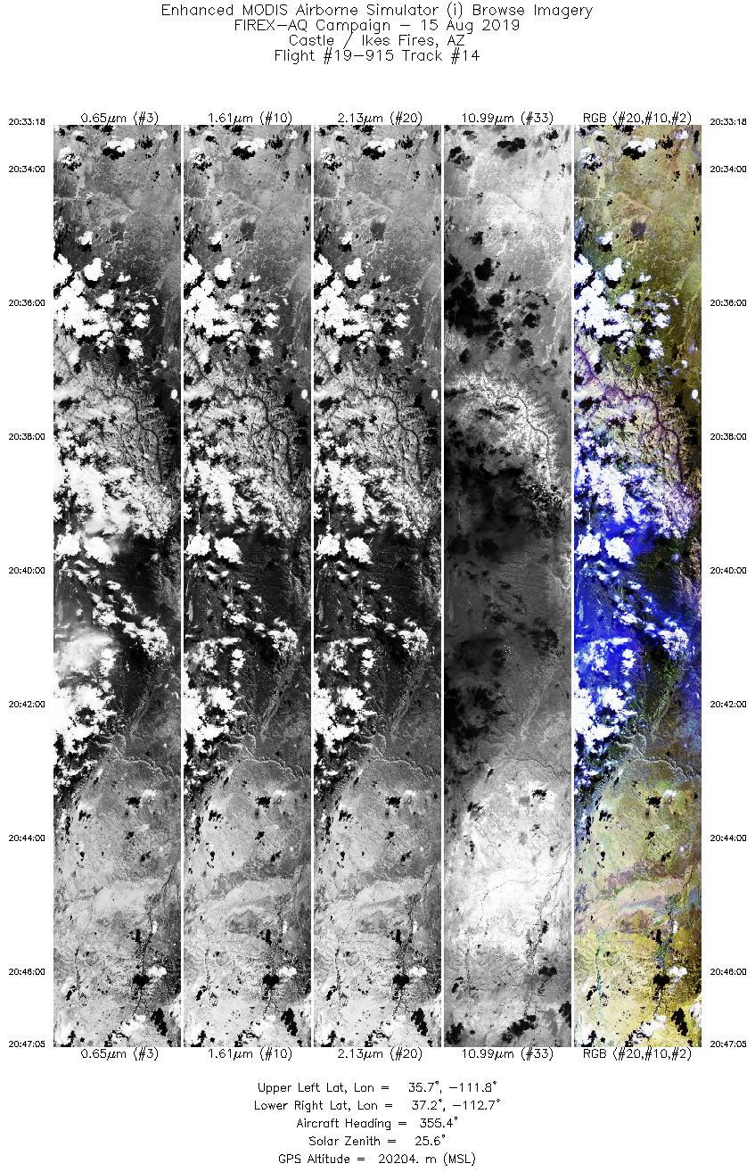
8/15/2019 |
20:39 |
19-915: 14 |
36.53116 |
-112.22810 |
| Castle Fire |
8/15/2019 |
21:02 |
19-915: 15 |
36.53116 |
-112.22810 |
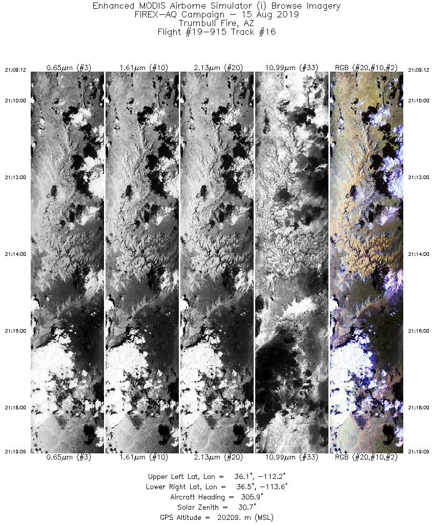
| Trumbull Fire |
8/15/2019 |
21:17 |
19-915: 16 |
36.41200 |
-113.14100 |
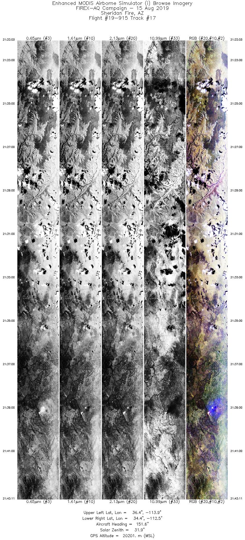
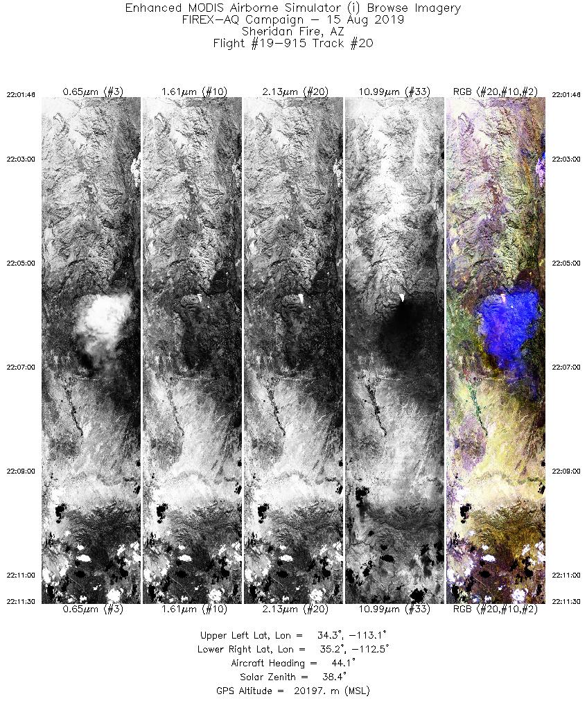
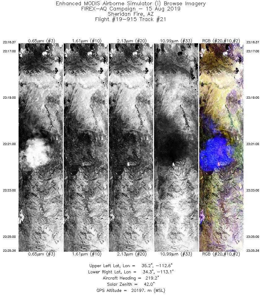
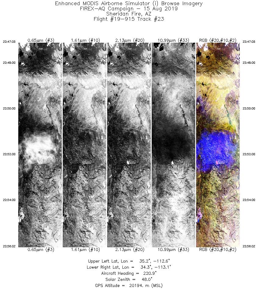
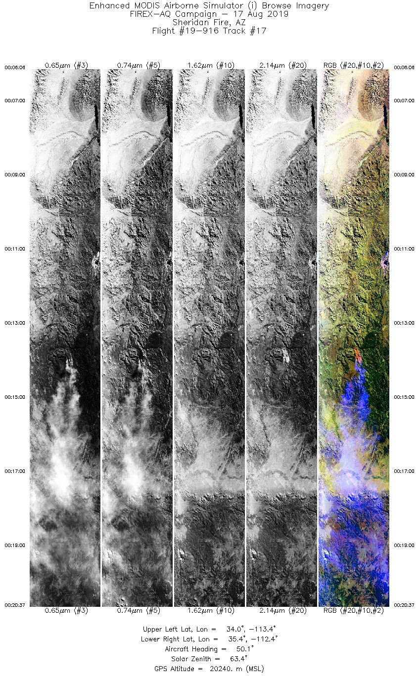
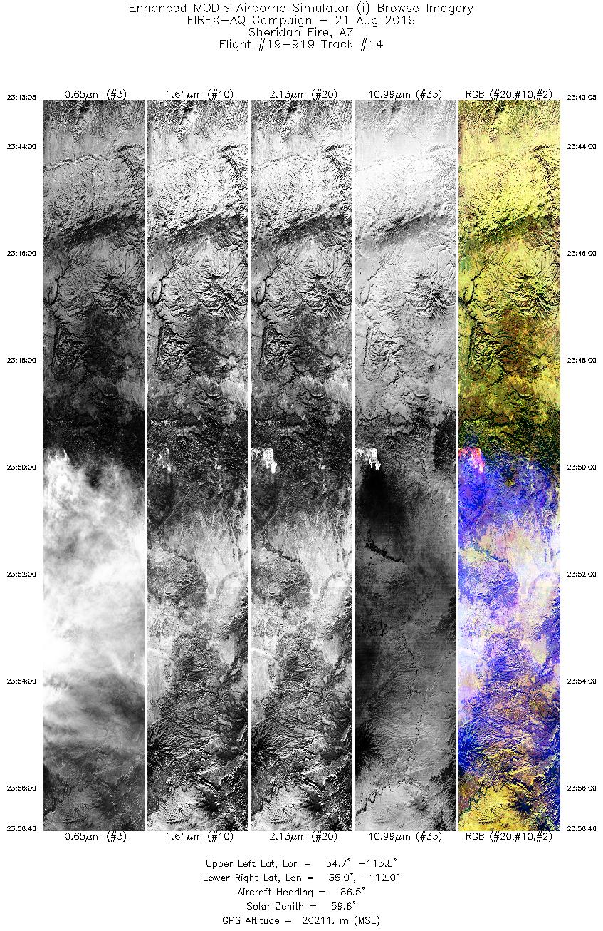
| Sheridan Fire |
8/15/2019 |
21:39 |
19-915: 17 |
34.67778 |
-112.89030 |
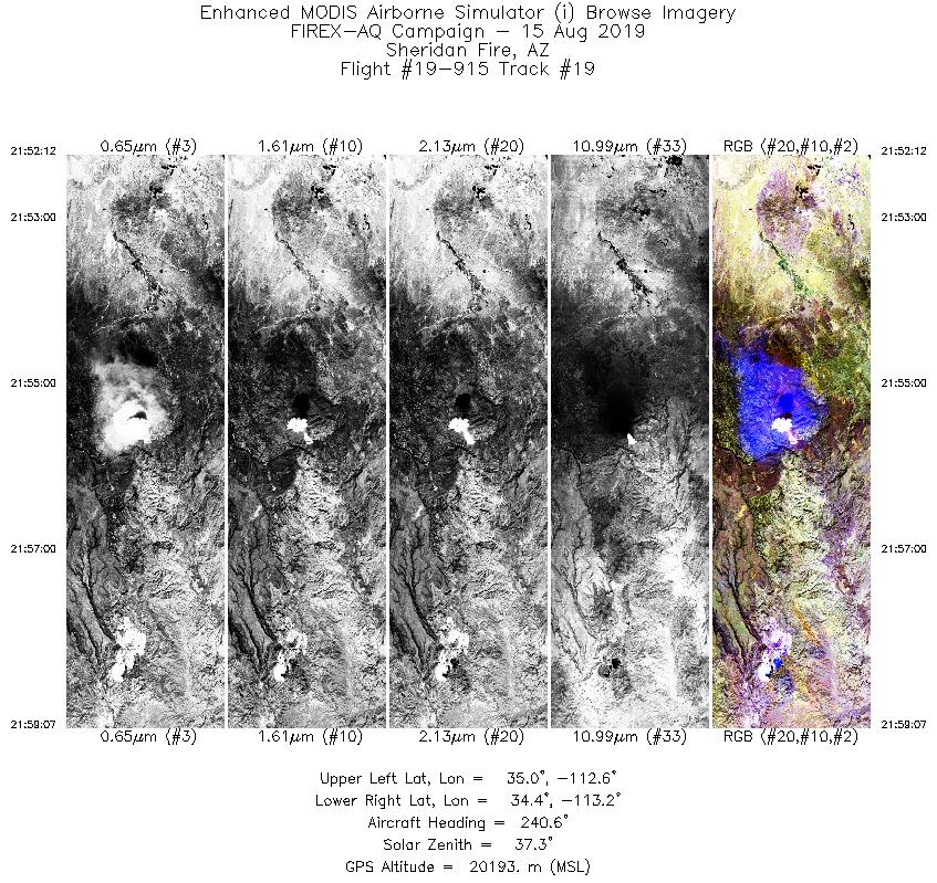
| Sheridan Fire |
8/15/2019 |
21:56 |
19-915: 19 |
34.67778 |
-112.89030 |
| Sheridan Fire |
8/15/2019 |
22:06 |
19-915: 20 |
34.67778 |
-112.89030 |
| Sheridan Fire |
8/15/2019 |
22:22 |
19-915: 21 |
34.67778 |
-112.89030 |
| Sheridan Fire |
8/15/2019 |
22:36 |
19-915: 22 |
34.67778 |
-112.89030 |
| Sheridan Fire |
8/15/2019 |
22:52 |
19-915: 23 |
34.67778 |
-112.89030 |
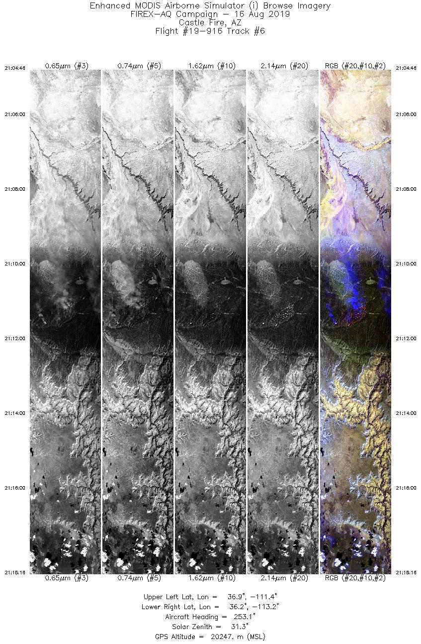
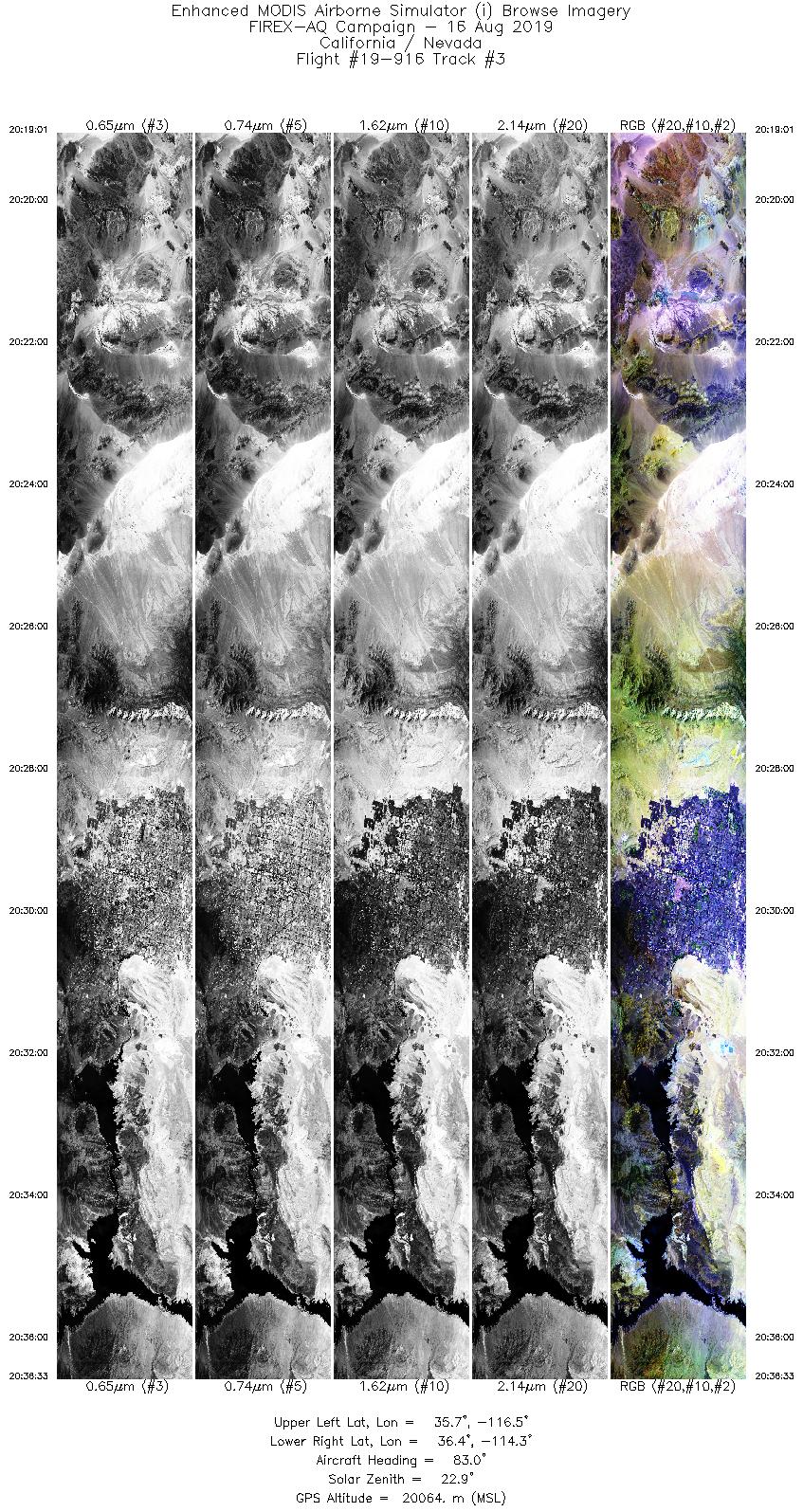
| Castle Fire |
8/16/2019 |
20:53 |
19-916: 05 |
36.53116 |
-112.22810 |
| Castle Fire |
8/16/2019 |
21:11 |
19-916: 06 |
36.53116 |
-112.22810 |
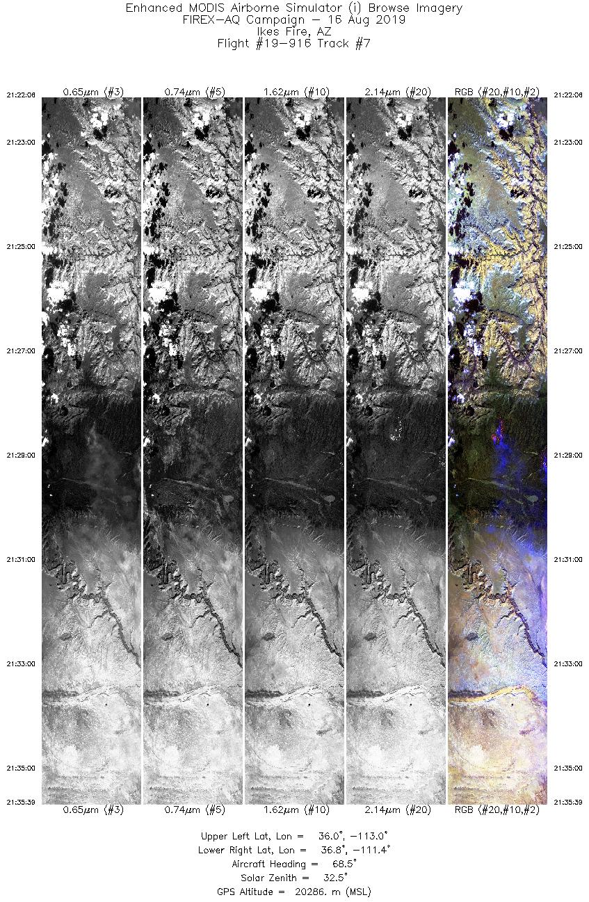
| Ikes Fire |
8/16/2019 |
21:29 |
19-916: 07 |
36.34793 |
-112.28560 |
| Castle Fire |
8/16/2019 |
21:45 |
19-916: 08 |
36.53116 |
-112.22810 |
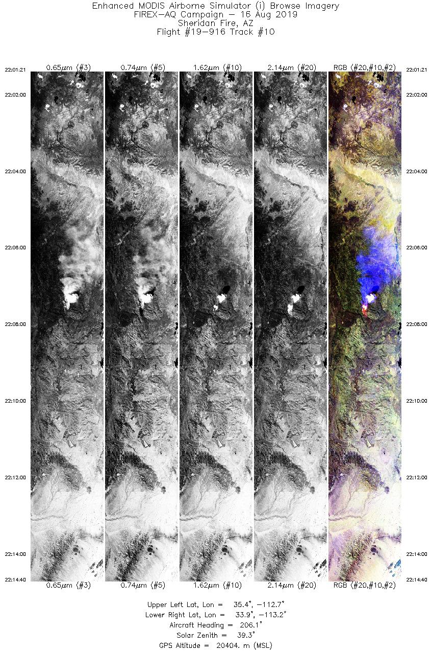
| Sheridan Fire |
8/16/2019 |
22:08 |
19-916: 10 |
34.67778 |
-112.89030 |
| Sheridan Fire |
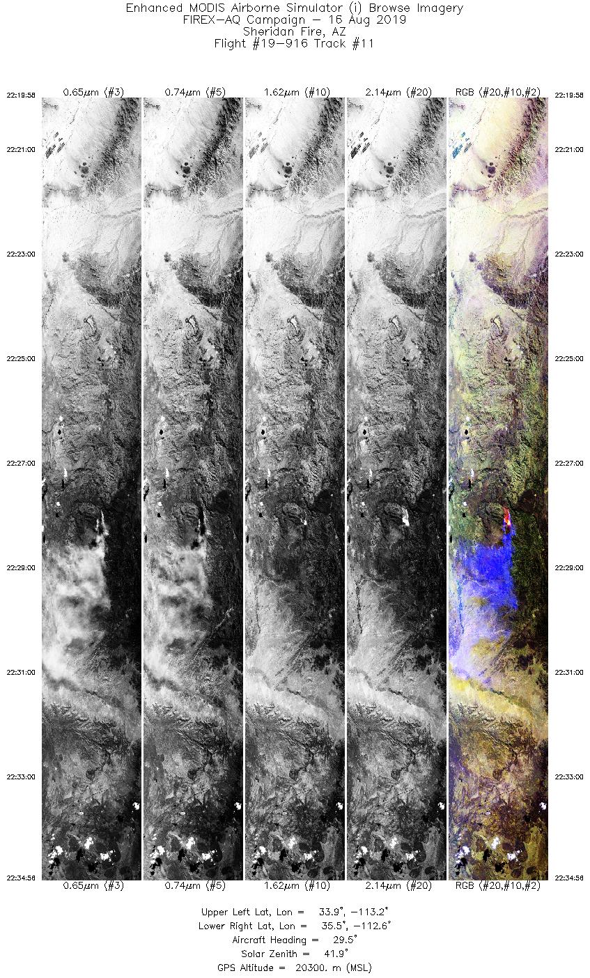
8/16/2019 |
22:28 |
19-916: 11 |
34.67778 |
-112.89030 |
| Sheridan Fire |
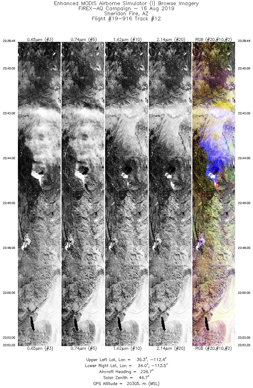
8/16/2019 |
22:45 |
19-916: 12 |
34.67778 |
-112.89030 |
| Sheridan Fire |
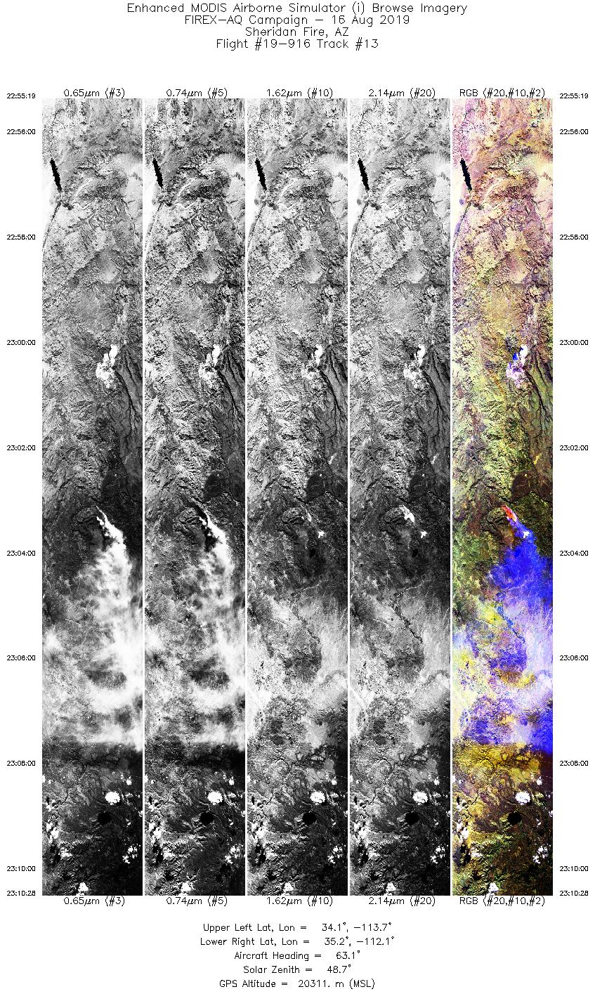
8/16/2019 |
23:03 |
19-916: 13 |
34.67778 |
-112.89030 |
| Sheridan Fire |
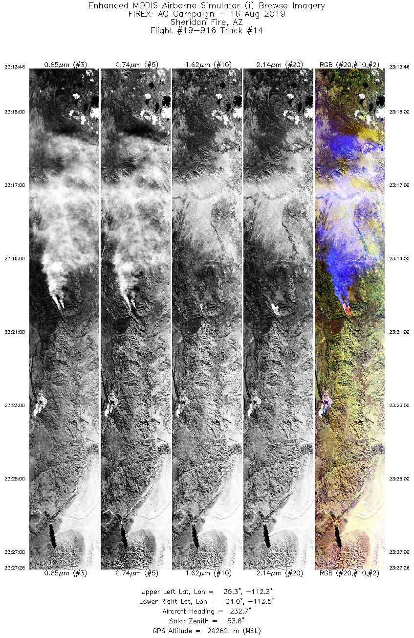
8/16/2019 |
23:20 |
19-916: 14 |
34.67778 |
-112.89030 |
| Sheridan Fire |
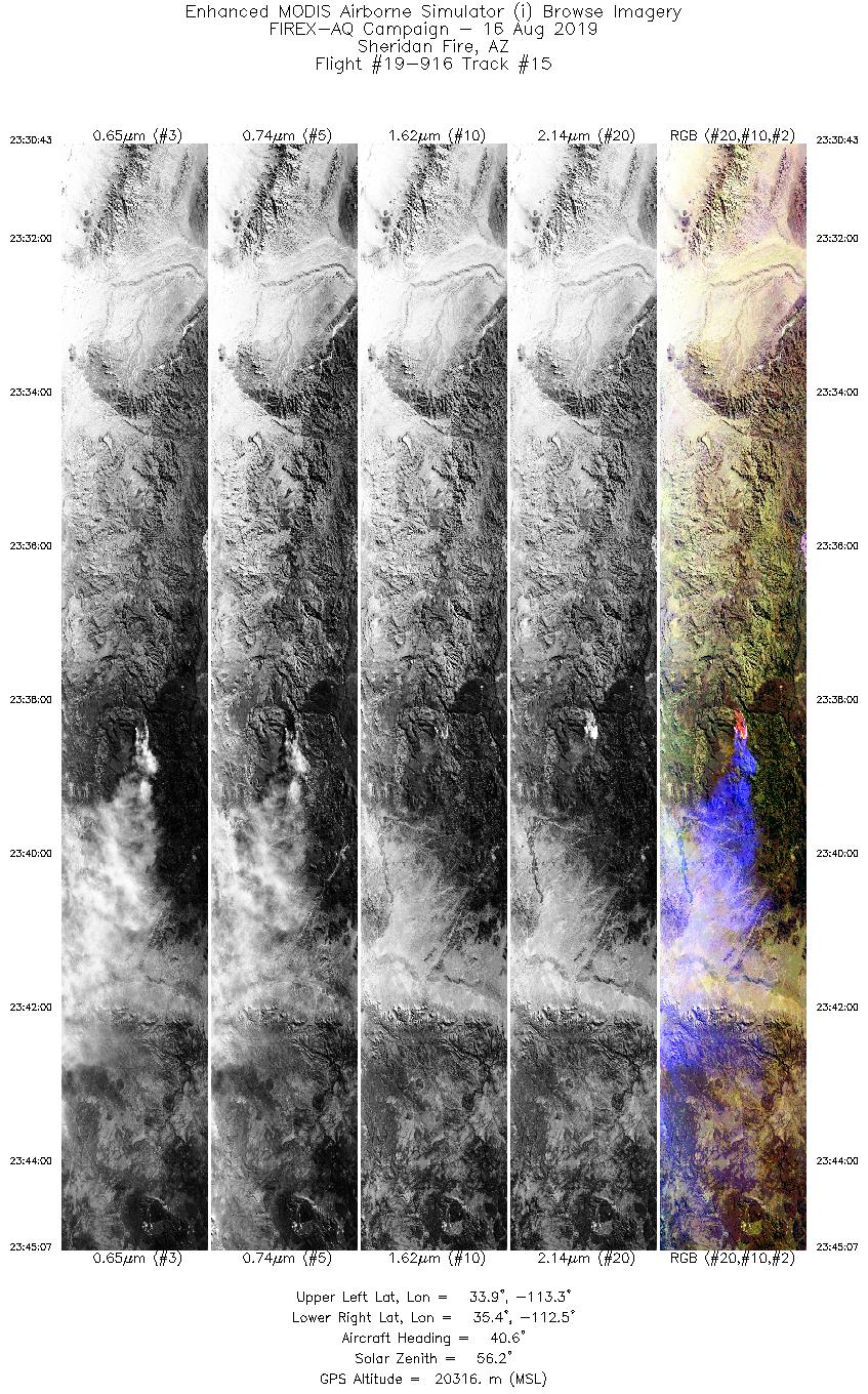
8/16/2019 |
23:38 |
19-916: 15 |
34.67778 |
-112.89030 |
| Sheridan Fire |
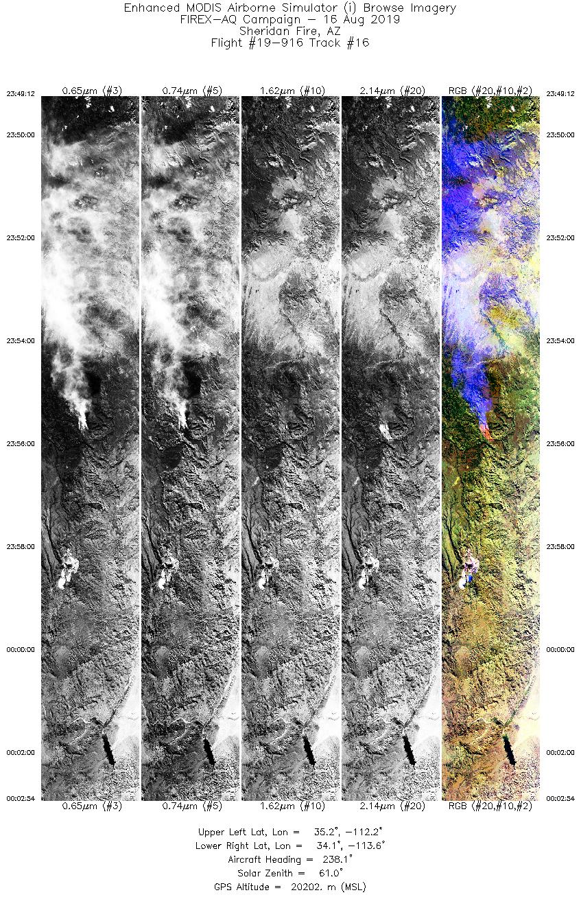
8/16/2019 |
23:56 |
19-916: 16 |
34.67778 |
-112.89030 |
| Sheridan Fire |
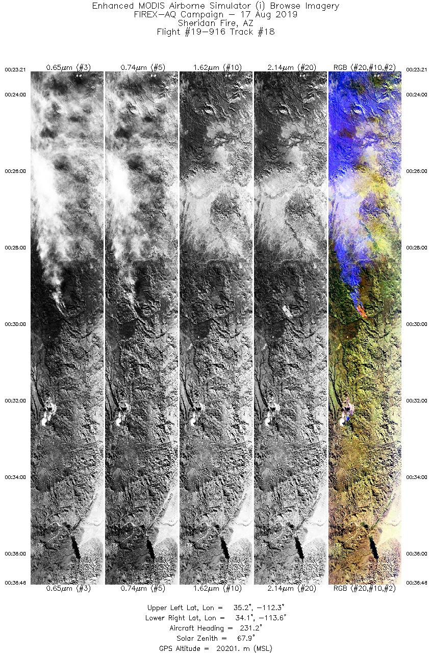
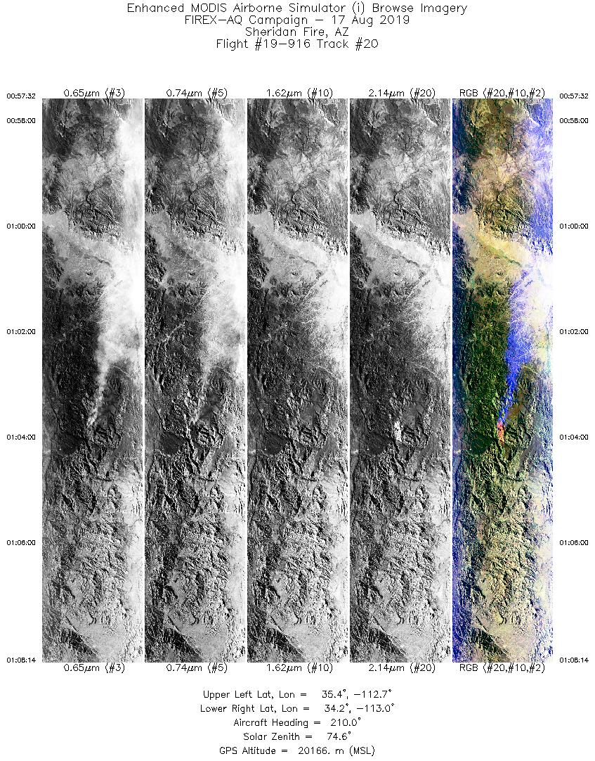
8/17/2019 |
00:14 |
19-916: 17 |
34.67778 |
-112.89030 |
| Sheridan Fire |
8/17/2019 |
00:30 |
19-916: 18 |
34.67778 |
-112.89030 |
| Sheridan Fire |
8/17/2019 |
00:47 |
19-916: 19 |
34.67778 |
-112.89030 |
| Sheridan Fire |
8/17/2019 |
01:04 |
19-916: 20 |
34.67778 |
-112.89030 |
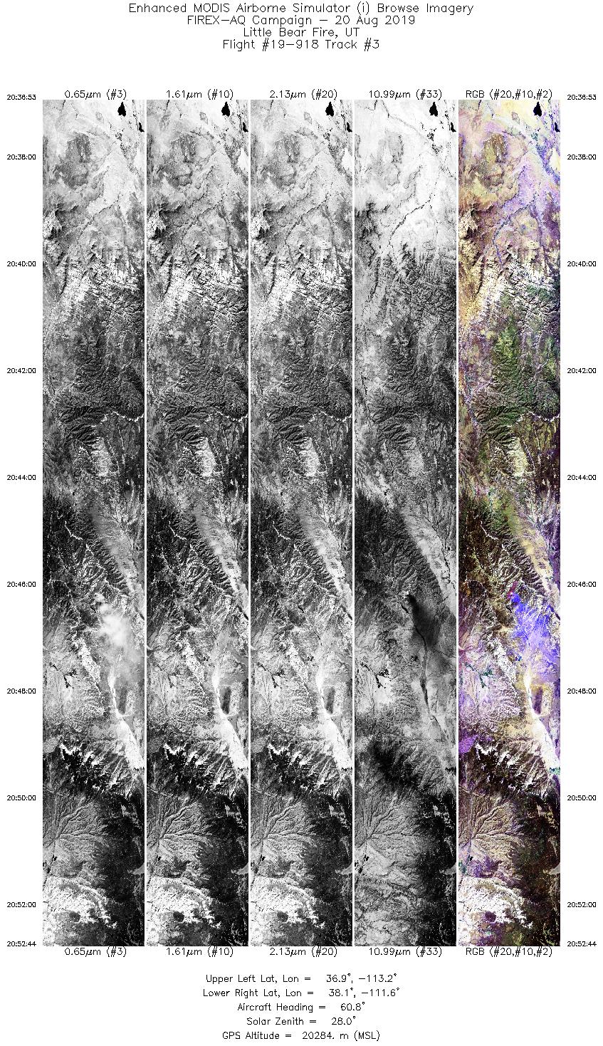
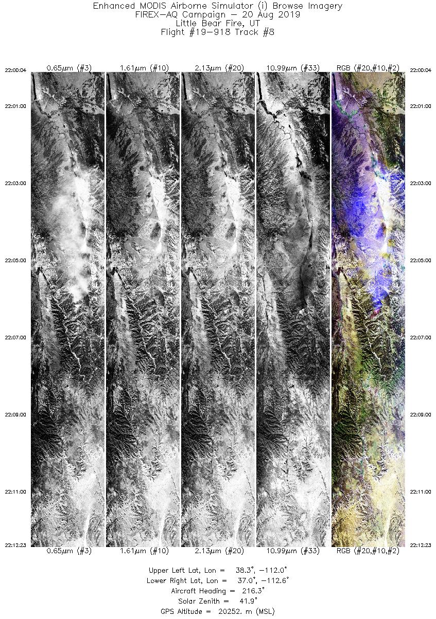
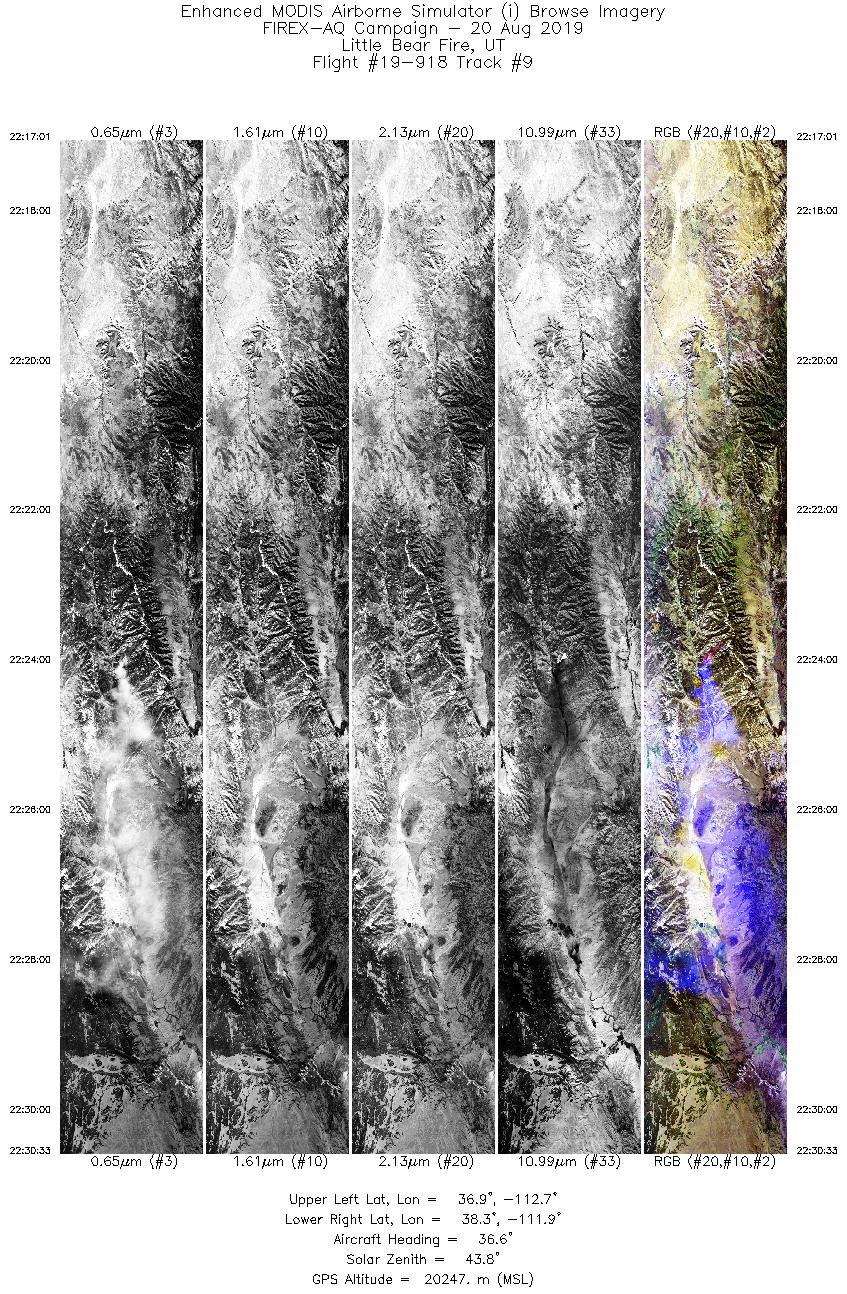
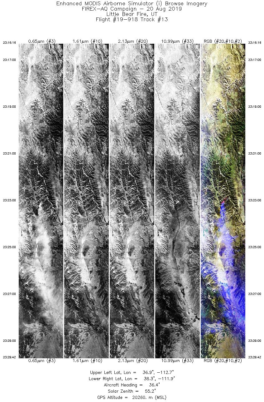
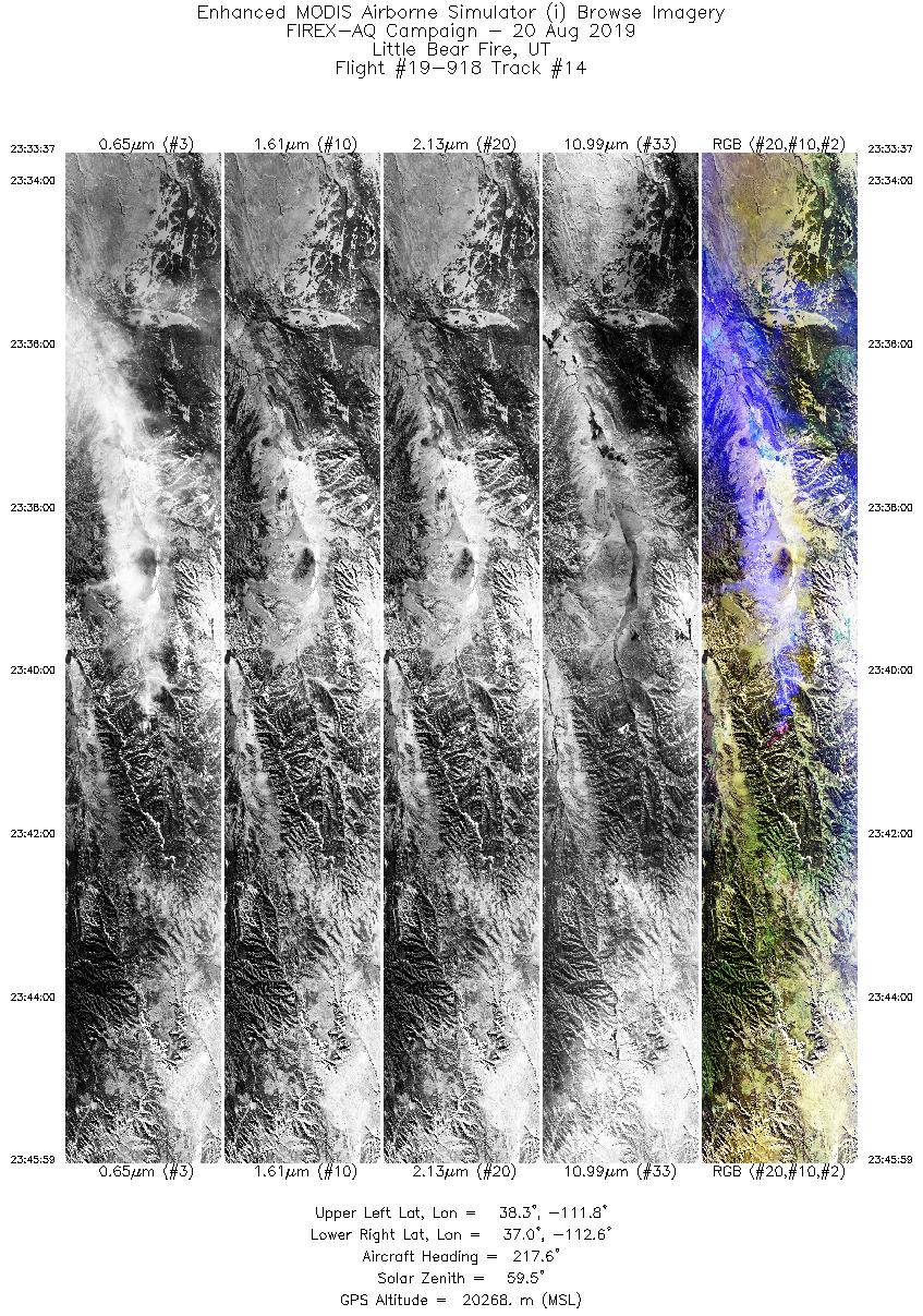
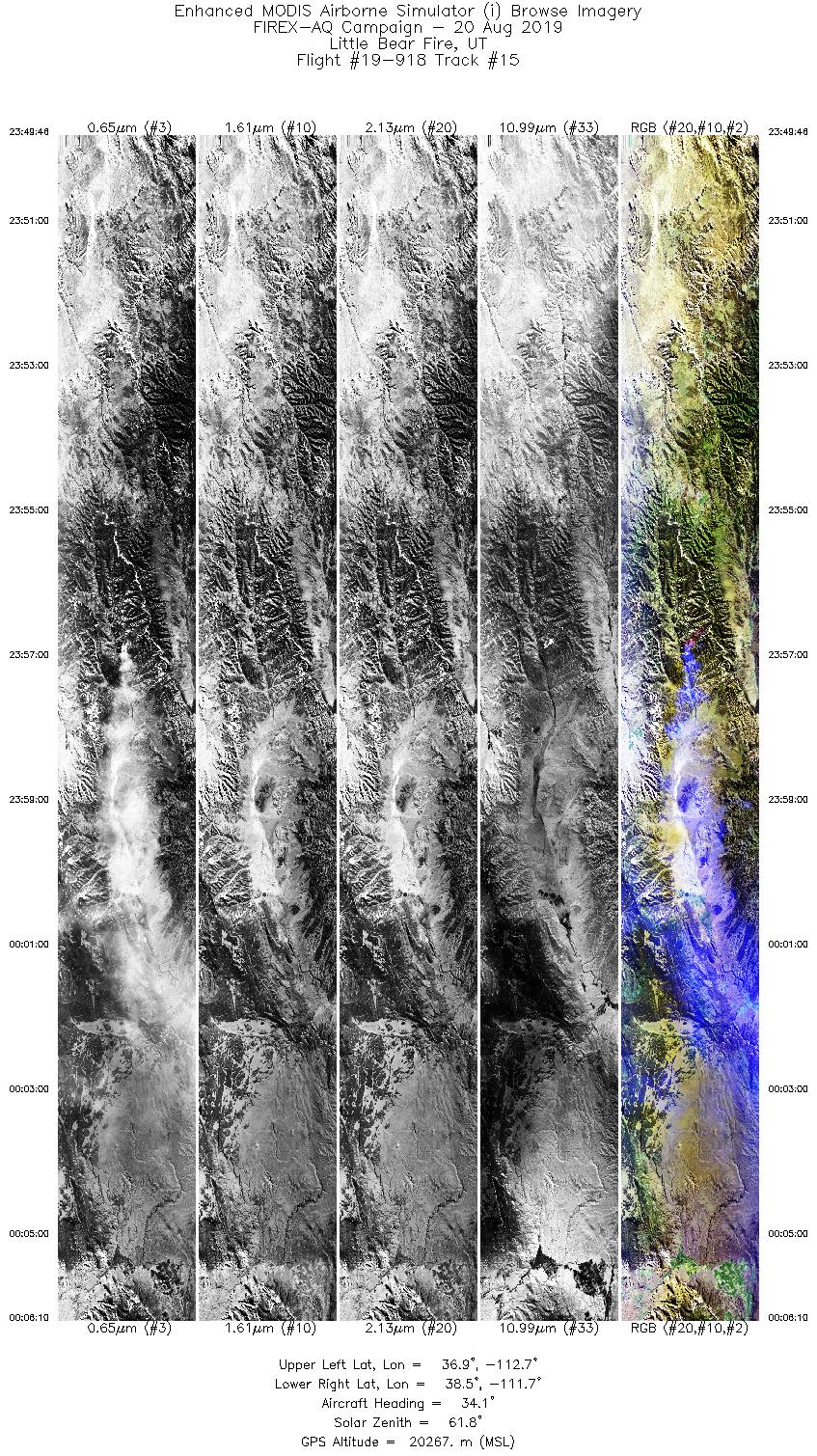
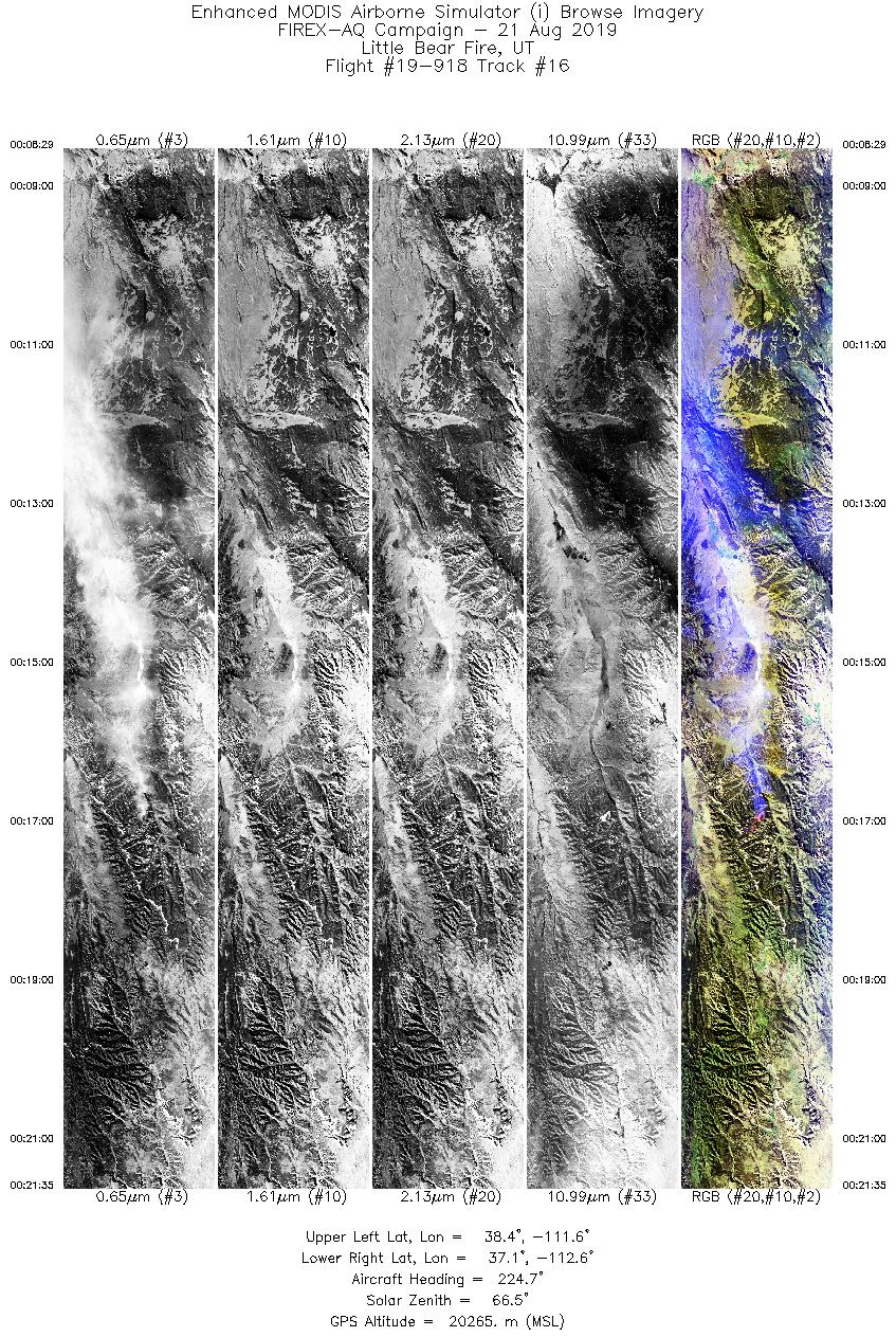
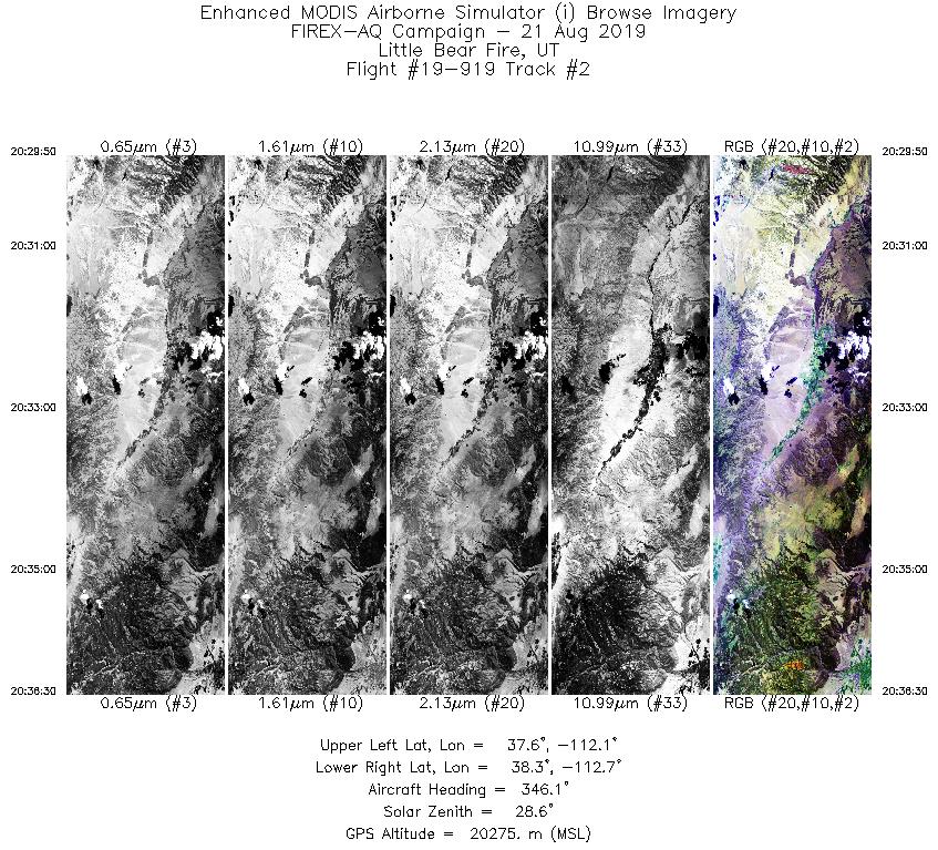
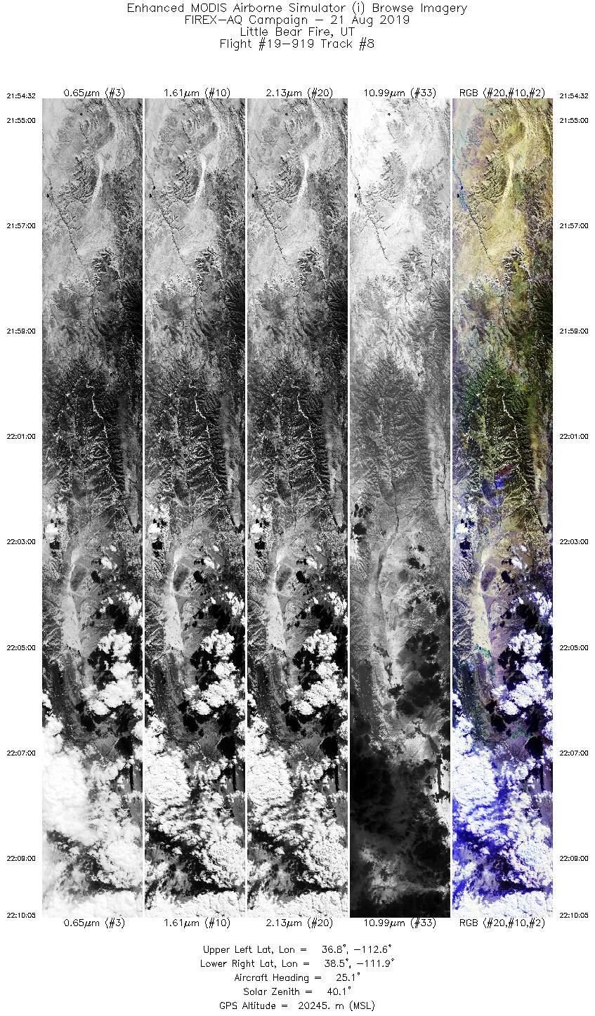
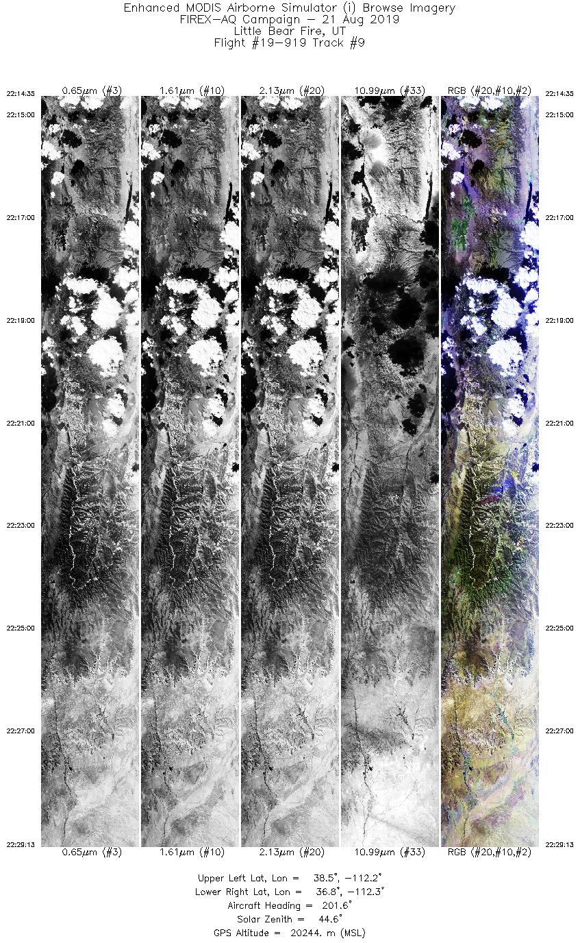
| Little Bear Fire |
8/20/2019 |
20:46 |
19-918: 03 |
37.58850 |
-112.32000 |
| Little Bear Fire |
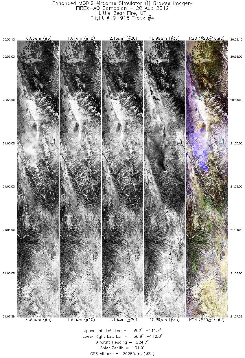
8/20/2019 |
21:01 |
19-918: 04 |
37.58850 |
-112.32000 |
| Little Bear Fire |
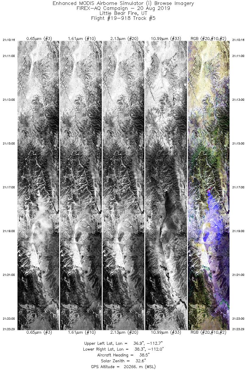
8/20/2019 |
21:17 |
19-918: 05 |
37.58850 |
-112.32000 |
| Little Bear Fire |
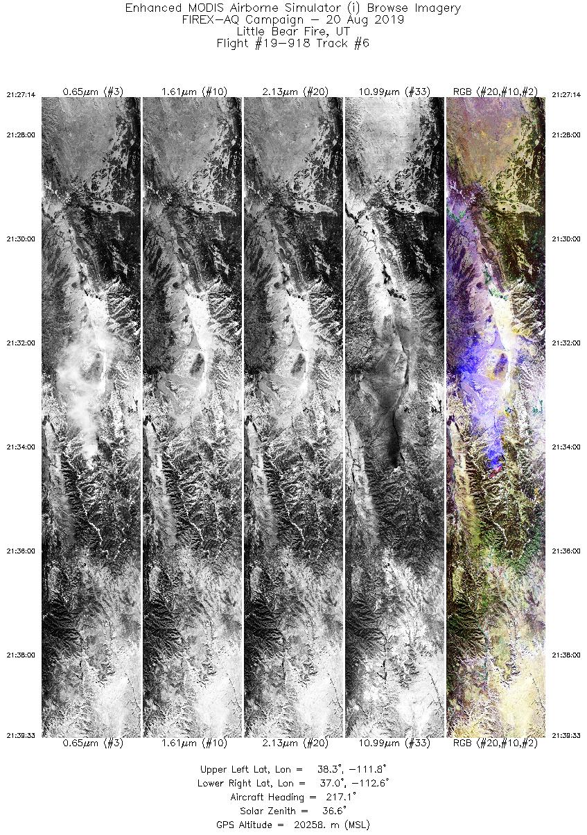
8/20/2019 |
21:34 |
19-918: 06 |
37.58850 |
-112.32000 |
| Little Bear Fire |
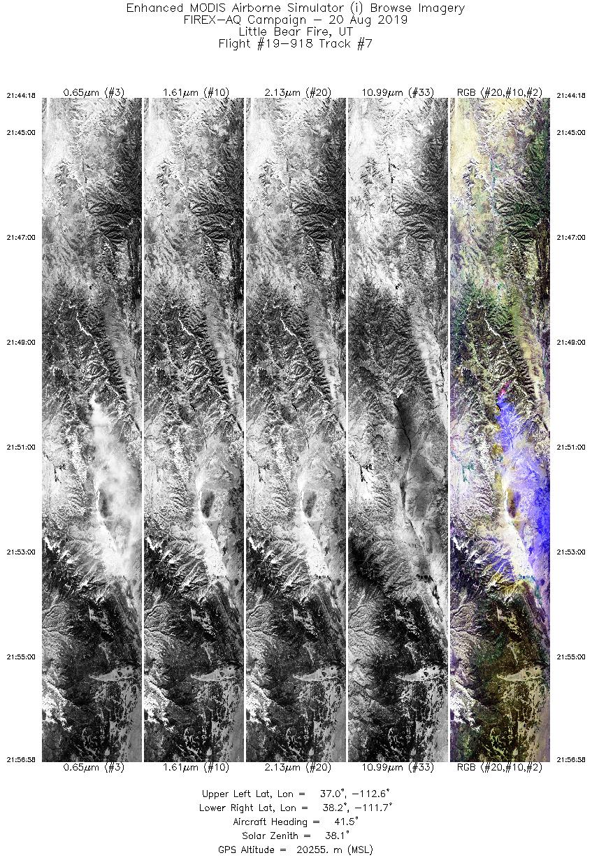
8/20/2019 |
21:50 |
19-918: 07 |
37.58850 |
-112.32000 |
| Little Bear Fire |
8/20/2019 |
22:06 |
19-918: 08 |
37.58850 |
-112.32000 |
| Little Bear Fire |
8/20/2019 |
22:24 |
19-918: 09 |
37.58850 |
-112.32000 |
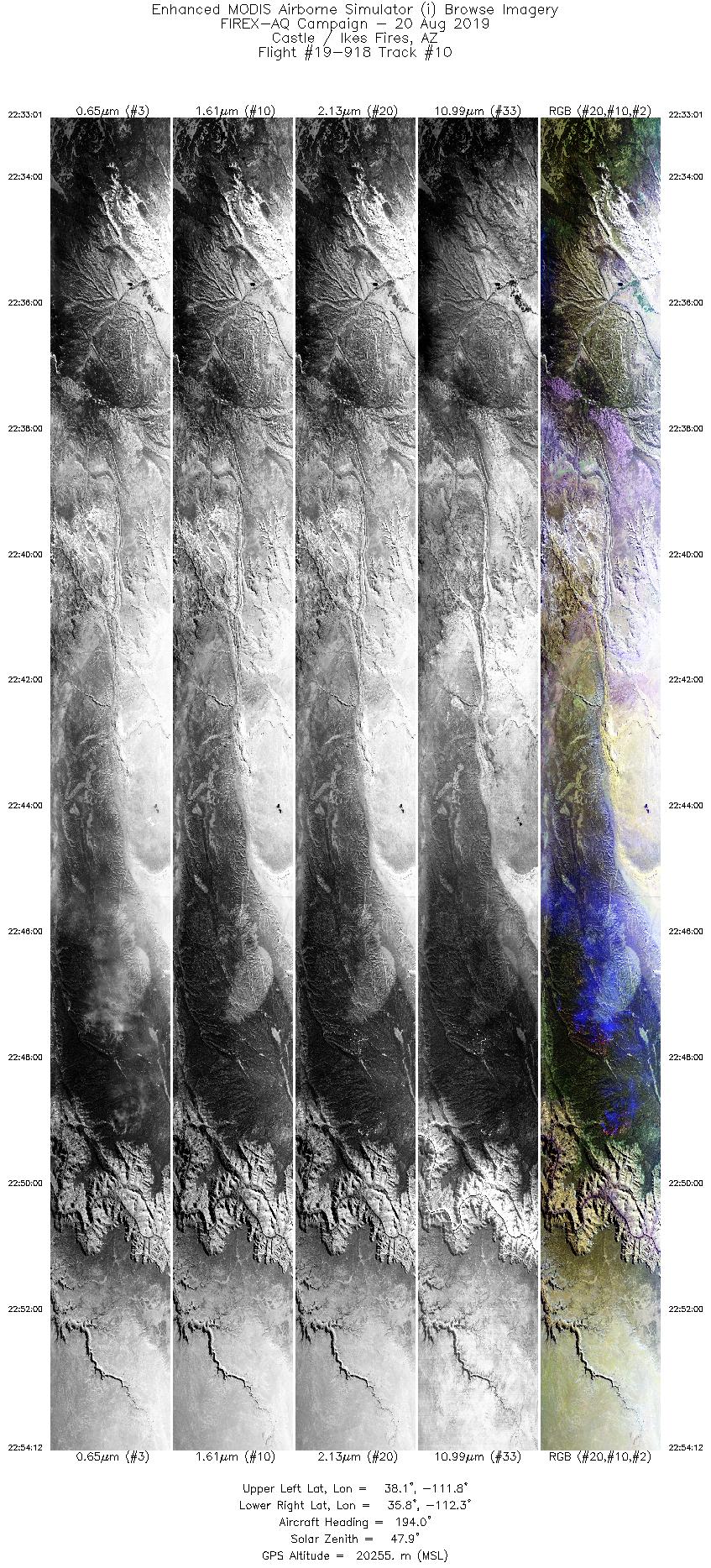
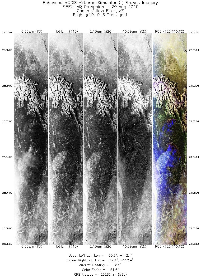
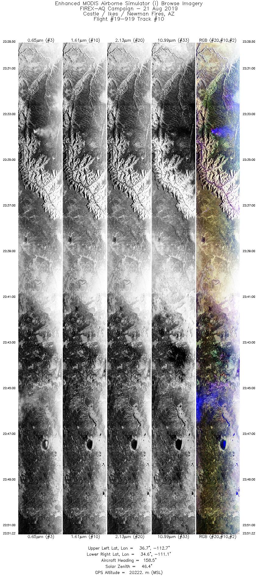
| Castle/Ikes Fires |
8/20/2019 |
22:48 |
19-918: 10 |
36.53116 |
-112.22810 |
| Castle/Ikes Fires |
8/20/2019 |
23:03 |
19-918: 11 |
36.53116 |
-112.22810 |
| Little Bear Fire |
8/20/2019 |
23:23 |
19-918: 13 |
37.58850 |
-112.32000 |
| Little Bear Fire |
8/20/2019 |
23:41 |
19-918: 14 |
37.58850 |
-112.32000 |
| Little Bear Fire |
8/20/2019 |
23:56 |
19-918: 15 |
37.58850 |
-112.32000 |
| Little Bear Fire |
8/21/2019 |
00:17 |
19-918: 16 |
37.58850 |
-112.32000 |
| Little Bear Fire |
8/21/2019 |
20:30 |
19-919: 02 |
37.58850 |
-112.32000 |
| Little Bear Fire |
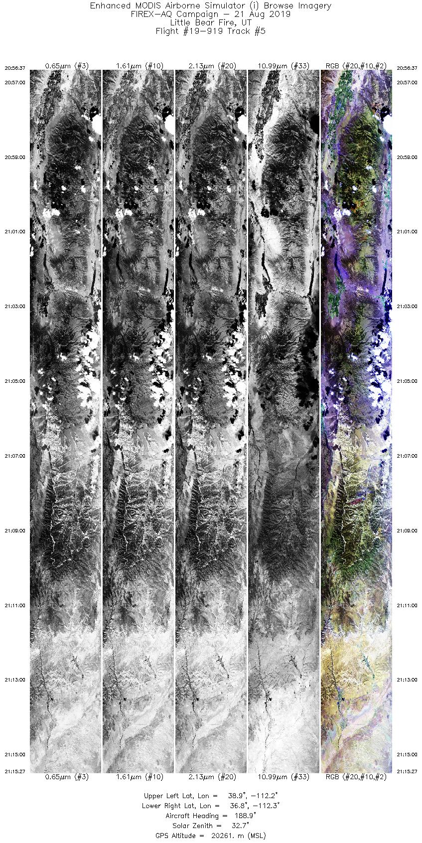
8/21/2019 |
21:08 |
19-919: 05 |
37.58850 |
-112.32000 |
| Little Bear Fire |
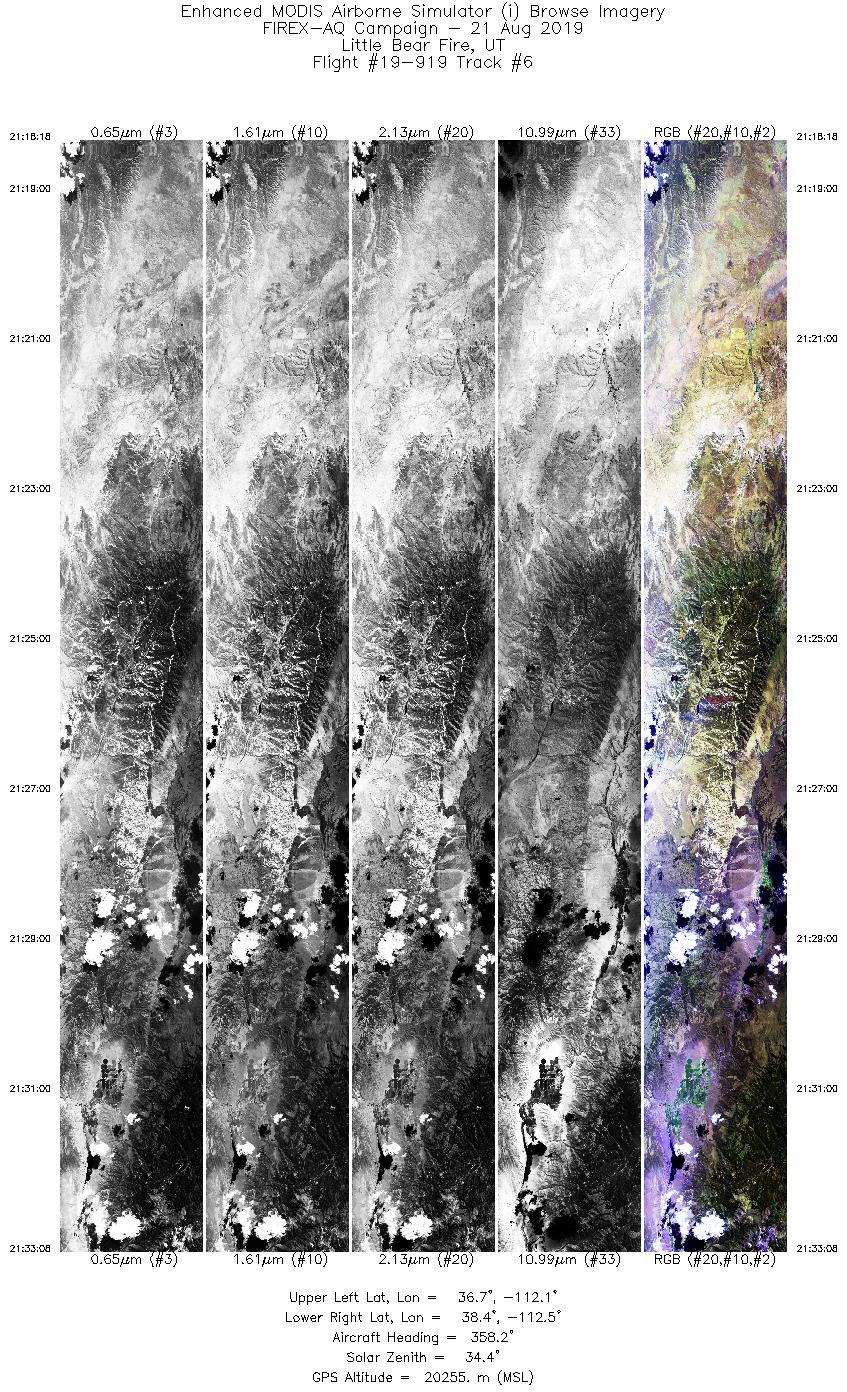
8/21/2019 |
21:26 |
19-919: 06 |
37.58850 |
-112.32000 |
| Little Bear Fire |
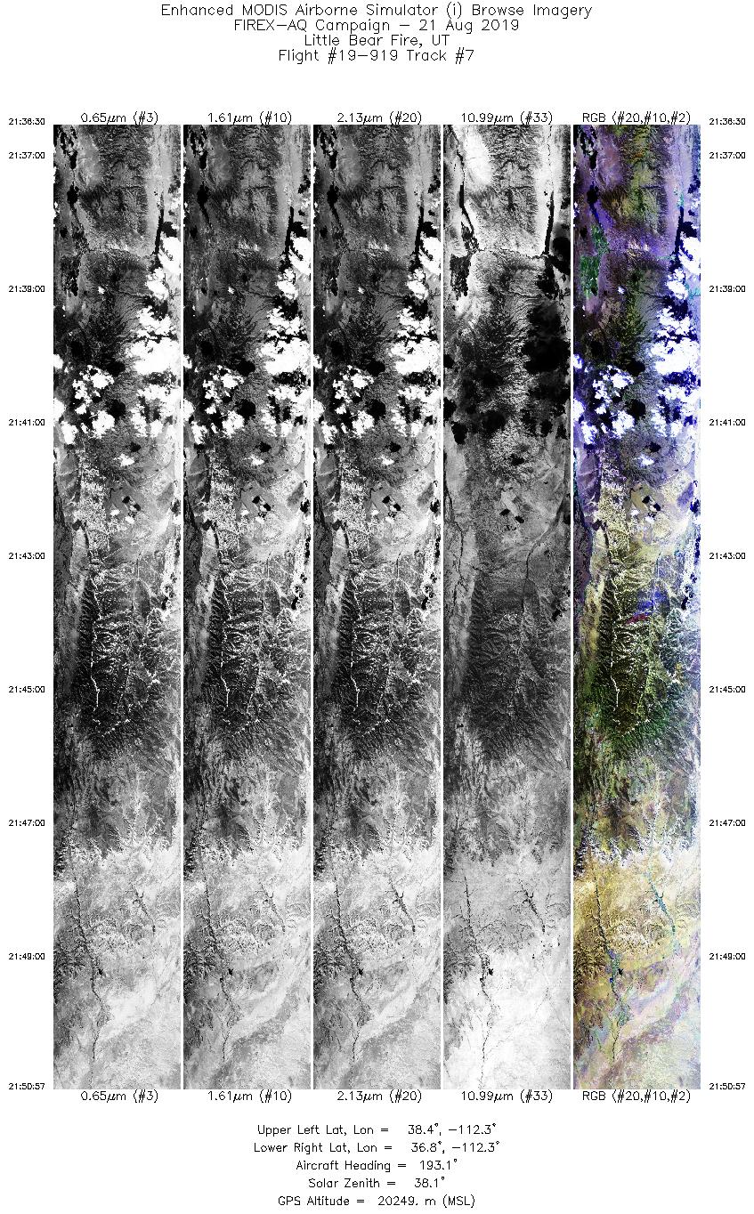
8/21/2019 |
21:44 |
19-919: 07 |
37.58850 |
-112.32000 |
| Little Bear Fire |
8/21/2019 |
22:02 |
19-919: 08 |
37.58850 |
-112.32000 |
| Little Bear Fire |
8/21/2019 |
22:22 |
19-919: 09 |
37.58850 |
-112.32000 |
| Castle/Ikes Fires |
8/21/2019 |
23:33 |
19-919: 10 |
36.53116 |
-112.22810 |
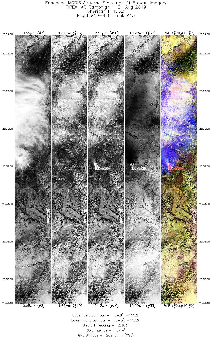
| Sheridan Fire |
8/21/2019 |
23:32 |
19-919: 13 |
34.67778 |
-112.89030 |
| Sheridan Fire |
8/21/2019 |
23:50 |
19-919: 14 |
34.67778 |
-112.89030 |
| Sheridan Fire |
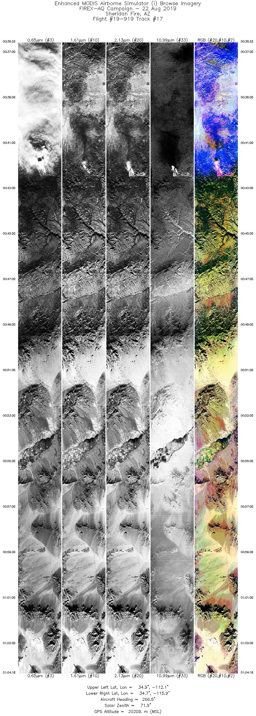
8/22/2019 |
00:42 |
19-919: 17 |
34.67778 |
-112.89030 |
|
|
|
Related Web Sites
NOAA / NASA FIREX-AQ Portal
NASA Airborne Science Program
|


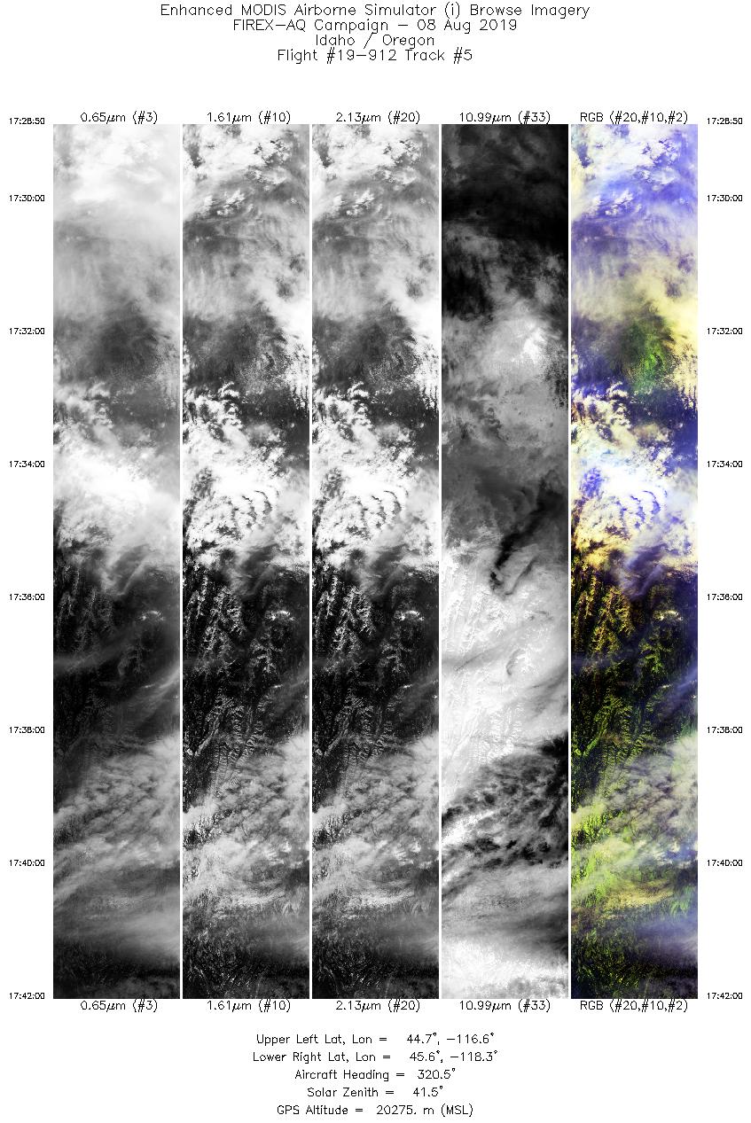
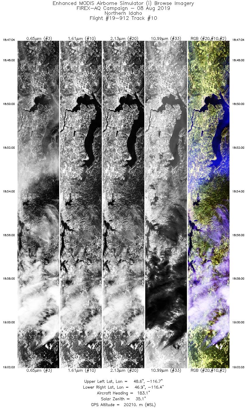
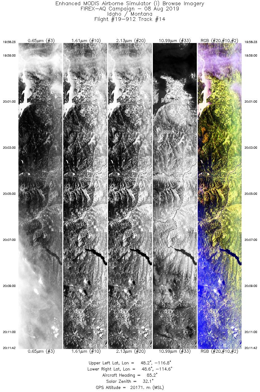
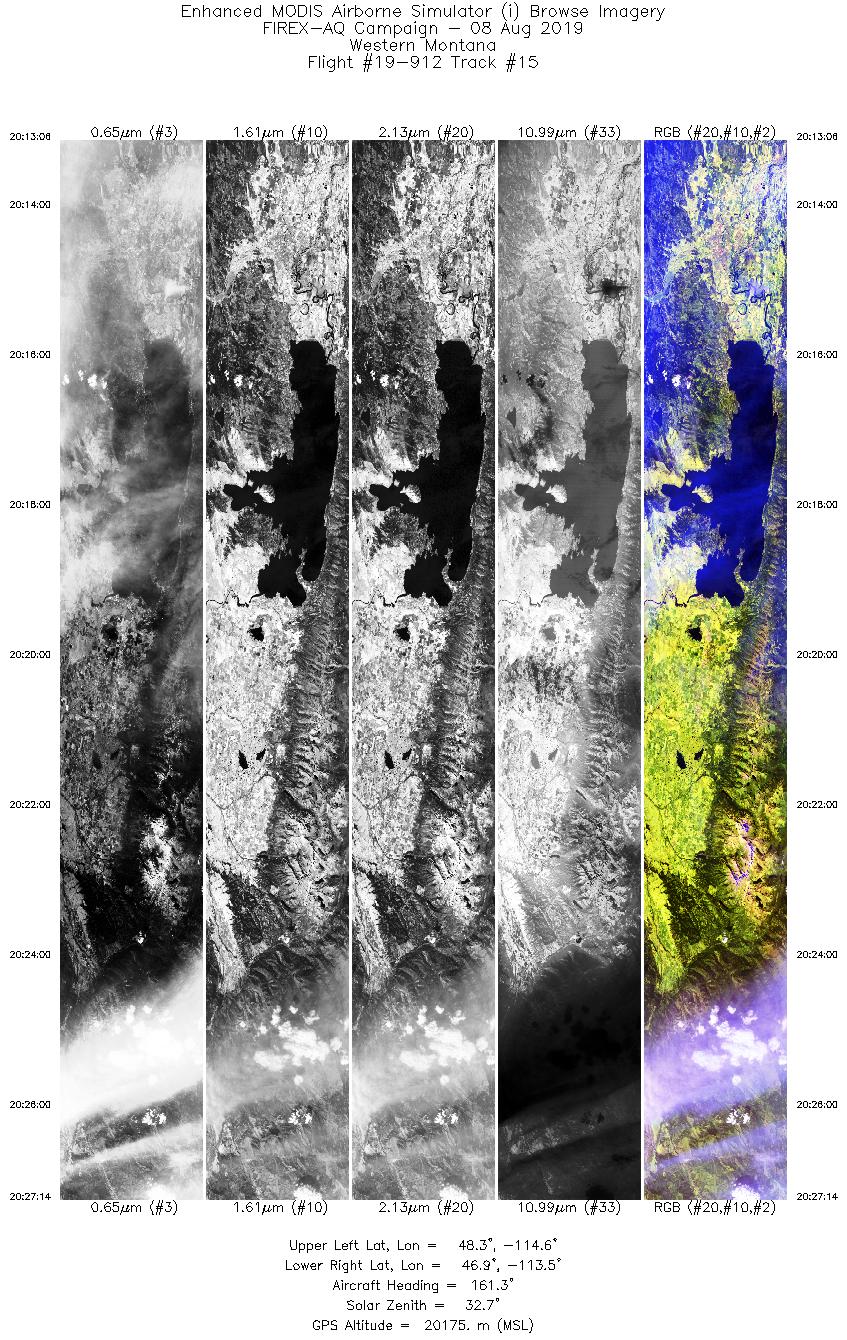
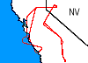 Flight: 19-909
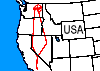 Flight: 19-910
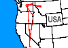 Flight: 19-911
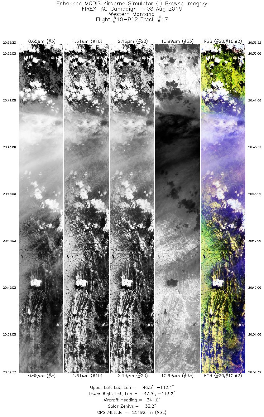
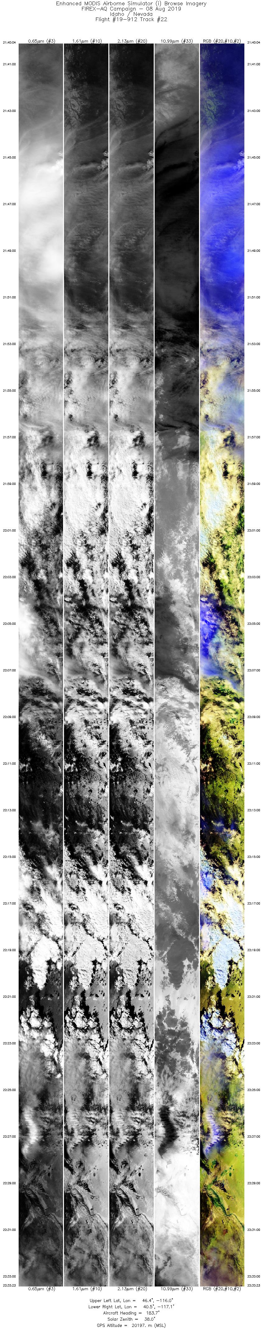
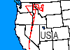 Flight: 19-912
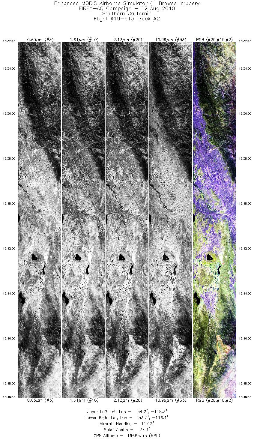
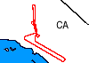 Flight: 19-913
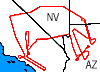 Flight: 19-915
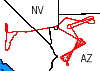 Flight: 19-916
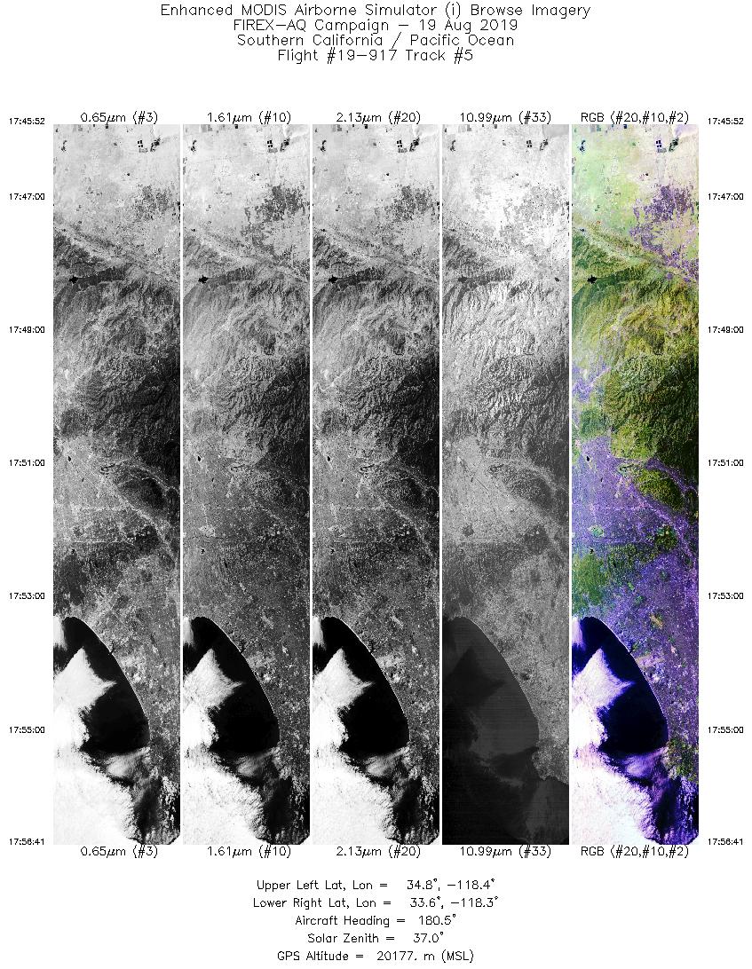
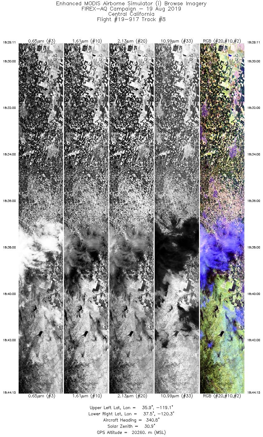
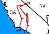 Flight: 19-917
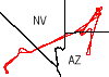 Flight: 19-918
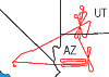 Flight: 19-919


