Flight: 19-915
Date: 15 Aug 2019
Location: Southwest USA
Deployment: FIREX-AQ
Principal Investigators: Dr. Steven Platnick (NASA GSFC)
Configuration: 38 Channel
Additional Sensors: FIREX-AQ Payload
|
Data Evaluation
Overall quality is fair
|
Processing Information
Level-1B Data in HDF format is available upon request
Flight Line Summary
Spectral Band Configuration
Spectral Response Function Table
Spectral Response Function (text)
|
Browse Imagery
Flight Tracks: 27
Scanlines: 107165
|
Browse Imagery Table
|
Click a Flight Track number to view a quicklook image
Lat/Lon ranges are for the BEG-END scanline nadir pixels
|
Flight
Track |
Time Span
(UTC) |
Heading
(Deg) |
Lat Range
(Deg N) |
Lon Range
(Deg W) |
Length
(Scanlines) |
Altitude
(Meters) |
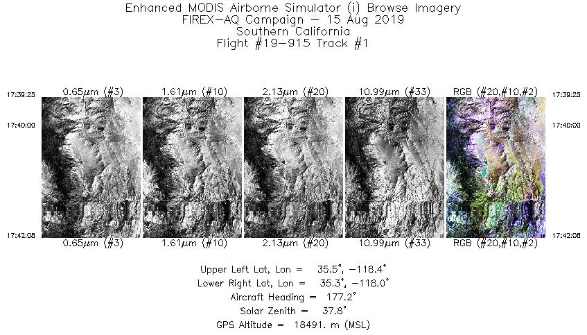
| 1 |
17:39 - 17:42 |
175.6 |
35.530 - 35.239 |
118.187 - 118.194 |
1015 |
18485 |
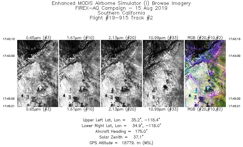
| 2 |
17:42 - 17:45 |
175.1 |
35.230 - 34.884 |
118.193 - 118.207 |
1178 |
18832 |
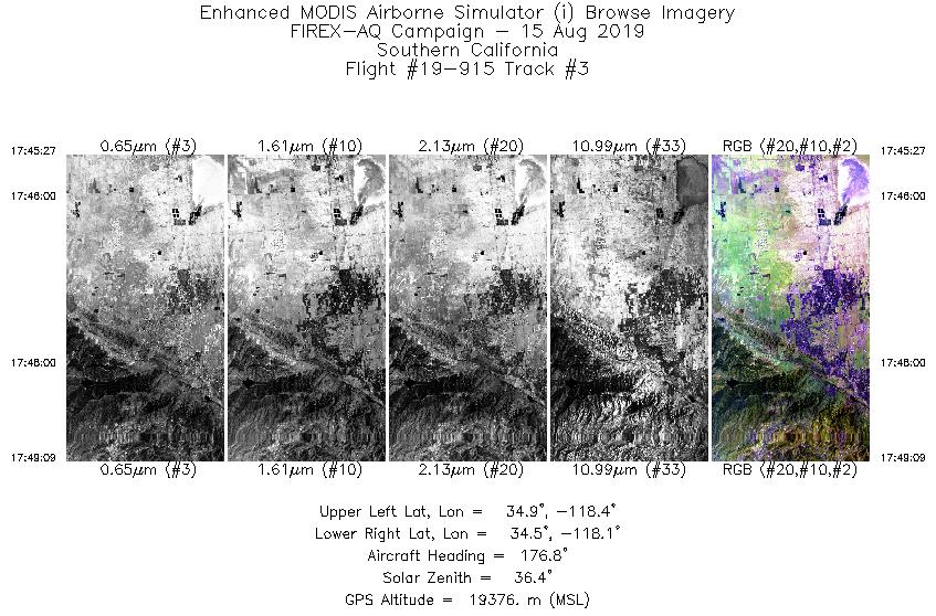
| 3 |
17:45 - 17:49 |
179.7 |
34.874 - 34.481 |
118.207 - 118.267 |
1390 |
19325 |
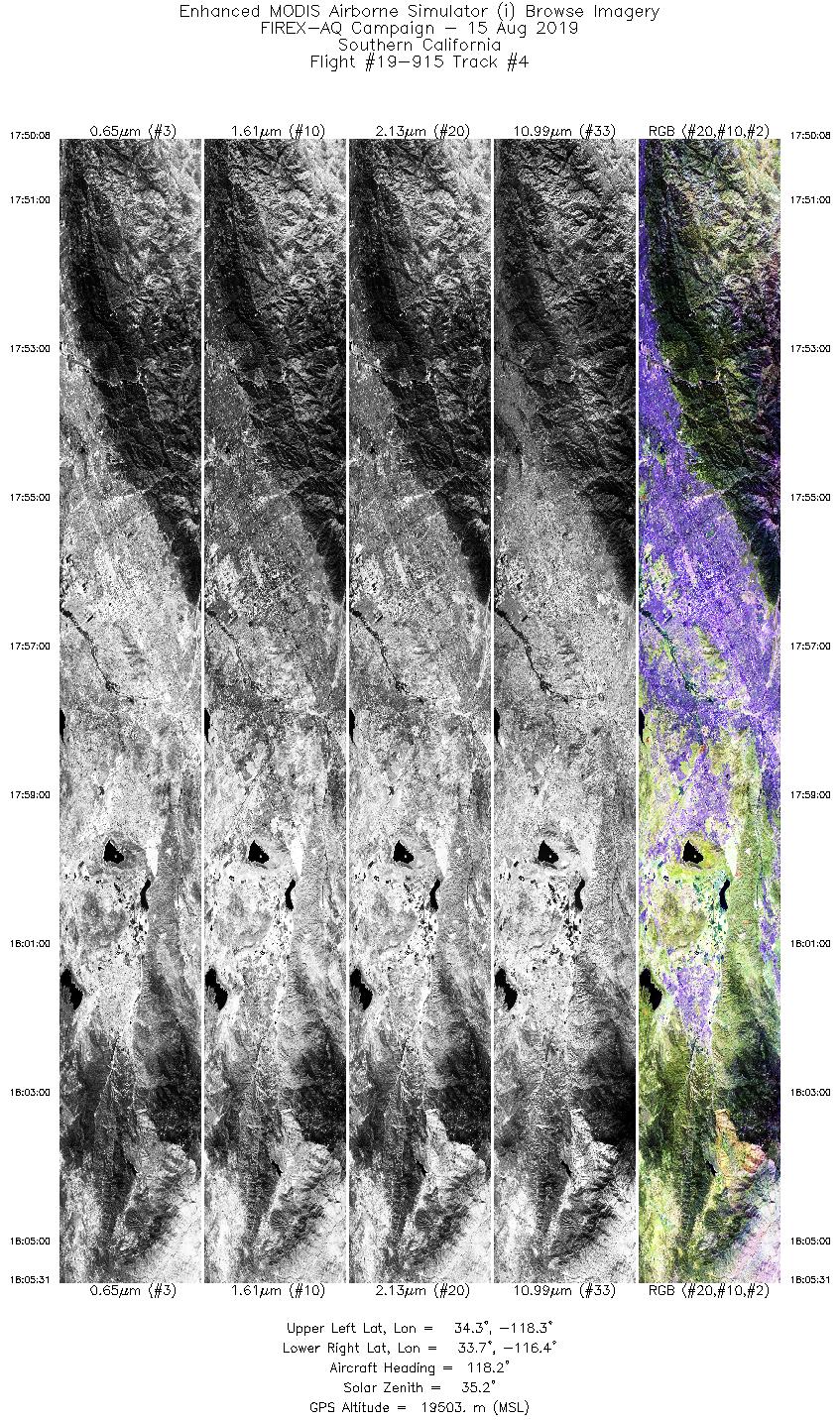
| 4 |
17:50 - 18:05 |
117.8 |
34.393 - 33.583 |
118.214 - 116.526 |
5771 |
19567 |
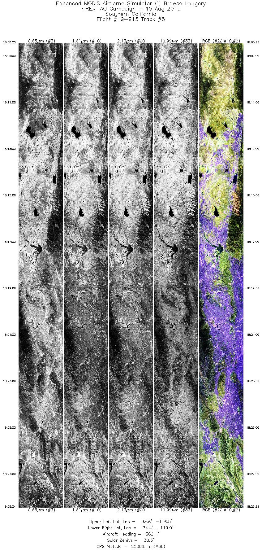
| 5 |
18:08 - 18:28 |
299.6 |
33.409 - 34.502 |
116.642 - 118.894 |
7495 |
19858 |
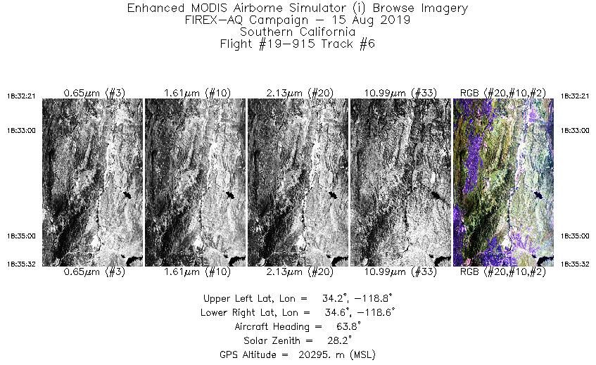
| 6 |
18:32 - 18:35 |
66.2 |
34.310 - 34.431 |
118.927 - 118.557 |
1198 |
20269 |
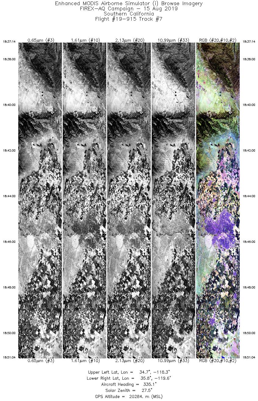
| 7 |
18:37 - 18:51 |
333.3 |
34.580 - 35.910 |
118.495 - 119.390 |
5193 |
20278 |
| 8 |
18:51 - 19:06 |
340.9 |
35.986 - 37.508 |
119.448 - 120.074 |
5421 |
20294 |
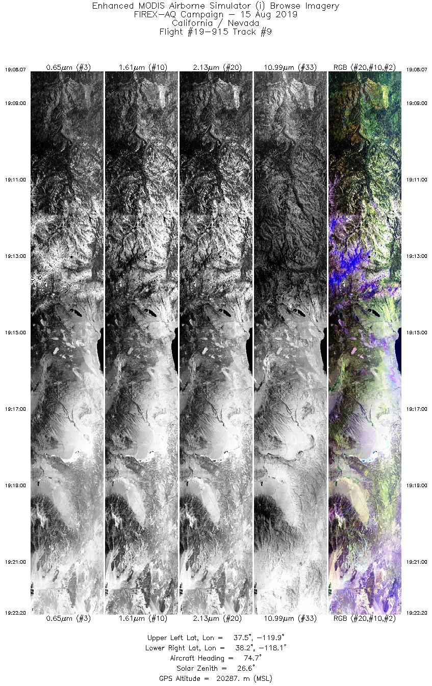
| 9 |
19:08 - 19:22 |
76.1 |
37.661 - 37.990 |
119.965 - 118.024 |
5331 |
20280 |
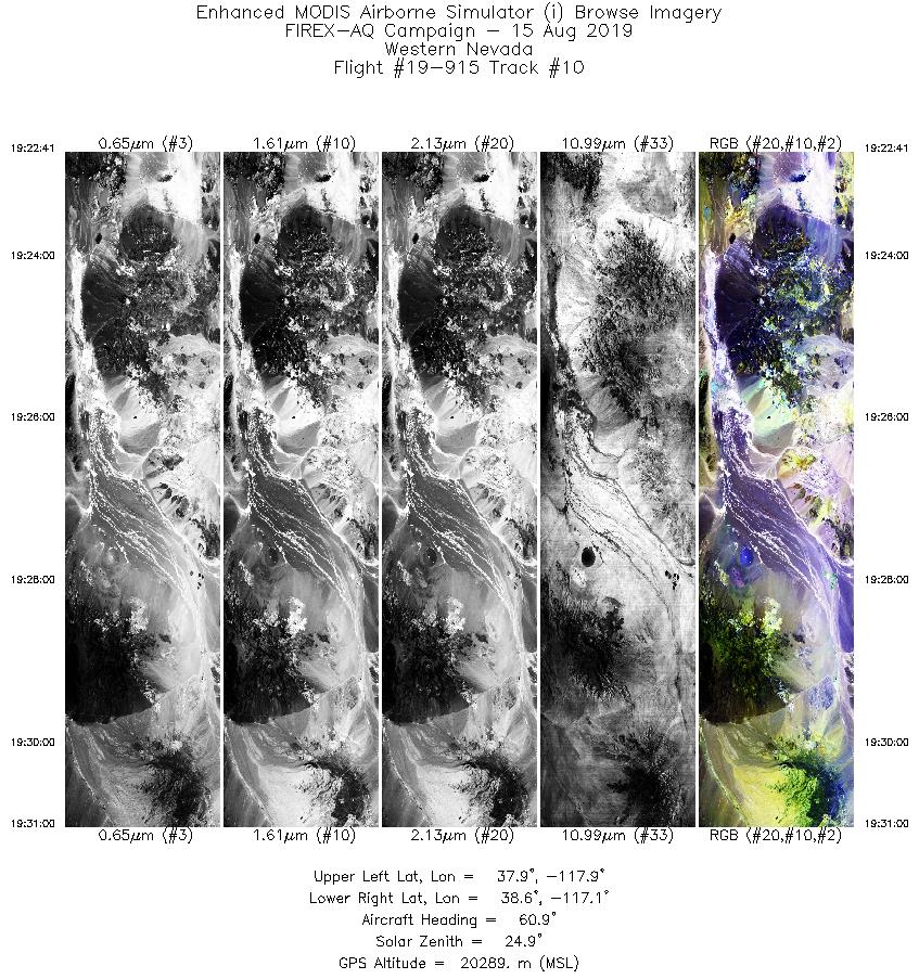
| 10 |
19:22 - 19:30 |
59.4 |
38.003 - 38.470 |
117.979 - 117.020 |
3118 |
20293 |
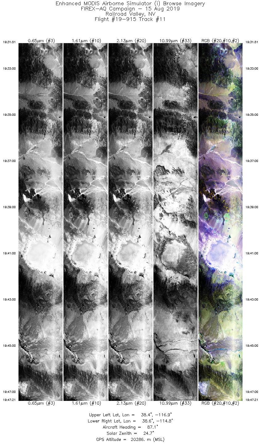
| 11 |
19:31 - 19:47 |
87.6 |
38.499 - 38.495 |
116.916 - 114.800 |
5810 |
20310 |
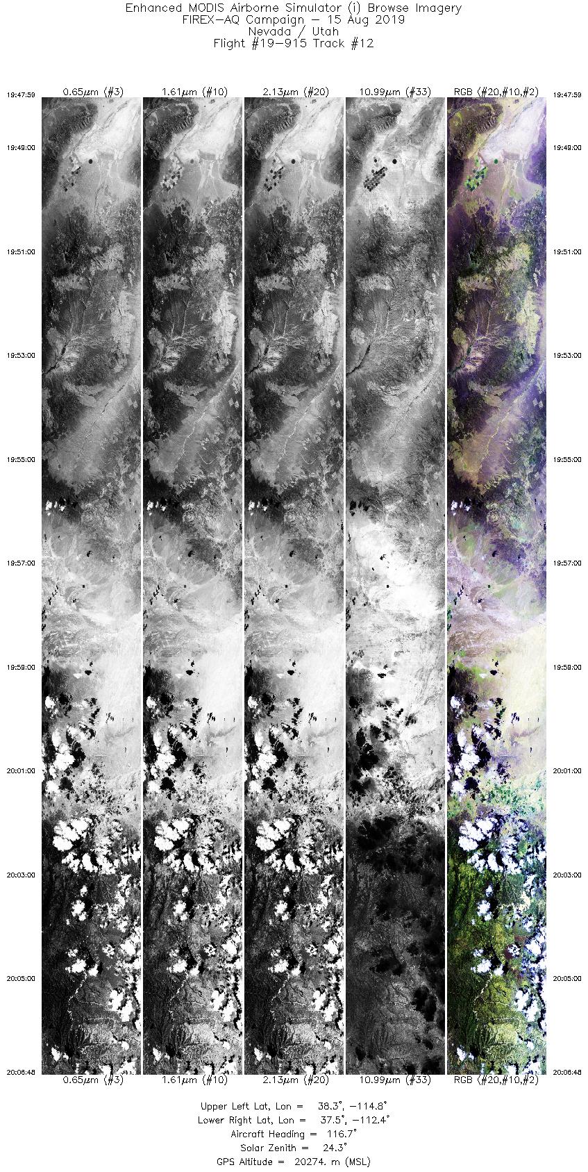
| 12 |
19:47 - 20:06 |
118.6 |
38.476 - 37.394 |
114.710 - 112.515 |
7056 |
20286 |
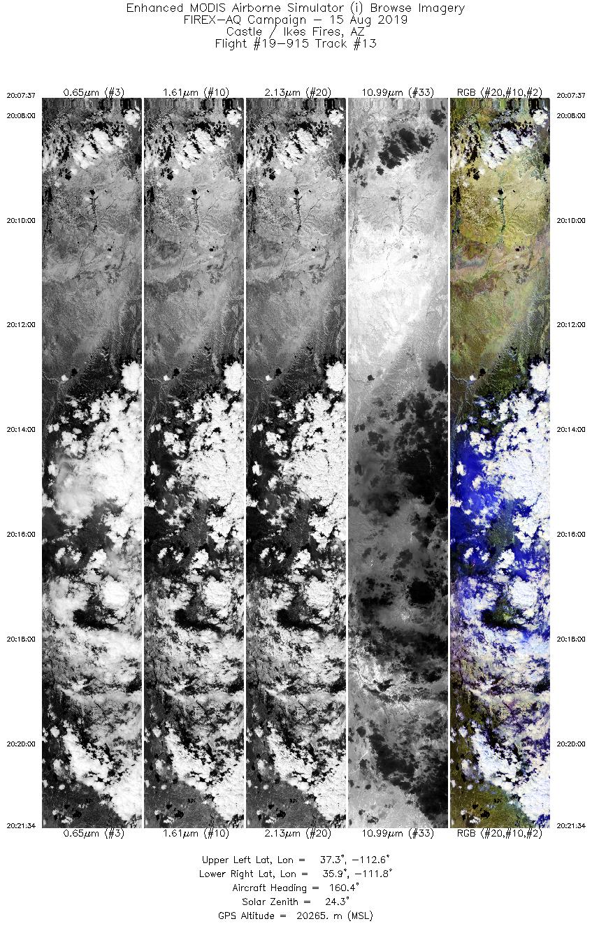
| 13 |
20:07 - 20:21 |
161.2 |
37.323 - 35.831 |
112.450 - 111.989 |
5229 |
20256 |
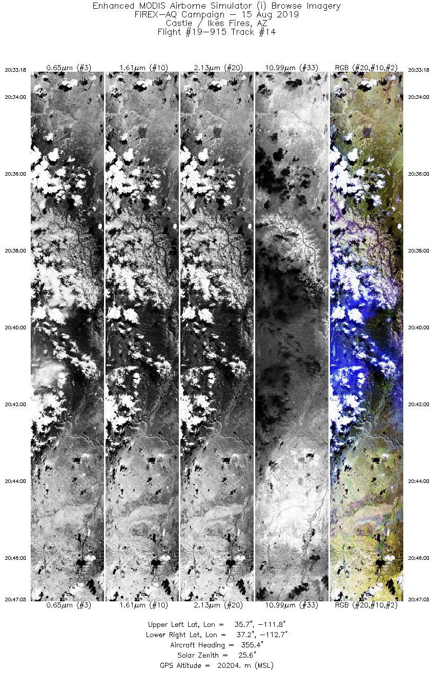
| 14 |
20:33 - 20:47 |
351.1 |
35.640 - 37.197 |
112.042 - 112.518 |
5170 |
20196 |
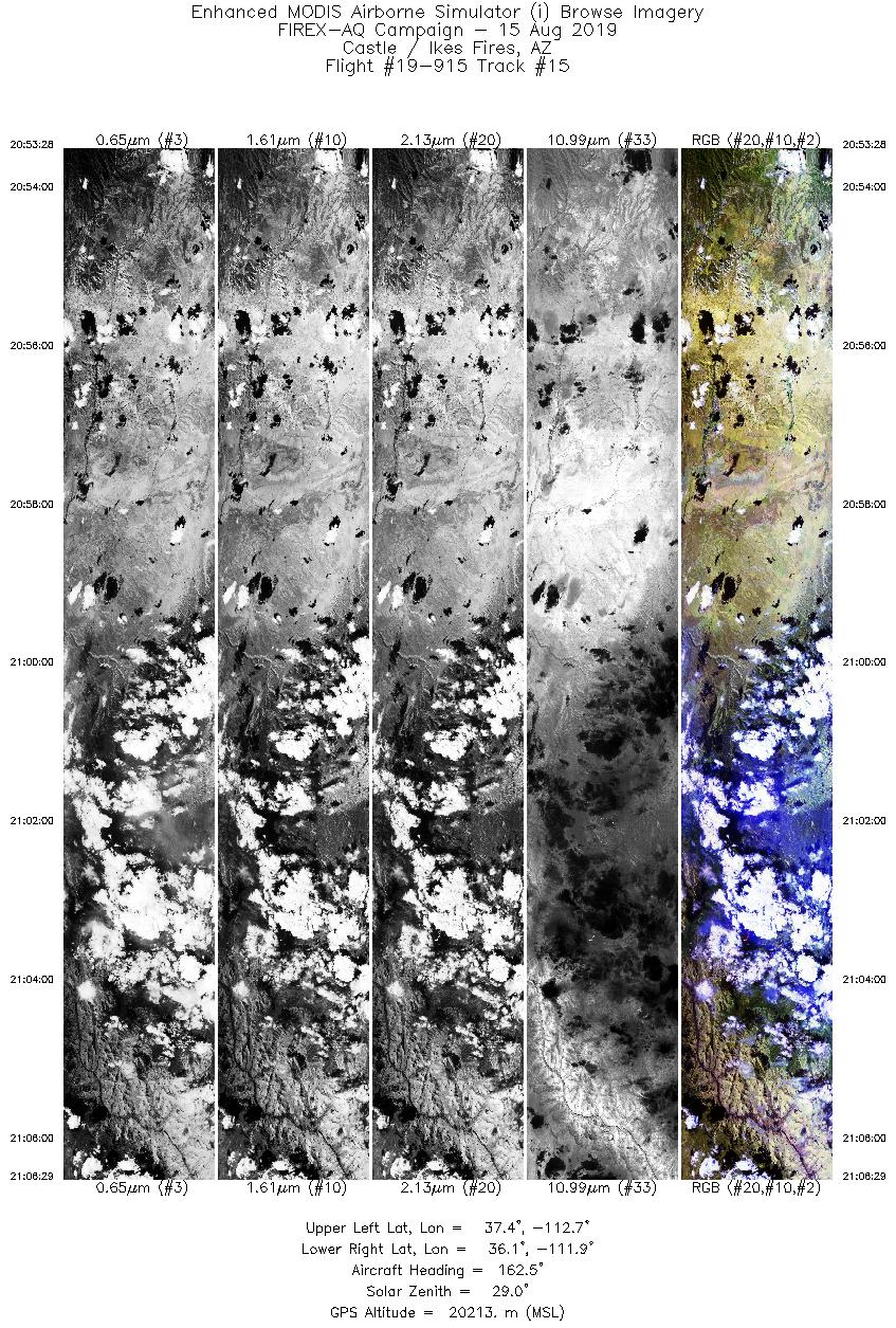
| 15 |
20:53 - 21:06 |
162.2 |
37.411 - 36.022 |
112.548 - 112.109 |
4879 |
20231 |
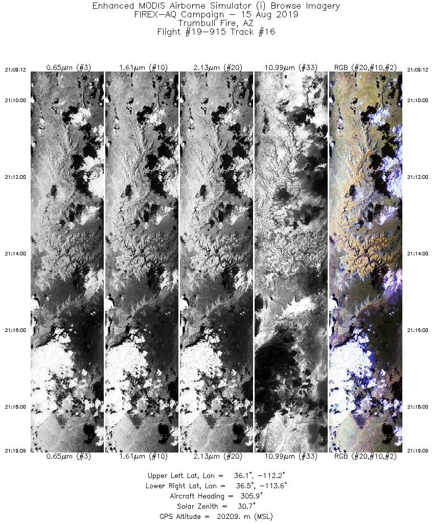
| 16 |
21:09 - 21:19 |
306.5 |
35.920 - 36.608 |
112.358 - 113.482 |
3732 |
20207 |
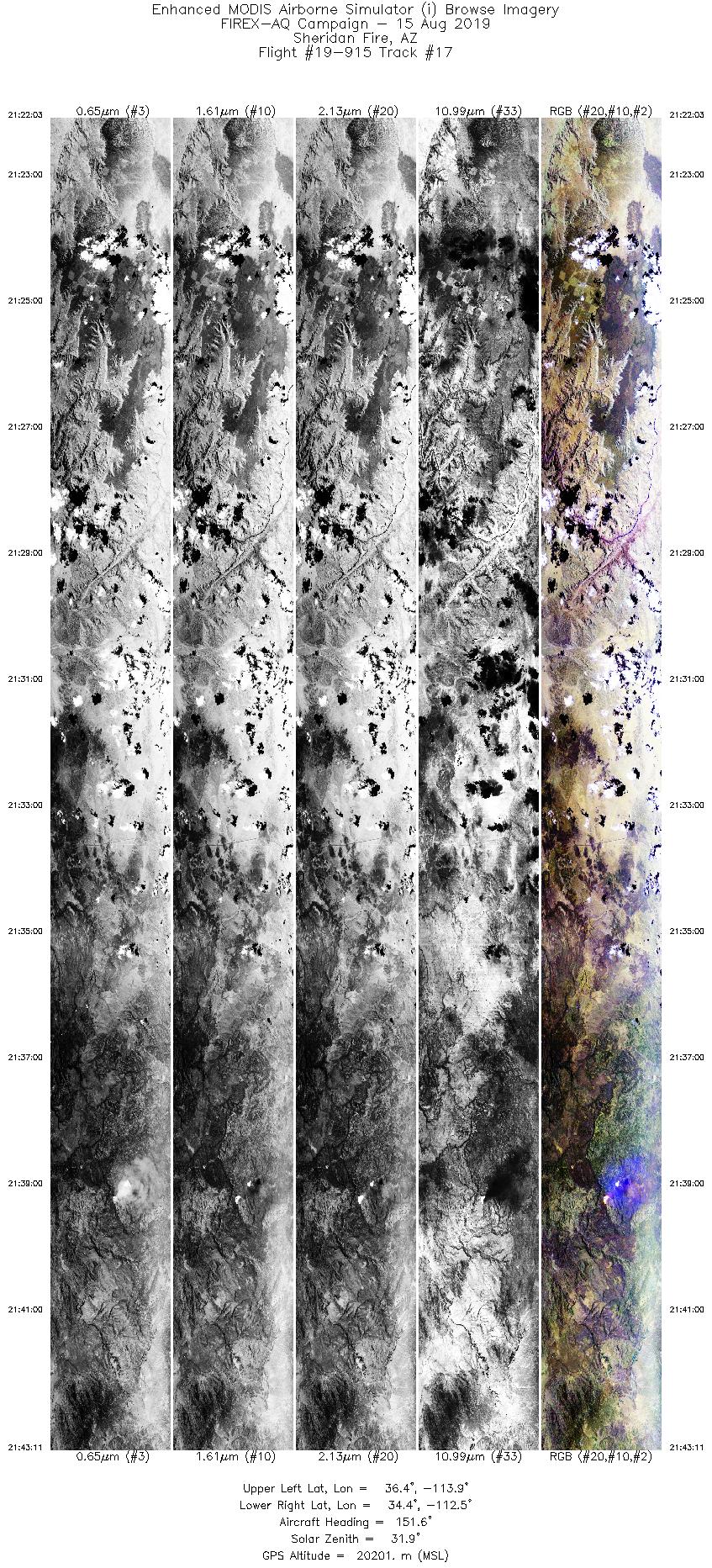
| 17 |
21:22 - 21:43 |
152.9 |
36.439 - 34.292 |
113.720 - 112.702 |
7925 |
20206 |
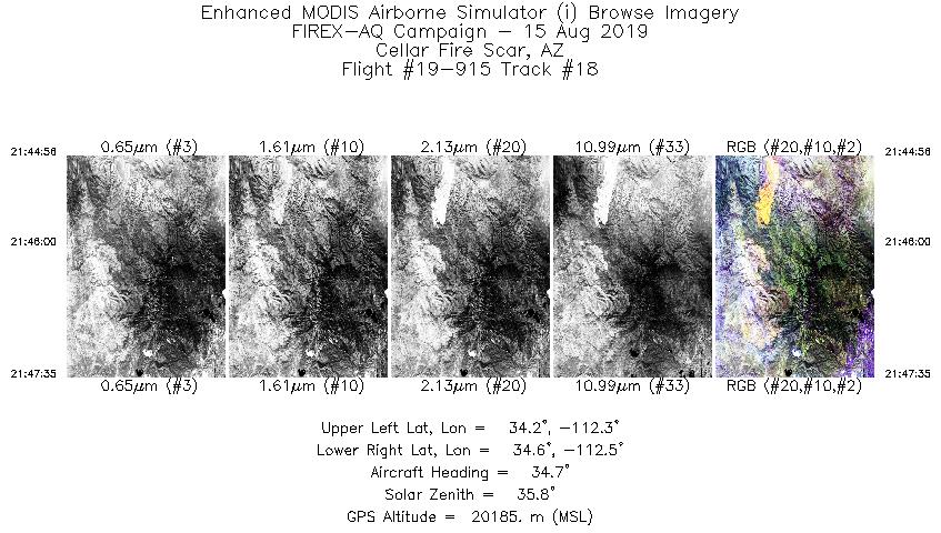
| 18 |
21:44 - 21:47 |
35.7 |
34.275 - 34.511 |
112.517 - 112.303 |
1000 |
20188 |
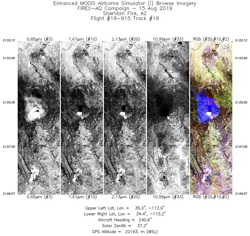
| 19 |
21:52 - 21:59 |
240.7 |
34.865 - 34.509 |
112.468 - 113.327 |
2596 |
20204 |
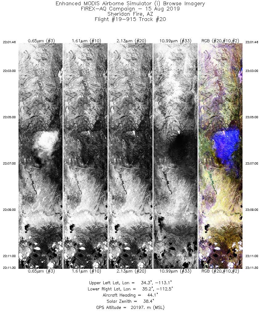
| 20 |
22:01 - 22:11 |
44.1 |
34.377 - 35.131 |
113.224 - 112.354 |
3656 |
20207 |
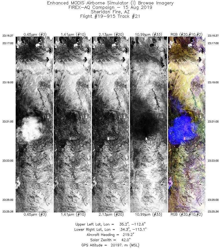
| 21 |
22:16 - 22:25 |
220.4 |
35.096 - 34.369 |
112.391 - 113.236 |
3370 |
20190 |
| 22 |
22:31 - 22:41 |
41.5 |
34.367 - 35.154 |
113.275 - 112.348 |
3858 |
20205 |
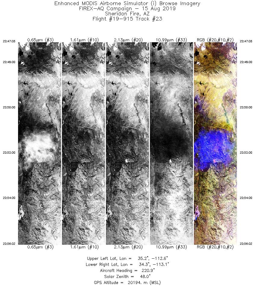
| 23 |
22:47 - 22:56 |
220.7 |
35.119 - 34.380 |
112.396 - 113.227 |
3355 |
20197 |
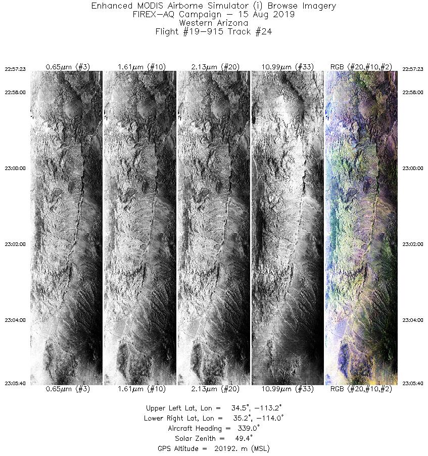
| 24 |
22:57 - 23:05 |
339.2 |
34.398 - 35.265 |
113.377 - 113.785 |
3108 |
20208 |
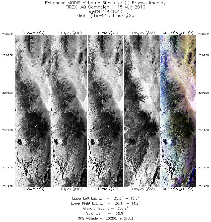
| 25 |
23:05 - 23:13 |
348.9 |
35.286 - 36.166 |
113.793 - 114.015 |
3050 |
20191 |
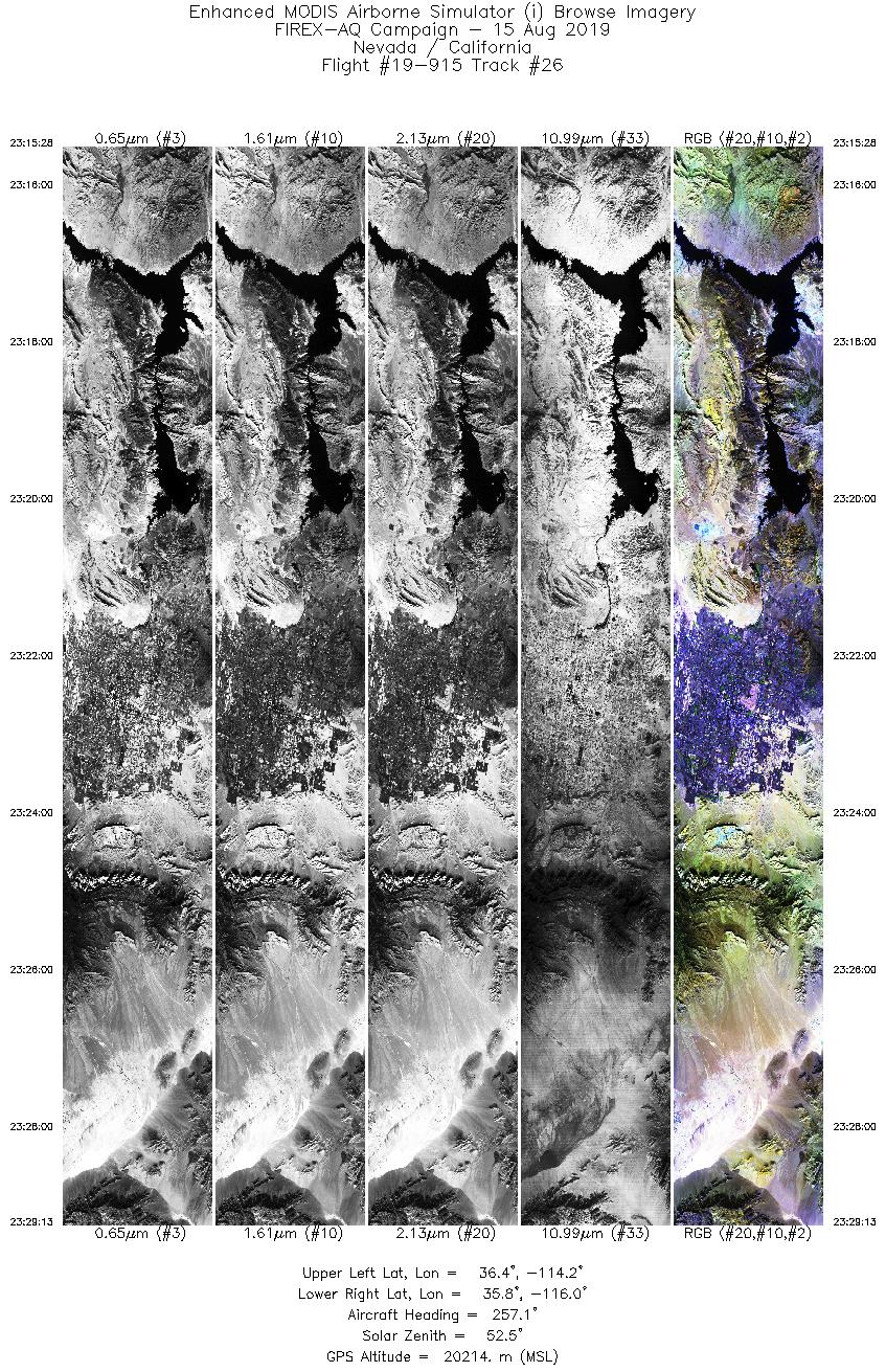
| 26 |
23:15 - 23:29 |
256.4 |
36.251 - 35.921 |
114.173 - 116.077 |
5158 |
20215 |
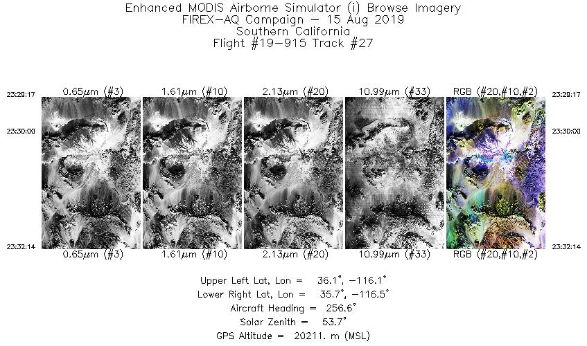
| 27 |
23:29 - 23:32 |
258.1 |
35.919 - 35.865 |
116.086 - 116.509 |
1103 |
20205 |
|
|
|


