Flight: 19-918
Date: 20 Aug 2019
Location: Western USA
Deployment: FIREX-AQ
Principal Investigators: Dr. Steven Platnick (NASA GSFC)
Configuration: 38 Channel
Additional Sensors: FIREX-AQ Payload
|
Data Evaluation
Overall quality is fair
|
Processing Information
Level-1B Data in HDF format is available upon request
Flight Line Summary
Spectral Band Configuration
Spectral Response Function Table
Spectral Response Function (text)
|
Browse Imagery
Flight Tracks: 17
Scanlines: 87164
|
Browse Imagery Table
|
Click a Flight Track number to view a quicklook image
Lat/Lon ranges are for the BEG-END scanline nadir pixels
|
Flight
Track |
Time Span
(UTC) |
Heading
(Deg) |
Lat Range
(Deg N) |
Lon Range
(Deg W) |
Length
(Scanlines) |
Altitude
(Meters) |
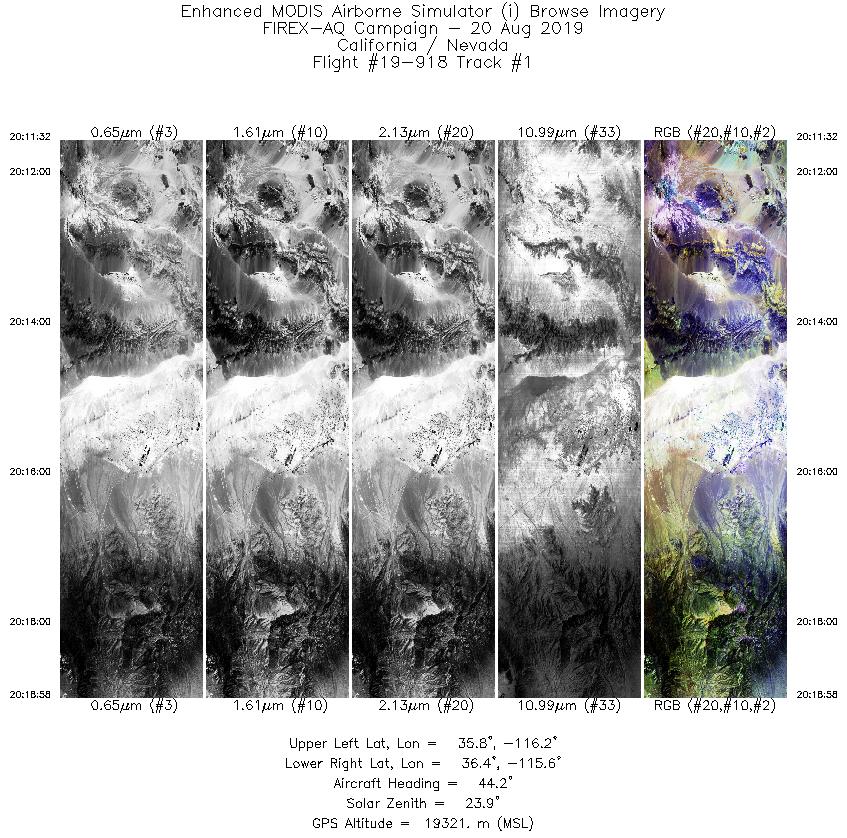
| 1 |
20:11 - 20:18 |
52.5 |
35.895 - 36.294 |
116.386 - 115.536 |
2790 |
19237 |
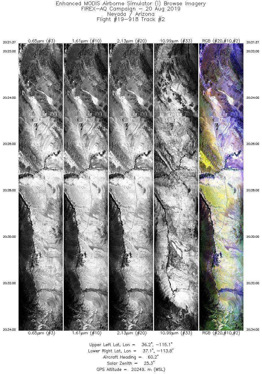
| 2 |
20:21 - 20:33 |
60.9 |
36.369 - 36.995 |
115.196 - 113.738 |
4644 |
20164 |
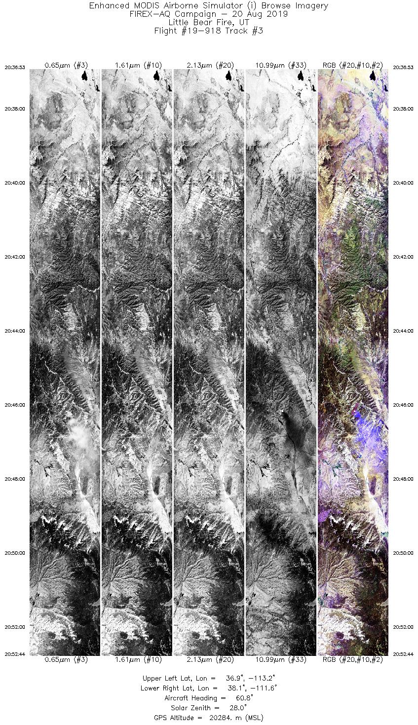
| 3 |
20:36 - 20:52 |
59.1 |
37.037 - 37.975 |
113.354 - 111.521 |
5945 |
20301 |
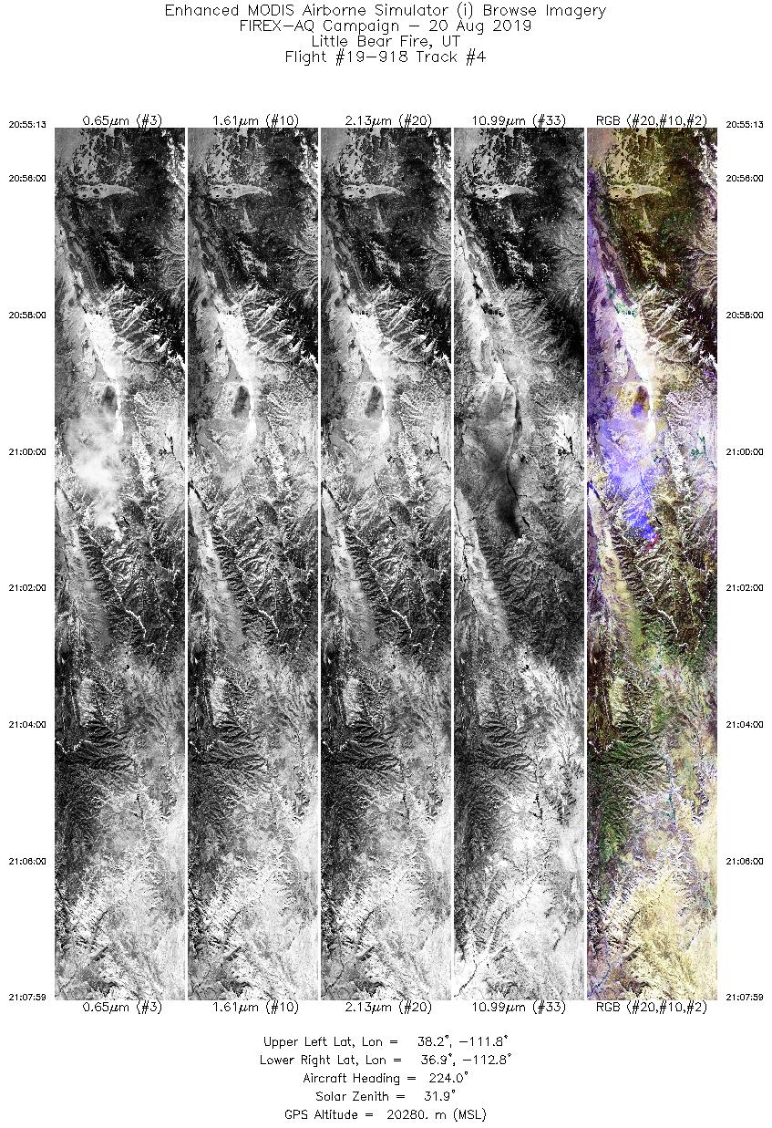
| 4 |
20:55 - 21:07 |
223.6 |
38.064 - 37.059 |
111.661 - 112.976 |
4789 |
20284 |
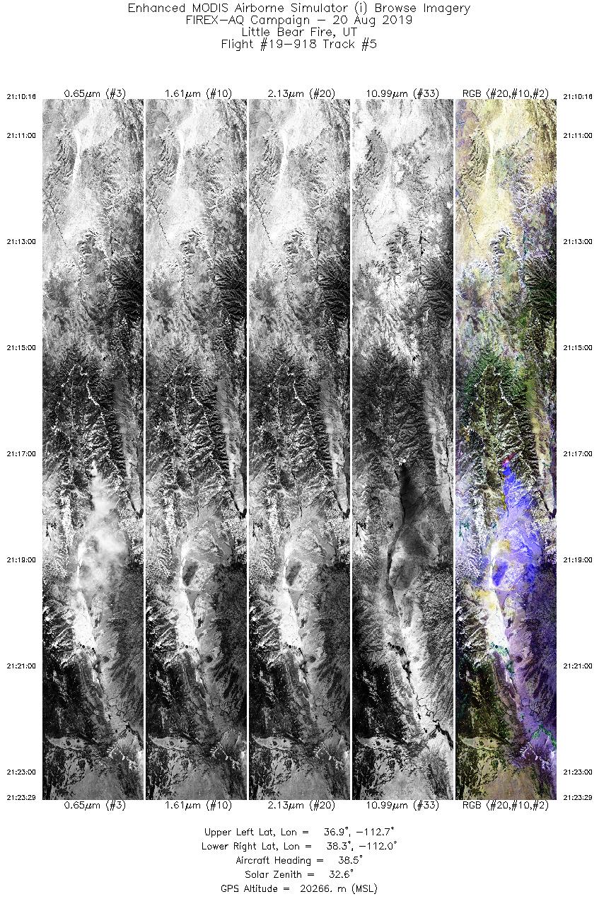
| 5 |
21:10 - 21:23 |
37.3 |
36.983 - 38.152 |
112.831 - 111.782 |
4958 |
20260 |
| 6 |
21:27 - 21:39 |
215.9 |
38.241 - 37.123 |
111.655 - 112.740 |
4622 |
20271 |
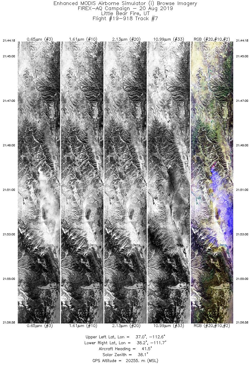
| 7 |
21:44 - 21:56 |
46.3 |
37.155 - 38.080 |
112.808 - 111.578 |
4750 |
20246 |
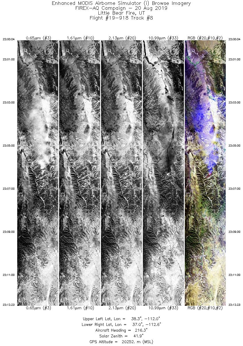
| 8 |
22:00 - 22:12 |
213.8 |
38.159 - 37.059 |
111.810 - 112.792 |
4622 |
20245 |
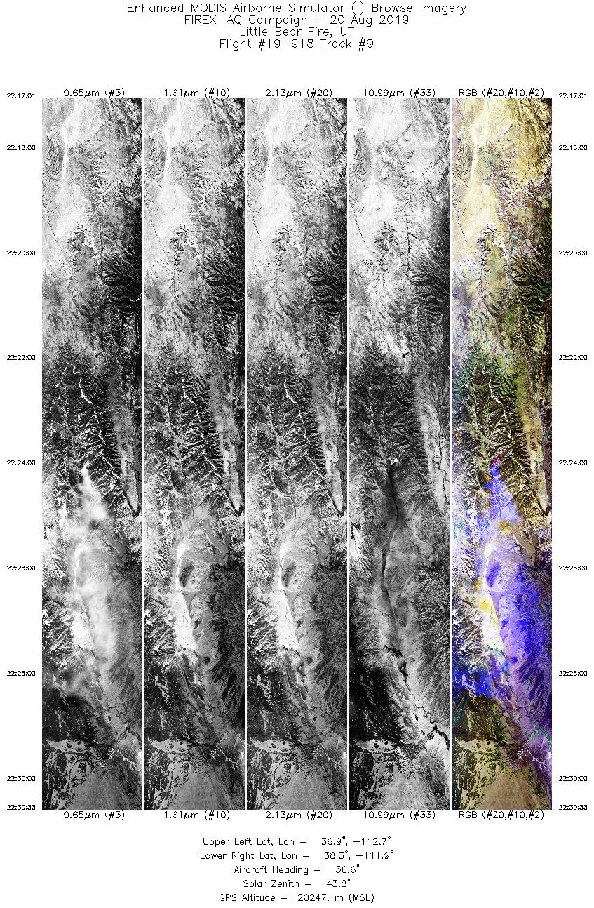
| 9 |
22:17 - 22:30 |
36.8 |
37.009 - 38.161 |
112.862 - 111.763 |
5074 |
20225 |
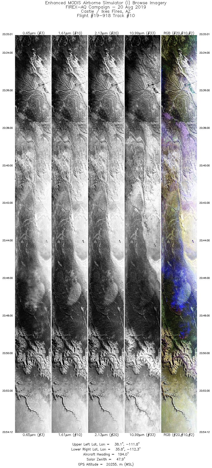
| 10 |
22:33 - 22:54 |
194.6 |
38.076 - 35.806 |
111.562 - 112.540 |
7942 |
20250 |
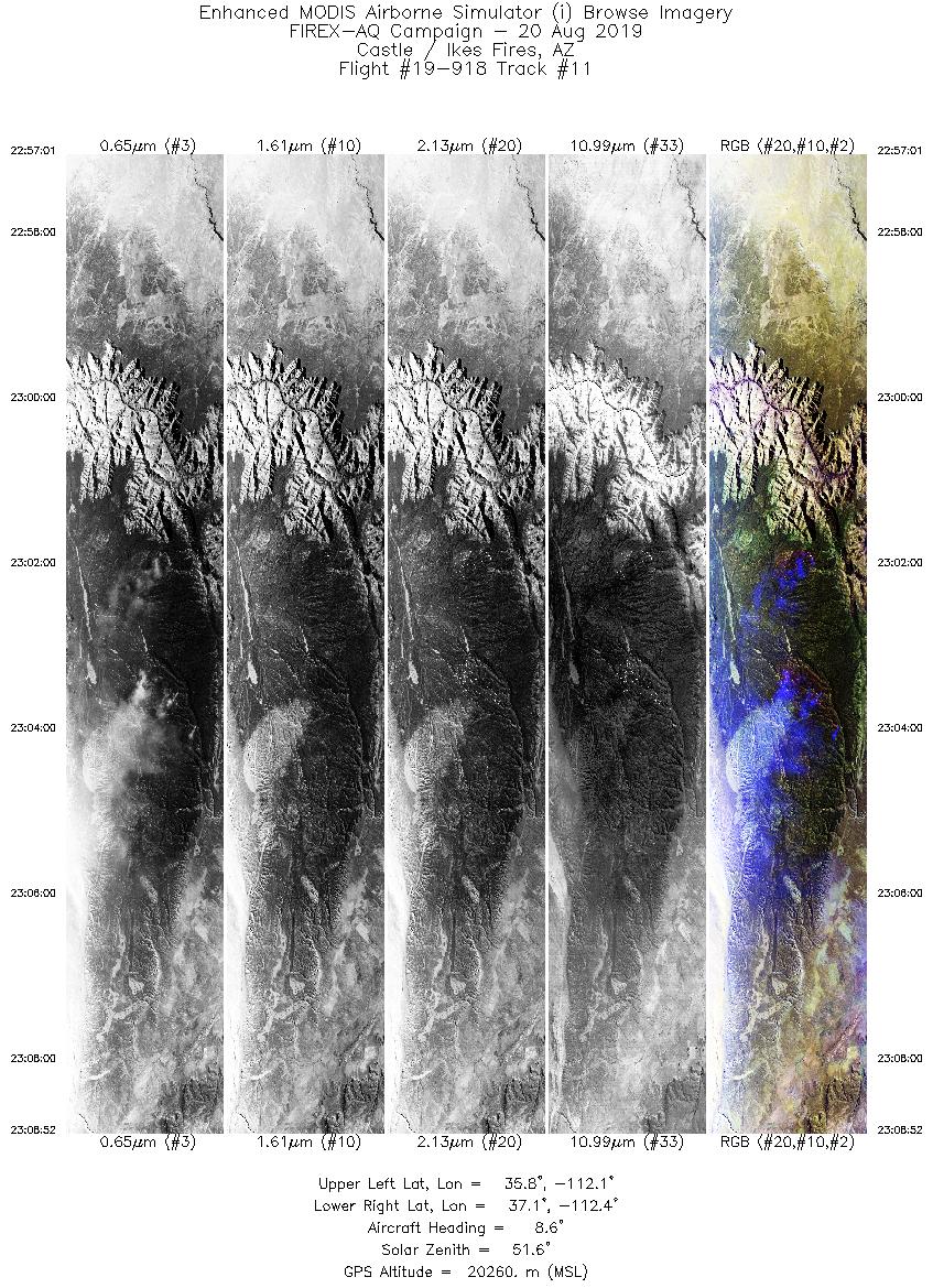
| 11 |
22:57 - 23:08 |
7.4 |
35.798 - 37.122 |
112.325 - 112.175 |
4445 |
20244 |
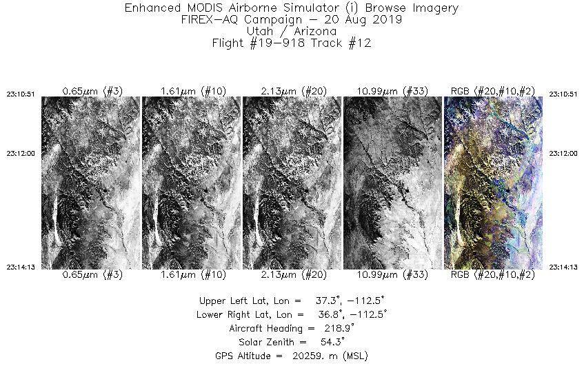
| 12 |
23:10 - 23:14 |
220.5 |
37.188 - 36.913 |
112.365 - 112.702 |
1258 |
20271 |
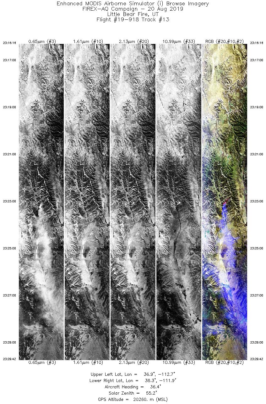
| 13 |
23:16 - 23:29 |
37.7 |
37.006 - 38.166 |
112.856 - 111.716 |
5043 |
20274 |
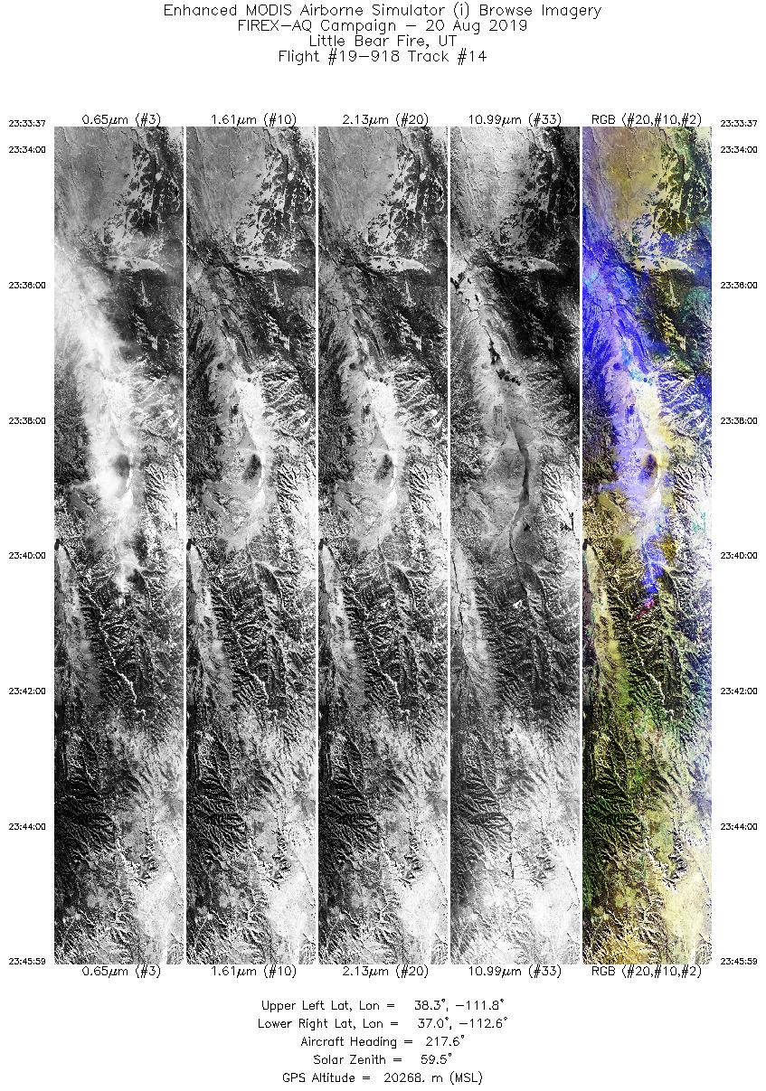
| 14 |
23:33 - 23:45 |
217.0 |
38.209 - 37.123 |
111.623 - 112.780 |
4637 |
20259 |
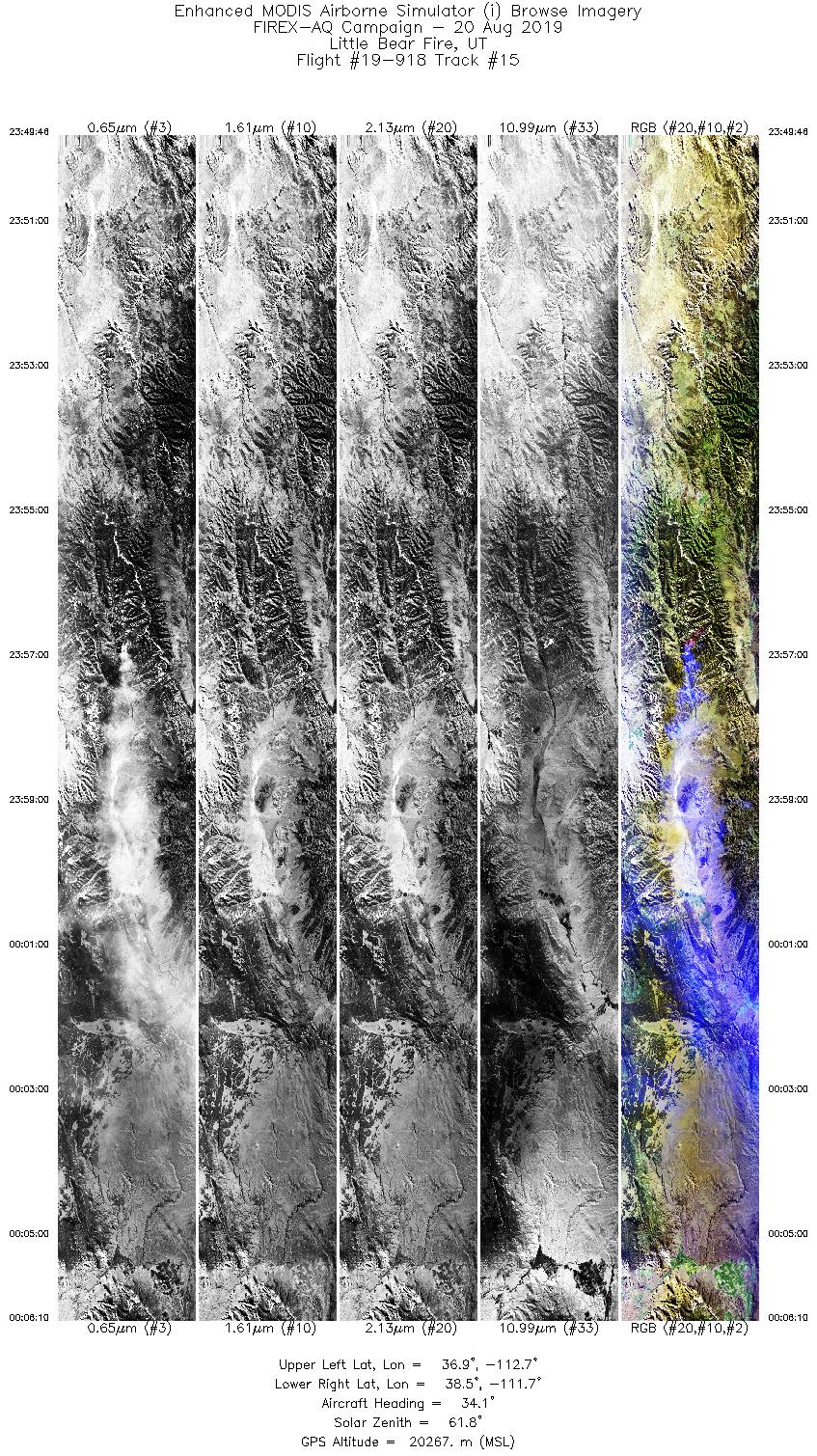
| 15 |
23:49 - 00:06 |
36.7 |
36.989 - 38.391 |
112.876 - 111.490 |
6148 |
20286 |
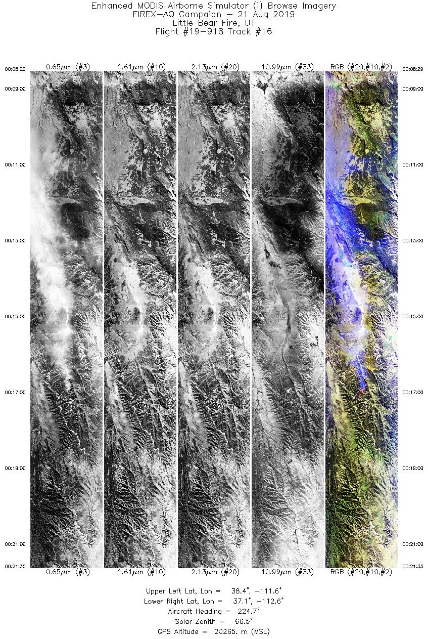
| 16 |
00:08 - 00:21 |
222.9 |
38.278 - 37.207 |
111.414 - 112.766 |
4915 |
20262 |
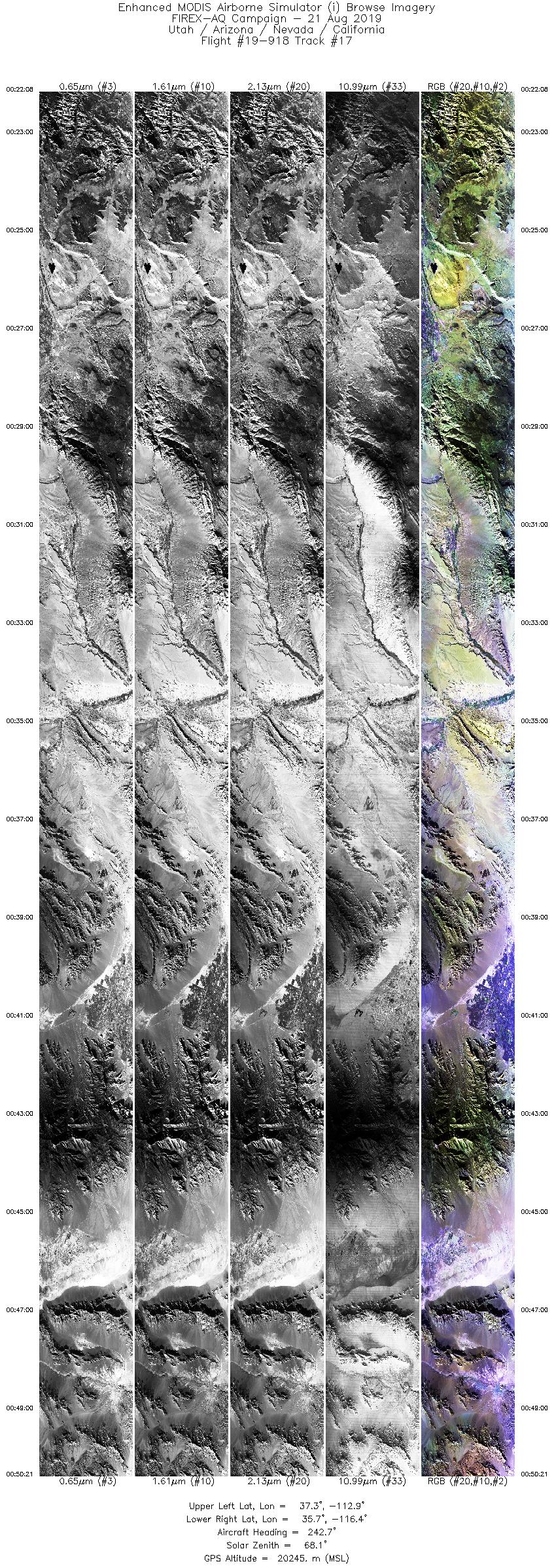
| 17 |
00:22 - 00:50 |
242.7 |
37.172 - 35.871 |
112.833 - 116.517 |
10582 |
20290 |
|
Wildfire Imagery
|
| Wildfire |
Date |
Time (UTC) |
Flight: Track |
Lat |
Lon |
| Little Bear Fire |
8/20/2019 |
20:46 |
19-918: 03 |
37.58850 |
-112.32000 |
| Little Bear Fire |
8/20/2019 |
21:01 |
19-918: 04 |
37.58850 |
-112.32000 |
| Little Bear Fire |
8/20/2019 |
21:17 |
19-918: 05 |
37.58850 |
-112.32000 |
| Little Bear Fire |
8/20/2019 |
21:34 |
19-918: 06 |
37.58850 |
-112.32000 |
| Little Bear Fire |
8/20/2019 |
21:50 |
19-918: 07 |
37.58850 |
-112.32000 |
| Little Bear Fire |
8/20/2019 |
22:06 |
19-918: 08 |
37.58850 |
-112.32000 |
| Little Bear Fire |
8/20/2019 |
22:24 |
19-918: 09 |
37.58850 |
-112.32000 |
| Castle/Ikes Fires |
8/20/2019 |
22:48 |
19-918: 10 |
36.53116 |
-112.22810 |
| Castle/Ikes Fires |
8/20/2019 |
23:03 |
19-918: 11 |
36.53116 |
-112.22810 |
| Little Bear Fire |
8/20/2019 |
23:23 |
19-918: 13 |
37.58850 |
-112.32000 |
| Little Bear Fire |
8/20/2019 |
23:41 |
19-918: 14 |
37.58850 |
-112.32000 |
| Little Bear Fire |
8/20/2019 |
23:56 |
19-918: 15 |
37.58850 |
-112.32000 |
| Little Bear Fire |
8/21/2019 |
00:17 |
19-918: 16 |
37.58850 |
-112.32000 |
|
Satellite Overpasses
|
| Satellite |
Date |
Time (UTC) |
Flight: Track |
| Suomi-NPP |
8/20/2019 |
20:46 |
19-918: 03 |
| TROPOMI |
8/20/2019 |
~20:50 |
19-918: 03 |
| AQUA |
8/20/2019 |
21:00 |
19-918: 04 |
|


