Flight: 19-919
Date: 21 Aug 2019
Location: Western USA
Deployment: FIREX-AQ
Principal Investigators: Dr. Steven Platnick (NASA GSFC)
Configuration: 38 Channel
Additional Sensors: FIREX-AQ Payload
|
Data Evaluation
Overall quality is fair
|
Processing Information
Level-1B Data in HDF format is available upon request
Flight Line Summary
Spectral Band Configuration
Spectral Response Function Table
Spectral Response Function (text)
|
Browse Imagery
Flight Tracks: 17
Scanlines: 90558
|
Browse Imagery Table
|
Click a Flight Track number to view a quicklook image
Lat/Lon ranges are for the BEG-END scanline nadir pixels
|
Flight
Track |
Time Span
(UTC) |
Heading
(Deg) |
Lat Range
(Deg N) |
Lon Range
(Deg W) |
Length
(Scanlines) |
Altitude
(Meters) |
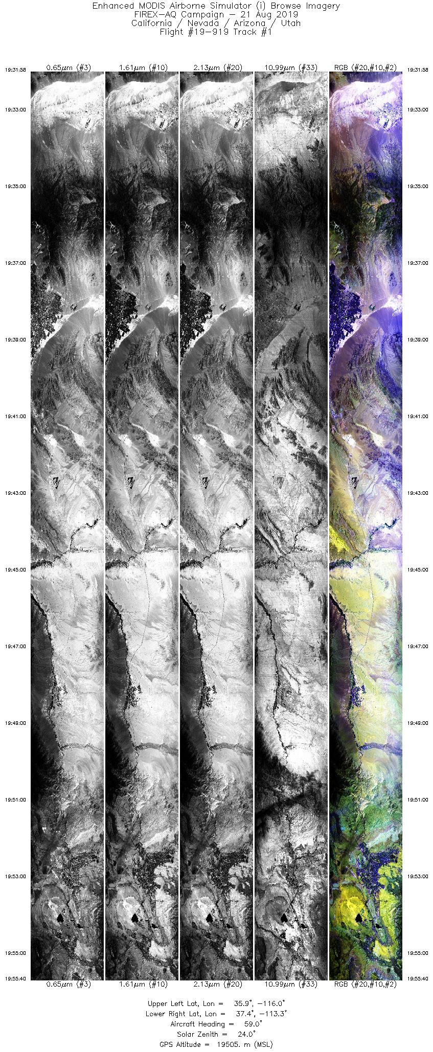
| 1 |
19:31 - 19:55 |
61.1 |
36.023 - 37.217 |
116.048 - 113.194 |
8891 |
19028 |
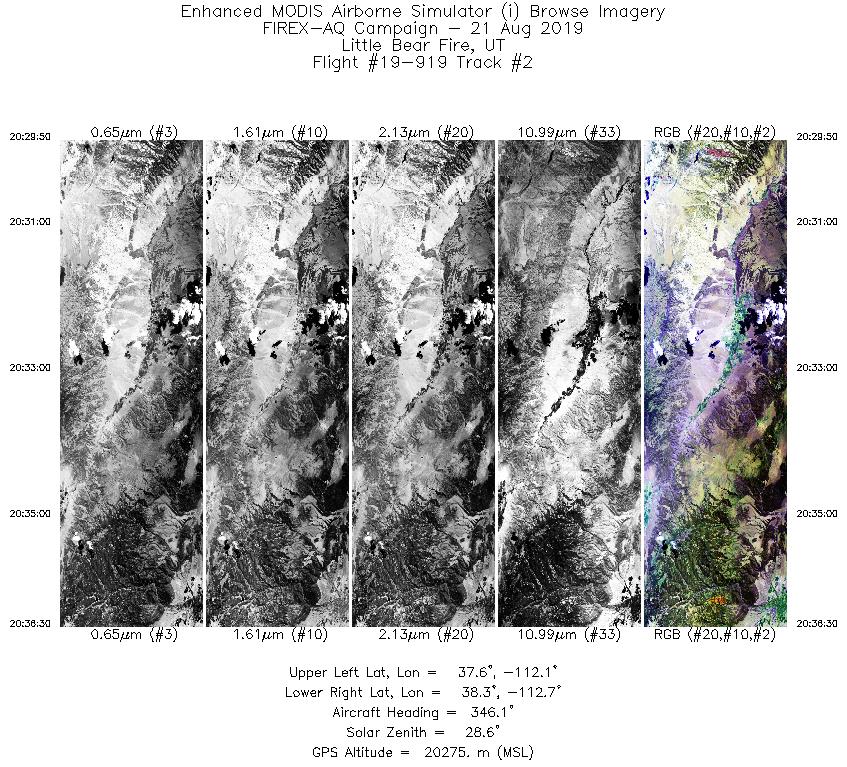
| 2 |
20:29 - 20:36 |
346.7 |
37.568 - 38.324 |
112.288 - 112.509 |
2502 |
20269 |
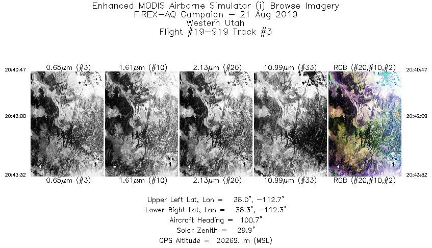
| 3 |
20:40 - 20:43 |
103.1 |
38.194 - 38.117 |
112.693 - 112.321 |
1032 |
20274 |
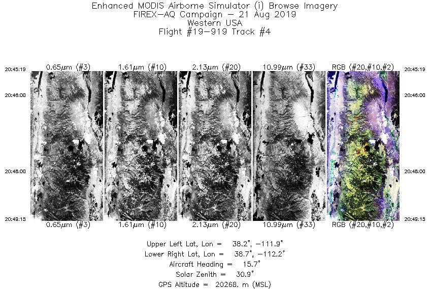
| 4 |
20:45 - 20:49 |
14.8 |
38.208 - 38.653 |
112.123 - 112.002 |
1477 |
20275 |
| 5 |
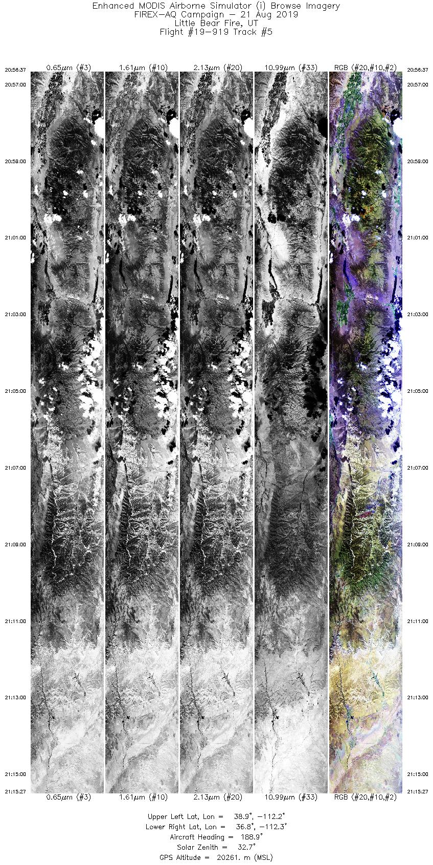
20:56 - 21:15 |
189.7 |
38.839 - 36.783 |
111.944 - 112.509 |
7059 |
20267 |
| 6 |
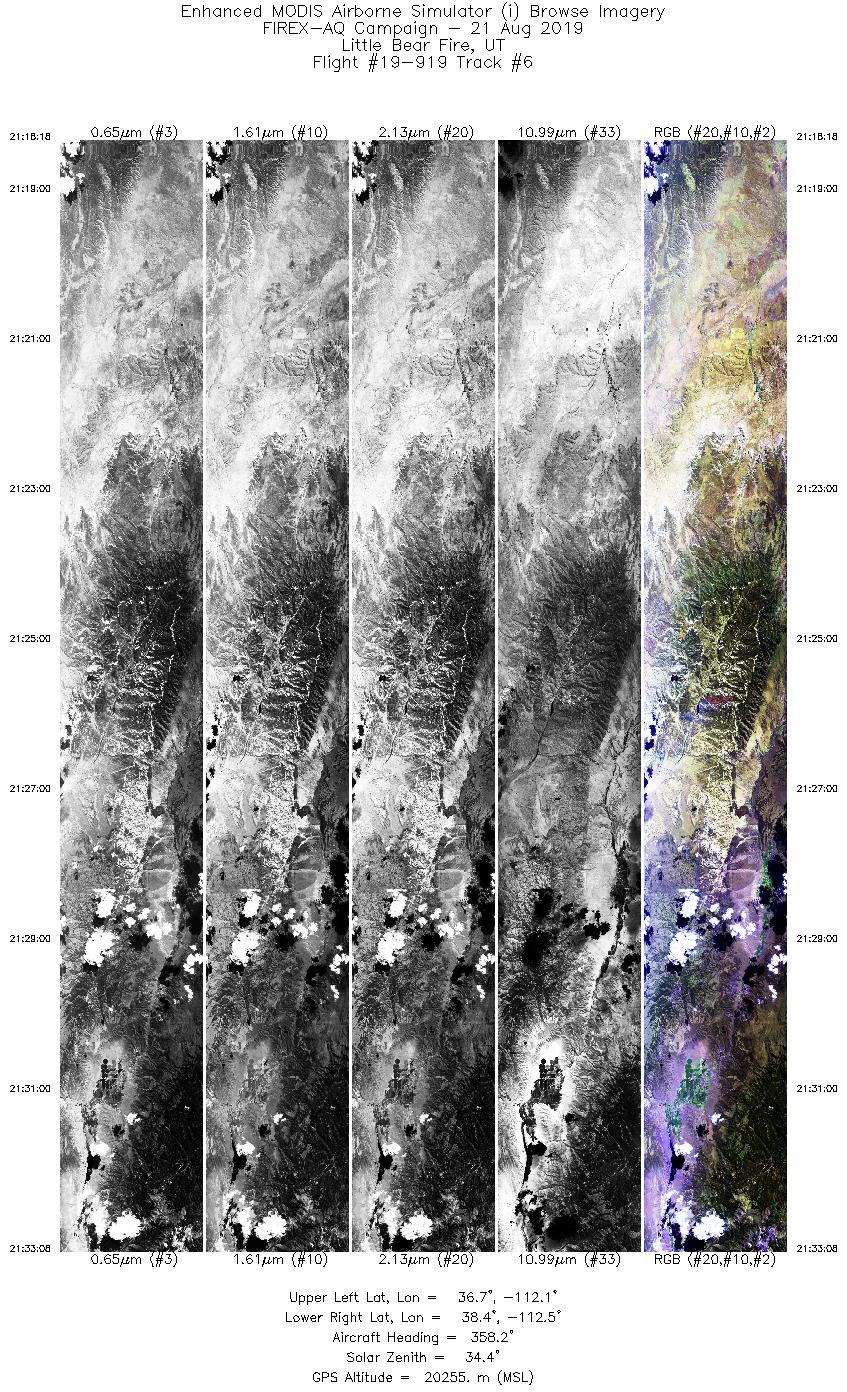
21:18 - 21:33 |
358.4 |
36.737 - 38.429 |
112.281 - 112.310 |
5563 |
20258 |
| 7 |
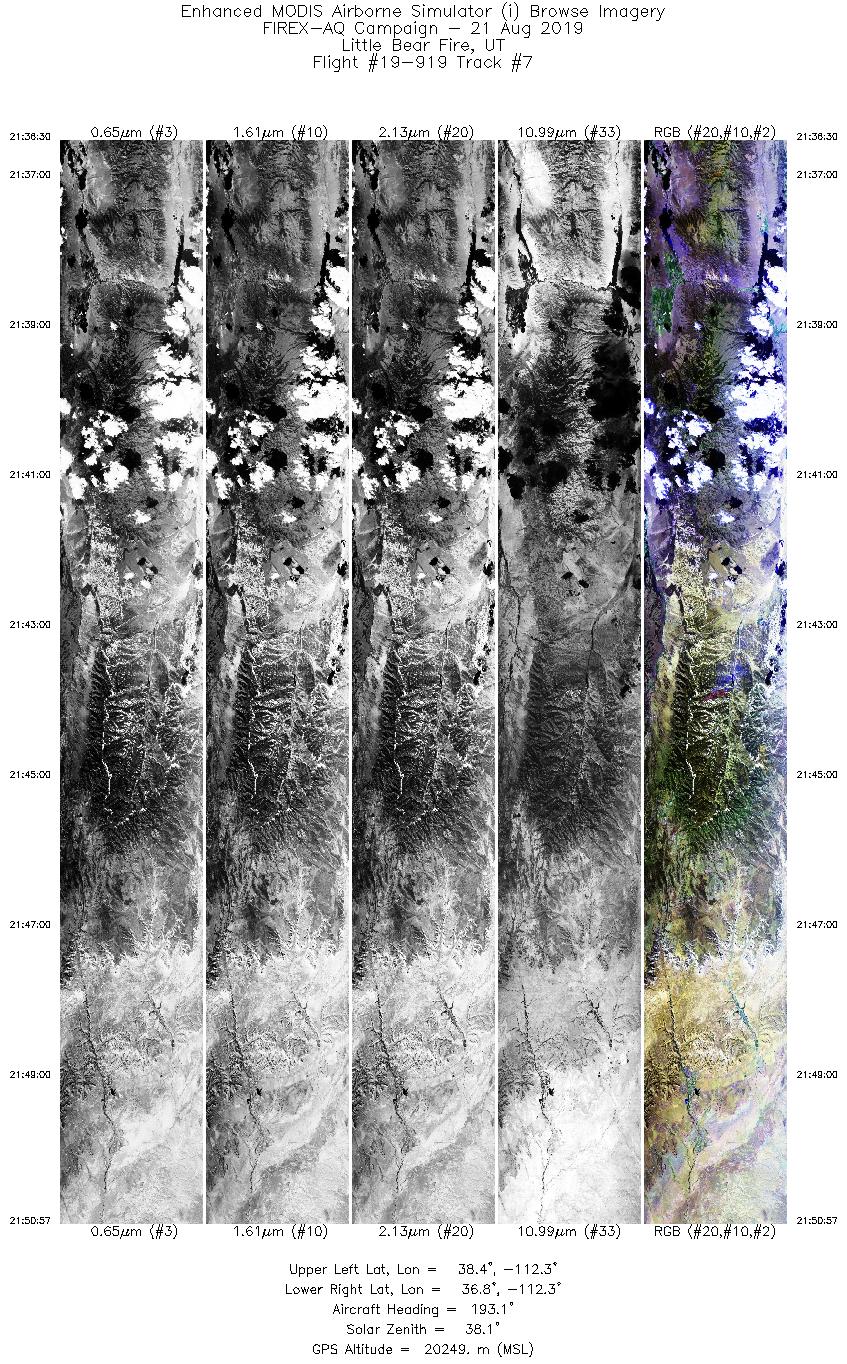
21:36 - 21:50 |
192.5 |
38.396 - 36.812 |
112.041 - 112.529 |
5420 |
20253 |
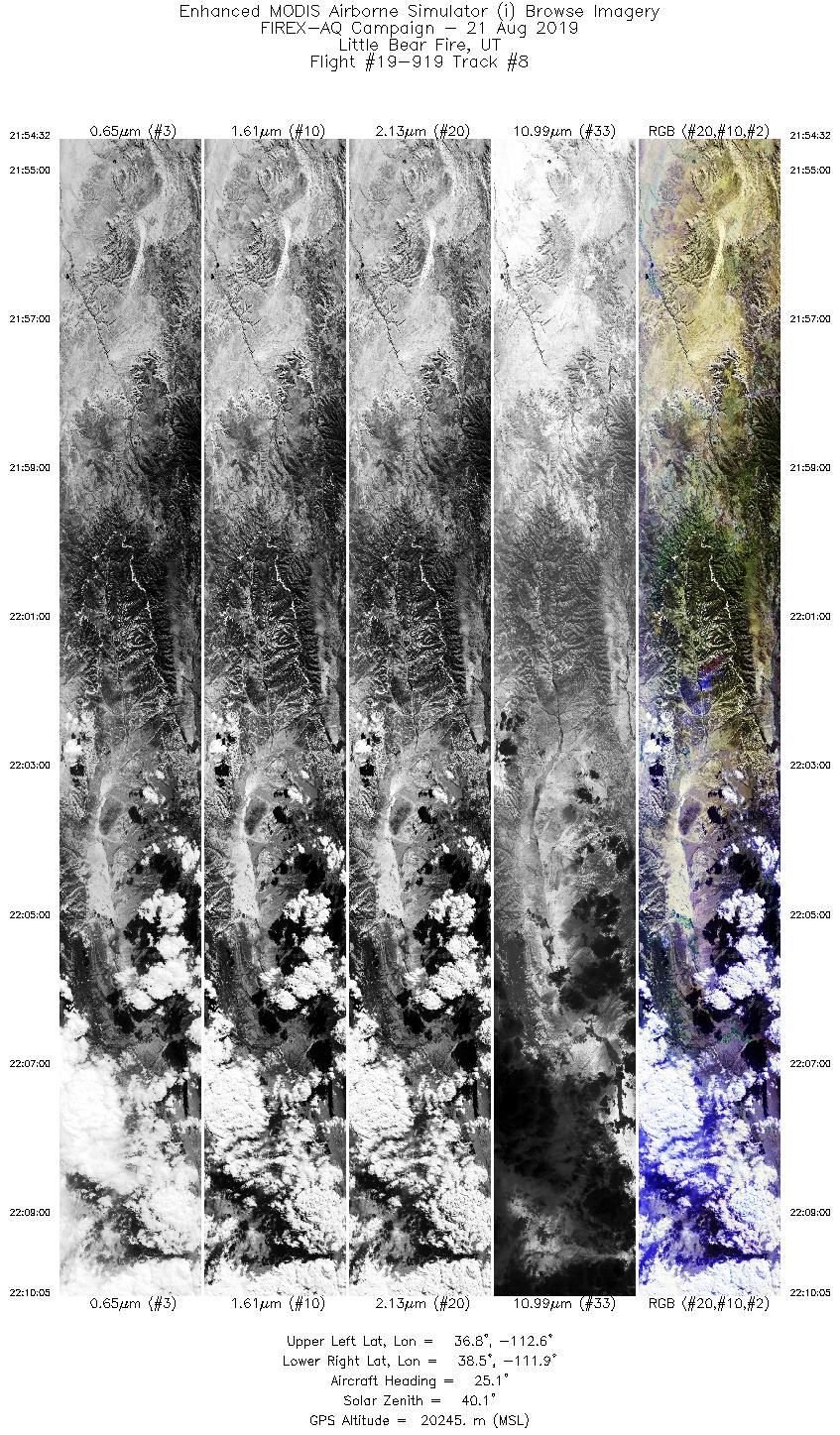
| 8 |
21:54 - 22:10 |
27.7 |
36.897 - 38.416 |
112.793 - 111.675 |
5836 |
20253 |
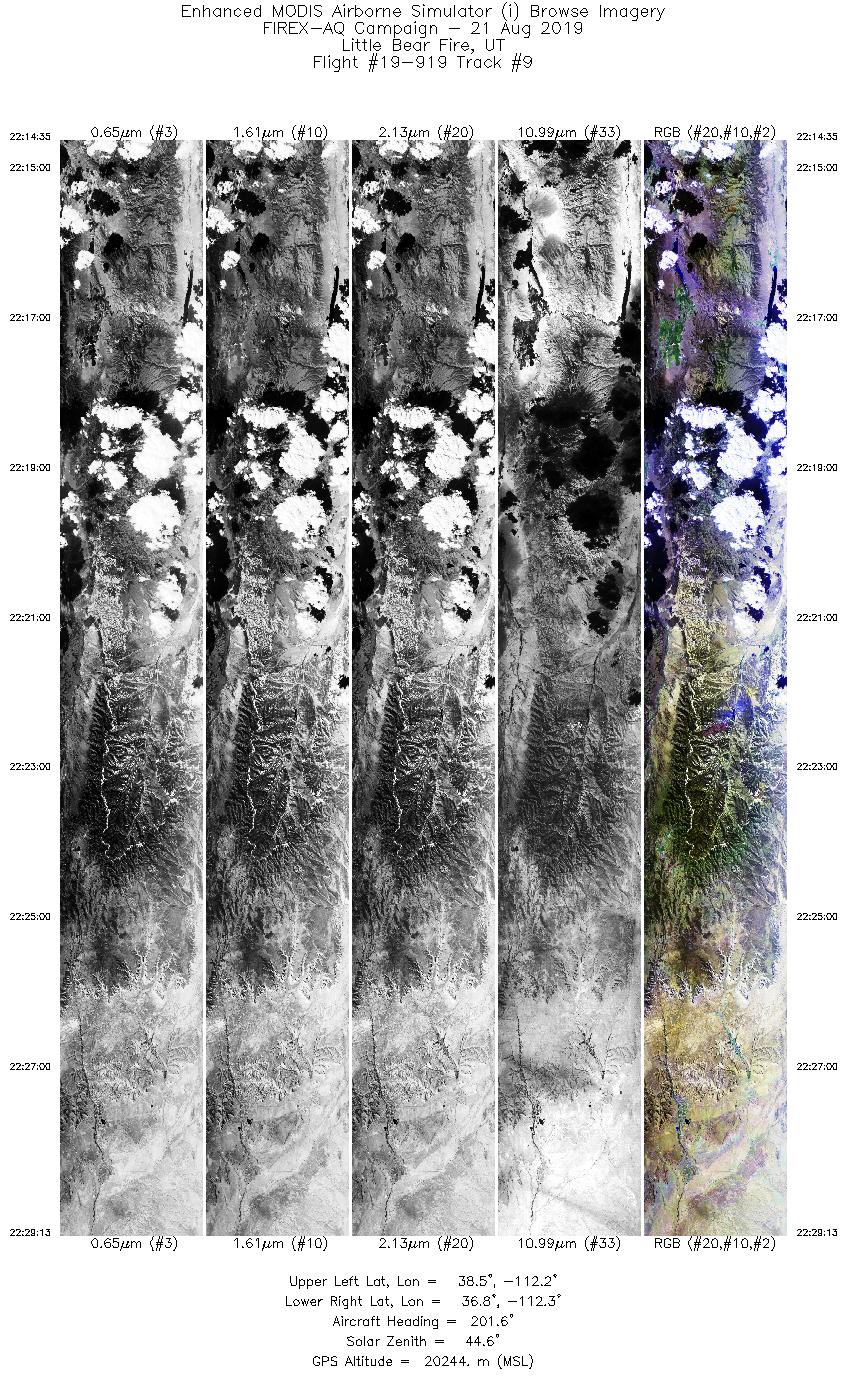
| 9 |
22:14 - 22:29 |
196.0 |
38.451 - 36.834 |
112.048 - 112.492 |
5484 |
20253 |
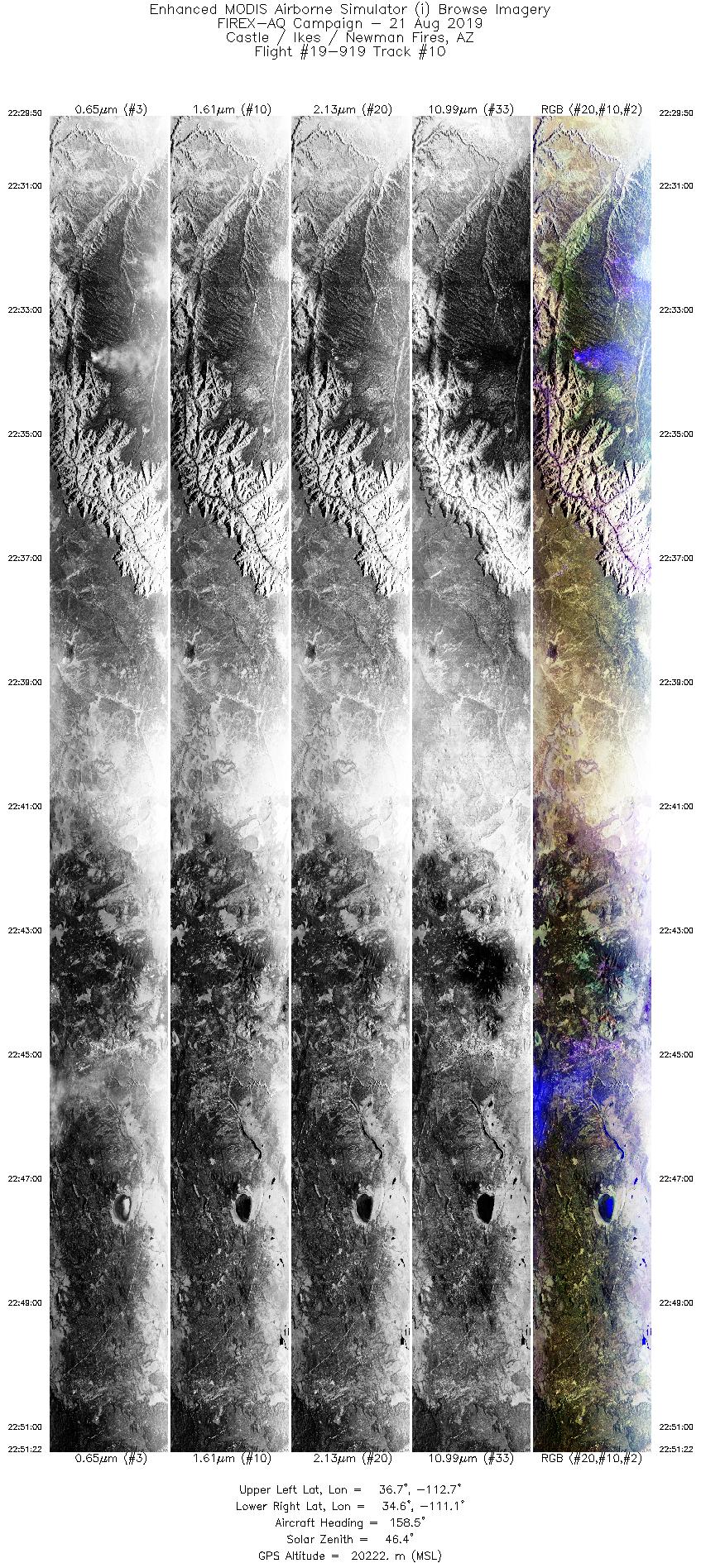
| 10 |
22:29 - 22:51 |
156.0 |
36.764 - 34.530 |
112.485 - 111.272 |
8077 |
20234 |
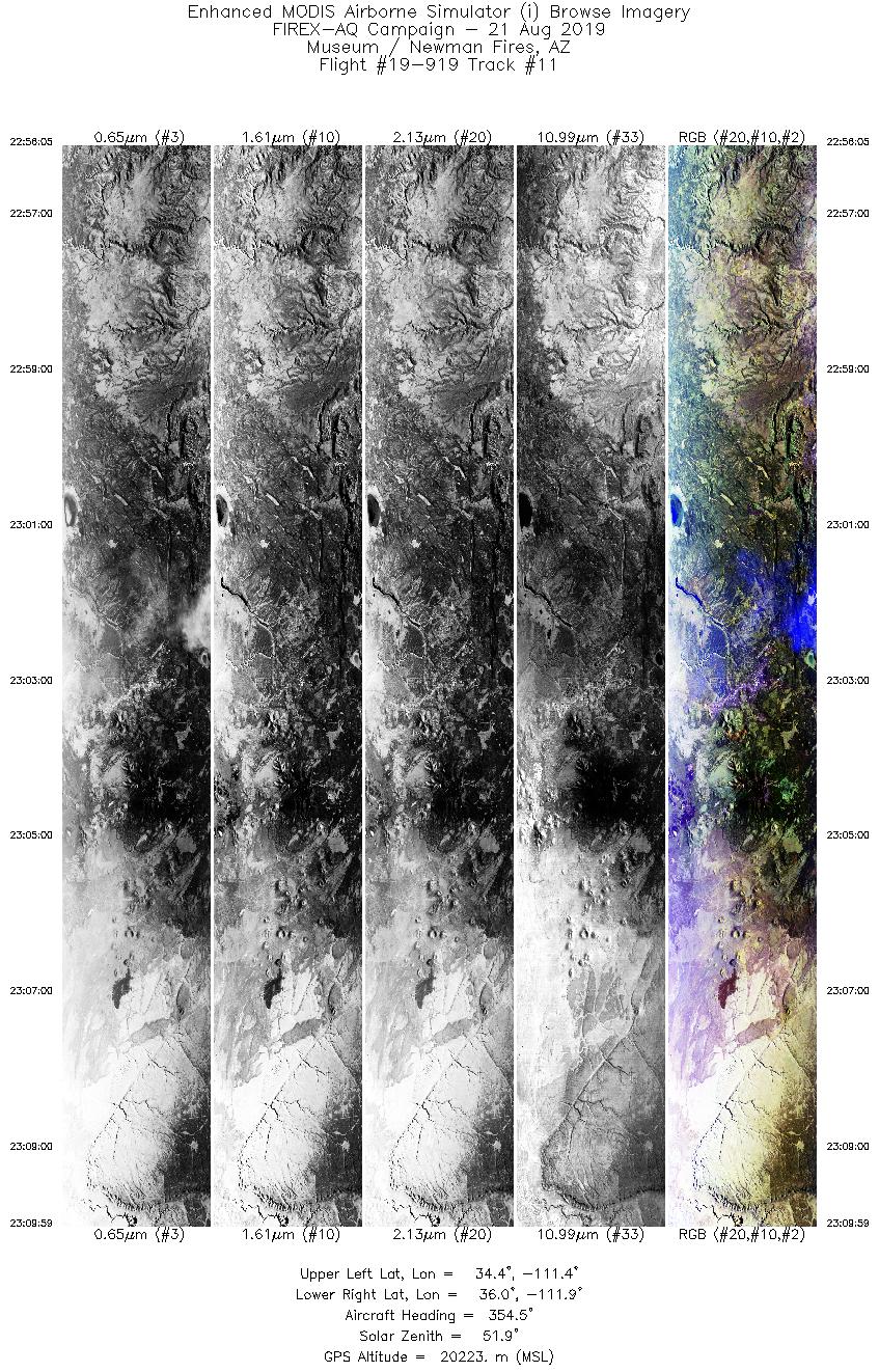
| 11 |
22:56 - 23:09 |
355.9 |
34.410 - 35.959 |
111.590 - 111.676 |
5213 |
20224 |
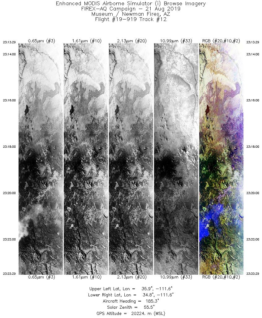
| 12 |
23:13 - 23:23 |
187.7 |
35.926 - 34.815 |
111.414 - 111.755 |
3749 |
20224 |
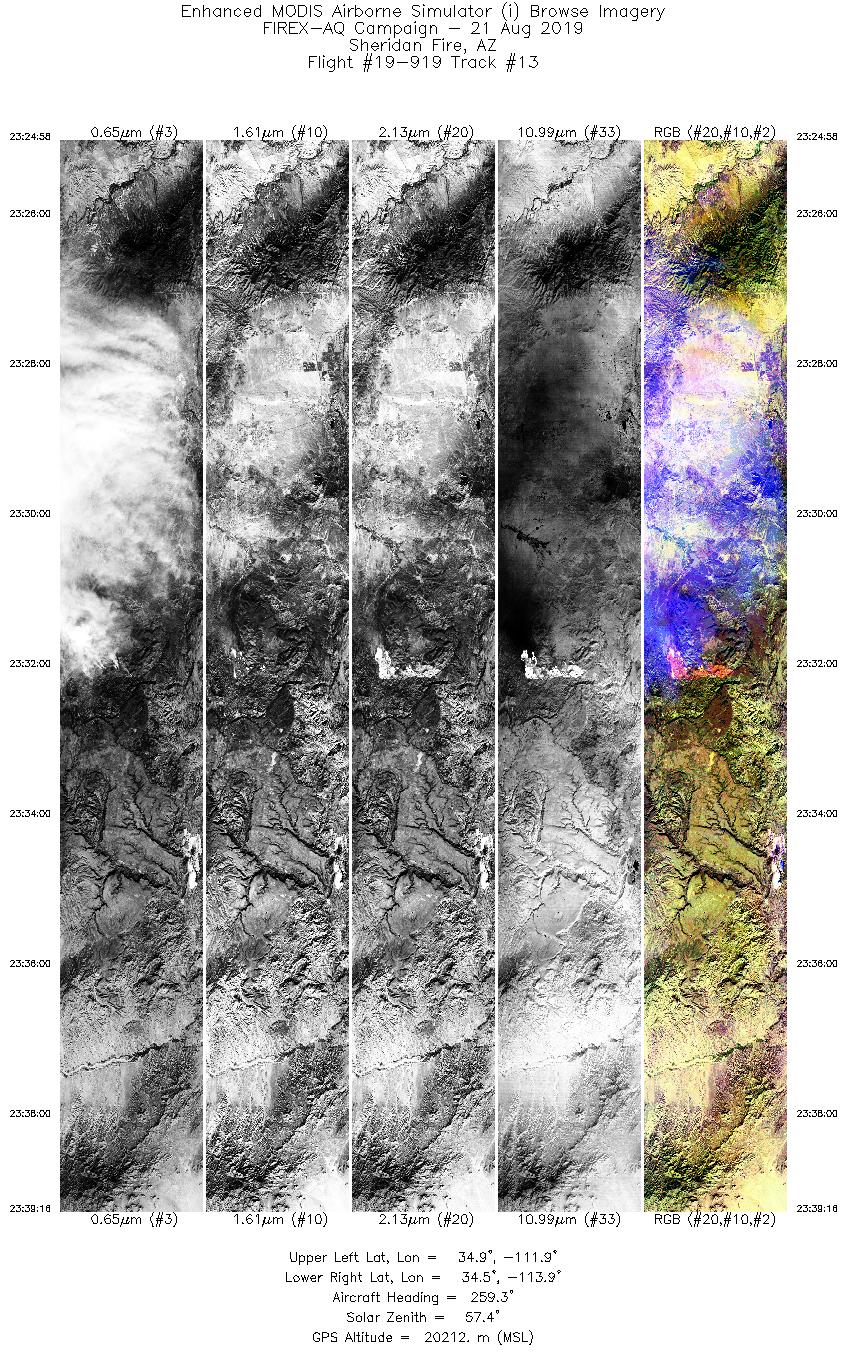
| 13 |
23:24 - 23:39 |
264.1 |
34.717 - 34.708 |
111.910 - 113.894 |
5362 |
20212 |
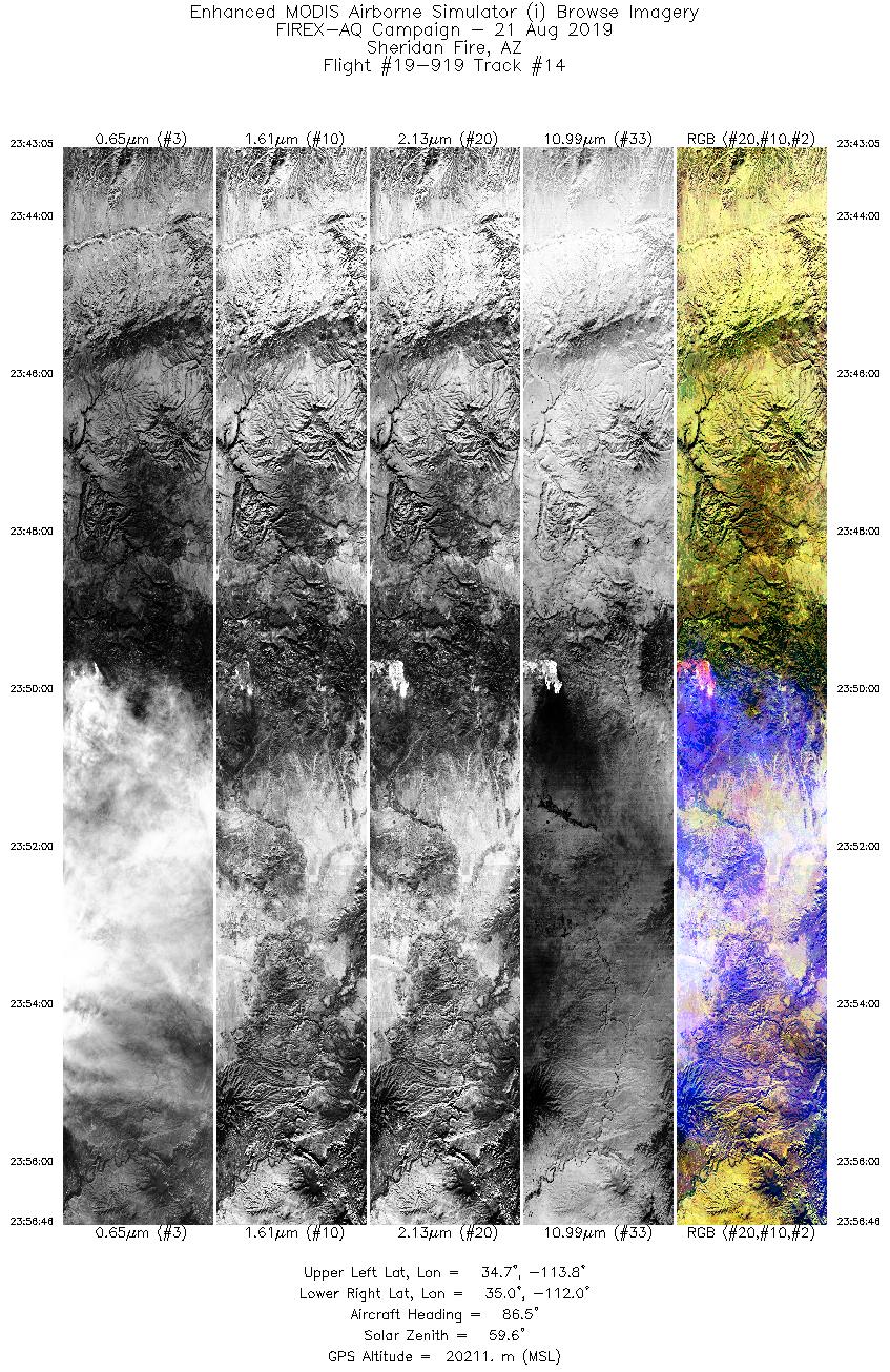
| 14 |
23:43 - 23:56 |
86.8 |
34.872 - 34.868 |
113.777 - 111.951 |
5132 |
20207 |
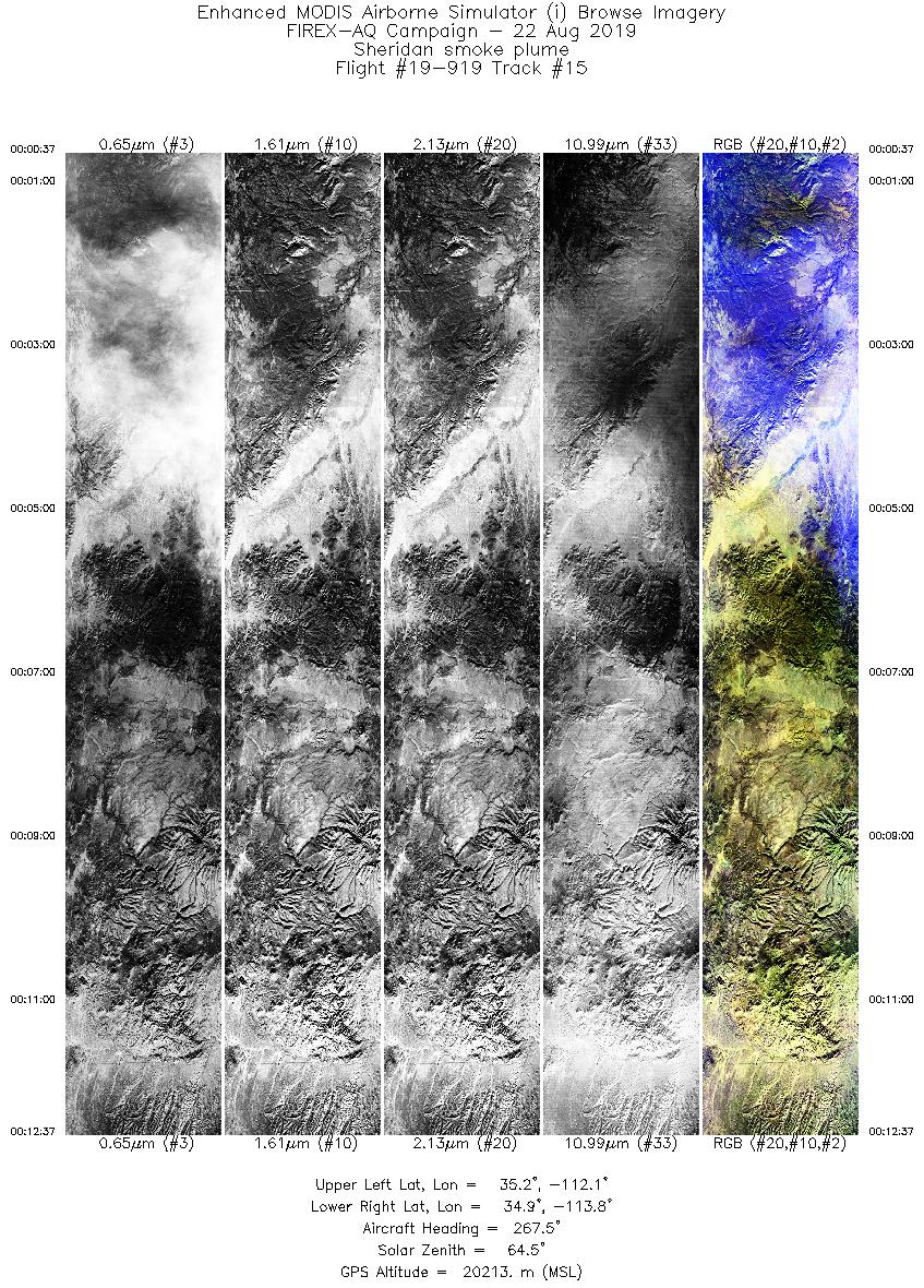
| 15 |
00:00 - 00:12 |
268.5 |
35.043 - 35.038 |
112.121 - 113.785 |
4500 |
20210 |
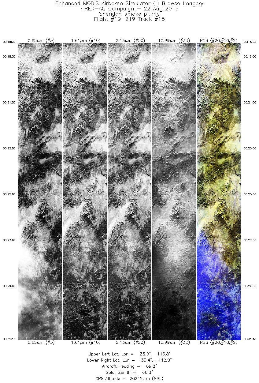
| 16 |
00:18 - 00:31 |
88.2 |
35.200 - 35.213 |
113.761 - 112.033 |
4855 |
20208 |
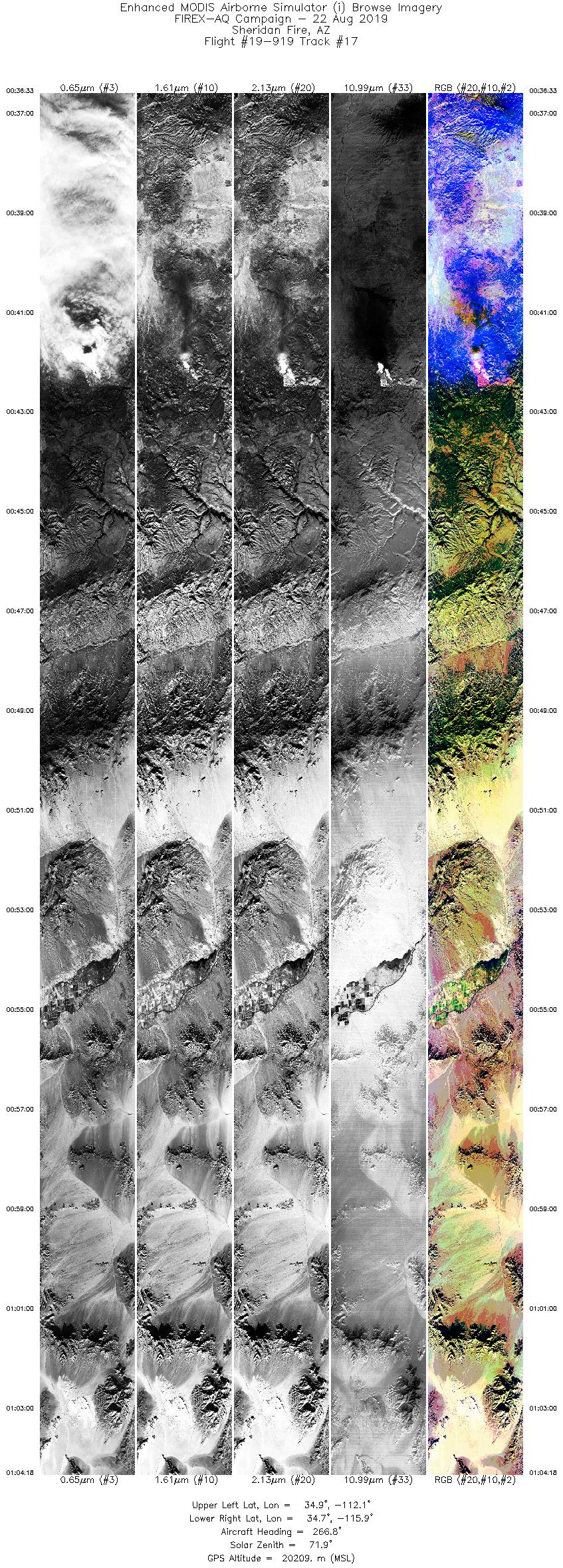
| 17 |
00:36 - 01:04 |
269.8 |
34.782 - 34.909 |
112.068 - 115.914 |
10406 |
20217 |
|
Wildfire Imagery
|
| Wildfire |
Date |
Time (UTC) |
Flight: Track |
Lat |
Lon |
| Little Bear Fire |
8/21/2019 |
20:30 |
19-919: 02 |
37.58850 |
-112.32000 |
| Little Bear Fire |
8/21/2019 |
21:08 |
19-919: 05 |
37.58850 |
-112.32000 |
| Little Bear Fire |
8/21/2019 |
21:26 |
19-919: 06 |
37.58850 |
-112.32000 |
| Little Bear Fire |
8/21/2019 |
21:44 |
19-919: 07 |
37.58850 |
-112.32000 |
| Little Bear Fire |
8/21/2019 |
22:02 |
19-919: 08 |
37.58850 |
-112.32000 |
| Little Bear Fire |
8/21/2019 |
22:22 |
19-919: 09 |
37.58850 |
-112.32000 |
| Castle/Ikes Fires |
8/21/2019 |
23:33 |
19-919: 10 |
36.53116 |
-112.22810 |
| Sheridan Fire |
8/21/2019 |
23:32 |
19-919: 13 |
34.67778 |
-112.89030 |
| Sheridan Fire |
8/21/2019 |
23:50 |
19-919: 14 |
34.67778 |
-112.89030 |
| Sheridan Fire |
8/22/2019 |
00:42 |
19-919: 17 |
34.67778 |
-112.89030 |
|
Satellite Overpasses
|
| Satellite |
Date |
Time (UTC) |
Flight: Track |
| SUOMI-NPP |
8/21/2019 |
20:27 |
19-919: 02 |
| TROPOMI |
8/21/2019 |
~20:30 |
19-919: 02 |
|


