Flight: 19-910
Date: 06 Aug 2019
Location: Western USA
Deployment: FIREX-AQ
Principal Investigators: Dr. Steven Platnick (NASA GSFC)
Configuration: 38 Channel
Additional Sensors: FIREX-AQ Payload
|
Data Evaluation
Overall quality is fair
|
Processing Information
Level-1B Data in HDF format is available upon request
Flight Line Summary
Spectral Band Configuration
Spectral Response Function Table
Spectral Response Function (text)
|
Browse Imagery
Flight Tracks: 25
Scanlines: 125628
|
Browse Imagery Table
|
Click a Flight Track number to view a quicklook image
Lat/Lon ranges are for the BEG-END scanline nadir pixels
|
Flight
Track |
Time Span
(UTC) |
Heading
(Deg) |
Lat Range
(Deg N) |
Lon Range
(Deg W) |
Length
(Scanlines) |
Altitude
(Meters) |
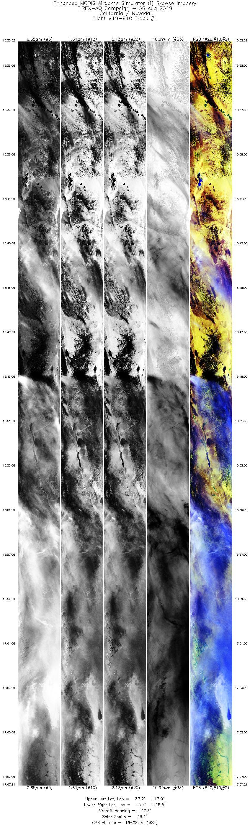
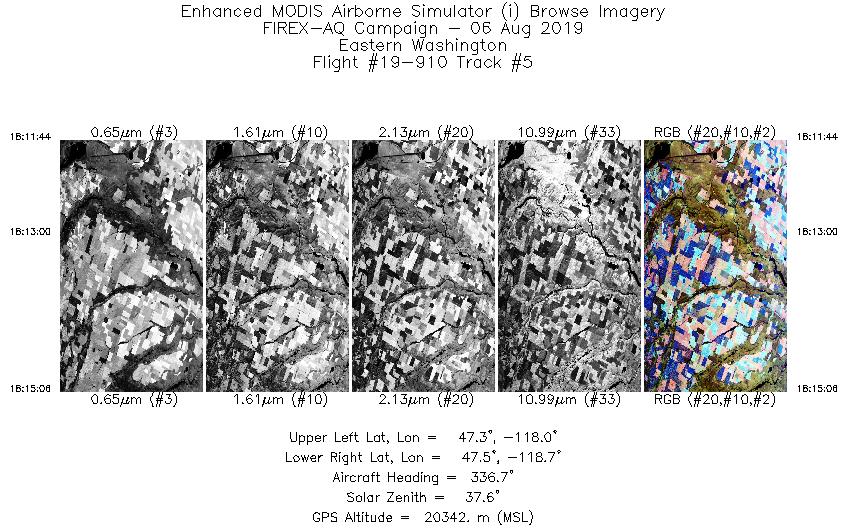
| 1 |
16:33 - 17:07 |
30.1 |
37.228 - 40.305 |
118.106 - 115.587 |
12562 |
19159 |
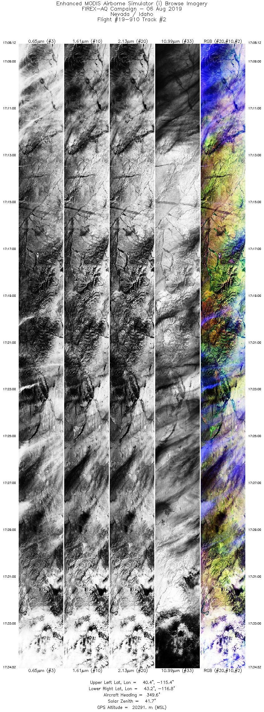
| 2 |
17:08 - 17:34 |
346.3 |
40.396 - 43.254 |
115.565 - 116.626 |
9999 |
20247 |
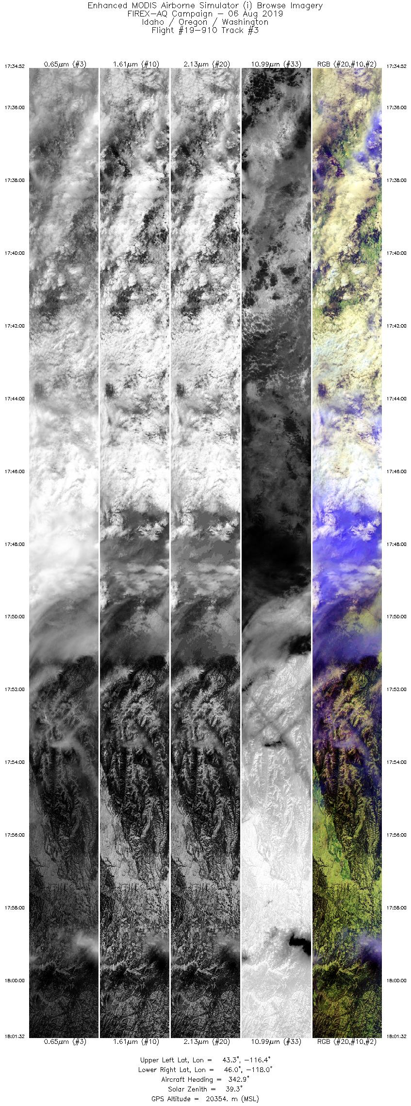
| 3 |
17:34 - 18:01 |
343.5 |
43.255 - 46.078 |
116.626 - 117.784 |
9999 |
20358 |
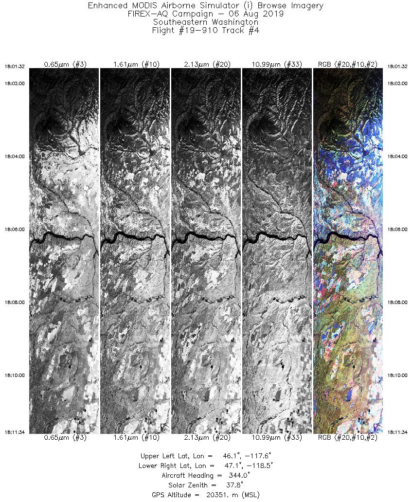
| 4 |
18:01 - 18:11 |
344.8 |
46.078 - 47.164 |
117.784 - 118.222 |
3762 |
20349 |
| 5 |
18:11 - 18:15 |
336.5 |
47.183 - 47.531 |
118.231 - 118.452 |
1261 |
20338 |
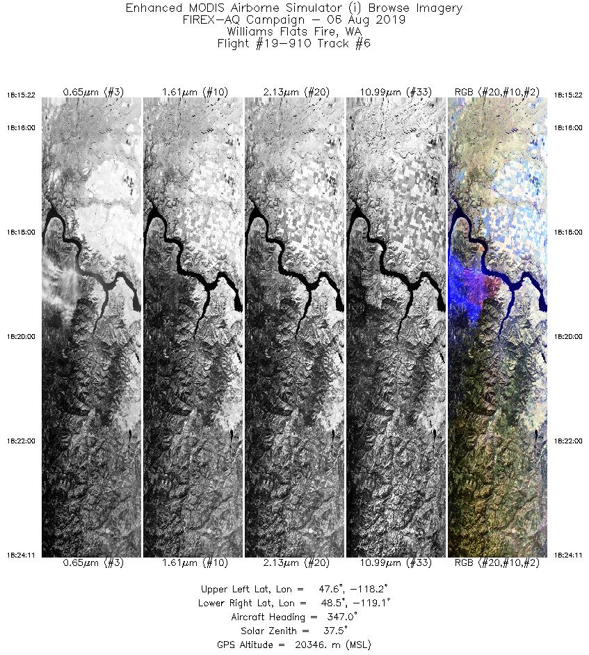
| 6 |
18:15 - 18:24 |
348.9 |
47.560 - 48.512 |
118.465 - 118.802 |
3308 |
20352 |
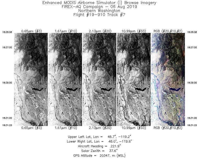
| 7 |
18:26 - 18:31 |
225.7 |
48.567 - 48.166 |
119.050 - 119.715 |
1983 |
20358 |
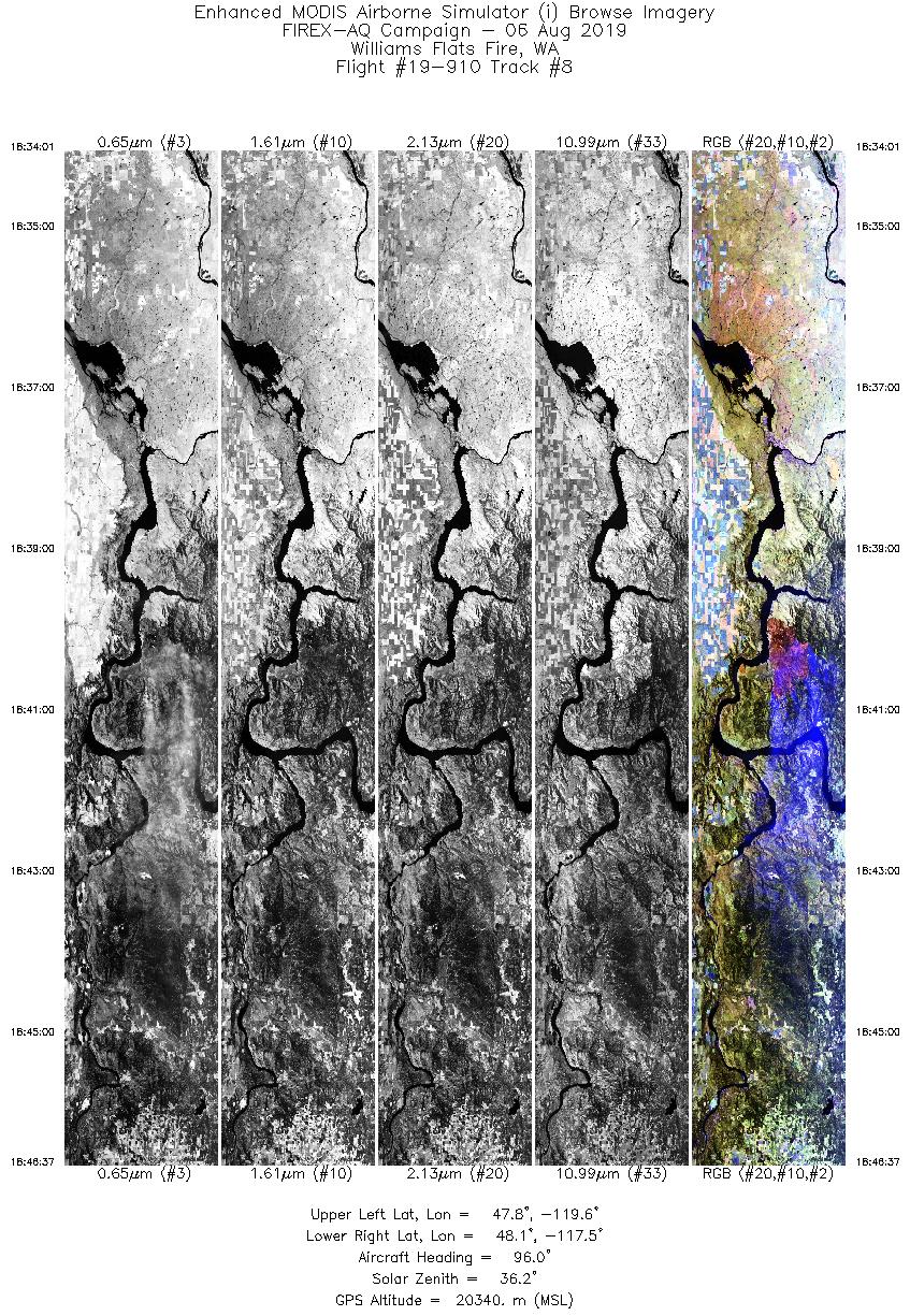
| 8 |
18:34 - 18:46 |
92.4 |
47.947 - 47.930 |
119.597 - 117.508 |
4726 |
20341 |
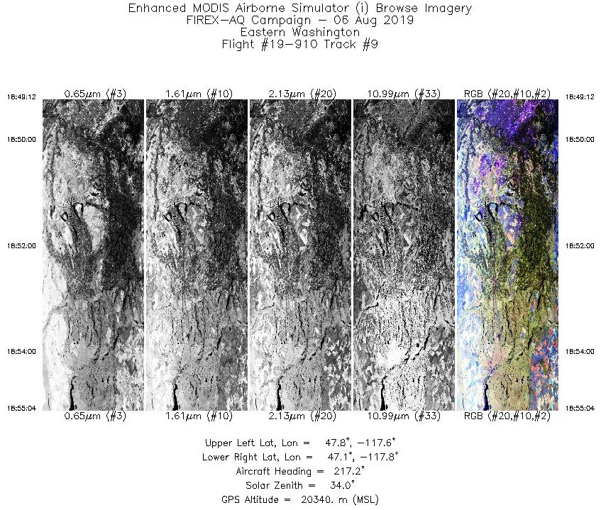
| 9 |
18:49 - 18:55 |
218.8 |
47.718 - 47.208 |
117.366 - 118.011 |
2196 |
20340 |
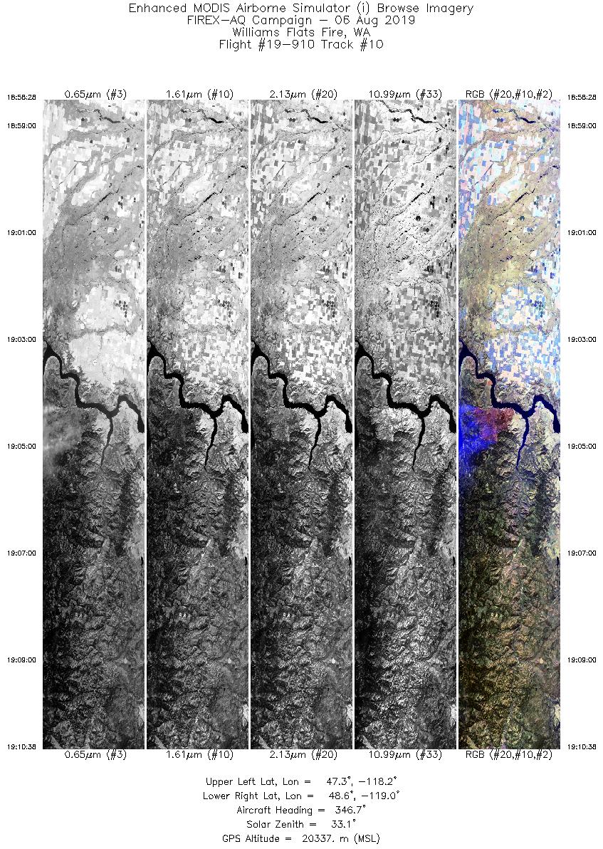
| 10 |
18:58 - 19:10 |
348.7 |
47.282 - 48.646 |
118.483 - 118.760 |
4562 |
20339 |
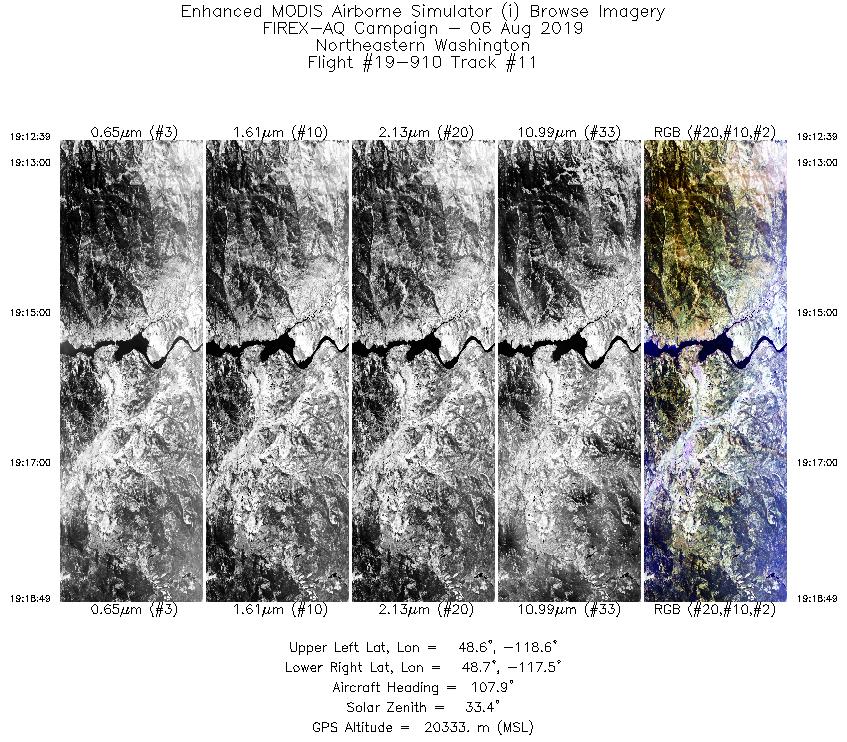
| 11 |
19:12 - 19:18 |
110.3 |
48.763 - 48.502 |
118.538 - 117.557 |
2311 |
20346 |
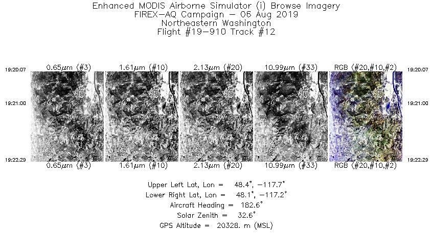
| 12 |
19:20 - 19:22 |
182.5 |
48.386 - 48.117 |
117.449 - 117.478 |
886 |
20342 |
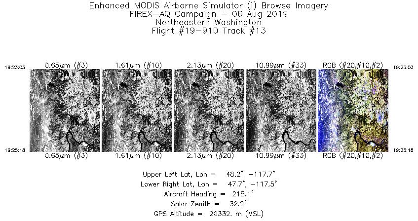
| 13 |
19:23 - 19:25 |
215.2 |
48.056 - 47.848 |
117.511 - 117.740 |
844 |
20345 |
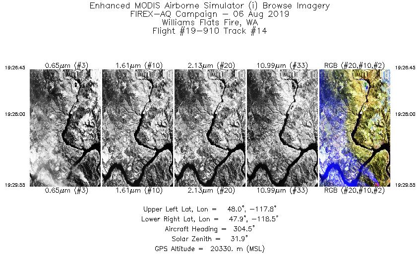
| 14 |
19:26 - 19:29 |
305.0 |
47.815 - 48.021 |
117.958 - 118.403 |
1189 |
20348 |
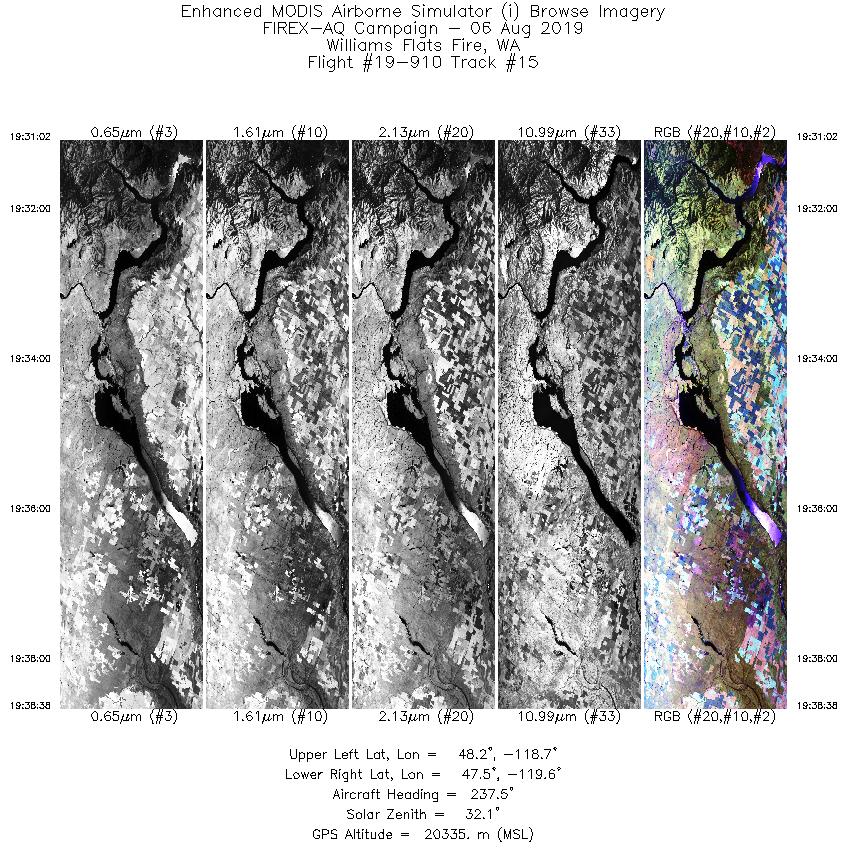
| 15 |
19:31 - 19:38 |
241.5 |
48.027 - 47.640 |
118.582 - 119.749 |
2845 |
20348 |
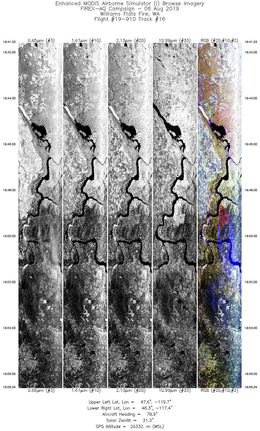
| 16 |
19:41 - 19:56 |
79.3 |
47.783 - 48.094 |
119.785 - 117.325 |
5636 |
20323 |
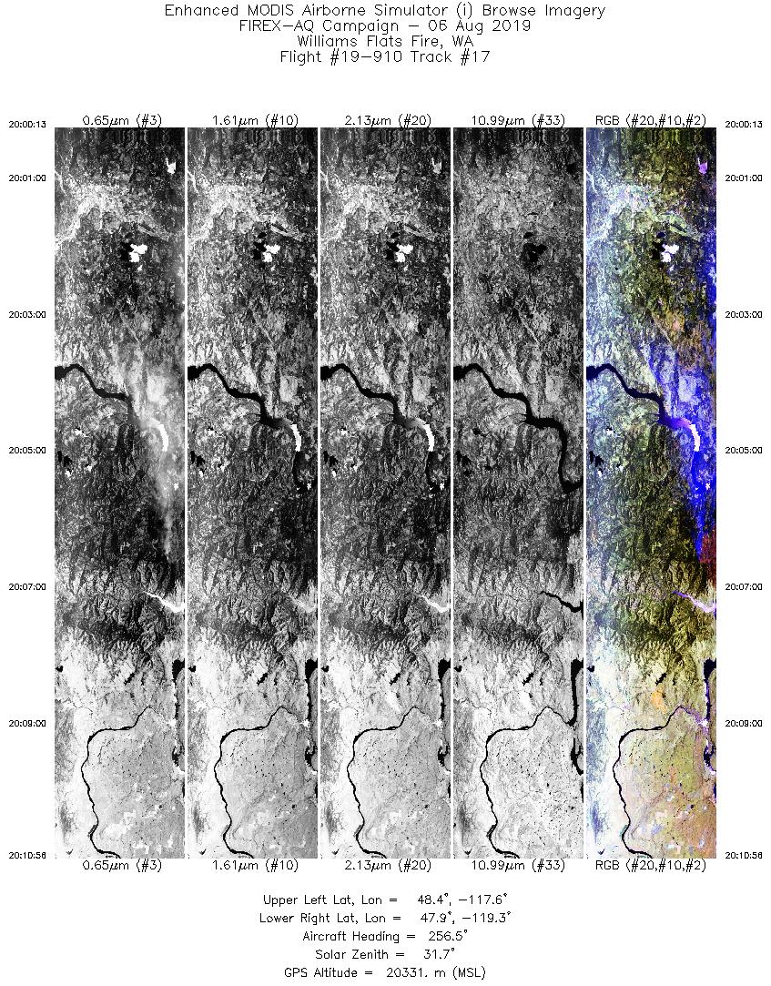
| 17 |
20:00 - 20:10 |
260.1 |
48.239 - 48.048 |
117.526 - 119.340 |
4019 |
20316 |
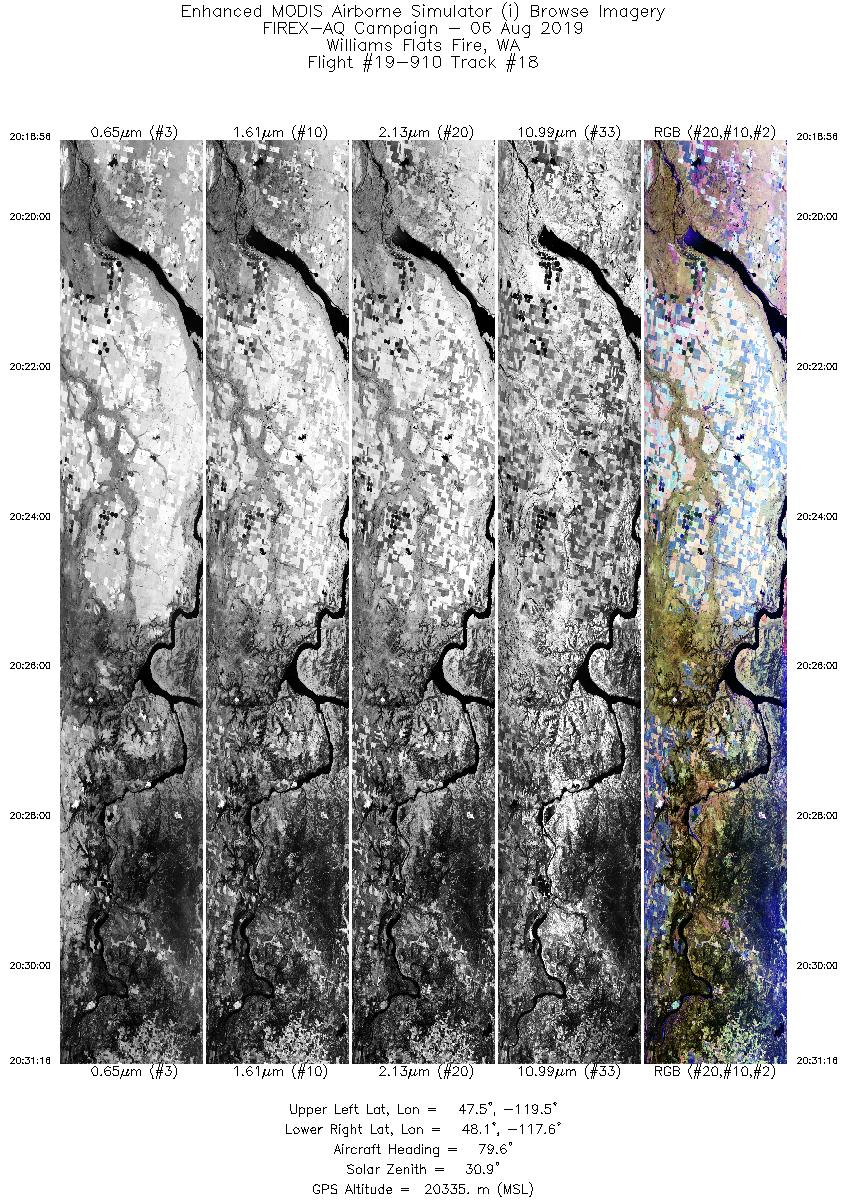
| 18 |
20:18 - 20:31 |
80.1 |
47.649 - 47.916 |
119.534 - 117.518 |
4624 |
20329 |
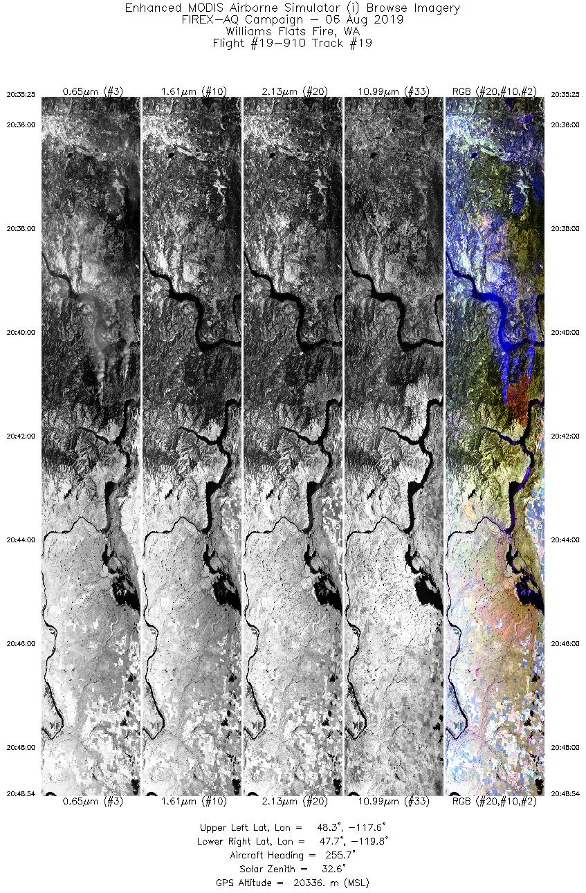
| 19 |
20:35 - 20:48 |
257.1 |
48.147 - 47.882 |
117.582 - 119.841 |
5056 |
20334 |
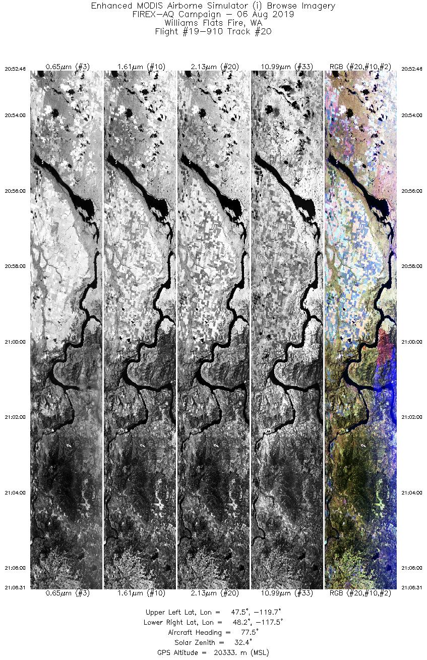
| 20 |
20:52 - 21:06 |
78.3 |
47.709 - 48.008 |
119.728 - 117.465 |
5153 |
20335 |
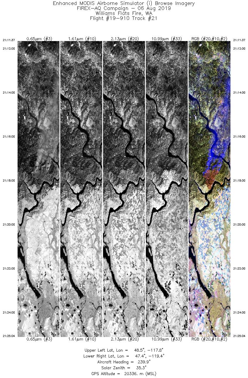
| 21 |
21:11 - 21:25 |
236.5 |
48.360 - 47.509 |
117.675 - 119.555 |
5047 |
20344 |
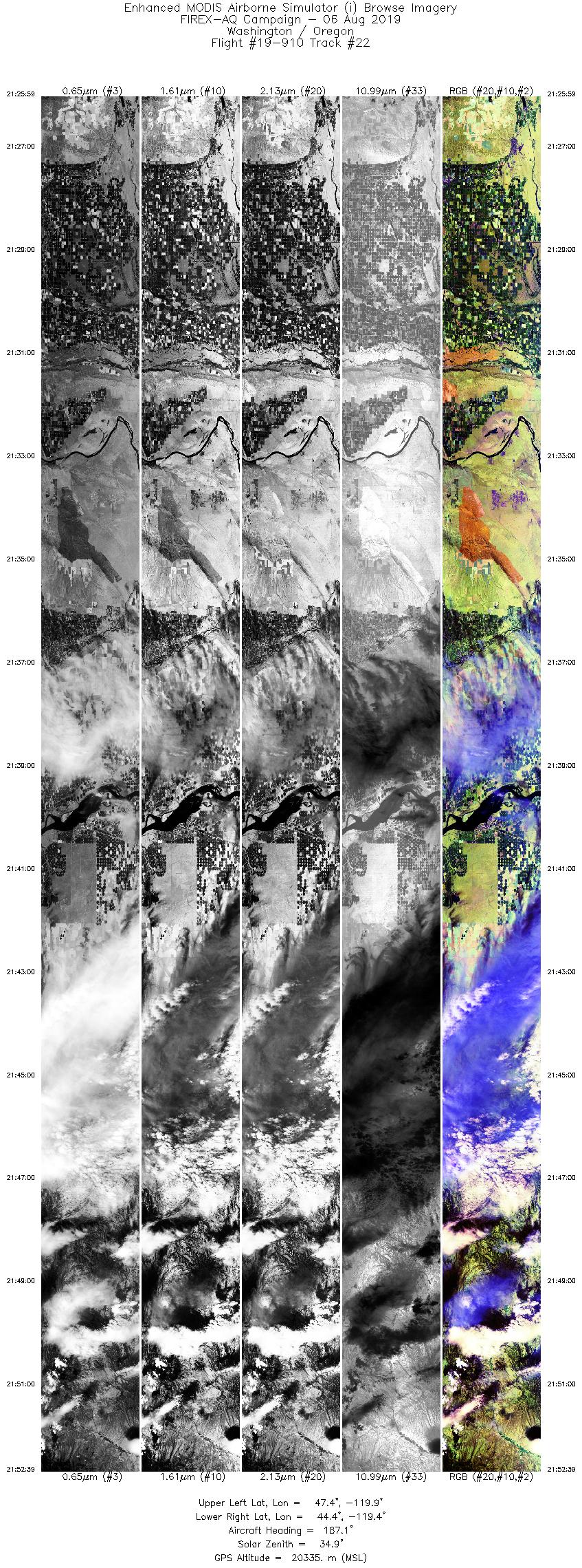
| 22 |
21:25 - 21:52 |
182.6 |
47.422 - 44.420 |
119.629 - 119.646 |
9999 |
20348 |
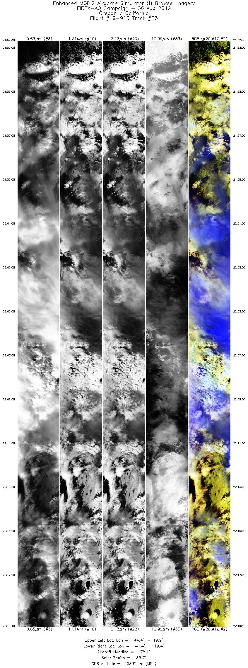
| 23 |
21:52 - 22:19 |
178.8 |
44.420 - 41.449 |
119.646 - 119.653 |
9999 |
20331 |
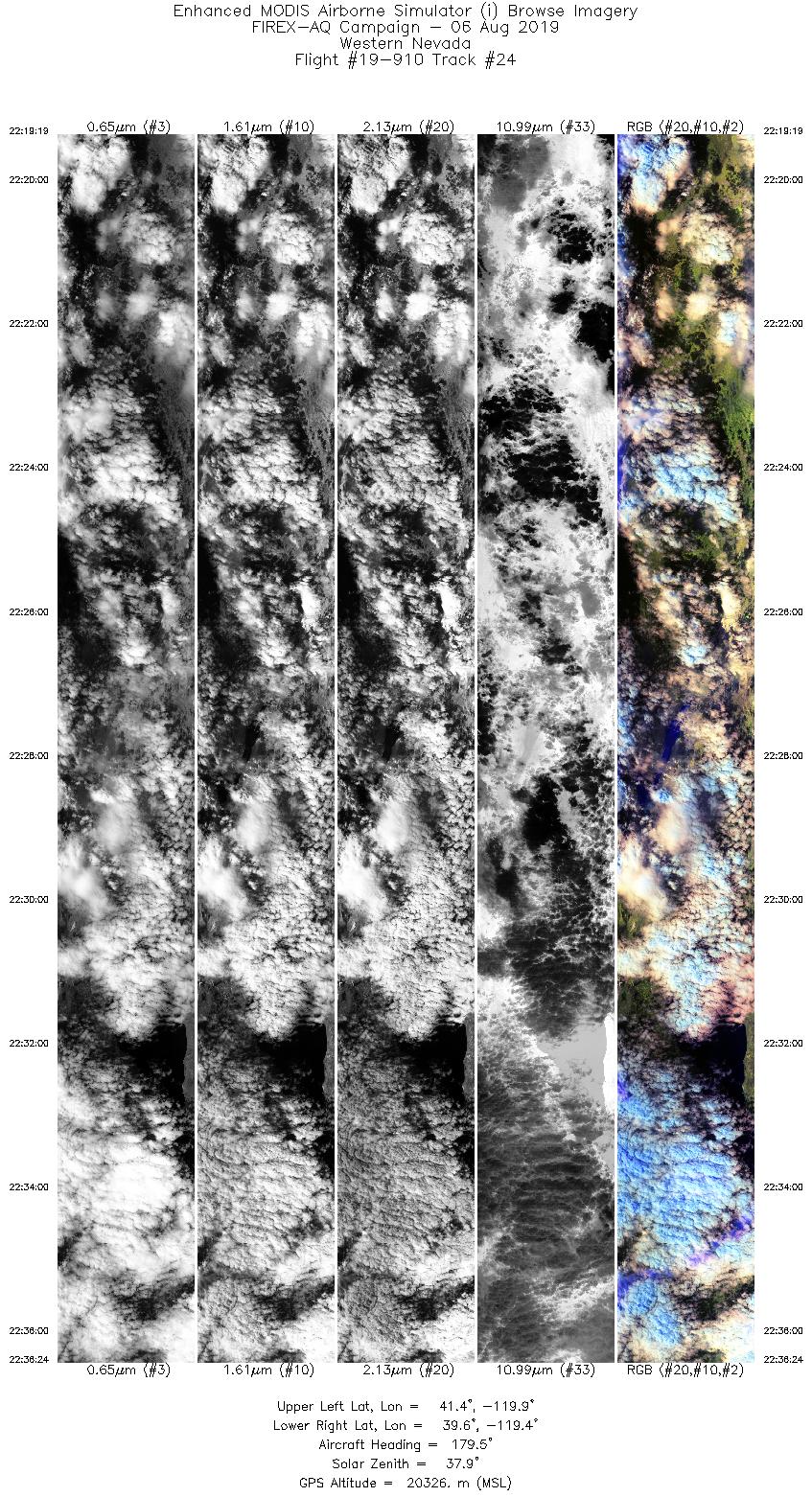
| 24 |
22:19 - 22:36 |
179.1 |
41.449 - 39.565 |
119.653 - 119.657 |
6410 |
20320 |
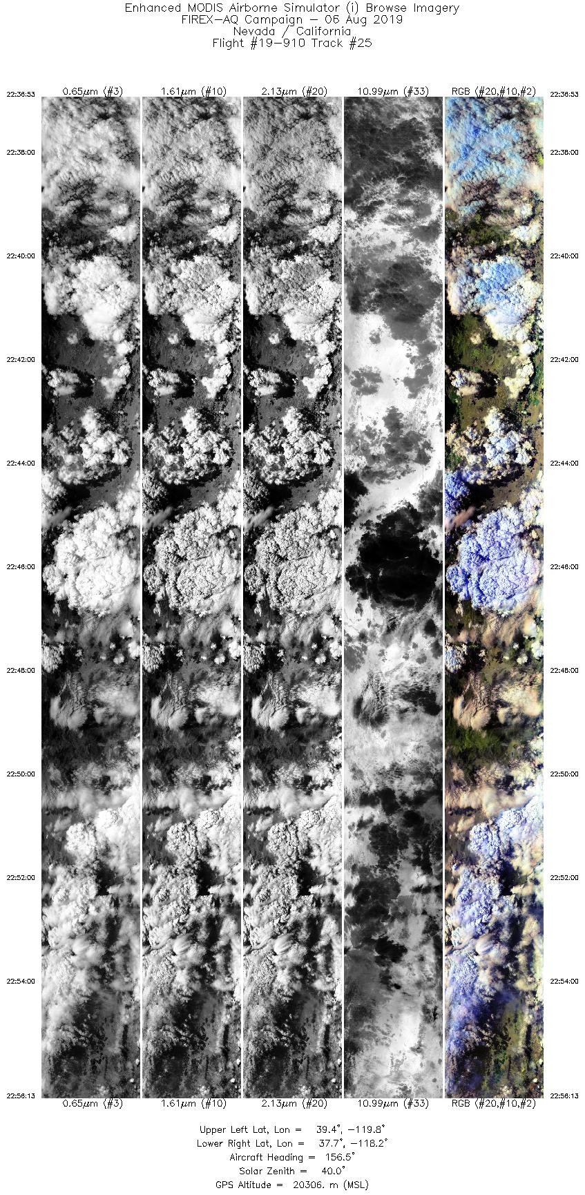
| 25 |
22:36 - 22:56 |
153.7 |
39.513 - 37.586 |
119.642 - 118.376 |
7252 |
20316 |
|
Wildfire Imagery
|
| Wildfire |
Date |
Time (UTC) |
Flight: Track |
Lat |
Lon |
| Williams Flat |
8/6/2019 |
18:19 |
19-910: 06 |
47.93917 |
-118.61833 |
| Williams Flat |
8/6/2019 |
18:40 |
19-910: 08 |
47.93917 |
-118.61833 |
| Williams Flat |
8/6/2019 |
19:04 |
19-910: 10 |
47.93917 |
-118.61833 |
| Williams Flat |
8/6/2019 |
19:30 |
19-910: 14 |
47.93917 |
-118.61833 |
| Williams Flat |
8/6/2019 |
19:30 |
19-910: 15 |
47.93917 |
-118.61833 |
| Williams Flat |
8/6/2019 |
19:49 |
19-910: 16 |
47.93917 |
-118.61833 |
| Williams Flat |
8/6/2019 |
20:06 |
19-910: 17 |
47.93917 |
-118.61833 |
| Williams Flat |
8/6/2019 |
20:26 |
19-910: 18 |
47.93917 |
-118.61833 |
| Williams Flat |
8/6/2019 |
20:42 |
19-910: 19 |
47.93917 |
-118.61833 |
| Williams Flat |
8/6/2019 |
21:00 |
19-910: 20 |
47.93917 |
-118.61833 |
| Williams Flat |
8/6/2019 |
21:18 |
19-910: 21 |
47.93917 |
-118.61833 |
|
|
|


