


CAMPAIGN SUMMARY INFORMATION
|
RSL August 2006 Dates: 21 August - 6 September, 2006 Location: Southern California / Nevada / Colorado Principal Investigators: Hook / Peltzer (JPL), Kruse (HGI) Aircraft: DOE 798 B-200 (DOE Remote Sensing Laboratory) Additional Sensors: DCS Objective: Southern California Fault mapping |
||||||||||||||||||||||||||||||||||||
|
Processing Information Flights Processed: 18 Total Flight Tracks: 183 Total Scanlines: 885,913 Level-1B Version: 1 Calibration Version: 1 Status: Level-1B Data available |
||||||||||||||||||||||||||||||||||||
|
MASTER Spectral Information Spectral Band Configuration Spectral Response Function Table |
||||||||||||||||||||||||||||||||||||
|
Related Web Sites NASA Airborne Science Program |
||||||||||||||||||||||||||||||||||||
|
||||||||||||||||||||||||||||||||||||
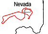 Flight: 06-010-01
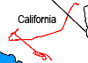 Flight: 06-010-02
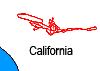 Flight: 06-010-04
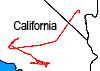 Flight: 06-010-05
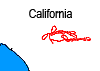 Flight: 06-010-06
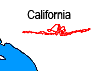 Flight: 06-010-07
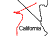 Flight: 06-010-08
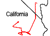 Flight: 06-010-09
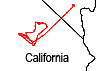 Flight: 06-010-10
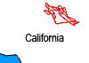 Flight: 06-010-11
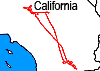 Flight: 06-010-12
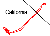 Flight: 06-010-13
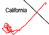 Flight: 06-010-14
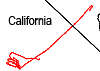 Flight: 06-010-15
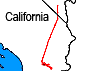 Flight: 06-010-16
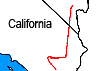 Flight: 06-010-17
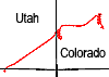 Flight: 06-010-18
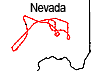 Flight: 06-010-19