


CAMPAIGN SUMMARY INFORMATION
|
GEMx Late Summer / Early Fall 2023 Dates: August 28 - September 26, 2023 Location: California / Arizona / Nevada Principal Investigators: Kokaly (USGS) Aircraft: NASA 806 ER-2 (Armstrong Flight Research Center) Additional Sensors: AVIRIS Objective: The Geological Earth Mapping Experiment (GEMx) research project will use NASA's Airborne Visible/Infrared Imaging Spectrometer (AVIRIS), Hyperspectral Thermal Emission Spectrometer (HyTES), and MODIS/ASTER Airborne Simulator (MASTER) instruments flown on NASA's ER-2 and Gulfstream V aircraft to collect the measurements over the country's arid and semi-arid regions, including parts of California, Nevada, Arizona, and New Mexico. |
||||||||||||||||||||
|
Processing Information Flights Processed: 11 Total Flight Tracks: 102 Total Scanlines: 604,649 Status: Level-1B Data available |
||||||||||||||||||||
|
MASTER Spectral Information Spectral Band Configuration Spectral Response Function Table |
||||||||||||||||||||
|
Related Web Sites GEMx / Earth MRI Campaign Mission List GEMX Press Release USGS Earth MRI NASA Airborne Science Program Airborne Visible-Infrared Imaging Spectrometer (AVIRIS) |
||||||||||||||||||||
|
||||||||||||||||||||
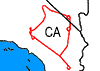 Flight: 23-909-00
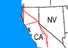 Flight: 23-910-00
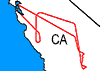 Flight: 23-911-00
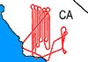 Flight: 23-912-00
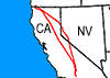 Flight: 23-913-00
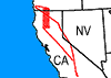 Flight: 23-914-00
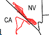 Flight: 23-915-00
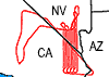 Flight: 23-916-00
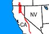 Flight: 23-917-00
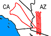 Flight: 23-918-00
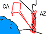 Flight: 23-919-00
GEMx
Late Summer / Early Fall 2023


| Sample Imagery |
| Click image for full resolution |
|
Flight: 23-915-00
Track: #01 California / Nevada |


|
|
R: 2.13µm G: 1.61µm B: 0.47µm |


