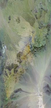
Flight: 23-916-00
Date: 19 Sep 2023
Aircraft: ER-2 #809
Deployment: GEMx Late Summer / Early Fall 2023
Flight Location: California / Nevada (CA08)
Principal Investigators: Kokaly (USGS)
Additional Sensors: AVIRIS
|
Data Evaluation
Overall quality is good
|
Processing Information
Level-1B Data in HDF format is available
Flight Line Summary
Spectral Band Configuration
Spectral Response Function Table
Spectral Response Function (text)
|
Browse Imagery
Flight Tracks: 10
Scanlines: 74105
|
Browse Imagery Table
|
Click a Flight Track number to view a quicklook image
Lat/Lon ranges are for the BEG-END scanline nadir pixels
|
Flight
Track |
Time Span
(UTC) |
Heading
(Deg) |
Lat Range
(Deg N) |
Lon Range
(Deg W) |
Length
(Scanlines) |
Altitude
(Meters) |
| 1 |
17:11 - 17:41 |
136.4 |
36.672 - 34.265 |
116.583 - 114.050 |
11087 |
20207 |
| 2 |
17:55 - 18:13 |
358.6 |
34.260 - 36.256 |
115.634 - 115.636 |
6859 |
20407 |
| 3 |
18:18 - 18:35 |
178.7 |
36.368 - 34.457 |
115.544 - 115.548 |
6541 |
20360 |
| 4 |
18:41 - 18:57 |
357.2 |
34.366 - 36.146 |
115.453 - 115.452 |
6102 |
20232 |
| 5 |
19:03 - 19:17 |
177.5 |
36.074 - 34.457 |
115.355 - 115.355 |
5475 |
20619 |
| 6 |
19:22 - 19:38 |
357.9 |
34.293 - 36.105 |
115.257 - 115.260 |
6240 |
20414 |
| 7 |
19:46 - 20:04 |
180.8 |
36.397 - 34.457 |
115.167 - 115.173 |
6667 |
20456 |
| 8 |
20:09 - 20:28 |
0.0 |
34.408 - 36.483 |
115.076 - 115.076 |
7098 |
20627 |
| 9 |
20:38 - 21:03 |
177.3 |
37.092 - 34.451 |
114.985 - 114.981 |
9073 |
20562 |
| 10 |
21:07 - 21:31 |
358.2 |
34.292 - 36.917 |
114.882 - 114.882 |
8963 |
20875 |
|


