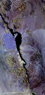
Flight: 23-919-00
Date: 26 Sep 2023
Aircraft: ER-2 #809
Deployment: GEMx Late Summer / Early Fall 2023
Flight Location: Arizona (AZ01)
Principal Investigators: Kokaly (USGS)
Additional Sensors: AVIRIS
|
Data Evaluation
Overall quality is good
|
Processing Information
Level-1B Data in HDF format is available
Flight Line Summary
Spectral Band Configuration
Spectral Response Function Table
Spectral Response Function (text)
|
Browse Imagery
Flight Tracks: 11
Scanlines: 73764
|
Browse Imagery Table
|
Click a Flight Track number to view a quicklook image
Lat/Lon ranges are for the BEG-END scanline nadir pixels
|
Flight
Track |
Time Span
(UTC) |
Heading
(Deg) |
Lat Range
(Deg N) |
Lon Range
(Deg W) |
Length
(Scanlines) |
Altitude
(Meters) |
| 1 |
17:32 - 17:59 |
148.3 |
35.212 - 32.699 |
116.838 - 114.935 |
10161 |
20204 |
| 2 |
18:05 - 18:25 |
356.1 |
32.447 - 34.744 |
114.801 - 114.807 |
7462 |
20152 |
| 3 |
18:30 - 18:52 |
177.6 |
34.869 - 32.460 |
114.704 - 114.711 |
8239 |
20163 |
| 4 |
18:56 - 19:17 |
359.0 |
32.297 - 34.743 |
114.614 - 114.610 |
7922 |
20169 |
| 5 |
19:21 - 19:37 |
180.4 |
34.778 - 33.061 |
114.313 - 114.314 |
5945 |
20168 |
| 6 |
19:41 - 19:44 |
176.9 |
32.707 - 32.338 |
114.315 - 114.314 |
1296 |
20198 |
| 7 |
19:53 - 20:16 |
19.0 |
32.678 - 35.169 |
115.217 - 114.061 |
8776 |
20201 |
| 8 |
20:22 - 20:46 |
180.5 |
34.936 - 32.397 |
114.512 - 114.512 |
8743 |
20163 |
| 9 |
20:50 - 21:12 |
358.0 |
32.220 - 34.746 |
114.412 - 114.412 |
8324 |
20114 |
| 10 |
21:16 - 21:30 |
178.9 |
34.809 - 33.181 |
114.217 - 114.217 |
5548 |
20200 |
| 11 |
21:36 - 21:40 |
180.1 |
32.703 - 32.305 |
114.219 - 114.218 |
1348 |
20147 |
|


