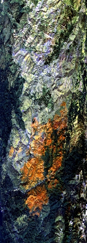
Flight: 23-910-00
Date: 05 Sep 2023
Aircraft: ER-2 #809
Deployment: GEMx Late Summer / Early Fall 2023
Flight Location: Northwestern California (CA10)
Principal Investigators: Kokaly (USGS)
Additional Sensors: AVIRIS
|
Data Evaluation
Overall quality is good
|
Processing Information
Level-1B Data in HDF format is available
Flight Line Summary
Spectral Band Configuration
Spectral Response Function Table
Spectral Response Function (text)
|
Browse Imagery
Flight Tracks: 12
Scanlines: 76368
|
Browse Imagery Table
|
Click a Flight Track number to view a quicklook image
Lat/Lon ranges are for the BEG-END scanline nadir pixels
|
Flight
Track |
Time Span
(UTC) |
Heading
(Deg) |
Lat Range
(Deg N) |
Lon Range
(Deg W) |
Length
(Scanlines) |
Altitude
(Meters) |
| 1 |
17:58 - 18:01 |
354.8 |
38.940 - 39.285 |
120.032 - 120.033 |
1139 |
20338 |
| 2 |
18:23 - 18:35 |
304.9 |
40.704 - 41.584 |
122.595 - 124.116 |
4796 |
20212 |
| 3 |
18:45 - 19:13 |
182.4 |
42.429 - 39.375 |
123.650 - 123.649 |
10265 |
20245 |
| 4 |
19:17 - 19:43 |
357.9 |
39.334 - 42.360 |
123.754 - 123.752 |
9774 |
20163 |
| 5 |
19:48 - 20:14 |
180.5 |
42.553 - 39.610 |
123.856 - 123.858 |
9927 |
20256 |
| 6 |
20:19 - 20:43 |
357.4 |
39.550 - 42.367 |
123.963 - 123.964 |
9081 |
20203 |
| 7 |
20:47 - 21:07 |
181.2 |
42.191 - 39.955 |
124.071 - 124.074 |
7557 |
20268 |
| 8 |
21:12 - 21:31 |
359.5 |
39.827 - 42.058 |
124.181 - 124.182 |
7251 |
20249 |
| 9 |
21:35 - 21:50 |
179.6 |
41.758 - 40.107 |
124.298 - 124.290 |
5605 |
20181 |
| 10 |
21:55 - 22:02 |
0.5 |
39.979 - 40.823 |
124.401 - 124.400 |
2701 |
20255 |
| 11 |
22:07 - 22:26 |
166.9 |
40.705 - 38.723 |
124.372 - 123.572 |
7061 |
20267 |
| 12 |
22:52 - 22:55 |
179.1 |
39.275 - 38.908 |
120.028 - 120.029 |
1211 |
20449 |
|


