
|
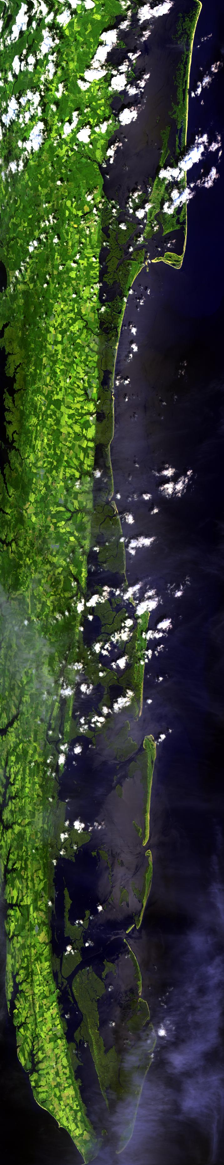
Sample Image

16 July 1996
Track #01


R: 2.15 microns
G: 1.64 microns
B: 0.55 microns
|
|
Summary Information
Date: July 16, 1996
ER-2 Flight Number: 96-147
Location: Mid-Atlantic Coast
Principle Investigator: Dr. Yorum Kaufman (GSFC)
Additional Sensors: LASE, VIS
Level-1B Processing Information
Level-1B Data processed by: Ames Research Center
Level-1B Data Version: #10
Level-1B Configuration: (sample file)
Calibration Type: Final
Calibration Version: TARFOX 1.0
Temperature Adjustment: No
Status: Completed with final calibration
|
|
Flight Track Map

|
Level-1B Browse Imagery
Straight Line Flight Tracks: 6
Scanlines Processed: 17935
Solar Azimuth and Zenith Angles
|
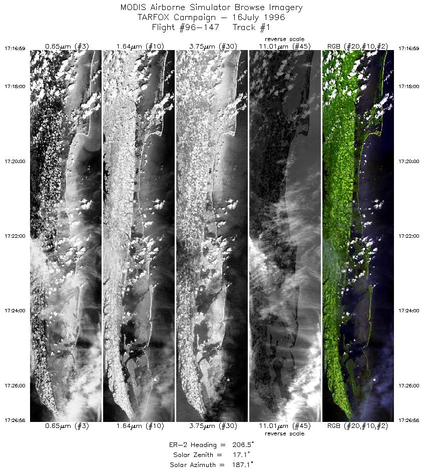
Browse Images
|
Click on the Flight Track number to load images.
Lat/Lon ranges are for the BEG-END scanline nadir pixels.
|
Flight
Track |
Time_Span
(GMT) |
Heading
(Deg) |
Lat_Range
(Deg_N) |
Lon_Range
(Deg_W) |
Length
(Scanlines) |
Altitude
(Meters) |
| 1 |
17:16-17:26 |
207 |
38.12-37.10 |
75.32-75.93 |
3715 |
~20000 |
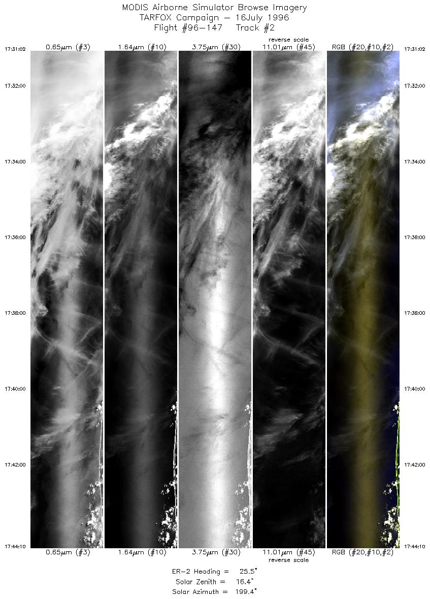
| 2 |
17:31-17:44 |
25 |
36.94-38.28 |
75.65-74.92 |
4904 |
~20000 |
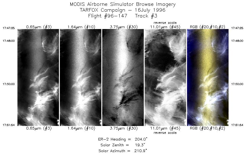
| 3 |
17:47-17:51 |
204 |
38.20-37.74 |
74.66-74.92 |
1674 |
~20000 |
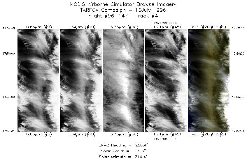
| 4 |
17:52-17:57 |
226 |
37.65-37.29 |
75.00-75.50 |
1768 |
~20000 |
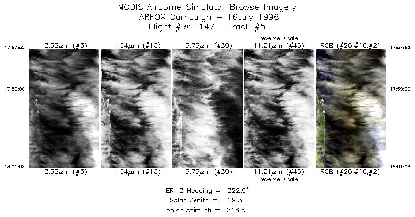
| 5 |
17:57-18:01 |
222 |
37.27-37.00 |
75.53-75.84 |
1219 |
~20000 |
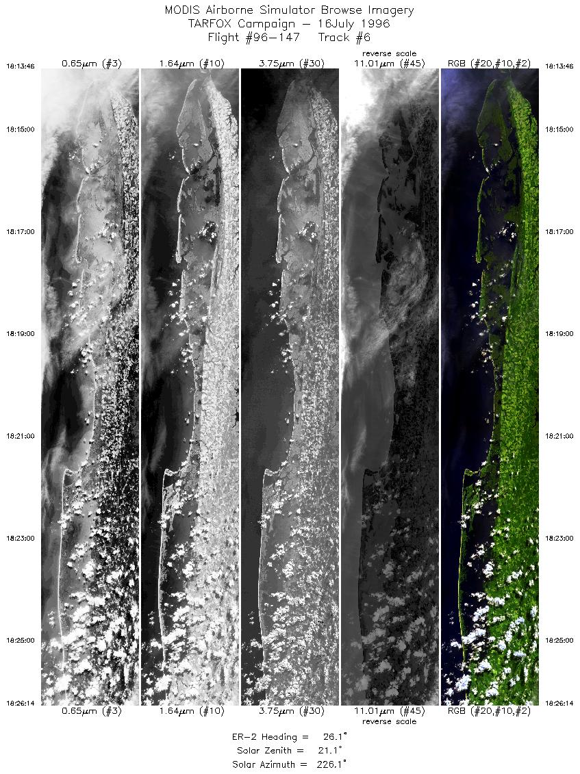
| 6 |
18:13-18:26 |
26 |
37.09-38.35 |
75.93-75.18 |
4655 |
~20000 |
|
Images 01 through 06 in sequence |
Level-1B HDF Data Distribution Point
NASA GSFC Earth Sciences (GES) Data Center
NASA DAAC's
Related Web Sites
Airborne Sensors Facility Page
Lidar Atmospheric Sensing Equipment (LASE)
NASA ER-2 Aircraft Program
Additional Information
Objectives: coming soon
|
|
Sample Image
The image tothe left is a flightline that begins over Chincoteague Bay and proceeds southward, overflying the Wallops Flight Facility. Following the peninsula further southward is Hog Island Bay and South Bay. Ends over Magothy Bay. The Atlantic Ocean is on the right side of the image.
|
|