
|
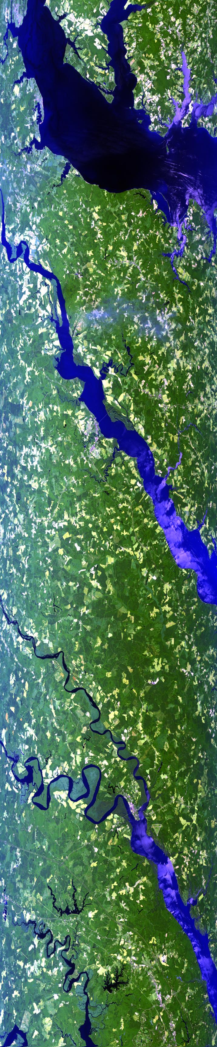
Sample Image

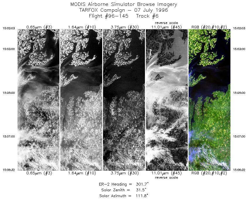
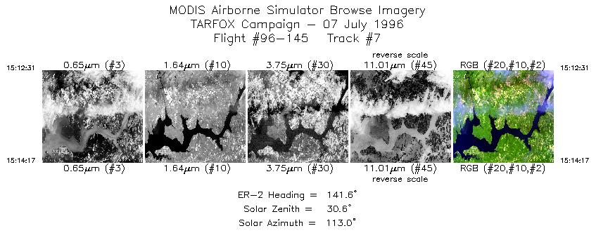
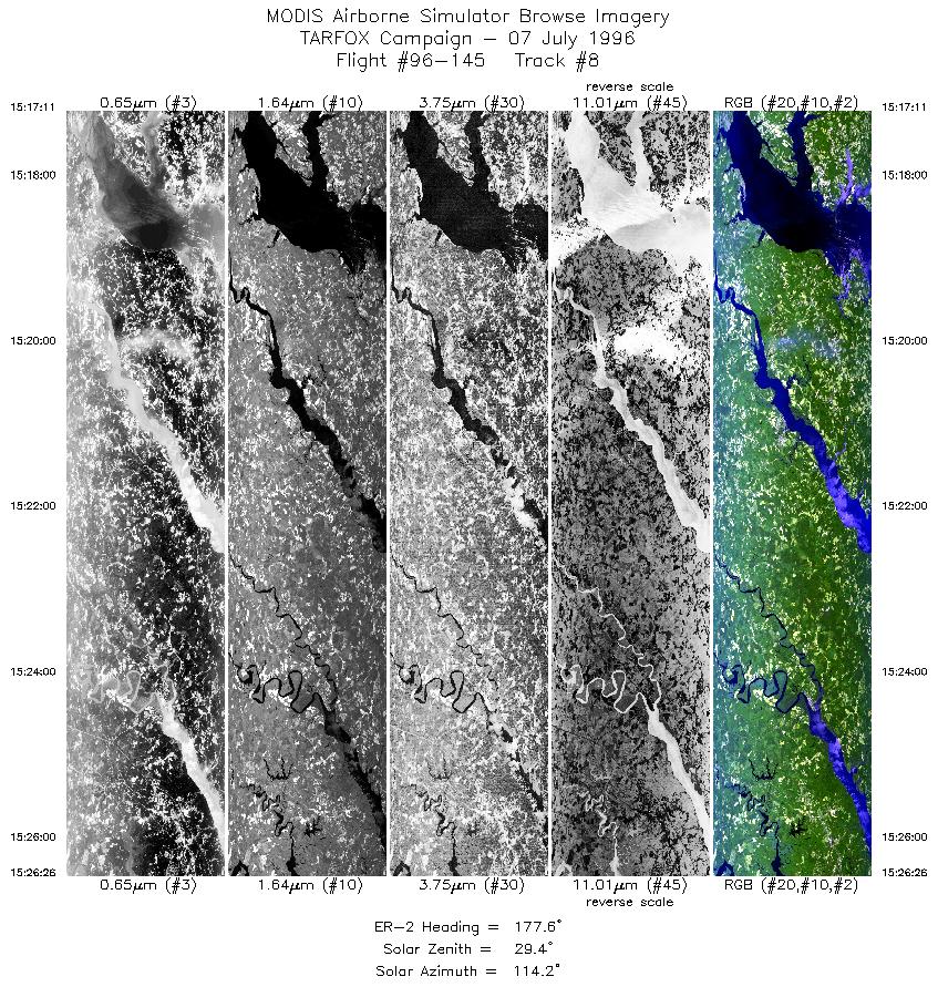
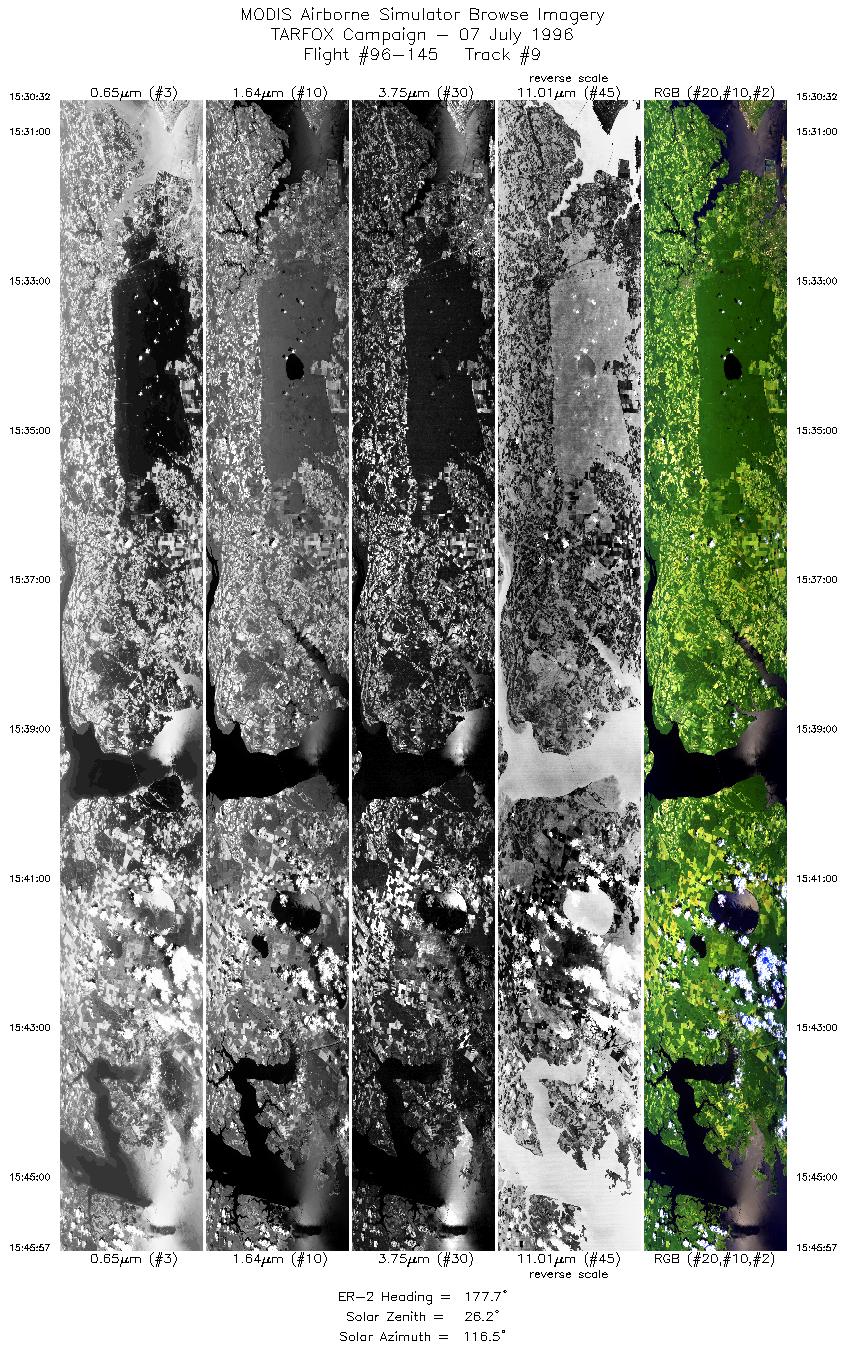
07 July 1996
Track #08


Flightline begins over the confluence of the Wicomico and Potomac Rivers. Proceeds southward over the Rappahanncock River and ending over the York River and tributaries to the the James River.
R: 2.15 microns
G: 1.64 microns
B: 0.55 microns
|
|
Summary Information
Date: July 07, 1996
ER-2 Flight Number: 96-145
Location: Central East Coast
Principle Investigator: Dr. Yorum Kaufman (GSFC)
Mission Scientists: Dr. Harding (GSFC), Dr. Stephen Sandor (TRW),
Dr. Lawrence Rowan (USGS)
Additional Sensors: 12"RC-10 (CIR), AVIRIS
Level-1B Processing Information
Level-1B Data processed by: Ames Research Center
Level-1B Data Version: #10
Level-1B Configuration: (sample file)
Calibration Type: Final
Calibration Version: TARFOX 1.0
Temperature Adjustment: No
Status: Completed with final calibration
|
|
Flight Track Map

|
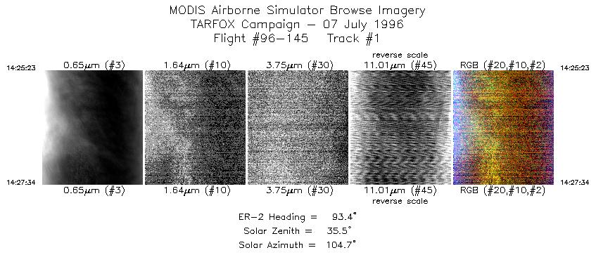
Level-1B Browse Imagery
Straight Line Flight Tracks: 17
Scanlines Processed: 56558
Solar Azimuth and Zenith Angles
|
Browse Images
|
Click on the Flight Track number to load images.
Lat/Lon ranges are for the BEG-END scanline nadir pixels.
|
Flight
Track |
Time_Span
(GMT) |
Heading
(Deg) |
Lat_Range
(Deg_N) |
Lon_Range
(Deg_W) |
Length
(Scanlines) |
Altitude
(Meters) |
| 1 |
14:25-14:27 |
93 |
38.01-38.00 |
72.61-72.31 |
815 |
~20000 |
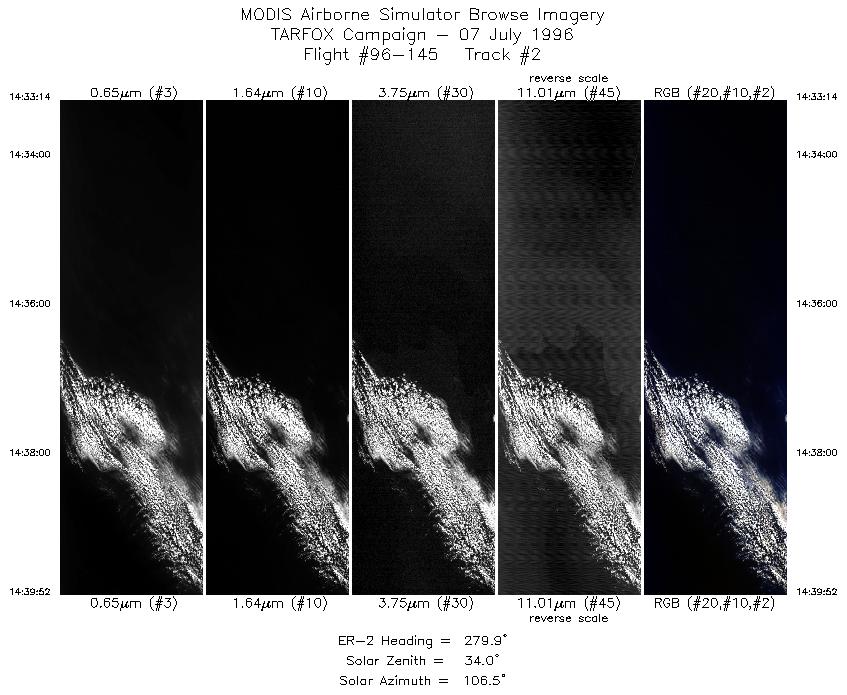
| 2 |
14:33-14:39 |
280 |
37.67-37.80 |
72.56-73.51 |
2477 |
~20000 |
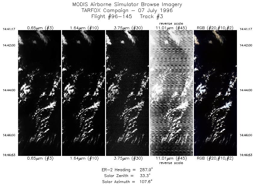
| 3 |
14:41-14:46 |
288 |
37.82-38.02 |
73.71-74.48 |
2092 |
~20000 |
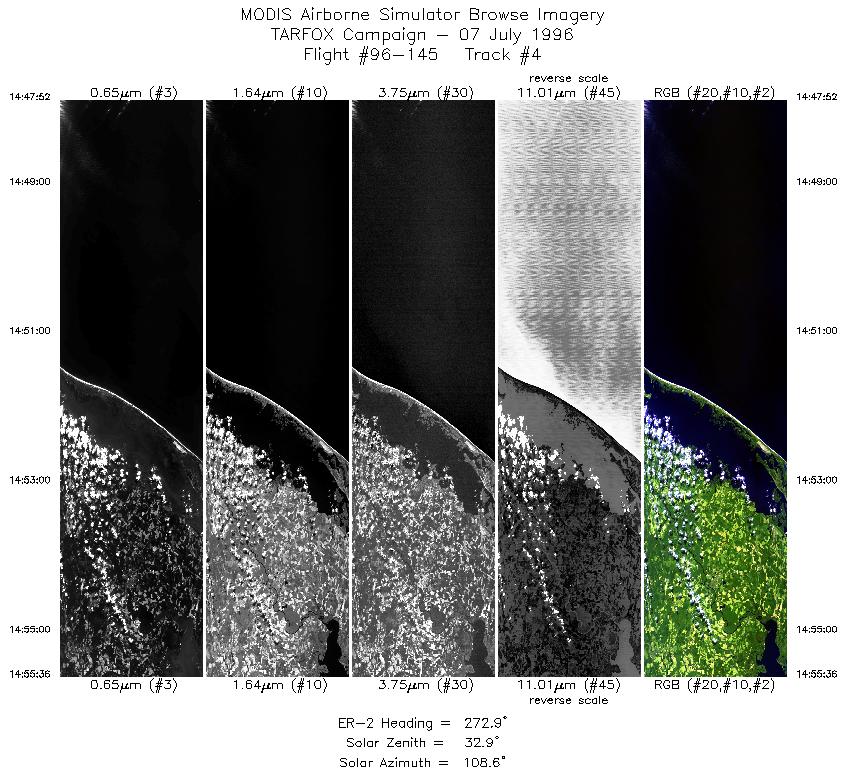
| 4 |
14:47-14:55 |
273 |
38.04-38.06 |
74.62-75.74 |
2888 |
~20000 |
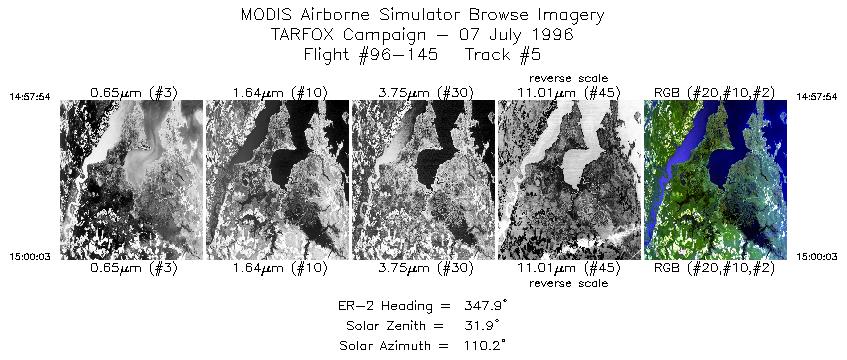
| 5 |
14:57-15:00 |
348 |
38.24-38.48 |
75.96-76.03 |
803 |
~20000 |
| 6 |
15:02-15:08 |
302 |
38.69-39.06 |
76.11-76.93 |
2420 |
~20000 |
| 7 |
15:12-15:14 |
142 |
38.79-38.63 |
77.21-77.06 |
661 |
~20000 |
| 8 |
15:17-15:26 |
178 |
38.36-37.30 |
76.84-76.83 |
3455 |
~20000 |
| 9 |
15:30-15:45 |
178 |
37.01-35.25 |
76.50-76.50 |
5756 |
~20000 |
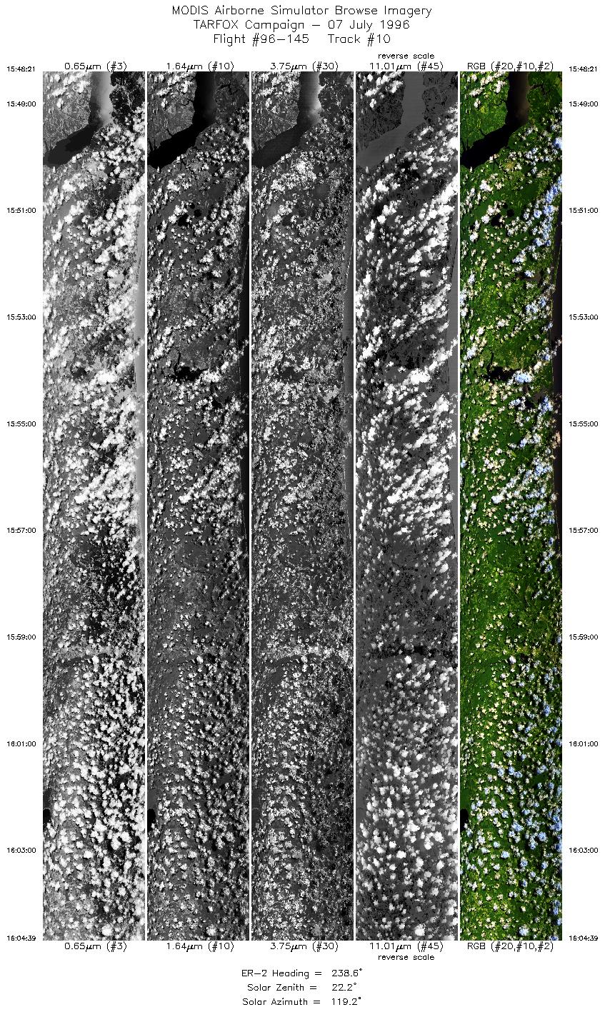
| 10 |
15:48-16:04 |
239 |
35.01-34.00 |
76.67-78.67 |
6086 |
~20000 |
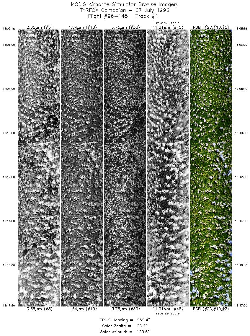
| 11 |
16:05-16:17 |
262 |
33.98-33.77 |
78.75-80.52 |
4692 |
~20000 |
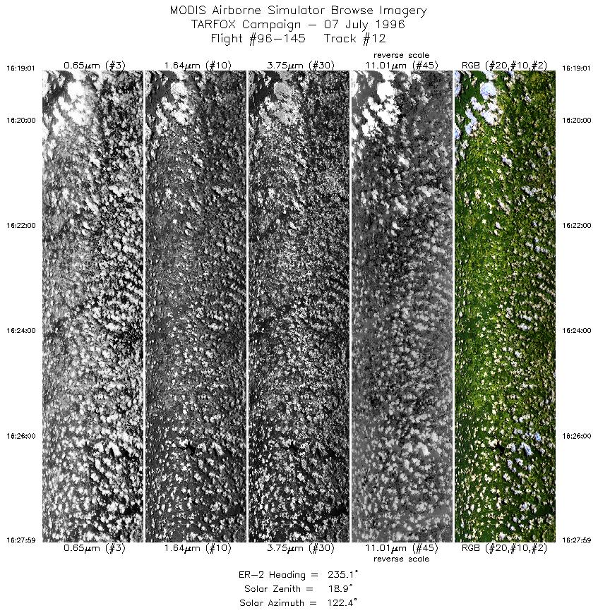
| 12 |
16:19-16:27 |
235 |
33.72-33.11 |
80.67-81.72 |
3348 |
~20000 |
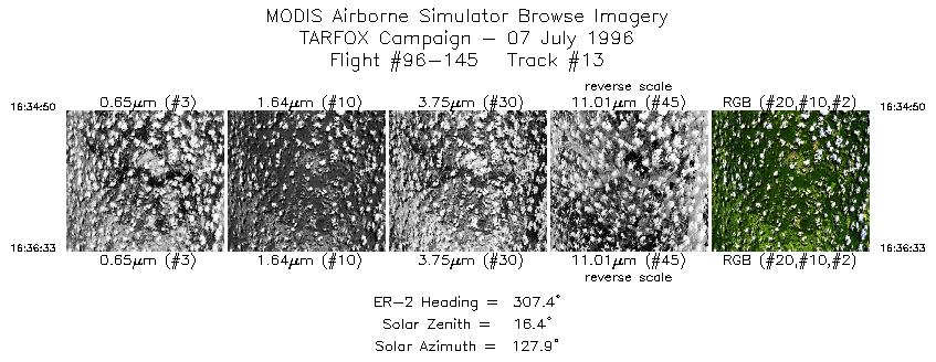
| 13 |
16:34-16:36 |
307 |
33.25-33.37 |
81.58-81.77 |
641 |
~20000 |
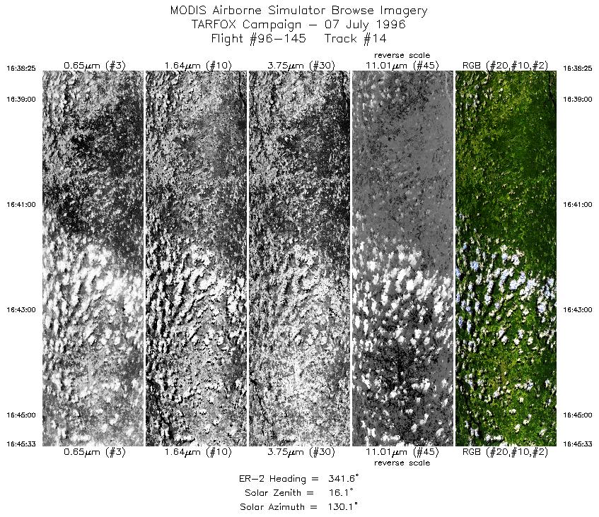
| 14 |
16:38-16:45 |
342 |
33.56-34.32 |
81.87-82.24 |
2664 |
~20000 |
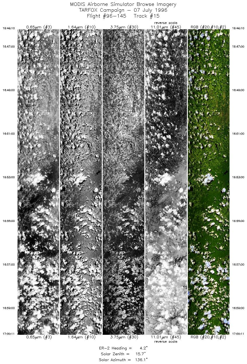
| 15 |
16:46-17:00 |
4 |
34.39-36.00 |
82.25-82.25 |
5234 |
~20000 |
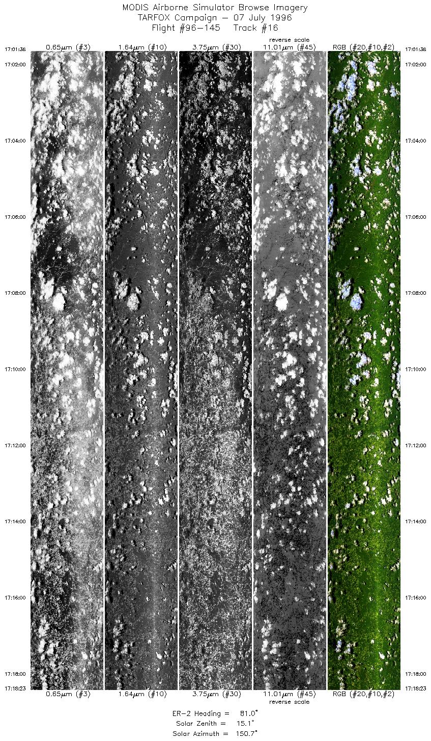
| 16 |
17:01-17:18 |
81 |
36.12-36.45 |
82.14-79.90 |
6266 |
~20000 |
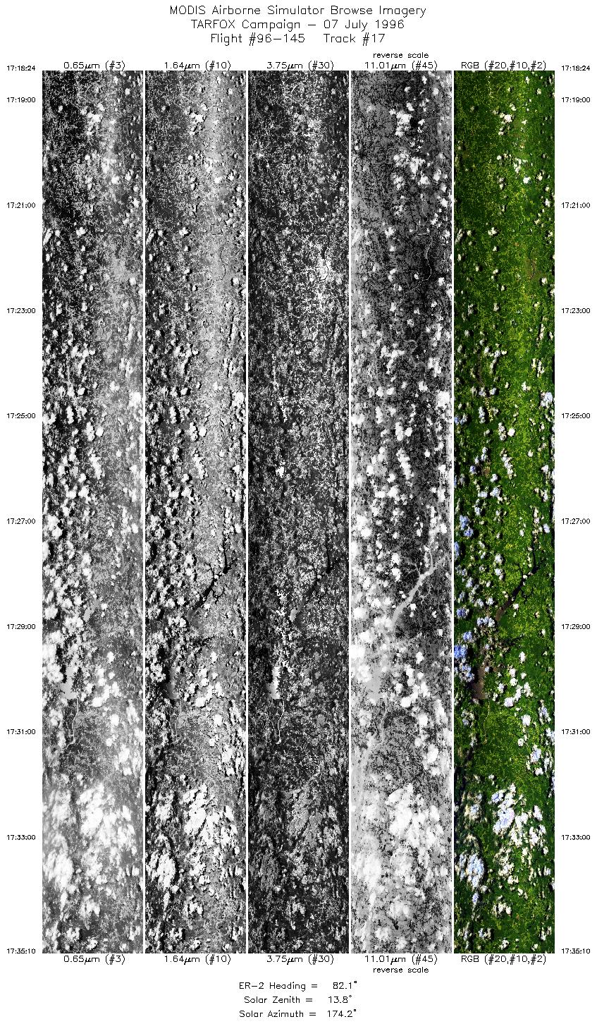
| 17 |
17:18-17:35 |
82 |
36.45-36.73 |
79.90-77.66 |
6260 |
~20000 |
|
Images 01 through 17 in sequence |
Level-1B HDF Data Distribution Point
NASA GSFC Earth Sciences (GES) Data Center
NASA DAAC's
Related Web Sites
JPL AVIRIS Web Page
Airborne Sensors Facility Page
NASA ER-2 Aircraft Program
Additional Information
Objectives: coming soon
|
|
|
|